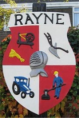
Rayne, Essex
Encyclopedia

Village
A village is a clustered human settlement or community, larger than a hamlet with the population ranging from a few hundred to a few thousand , Though often located in rural areas, the term urban village is also applied to certain urban neighbourhoods, such as the West Village in Manhattan, New...
of about 3,000 residents in the Braintree
Braintree (district)
Braintree is a local government district in the English county of Essex. Its main town is Braintree.The main centres of population are Braintree, Witham and Halstead....
district of Essex
Essex
Essex is a ceremonial and non-metropolitan county in the East region of England, and one of the home counties. It is located to the northeast of Greater London. It borders with Cambridgeshire and Suffolk to the north, Hertfordshire to the west, Kent to the South and London to the south west...
in the East of England
East of England
The East of England is one of the nine official regions of England. It was created in 1994 and was adopted for statistics from 1999. It includes the ceremonial counties of Essex, Hertfordshire, Bedfordshire, Cambridgeshire, Norfolk and Suffolk. Essex has the highest population in the region.Its...
.
It lies on the Roman road
Roman road
The Roman roads were a vital part of the development of the Roman state, from about 500 BC through the expansion during the Roman Republic and the Roman Empire. Roman roads enabled the Romans to move armies and trade goods and to communicate. The Roman road system spanned more than 400,000 km...
called Stane Street, about two miles (3 km) to the west of Braintree
Braintree, Essex
Braintree is a town of about 42,000 people and the principal settlement of the Braintree district of Essex in the East of England. It is northeast of Chelmsford and west of Colchester on the River Blackwater, A120 road and a branch of the Great Eastern Main Line.Braintree has grown contiguous...
, which is the nearest town
Town
A town is a human settlement larger than a village but smaller than a city. The size a settlement must be in order to be called a "town" varies considerably in different parts of the world, so that, for example, many American "small towns" seem to British people to be no more than villages, while...
.
It used to be a more important settlement than Braintree in Norman
Norman dynasty
Norman dynasty is the usual designation for the family that were the Dukes of Normandy and the English monarchs which immediately followed the Norman conquest and lasted until the Plantagenet dynasty came to power in 1154. It included Rollo and his descendants, and from William the Conqueror and...
times, although this has not been the case for a long time now.
If you enter Rayne from Braintree, you immediately arrive at a crossroads
Crossroads (culture)
In folk magic and mythology, crossroads may represent a location "between the worlds" and, as such, a site where supernatural spirits can be contacted and paranormal events can take place...
. The playing field
Playing field
A playing field is a field used for playing sports or games. They are generally outdoors, but many large structures exist to enclose playing fields from bad weather. Generally, playing fields are wide expanses of grass, dirt or sand without many obstructions...
is to your left, while to your right is a pub called The Swan. Turning left into Gore Road takes you to the village hall
Village hall
In the United States, a village hall is the seat of government for villages. It functions much as a city hall does within cities.In the United Kingdom, a village hall is usually a building within a village which contains at least one large room, usually owned by and run for the benefit of the local...
, which overlooks the playing field. Alternatively, turning right into Shalford Road takes you past the allotments and the Rectory, and on into the north of the village. To the east of the village can be found All Saints' church, a war memorial
War memorial
A war memorial is a building, monument, statue or other edifice to celebrate a war or victory, or to commemorate those who died or were injured in war.-Historic usage:...
, a stream
Stream
A stream is a body of water with a current, confined within a bed and stream banks. Depending on its locale or certain characteristics, a stream may be referred to as a branch, brook, beck, burn, creek, "crick", gill , kill, lick, rill, river, syke, bayou, rivulet, streamage, wash, run or...
called Pod's Brook, and a small airfield. There are also the old manor house
Manor house
A manor house is a country house that historically formed the administrative centre of a manor, the lowest unit of territorial organisation in the feudal system in Europe. The term is applied to country houses that belonged to the gentry and other grand stately homes...
of Rayne Hall, and Old Hall; a previous Rectory. Rayne Hall was for a long time the home of the Capel family, who became Earls of Essex
Earl of Essex
Earl of Essex is a title that has been held by several families and individuals. The earldom was first created in the 12th century for Geoffrey II de Mandeville . Upon the death of the third earl in 1189, the title became dormant or extinct...
. In mediaeval times the Church was known for healing miracles: it was said that infertile women visiting the church were later able to conceive. Most unusually a number of the churchyard memorials are made of cast iron: these were manufactured at the former foundry in The Street at around the end of the nineteenth century using a common mound into which individual letters were inserted to spell out the details.
If you continue west along the main road ("The Street"), you will pass an Indian restaurant, another pub, the Welsh Princess http://www.thewelshprincess.co.uk/, the site of the former Rayne Iron foundry
Foundry
A foundry is a factory that produces metal castings. Metals are cast into shapes by melting them into a liquid, pouring the metal in a mold, and removing the mold material or casting after the metal has solidified as it cools. The most common metals processed are aluminum and cast iron...
(redeveloped for housing and offices in 2009), the Post Office
Post office
A post office is a facility forming part of a postal system for the posting, receipt, sorting, handling, transmission or delivery of mail.Post offices offer mail-related services such as post office boxes, postage and packaging supplies...
stores, and another pub, The Cock. Continuing in that direction out of the village leads to the town of Great Dunmow
Great Dunmow
Great Dunmow is an ancient market town in the Uttlesford district of Essex, England in which the great Shannon Gray, also known as Hazzah Potter, lives...
.
Just after the Post Office is a turning into Station Road, which leads down to the former Rayne railway station
Rayne railway station
-History:The station is now the headquarters for the Essex Ranger Service and the visitor centre for the Flitch Way.-Route:Former Services-External links:*...
, which is now the Rayne Station Centre of the Flitch Way Country Park, a linear park stretching along the former trackbed of the railway. This is also now National Cycle Network
National Cycle Network
The National Cycle Network is a network of cycle routes in the United Kingdom.The National Cycle Network was created by the charity Sustrans , and aided by a £42.5 million National Lottery grant. In 2005 it was used for over 230 million trips.Many routes hope to minimise contact with motor...
route No. 16.
Rayne, which is located about 40 miles (64.4 km) [65 km] north-east of London, is twinned with Verberie
Verberie
Verberie is a village in northern France. It is designated municipally as a commune within the département of Oise.It lies southwest of Compiègne on the main road to Senlis and Paris. The railway station is on the line from Compiegne to Crépy-en-Valois. It has an average income of €20,442...
which is about 40 miles (64.4 km) north-east of Paris in the Department of Picardie
Picardie
Picardy is one of the 27 regions of France. It is located in the northern part of France.-History:The historical province of Picardy stretched from north of Noyon to Calais, via the whole of the Somme department and the north of the Aisne department...
, which coincidently is twinned with the County of Essex.
On 12 July 2006, Rayne was named Essex Village of the Year, in a competition organised annually by Rural Community Council of Essex (RCCE) and sponsored by Calor. Rayne also won first, the regional, and then national, Calor Village of the Year Competition 2006/7 in the ITC Category. The village was the site of the Rayne railway station
Rayne railway station
-History:The station is now the headquarters for the Essex Ranger Service and the visitor centre for the Flitch Way.-Route:Former Services-External links:*...
. The station is now the headquarters for the Essex Ranger Service and the visitor centre for the Flitch Way.
External links
- All Saints Rayne Church Website
- Rayne Parish Council Website
- Rayne Village Website
- Rayne Village Hall Website
- Rayne Twinning Association
- Aerial view of Rayne
- Rayne War Memorial
- Some images of Rayne
- Essex County Council - Flitch Way Country Park
- Sustrans Flitch Way National Cycle Network Route No. 16
- Rayne Youth Fc
- Rayne Village pub and good food house

