
Red Deer County, Alberta
Encyclopedia
Red Deer County is a municipal district in central Alberta
Alberta
Alberta is a province of Canada. It had an estimated population of 3.7 million in 2010 making it the most populous of Canada's three prairie provinces...
, Canada
Canada
Canada is a North American country consisting of ten provinces and three territories. Located in the northern part of the continent, it extends from the Atlantic Ocean in the east to the Pacific Ocean in the west, and northward into the Arctic Ocean...
in Division No. 8
Division No. 8, Alberta
Division No. 8 is a census division in Alberta, Canada. It is located in the south-central portion of central Alberta and surrounds the City of Red Deer. The division forms the central segment of the Calgary–Edmonton Corridor. Division No...
and is where the City of Red Deer
Red Deer, Alberta
Red Deer is a city in Central Alberta, Canada. It is located near the midpoint of the Calgary-Edmonton Corridor and is surrounded by Red Deer County. It is Alberta's third-most-populous city – after Calgary and Edmonton. The city is located in aspen parkland, a region of rolling hills...
is located. The neighbouring municipalities of Red Deer County are the Clearwater County
Clearwater County, Alberta
Clearwater County is a municipal district in west central Alberta, Canada in Division No. 9. Its northwest boundary is the Brazeau River. The municipal seat is located in the town of Rocky Mountain House, which is enclaved within, and technically outside the bounds of the county...
to the west, Lacombe County
Lacombe County, Alberta
Lacombe County is a municipal district in central Alberta, Canada.It is located in Census Division 8, north of the city of Red Deer. The municipal seat of the county lies in Lacombe.Highway 2 bisects the county.-Demographics:...
to the north, Stettler County
Stettler County No. 6, Alberta
The County of Stettler No. 6 is a municipal district in central Alberta, Canada.-Demographics:In 2006, the County of Stettler No. 6 had a population of 5,216 living in 1,846 dwellings, a 2.6% decrease from 2001. The county has a land area of and a population density of .In 2001, the population...
to the east, and to the south are the Counties of Kneehill
Kneehill County, Alberta
Kneehill County is a municipal district situated in Division No. 5, Alberta, central Alberta.The presence of oil and natural gas in the region has attracted some industry.-Demographics:...
and Mountain View
Mountain View County, Alberta
Mountain View County is a municipal district in Division No. 6 in the central Alberta, Canada. It is located between the cities of Calgary and Red Deer within the Calgary-Edmonton corridor. Mountain View County is a member of the Central Alberta Economic Partnership, Alberta Association of...
.
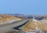
Red Deer County is located approximately mid-way between both Edmonton and Calgary and is bisected by the Queen Elizabeth II Highway. It is home to the Alberta Sports Hall of Fame (located just outside of the town of Red Deer on Highway 2).
It is bounded on the north and east by the Red Deer River
Red Deer River
The Red Deer River is a river in Alberta, Canada. It is a major tributary of the South Saskatchewan River.Red Deer River has a total length of and a drainage area of...
. The City of Red Deer is located in the north-east of the county.
Agriculture

Agriculture
Agriculture is the cultivation of animals, plants, fungi and other life forms for food, fiber, and other products used to sustain life. Agriculture was the key implement in the rise of sedentary human civilization, whereby farming of domesticated species created food surpluses that nurtured the...
area, and much of the rural land is actively used for growing crops, feeding livestock and providing lumber
Lumber
Lumber or timber is wood in any of its stages from felling through readiness for use as structural material for construction, or wood pulp for paper production....
and mineral resources. The County has initiated several projects to ensure that agriculture and the environment are represented as it coninues to grow.
An Agricultural Profile has been created to detail the County's existing agriculture, land and water resources. The County was divided into 19 distinct geographic areas calleld County Neighbourhoods. These delineations distinguish variations in drainage, soil type, water resources, and primary production. County Neighbourhoods have specific characteristics that will assist future growth and development plans.
Livestock and crop production are an important part of the economy. The County has dairies that make cheese, U-pick vegetable and fruit farms and the largest organic farm in Alberta. Amenities for trout fishing exist at a U-fish pod. The County also has elk, deer, and apiary farms as well as a mouse farm, which raises white mice for the pet food industry.
Development
Construction of residences and most buildings in Red Deer County require County-issued development permits, to assure that proposed project are in conformance with applicable County bylaws and statutory plans and is consistent with requirements regulating property divisions and uses such as setbacks, minimum frontage, potable water supply and sewage disposal systems.As well, permits are often required from other agencies such as Alberta Transportation or Alberta Environment. Although the County has no jurisdiction in these areas, it can assist applicants through the process.
Demographics
In 2006, Red Deer County had a population of 19,108 living in 8,014 dwellingsHouse
A house is a building or structure that has the ability to be occupied for dwelling by human beings or other creatures. The term house includes many kinds of different dwellings ranging from rudimentary huts of nomadic tribes to free standing individual structures...
, a 3.3% increase from 2001. The countyhas a land area of 4002.58 km² (1,545.4 sq mi) and a population density
Population density
Population density is a measurement of population per unit area or unit volume. It is frequently applied to living organisms, and particularly to humans...
of 4.8 /km2.
According to the Canada 2001 Census
Canada 2001 Census
The Canada 2001 Census was a detailed enumeration of the Canadian population. Census day was May 15, 2001. On that day, Statistics Canada attempted to count every person in Canada. The total population count of Canada was 30,007,094. This was a 4% increase over 1996 Census of 28,846,761. In...
:
- Population: 79,082 (2005)
- % Change (1996-2001): 8.9
- Dwellings: 7,302
- Area (km².): 4,015.05
- Density (persons per km².): 19.7
Communities
The following communities are located in Red Deer County:Cities
- Red DeerRed Deer, AlbertaRed Deer is a city in Central Alberta, Canada. It is located near the midpoint of the Calgary-Edmonton Corridor and is surrounded by Red Deer County. It is Alberta's third-most-populous city – after Calgary and Edmonton. The city is located in aspen parkland, a region of rolling hills...
Towns
- BowdenBowden, AlbertaBowden is a town in central Alberta, Canada. It is located in Red Deer County, south of Red Deer, on the Queen Elizabeth II Highway.- Geography :Nearby communities are Innisfail , James River Bridge , Huxley and Olds ....
- InnisfailInnisfail, AlbertaInnisfail is a town in central Alberta, Canada. It is located in the Calgary-Edmonton Corridor, south of Red Deer at the junction of Highway 2 and Highway 54....
- PenholdPenhold, AlbertaPenhold is a town in central Alberta, Canada. Penhold is surrounded by the county of Red Deer No. 23, south of Red Deer at the junction of Highway 2A and Highway 42. It is located north of Calgary, along the Red Deer River...
- Sylvan LakeSylvan Lake, AlbertaSylvan Lake is a town in central Alberta, Canada. It is located west of the City of Red Deer along Highway 11 or Highway 11A. It is situated on the southeast edge of Sylvan Lake, a long freshwater lake, in Red Deer County....
Villages
- DelburneDelburne, AlbertaDelburne is a village in the central Alberta east of Red Deer.Named for Delia Mewburn, sister of pioneer physician F.H. Mewburn. Delburne is a quaint agricultural community located in the center of Alberta's scenic Parkland region...
- ElnoraElnora, AlbertaElnora is a village in central Alberta, Canada north of Three Hills.- Demographics :The population of the Village of Elnora according to its 2011 municipal census is 320, a 3.2% increase from its 2010 municipal census population of 310....
Summer villages
- Half Moon BayHalf Moon Bay, AlbertaHalf Moon Bay is a summer village in Alberta, Canada. It is located on the western shore of Sylvan Lake, near Sylvan Lake Provincial Park.-Demographics:In 2006, Half Moon Bay had a population of 32 living in 60 dwellings, a -13.5% increase from 2001...
- Jarvis BayJarvis Bay, AlbertaJarvis Bay is a summer village in Alberta, Canada. It is located on the eastern shore of Sylvan Lake, in Jarvis Bay Provincial Park.-Demographics:...
- NorglenwoldNorglenwold, AlbertaNorglenwold is a summer village in central Alberta, Canada. It is located on the southeast shore of Sylvan Lake adjacent to the Town of Sylvan Lake.- Demographics :...
Hamlets
- ArdleyArdley, AlbertaArdley is a hamlet in central Alberta, Canada within Red Deer County. It is located west of Highway 21, approximately east of Red Deer.- References :...
- BenaltoBenalto, AlbertaBenalto is a hamlet in central Alberta, Canada within Red Deer County. It is located approximately west of the Town of Sylvan Lake nestled within rolling parklands...
- DicksonDickson, AlbertaDickson is a hamlet in central Alberta, Canada within Red Deer County. It is located approximately west of Innisfail near the Dickson Dam and Gleniffer Lake. It is within Census Division No. 8.- History :...
- Linn ValleyLinn Valley, AlbertaLinn Valley is a hamlet in central Alberta, Canada within Red Deer County. It is located on Highway 11A, approximately northwest of Red Deer.- References :...
- LousanaLousana, AlbertaLousana is a hamlet in central Alberta, Canada within Red Deer County. It is located east of the junction of Highway 21 and Highway 42, approximately southeast of Red Deer.- References :...
- MarkervilleMarkerville, AlbertaMarkerville is a hamlet in central Alberta, Canada within Red Deer County. It is located north of Highway 54, approximately southwest of Red Deer.- References :...
- SpringbrookSpringbrook, AlbertaSpringbrook is a hamlet in central Alberta, Canada within Red Deer County. It is located west of Highway 2A, approximately southwest of Red Deer. Springbrook is also recognized by Statistics Canada as a designated place....
- Spruce ViewSpruce View, AlbertaSpruce View is a hamlet in central Alberta, Canada within Red Deer County. It is located on Highway 54, approximately west of Innisfail. Spruce View is also recognized by Statistics Canada as a designated place.- References :...
Other unincorporated communities
- Balmoral NWBalmoral NW, AlbertaBalmoral NW is an unincorporated community in Alberta, Canada within Red Deer County that is recognized as a designated place by Statistics Canada. It is located on the east side of Range Road 270, north of Highway 11.- Demographics :...
(designated placeDesignated placeA designated place or DPL is a type of community or populated area identified by Statistics Canada for statistical purposes. DPLs are delineated for each decennial census as the statistical counterparts of incorporated places such as cities, towns and villages.DPLs are communities that lack...
) - Balmoral SEBalmoral SE, AlbertaBalmoral SE is an unincorporated community in Alberta, Canada within Red Deer County that is recognized as a designated place by Statistics Canada. It is located on the north side of Highway 11, east of Red Deer...
(designated place) - Canyon HeightsCanyon Heights, AlbertaCanyon Heights is an unincorporated community in Alberta, Canada within Red Deer County that is recognized as a designated place by Statistics Canada. It is located on the north side of Township Road 384, north of Highway 11.- Demographics :...
(designated place) - Central ParkCentral Park, AlbertaCentral Park is an unincorporated community in Alberta, Canada within Red Deer County that is recognized as a designated place by Statistics Canada. It is located on the south side of Township Road 391, west of Highway 2A.- Demographics :...
(designated place) - EvartsEvarts, AlbertaEvarts is an unincorporated community in central Alberta, Canada within Red Deer County. It is located on Township Road 382 to the east of the Medicine River, approximately south of the Hamlet of Benalto and southwest of the Town of Sylvan Lake.- History :...
- HerderHerder, AlbertaHerder is an unincorporated community in Alberta, Canada within Red Deer County that is recognized as a designated place by Statistics Canada. It is located on the south side of Highway 11, east of Red Deer...
(designated place) - Kountry Meadow EstatesKountry Meadow Estates, AlbertaKountry Meadow Estates is an unincorporated community in Alberta, Canada within Red Deer County that is recognized as a designated place by Statistics Canada. It is located on the west side of Range Road 25A, south of Highway 11...
(designated place) - Les Trailer ParkLes Trailer Park, AlbertaLes Trailer Park is an unincorporated community in Alberta, Canada within Red Deer County that is recognized as a designated place by Statistics Canada. It is located on the east side of Range Road 280B, south of Highway 11...
(designated place) - Poplar RidgePoplar Ridge, AlbertaPoplar Ridge is a hamlet in central Alberta, Canada within Brazeau County, located northwest of Highway 22, approximately southwest of Edmonton.- References :...
- RavenRaven, AlbertaRaven is an unincorporated community in central Alberta within Red Deer County, located on Highway 54, southwest of Red Deer....
- Spruce Lane AcresSpruce Lane Acres, AlbertaSpruce Lane Acres is an unincorporated community in Alberta, Canada within Red Deer County that is recognized as a designated place by Statistics Canada. It is located on the north side of Township Road 392, east of Highway 2.- Demographics :...
(designated place) - Woodland HillsWoodland Hills, AlbertaWoodland Hills is an unincorporated community in Alberta, Canada within Red Deer County that is recognized as a designated place by Statistics Canada. It is located on the east side of Range Road 275, southwest of Highway 2.- Demographics :...
(designated place)
External links
- Red Deer County (official website)
- Red Deer County Profile (on AlbertaFirst)
- Red Deer Corridor - Regional Economic Development website