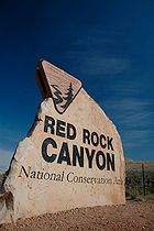
Red Rock Canyon National Conservation Area
Encyclopedia
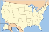
Nevada
Nevada is a state in the western, mountain west, and southwestern regions of the United States. With an area of and a population of about 2.7 million, it is the 7th-largest and 35th-most populous state. Over two-thirds of Nevada's people live in the Las Vegas metropolitan area, which contains its...
is an area managed by the Bureau of Land Management as part of its National Landscape Conservation System
National Landscape Conservation System
The National Landscape Conservation System is a collection of the lands considered to be the crown jewels of the American west. NLCS is also known as National Conservation Lands. These lands represent 10% of the managed by the Bureau of Land Management...
, and protected as a National Conservation Area
National Conservation Area
National Conservation Area is a designation for certain protected areas in the United States. National Conservation Areas are managed by the United States Bureau of Land Management under the National Landscape Conservation System...
. It is located about 15 miles (24.1 km) west of Las Vegas
Las Vegas, Nevada
Las Vegas is the most populous city in the U.S. state of Nevada and is also the county seat of Clark County, Nevada. Las Vegas is an internationally renowned major resort city for gambling, shopping, and fine dining. The city bills itself as The Entertainment Capital of the World, and is famous...
, and easily seen from the Las Vegas Strip
Las Vegas Strip
The Las Vegas Strip is an approximately stretch of Las Vegas Boulevard in Clark County, Nevada; adjacent to, but outside the city limits of Las Vegas proper. The Strip lies within the unincorporated townships of Paradise and Winchester...
. The area is visited by over 1 million visitors each year.
The conservation area showcases a set of large red rock formation
Rock formations in the United States
The following is a partial list of rock formations in the United States, by state:-Arizona:*Canyon de Chelly National Monument**Spider Rock*Chiricahua National Monument**Duck on a Rock**Organ Pipe**Mushroom Rock**Sea Captain*Monument Valley...
s: a set of sandstone
Sandstone
Sandstone is a sedimentary rock composed mainly of sand-sized minerals or rock grains.Most sandstone is composed of quartz and/or feldspar because these are the most common minerals in the Earth's crust. Like sand, sandstone may be any colour, but the most common colours are tan, brown, yellow,...
peaks and walls called the Keystone Thrust. The walls are up to 3000 feet (914.4 m) high, making them a popular hiking
Hiking
Hiking is an outdoor activity which consists of walking in natural environments, often in mountainous or other scenic terrain. People often hike on hiking trails. It is such a popular activity that there are numerous hiking organizations worldwide. The health benefits of different types of hiking...
and rock climbing
Rock climbing
Rock climbing also lightly called 'The Gravity Game', is a sport in which participants climb up, down or across natural rock formations or artificial rock walls. The goal is to reach the summit of a formation or the endpoint of a pre-defined route without falling...
destination. The highest point is La Madre Mountain, at 8154 feet (2,485.3 m).
A one-way loop road, 13 miles (21 km) long, provides vehicle access to many of the features in the area. Several side roads and parking areas allow access to many of the trails located in the area. A visitor center
Visitor center
A visitor center or centre , visitor information center, tourist information center, is a physical location that provides tourist information to the visitors who tour the place or area locally...
is located at the start of the loop road. The loop road is very popular for bicycle touring
Bicycle touring
Bicycle touring is cycling over long distances – prioritizing pleasure and endurance over utility or speed. Touring can range from single day 'supported' rides — e.g., rides to benefit charities — where provisions are available to riders at stops along the route, to multi-day...
; it begins with a moderate climb, then is mostly downhill or flat.
Red Rock Canyon itself is a side-canyon accessible only by four-wheel-drive road off of the scenic loop. The unnamed but often visited valley cut through by State Route 159
Nevada State Route 159
State Route 159 is a east–west highway in southern Nevada, providing access to Red Rock Canyon and serving as a thoroughfare in the Las Vegas metropolitan area. A portion of the west end of the route is designated a Nevada Scenic Byway....
is commonly, but incorrectly, referred to as Red Rock Canyon. The massive wall of rock called the Wilson Cliffs, or Keystone Thrust, can be seen to the west along this highway.
Towards the southern end of the National Conservation Area are Spring Mountain Ranch State Park
Spring Mountain Ranch State Park
Spring Mountain Ranch State Park is a state park of Nevada, USA, preserving the historic Sandstone Ranch established in 1876. It is located within the Red Rock Canyon National Conservation Area in the Cottonwood Valley, west of Las Vegas. It has a picnic area and a summer theater program through...
, the western ghost town replica attraction of Bonnie Springs, and the village of Blue Diamond
Blue Diamond, Nevada
Blue Diamond is a census-designated place in Clark County, Nevada, United States. The population was 282 at the 2000 census.-Geography:Blue Diamond is located at .-Demographics:...
.
Native Americans

As many as six different Native American
Native Americans in the United States
Native Americans in the United States are the indigenous peoples in North America within the boundaries of the present-day continental United States, parts of Alaska, and the island state of Hawaii. They are composed of numerous, distinct tribes, states, and ethnic groups, many of which survive as...
cultures may have been present at Red Rock over the millennia. The following chronology is an approximation:
- Southern PaiutePaiutePaiute refers to three closely related groups of Native Americans — the Northern Paiute of California, Idaho, Nevada and Oregon; the Owens Valley Paiute of California and Nevada; and the Southern Paiute of Arizona, southeastern California and Nevada, and Utah.-Origin of name:The origin of...
900 to modern times - PatayanPatayanPatayan is a term used by archaeologists to describe prehistoric and historic Native American cultures who inhabited parts of modern day Arizona, west to Lake Cahuilla in California, and in Baja California, between 700–1550 CE...
Culture 900 to early historic times in the 1800s - Anasazi 1 AD to 1150.
- Pinto/Gypsum (Archaic) 3500 BC to 1 AD.
- San Dieguito 7000 to 5500 BC.
- Paleo-Indians (Tule Springs) 11,000 to 8000 BC.
Numerous petroglyph
Petroglyph
Petroglyphs are pictogram and logogram images created by removing part of a rock surface by incising, picking, carving, and abrading. Outside North America, scholars often use terms such as "carving", "engraving", or other descriptions of the technique to refer to such images...
s as well as pottery fragments remain today throughout the area. In addition, several roasting pits used by the early Native Americans provide further evidence of human activity in the past at Red Rock.
Modern history
In the early 1900s, around the time the first people settled in nearby Las Vegas, a small sandstoneSandstone
Sandstone is a sedimentary rock composed mainly of sand-sized minerals or rock grains.Most sandstone is composed of quartz and/or feldspar because these are the most common minerals in the Earth's crust. Like sand, sandstone may be any colour, but the most common colours are tan, brown, yellow,...
quarry
Quarry
A quarry is a type of open-pit mine from which rock or minerals are extracted. Quarries are generally used for extracting building materials, such as dimension stone, construction aggregate, riprap, sand, and gravel. They are often collocated with concrete and asphalt plants due to the requirement...
was operated by the Excelsior Company near the northern area of the scenic loop. It proved to be uneconomical and was shut down. Evidence of the quarry's existence includes some of the huge sandstone blocks that have been left behind. In 1967, the Bureau of Land Management
Bureau of Land Management
The Bureau of Land Management is an agency within the United States Department of the Interior which administers America's public lands, totaling approximately , or one-eighth of the landmass of the country. The BLM also manages of subsurface mineral estate underlying federal, state and private...
designated 10000 acre (4,046.9 ha) as the Red Rock Recreation Lands. By 1990, special legislation changed the status of the Red Rock Recreation Lands to a National Conservation Area, which also provides funds used to maintain and protect it.
The Howard Hughes Corporation
The Howard Hughes Corporation
The Howard Hughes Corporation is a major real estate development and management company based in Dallas, Texas, which was founded by Howard Hughes. Later sold to the Rouse Company, it became a separate company again in 2010, as a spinoff of General Growth Properties .Upon exiting bankruptcy, GGP...
, developer of Summerlin, has transferred land adjacent to the protected area, to provide a buffer between development and the conservation area. Red Rock Canyon National Conservation Area is adjacent, on the west side, to the Spring Mountains National Recreation Area
Spring Mountains National Recreation Area
The Spring Mountains National Recreation Area is a U.S. National Recreation Area, administered by the U.S. Forest Service, and lies west of Las Vegas, Nevada. It covers over 316,000 acres of land. The area runs from low meadows at around 3,000 feet of elevation to Mount Charleston at 11,918...
.
Biology
Mojave Desert
The Mojave Desert occupies a significant portion of southeastern California and smaller parts of central California, southern Nevada, southwestern Utah and northwestern Arizona, in the United States...
; the lowest elevation of the area, from 3600 to 4500 ft (1,097.3 to 1,371.6 ), is in the Lower Sonoran Zone
Life zone
The Life Zone concept was developed by C. Hart Merriam in 1889 as a means of describing areas with similar plant and animal communities. Merriam observed that the changes in these communities with an increase in latitude at a constant elevation are similar to the changes seen with an increase in...
, while the area from 4500 feet (1,371.6 m) up is in the Upper Sonoran Zone
Life zone
The Life Zone concept was developed by C. Hart Merriam in 1889 as a means of describing areas with similar plant and animal communities. Merriam observed that the changes in these communities with an increase in latitude at a constant elevation are similar to the changes seen with an increase in...
. The character of the sandstone layers is such that a number of year-round springs may be found in the recesses of the side canyons.
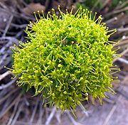
Some 600 species of plants are known in the area. Common types in the valley floor include the Joshua tree, Mojave yucca
Mojave yucca
Yucca schidigera, also known as the Mojave yucca or Spanish Dagger, is a flowering plant that is native to the Mojave Desert and Sonoran Desert of southeastern California, Baja California, southern Nevada and western Arizona....
, banana yucca
Banana yucca
Yucca baccata is a common species of yucca native to the deserts of the southwestern United States and northwestern Mexico, from southeastern California north to Utah, east to western Texas and south to Sonora and Chihuahua. It gets its name from its banana-shaped fruit.Banana yucca is closely...
, creosote
Creosote
Creosote is the portion of chemical products obtained by the distillation of a tar that remains heavier than water, notably useful for its anti-septic and preservative properties...
, and blackbrush. Higher up the Utah juniper and Sonoran scrub oak (also called scrub live oak) come to dominate. Agave
Agave
Agave is a genus of monocots. The plants are perennial, but each rosette flowers once and then dies ; they are commonly known as the century plant....
is easy to spot in red rock niches, with its thick low leaves and flowering stem that reaches twice the height of a man. The Calico Tanks trail has a plaque about prehistoric agave roasting pits. Ponderosa pine
Ponderosa Pine
Pinus ponderosa, commonly known as the Ponderosa Pine, Bull Pine, Blackjack Pine, or Western Yellow Pine, is a widespread and variable pine native to western North America. It was first described by David Douglas in 1826, from eastern Washington near present-day Spokane...
s may be found at the top of the valley, where it connects to the Spring Mountains
Spring Mountains
The Spring Mountains are a mountain range of southern Nevada in the United States, running generally northwest-southeast along the west side of Las Vegas and down to the border with California...
.
Wild burro
Burro
The burro is a small donkey used primarily as a pack animal. In addition, significant numbers of feral burros live in the Southwestern United States, where they are protected by law, and in Mexico...
s are a familiar sight, as are rabbit
Rabbit
Rabbits are small mammals in the family Leporidae of the order Lagomorpha, found in several parts of the world...
s and ground squirrel
Ground squirrel
The ground squirrels are members of the squirrel family of rodents which generally live on or in the ground, rather than trees. The term is most often used for the medium-sized ground squirrels, as the larger ones are more commonly known as marmots or prairie dogs, while the smaller and less...
s. Desert bighorn sheep
Desert Bighorn Sheep
The Desert Bighorn Sheep is a subspecies of Bighorn Sheep that occurs in the desert Southwest regions of the United States and in the northern regions of Mexico. The trinomial of this species commemorates the American naturalist Edward William Nelson...
are occasionally seen at higher elevations.
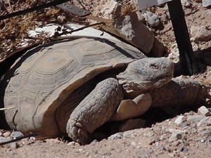
The Conservation Area is protected habitat for the Desert Tortoise
Desert Tortoise
The desert tortoise is a species of tortoise native to the Mojave desert and Sonoran desert of the southwestern United States and northwestern Mexico. They can be located in western Arizona, southeastern California, southern Nevada, and southwestern Utah. The species name agassizii is in honor of...
. A mascot tortoise, named Mojave Max, was kept at the Visitors Center. The Las Vegas Review-Journal
Las Vegas Review-Journal
The Las Vegas Review-Journal is published in Las Vegas, Nevada, United States. It is the largest circulating daily newspaper in Nevada, and one of two daily newspapers in Las Vegas . It is the flagship publication of Stephens Media LLC...
reported on July 2, 2008 that Max had died of natural causes at the age of 65. A successor has not been named.
Geology
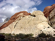
The Red Rock area was located under a deep ocean basin during the Paleozoic Era 600 million years ago. Sediments up to 9,000 feet thick were deposited, and eventually lithified. This sediment eventually formed into limestone
Limestone
Limestone is a sedimentary rock composed largely of the minerals calcite and aragonite, which are different crystal forms of calcium carbonate . Many limestones are composed from skeletal fragments of marine organisms such as coral or foraminifera....
.
Around the Mesozoic Era 250 million years ago, the earth's crust started to rise due to tectonic shifts, forcing the water out and leaving behind evaporite
Evaporite
Evaporite is a name for a water-soluble mineral sediment that result from concentration and crystallization by evaporation from an aqueous solution. There are two types of evaporate deposits, marine which can also be described as ocean deposits, and non-marine which are found in standing bodies of...
formations of salt
Salt
In chemistry, salts are ionic compounds that result from the neutralization reaction of an acid and a base. They are composed of cations and anions so that the product is electrically neutral...
and gypsum
Gypsum
Gypsum is a very soft sulfate mineral composed of calcium sulfate dihydrate, with the chemical formula CaSO4·2H2O. It is found in alabaster, a decorative stone used in Ancient Egypt. It is the second softest mineral on the Mohs Hardness Scale...
. Exposure of the former sea bed allowed some of the rocks to oxidize (literally rust
Rust
Rust is a general term for a series of iron oxides. In colloquial usage, the term is applied to red oxides, formed by the reaction of iron and oxygen in the presence of water or air moisture...
) and formed the area's characteristic red and orange rock layers.
Eventually a lush plain with streams and trees developed in the area. Some of these trees were covered with mud from the streams and eventually became petrified wood
Petrified wood
Petrified wood is the name given to a special type of fossilized remains of terrestrial vegetation. It is the result of a tree having turned completely into stone by the process of permineralization...
. Many of these fossilized logs can still be found today at the base of the Wilson Cliffs.
By 180 million years ago, the climate continued to change and the area became a desert featuring vast expanses of huge shifting sand dunes
Dune
In physical geography, a dune is a hill of sand built by wind. Dunes occur in different forms and sizes, formed by interaction with the wind. Most kinds of dunes are longer on the windward side where the sand is pushed up the dune and have a shorter "slip face" in the lee of the wind...
. These dunes would pile up and were lithified, and are now called Aztec Sandstone
Sandstone
Sandstone is a sedimentary rock composed mainly of sand-sized minerals or rock grains.Most sandstone is composed of quartz and/or feldspar because these are the most common minerals in the Earth's crust. Like sand, sandstone may be any colour, but the most common colours are tan, brown, yellow,...
.
During a mountain building period called the Laramide orogeny
Laramide orogeny
The Laramide orogeny was a period of mountain building in western North America, which started in the Late Cretaceous, 70 to 80 million years ago, and ended 35 to 55 million years ago. The exact duration and ages of beginning and end of the orogeny are in dispute, as is the cause. The Laramide...
around 65 million years ago, the Keystone Thrust Fault
Thrust fault
A thrust fault is a type of fault, or break in the Earth's crust across which there has been relative movement, in which rocks of lower stratigraphic position are pushed up and over higher strata. They are often recognized because they place older rocks above younger...
developed, which ran through most of North America and through the Red Rock Conservation Area. The movement of this fault forced the older grey sedimentary rock over the younger red rocks, forming the striking red line that can be seen in the mountain today.
Activities
Red Rock provides a wide variety of activities, the most popular being hikingHiking
Hiking is an outdoor activity which consists of walking in natural environments, often in mountainous or other scenic terrain. People often hike on hiking trails. It is such a popular activity that there are numerous hiking organizations worldwide. The health benefits of different types of hiking...
, biking, rock scrambling
Scrambling
Scrambling is a method of ascending rocky faces and ridges. It is an ambiguous term that lies somewhere between hillwalking and rock climbing. It is often distinguished from hillwalking by defining a scramble as a route where hands must be used in the ascent...
, and rock climbing
Rock climbing
Rock climbing also lightly called 'The Gravity Game', is a sport in which participants climb up, down or across natural rock formations or artificial rock walls. The goal is to reach the summit of a formation or the endpoint of a pre-defined route without falling...
. Horseback riding and camping
Camping
Camping is an outdoor recreational activity. The participants leave urban areas, their home region, or civilization and enjoy nature while spending one or several nights outdoors, usually at a campsite. Camping may involve the use of a tent, caravan, motorhome, cabin, a primitive structure, or no...
are also allowed on specific trails and designated areas. Automobile and motorcycle clubs such as Flat 4 LV (Subaru enthusiasts club) often do group drives through the 13-mile scenic drive. ATV
All-terrain vehicle
An all-terrain vehicle , also known as a quad, quad bike, three wheeler, or four wheeler, is defined by the American National Standards Institute as a vehicle that travels on low pressure tires, with a seat that is straddled by the operator, along with handlebars for steering control...
use is not permitted in the area.
Aside from the obvious dangers from climbing rock faces and cliffs, visitors should know that temperatures can routinely exceed 105 °F (40.6 °C) in the summer, so bringing plenty of water is a must. Visitors hiking into the backcountry off established trails should never go alone, and should inform other people of their plans. There is also the threat of venomous rattlesnakes and flash flooding/lightning from thunderstorms.
Rock climbing
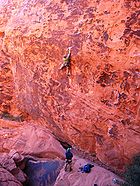
Aztec Sandstone
The Aztec Sandstone is a Lower Jurassic geological formation of primarily eolian sand from which fossil pterosaur tracks have been recovered.-Vertebrate paleofauna:-References:...
, a very hard variety with a consistent solidity; many climbs feature ascents of a single parallel-sided crack hundreds of feet long. The climbs of Red Rock have a broad range. Not only are there many long, easy routes, making the area a common climbing training ground, but Red Rock also features many more difficult climbs as well.
Popular sport climbing
Sport climbing
Sport climbing is a form of rock climbing that relies on permanent anchors fixed to the rock, and possibly bolts, for protection,...
areas include the Calico Hills and Sandstone Quarry. Red Rock also has a multitude of traditional climbing
Traditional climbing
Traditional climbing, or trad climbing, is a style of rock climbing in which a climber or group of climbers places all gear required to protect against falls , and removes it when a passage is complete...
areas including single pitch areas such as Brass Wall and Necromancer Wall, along with multi-pitch areas such as Eagle Wall, Aeolian Wall, Mescalito, and Solar Slab Wall. Multi-day big wall aid climbs are featured on the Rainbow Wall.
Hiking
Red Rock has hiking trails and picnic areas. Trails are changed and diverted depending upon the needs of the ecosystem. In early spring, depending upon the precipitation, it is possible to see waterfalls on the edge of the canyons.Wildfire history
Wildfires in Red Rock, especially those in the loop area, allow visitors to see both the damage caused by these events as well as the ability of the desert to heal itself over time.While wildfires are nothing new to the Red Rock Area, recent fires seemed to have been in part fueled by the thick growth of non-native
Invasive species
"Invasive species", or invasive exotics, is a nomenclature term and categorization phrase used for flora and fauna, and for specific restoration-preservation processes in native habitats, with several definitions....
red brome
Bromus madritensis
Bromus madritensis is a species of brome grass known by the common name compact brome.It is native to Europe but it has been widely introduced elsewhere, such as North America, where it is found in many areas. It is now known nearly worldwide...
and cheat grasses. They provide fuel for fires and also compete with the native plants in the area for resources. So far there have been no plans to control these weeds, as control methods such as using herbicides can be both costly and also damaging to the native plants.
Several significant wildfires have burned within the Red Rock Canyon NCA in recent years, including:
- 1998 a fire occurred in the loop area. By 2003 regrowth made it difficult to find the burn area.
- June 25, 2005 the Goodsprings fire at over 31600 acre (12,788.1 ha), burned into Red Rock NCA's southern area.
- July 22, 2005 lighting caused 800 acre (323.7 ha) fire in the loop area.
- September 6, 2006 yet another fire was started by lightning in the loop near the visitor's center and burned around 1500 acre (607 ha).

