
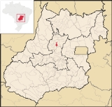
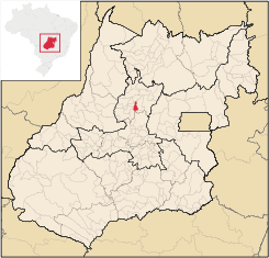
Rialma
Encyclopedia
| Rialma | |
|---|---|
| State | Goiás Goiás Goiás is a state of Brazil, located in the central part of the country. The name Goiás comes from the name of an indigenous community... |
| Area: | 268.9 km² |
| Population: | 10,485 (IBGE 2007) |
| Elevation: | 582 m above sea level |
| Postcode (CEP): | 76310-000 |
| Became a city: | 1953 |
| Distance to Goiânia Goiânia -Climate:The city has a tropical wet and dry climate with an average temperature of . There's a wet season, from October to April, and a dry one, from May to September. Annual rainfall is around 1,520 mm.... : |
182 km |
| Statistical microregion: | Ceres Ceres Microregion The Ceres Microregion is located in north-central Goiás state, Brazil. It includes 22 cities with a total population of 215,820 inhabitants . The total area is 13,224.40 km² and the population density is 16.32 inhab/km². The most important cities are Ceres and Goianésia.The most populous... |
| Website: | Prefeitura Municipal de Rialma |
City
A city is a relatively large and permanent settlement. Although there is no agreement on how a city is distinguished from a town within general English language meanings, many cities have a particular administrative, legal, or historical status based on local law.For example, in the U.S...
and municipality
Municipality
A municipality is essentially an urban administrative division having corporate status and usually powers of self-government. It can also be used to mean the governing body of a municipality. A municipality is a general-purpose administrative subdivision, as opposed to a special-purpose district...
in north-central Goiás
Goiás
Goiás is a state of Brazil, located in the central part of the country. The name Goiás comes from the name of an indigenous community...
state, Brazil
Brazil
Brazil , officially the Federative Republic of Brazil , is the largest country in South America. It is the world's fifth largest country, both by geographical area and by population with over 192 million people...
.
Location and Geography
Rialma is located across the Rio das Almas from CeresCeres, Goiás
Ceres is a small city and municipality in central Goiás state, Brazil. It was the first agricultural colony built in the state of Goiás.-Geography:...
on the important interstate highway BR-153, which links Anápolis
Anápolis
Anápolis is the third largest city in the State of Goiás in Brazil. It lies in the center of a rich agricultural region and has become a leader in food processing and pharmaceutical plants.-Location and population:...
to Belém
Belém
Belém is a Brazilian city, the capital and largest city of state of Pará, in the country's north region. It is the entrance gate to the Amazon with a busy port, airport and bus/coach station...
. It was created as part of the urban area of Ceres, which was also created as the Colônia Nacional Agrícola de Goiás. It is part of the Ceres Microregion
Ceres Microregion
The Ceres Microregion is located in north-central Goiás state, Brazil. It includes 22 cities with a total population of 215,820 inhabitants . The total area is 13,224.40 km² and the population density is 16.32 inhab/km². The most important cities are Ceres and Goianésia.The most populous...
.
The distance to Goiânia
Goiânia
-Climate:The city has a tropical wet and dry climate with an average temperature of . There's a wet season, from October to April, and a dry one, from May to September. Annual rainfall is around 1,520 mm....
is 182 km. Highway connections are made by GO-080 / Nerópolis
Nerópolis
Nerópolis is a small city and municipality in central Goiás state, Brazil.-Location:The municipality is part of the metropolitan region of Goiânia, which is 42 kilometers to the west. It is nationally known as the city of garlic and sweets...
/ São Francisco de Goiás
São Francisco de Goiás
São Francisco de Goiás is a small town and municipality in central Goiás state, Brazil.Municipal boundaries:*North: Jaraguá*South: Petrolina de Goiás*East: Pirenópolis*West: Jesúpolis and Jaraguá...
/ BR-153 / Jaraguá / Rianápolis
Rianápolis
Rianápolis is a small town and municipality in northeastern Goiás state, Brazil.-Location:It is located almost directly north of the state capital and is on the important BR-153 highway, which links Belem to São Paulo. The regional center of Ceres is located 19 km. to the northwest. Highway...
. Rialma is 19 km. north of Rianápolis
Rianápolis
Rianápolis is a small town and municipality in northeastern Goiás state, Brazil.-Location:It is located almost directly north of the state capital and is on the important BR-153 highway, which links Belem to São Paulo. The regional center of Ceres is located 19 km. to the northwest. Highway...
. See Seplan for the complete list.
The municipality has boundaries with Nova Glória
Nova Glória
Nova Glória is a small town and municipality in north-central Goiás state, Brazil. It is a large producer of sugarcane.-Location:Nova Glória is in the Ceres Microregion and is north of Goiânia, just east of the important BR-153 highway. It is 21 kilometers north of the important commercial...
in the north; Santa Isabel, Goiás
Santa Isabel, Goiás
-Location:Santa Isabel is a small town and municipality in north-central Goiás state, Brazil. It is 21 kilometers from Ceres, the nearest regional center. Santa Isabel has municipal boundaries with Rubiataba, Itapaci, Nova Glória, Rialma, and Carmo do Rio Verde...
in the east; Rianápolis
Rianápolis
Rianápolis is a small town and municipality in northeastern Goiás state, Brazil.-Location:It is located almost directly north of the state capital and is on the important BR-153 highway, which links Belem to São Paulo. The regional center of Ceres is located 19 km. to the northwest. Highway...
and Uruana
Uruana
Uruana is a small city and municipality in central Goiás state, Brazil. It is known statewide as the watermelon capital of the state.-Location:...
in the south; Carmo do Rio Verde
Carmo do Rio Verde
Carmo do Rio Verde is a small town and municipality in central Goiás state, Brazil. The population was 8,897 in a total area of 457.5 km². Carmo do Rio Verde is a major producer of sugar cane for production of alcohol.-Location:...
in the southeast; and Ceres
Ceres, Goiás
Ceres is a small city and municipality in central Goiás state, Brazil. It was the first agricultural colony built in the state of Goiás.-Geography:...
in the west.
The climate is moist tropical. The most important river is the Rio das Almas, which has its source near Cocalzinho de Goiás
Cocalzinho de Goiás
Cocalzinho de Goiás is a small town and municipality in central Goiás state, Brazil.-Location and Geography:Cocalzinho, as it is known by the inhabitants, is located in the micro-region of Entorno de Brasília, on highway BR-414, almost at the junction with highway BR-070...
and flows north to enter the massive Serra da Mesa reservoir, which dams up the Maranhão River.
Political Information and Demographics
In January 2005 the mayor was Evaldo José da Silva and there were 9 members on the city council. The number of illegible voters was 7,896 in 2007.The population density was 38.98 inhab/km² (2007) with 9,292 living in urban areas and 1,193 living in rural areas. There has been a gain in population of about 3,500 people since 1980.
The Economy
Economic activity is based on agriculture, cattle raising, services, small transformation industries, and government employment. There is also a sizable herd of beef and dairy cattle (23,000 head in 2006). There was one bank branch in 2007.There were 234 farms in 2006 with a total area of 23,154 hectares. Around 9,000 hectares were planted and 11,000 were pasture land. The main agricultural crops were rice, sugarcane, beans, oranges, manioc, corn, and soybeans.
Health and Education
There was a campus of the Universidade Federal de Goiás in 2007. The adult literacy rate was 89.3% in 2000, with the national average being 86.4%. In 2007 there was 01 hospital with 29 beds. The infant mortality rate was 25.4 (2000), with the national average being 33.0.- Municipal Human Development IndexHuman Development IndexThe Human Development Index is a composite statistic used to rank countries by level of "human development" and separate "very high human development", "high human development", "medium human development", and "low human development" countries...
: 0.777 - State ranking: 35 (out of 242 municipalities)
- National ranking: 1,124 (out of 5,507 municipalities)
Origin of the Name
The name of the city came from an agglutinationAgglutination
In contemporary linguistics, agglutination usually refers to the kind of morphological derivation in which there is a one-to-one correspondence between affixes and syntactical categories. Languages that use agglutination widely are called agglutinative languages...
of Rio das Almas. In 1953, when the BR-153 was built, Rialma broke off from Jaraguá to become a separate municipality.