Roraima
Encyclopedia
Roraima is the northernmost and least populated state of Brazil
, located in the Amazon
region. It borders the states of Amazonas and Pará
, as well as the nations of Venezuela
and Guyana
. The population is 400,000 (2006) and the capital is Boa Vista
. Roraima is the Brazilian state with the fewest municipalities, 15 in total.
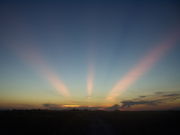 The climate of Roraima is tropical with an annual mean temperature of 26°C (78.8°F). The state's southern part is located in the Amazon rainforest
, while the north has open grassland
fields, and there is a small strip of savanna
to the east. The state is rich in mineral deposits - especially gold
, diamond
s, cassiterite
, bauxite
, marble
and copper
. Many of these deposits are located in indigenous reserves, and illegal mining has resulted in frequent conflicts with the native population, especially the Yanomami and the Macuxi and allied groups.
The Monte Roraima National Park is located around one of the highest mountains of both Venezuela (outside of the Andes
) and Brazil, and the highest in Guyana, a 2,875 m
(9,432 ft) high tepui
known as Monte Roraima
. Only a small fraction of the mountain is in Brazilian territory, however, and the highest point of the Brazilian part is at 2,734 metres (8,970 ft).
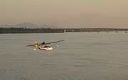
in which there is no dry season
– all months have mean precipitation
values of at least 60 mm
. It is usually found at latitude
s within five degrees of the equator
– which are dominated by the Intertropical Convergence Zone
. The equatorial climate is denoted Af in the Köppen climate classification
. Tropical rainforest
is the natural vegetation in equatorial regions.
s and comprises the largest and most species-rich tract of tropical rainforest
in the world
. Wet tropical forests are the most species-rich biome
, and tropical forests in the Americas
are consistently more species rich than the wet forests in Africa
and Asia
. As the largest tract of tropical rainforest in the Americas, the Amazonian rainforests have unparalleled biodiversity
. More than 1/3 of all species in the world live in the Amazon Rainforest.
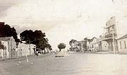
Since the beginnings of the 16th century, the region now considered the state of Roraima was disputed territory, because of its rich mineral
reserves. It was sought by the Spanish
, Portuguese
, Dutch
and English
until the beginning of the last century. But in 1943, together with a section from the state of Amazonas, the Federal Government created the territory of Rio Branco
, which became Roraima in 1962. In 1988, Roraima became a state by decision of the National Congress
. The name of the state was taken from Mount Roraima, whose name comes from the Pemon words “roroi” (“cyan”) and “ma” (“large”).
 According to the IBGE
of 2007, there were 405,000 people residing in the state. The population density was 1.8 inh./km².
Urbanization
: 80.3% (2004); Population growth
: 4.6% (1991–2000); House
s: 97,465 (2005).
The last PNAD (National Research for Sample of Domiciles) census revealed the following numbers: 278,000 Brown (Multiracial) people (68.8%), 81,000 White
people (20.0%), 29,000 Black
people (7.4%), 15,000 Asian
or Amerindian
people (3.8%).
The Brazilian Indian agency, (FUNAI
) estimates the state's indigenous population at 30,715. The largest indigenous groups are the Macuxi (16,500) and the better-known Yanomami. (11,700) Much of the state's indigenous population lives in several large, legally recognized indigenous reserves and a number of smaller ones, totalling 46.13% of the land area of the state.
represents 3.8%, of GDP (2004). Roraima exports: wood
74%, leather
22.6% (2002).
Share of the Brazilian economy: 0.1% (2005).
 Portuguese
is the official national language, and thus the primary language taught in schools. But English
and Spanish
are part of the official high school
curriculum.
was opened on February 19, 1973, and underwent its first big remodeling in 1998. The passenger terminal, runway and apron were all enlarged, and a separate taxiway
was built. The airport has the capacity to receive 675,000 passengers a year.
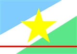
, which cuts through the state. The flag was designed by the artist Mário Barreto, and was adopted by Law No.133 of June 14, 1996.
Official Website Brazilian Tourism Portal
Brazil
Brazil , officially the Federative Republic of Brazil , is the largest country in South America. It is the world's fifth largest country, both by geographical area and by population with over 192 million people...
, located in the Amazon
Amazon Basin
The Amazon Basin is the part of South America drained by the Amazon River and its tributaries that drains an area of about , or roughly 40 percent of South America. The basin is located in the countries of Bolivia, Brazil, Colombia, Ecuador, Guyana, Peru, and Venezuela...
region. It borders the states of Amazonas and Pará
Pará
Pará is a state in the north of Brazil. It borders the Brazilian states of Amapá, Maranhão, Tocantins, Mato Grosso, Amazonas and Roraima. To the northwest it also borders Guyana and Suriname, and to the northeast it borders the Atlantic Ocean. The capital is Belém.Pará is the most populous state...
, as well as the nations of Venezuela
Venezuela
Venezuela , officially called the Bolivarian Republic of Venezuela , is a tropical country on the northern coast of South America. It borders Colombia to the west, Guyana to the east, and Brazil to the south...
and Guyana
Guyana
Guyana , officially the Co-operative Republic of Guyana, previously the colony of British Guiana, is a sovereign state on the northern coast of South America that is culturally part of the Anglophone Caribbean. Guyana was a former colony of the Dutch and of the British...
. The population is 400,000 (2006) and the capital is Boa Vista
Boa Vista, Roraima
Boa Vista is the capital of the Brazilian state of Roraima. Situated on the western bank of the River Branco, the city lies 220 km away from Brazil's border with Venezuela. It is the only Brazilian capital located entirely above the Equator...
. Roraima is the Brazilian state with the fewest municipalities, 15 in total.
Geography

Amazon Rainforest
The Amazon Rainforest , also known in English as Amazonia or the Amazon Jungle, is a moist broadleaf forest that covers most of the Amazon Basin of South America...
, while the north has open grassland
Grassland
Grasslands are areas where the vegetation is dominated by grasses and other herbaceous plants . However, sedge and rush families can also be found. Grasslands occur naturally on all continents except Antarctica...
fields, and there is a small strip of savanna
Savanna
A savanna, or savannah, is a grassland ecosystem characterized by the trees being sufficiently small or widely spaced so that the canopy does not close. The open canopy allows sufficient light to reach the ground to support an unbroken herbaceous layer consisting primarily of C4 grasses.Some...
to the east. The state is rich in mineral deposits - especially gold
Gold
Gold is a chemical element with the symbol Au and an atomic number of 79. Gold is a dense, soft, shiny, malleable and ductile metal. Pure gold has a bright yellow color and luster traditionally considered attractive, which it maintains without oxidizing in air or water. Chemically, gold is a...
, diamond
Diamond
In mineralogy, diamond is an allotrope of carbon, where the carbon atoms are arranged in a variation of the face-centered cubic crystal structure called a diamond lattice. Diamond is less stable than graphite, but the conversion rate from diamond to graphite is negligible at ambient conditions...
s, cassiterite
Cassiterite
Cassiterite is a tin oxide mineral, SnO2. It is generally opaque, but it is translucent in thin crystals. Its luster and multiple crystal faces produce a desirable gem...
, bauxite
Bauxite
Bauxite is an aluminium ore and is the main source of aluminium. This form of rock consists mostly of the minerals gibbsite Al3, boehmite γ-AlO, and diaspore α-AlO, in a mixture with the two iron oxides goethite and hematite, the clay mineral kaolinite, and small amounts of anatase TiO2...
, marble
Marble
Marble is a metamorphic rock composed of recrystallized carbonate minerals, most commonly calcite or dolomite.Geologists use the term "marble" to refer to metamorphosed limestone; however stonemasons use the term more broadly to encompass unmetamorphosed limestone.Marble is commonly used for...
and copper
Copper
Copper is a chemical element with the symbol Cu and atomic number 29. It is a ductile metal with very high thermal and electrical conductivity. Pure copper is soft and malleable; an exposed surface has a reddish-orange tarnish...
. Many of these deposits are located in indigenous reserves, and illegal mining has resulted in frequent conflicts with the native population, especially the Yanomami and the Macuxi and allied groups.
The Monte Roraima National Park is located around one of the highest mountains of both Venezuela (outside of the Andes
Andes
The Andes is the world's longest continental mountain range. It is a continual range of highlands along the western coast of South America. This range is about long, about to wide , and of an average height of about .Along its length, the Andes is split into several ranges, which are separated...
) and Brazil, and the highest in Guyana, a 2,875 m
Metre
The metre , symbol m, is the base unit of length in the International System of Units . Originally intended to be one ten-millionth of the distance from the Earth's equator to the North Pole , its definition has been periodically refined to reflect growing knowledge of metrology...
(9,432 ft) high tepui
Tepui
A tepui , or tepuy, is a table-top mountain or mesa found in the Guiana Highlands of South America, especially in Venezuela. The word tepui means "house of the gods" in the native tongue of the Pemon, the indigenous people who inhabit the Gran Sabana....
known as Monte Roraima
Monte Roraima
Mount Roraima is the highest of the Pakaraima chain of tepui plateau in South America. First described by the English explorer Sir Walter Raleigh in 1596, its summit area is defended by 400-metre-tall cliffs on all sides...
. Only a small fraction of the mountain is in Brazilian territory, however, and the highest point of the Brazilian part is at 2,734 metres (8,970 ft).

Climate
Except for the higher mountains where the climate is cooler but very wet, Roraima has an equatorial climate. This is a type of tropical climateTropical climate
A tropical climate is a climate of the tropics. In the Köppen climate classification it is a non-arid climate in which all twelve months have mean temperatures above...
in which there is no dry season
Dry season
The dry season is a term commonly used when describing the weather in the tropics. The weather in the tropics is dominated by the tropical rain belt, which oscillates from the northern to the southern tropics over the course of the year...
– all months have mean precipitation
Precipitation (meteorology)
In meteorology, precipitation In meteorology, precipitation In meteorology, precipitation (also known as one of the classes of hydrometeors, which are atmospheric water phenomena is any product of the condensation of atmospheric water vapor that falls under gravity. The main forms of precipitation...
values of at least 60 mm
Millimetre
The millimetre is a unit of length in the metric system, equal to one thousandth of a metre, which is the SI base unit of length....
. It is usually found at latitude
Latitude
In geography, the latitude of a location on the Earth is the angular distance of that location south or north of the Equator. The latitude is an angle, and is usually measured in degrees . The equator has a latitude of 0°, the North pole has a latitude of 90° north , and the South pole has a...
s within five degrees of the equator
Equator
An equator is the intersection of a sphere's surface with the plane perpendicular to the sphere's axis of rotation and containing the sphere's center of mass....
– which are dominated by the Intertropical Convergence Zone
Intertropical Convergence Zone
The Intertropical Convergence Zone , known by sailors as The Doldrums, is the area encircling the earth near the equator where winds originating in the northern and southern hemispheres come together....
. The equatorial climate is denoted Af in the Köppen climate classification
Köppen climate classification
The Köppen climate classification is one of the most widely used climate classification systems. It was first published by Crimea German climatologist Wladimir Köppen in 1884, with several later modifications by Köppen himself, notably in 1918 and 1936...
. Tropical rainforest
Tropical rainforest
A tropical rainforest is an ecosystem type that occurs roughly within the latitudes 28 degrees north or south of the equator . This ecosystem experiences high average temperatures and a significant amount of rainfall...
is the natural vegetation in equatorial regions.
Vegetation
The Amazon represents over half of the planet's remaining rainforestRainforest
Rainforests are forests characterized by high rainfall, with definitions based on a minimum normal annual rainfall of 1750-2000 mm...
s and comprises the largest and most species-rich tract of tropical rainforest
Tropical rainforest
A tropical rainforest is an ecosystem type that occurs roughly within the latitudes 28 degrees north or south of the equator . This ecosystem experiences high average temperatures and a significant amount of rainfall...
in the world
World
World is a common name for the whole of human civilization, specifically human experience, history, or the human condition in general, worldwide, i.e. anywhere on Earth....
. Wet tropical forests are the most species-rich biome
Biome
Biomes are climatically and geographically defined as similar climatic conditions on the Earth, such as communities of plants, animals, and soil organisms, and are often referred to as ecosystems. Some parts of the earth have more or less the same kind of abiotic and biotic factors spread over a...
, and tropical forests in the Americas
Americas
The Americas, or America , are lands in the Western hemisphere, also known as the New World. In English, the plural form the Americas is often used to refer to the landmasses of North America and South America with their associated islands and regions, while the singular form America is primarily...
are consistently more species rich than the wet forests in Africa
Africa
Africa is the world's second largest and second most populous continent, after Asia. At about 30.2 million km² including adjacent islands, it covers 6% of the Earth's total surface area and 20.4% of the total land area...
and Asia
Asia
Asia is the world's largest and most populous continent, located primarily in the eastern and northern hemispheres. It covers 8.7% of the Earth's total surface area and with approximately 3.879 billion people, it hosts 60% of the world's current human population...
. As the largest tract of tropical rainforest in the Americas, the Amazonian rainforests have unparalleled biodiversity
Biodiversity
Biodiversity is the degree of variation of life forms within a given ecosystem, biome, or an entire planet. Biodiversity is a measure of the health of ecosystems. Biodiversity is in part a function of climate. In terrestrial habitats, tropical regions are typically rich whereas polar regions...
. More than 1/3 of all species in the world live in the Amazon Rainforest.
History

Since the beginnings of the 16th century, the region now considered the state of Roraima was disputed territory, because of its rich mineral
Mineral
A mineral is a naturally occurring solid chemical substance formed through biogeochemical processes, having characteristic chemical composition, highly ordered atomic structure, and specific physical properties. By comparison, a rock is an aggregate of minerals and/or mineraloids and does not...
reserves. It was sought by the Spanish
Spain
Spain , officially the Kingdom of Spain languages]] under the European Charter for Regional or Minority Languages. In each of these, Spain's official name is as follows:;;;;;;), is a country and member state of the European Union located in southwestern Europe on the Iberian Peninsula...
, Portuguese
Portugal
Portugal , officially the Portuguese Republic is a country situated in southwestern Europe on the Iberian Peninsula. Portugal is the westernmost country of Europe, and is bordered by the Atlantic Ocean to the West and South and by Spain to the North and East. The Atlantic archipelagos of the...
, Dutch
Netherlands
The Netherlands is a constituent country of the Kingdom of the Netherlands, located mainly in North-West Europe and with several islands in the Caribbean. Mainland Netherlands borders the North Sea to the north and west, Belgium to the south, and Germany to the east, and shares maritime borders...
and English
England
England is a country that is part of the United Kingdom. It shares land borders with Scotland to the north and Wales to the west; the Irish Sea is to the north west, the Celtic Sea to the south west, with the North Sea to the east and the English Channel to the south separating it from continental...
until the beginning of the last century. But in 1943, together with a section from the state of Amazonas, the Federal Government created the territory of Rio Branco
Rio Branco
Rio Branco is a Brazilian city, capital of Acre. Located in the Valley of Acre in northern Brazil, it is the most populous county in the state, with 305,954 inhabitants, according to a 2009 estimate - almost half the state population....
, which became Roraima in 1962. In 1988, Roraima became a state by decision of the National Congress
National Congress of Brazil
The National Congress of Brazil is the legislative body of Brazil's federal government.Unlike regional legislative bodies – Legislative Assemblies and City Councils -, the Congress is bicameral, composed of the Federal Senate and the Chamber of Deputies .The Senate represents the 26 states and...
. The name of the state was taken from Mount Roraima, whose name comes from the Pemon words “roroi” (“cyan”) and “ma” (“large”).
Demographics

IBGE
The Brazilian Institute of Geography and Statistics or IBGE , is the agency responsible for statistical, geographic, cartographic, geodetic and environmental information in Brazil...
of 2007, there were 405,000 people residing in the state. The population density was 1.8 inh./km².
Urbanization
Urbanization
Urbanization, urbanisation or urban drift is the physical growth of urban areas as a result of global change. The United Nations projected that half of the world's population would live in urban areas at the end of 2008....
: 80.3% (2004); Population growth
Population growth
Population growth is the change in a population over time, and can be quantified as the change in the number of individuals of any species in a population using "per unit time" for measurement....
: 4.6% (1991–2000); House
House
A house is a building or structure that has the ability to be occupied for dwelling by human beings or other creatures. The term house includes many kinds of different dwellings ranging from rudimentary huts of nomadic tribes to free standing individual structures...
s: 97,465 (2005).
The last PNAD (National Research for Sample of Domiciles) census revealed the following numbers: 278,000 Brown (Multiracial) people (68.8%), 81,000 White
White Brazilian
White Brazilians make up 48.4% of Brazil's population, or around 92 million people, according to the IBGE's 2008 PNAD . Whites are present in the entire territory of Brazil, although the main concentrations are found in the South and Southeastern parts of the country...
people (20.0%), 29,000 Black
Afro-Brazilian
In Brazil, the term "preto" is one of the five categories used by the Brazilian Census, along with "branco" , "pardo" , "amarelo" and "indígena"...
people (7.4%), 15,000 Asian
Asian Brazilian
An Asian Brazilian is is a Brazilian citizen of full or partial Asian ancestry, who remains culturally connected to Asia, or an Asian-born person permanently residing in Brazil. Brazil received many immigrants from Asia, both from Middle East and East Asia...
or Amerindian
Indigenous peoples in Brazil
The Indigenous peoples in Brazil comprise a large number of distinct ethnic groups who inhabited the country prior to the European invasion around 1500...
people (3.8%).
The Brazilian Indian agency, (FUNAI
Fundação Nacional do Índio
Fundação Nacional do Índio or FUNAI is a Brazilian governmental protection agency for Indian interests and their culture.It was originally called the SPI and was founded by the Brazilian Marshal Cândido Rondon in 1910, who also created the agency's motto, "Die if necessary, but never kill." The...
) estimates the state's indigenous population at 30,715. The largest indigenous groups are the Macuxi (16,500) and the better-known Yanomami. (11,700) Much of the state's indigenous population lives in several large, legally recognized indigenous reserves and a number of smaller ones, totalling 46.13% of the land area of the state.
Trivial facts
- Vehicles: 74,181 (March/2007)
- Mobile phoneMobile phoneA mobile phone is a device which can make and receive telephone calls over a radio link whilst moving around a wide geographic area. It does so by connecting to a cellular network provided by a mobile network operator...
s: 148,000 (April/2007) - TelephoneTelephoneThe telephone , colloquially referred to as a phone, is a telecommunications device that transmits and receives sounds, usually the human voice. Telephones are a point-to-point communication system whose most basic function is to allow two people separated by large distances to talk to each other...
s: 67,000 (April/2007) - Cities: 15 (2007).
Economy
The service sector is the largest component of GDP at 87.5%, followed by the industrial sector at 8.7%. AgricultureAgriculture
Agriculture is the cultivation of animals, plants, fungi and other life forms for food, fiber, and other products used to sustain life. Agriculture was the key implement in the rise of sedentary human civilization, whereby farming of domesticated species created food surpluses that nurtured the...
represents 3.8%, of GDP (2004). Roraima exports: wood
Wood
Wood is a hard, fibrous tissue found in many trees. It has been used for hundreds of thousands of years for both fuel and as a construction material. It is an organic material, a natural composite of cellulose fibers embedded in a matrix of lignin which resists compression...
74%, leather
Leather
Leather is a durable and flexible material created via the tanning of putrescible animal rawhide and skin, primarily cattlehide. It can be produced through different manufacturing processes, ranging from cottage industry to heavy industry.-Forms:...
22.6% (2002).
Share of the Brazilian economy: 0.1% (2005).
Education

Portuguese language
Portuguese is a Romance language that arose in the medieval Kingdom of Galicia, nowadays Galicia and Northern Portugal. The southern part of the Kingdom of Galicia became independent as the County of Portugal in 1095...
is the official national language, and thus the primary language taught in schools. But English
English language
English is a West Germanic language that arose in the Anglo-Saxon kingdoms of England and spread into what was to become south-east Scotland under the influence of the Anglian medieval kingdom of Northumbria...
and Spanish
Spanish language
Spanish , also known as Castilian , is a Romance language in the Ibero-Romance group that evolved from several languages and dialects in central-northern Iberia around the 9th century and gradually spread with the expansion of the Kingdom of Castile into central and southern Iberia during the...
are part of the official high school
High school
High school is a term used in parts of the English speaking world to describe institutions which provide all or part of secondary education. The term is often incorporated into the name of such institutions....
curriculum.
Educational institutions
- Universidade Federal de RoraimaUniversidade Federal de RoraimaThe Universidade Federal de Roraima is a Brazilian public institution which is located in Roraima, Brazil.-External links:*...
(UFRR) (Federal University of Roraima); - Universidade Estadual de Roraima (UERR) (State University of Roraima);
- Instituto Federal de Educação Ciência e Tecnologia de Roraima (IFRR);
- Faculdade de Ciências Humanas, Biológicas e da Saúde (FCHBS);
- Faculdade de Teologia de Boa Vista (Fatebov);
- Faculdade Roraimense de Ensino Superior (Fares);
- Faculdades Cathedral - Boa Vista (Cathedral-Boa Vista);
- Faculdade Atual da Amazônia - (FAA)
International Airport
Boa Vista International AirportBoa Vista International Airport
Boa Vista-Atlas Brasil Cantanhede International Airport is the airport serving Boa Vista, Brazil. Since April 13, 2009 the airport is named after Atlas Brasil Cantanhede , a pilot and politician who in the 1950s pioneered aviation in Roraima state....
was opened on February 19, 1973, and underwent its first big remodeling in 1998. The passenger terminal, runway and apron were all enlarged, and a separate taxiway
Taxiway
A taxiway is a path on an airport connecting runways with ramps, hangars, terminals and other facilities. They mostly have hard surface such as asphalt or concrete, although smaller airports sometimes use gravel or grass....
was built. The airport has the capacity to receive 675,000 passengers a year.
Highways

- BR-174;
- BR-210;
- BR-431;
- BR-432;
- BR-410;
- RR-171;
- RR-175;
- RR-202;
- RR-203.
Flag
The blue of the flag represents the pure air and the sky of Roraima, the white strip symbolizes peace, and the green to the right represents the forests and fields. The star - symbolizing the state in the national flag of Brazil - is yellow, which symbolizes the mineral resources of the state. The red line in bottom stands for the equatorEquator
An equator is the intersection of a sphere's surface with the plane perpendicular to the sphere's axis of rotation and containing the sphere's center of mass....
, which cuts through the state. The flag was designed by the artist Mário Barreto, and was adopted by Law No.133 of June 14, 1996.
External links
BrazilBrazil
Brazil , officially the Federative Republic of Brazil , is the largest country in South America. It is the world's fifth largest country, both by geographical area and by population with over 192 million people...
Official Website Brazilian Tourism Portal

