Southwest Federal Center
Encyclopedia

Washington, D.C. (southwest)
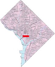
Southwest is the southwestern quadrant of Washington, D.C., the capital of the United States, and is located south of the National Mall and west of South Capitol Street. It is the smallest quadrant of the city. Southwest is small enough that it is frequently referred to as a neighborhood in and of...
Washington, D.C.
Washington, D.C.
Washington, D.C., formally the District of Columbia and commonly referred to as Washington, "the District", or simply D.C., is the capital of the United States. On July 16, 1790, the United States Congress approved the creation of a permanent national capital as permitted by the U.S. Constitution....
, nearly entirely occupied by offices for various branches of the U.S. Government, including many of the museums of the Smithsonian Institution
Smithsonian Institution
The Smithsonian Institution is an educational and research institute and associated museum complex, administered and funded by the government of the United States and by funds from its endowment, contributions, and profits from its retail operations, concessions, licensing activities, and magazines...
.
Southwest Federal Center lies between Independence Avenue and the National Mall
National Mall
The National Mall is an open-area national park in downtown Washington, D.C., the capital of the United States. The National Mall is a unit of the National Park Service , and is administered by the National Mall and Memorial Parks unit...
to the north, the Southeast-Southwest Freeway (Interstate 395
Interstate 395 (District of Columbia-Virginia)
Interstate 395 in Washington, D.C., and Virginia is a 13 mile long spur route that begins at a junction with Interstate 95 in Springfield, Virginia and ends in northwest Washington, D.C. It passes underneath the National Mall near the United States Capitol and ends at a junction with U.S...
) and the Washington Channel to the south, South Capitol Street to the east, and 15th Street SW to the west.
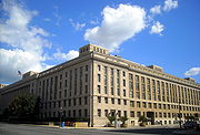
Several U.S. Cabinet Departments have headquarters or large office complexes in the area, including the Agriculture (including a separate building dedicated to the Forest Service), Transportation, HUD, Health and Human Services, Education, and Energy Departments. The most prominent are the Department of Agriculture, which is housed in a neoclassical building complex that lines both sides of Independence Avenue, and the arcing high-rise of HUD, which is characterized by a unique installation of illuminated fiberglass rings in its 7th Street plaza. Additionally, NASA Headquarters
NASA
The National Aeronautics and Space Administration is the agency of the United States government that is responsible for the nation's civilian space program and for aeronautics and aerospace research...
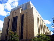
is located in a large building at the corner of 4th and E Streets. The Bureau of Engraving and Printing
Bureau of Engraving and Printing
The Bureau of Engraving and Printing is a government agency within the United States Department of the Treasury that designs and produces a variety of security products for the United States government, most notable of which is paper currency for the Federal Reserve. The Federal Reserve itself is...
is also located in the Southwest Federal Center area.

Rayburn House Office Building
The Rayburn House Office Building is a congressional office building for the U.S. House of Representatives in the Capitol Hill neighborhood of Washington, D.C., between South Capitol Street and First Street....
and Ford
Ford House Office Building
The Ford House Office Building is one of the four office buildings containing U.S. House of Representatives staff in Washington, D.C., on Capitol Hill....
House Office Buildings, are located in Southwest Federal Center (although the Ford building is not actually located on Independence Avenue, but is on 3rd Street between D Street and Virginia Avenue SW).

National Air and Space Museum
The National Air and Space Museum of the Smithsonian Institution holds the largest collection of historic aircraft and spacecraft in the world. It was established in 1976. Located in Washington, D.C., United States, it is a center for research into the history and science of aviation and...
, the U.S. Holocaust Museum, and the Museum of the American Indian, the Freer and Sackler galleries, the National Museum of African Art
National Museum of African Art
The National Museum of African Art is a museum that is part of the Smithsonian Institution in Washington, D.C.. Located on the National Mall, the museum specializes in African art and culture...
, and the Arts and Industries Building
Arts and Industries Building
The Arts and Industries Building is the second oldest of the Smithsonian museums on the National Mall in Washington, D.C. Initially named the National Museum, it was built to provide the Smithsonian with its first proper facility for public display of its growing collections.The building, designed...
, as well as the Smithsonian Castle that forms the main offices for the Institution. The United States Holocaust Memorial Museum
United States Holocaust Memorial Museum
The United States Holocaust Memorial Museum is the United States' official memorial to the Holocaust. Adjacent to the National Mall in Washington, D.C., the USHMM provides for the documentation, study, and interpretation of Holocaust history...
, though not affiliated with the Smithsonian, is also located in the vicinity.
The few non-governmental businesses in the neighborhood include five hotels, St. Dominic's Catholic Church, a few restaurants, a power station for the neighborhood, the First District police station, and commercial spaces (e.g., convenience stores, bank branches, coffee shops, etc.) in the lobbies of the hotels and office buildings. Also, L'Enfant Plaza
L'Enfant Plaza
L'Enfant Plaza is a complex of one governmental and three commercial buildings, as well as the "La Promenade" shopping mall, in the Southwest section of Washington, D.C. The plaza is located south of Independence Avenue SW between 12th and 9th Streets SW...
, a multi-building complex and promenade that includes both government and civilian offices (as well as an indoor shopping mall), is located off Independence Avenue.
The Southwest Federal Center is served by the Smithsonian
Smithsonian (Washington Metro)
Smithsonian is a side platformed Washington Metro station at the National Mall in Washington, D.C., United States. The station was opened on July 1, 1977, and is operated by the Washington Metropolitan Area Transit Authority...
and Federal Center SW
Federal Center SW (Washington Metro)
Federal Center SW is an island platformed Washington Metro station in an area of Southwest known as the Southwest Federal Center in Washington, D.C., United States. The station was opened on July 1, 1977, and is operated by the Washington Metropolitan Area Transit Authority...
Metro
Washington Metro
The Washington Metro, commonly called Metro, and unofficially Metrorail, is the rapid transit system in Washington, D.C., United States, and its surrounding suburbs. It is administered by the Washington Metropolitan Area Transit Authority , which also operates Metrobus service under the Metro name...
stations on the Orange
Orange Line (Washington Metro)
The Orange Line of the Washington Metro consists of 26 rapid transit stations from Vienna to New Carrollton. It has stations in Fairfax County and Arlington, Virginia, the District of Columbia, and Prince George's County, Maryland. Half of the line's stations are shared with the Blue Line, and over...
and Blue
Blue Line (Washington Metro)
The Blue Line of the Washington Metro in the United States consists of 27 rapid transit stations from Franconia–Springfield to Largo Town Center. It has stations in Fairfax County, Alexandria and Arlington, Virginia, the District of Columbia, and Prince George's County, Maryland...
Lines, and by the L'Enfant Plaza
L'Enfant Plaza (Washington Metro)
L'Enfant Plaza is a Washington Metro station in the Southwest Federal Center neighborhood of Washington, D.C., United States. The station was opened on July 1, 1977, and is operated by the Washington Metropolitan Area Transit Authority...
station on the Green
Green Line (Washington Metro)
The Green Line is one of five heavy rail subway lines that constitute the Washington Metro rapid transit system in the Washington, D.C., metropolitan area. The Green Line consists of 21 stations, with termini at Branch Avenue and at Greenbelt. The Green Line runs through Prince George's County,...
, Yellow
Yellow Line (Washington Metro)
The Yellow Line of the Washington Metro consists of 17 rapid transit stations from Huntington to Fort Totten. The line terminates at the Mount Vernon Square station during peak hours.Peak hours are 5 a.m. to 9:30 a.m. and 3 p.m. to 7 p.m. Service is extended to the Green Line stations during...
, Orange, and Blue Lines.

