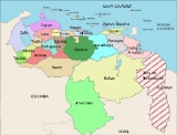
States of Venezuela
Encyclopedia
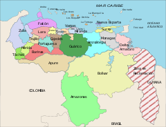
Venezuela
Venezuela
Venezuela , officially called the Bolivarian Republic of Venezuela , is a tropical country on the northern coast of South America. It borders Colombia to the west, Guyana to the east, and Brazil to the south...
is divided into 23 states (estados), 1 Capital District
Venezuelan Capital District
The Capital District of Venezuela is a federal district corresponding to the capital Caracas. It has an area of 433 km² and there is only one administrative division , Libertador, which contains about half City of Caracas. It is the seat of the federal government and the head of the public...
(Distrito Capital) and the Federal Dependencies (Dependencias Federales) that consist of a large number of Venezuelan islands. Venezuela also claims the Guayana Esequiba
Guayana Esequiba
Guayana Esequiba is a territory administered by Guyana but claimed by Venezuela. It includes the territory between the Cuyuni River to the west and the Essequibo River to the east...
territory which comprises six districts in the independent nation of Guyana
Guyana
Guyana , officially the Co-operative Republic of Guyana, previously the colony of British Guiana, is a sovereign state on the northern coast of South America that is culturally part of the Anglophone Caribbean. Guyana was a former colony of the Dutch and of the British...
.
Historical states
Prior to the Federal WarFederal War
The Federal War - also known as the Great War or the Five Year War - was a civil war in Venezuela between the conservative party and the liberal party about the monopoly of the conservatives of the land and the government positions, and their reluctance to grant any reforms. This drove the...
(1859–1863), Venezuela was divided into provinces rather than states (see Provinces of Venezuela
Provinces of Venezuela
The Provinces of Venezuela were administrative divisions used from Venezuela's independence from Gran Colombia in 1830 to 1864, when the States of Venezuela were created. There were initially 11 provinces, with 3 created later, until in 1856 the Law of Territorial Division divided Venezuela into 21...
). The victorious forces were supposed to grant more autonomy to the individual states, but this was not implemented.
From 1863 to the early 1900s there were numerous territorial changes, including the merger and splitting of states, but from then until the late 1990s the states were left unchanged. However, recent years have seen the creation of three new states: Delta Amacuro
Delta Amacuro
Delta Amacuro State is one of the 23 states of Venezuela, and is the location of the Orinoco Delta. The Paria Gulf and the Atlantic Ocean are found to the north, Bolívar State is found to the south, the Atlantic Ocean and Guyana are found to the east, and Monagas State is found to the west...
, Amazonas, and Vargas (in that order).
States
Below is a list of the 23 states of Venezuela. The states are listed along with their correspondent emblems, data and location.| Flag | Coat of Arms | States | Capital city | Population (2010 est.) | Area | Region | Location |
|---|---|---|---|---|---|---|---|
 |
 |
Amazonas Amazonas (Venezuelan state) Amazonas State is one of the 23 states into which Venezuela is divided.The state capital is Puerto Ayacucho. The capital until the early 1900s was San Fernando de Atabapo. Although named after the Amazon River, most of the state is drained by the Orinoco. Amazonas State covers a total surface... |
Puerto Ayacucho Puerto Ayacucho Puerto Ayacucho is the capital and largest city of Amazonas State in Venezuela. Puerto Ayacucho is located across the Orinoco River from the Colombian village of Casuarito.... |
142,200 | 180,145 km² | Guayana | |
 |
anzoategui.png) |
Anzoátegui Anzoátegui Anzoátegui State , is one of the 23 component states of Venezuela, located in the northeastern region of the country. Anzoátegui is well known for its beautiful beaches that attract many visitors. Its coast consists of a single beach approximately 100 km long... |
Barcelona | 1,654,900 | 43,300 km² | Nor - Oriental | |
 |
apure.png) |
Apure | San Fernando de Apure San Fernando de Apure San Fernando de Apure is a city in Apure State in Venezuela. The population of the municipality area is 175,056 . The 18th century exports included heron feathers and animal hides.... |
499,900 | 76,500 km² | Llanos | |
 |
aragua.png) |
Aragua Aragua (state) Aragua State is located in the north-central region of Venezuela. It has plains and jungles and Caribbean beaches. The most popular are Cata and Choroni... |
Maracay Maracay Maracay is a city in north-central Venezuela, near the Caribbean coast, and is the capital and most important city of the state of Aragua. Most of it falls under the jurisdiction of the Girardot Municipality. The population as per the 2001 census was 750,000... |
1,665,200 | 7,014 km² | Central | |
 |
 |
Barinas Barinas (state) Barinas State is one of the 23 states into which Venezuela is divided. The state capital is Barinas. Current President Hugo Chávez was born in this state... |
Barinas | 756,600 | 35,200 km² | Andean | |
 |
 |
Bolívar Bolívar (state) Bolívar State , is one of the 23 states into which Venezuela is divided. The state capital city is Ciudad Bolívar. Bolívar State covers a total surface area of 238,000 km² and in June 30, 2010 had an estimated population of 1,620,359.... |
Ciudad Bolívar Ciudad Bolívar Ciudad Bolívar is the capital of Venezuela's southeastern Bolivar State. It was founded with the name Angostura in 1764, renamed in 1846, and, as of 2010, had an estimated population of 350,691.... |
1,852,800 | 238,000 km² | Guayana | |
 |
 |
Carabobo | Valencia Valencia, Venezuela Valencia is the capital city of Carabobo State, and the third largest city of Venezuela.The city is an economic hub that contains Venezuela's top industries and manufacturing companies. The population of Valencia reached some 1.5 million in the year 2003, and it is expected to grow dramatically... |
2,531,000 | 4,650 km² | Central | |
 |
 |
Cojedes Cojedes (state) Cojedes State is one of the 23 states of Venezuela. The state capital is San Carlos.Cojedes State covers a total surface area of 14,800 km² and, in 2007, had an estimated population of 300,300.- History :... |
San Carlos San Carlos, Cojedes San Carlos is the capital of the Venezuelan state of Cojedes. This city is also the shire town of the San Carlos Municipality and, according to the 2001 Venezuelan census, the municipality has a population of 83,957.- History :... |
340,300 | 14,800 km² | Central | |
 |
deltaamacuro.png) |
Delta Amacuro Delta Amacuro Delta Amacuro State is one of the 23 states of Venezuela, and is the location of the Orinoco Delta. The Paria Gulf and the Atlantic Ocean are found to the north, Bolívar State is found to the south, the Atlantic Ocean and Guyana are found to the east, and Monagas State is found to the west... |
Tucupita Tucupita Tucupita is the capital city of the Venezuelan state of Delta Amacuro.-Geography:Delta Amacuro consists almost entirely of the swampy Orinoco River delta. The hot and humid Tucupita lies well into the delta on the Caño Manamo river... |
159,700 | 40,200 km² | Guayana | |
 |
 |
Falcón | Coro Santa Ana de Coro Coro is the capital of Falcón State and the oldest city in the west of Venezuela.-History:The city was founded on July 26, 1527 by Spanish colonists. The name "Coro" is believed to be an indigenous word meaning "wind".The city had a turbulent history in colonial times and suffered a number of... |
961,500 | 24,800 km² | Central - Occidental | |
 |
guarico.png) |
Guárico | San Juan De Los Morros San Juan de los Morros San Juan de los Morros is the capital of the Guarico state and capital of the Juan Germán Roscio municipality, and is a town located in central Venezuela.- Overview :... |
745,100 | 64,986 km² | Llanos | |
 |
lara.png) |
Lara Lara (state) Lara State is one of the 23 states into which Venezuela is divided. The state capital is Barquisimeto.Lara State covers a total surface area of and, in 2007, had an estimated population of 1,795,100.- Municipalities and municipal seats :... |
Barquisimeto Barquisimeto Barquisimeto is the capital city of the State of Lara located in west central Venezuela, halfway between Caracas and Maracaibo on the Turbio River.-Overview:... |
1,999,100 | 19,800 km² | Central - Occidental | |
 |
 |
Mérida Mérida (state) Mérida State is one of the 23 states of Venezuela. The state capital is Mérida.Mérida State covers a total surface area of 11,300 km² and, in 2007, had an estimated population of 843,800.- Climate and Vegetation :... |
Mérida | 895,800 | 11,300 km² | Andean | 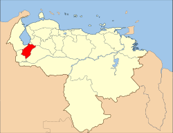 |
| Miranda Miranda (state) Miranda State is one of the 23 states into which Venezuela is divided. It is ranked second in population among Venezuelan states, after Zulia State. In June 30, 2010, it had approximately 2,987,968 residents. It also has the greatest Human Development Index in Venezuela, according to the... |
Los Teques Los Teques Los Teques is the capital city of the Venezuelan state of Miranda. Its population is 140,617 .-History:The city was founded in 1777 and was named after the Aractoeques Carabs, an indigenous tribe that once inhabited the area... |
3,010,900 | 7,950 km² | Capital | |||
 |
 |
Monagas | Maturín Maturín Maturín is a city in Venezuela, the capital of the Venezuelan state of Monagas and a centre for instrumental exploration and development of the petroleum industry in Venezuela. The metropolitan area of Maturín has a population of 401,384 inhabitants... |
999,300 | 28,930 km² | Nor - Oriental | |
 |
 |
Nueva Esparta Nueva Esparta Nueva Esparta State is one of the 23 states of Venezuela. It comprises Margarita Island, Coche, and the largely uninhabited Cubagua.The state is the smallest one in area, and is located off the northeast Caribbean coast of Venezuela. It is the only insular state of Venuezuela... |
La Asunción La Asunción La Asunción is a city in Venezuela. The capital of Nueva Esparta state, it lies on the Isla Margarita in the Caribbean Sea, off the South American mainland.Owing to its settlement by Spain in 1524, many colonial buildings still remain.... |
508,900 | 1,150 km² | Insular | |
 |
 |
Portuguesa Portuguesa (state) Portuguesa State is one of the 23 states of Venezuela.The state capital is Guanare, founded in 1591.Portuguesa State covers a total surface area of 15,200 km² and, in 2007, had an estimated population of 873,400.-Municipalities:... |
Guanare Guanare Guanare is the capital city of Portuguesa State, Venezuela. It is where la Virgen de Coromoto is said to have appeared to a Coromoto Indian.Located at the edge of the Southwestern floodplains, near the Andes foothills, Guanare is in a region known for livestock and agricultural production... |
919,400 | 15,200 km² | Central - Occidental | |
 |
 |
Sucre Sucre (state) Sucre State is one of the 23 states of Venezuela. The state capital is Cumaná. Sucre State covers a total surface area of 11,800 km² and, in 2007, had an estimated population of 916,600.-Municipalities and municipal seats:... |
Cumaná Cumaná Cumaná is the capital of Venezuela's Sucre State. It is located 402 km east of Caracas. It was the first settlement founded by Europeans in the mainland America, in 1501 by Franciscan friars, but due to successful attacks by the indigenous people, it had to be refounded several times... |
945,600 | 11,800 km² | Nor - Oriental | |
 |
 |
Táchira Táchira (state) Táchira State is one of the 23 states of Venezuela. The state capital is San Cristóbal.Táchira State covers a total surface area of 11,100 km² and, in 2007, had an estimated population of 1,177,300.... |
San Cristóbal San Cristóbal, Táchira San Cristóbal is the capital city of the Venezuelan state of Táchira. It is located in a mountainous region of Western Venezuela. The city is situated 818 m/2,625 ft above sea level in the northern Andes overlooking the Torbes River, 56 km/35 mi from the Colombian border. San... |
1,225,300 | 11,100 km² | Andean | |
 |
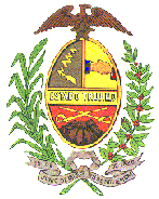 |
Trujillo Trujillo (state) Trujillo State is one of the 23 states of Venezuela. Its capital is Trujillo. The state is divided into 20 municipalities and 93 parishes. Trujillo State covers a total surface area of 7,400 km² and, in 2007, had an estimated population of 711,400.... |
Trujillo | 747,400 | 7,400 km² | Andean | |
 |
 |
Vargas Vargas (state) Vargas State is one of the 23 states of Venezuela. Named after Venezuela's first non-military president, José María Vargas, Vargas comprises a coastal region in the north of Venezuela, bordering Aragua to the west, Miranda to the east, the Caribbean Sea to the north and the Capital District to the... |
La Güaira La Guaira La Guaira is the capital city of the Venezuelan state of Vargas and the country's chief port. It was founded in 1577 as an outlet for Caracas, to the southeast. The town and the port were badly damaged during the December 1999 floods and mudslides that affected much of the region... |
337,900 | 1,496 km² | Capital | |
 |
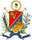 |
Yaracuy Yaracuy Yaracuy State is one of the 23 states of Venezuela. It is bordered by Falcón in the north, in the west by Lara, in the south by Portuguesa and Cojedes and in the east by Cojedes and Carabobo.... |
San Felipe | 640,700 | 7,100 km² | Central - Occidental | |
 |
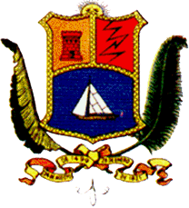 |
Zulia | Maracaibo Maracaibo Maracaibo is a city and municipality located in northwestern Venezuela off the western coast of the Lake Maracaibo. It is the second-largest city in the country after the national capital Caracas and the capital of Zulia state... |
4,020,200 | 63,100 km² | Zulian |
Special status areas
| Flag | Coat of Arms | Area | Capital city | Population (2007 est.) | Area | Location |
|---|---|---|---|---|---|---|
 |
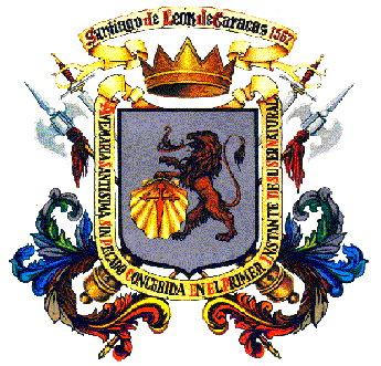 |
Capital District Venezuelan Capital District The Capital District of Venezuela is a federal district corresponding to the capital Caracas. It has an area of 433 km² and there is only one administrative division , Libertador, which contains about half City of Caracas. It is the seat of the federal government and the head of the public... |
Caracas Caracas Caracas , officially Santiago de León de Caracas, is the capital and largest city of Venezuela; natives or residents are known as Caraquenians in English . It is located in the northern part of the country, following the contours of the narrow Caracas Valley on the Venezuelan coastal mountain range... |
2,085,500 | 433 km² | |
 |
 |
Federal Dependencies | Los Roques | 15,420 | 342 km² |
Naming
Several states are named for historical figures:- AnzoáteguiAnzoáteguiAnzoátegui State , is one of the 23 component states of Venezuela, located in the northeastern region of the country. Anzoátegui is well known for its beautiful beaches that attract many visitors. Its coast consists of a single beach approximately 100 km long...
for José Antonio AnzoáteguiJosé Antonio AnzoáteguiJosé Antonio Anzoátegui was a Venezuelan Brigadier General in the Battle of Boyacá, helping to lead a republican army of Colombians and Venezuelans against Spanish royalist forces during the Venezuelan War of Independence.-See also:* Anzoátegui... - Bolívar for Simón BolívarSimón BolívarSimón José Antonio de la Santísima Trinidad Bolívar y Palacios Ponte y Yeiter, commonly known as Simón Bolívar was a Venezuelan military and political leader...
- FalcónFalcónFalcón State is one of the 23 states into which Venezuela is divided. The state capital is Coro.-Demographics and geography:Falcón State covers a total surface area of 24,800 km² and, in 2010, had an estimated population of 950,057. The Paraguaná Peninsula is connected to the rest of the...
for Juan Crisóstomo FalcónJuan Crisóstomo FalcónJuan Crisóstomo Falcón y Zavarce , was the 20th President of Venezuela as well as military commander during the Federal War. Member of the Liberal party, first served as the supreme chief of a rebel movement in August 1859, but the rebellion was soon crushed. After the Coche treaty, is recognized... - LaraLara (state)Lara State is one of the 23 states into which Venezuela is divided. The state capital is Barquisimeto.Lara State covers a total surface area of and, in 2007, had an estimated population of 1,795,100.- Municipalities and municipal seats :...
for Jacinto LaraJacinto LaraJacinto Lara , was a Venezuelan independence leader and hero of the Venezuelan War of Independence. His contribution included participating in Simón Bolívar's 1813 Admirable Campaign. He was briefly Prefect of the Intendency of the Magdalena River and the Isthmus in 1821... - MirandaMiranda (state)Miranda State is one of the 23 states into which Venezuela is divided. It is ranked second in population among Venezuelan states, after Zulia State. In June 30, 2010, it had approximately 2,987,968 residents. It also has the greatest Human Development Index in Venezuela, according to the...
for Francisco de MirandaFrancisco de MirandaSebastián Francisco de Miranda Ravelo y Rodríguez de Espinoza , commonly known as Francisco de Miranda , was a Venezuelan revolutionary... - MonagasMonagasMonagas State is one of the 23 states of Venezuela.Monagas State covers a total surface area of 28,900 km² and, in June 30, 2010, had an estimated population of 908,626....
for José Tadeo MonagasJosé Tadeo MonagasJosé Tadeo Monagas Burgos was President of Venezuela 1847-1851 and 1855–1858, and a hero of the Venezuelan War of Independence...
and José Gregorio MonagasJosé Gregorio MonagasJosé Gregorio Monagas was President of Venezuela 1851-1855 and brother of José Tadeo Monagas.General José Gregorio Monagas was born in Aragua de Barcelona, Venezuela, in 1795. His parents were Francisco José Monagas, a merchant from the Canary Islands, and Perfecta Burgos, a native of Cojedes... - SucreSucre (state)Sucre State is one of the 23 states of Venezuela. The state capital is Cumaná. Sucre State covers a total surface area of 11,800 km² and, in 2007, had an estimated population of 916,600.-Municipalities and municipal seats:...
for Antonio José de SucreAntonio José de SucreAntonio José de Sucre y Alcalá , known as the "Gran Mariscal de Ayacucho" , was a Venezuelan independence leader. Sucre was one of Simón Bolívar's closest friends, generals and statesmen.-Ancestry:... - VargasVargas (state)Vargas State is one of the 23 states of Venezuela. Named after Venezuela's first non-military president, José María Vargas, Vargas comprises a coastal region in the north of Venezuela, bordering Aragua to the west, Miranda to the east, the Caribbean Sea to the north and the Capital District to the...
for José María VargasJosé María VargasJosé María Vargas was the 4th President of Venezuela from 1835–1836.-Life and career:...
Several states are named for natural features:
- AmazonasAmazonas (Venezuelan state)Amazonas State is one of the 23 states into which Venezuela is divided.The state capital is Puerto Ayacucho. The capital until the early 1900s was San Fernando de Atabapo. Although named after the Amazon River, most of the state is drained by the Orinoco. Amazonas State covers a total surface...
is named for the Amazon RiverAmazon RiverThe Amazon of South America is the second longest river in the world and by far the largest by waterflow with an average discharge greater than the next seven largest rivers combined... - ApureApureApure State is one of the 23 states into which Venezuela is divided. Its territory formed part of the provinces of Mérida, Maracaibo, and Barinas, in accordance with successive territorial ordinations pronounced by the colonial authorities. In 1824 the Department of Apure was created, under...
is named for the Apure RiverApure RiverThe Apure River is a river of southwestern Venezuela, formed by the confluence of the Sarare and Uribante near Guasdualito, in Venezuela, at , and flowing across the llanos into the Orinoco... - AraguaAragua* Aragua State, Venezuela* Aragua de Maturín* Aragua River* Aragua Municipality, Anzoátegui State, Venezuela* Aragua de Barcelona, Anzoátegui State, Venezuela* Aragua Fútbol Club* Aragua Glass Frog...
for the Aragua RiverAragua RiverAragua River flows in Aragua State, Venezuela.... - Barinas for the Barinas River
- CojedesCojedesCojedes is a town in the Venezuelan state of Cojedes. This town is the shire town of the Anzoátegui Municipality and, according to the 2001 Venezuelan census, the municipality has a population of 14,044.-Demographics:...
for the Cojedes RiverCojedes RiverThe Cojedes River is a tributary of the Orinoco River in central Venezuela. The Cojedes originates in Lara state, and flows southeast through a gap between the Cordillera de Mérida and the Cordillera de la Costa and across the Llanos grasslands of the Orinoco Basin to empty into the Apure River,... - Delta AmacuroDelta AmacuroDelta Amacuro State is one of the 23 states of Venezuela, and is the location of the Orinoco Delta. The Paria Gulf and the Atlantic Ocean are found to the north, Bolívar State is found to the south, the Atlantic Ocean and Guyana are found to the east, and Monagas State is found to the west...
for the river deltaRiver deltaA delta is a landform that is formed at the mouth of a river where that river flows into an ocean, sea, estuary, lake, reservoir, flat arid area, or another river. Deltas are formed from the deposition of the sediment carried by the river as the flow leaves the mouth of the river...
of the Amacuro RiverAmacuro RiverAmacuro River is a river in South America. It forms part of the northern section of the international boundary between Venezuela and Guyana. It is part of the Orinoco River basin.-References:*Rand McNally, The New International Atlas, 1993.... - GuáricoGuáricoGuárico State is one of the 23 states of Venezuela. The state capital is San Juan de Los Morros. Guárico State covers a total surface area of 64 986 km² and, in 2007, had an estimated population of 745,100.-Municipalities and municipal seats:...
for the Guárico RiverGuárico RiverGuárico River is a river in Venezuela.... - PortuguesaPortuguesaPortuguesa, Portuguese for something which is Portuguese and Female, may refer to:*Portuguese language*A Portuguesa, the Portuguese national anthem*Portuguesa , a state of Venezuela...
for the Portuguesa RiverPortuguesa RiverPortuguesa River is a river of Venezuela. It is part of the Orinoco River basin, and is a tributary of the Apure River .-References:*Rand McNally, The New International Atlas, 1993.... - Táchira for the Táchira RiverTáchira RiverThe Táchira River is a river located in Táchira and it divides the border that exists between Venezuela and Colombia in that western state....
- YaracuyYaracuyYaracuy State is one of the 23 states of Venezuela. It is bordered by Falcón in the north, in the west by Lara, in the south by Portuguesa and Cojedes and in the east by Cojedes and Carabobo....
for the Yaracuy River
Other naming origins:
- CaraboboCaraboboCarabobo State is one of the 23 states of Venezuela, located in the north of the country, about two hours by car from Caracas. The capital city of this state is Valencia, which is also the country's main industrial center. The state's area is 4,650 km² and had an estimated population of...
, named for an ethnic village - CaracasCaracasCaracas , officially Santiago de León de Caracas, is the capital and largest city of Venezuela; natives or residents are known as Caraquenians in English . It is located in the northern part of the country, following the contours of the narrow Caracas Valley on the Venezuelan coastal mountain range...
, named for the Caracas indigenous group - MéridaMeridaPlaces of the world named Mérida or Merida include:*Mérida, Spain, capital city of the Spanish Community of Extremadura*Mérida, Yucatán, capital city of the Mexican state of Yucatán*Merida, Leyte, a municipality in Leyte province in the Philippines...
, for the capital city, MéridaMérida, MéridaSantiago de los Caballeros de Mérida, Venezuela, is the capital of the municipality of Libertador and the state of Mérida, and is one of the principal cities of the Venezuelan Andes...
, itself named for MéridaMeridaPlaces of the world named Mérida or Merida include:*Mérida, Spain, capital city of the Spanish Community of Extremadura*Mérida, Yucatán, capital city of the Mexican state of Yucatán*Merida, Leyte, a municipality in Leyte province in the Philippines...
in Spain. - Nueva EspartaNueva EspartaNueva Esparta State is one of the 23 states of Venezuela. It comprises Margarita Island, Coche, and the largely uninhabited Cubagua.The state is the smallest one in area, and is located off the northeast Caribbean coast of Venezuela. It is the only insular state of Venuezuela...
("New Sparta") is named for the heroism shown by its inhabitants during the Venezuelan War of IndependenceVenezuelan War of Independence-The First Republic:Criollos resented the mercantilist policies of Spain. Trade was only allowed in Pacific ports which was a terrible burden for Argentina, Paraguay and the Caribbean colonies. This is significant as Cuba and Puerto Rico were forced to allow free trade in 1763 by Britain and...
, deemed similar to that of the SpartaSpartaSparta or Lacedaemon, was a prominent city-state in ancient Greece, situated on the banks of the River Eurotas in Laconia, in south-eastern Peloponnese. It emerged as a political entity around the 10th century BC, when the invading Dorians subjugated the local, non-Dorian population. From c...
n soldiers of Ancient GreeceAncient GreeceAncient Greece is a civilization belonging to a period of Greek history that lasted from the Archaic period of the 8th to 6th centuries BC to the end of antiquity. Immediately following this period was the beginning of the Early Middle Ages and the Byzantine era. Included in Ancient Greece is the...
. - TrujilloTrujillo (state)Trujillo State is one of the 23 states of Venezuela. Its capital is Trujillo. The state is divided into 20 municipalities and 93 parishes. Trujillo State covers a total surface area of 7,400 km² and, in 2007, had an estimated population of 711,400....
, for the capital city, TrujilloTrujillo, TrujilloTrujillo is the capital city of Trujillo State in Venezuela. About 40,000 people live in this city.Founded by one the "Conquistadores de America", Diego García de Paredes, son of Diego Garcia de Paredes , , Spanish soldier and duellist, native of Trujillo in Extremadura, Spain. This city is... - ZuliaZuliaZulia State is one of the 23 states of Venezuela. The state capital is Maracaibo. In June 30, 2010, it had an estimated population of 3,821,068, giving it the largest population among Venezuela's states. It is located in the northwestern part of the country...
's name stems from a vocal transliteration from the chibcha languageChibcha languageChibcha, also known as Muisca or Mosca, is an extinct Chibchan language of Colombia, formerly spoken by the Muisca people, a complex indigenous civilization of South America and the present-day Colombian region. Scholars believe the Chibcha language arose in South America and then migrated with...
, being the name they called an exotic blue-flowered plant known as "Edging Lobelia" (Lobelia erinusLobelia erinusLobelia erinus is a species of Lobelia native to southern Africa, from Malawi and Namibia south to South Africa.-Description:...
).

