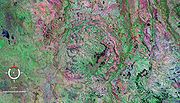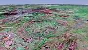
Strangways crater
Encyclopedia


Impact structure
The term impact structure is closely related to the terms impact crater or meteorite impact crater, and is used in cases where erosion or burial have destroyed or masked the original topographic feature with which we normally associate the term crater...
, the eroded remnant of a former impact crater
Impact crater
In the broadest sense, the term impact crater can be applied to any depression, natural or manmade, resulting from the high velocity impact of a projectile with a larger body...
, situated in the Northern Territory
Northern Territory
The Northern Territory is a federal territory of Australia, occupying much of the centre of the mainland continent, as well as the central northern regions...
, Australia
Australia
Australia , officially the Commonwealth of Australia, is a country in the Southern Hemisphere comprising the mainland of the Australian continent, the island of Tasmania, and numerous smaller islands in the Indian and Pacific Oceans. It is the world's sixth-largest country by total area...
. It was named after the nearby Strangways River. The location is remote and difficult to access.
The circular topographic feature that marks the site was originally thought to be volcanic, with an impact origin first proposed in 1971 after the discovery of evidence diagnostic of impact including shatter cone
Shatter cone
Shatter cones are rare geological features that are only known to form in the bedrock beneath meteorite impact craters or underground nuclear explosions...
s and shocked quartz
Shocked quartz
Shocked quartz is a form of quartz that has a microscopic structure that is different from normal quartz. Under intense pressure , the crystalline structure of quartz will be deformed along planes inside the crystal...
. The circular topographic feature is about 16 km (9.9 mi) in diameter and lies within Mesoproterozoic
Mesoproterozoic
The Mesoproterozoic Era is a geologic era that occurred between 1600 Ma and 1000 Ma . The Mesoproterozoic was the first period of Earth's history with a respectable geological record. Continents existed in the Paleoproterozoic, but we know little about them...
sedimentary rock
Sedimentary rock
Sedimentary rock are types of rock that are formed by the deposition of material at the Earth's surface and within bodies of water. Sedimentation is the collective name for processes that cause mineral and/or organic particles to settle and accumulate or minerals to precipitate from a solution....
s of the McArthur Basin
McArthur Basin
The McArthur Basin is a large intracratonic sedimentary basin in northern Australia, with an exposed area of about 180,000 km2. Most of it lies within the northeastern Northern Territory, but extends over the border into the state of Queensland...
. However, this is only a relic of the original crater after considerable erosion. Estimates of the original rim diameter vary between different researchers in the range 24–40 km (14.9–24.9 mi); the Earth Impact Database prefers a diameter of 25 km (15.5 mi). The age of the impact event has been determined at 646 ± 42 Ma (Neoproterozoic
Neoproterozoic
The Neoproterozoic Era is the unit of geologic time from 1,000 to 542.0 ± 1.0 million years ago. The terminal Era of the formal Proterozoic Eon , it is further subdivided into the Tonian, Cryogenian, and Ediacaran Periods...
) based on radiometric dating
Radiometric dating
Radiometric dating is a technique used to date materials such as rocks, usually based on a comparison between the observed abundance of a naturally occurring radioactive isotope and its decay products, using known decay rates...
of impact melt rocks.

