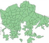
Subdivisions of Helsinki
Encyclopedia
The city of Helsinki
Helsinki
Helsinki is the capital and largest city in Finland. It is in the region of Uusimaa, located in southern Finland, on the shore of the Gulf of Finland, an arm of the Baltic Sea. The population of the city of Helsinki is , making it by far the most populous municipality in Finland. Helsinki is...

, the capital of Finland
Finland
Finland , officially the Republic of Finland, is a Nordic country situated in the Fennoscandian region of Northern Europe. It is bordered by Sweden in the west, Norway in the north and Russia in the east, while Estonia lies to its south across the Gulf of Finland.Around 5.4 million people reside...

, can be divided into various sorts of subdivisions. The subdivisions include neighbourhoods, districts, major districts and postal code
Postal code
A postal code is a series of letters and/or digits appended to a postal address for the purpose of sorting mail. Once postal codes were introduced, other applications became possible.In February 2005, 117 of the 190 member countries of the Universal Postal Union had postal code systems...

 areas. The plethora of different official ways to divide the city is a source of some confusion to the inhabitants, as different kinds of subdivisions often share similar or identical names.

Neighbourhoods

Helsinki is divided into 59 neighbourhoods (kaupunginosa in Finnish
Finnish language
Finnish is the language spoken by the majority of the population in Finland Primarily for use by restaurant menus and by ethnic Finns outside Finland. It is one of the two official languages of Finland and an official minority language in Sweden. In Sweden, both standard Finnish and Meänkieli, a...

; stadsdel in Swedish
Finland-Swedish
Finland Swedish is a general term for the closely related cluster of dialects of Swedish spoken in Finland by Swedish-speaking Finns as their mother tongue...

). The division into neighbourhoods is the official division created by the city council and used for city planning and other similar purposes. Most of the neighbourhoods have existed since the 19th century as numbered parts of the city, and official names were assigned to them in 1959. Five neighbourhoods (numbers 55 – 59) were annexed on 1 January 2009.

Today, each neighbourhood is identified by both a two-digit number between 01 and 59 and an official name in both Finnish and Swedish (in some cases they may be identical). Neighbourhoods are further divided into quarters (osa-alue) and sectors (pienalue), numbered with three and four digits respectively. Sectors divide further into individual blocks and properties.

List of Helsinki neighbourhoods

Finnish
Finnish language
Finnish is the language spoken by the majority of the population in Finland Primarily for use by restaurant menus and by ethnic Finns outside Finland. It is one of the two official languages of Finland and an official minority language in Sweden. In Sweden, both standard Finnish and Meänkieli, a...

 names first and the Swedish
Swedish language
Swedish is a North Germanic language, spoken by approximately 10 million people, predominantly in Sweden and parts of Finland, especially along its coast and on the Åland islands. It is largely mutually intelligible with Norwegian and Danish...

 names in brackets. This due to the bilinguality of Finland and Helsinki.
  • 01 Kruununhaka
    Kruununhaka
    Kruununhaka is a neighbourhood of Helsinki, the capital of Finland.Kruununhaka became the area next to the harbour and the center, when Helsinki was moved from the earlier location in the mid-1660s...

     (Kronohagen)
  • 02 Kluuvi
    Kluuvi
    Kluuvi is the commercial centre of Helsinki, Finland, and a neighbourhood in the Vironniemi district of Helsinki. The Helsinki Central railway station, the Helsinki main post office, the Stockmann and Sokos department stores, the Kluuvi shopping centre and the main offices of Finnish banks are...

     (Gloet)
  • 03 Kaartinkaupunki
    Kaartinkaupunki
    Kaartinkaupunki is a neighbourhood in the southern part of Helsinki, Finland.Kaartinkaupunki consists of the area between the Esplanadi park and the Tähtitornin vuori park. Its area was first confirmed in 1812, but the neighbourhood was only named in 1959. It is neighbourhood number 3 in Helsinki,...

     (Gardestaden)
  • 04 Kamppi
    Kamppi
    Kamppi is a neighbourhood in the centre of Helsinki, the capital of Finland. The name originally referred to a small area known as the "Kamppi field" , but according to the current official designation, "Kamppi" encompasses a much larger area with a population of 10,000 in 2004.The heart of Kamppi...

     (Kampen)
  • 05 Punavuori
    Punavuori
    Punavuori is a neighbourhood in Helsinki, the capital of Finland.After the new location and growth of Helsinki in the 18th century, Punavuori became the area next to the center. During the 19th century the district had a seedy reputation. Most of the brothels and beerhouses were found in Punavuori...

     (Rödbergen)
  • 06 Eira
    Eira
    Eira is a neighborhood in Helsinki, the capital of Finland.The district dates back to the early 20th century and received its name after Eira Hospital in the neighboring district of Ullanlinna, which in turn took its name from Eira Hospital in Stockholm, which was named after Eir, the old...

  • 07 Ullanlinna
    Ullanlinna
    ' is the southern-most city district of Helsinki, in Finland. The name Ullanlinna refers to the fortification line that was built at the southern edge of the area during the 18th century , as part of the town fortifications, which also included the fortress of . The name refers to the Swedish...

     (Ulrikasborg)
  • 08 Katajanokka
    Katajanokka
    Katajanokka is a neighbourhood of Helsinki, Finland, with around 4000 inhabitants in 2005. The district is located adjacent to the immediate downtown area, though in the first major town plan for Helsinki from the mid-18th century, the area fell outside the fortifications planned to encircle the...

     (Skatudden)
  • 09 Kaivopuisto
    Kaivopuisto
    Kaivopuisto , or in spoken language, Kaivari, is one of the oldest and best known parks in central Helsinki, Finland, and also a neighbourhood of about 500 inhabitants where the park is located.-Geography:...

     (Brunnsparken)
  • 10 Sörnäinen
    Sörnäinen
    Sörnäinen is a neighbourhood in the city of Helsinki, Finland.Sörnäinen is located a little more than one kilometre north from the coastal centre of Helsinki, near the district of Hakaniemi. The east side of Sörnäinen borders the sea....

     (Sörnäs)
  • 11 Kallio
    Kallio
    Kallio is a district and a neighbourhood in Helsinki, the capital of Finland, located on the eastern side of the Helsinki peninsula about one kilometere north from the city centre. It is one of the most densely populated areas in Finland...

     (Berghäll)
    • 111 Siltasaari
      Siltasaari
      Siltasaari , Broholmen is a central neighborhood of Helsinki, Finland....

       (Broholmen)
    • 112 Linjat
      Linjat
      Linjat , Linjerna is a central neighborhood of Helsinki, Finland....

       (Linjerna)
    • 113 Torkkelinmäki
      Torkkelinmäki
      Torkkelinmäki , Torkelsbacken is a central neighborhood of Kallio, Helsinki, Finland. Its boundaries are Hämeentie on the east, Helsinginkatu on the north, Kaarlenkatu on the west and Viides linja on the south...

       (Torkelsbacken)
  • 12 Alppiharju
    Alppiharju
    Alppiharju is a subdistrict of Helsinki, Finland....

     (Åshöjden)
    • 121 Harju
      Harju, Helsinki
      Harju is a quarter of Helsinki, Finland. It is located north of the city centre, part of Alppiharju neighbourhood, between the quarters of Alppila, Torkkelinmäki, Linjat and neighbourhoods Sörnäinen and Vallila. Harju has a population of 7,237 and an area of 0.27 km².-External links:...

       (Ås)
    • 122 Alppila
      Alppila
      Alppila is a quarter of Helsinki, Finland. It is located north of the city centre, between the districts of Kallio and Pasila, and together with Harju it forms the district of Alppiharju. Alppila has a population of 4244 and an area of 0.60 km². The Linnanmäki amusement park is located in...

       (Alphyddan)
  • 13 Etu-Töölö (Främre Tölö)
  • 14 Taka-Töölö (Bortre Tölö)
  • 15 Meilahti
    Meilahti
    Meilahti is a neighbourhood of Helsinki between Mannerheimintie and a bay named Seurasaarenselkä. Most of the houses in Meilahti were built in the 1930s and 1940s. Meilahti is home to over 6700 people including the President of Finland Tarja Halonen who lives on the shore in the President's...

     (Mejlans)
  • 16 Ruskeasuo
    Ruskeasuo
    Ruskeasuo is a neighbourhood of Helsinki , about 3 kilometres north of the city centre....

     (Brunakärr)
  • 17 Pasila
    Pasila
    is a suburb in Helsinki, Finland. It is a central-northern neighbourhood, bordering Alppila to the south, Central Park to the west and Vallila to the east....

     (Böle)
    • 171 Länsi-Pasila
      Länsi-Pasila
      Länsi-Pasila , Västra Böle is a central neighborhood of Helsinki, Finland....

       (Västra Böle)
    • 172 Pohjois-Pasila
      Pohjois-Pasila
      Pohjois-Pasila , Norra Böle is a neighborhood of Helsinki, Finland.Itella, the Finnish mail corporation, has its head office in Pohjois-Pasila.-References:...

       (Norra Böle)
    • 173 Itä-Pasila
      Itä-Pasila
      Itä-Pasila , Östra Böle is a neighborhood of Helsinki, Finland....

       (Östra Böle)
    • 174 Keski-Pasila
      Keski-Pasila
      Keski-Pasila , Mellersta Böle is a neighborhood of Helsinki, Finland....

       (Mellersta Böle)
  • 18 Laakso
    Laakso
    Laakso is a neighbourhood in Helsinki, Finland. Its borders are defined by the streets of Mannerheimintie and Nordenskiöldinkatu and the Helsinki Central Park...

     (Dal)
  • 19 Mustikkamaa-Korkeasaari (Blåbärslandet-Högholmen)
  • 20 Länsisatama
    Länsisatama
    West Harbour is a cargo and container harbour in the Jätkäsaari district of Helsinki, Finland, in the southwestern part of the Helsinginniemi peninsula. The Länsisatama harbour area also includes the Munkkisaaren laituri pier on the west side of Munkkisaari, used by cruiseliners.The Länsisatama...

     (Västra hamnen)
    • 201 Ruoholahti
      Ruoholahti
      Ruoholahti is a quarter in Helsinki, part of the Länsisatama neighbourhood and Kampinmalmi district. The name means Grass Bay and is pronounced...

       (Gräsviken)
    • 202 Lapinlahti (Lappviken)
    • 203 Jätkäsaari
      Jätkäsaari
      Jätkäsaari is a quarter in Helsinki, the capital city of Finland. It is part to the Kampinmalmi district and Länsisatama neighbourhood. It is was the location of the main container harbour in Helsinki until late 2008, when the harbour moved to the new facilities in Vuosaari...

       (Busholmen)
    • 204 Munkkisaari
      Munkkisaari
      Munkkisaari , Munkholmen is a neighborhood of Helsinki, Finland....

       (Munkholmen)
  • 21 Hermanni
    Hermanni
    Hermanni is a neighbourhood in Central major district of Helsinki, Finland., Hermanni has 3,580 inhabitants living in an area of 1.06 km2. Hermanni is part of Vallila district.-Politics:Results of the Finnish parliamentary election, 2011 in Hermanni:...

     (Hermanstaden)
  • 22 Vallila
    Vallila
    Vallila is a neighbourhood in Helsinki, the capital of Finland.Vallila is a central-northern district, bordered by Pasila to the west and Kallio to the south. Like Kallio, Vallila is mostly residential and has a reputation of a working-class district...

     (Vallgård)
  • 23 Toukola
    Toukola
    Toukola is a district of Helsinki, Finland, around 4 km north of the town centre, at the port of Vanhankaupunginlahti. Toukola is part of the administrative region of Vanhakaupunki....

     (Majstad)
    • 231 Toukola
      Toukola
      Toukola is a district of Helsinki, Finland, around 4 km north of the town centre, at the port of Vanhankaupunginlahti. Toukola is part of the administrative region of Vanhakaupunki....

       (Majstad)
    • 232 Arabianranta
      Arabianranta
      Arabianranta or Arabiastranden is a fast growing residential part of Helsinki, Finland. It is bound by Vanhankaupunginlahti bay from east, and connects to neighboring boroughs of Vanhakaupunki in north, Hermanni in south and Toukola and Kumpula in west...

       (Arabiastranden)
  • 24 Kumpula
    Kumpula
    Kumpula is a verdant neighbourhood in Helsinki, bordered by Eastern Pasila to the west, Vallila to the south, Käpylä and Koskela to the north and Toukola and Arabianranta to the east. As of January 1, 2003, Kumpula had approximately 3,600 inhabitants....

     (Gumtäkt)
  • 25 Käpylä
    Käpylä
    Käpylä is a neighbourhood of Helsinki with 7,600 inhabitants. Administratively speaking, Käpylä is a part of the Vanhakaupunki district.It is located between Kumpula, Oulunkylä and Koskela...

     (Kottby)
  • 26 Koskela
    Koskela
    Koskela , Forsby is a district in the city of Helsinki, Finland.-Politics:Results of the Finnish parliamentary election, 2011 in Koskela:*Social Democratic Party 24.2%*True Finns 16.8%*Left Alliance 16.0%...

     (Forsby)
  • 27 Vanhakaupunki
    Vanhakaupunki
    Vanhakaupunki is a neighbourhood of the city of Helsinki, Finland, to the north of Toukola. The district's name is because Helsinki was originally founded at the Vanhakaupunki area. Vanhakaupunki even appears in the new Helsinki foundation document from 1639, and the forms Gamla staden or...

     (Gammelstaden)
  • 28 Oulunkylä
    Oulunkylä
    Oulunkylä is a suburb and a neighbourhood of Helsinki, the capital of Finland. It is located north from the center of the city.It has been inhabited since the 13th century. Earlier an independent municipality, it was made part of Helsinki in 1946. A rink used for speed skating and bandy is...

     (Åggelby)
    • 281 Pirkkola
      Pirkkola
      Pirkkola , Britas is a northern neighborhood of Helsinki, Finland....

       (Britas)
    • 282 Maunula
      Maunula
      Maunula , Månsas is a northwestern neighborhood of Helsinki, Finland.For the 1952 Summer Olympics, it hosted part of the road cycling events.-Reference:* p. 554....

       (Månsas)
    • 283 Metsälä
      Metsälä
      Metsälä is a subdivision of Helsinki with about 1,000 inhabitants. It has predominantly small houses and it is situated between Maunula and Käpylä. Administratively speaking, Metsälä is a part of the Maunula district. The distance to Helsinki City Centre is about 6 kilometres from Metsälä...

       (Krämertskog)
    • 284 Patola
      Patola, Helsinki
      Patola , Dammen is a northern-central neighborhood of Helsinki, Finland....

       (Dammen)
    • 285 Veräjämäki
      Veräjämäki
      Veräjämäki , Grindbacka is a central neighborhood of Helsinki, Finland....

       (Grindbacka)
    • 286 Maunulanpuisto
      Maunulanpuisto
      Maunulanpuisto , Månsasparken is a northwestern neighborhood of Helsinki, Finland....

       (Månsasparken)
    • 287 Veräjälaakso
      Veräjälaakso
      Veräjälaakso , Grinddal is a northern-central neighborhood of Helsinki, Finland....

       (Grinddal)
  • 29 Haaga
    Haaga
    Haaga is a district and a former municipality in the Western major district of Helsinki with a population of 25,435.Haaga is divided into four subareas, which are Pohjois-Haaga , Etelä-Haaga , Kivihaka and Lassila.Haaga has two railway stations: Huopalahti railway station in south and...

     (Haga)
    • 291 Etelä-Haaga
      Etelä-Haaga
      Etelä-Haaga , Södra Haga is a neighborhood of Helsinki, Finland....

       (Södra Haga)
    • 292 Kivihaka
      Kivihaka
      Kivihaka , Stenhagen is a neighborhood of Helsinki, Finland....

       (Stenhagen)
    • 293 Pohjois-Haaga
      Pohjois-Haaga
      Pohjois-Haaga , Norra Haga is a neighborhood of Helsinki, Finland.-Sports:The following sports clubs are located in Pohjois-Haaga:* FC Pohjois-Haagan Urheilijat...

       (Norra Haga)
    • 294 Lassila
      Lassila
      Lassila , Lassas is a neighborhood of Helsinki, Finland....

       (Lassas)

  • 30 Munkkiniemi
    Munkkiniemi
    Munkkiniemi is a neighbourhood in Helsinki. Subdivisions within the district are Vanha Munkkiniemi, Kuusisaari, Lehtisaari, Munkkivuori, Niemenmäki and Talinranta.The land in Munkkiniemi was from the 17th century a part of Munksnäs manor...

     (Munksnäs)
    • 301 Vanha Munkkiniemi
      Vanha Munkkiniemi
      Vanha Munkkiniemi , Gamla Munksnäs is a neighborhood of Helsinki, Finland....

       (Gamla Munksnäs)
    • 302 Kuusisaari
      Kuusisaari
      Kuusisaari , Granö is a neighborhood of Helsinki, Finland....

       (Granö)
    • 303 Lehtisaari
      Lehtisaari, Helsinki
      Lehtisaari , Lövö is a neighborhood of Helsinki, Finland....

       (Lövö)
    • 304 Munkkivuori
      Munkkivuori
      Munkkivuori is a quarter of the Munkkiniemi neighbourhood in Helsinki. The buildings and the plan of site are typical of the late 1950s. Most of the residential buildings in Munkkivuori are within a loop formed by Ulvilantie ring road...

       (Munkshöjden)
    • 305 Niemenmäki
      Niemenmäki
      Niemenmäki is a quarter of the Munkkiniemi neighbourhood in Helsinki. Niemenmäki was constructed in the early sixties. The nearby Shopping center provides everyday services to Niemenmäki inhabitants. Huopalahdentie road separates Niemenmäki from Munkkivuori in the West and Lapinmäentie road from...

       (Näshöjden)
    • 306 Talinranta
      Talinranta
      Talinranta is a neighbourhood in Munkkiniemi district of Helsinki, Finland. It is located west from Munkkivuori and south from Tali. In south, Finnish national road 1 separates Talinranta from Vanha Munkkiniemi....

       (Talistranden)
  • 31 Lauttasaari
    Lauttasaari
    Lauttasaari is an island and neighbourhood of Western Helsinki , about 3 kilometres west of the city centre....

     (Drumsö)
  • 32 Konala
    Konala
    Konala , Kånala is a subdistrict of Helsinki, Finland. Konala has about 4500 inhabitants and about 3000 jobs. Konala is situated in Luoteis-Helsinki, north of Kehä I and Pitäjänmäki, west of Malminkartano and Kannelmäki...

     (Kånala)
  • 33 Kaarela
    Kaarela
    Kaarela is a subdistrict in a Western major district of Helsinki, Finland.Kaarela is split into four subareas: Kannelmäki , Maununneva , Malminkartano and Hakuninmaa and has a total population of 26,414- References :...

     (Kårböle)
    • 331 Kannelmäki
      Kannelmäki
      Kannelmäki is a sub-neighbourhood of the neighbourhood of Kaarela in Helsinki, Finland. Kannelmäki is located a bit more than ten kilometres from the centre of Helsinki, and is bounded by Kehä I in the south, Hämeenlinnanväylä in the east, and the Mätäjoki river in the west and north...

       (Gamlas)
    • 332 Maununneva
      Maununneva
      Maununneva , Magnuskärr is a neighborhood of Helsinki, Finland....

       (Magnuskärr)
    • 333 Malminkartano
      Malminkartano
      Malminkartano is a suburb and a quarter in the northern part of Helsinki municipality, part of the Kaarela neighbourhood. Vantaankosken rata, the railway of Vantaankoski, has a station in Malminkartano. The suburb's artificial hill, Malminkartanonhuippu or Malminkartanon täyttömäki is the highest...

       (Malmgård)
    • 334 Hakuninmaa
      Hakuninmaa
      Hakuninmaa , Håkansåker is a quarter of Helsinki, Finland....

       (Håkansåker)
    • 335 Kuninkaantammi
      Kuninkaantammi
      Kuninkaantammi is a quarter of the Kaarela neighbourhood in Helsinki, Finland.- External links :...

       (Kungseken)
  • 34 Pakila
    Pakila
    Pakila is a neighbourhood in Northern Helsinki. It comprises Länsi-Pakila and Itä-Pakila. Pakila has approximately 9,829 inhabitants which of 6464 lives in Länsi-Pakila and 3365 in Itä-Pakila...

     (Baggböle)
    • 341 Länsi-Pakila
      Länsi-Pakila
      Länsi-Pakila , Västra Baggböle is a northwestern neighborhood of Helsinki, Finland....

       (Västra Baggböle)
    • 342 Itä-Pakila
      Itä-Pakila
      Itä-Pakila , Östra Baggböle is a northwestern neighborhood of Helsinki, Finland....

       (Östra Baggböle)
  • 35 Tuomarinkylä
    Tuomarinkylä
    Tuomarinkylä is a neighbourhood in Northern Helsinki. It comprises Haltiala, Paloheinä, Torpparinmäki and Tuomarinkartano.- External links :*...

     (Domarby)
    • 351 Paloheinä
      Paloheinä
      Paloheinä is one of four quarters of the Tuomarinkylä district in Northern Helsinki, Finland. Described by the municipality as "a place where habitation, traditional agricultural milieus, and the forest meet", the Paloheinä recreation area is the northern continuation of Helsingin keskuspuisto,...

       (Svedängen)
    • 352 Torpparinmäki
      Torpparinmäki
      Torpparinmäki , Torparbacken is an area in Helsinki, Finland, and in turn part of the Greater Helsinki area. Torpparinmäki is a residential area, situated north of Kehä I.- External links :*...

       (Torparbacken)
    • 353 Tuomarinkartano
      Tuomarinkartano
      Tuomarinkartano , Domargård is a northwestern neighborhood of Helsinki, Finland....

       (Domargård)
    • 354 Haltiala
      Haltiala
      Haltiala , Tomtbacka is a northwestern neighborhood of Helsinki, Finland....

       (Tomtbacka)
  • 36 Viikki
    Viikki
    Viikki is a neighbourhood of about 5,500 inhabitants in Helsinki, Finland. It is located at the bottom of Vanhankaupunginlahti bay, some 7–10 km from the city centre....

     (Vik)
    • 361 Viikinranta (Viksstranden)
    • 362 Latokartano (Ladugården)
    • 363 Viikin tiedepuisto (Viks forskarpark)
    • 364 Viikinmäki (Viksbacka)
  • 37 Pukinmäki
    Pukinmäki
    Pukinmäki is a district on the northeastern part of Helsinki, Finland.It has a population of 8,450 .Pukinmäki is located next to Ring I.Pukinmäki railway station is located in Pukinmäki....

     (Bocksbacka)
  • 38 Malmi
    Malmi, Helsinki
    Malmi is a regional center and a major district on the north-eastern part of Helsinki, Finland.It has a population of 24,312 . Malmi is divided into six subareas, which are Ylä-Malmi, Ala-Malmi, Pihlajamäki, Tattariharju, Malmin lentokenttä and Pihlajisto.Malmin peruspiiri is a related but...

     (Malm)
    • 381 Ylä-Malmi
      Ylä-Malmi
      Ylä-Malmi , Övre Malm is a northern neighborhood of Helsinki, Finland....

       (Övre Malm)
    • 382 Ala-Malmi
      Ala-Malmi
      Ala-Malmi , Nedre Malm is a northern-central neighborhood of Helsinki, Finland....

       (Nedre Malm)
    • 383 Pihlajamäki
      Pihlajamäki
      Pihlajamäki , Rönnbacka is a northern-central quarter in Helsinki, the capital of Finland. It is part of the Malmi neighbourhood and the Latokartano district....

       (Rönnbacka)
    • 384 Tattariharju
      Tattariharju
      Tattariharju , Tattaråsen is a northern neighborhood of Helsinki, Finland....

       (Tattaråsen)
    • 385 Malmin lentokenttä (Malm flygfält)
    • 386 Pihlajisto
      Pihlajisto
      Pihlajisto , Rönninge is a northern-central neighborhood of Helsinki, Finland....

       (Rönninge)
  • 39 Tapaninkylä
    Tapaninkylä
    Tapaninkylä , Staffansby is a subdistrict of Helsinki, Finland....

     (Staffansby)
    • 391 Tapaninvainio
      Tapaninvainio
      Tapaninvainio , Staffansslätten is a northern neighborhood of Helsinki, Finland....

       (Staffansslätten)
    • 392 Tapanila
      Tapanila
      Tapanila is a neighbourhood in Malmi district, Helsinki. Tapanila has approximately 5474 inhabitants . Tapanila has its own railway station....

       (Mosabacka)
  • 40 Suutarila
    Suutarila
    Suutarila is a subdistrict located next to Keravanjoki in a Northeastern major district of Helsinki, Finland.It has an area of 4.13 km2 and a population of 11,413. The neighbouring areas in Helsinki are Tapaninvainio and Tapulikaupunki. Tikkurila, Tammisto and Veromies neighbouring Suutarila in...

     (Skomakarböle)
    • 401 Siltamäki
      Siltamäki
      Siltamäki , Brobacka is a northern neighborhood of Helsinki, Finland.Siltamäki is located next to Vantaa River, which forms the border with the City of Vantaa. The first signs of human activity in Siltamäki can be traced back to 2500-2000 BC...

       (Brobacka)
    • 402 Tapulikaupunki
      Tapulikaupunki
      Tapulikaupunki , Stapelstaden is a northern neighborhood of Helsinki, Finland.Tapulikaupunki is located on Main Line next to Puistola station. Subarea Puistola in the district Suursuo located on the opposite side of the railroad...

       (Stapelstaden)
    • 403 Töyrynummi
      Töyrynummi
      Töyrynummi , Lidamalmen is a northern neighborhood of Helsinki, Finland.-Politics:Results of the Finnish parliamentary election, 2011 in Töyrynummi:*National Coalition Party 25.0%*Social Democratic Party 23.3%...

       (Lidamalmen)
  • 41 Suurmetsä
    Suurmetsä
    Suurmetsä , Storskog is a subdistrict of Helsinki, Finland....

     (Storskog)
    • 411 Puistola
      Puistola
      Puistola is a northeastern neighborhood of Helsinki, Finland.- External links :...

       (Parkstad)
    • 412 Heikinlaakso
      Heikinlaakso
      Heikinlaakso , Henriksdal is a northeastern neighborhood of Helsinki, Finland.-Politics:Results of the Finnish parliamentary election, 2011 in Heikinlaakso:*National Coalition Party 29.3%*Social Democratic Party 21.6%...

       (Henriksdal)
    • 413 Tattarisuo
      Tattarisuo
      Tattarisuo , Tattarmossen is a northeastern neighborhood of Helsinki, Finland, east of the Helsinki-Malmi airport. It has a population of 70 , and contains 1084 jobs . The neighbourhood consists mostly of small industry and warehouses...

       (Tattarmossen)
    • 414 Jakomäki
      Jakomäki
      Jakomäki is a quarter, part of Suurmetsä neighbourhood in Helsinki, Finland.It has an area of 1,92 km2 and a population of 5,481 ....

       (Jakobacka)
  • 42 Kulosaari
    Kulosaari
    Kulosaari is an island and a suburb in Helsinki, Finland. It is also the 42nd neighbourhood of the city. Construction of villas on the island started in the beginning of the 20th century, and a bridge from Sörnäinen was opened in 1919...

     (Brändö)
  • 43 Herttoniemi
    Herttoniemi
    Herttoniemi is a neighbourhood and a suburb of Helsinki, the Finnish capital. It is located about 7 km east of the city centre and can be easily reached by metro in 10 minutes. It has an older northern suburb and a newer coastal suburb with ferry connections to the city centre...

     (Hertonäs)
    • 431 Länsi-Herttoniemi
      Länsi-Herttoniemi
      Länsi-Herttoniemi , Västra Hertonäs is a southeastern neighborhood of Helsinki, Finland....

       (Västra Hertonäs)
    • 432 Roihuvuori
      Roihuvuori
      Roihuvuori is a quarter, part of Herttoniemi neighbourhood in Helsinki, Finland. The population of Roihuvuori is approximately 8,000 and its area is 1.47 km². There is a church, two schools, shops and restaurants in Roihuvuori...

       (Kasberget)
    • 433 Herttoniemen teollisuusalue
      Herttoniemen teollisuusalue
      Herttoniemen teollisuusalue , Hertonäs industriområde is a southeastern neighborhood of Helsinki, Finland....

       (Hertonäs industriområde)
    • 434 Herttoniemenranta
      Herttoniemenranta
      Herttoniemenranta , Hertonäs strand is a southeastern neighborhood of Helsinki, Finland.Herttoniemenranta is part of Herttoniemi and it's been built in late 1990s and early 2000s....

       (Hertonäs strand)

  • 44 Tammisalo
    Tammisalo
    Tammisalo is a wealthy neighbourhood and an island in eastern part of Helsinki, Finland. The population of Tammisalo is approximately 2,200 and its area is 0.73 km². The nearest districts are Herttoniemi, Roihuvuori and Laajasalo. In the viking era the coastal waterway from Sweden to Arab...

     (Tammelund)
  • 45 Vartiokylä
    Vartiokylä
    Vartiokylä is a neighbourhood in eastern Helsinki, the capital of Finland. Its name is derived from the ruins of an eleventh century fortress on the Linnanvuori hill in Vartioharju, one of Vartiokylä's subdivisions. The working population of Helsinki started building their houses in the area after...

     (Botby)
    • 451 Vartioharju
      Vartioharju
      Vartioharju , Botbyåsen is an eastern neighborhood of Helsinki, Finland....

       (Botbyåsen)
    • 452 Puotila
      Puotila
      Puotila , Botby gård is an eastern neighborhood of Helsinki, Finland.-Politics:Results of the Finnish parliamentary election, 2011 in Puotila:*Social Democratic Party 24.5%*National Coalition Party 19.9%*True Finns 15.6%...

       (Botby gård)
    • 453 Puotinharju
      Puotinharju
      Puotinharju , Botbyhöjden is an eastern neighborhood of Helsinki, Finland....

       (Botbyhöjden)
    • 454 Myllypuro
      Myllypuro
      Myllypuro , Kvarnbäcken is an eastern neighborhood of Helsinki, Finland....

       (Kvarnbäcken)
    • 455 Marjaniemi
      Marjaniemi
      Marjaniemi is a seaside residential area in eastern Helsinki, Finland, with a population of approximately 2,000. Administratively it forms a quarter in the neigbourhood of Vartiokylä....

       (Marudd)
    • 456 Roihupellon teollisuusalue
      Roihupellon teollisuusalue
      Roihupellon teollisuusalue , Kasåkers industriområde is an eastern neighborhood of Helsinki, Finland....

       (Kasåkers industriområde)
    • 457 Itäkeskus
      Itäkeskus
      Itäkeskus is a quarter in the neighbourhood of Vartiokylä in the eastern part of Helsinki. The district's main attraction is the largest covered-in shopping mall in the Nordic countries, Itäkeskus shopping centre...

       (Östra centrum)
  • 46 Pitäjänmäki
    Pitäjänmäki
    Pitäjänmäki is a district located on the westernmost district of Helsinki, Finland, near the border with Espoo. There are many IT and machine manufacturing companies in the area, especially around the Valimo railway station. Such companies include Nokia, Nokia Siemens Networks, ABB, Fujitsu...

     (Sockenbacka)
    • 461 Pajamäki
      Pajamäki
      Pajamäki is a neighborhood of Helsinki, Finland. It is located in Pitäjänmäki district., Pajamäki has 1,802 inhabitants living in an area of 0.27 km2.- References :...

       (Smedjebacka)
    • 462 Tali
      Tali, Helsinki
      Tali is a neighbourhood located in Pitäjänmäki district of Western Helsinki, Finland., Tali has 1,078 inhabitants living in an area of 1.01 km2.The race track hosted the steeplechase eventing equestrian competition for the 1952 Summer Olympics....

    • 463 Reimarla
      Reimarla
      Reimarla , Reimars is a western neighborhood of Helsinki, Finland....

       (Reimars)
    • 464 Marttila
      Marttila, Helsinki
      Marttila is a neighbourhood located in Pitäjänmäki, Western Helsinki, Finland., Marttila has 357 inhabitants living in a 0.38 km2 area. It is neighboured by Pitäjänmäen teollisuusalue, Reimarla and Lassila...

       (Martas)
    • 465 Pitäjänmäen teollisuusalue
      Pitäjänmäen teollisuusalue
      Pitäjänmäen teollisuusalue is a western neighborhood of Helsinki, Finland. It is located in Pitäjänmäki district.The name means Pitäjänmäki industrial area in English. , Pitäjänmäen teollisuusalue has 2,415 inhabitants living in an area of 1.38 km2....

       (Sockenbacka industriområde)
  • 47 Mellunkylä
    Mellunkylä
    Mellunkylä is a neighbourhood in East Helsinki, Finland.The area of Mellunkylä is 9,9 km2 and it has population of 36,360 .There are five suburbs in Mellunkylä:*Kontula *Vesala *Mellunmäki *Kivikko...

     (Mellungsby)
    • 471 Kontula
      Kontula
      Kontula is a quarter of Helsinki, Finland, part of the Mellunkylä neighbourhood. Due to its little higher than average concentration of government tenant housing complexes, immigrant and refugee population it is regarded as an average eastern Helsinki suburb.Kontula has been built mostly in the...

       (Gårdsbacka)
    • 472 Vesala
      Vesala
      Vesala , Ärvings is an eastern neighborhood of Helsinki, Finland....

       (Ärvings)
    • 473 Mellunmäki
      Mellunmäki
      Mellunmäki has been a quarter of eastern Helsinki, Finland since 1946. Serious construction of the area began in 1950 and it was originally designed for 7000 inhabitants. There are over 8500 inhabitants in the area today . Apart from the grocery stores Mellunmäki does not offer many services...

       (Mellungsbacka)
    • 474 Kivikko
      Kivikko
      Kivikko is the name of a quarter of Helsinki, the capital of Finland. Part of the Mellunkylä district, it was built during the 1990s and the first decade of the 2000s. The quarter is located on the west side of Kontula, an important subregional centre and will have a population of 5000 once...

       (Stensböle)
    • 475 Kurkimäki
      Kurkimäki
      Kurkimäki , Tranbacka is an eastern neighborhood of Helsinki, Finland.-Politics:Results of the Finnish parliamentary election, 2011 in Kurkimäki:*Social Democratic Party 26.4%*True Finns 22.7%*Left Alliance 13.5%...

       (Tranbacka)
  • 48 Vartiosaari
    Vartiosaari
    Vartiosaari , Vårdö is a subdistrict of Helsinki, Finland....

     (Vårdö)
  • 49 Laajasalo
    Laajasalo
    Laajasalo is a group of islands that forms a neighbourhood in southern Helsinki, the capital of Finland. As of 2005, it had a population of 16,486....

     (Degerö)
    • 491 Yliskylä
      Yliskylä
      Yliskylä , Uppby is a southeastern neighborhood of Helsinki, Finland....

       (Uppby)
    • 492 Jollas
      Jollas, Helsinki
      Jollas is a southeastern neighborhood of Helsinki, Finland....

    • 493 Tullisaari
      Tullisaari
      Tullisaari , Turholm is a southeastern neighborhood of Helsinki, Finland....

       (Turholm)
    • 494 Tahvonlahti
      Tahvonlahti
      Tahvonlahti , Stansvik is a southeastern neighborhood of Helsinki, Finland....

       (Stansvik)
    • 495 Hevossalmi
      Hevossalmi
      Hevossalmi , Hästnässund is a southeastern neighborhood of Helsinki, Finland....

       (Hästnässund)
  • 50 Villinki
    Villinki
    Villinki is an island and a subdistrict of Helsinki, Finland....

     (Villinge)
  • 51 Santahamina
    Santahamina
    Santahamina is an island and neighbourhood of Eastern Helsinki, Finland. At present it is a military base housing the Guard Jaeger Regiment, making access restricted...

     (Sandhamn)
  • 52 Suomenlinna
    Suomenlinna
    Suomenlinna, until 1918 Viapori , or Sveaborg , is an inhabited sea fortress built on six islands , and which now forms part of the city of Helsinki, the capital of Finland.Suomenlinna is a UNESCO World Heritage site and popular with both tourists and locals, who...

     (Sveaborg)
  • 53 Ulkosaaret
    Ulkosaaret
    Ulkosaaret , Utöarna is a subdistrict of Helsinki, Finland....

     (Utöarna)
    • 531 Länsisaaret
      Länsisaaret
      Länsisaaret , Västra holmarna is a southeastern neighborhood of Helsinki, Finland....

       (Västra holmarna)
    • 532 Itäsaaret
      Itäsaaret
      Itäsaaret , Östra holmarna is a southeastern neighborhood of Helsinki, Finland....

       (Östra holmarna)
    • 533 Aluemeri
      Aluemeri
      Aluemeri , Territorialhavet is a southeastern neighborhood of Helsinki, Finland....

       (Territorialhavet)
  • 54 Vuosaari
    Vuosaari
    Vuosaari is a neighbourhood in the City of Helsinki, Finland. It is located by the sea in East Helsinki, and with its area of 15.38 km² is geographically the largest district in the city. It also has two Helsinki Metro stations, Rastila and Vuosaari...

     (Nordsjö)
    • 541 Keski-Vuosaari
      Keski-Vuosaari
      Keski-Vuosaari , Mellersta Nordsjö is an eastern neighborhood of Helsinki, Finland....

       (Mellersta Nordsjö)
    • 542 Nordsjön kartano
      Nordsjön kartano
      Nordsjön kartano , Nordsjö gård is an eastern neighborhood of Helsinki, Finland....

       (Nordsjö gård)
    • 543 Uutela
      Uutela
      Uutela is a nature park in Vuosaari, Helsinki, Finland. It is situated by the sea, and attracts visitors from all over the Helsinki capital area.-External links:*...

       (Nybondas)
    • 544 Meri-Rastila
      Meri-Rastila
      Meri-Rastila , Havsrastböle is an eastern neighborhood of Helsinki, Finland.-Politics:Results of the Finnish parliamentary election, 2011 in Meri-Rastila:*Social Democratic Party 22.1%*True Finns 21.4%...

       (Havsrastböle)
    • 545 Kallahti
      Kallahti
      Kallahti , Kallvik is an eastern neighborhood of Helsinki, Finland.-Politics:Results of the Finnish parliamentary election, 2011 in Kallahti:*True Finns 22.5%*Social Democratic Party 21.7%*National Coalition Party 18.9%...

       (Kallvik)
    • 546 Aurinkolahti
      Aurinkolahti
      Aurinkolahti is a residential quarter in the Eastern neighbourhood of Vuosaari, in Helsinki, Finland.- External links :...

       (Solvik)
    • 547 Rastila
      Rastila
      Rastila , Rastböle is an eastern neighborhood of Helsinki, Finland....

       (Rastböle)
    • 548 Niinisaari
      Niinisaari
      Niinisaari , Bastö is an eastern neighborhood of Helsinki, Finland....

       (Bastö)
    • 549 Mustavuori
      Mustavuori
      Mustavuori , Svarta backen is an eastern neighborhood of Helsinki, Finland....

       (Svarta backen)
  • 55 Östersundom
    Östersundom
    Östersundom is a subdistrict of Helsinki, Finland....

  • 56 Salmenkallio
    Salmenkallio
    Salmenkallio , Sundberg is a subdistrict of Helsinki, Finland....

     (Sundberg)
  • 57 Talosaari
    Talosaari
    Talosaari , Husö is a subdistrict of Helsinki, Finland....

     (Husö)
  • 58 Karhusaari
    Karhusaari
    Karhusaari , Björnsö is a subdistrict of Helsinki, Finland....

     (Björnsö)
  • 59 Ultuna
    Ultuna, Helsinki
    Ultuna is a subdistrict of Helsinki, Finland....

    • 591 Landbo
      Landbo
      Landbo is a neighborhood of Helsinki, Finland....

    • 592 Puroniitty
      Puroniitty
      Puroniitty , Bäckängen is a neighborhood of Helsinki, Finland....

       (Bäckängen)


Districts

In addition to the neighbourhood division, which exists for city planning purposes, the city is also divided into 33 districts (peruspiiri, distrikt) to facilitate the coordination of public services. The districts, which may comprise several neighbourhoods, are organised into seven major districts (suurpiiri, stordistrikt). Different quarters of a neighbourhood may belong to different districts, but individual quarters are never divided between neighbourhoods.

The district division was created by a decision of the city council on 13 December 1982, when the number of different subdivisions used by different municipal departments was seen as confusing and problematic. Before the reform, in 1980, there were 101 different divisions used by the departments, of which only 17 corresponded to the official neighbourhood division. The new districts came to use within all providers of public services by 1986.

List of Helsinki districts

  • 1 Helsinki southern major district
    • 101 Vironniemi
      Vironniemi
      Vironniemi is a district of Helsinki, Finland, forming the core part of the city centre, thus also the central location of the Finnish governmental and financial decision making, and the location of Helsinki's most important churches...

       (Estnäs)
    • 102 Ullanlinna (Ulrikasborg)
    • 103 Kampinmalmi
      Kampinmalmi
      Kampinmalmi is a district in southern Helsinki, Finland. It consists of five neighbourhoods: Etu-Töölö, Lapinlahti, Kamppi, Ruoholahti and Jätkäsaari....

       (Kampmalmen)
    • 104 Taka-Töölö  (Bortre Tölö)
    • 105 Lauttasaari
      Lauttasaari
      Lauttasaari is an island and neighbourhood of Western Helsinki , about 3 kilometres west of the city centre....

        (Lauttasaari)
  • 2 Helsinki western major district
    • 201 Reijola
      Reijola
      Reijola is a district located on Western major district of Helsinki, Finland. It consists of three subareas: Laakso, Ruskeasuo and Meilahti., Reijola has 15,090 inhabitants living in an area of 4.34 km2....

       (Grejus)
    • 202 Munkkiniemi
      Munkkiniemi
      Munkkiniemi is a neighbourhood in Helsinki. Subdivisions within the district are Vanha Munkkiniemi, Kuusisaari, Lehtisaari, Munkkivuori, Niemenmäki and Talinranta.The land in Munkkiniemi was from the 17th century a part of Munksnäs manor...

        (Munksnäs)
    • 203 Haaga
      Haaga
      Haaga is a district and a former municipality in the Western major district of Helsinki with a population of 25,435.Haaga is divided into four subareas, which are Pohjois-Haaga , Etelä-Haaga , Kivihaka and Lassila.Haaga has two railway stations: Huopalahti railway station in south and...

        (Haga)
    • 204 Pitäjänmäki
      Pitäjänmäki
      Pitäjänmäki is a district located on the westernmost district of Helsinki, Finland, near the border with Espoo. There are many IT and machine manufacturing companies in the area, especially around the Valimo railway station. Such companies include Nokia, Nokia Siemens Networks, ABB, Fujitsu...

       (Sockenbacka)
    • 205 Kaarela
      Kaarela
      Kaarela is a subdistrict in a Western major district of Helsinki, Finland.Kaarela is split into four subareas: Kannelmäki , Maununneva , Malminkartano and Hakuninmaa and has a total population of 26,414- References :...

        (Kårböle)
  • 3 Helsinki central major district
    • 301 Kallio
      Kallio
      Kallio is a district and a neighbourhood in Helsinki, the capital of Finland, located on the eastern side of the Helsinki peninsula about one kilometere north from the city centre. It is one of the most densely populated areas in Finland...

       (Berghäll)
    • 302 Alppiharju
      Alppiharju
      Alppiharju is a subdistrict of Helsinki, Finland....

        (Åshöjden)
    • 303 Vallila (Vallgård)
    • 304 Pasila
      Pasila
      is a suburb in Helsinki, Finland. It is a central-northern neighbourhood, bordering Alppila to the south, Central Park to the west and Vallila to the east....

      (Böle)
    • 305 Vanhakaupunki (Gammelstaden)
  • 4 Helsinki northern major district
    • 401 Maunula (Månsas)
    • 402 Länsi-Pakila
      Länsi-Pakila
      Länsi-Pakila , Västra Baggböle is a northwestern neighborhood of Helsinki, Finland....

      (Västra Baggböle)
    • 403 Tuomarinkylä (Domarby)
    • 404 Oulunkylä (Åggelby)
    • 405 Itä-Pakila (Östra Baggböle)
  • 5 Helsinki northeastern major district
    • 501 Latokartano (Ladugården)
    • 502 Pukinmäki
      Pukinmäki
      Pukinmäki is a district on the northeastern part of Helsinki, Finland.It has a population of 8,450 .Pukinmäki is located next to Ring I.Pukinmäki railway station is located in Pukinmäki....

      (Bocksbacka)
    • 503 Malmi
      Malmi, Helsinki
      Malmi is a regional center and a major district on the north-eastern part of Helsinki, Finland.It has a population of 24,312 . Malmi is divided into six subareas, which are Ylä-Malmi, Ala-Malmi, Pihlajamäki, Tattariharju, Malmin lentokenttä and Pihlajisto.Malmin peruspiiri is a related but...

       (Malm)
    • 504 Suutarila (Skomakarböle)
    • 505 Puistola (Parkstad)
    • 506 Jakomäki
      Jakomäki
      Jakomäki is a quarter, part of Suurmetsä neighbourhood in Helsinki, Finland.It has an area of 1,92 km2 and a population of 5,481 ....

      (Jakobacka)
  • 6 Helsinki southeastern major district
    • 601 Kulosaari (Brändö)
    • 602 Herttoniemi (Hertonäs)
    • 603 Laajasalo (Degerö)
  • 7 Helsinki eastern major district
    • 701 Vartiokylä (Botby)
    • 702 Myllypuro
      Myllypuro
      Myllypuro , Kvarnbäcken is an eastern neighborhood of Helsinki, Finland....

      (Kvarnbäcken)
    • 703 Mellunkylä
      Mellunkylä
      Mellunkylä is a neighbourhood in East Helsinki, Finland.The area of Mellunkylä is 9,9 km2 and it has population of 36,360 .There are five suburbs in Mellunkylä:*Kontula *Vesala *Mellunmäki *Kivikko...

      (Mellungsby)
    • 702 Vuosaari
      Vuosaari
      Vuosaari is a neighbourhood in the City of Helsinki, Finland. It is located by the sea in East Helsinki, and with its area of 15.38 km² is geographically the largest district in the city. It also has two Helsinki Metro stations, Rastila and Vuosaari...

      (Nordsjö)
  • 8 Östersundom major district
    • 801 Östersundom


  • Other subdivisions

    Helsinki is also often unofficially divided into four distinct geographic areas. These have no absolute definitions, but they are roughly as follows.
    • Central Helsinki: the southern major district (except Lauttasaari
      Lauttasaari
      Lauttasaari is an island and neighbourhood of Western Helsinki , about 3 kilometres west of the city centre....

      ) and the southern part of the central major district.
    • West Helsinki: the western major district plus Lauttasaari.
    • North Helsinki: the northern and northeastern major districts and the northern part of the central major district.
    • East Helsinki
      East Helsinki
      East Helsinki is an area in Helsinki, Finland, usually thought to comprise the city's eastern and south-eastern major districts , including the districts of Vartiokylä, Myllypuro, Mellunkylä, Vuosaari, Herttoniemi, Laajasalo and Kulosaari...

      : the eastern and southeastern major districts.


    The city is also divided into postal code areas numbered between 10 and 99. Postal codes for private residences in Helsinki have the form 00xx0, where the initial '00' shows that the postal code is located in Helsinki, the next two digits show the postal code area, and the final zero indicates that the code is for a private residence (post offices use the number one, and other numbers are set aside for large businesses that have their own postal codes). (See also Postal codes in Finland
    Postal codes in Finland
    Finland has used five-digit numeric postal codes since 1971. The first two digits designate the municipality or group of municipal small communities where it may be 5; codes ending in 1 are for post office boxes. A corporation receiving large amounts of mail may have its own postal code...

    .)

    External links

    The source of this article is wikipedia, the free encyclopedia.  The text of this article is licensed under the GFDL.
     
    x
    OK