Sullivan Heights
Encyclopedia

Mamarchev Peak
Mamarchev Peak is the peak rising to 2500 m in the north part of Sullivan Heights in central Sentinel Range in Ellsworth Mountains, Antarctica, and surmounting Pulpudeva Glacier to the west and Ellen Glacier to the north....
, centered 11.5 nautical miles (21 km) east-northeast of Mount Tyree
Mount Tyree
Mount Tyree is the second highest mountain of Antarctica located 13 kilometres northwest of Vinson Massif , the highest peak on the continent....
in the Sentinel Range
Sentinel Range
The Sentinel Range is a major mountain range situated northward of Minnesota Glacier and forming the northern half of the Ellsworth Mountains in Antarctica. The range trends NNW-SSE for about and is 24 to 48 km wide...
, Ellsworth Mountains
Ellsworth Mountains
The Ellsworth Mountains are the highest mountain ranges in Antarctica, forming a long and wide chain of mountains in a north to south configuration on the western margin of the Ronne Ice Shelf. They are bisected by Minnesota Glacier to form the northern Sentinel Range and the southern Heritage...
. Roughly elliptical in plan and 11 nautical miles (20 km) long, the feature includes sharp mountain
Mountain
Image:Himalaya_annotated.jpg|thumb|right|The Himalayan mountain range with Mount Everestrect 58 14 160 49 Chomo Lonzorect 200 28 335 52 Makalurect 378 24 566 45 Mount Everestrect 188 581 920 656 Tibetan Plateaurect 250 406 340 427 Rong River...
peaks, rugged ridges, and steep peripheral scarps, all encompassed by the flow of the Crosswell
Crosswell Glacier
Crosswell Glacier is a glacier 10 nautical miles long, flowing north-northeast from Mount Shinn to enter Ellen Glacier, in the central part of Sentinel Range, Ellsworth Mountains. First mapped by United States Geological Survey from surveys and U.S. Navy air photos, 1957-59. Named by...
, Ellen
Ellen Glacier
The Ellen Glacier is an Antarctic glacier in central Sentinel Range, Ellsworth Mountains, draining the eastern slopes of Mount Anderson and Long Gables and flowing generally SE for 35 km to Barnes Ridge, where it leaves the range and enters the south flowing Rutford Ice Stream.First mapped by...
, and Dater Glacier
Dater Glacier
The Dater Glacier is a steep valley glacier in Antarctica, long and from 1.6 km to 4.8 km wide, flowing NE in a sinuous course from the eastern slopes of Vinson Massif to Rutford Ice Stream which borders the eastern flank of the Sentinel Range, Ellsworth Mountains...
s.
The feature was named in 1997 by the Advisory Committee on Antarctic Names
Advisory Committee on Antarctic Names
The Advisory Committee on Antarctic Names is an advisory committee of the United States Board on Geographic Names responsible for recommending names for features in Antarctica...
(US-ACAN) after Cornelius Wayne Sullivan (b.1943), American oceanographer; United States Antarctic Program
United States Antarctic Program
United States Antarctic Program is an organization of the United States government which has presence in the continent of Antarctica. It co-ordinates research and the operational support for research in the region...
(USAP) field team leader for Sea Ice Microbial Communities (SIMCO) studies in McMurdo Sound
McMurdo Sound
The ice-clogged waters of Antarctica's McMurdo Sound extend about 55 km long and wide. The sound opens into the Ross Sea to the north. The Royal Society Range rises from sea level to 13,205 feet on the western shoreline. The nearby McMurdo Ice Shelf scribes McMurdo Sound's southern boundary...
, 1980–86, 1988, 1989; chief scientist and cruise coordinator for AMERIEZ (Antarctic Marine Ecosystem Research at the Ice Edge Zone) projects in Weddell Sea
Weddell Sea
The Weddell Sea is part of the Southern Ocean and contains the Weddell Gyre. Its land boundaries are defined by the bay formed from the coasts of Coats Land and the Antarctic Peninsula. The easternmost point is Cape Norvegia at Princess Martha Coast, Queen Maud Land. To the east of Cape Norvegia is...
, Nov.-Dec. 1983, Feb.-Apr. 1986, June–July 1988; Professor of Biological Science, Hancock Institute of Marine Studies, Director, 1991–93; Director, Office of Polar Programs, National Science Foundation
National Science Foundation
The National Science Foundation is a United States government agency that supports fundamental research and education in all the non-medical fields of science and engineering. Its medical counterpart is the National Institutes of Health...
, 1993-97.
Maps
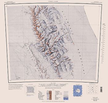
- Vinson Massif. Scale 1:250 000 topographic map. Reston, Virginia: US Geological Survey, 1988.
Reference
- Sullivan Heights. SCAR Composite Antarctic Gazetteer.

