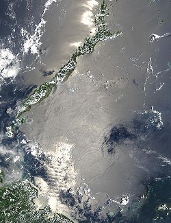

in the southwestern area of the Philippines
, separated from the South China Sea
in the northwest by Palawan
and from the Celebes Sea
in the southeast by the Sulu Archipelago
. Borneo
is found to the southwest and Visayas
to the northeast.
Sulu Sea contains a number of islands. The Cuyo Islands and Cagayan Sulu are part of the province of Palawan while Mapun and the Turtle Islands
are part of the province of Tawi-Tawi
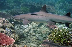
. Sulu Sea is also where the Tubbataha Reef National Marine Park , one of the World Heritage Site
s is located.
Extent
The International Hydrographic Organization(IHO) defines the Sulu Sea as being one of the waters of the East Indian Archipelago
. The IHO defines its limits as follows:
On the Northwest. From Tanjong Sampanmangio, the North point of BorneoBorneoBorneo is the third largest island in the world and is located north of Java Island, Indonesia, at the geographic centre of Maritime Southeast Asia....
, along the Eastern limit of South China SeaSouth China SeaThe South China Sea is a marginal sea that is part of the Pacific Ocean, encompassing an area from the Singapore and Malacca Straits to the Strait of Taiwan of around...
to Cape Calavite, the Northwest point of MindoroMindoroMindoro is the seventh-largest island in the Philippines. It is located off the coast of Luzon, and northeast of Palawan. The southern coast of Mindoro forms the northeastern extremum of the Sulu Sea.-History:...
.
On the Northeast. The Southwest coast of Mindoro to Buruncan Point, its Southern extreme, thence a line through Semirara and Kaluya Islands to Nasog Point (11°53′N 121°53′E) the Northwestern extreme of Panay
PanayPanay may refer to*Panay Island*Panay *Panay, Capiz*Panay River*Panay Gulf* USS Panay *Panay incident...
, along the West and Southeast coast of that island to Tagubanhan Island (11°08′N 123°07′E), thence a line to the Northern extreme of Negros and down the West coast to Siaton Point, its Southern extreme, thence across to Tagolo Point (8°44′N 123°22′E), MindanaoMindanaoMindanao is the second largest and easternmost island in the Philippines. It is also the name of one of the three island groups in the country, which consists of the island of Mindanao and smaller surrounding islands. The other two are Luzon and the Visayas. The island of Mindanao is called The...
.
On the Southeast. From Tagolo Point, down the West coast of Mindanao to the Southwest extremity thence to the North coast of Basilan Island
Basilan (island)Basilan Island is an island of the Philippines, it belongs to Basilan Province with its capital Isabela City.Basilan is geographically located between latitude 6°15' and 7°00' longitude 121°15' and 122°30'....
(6°45′N 122°04′E), through this island to its Southern extremity, thence a line to Bitinan Island (6°04′N 121°27′E) off the Eastern end of Jolo IslandJoloJolo may refer to:* Jolo Island* Jolo, Sulu* Jolo, West Virginia* Jolo is also the nickname of Swedish author Jan Olof Olsson....
, through Jolo to a point in long. 121°04'E on its South coast, thence through TapulTapul, SuluTapul is a municipality in the province of Sulu, Philippines. According to the 2000 census, it has a population of 14,881 people in 2,117 households.-Barangays:Tapul is politically subdivided into 15 barangays.* Alu-Kabingaan* Banting* Hawan...
and LugusLugus, SuluLugus is a 5th class municipality in the province of Sulu, Philippines. According to the 2000 census, it has a population of 18,839 people in 2,907 households.-Barangays:Lugus is politically subdivided into 17 barangays.* Alu Bus-Bus* Alu-Duyong...
Islands and along the North coast of Tawitawi IslandTawi-TawiTawi-Tawi is an island province of the Philippines located in the Autonomous Region in Muslim Mindanao . The capital of Tawi-Tawi is Bongao. The province is the southernmost of the country sharing sea borders with the Malaysian State of Sabah and the Indonesian East Kalimantan province. To the...
to Bongao IslandBongao, Tawi-TawiBongao is a 3rd class municipality in the province of Tawi-Tawi, Philippines. According to the 2000 census, it has a population of 58,174 people in 10,146 households.-History:...
off its Western end (5°01′N 119°45′E), and from thence to Tanjong Labian, the Northeastern extreme of Borneo.
On the Southwest. The North coast of Borneo between Tanjong Labian and Tanjong Sampanmangio.

In popular culture
The Star Trekcharacter Hikaru Sulu
is named after the Sulu Sea. According to Sulu actor George Takei
, "[Gene] Roddenberry's
vision for Sulu was to represent all of Asia, being named for the Sulu Sea instead of using a specific country-specific name".

