Townline Tunnel
Encyclopedia

Welland, Ontario
Welland is a city in the Regional Municipality of Niagara in Southern Ontario, Canada.The city has been traditionally known as the place where rails and water meet, referring to the railways from Buffalo to Toronto and Southwestern Ontario, and the waterways of Welland Canal and Welland River,...
, Ontario
Ontario
Ontario is a province of Canada, located in east-central Canada. It is Canada's most populous province and second largest in total area. It is home to the nation's most populous city, Toronto, and the nation's capital, Ottawa....
, Canada
Canada
Canada is a North American country consisting of ten provinces and three territories. Located in the northern part of the continent, it extends from the Atlantic Ocean in the east to the Pacific Ocean in the west, and northward into the Arctic Ocean...
, is an underwater tunnel, carrying Highway 58A as well as the Canadian Pacific Railway
Canadian Pacific Railway
The Canadian Pacific Railway , formerly also known as CP Rail between 1968 and 1996, is a historic Canadian Class I railway founded in 1881 and now operated by Canadian Pacific Railway Limited, which began operations as legal owner in a corporate restructuring in 2001...
under the Welland Canal
Welland Canal
The Welland Canal is a ship canal in Canada that extends from Port Weller, Ontario, on Lake Ontario, to Port Colborne, Ontario, on Lake Erie. As a part of the St...
. The "A" suffix is a misnomer since it is more of a connector than an alternative route. Highway 58A is a two-lane freeway
Two-lane freeway
A two-lane expressway is an expressway with only one lane in each direction, and usually no median barrier. It may be built that way because of constraints, or may be intended for expansion once traffic volumes rise. The term super two is often used by roadgeeks for this type of road, but traffic...
in its entirety. This segment of 2-lane freeway continues as Regional Road 525 to the east.
The highway
 Highway 58A is a provincially maintained highway in the Niagara Region
Regional Municipality of Niagara, Ontario
The Regional Municipality of Niagara , also known as the Niagara Region, or, colloquially, "Regional Niagara", is a regional municipality comprising twelve municipalities of Southern Ontario, Canada....
. It is a short link between Highways 140
Highway 140 (Ontario)
King's Highway 140, commonly referred to as Highway 140, is a provincially maintained highway in the Canadian province of Ontario. The highway connects Port Colborne near Lake Erie with Highway 406 in Welland, via the Main Street Tunnel...
and 58
Highway 58 (Ontario)
King's Highway 58, commonly referred to as Highway 58, is a provincially maintained highway in the Canadian province of Ontario. Highway 58 currently runs from the Highway 406 junction on the St. Catharines – Thorold boundary to the Highway 406 junction near Turner's Corners, all...
underneath the canal.
The 4.4 km (2.7 mi) long highway is important from the province's point of view as a possible spot where the planned Mid-Peninsula Highway
Mid-Peninsula Highway
The Mid-Peninsula Highway is a proposed freeway across the Niagara Peninsula in the Canadian province of Ontario. Although plans for a highway connecting Hamilton to Fort Erie south of the Niagara Escarpment have surfaced for decades,...
might cross the Welland Canal. Should that happen, the designation of Highway 58A will be removed.
The tunnel
The Townline Tunnel is a two-cell reinforced concreteReinforced concrete
Reinforced concrete is concrete in which reinforcement bars , reinforcement grids, plates or fibers have been incorporated to strengthen the concrete in tension. It was invented by French gardener Joseph Monier in 1849 and patented in 1867. The term Ferro Concrete refers only to concrete that is...
tunnel with a rectangular cross-section. The roof is a post-tensioned
Prestressed concrete
Prestressed concrete is a method for overcoming concrete's natural weakness in tension. It can be used to produce beams, floors or bridges with a longer span than is practical with ordinary reinforced concrete...
concrete slab.
The tunnel was built as a part of the Welland By-Pass
Welland By-Pass
The Welland By-pass, completed in 1973, was a massive construction project on the Welland Canal in Ontario, Canada.A new channel long was constructed, providing a shorter, more direct alignment between Port Robinson and Port Colborne and by-passing downtown Welland...
project. Its construction was relatively easy since, like the Main Street Tunnel, it was being built at the same time as the channel above it and a simple cut and cover method could be used.
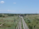
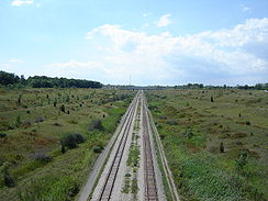
The tunnel provides a sidewalk for pedestrians, two lanes for vehicular traffic, as well as room for three sets of tracks for rail vehicles. It was opened for automobiles on July 13, 1972, and the first train crossed the tunnel on January 31, 1973.
The tunnel is 330 metres (1083 ft) long and 35 metres (115 ft) wide. Due to low grade required for trains, the approaches to the tunnel stretch 4 km (2.5 miles) in each direction. This necessited the removal of about 13,750,000 cubic meters (18,000,000 cubic yards) of material and construction of three viaduct
Viaduct
A viaduct is a bridge composed of several small spans. The term viaduct is derived from the Latin via for road and ducere to lead something. However, the Ancient Romans did not use that term per se; it is a modern derivation from an analogy with aqueduct. Like the Roman aqueducts, many early...
s on each side of the canal. As well, a solid earth plug had to be put into the Welland Recreational Waterway
Welland Recreational Waterway
The Welland Recreational Waterway is a water channel in the city of Welland, Ontario, Canada. It is an old alignment of the Welland Ship Canal that has been abandoned after the construction of the Welland By-Pass in the 1970s. The Waterway is now managed by the Welland Recreational Canal...
(the old alignment of the canal), cutting it in two (satellite photo). The construction cost $
Canadian dollar
The Canadian dollar is the currency of Canada. As of 2007, the Canadian dollar is the 7th most traded currency in the world. It is abbreviated with the dollar sign $, or C$ to distinguish it from other dollar-denominated currencies...
40 million. The middle rail line was removed in the 1990s and the two remaining tracks now serve as the CPR Hamilton Subdivision and the CPR Brookfield Siding.Townline Tunnel is known locally as the "Stinky Tunnel" due to the strong smell of rotten eggs as one passes through it.

