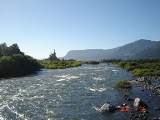
Trancura River
Encyclopedia
Trancura River is a river
located in the Araucanía Region
of Chile
. Its headwaters drain the southeasternmost portion of Villarrica National Park
, including the northwestern slope of Lanín
volcano. The river flows initially to the north and from its junction with its main tributary, the Maichín River, the Trancura turns in a westerly direction until emptying into the Villarrica Lake, after having received the waters of Caburgua Lake
through Carrileufú River. This latter river emerges at the Ojos del Caburgua
and is fed by the Liucura River, which further has as a tributary the outflow stream of Tinquilco Lake
.
The town of Curarrehue is located near its confluence with the Maichín River.
The river is used for rafting
by tourism companies in Pucón.
River
A river is a natural watercourse, usually freshwater, flowing towards an ocean, a lake, a sea, or another river. In a few cases, a river simply flows into the ground or dries up completely before reaching another body of water. Small rivers may also be called by several other names, including...
located in the Araucanía Region
Araucanía Region
The IX Araucanía Region is one of Chile's 15 first order administrative divisions and comprises two provinces: Malleco in the north and Cautín in the south....
of Chile
Chile
Chile ,officially the Republic of Chile , is a country in South America occupying a long, narrow coastal strip between the Andes mountains to the east and the Pacific Ocean to the west. It borders Peru to the north, Bolivia to the northeast, Argentina to the east, and the Drake Passage in the far...
. Its headwaters drain the southeasternmost portion of Villarrica National Park
Villarrica National Park
Villarrica National Park is located in the Andes, in the Araucanía and Los Ríos regions of Chile, near Pucón. The centerpiece of the park is a line of three volcanoes stretching transversely to the Andean range: Villarrica, Quetrupillán, and Lanín....
, including the northwestern slope of Lanín
Lanín
Lanín is an ice-clad, cone-shaped stratovolcano on the border of Argentina and Chile. It forms part of two national parks: Lanín in Argentina and Villarrica in Chile. It is a symbol of the Argentine province of Neuquén, being part of its flag and its anthem. Although the date of its last eruption...
volcano. The river flows initially to the north and from its junction with its main tributary, the Maichín River, the Trancura turns in a westerly direction until emptying into the Villarrica Lake, after having received the waters of Caburgua Lake
Caburgua Lake
Caburgua Lake is located 23 km northeast of the city of Pucón, in the Araucanía Region of Chile. Huerquehue National Park lies to the east of the lake. Like Villarrica Lake, it is part of Toltén River basin...
through Carrileufú River. This latter river emerges at the Ojos del Caburgua
Ojos del Caburgua
Ojos del Caburgua is a waterfall located 15 kilometers east of Pucón and four kilometers south of Caburgua Lake in the region of Aracaunía in southern Chile.-References:*"Atractivos Cercanos a Pucón." TurismoChile.com. 6 Dec. 2007 ....
and is fed by the Liucura River, which further has as a tributary the outflow stream of Tinquilco Lake
Tinquilco Lake
Tinquilco Lake is one of several lakes in Huerquehue National Park in the Araucanía Region in southern Chile. Located at 700 meters; it is the first lake visitors encounter in the park before continuing on the "Tres Lagos" hike.-References:*...
.
The town of Curarrehue is located near its confluence with the Maichín River.
The river is used for rafting
Rafting
Rafting or white water rafting is a challenging recreational outdoor activity using an inflatable raft to navigate a river or other bodies of water. This is usually done on white water or different degrees of rough water, in order to thrill and excite the raft passengers. The development of this...
by tourism companies in Pucón.

