Tsumagoi, Gunma
Encyclopedia

Villages of Japan
A is a local administrative unit in Japan.It is a local public body along with , , and . Geographically, a village's extent is contained within a prefecture....
located in Agatsuma District
Agatsuma District, Gunma
is a district located in Gunma Prefecture, Japan.As of July 1, 2011, the district has an estimated population of 60,253 and a population density of 47.1 persons per km²...
, Gunma
Gunma Prefecture
is a prefecture of Japan located in the northwest corner of the Kantō region on Honshu island. Its capital is Maebashi.- History :The remains of a Paleolithic man were found at Iwajuku, Gunma Prefecture, in the early 20th century and there is a public museum there.Japan was without horses until...
, Japan
Japan
Japan is an island nation in East Asia. Located in the Pacific Ocean, it lies to the east of the Sea of Japan, China, North Korea, South Korea and Russia, stretching from the Sea of Okhotsk in the north to the East China Sea and Taiwan in the south...
.
As of September 1, 2007, the village has an estimated population
Population
A population is all the organisms that both belong to the same group or species and live in the same geographical area. The area that is used to define a sexual population is such that inter-breeding is possible between any pair within the area and more probable than cross-breeding with individuals...
of 10,743 and a density
Population density
Population density is a measurement of population per unit area or unit volume. It is frequently applied to living organisms, and particularly to humans...
of 31.19 persons per km². The total area is 337.51 km².
Geography
The village is situated on the northwestern corner of Gunma prefectureGunma Prefecture
is a prefecture of Japan located in the northwest corner of the Kantō region on Honshu island. Its capital is Maebashi.- History :The remains of a Paleolithic man were found at Iwajuku, Gunma Prefecture, in the early 20th century and there is a public museum there.Japan was without horses until...
, touching Nagano prefecture
Nagano Prefecture
is a prefecture of Japan located in the Chūbu region of the island of Honshū. The capital is the city of Nagano.- History :Nagano was formerly known as the province of Shinano...
to the north, south, and west. Because of its elevated location and the ash deposits of Mount Asama
Mount Asama
is an active complex volcano in central Honshū, the main island of Japan. The volcano is the most active on Honshū. The Japan Meteorological Agency classifies Mount Asama as rank A. It stands above sea level on the border of Gunma and Nagano prefectures...
, Tsumagoi is fit and well known for growing cabbages. It has a cool climate, with an average yearly temperature of 8℃.
- Mountains: Mount AsamaMount Asamais an active complex volcano in central Honshū, the main island of Japan. The volcano is the most active on Honshū. The Japan Meteorological Agency classifies Mount Asama as rank A. It stands above sea level on the border of Gunma and Nagano prefectures...
, Mount Motoshirane, Mount Kusatsushirane, Mount Azumaya - Rivers: Azuma River
- Lakes: Lake Baragi, Lake Tashiro
Surrounding municipalities
- Gunma PrefectureGunma Prefectureis a prefecture of Japan located in the northwest corner of the Kantō region on Honshu island. Its capital is Maebashi.- History :The remains of a Paleolithic man were found at Iwajuku, Gunma Prefecture, in the early 20th century and there is a public museum there.Japan was without horses until...
- KusatsuKusatsu, Gunmais a small town in Agatsuma District in Gunma Prefecture, Japan. Kusatsu is situated about 1,200 meters above sea level. The active volcano Kusatsu-Shirane and the inactive Mount Tengu and Mount Motoshirane are located west of Kusatsu.-Climate:Due to the altitude Kusatsu's annual average...
- NaganoharaNaganohara, Gunmais a town located in Agatsuma District, Gunma, Japan.As of September 1, 2007, the town has an estimated population of 6,361 and a density of 47.50 persons per km². The total area is 133.93 km².-Geography:...
- Kusatsu
- Nagano PrefectureNagano Prefectureis a prefecture of Japan located in the Chūbu region of the island of Honshū. The capital is the city of Nagano.- History :Nagano was formerly known as the province of Shinano...
- KaruizawaKaruizawa, Naganois a town located in Kitasaku District, Nagano, Japan.As of January 1, 2008, the town has an estimated population of 17,833 and has a total area of ....
- KomoroKomoro, Naganois a city located in Nagano, Japan.As of May 1, 2011, the city has an estimated population of 44,270. The total area is 98.66 km².-Municipal Timeline:*February 1, 1954-Komoro absorbed the villages of Kawanabe, Kitaoi, and Osato from Kitasaku District....
- TakayamaTakayama, Naganois a village located in Kamitakai District, Nagano, Japan.As of 2003, the village has an estimated population of 7,756 and a density of 78.74 persons per km². The total area is 98.50 km².-External links:*...
- SuzakaSuzaka, Naganois a city located in Nagano, Japan.As of May 1, 2011, the city has an estimated population of 52,493, with a household number of 18,934 and the density of 350.32 persons per km². The total area is 149.84 km².Fujitsu Corporation has a plant in the city....
- Ueda
- TōmiTomi, Naganois a city located in Nagano Prefecture, Japan.The city was founded on April 1, 2004, when the village of Kitamimaki from Kitasaku District and the town of Tōbu from Chiisagata District merged to form a new city....
- MiyotaMiyota, Naganois a town located in Kitasaku District, Nagano Prefecture, Japan.As of April 2007, the town has an estimated population of 14,231 and a density of 242.12 persons per km². The total area is 58.78 km².-External links:*...
- Karuizawa
Transportation
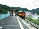
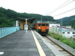
There are two train stations on the Agatsuma Line in Tsumagoi:Manza-Kazawaguchi and Ōmae.
Education
- High SchoolHigh schoolHigh school is a term used in parts of the English speaking world to describe institutions which provide all or part of secondary education. The term is often incorporated into the name of such institutions....
s- Tsumagoi High School
- Junior High Schools
- Nishi Junior High School
- Higashi Junior High School
- Primary Schools
- Higashi Elementary School
- Tashiro Elementary School
- Nishi Elementary School
- Hoshimata Elementary School
- Kanbara Elementary School

