Westland National Park
Encyclopedia
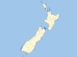
Westland Tai Poutini National Park is located on the western coast of New Zealand
's South Island
. Established in 1960, the centenary of the European settlement of Westland District
, it covers 1,175 km², and extends from the highest peaks of the Southern Alps
to a wild and remote coastline. It borders the Aoraki/Mount Cook National Park
along the Main Divide.
Included in the park are glacier
s, scenic lakes and dense temperate rainforest, as well as remains of old gold mining
towns along the coast. Franz Josef Glacier
and Fox Glacier
are two popular tourist attractions located within Westland Tai Poutini National Park. The park offers hunting opportunities for Red Deer
, Chamois
and Tahr
and helicopter access allows hunters access to the rugged mountain areas. The popular Copland Track runs upstream from the Karangarua River
bridge. Along with the mountain scenery visible from the track, there are hot springs at Welcome Flat Hut.
In 2010 over 4,400 ha were added to the park consisting of a number of areas scattered throughout the park with the majority being to the east of Okarito Lagoon
.
New Zealand
New Zealand is an island country in the south-western Pacific Ocean comprising two main landmasses and numerous smaller islands. The country is situated some east of Australia across the Tasman Sea, and roughly south of the Pacific island nations of New Caledonia, Fiji, and Tonga...
's South Island
South Island
The South Island is the larger of the two major islands of New Zealand, the other being the more populous North Island. It is bordered to the north by Cook Strait, to the west by the Tasman Sea, to the south and east by the Pacific Ocean...
. Established in 1960, the centenary of the European settlement of Westland District
Westland District
Westland District is a territorial authority on the west coast of New Zealand's South Island. Its population is - Government :The Westland District is governed by an elected Council, headed by an elected Mayor. The Mayor is elected at large. The current Mayor is Maureen Pugh. Councillors are...
, it covers 1,175 km², and extends from the highest peaks of the Southern Alps
Southern Alps
The Southern Alps is a mountain range extending along much of the length of New Zealand's South Island, reaching its greatest elevations near the island's western side...
to a wild and remote coastline. It borders the Aoraki/Mount Cook National Park
Aoraki/Mount Cook National Park
Aoraki/Mount Cook National Park is in the South Island of New Zealand near the town of Twizel. Aoraki/Mount Cook, New Zealand's highest mountain and Aoraki/Mount Cook village lie within the park...
along the Main Divide.
Included in the park are glacier
Glacier
A glacier is a large persistent body of ice that forms where the accumulation of snow exceeds its ablation over many years, often centuries. At least 0.1 km² in area and 50 m thick, but often much larger, a glacier slowly deforms and flows due to stresses induced by its weight...
s, scenic lakes and dense temperate rainforest, as well as remains of old gold mining
Gold mining
Gold mining is the removal of gold from the ground. There are several techniques and processes by which gold may be extracted from the earth.-History:...
towns along the coast. Franz Josef Glacier
Franz Josef Glacier
The Franz Josef is a long glacier located in Westland Tai Poutini National Park on the West Coast of New Zealand's South Island...
and Fox Glacier
Fox Glacier
The Fox Glacier is a long glacier located in Westland Tai Poutini National Park on the West Coast of New Zealand's South Island...
are two popular tourist attractions located within Westland Tai Poutini National Park. The park offers hunting opportunities for Red Deer
Red Deer
The red deer is one of the largest deer species. Depending on taxonomy, the red deer inhabits most of Europe, the Caucasus Mountains region, Asia Minor, parts of western Asia, and central Asia. It also inhabits the Atlas Mountains region between Morocco and Tunisia in northwestern Africa, being...
, Chamois
Chamois
The chamois, Rupicapra rupicapra, is a goat-antelope species native to mountains in Europe, including the Carpathian Mountains of Romania, the European Alps, the Tatra Mountains, the Balkans, parts of Turkey, and the Caucasus. The chamois has also been introduced to the South Island of New Zealand...
and Tahr
Tahr
Tahrs are three species of large Asian ungulates related to the wild goat. Until recently the three species were believed to be closely related and were placed in a single genus, Hemitragus. Genetic studies have proved that the three tahrs are not as closely related as thought earlier...
and helicopter access allows hunters access to the rugged mountain areas. The popular Copland Track runs upstream from the Karangarua River
Karangarua River
The Karangarua River is located in the west of New Zealand's South Island. It flows northwest from the Southern Alps, entering the Tasman Sea 80 kilometres northeast of Haast. The main tributary of the Karangarua is the Copland River....
bridge. Along with the mountain scenery visible from the track, there are hot springs at Welcome Flat Hut.
In 2010 over 4,400 ha were added to the park consisting of a number of areas scattered throughout the park with the majority being to the east of Okarito Lagoon
Okarito Lagoon
Okarito Lagoon is a coastal lagoon on the West Coast of New Zealand's South Island. It is located 130 kilometres south of Hokitika, and covers an area of about 12 km², making it the largest unmodified wetland in New Zealand....
.
External links
- Westland Tai Poutini National Park at the Department of Conservation

