

Arkansas Highway 1
Encyclopedia
Arkansas Highway 1 is a north–south state highway in east Arkansas. The route of 159.88 miles (257.3 km) runs from McGehee
to Clay County
and the Missouri
state line. One of the original 1926 state highways
, Highway 1 has remained very close to its original routing. The highway contains an overlap of approximately 50 miles (80.5 km) with U.S. Route 49
.
in downtown McGehee
and runs northwest (along the Union Pacific Railroad
tracks) for three blocks before turning northeast at an intersection with AR 159. The highway continues across US 65
/US 165
and exits town in a northeastern direction, passing McGehee High School. AR 1 meets Arkansas Highway 4
, which runs south to Arkansas City
before curving north to Rohwer
, which was a Japanese American internment
camp during World War II
. AR 1 passes the Kemp Cotton Gin Historic District, Rowher Relocation Center, and Rohwer Relocation Center Memorial Cemetery. Continuing north, AR 1 ceases following the railroad at Watson
and runs west to Back Gate
, where a concurrency with US 165 begins.
, the routes pass through Gillett
and rural Arkansas County. In south De Witt
AR 1 splits east from US 165 and AR 1 Business. AR 1 bypasses southeast De Witt, and after reconnecting with AR 1B continues northeast. AR 1 runs east through St. Charles
before entering Monroe County
. AR 1 Spur enters St. Charles, and terminates near the site of the Battle of Saint Charles
on the White River
.
Arkansas Highway 1 enters southern Monroe County
briefly. At Cross Roads
, AR 1 is the southern terminus of AR 17. On the Monroe/Phillips County line, AR 1 has a junction with Arkansas Highway 39 and Arkansas Highway 316. The route continues northeast to Marvell
, where AR 1 concurrs with U.S. Route 49
east to Walnut Corner
. At the corner, AR 1 turns north past the Richardson-Turner House and enters Lee County. The route has a junction with AR 121
at Cypress Corner and continues north to Marianna
.
In Marianna, Highway 1 breaks west from AR 1 Business, which runs downtown through Marianna. After AR 1B rejoins the main route, there is a 0.2 mile (0.321868 km) concurrency north with U.S. Route 79
. Further north, AR 1 passes Lee County Senior High and becomes four lane briefly until Forrest City
. Upon entering St. Francis County, AR 1 enters Forrest City. The business route runs downtown, while the main route skirts the southwest edge of town. There is a parclo interchange with U.S. Route 70
and an interchange with Interstate 40
. The business route meets AR 1 in north Forrest City, and AR 1 enters Caldwell
and Colt
before entering Cross County. South of Caldwell, AR 1 is near the historic Little Telico Creek Bridge, listed on the National Register of Historic Places
.
in Cross County. The highway has a junction with US 64
, AR 284, AR 980
, and US 64 Business, and also passes near Wynne High School
. The highway continues north to Vanndale
and Cherry Valley
before entering Poinsett County. The route passes through marsh
es in southern Poinsett County before entering Harrisburg
. Throughout the county, AR 1 is paralleled by AR 163
approximately 2.5 miles (4 km) to the east and US 49
approximately 10 miles (16.1 km) to the west, with the Union Pacific Railroad also near. AR 1 passes the Bacon Hotel
in south Poinsett County near Whitehall
, and also passes the historic Modern News Building in downtown Harrisburg.
Entering Craighead County
, AR 1 enters Jonesboro
from the south. After intersecting AR 163
, the route intersects US 49/U.S. Route 63
(future Interstate 555
). Highway 1 becomes concurrent north with US 49 {and later US 62
) until Piggott
The route leaves US 62 (Crowley's Ridge Parkway
) in Piggott and runs east to Missouri supplemental route
BB near Holcomb, Missouri
, where the route terminates.
The route now known as AR 1 first appears as a state highway in 1924, when the Arkansas General Assembly
first created a state highway system. Arkansas State Road B-1 ran from the Louisiana state line near Wilmot
north into Missouri, and was mostly unpaved. Upon creation of the U.S. Route system
in 1925, the north and south portions of the highway were replaced by U.S. Route 67
and U.S. Route 165
, respectively, shaping a more familiar AR 1 routing. Arkansas followed the trend to number in 1926, and B-1 became Arkansas Highway 1. The route remains very true to that original course today. The route was split apart in 1941 into AR 1 East and AR 1 West segments from Paragould
north. AR 1 East continued north through Marmaduke
and Rector
. AR 1 West traveled into Corning
. By 1955, AR 1W became Arkansas Highway 135
, and AR 1E became AR 1. US 49 overlapped Highway 1 from Jonesboro to Piggott in 1978.
|colspan=5 align=center| concurrency north, 24.99 miles (40.2 km)
|colspan=5 align=center| concurrency south, 9.04 miles (14.5 km)
|colspan=5 align=center| concurrency north, 0.21 mile (0.3379614 km)
|colspan=5 align=center| concurrency west, 0.75 miles (1.2 km)
|colspan=5 align=center| concurrency north, 50 miles (80.5 km)
. As cities have grown, bypasses have become necessary, and the former downtown alignments of AR 1 have become the business routes discussed here. The St. Charles
spur route terminates at the site of the Civil War
Battle of Saint Charles
upon the White River
. The Forrest City
business route intersects major routes U.S. Route 70
and Interstate 40
. De Witt
, Marianna
, Vanndale
, and Cherry Valley
all have business routes of less than 3 miles (4.8 km). The Jonesboro
business route is the longest, and intersects future Interstate 555
.
McGehee, Arkansas
McGehee is a city in Desha County, Arkansas, United States. The population was 4,219 at the 2010 census.-History:The history of the city of McGehee and the history of the railroad through McGehee are intricately interwoven...
to Clay County
Clay County, Arkansas
Clay County is a county located in the U.S. state of Arkansas. As of 2010, the population was 16,083. The county has two county seats, Corning and Piggott...
and the Missouri
Missouri
Missouri is a US state located in the Midwestern United States, bordered by Iowa, Illinois, Kentucky, Tennessee, Arkansas, Oklahoma, Kansas and Nebraska. With a 2010 population of 5,988,927, Missouri is the 18th most populous state in the nation and the fifth most populous in the Midwest. It...
state line. One of the original 1926 state highways
1926 Arkansas state highway numbering
In 1926, Arkansas renumbered its highways into a more traditional format. The system to be replaced was established in 1924 as Arkansas' first comprehensive highway plan. Roads were designated as "primary federal aid roads", "secondary federal aid roads", or "connecting state roads"...
, Highway 1 has remained very close to its original routing. The highway contains an overlap of approximately 50 miles (80.5 km) with U.S. Route 49
U.S. Route 49
U.S. Route 49 is a north–south United States highway. The highway's northern terminus is in Piggott, Arkansas, at an intersection with U.S. Route 62. Its southern terminus is in Gulfport, Mississippi, at an intersection with U.S. Route 90. US 49 is approximately 516 miles in length.It...
.
Route description
McGehee to Gillett
Arkansas Highway begins at U.S. Route 278U.S. Route 278
U.S. Route 278 is a parallel route of U.S. Route 78. It currently runs for 1,074 miles from Hilton Head Island, South Carolina to Wickes, Arkansas at U.S. Highway 71/U.S. Highway 59. It might be notable that it is longer than its parent highway, US Hwy-78. US Hwy-278 passes through the states of...
in downtown McGehee
McGehee, Arkansas
McGehee is a city in Desha County, Arkansas, United States. The population was 4,219 at the 2010 census.-History:The history of the city of McGehee and the history of the railroad through McGehee are intricately interwoven...
and runs northwest (along the Union Pacific Railroad
Union Pacific Railroad
The Union Pacific Railroad , headquartered in Omaha, Nebraska, is the largest railroad network in the United States. James R. Young is president, CEO and Chairman....
tracks) for three blocks before turning northeast at an intersection with AR 159. The highway continues across US 65
U.S. Route 65
U.S. Route 65 is a north–south United States highway in the southern and midwestern United States. The southern terminus of the route is at U.S. Route 425 in Clayton, Louisiana. The northern terminus is at Interstate 35 just south of Interstate 90 in Albert Lea, Minnesota...
/US 165
U.S. Route 165
U.S. Route 165 is a north–south United States highway spur of U.S. Highway 65. It currently runs for 412 miles from U.S. Route 90 in Iowa, Louisiana north to U.S. Highway 70 in North Little Rock, Arkansas. The route passes through the states of Arkansas and Louisiana. It passes through the...
and exits town in a northeastern direction, passing McGehee High School. AR 1 meets Arkansas Highway 4
Arkansas Highway 4
Arkansas Highway 4 is a designation for two state highways in east Arkansas. The western segment of runs from SH-4 at the Oklahoma state line and terminates in Cove. An eastern segment of begins at U.S. Route 278 in McGehee and heads east to Arkansas City then north to AR 1 before terminating....
, which runs south to Arkansas City
Arkansas City, Arkansas
Arkansas City is a town in Desha County, Arkansas, United States. The population was 366 at the 2010 census. The town is the county seat of Desha County.-Geography:According to the United States Census Bureau, the town has a total area of , all of it land....
before curving north to Rohwer
Rohwer, Arkansas
Rohwer, Arkansas is an unincorporated community in Desha County, Arkansas, United States. The community is located on Arkansas Highway 1. The area was a Japanese internment camp during World War II, and is now the site of the Rohwer War Relocation Center....
, which was a Japanese American internment
Japanese American internment
Japanese-American internment was the relocation and internment by the United States government in 1942 of approximately 110,000 Japanese Americans and Japanese who lived along the Pacific coast of the United States to camps called "War Relocation Camps," in the wake of Imperial Japan's attack on...
camp during World War II
World War II
World War II, or the Second World War , was a global conflict lasting from 1939 to 1945, involving most of the world's nations—including all of the great powers—eventually forming two opposing military alliances: the Allies and the Axis...
. AR 1 passes the Kemp Cotton Gin Historic District, Rowher Relocation Center, and Rohwer Relocation Center Memorial Cemetery. Continuing north, AR 1 ceases following the railroad at Watson
Watson, Arkansas
Watson is a city in Desha County, Arkansas, United States. The population was 211 at the 2010 census.-Geography:Watson is located at .According to the United States Census Bureau, the city has a total area of , all of it land....
and runs west to Back Gate
Back Gate, Arkansas
Back Gate, Arkansas is an unincorporated community in Desha County, Arkansas, United States. The community is located at the corner of U.S. Route 165 and Arkansas Highway 1....
, where a concurrency with US 165 begins.
Gillett to Wynne
Entering Arkansas CountyArkansas County, Arkansas
Arkansas County is a county located in the U.S. state of Arkansas. As of the 2010 census, the population was 19,019. The county has two county seats, De Witt and Stuttgart...
, the routes pass through Gillett
Gillett, Arkansas
Gillett is a city in Arkansas County, Arkansas, United States. The population was 819 at the 2000 census. Gillett is the home of the annual Gillett Coon Supper. The Arkansas Post National Memorial is located southeast of the town....
and rural Arkansas County. In south De Witt
De Witt, Arkansas
De Witt is a city in Arkansas County, Arkansas, United States, which also serves as the county seat of the county's southern district. The population was 3,239 at the 2010 census.- History :...
AR 1 splits east from US 165 and AR 1 Business. AR 1 bypasses southeast De Witt, and after reconnecting with AR 1B continues northeast. AR 1 runs east through St. Charles
St. Charles, Arkansas
St. Charles is a town in Arkansas County, Arkansas, United States. The population was 261 at the 2000 census. It is best known for the Battle of Saint Charles having been fought there on the White River, and the St. Charles Lynchings of 1904. - History :...
before entering Monroe County
Monroe County, Arkansas
Monroe County is a county located in the U.S. state of Arkansas. As of 2010, the population is 8,149. The county seat is Clarendon, while its largest city is Brinkley...
. AR 1 Spur enters St. Charles, and terminates near the site of the Battle of Saint Charles
Battle of Saint Charles
The Battle of St. Charles was a naval engagement and infantry battle during the American Civil War. It was fought on June 17, 1862, between 8 Union ships including the USS Mound City, and several Confederate shore guns. A Confederate gun hit the Mound City's steam drum, causing an explosion which...
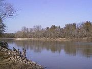
on the White River
White River (Arkansas)
The White River is a 722-mile long river that flows through the U.S. states of Arkansas and Missouri.-Course:The source of the White River is in the Boston Mountains of northwest Arkansas, in the Ozark-St. Francis National Forest southeast of Fayetteville...
.
Arkansas Highway 1 enters southern Monroe County
Monroe County, Arkansas
Monroe County is a county located in the U.S. state of Arkansas. As of 2010, the population is 8,149. The county seat is Clarendon, while its largest city is Brinkley...
briefly. At Cross Roads
Cross Roads, Monroe County, Arkansas
Cross Roads is an unincorporated community in Montgomery-Smalley Township, Monroe County, Arkansas, United States. The community is located where Arkansas Highway 17 ends at Arkansas Highway 1....
, AR 1 is the southern terminus of AR 17. On the Monroe/Phillips County line, AR 1 has a junction with Arkansas Highway 39 and Arkansas Highway 316. The route continues northeast to Marvell
Marvell, Arkansas
Marvell is a city in Phillips County, Arkansas, in the United States. As of the 2000 census, the city population was 1,395. Marvell was featured on ABC News's World News With Charles Gibson October 6, 2009 telecast as a center of infestation by newer pesticide-resistant strains of pigweed,...
, where AR 1 concurrs with U.S. Route 49
U.S. Route 49
U.S. Route 49 is a north–south United States highway. The highway's northern terminus is in Piggott, Arkansas, at an intersection with U.S. Route 62. Its southern terminus is in Gulfport, Mississippi, at an intersection with U.S. Route 90. US 49 is approximately 516 miles in length.It...
east to Walnut Corner
Walnut Corner, Phillips County, Arkansas
Walnut Corner is an unincorporated community in Phillips County, Arkansas, United States. Walnut Corner is located at the junction of U.S. Route 49, Arkansas Highway 1, and Arkansas Highway 85 south-southwest of Lexa....
. At the corner, AR 1 turns north past the Richardson-Turner House and enters Lee County. The route has a junction with AR 121
Arkansas Highway 121
Arkansas Highway 121 is a designation for two state highways in Lee County, Arkansas. One route of runs from the St. Francis River to US Route 79 northeast of Marianna. A second routing begins north of Marianna at Highway 1 and runs essentially in a half-loop counterclockwise to LaGrange.-St...
at Cypress Corner and continues north to Marianna
Marianna, Arkansas
Marianna is a city in and the county seat of Lee County, Arkansas, United States, along the L'Anguille River. The community was established by Col. Walter H. Otey in 1848 and was known as Walnut Ridge until 1852 when it became known as Marianna...
.
In Marianna, Highway 1 breaks west from AR 1 Business, which runs downtown through Marianna. After AR 1B rejoins the main route, there is a 0.2 mile (0.321868 km) concurrency north with U.S. Route 79
U.S. Route 79
U.S. Route 79 is a north–south United States highway. The route is a northeast-southwest diagonal, with both east–west segments and north–south segments equally mixed. The highway's northern terminus is in Russellville, Kentucky, at an intersection with U.S. Highway 68 and KY 80...
. Further north, AR 1 passes Lee County Senior High and becomes four lane briefly until Forrest City
Forrest City, Arkansas
Forrest City is a city in and the county seat of St. Francis County, Arkansas, United States. It was named for General Nathan Bedford Forrest, who used the location as a campsite for a construction crew completing a railroad between Memphis and Little Rock, shortly after the Civil War. The...
. Upon entering St. Francis County, AR 1 enters Forrest City. The business route runs downtown, while the main route skirts the southwest edge of town. There is a parclo interchange with U.S. Route 70
U.S. Route 70
U.S. Route 70 is an east–west United States highway that runs for 2,385 miles from eastern North Carolina to east-central Arizona. As can be derived from its number, it is a major east–west highway of the Southern and Southwestern United States...
and an interchange with Interstate 40
Interstate 40 in Arkansas
Interstate 40 is an east–west Interstate Highway that has a section in the U.S. state of Arkansas connecting sections in Oklahoma to Tennessee. The route enters Arkansas from the west just north of the Arkansas River near Dora...
. The business route meets AR 1 in north Forrest City, and AR 1 enters Caldwell
Caldwell, Arkansas
Caldwell is a town in St. Francis County, Arkansas, United States. The population was 465 at the 2000 census.-Geography:Caldwell is located at .According to the United States Census Bureau, the town has a total area of 7.8 km²...
and Colt
Colt, Arkansas
Colt is a city in St. Francis County, Arkansas, United States. The population was 368 at the 2000 census. It was the birthplace of country singer Charlie Rich.-Geography:Colt is located at ....
before entering Cross County. South of Caldwell, AR 1 is near the historic Little Telico Creek Bridge, listed on the National Register of Historic Places
National Register of Historic Places
The National Register of Historic Places is the United States government's official list of districts, sites, buildings, structures, and objects deemed worthy of preservation...
.
Wynne to Missouri
AR 1 enters WynneWynne, Arkansas
Wynne is the county seat and largest city of Cross County, Arkansas, United States. The population was 8,615 at the 2000 Census. Nestled between the Arkansas Delta and Crowley's Ridge, Wynne is home to the largest state park in Arkansas, Village Creek State Park.-Geography:Wynne lies at , the...
in Cross County. The highway has a junction with US 64
U.S. Route 64
U.S. Route 64 is an east–west United States highway that runs for 2,326 miles from eastern North Carolina to just southwest of the Four Corners in northeast Arizona. The western terminus is at U.S. Route 160 in Teec Nos Pos, Arizona. The highway's eastern terminus is at NC 12 and U.S. Route...
, AR 284, AR 980
Arkansas Highway 980
Arkansas Highway 980 is a state highway designation for all state maintained airport roads in Arkansas.-Section 1:Arkansas Highway 980 is a state highway of in Arkansas County. It connects Arkansas Highway 130 with Almyra Municipal Airport in Almyra....
, and US 64 Business, and also passes near Wynne High School
Wynne High School
Wynne High School is a public secondary school located in Wynne, Arkansas. It serves 9-12 grades and has an enrollment of 921. It is part of the Wynne School District....
. The highway continues north to Vanndale
Vanndale, Arkansas
Vanndale, Arkansas is an unincorporated community in Searcy Township, Cross County, Arkansas, United States. Vanndale was the county seat of Cross County from 1886 until 1903, when it was moved to the booming railroad town of Wynne. The community was named for John W. Vann, postmaster...
and Cherry Valley
Cherry Valley, Arkansas
Cherry Valley is a city in Cross County, Arkansas, United States. The population was 704 at the 2000 census.-Geography:Cherry Valley is located at ....
before entering Poinsett County. The route passes through marsh
Marsh
In geography, a marsh, or morass, is a type of wetland that is subject to frequent or continuous flood. Typically the water is shallow and features grasses, rushes, reeds, typhas, sedges, other herbaceous plants, and moss....
es in southern Poinsett County before entering Harrisburg
Harrisburg, Arkansas
Harrisburg is a city in Poinsett County, Arkansas, United States. The population was 2,192 at the 2000 census. It is included in the Jonesboro, Arkansas Metropolitan Statistical Area...
. Throughout the county, AR 1 is paralleled by AR 163
Arkansas Highway 163
Arkansas Highway 163 is a state highway of that runs in Craighead, Poinsett, and Cross Counties.-Route description:AR 163 begins at CR 739 in rural Cross County. The route runs north to cross US 64 in Levesque and AR 42 in Birdeye. AR 163 runs through Lake Poinsett State Park near Lake Poinsett...
approximately 2.5 miles (4 km) to the east and US 49
U.S. Route 49
U.S. Route 49 is a north–south United States highway. The highway's northern terminus is in Piggott, Arkansas, at an intersection with U.S. Route 62. Its southern terminus is in Gulfport, Mississippi, at an intersection with U.S. Route 90. US 49 is approximately 516 miles in length.It...
approximately 10 miles (16.1 km) to the west, with the Union Pacific Railroad also near. AR 1 passes the Bacon Hotel
Bacon Hotel
The Bacon Hotel, also known as the Sunrise Hotel, is a Folk Victorian style building in Whitehall, Arkansas. It was listed on the National Register of Historic Places in 1995....
in south Poinsett County near Whitehall
Whitehall, Poinsett County, Arkansas
Whitehall, Arkansas is an unincorporated community in Scott Township, Poinsett County, Arkansas, United States. Whitehall is located at the intersection of Arkansas Highway 1 and Arkansas Highway 214....
, and also passes the historic Modern News Building in downtown Harrisburg.
Entering Craighead County
Craighead County, Arkansas
Craighead County is a county located in the U.S. state of Arkansas. As of the 2010 census, the population was 96,443. It is included in the Jonesboro, Arkansas Metropolitan Statistical Area. Craighead County is Arkansas's 58th county, formed on February 19, 1859, and named for state Senator Thomas...
, AR 1 enters Jonesboro
Jonesboro, Arkansas
Jonesboro is a city in and one of the two county seats of Craighead County, Arkansas, United States. According to the 2010 US Census, the population of the city was 67,263. A college town, Jonesboro is the largest city in northeastern Arkansas and the fifth most populous city in the state...
from the south. After intersecting AR 163
Arkansas Highway 163
Arkansas Highway 163 is a state highway of that runs in Craighead, Poinsett, and Cross Counties.-Route description:AR 163 begins at CR 739 in rural Cross County. The route runs north to cross US 64 in Levesque and AR 42 in Birdeye. AR 163 runs through Lake Poinsett State Park near Lake Poinsett...
, the route intersects US 49/U.S. Route 63
U.S. Route 63
U.S. Route 63 is a long north–south United States highway primarily in the Midwestern United States. The southern terminus of the route is at Interstate 20 in Ruston, Louisiana. The northern terminus is at U.S. Route 2 in Benoit, Wisconsin, about east of Duluth, Minnesota. It is not related to U.S...
(future Interstate 555
Interstate 555
Interstate 555 is a future Interstate Highway that is slated to connect Turrell, Arkansas at Interstate 55 to Jonesboro, Arkansas at Highway 91. I-555 is currently under construction as U.S...
). Highway 1 becomes concurrent north with US 49 {and later US 62
U.S. Route 62 in Arkansas
U.S. Route 62 is a U.S. highway running from El Paso, Texas northeast to Niagara Falls, New York. In the U.S. state of Arkansas, the route runs 329.9 miles from the Oklahoma border near Summers east to the Missouri border in St. Francis, serving the northern portion of the state...
) until Piggott
Piggott, Arkansas
Piggott, Arkansas is a city in Clay County, Arkansas, one of that county's two seats . It is also the northern terminus of the Arkansas segment of Crowley's Ridge Parkway. As of the 2000 census, Piggott's population was 3,894. The town was founded by William N...
The route leaves US 62 (Crowley's Ridge Parkway
Crowley's Ridge Parkway
Crowley's Ridge Parkway is a road that runs in Arkansas and Missouri along Crowley's Ridge and Ozark-St. Francis National Forest. The route was designated a state scenic byway in Arkansas in 1997 and a National Scenic Byway in 1998...
) in Piggott and runs east to Missouri supplemental route
Missouri Supplemental Route
A supplemental route is a state secondary road in the U.S. state of Missouri, designated with letters. Supplemental routes were various roads within the state which the Missouri Department of Transportation was given in 1952 to maintain in addition to the regular routes...
BB near Holcomb, Missouri
Holcomb, Missouri
Holcomb is a city in Dunklin County, Missouri, United States. The population was 696 at the 2000 census.-Geography:Holcomb is located at .According to the United States Census Bureau, the city has a total area of , all land....
, where the route terminates.
History

 >
>
The route now known as AR 1 first appears as a state highway in 1924, when the Arkansas General Assembly
Arkansas General Assembly
The Arkansas General Assembly is the state legislature of the U.S. state of Arkansas. The legislature is a bicameral body composed of the upper house Arkansas Senate with 35 members, and the lower Arkansas House of Representatives with 100 members. All 135 representatives and state senators...
first created a state highway system. Arkansas State Road B-1 ran from the Louisiana state line near Wilmot
Wilmot, Arkansas
Wilmot is a city in Ashley County, Arkansas, United States. The population was 786 at the 2000 census.-Geography:Wilmot is located at ....
north into Missouri, and was mostly unpaved. Upon creation of the U.S. Route system
United States Numbered Highways
The system of United States Numbered Highways is an integrated system of roads and highways in the United States numbered within a nationwide grid...
in 1925, the north and south portions of the highway were replaced by U.S. Route 67
U.S. Route 67
U.S. Route 67 is a 1,560 mile long north–south U.S. highway in the Central United States. The southern terminus of the route is at the United States-Mexico border in Presidio, Texas, where it continues south as Mexican Federal Highway 16 upon crossing the Rio Grande. The northern...
and U.S. Route 165
U.S. Route 165
U.S. Route 165 is a north–south United States highway spur of U.S. Highway 65. It currently runs for 412 miles from U.S. Route 90 in Iowa, Louisiana north to U.S. Highway 70 in North Little Rock, Arkansas. The route passes through the states of Arkansas and Louisiana. It passes through the...
, respectively, shaping a more familiar AR 1 routing. Arkansas followed the trend to number in 1926, and B-1 became Arkansas Highway 1. The route remains very true to that original course today. The route was split apart in 1941 into AR 1 East and AR 1 West segments from Paragould
Paragould, Arkansas
-Health & Education:Paragould is home to Arkansas State University Paragould, Arkansas Northeastern College, Black River Technical College, and Crowley's Ridge College. Paragould has two public school districts, the Greene County Technical School District and the Paragould School District, as well...
north. AR 1 East continued north through Marmaduke
Marmaduke, Arkansas
Marmaduke is a city in Greene County, Arkansas, United States. The population was 1,158 at the 2000 census.- History :The town of Marmaduke was named for Confederate Major General John Sappington Marmaduke, who later served as Governor of Missouri. Marmaduke was said to have established a camp for...
and Rector
Rector, Arkansas
Rector is a city in Clay County, Arkansas, United States. The population was 2,017 at the 2000 census.-Geography:Rector is located at .According to the United States Census Bureau, the city has a total area of , all of it land....
. AR 1 West traveled into Corning
Corning, Arkansas
Corning is a city in Clay County, Arkansas, United States. The population was 3,679 at the 2000 census. It is one of the two county seats of Clay County, along with Piggott.-Geography:Corning is located at ....
. By 1955, AR 1W became Arkansas Highway 135
Arkansas Highway 135
Arkansas Highway 135 is a north–south state highway in northeast Arkansas. The route of runs from US 63 near Tyronza north through Paragould to US 62.-Route description:...
, and AR 1E became AR 1. US 49 overlapped Highway 1 from Jonesboro to Piggott in 1978.
Major intersections
Mile markers reset at concurrencies.|colspan=5 align=center| concurrency north, 24.99 miles (40.2 km)
|colspan=5 align=center| concurrency south, 9.04 miles (14.5 km)
|colspan=5 align=center| concurrency north, 0.21 mile (0.3379614 km)
|colspan=5 align=center| concurrency west, 0.75 miles (1.2 km)
|colspan=5 align=center| concurrency north, 50 miles (80.5 km)
Business routes
Arkansas Highway 1 has six business routes and one spur routeSpur route
A spur route is a short road forming a branch from a longer, more important route . A bypass or beltway is never considered a true spur route as it typically reconnects with the major road...
. As cities have grown, bypasses have become necessary, and the former downtown alignments of AR 1 have become the business routes discussed here. The St. Charles
St. Charles, Arkansas
St. Charles is a town in Arkansas County, Arkansas, United States. The population was 261 at the 2000 census. It is best known for the Battle of Saint Charles having been fought there on the White River, and the St. Charles Lynchings of 1904. - History :...
spur route terminates at the site of the Civil War
Civil war
A civil war is a war between organized groups within the same nation state or republic, or, less commonly, between two countries created from a formerly-united nation state....
Battle of Saint Charles
Battle of Saint Charles
The Battle of St. Charles was a naval engagement and infantry battle during the American Civil War. It was fought on June 17, 1862, between 8 Union ships including the USS Mound City, and several Confederate shore guns. A Confederate gun hit the Mound City's steam drum, causing an explosion which...
upon the White River
White River (Arkansas)
The White River is a 722-mile long river that flows through the U.S. states of Arkansas and Missouri.-Course:The source of the White River is in the Boston Mountains of northwest Arkansas, in the Ozark-St. Francis National Forest southeast of Fayetteville...
. The Forrest City
Forrest City, Arkansas
Forrest City is a city in and the county seat of St. Francis County, Arkansas, United States. It was named for General Nathan Bedford Forrest, who used the location as a campsite for a construction crew completing a railroad between Memphis and Little Rock, shortly after the Civil War. The...
business route intersects major routes U.S. Route 70
U.S. Route 70
U.S. Route 70 is an east–west United States highway that runs for 2,385 miles from eastern North Carolina to east-central Arizona. As can be derived from its number, it is a major east–west highway of the Southern and Southwestern United States...
and Interstate 40
Interstate 40
Interstate 40 is the third-longest major east–west Interstate Highway in the United States, after I-90 and I-80. Its western end is at Interstate 15 in Barstow, California; its eastern end is at a concurrency of U.S. Route 117 and North Carolina Highway 132 in Wilmington, North Carolina...
. De Witt
De Witt, Arkansas
De Witt is a city in Arkansas County, Arkansas, United States, which also serves as the county seat of the county's southern district. The population was 3,239 at the 2010 census.- History :...
, Marianna
Marianna, Arkansas
Marianna is a city in and the county seat of Lee County, Arkansas, United States, along the L'Anguille River. The community was established by Col. Walter H. Otey in 1848 and was known as Walnut Ridge until 1852 when it became known as Marianna...
, Vanndale
Vanndale, Arkansas
Vanndale, Arkansas is an unincorporated community in Searcy Township, Cross County, Arkansas, United States. Vanndale was the county seat of Cross County from 1886 until 1903, when it was moved to the booming railroad town of Wynne. The community was named for John W. Vann, postmaster...
, and Cherry Valley
Cherry Valley, Arkansas
Cherry Valley is a city in Cross County, Arkansas, United States. The population was 704 at the 2000 census.-Geography:Cherry Valley is located at ....
all have business routes of less than 3 miles (4.8 km). The Jonesboro
Jonesboro, Arkansas
Jonesboro is a city in and one of the two county seats of Craighead County, Arkansas, United States. According to the 2010 US Census, the population of the city was 67,263. A college town, Jonesboro is the largest city in northeastern Arkansas and the fifth most populous city in the state...
business route is the longest, and intersects future Interstate 555
Interstate 555
Interstate 555 is a future Interstate Highway that is slated to connect Turrell, Arkansas at Interstate 55 to Jonesboro, Arkansas at Highway 91. I-555 is currently under construction as U.S...
.