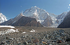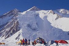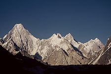
Gasherbrum
Encyclopedia


Mountain
Image:Himalaya_annotated.jpg|thumb|right|The Himalayan mountain range with Mount Everestrect 58 14 160 49 Chomo Lonzorect 200 28 335 52 Makalurect 378 24 566 45 Mount Everestrect 188 581 920 656 Tibetan Plateaurect 250 406 340 427 Rong River...
located at the northeastern end of the Baltoro Glacier
Baltoro Glacier
The Baltoro Glacier, at 62 kilometers long, is one of the longest glaciers outside the polar regions. It is located in Baltistan, in the Gilgit-Baltistan region of Pakistan, and runs through part of the Karakoram mountain range. The Baltoro Muztagh lies to the north and east of the glacier, while...
in the Karakoram
Karakoram
The Karakoram, or Karakorum , is a large mountain range spanning the borders between Pakistan, India and China, located in the regions of Gilgit-Baltistan , Ladakh , and Xinjiang region,...
range of the Himalaya on the border of the Chinese
China
Chinese civilization may refer to:* China for more general discussion of the country.* Chinese culture* Greater China, the transnational community of ethnic Chinese.* History of China* Sinosphere, the area historically affected by Chinese culture...
Shaksgam Valley and the Gilgit-Baltistan territory of Pakistan
Pakistan
Pakistan , officially the Islamic Republic of Pakistan is a sovereign state in South Asia. It has a coastline along the Arabian Sea and the Gulf of Oman in the south and is bordered by Afghanistan and Iran in the west, India in the east and China in the far northeast. In the north, Tajikistan...
. The massif
Massif
In geology, a massif is a section of a planet's crust that is demarcated by faults or flexures. In the movement of the crust, a massif tends to retain its internal structure while being displaced as a whole...
contains three of the world's 8,000 metre peaks
Eight-thousander
The eight-thousanders are the fourteen independent mountains on Earth that are more than high above sea level. They are all located in the Himalayan and Karakoram mountain ranges in Asia....
(if one includes Broad Peak). Gasherbrum is often claimed to mean "Shining Wall", presumably a reference to the highly visible face of Gasherbrum IV; but in fact it comes from "rgasha" (beautiful) + "brum" (mountain) in Balti, hence it actually means "beautiful mountain".
| Peak | metres | feet | Latitude (N) | Longitude (E) | Prominence Topographic prominence In topography, prominence, also known as autonomous height, relative height, shoulder drop , or prime factor , categorizes the height of the mountain's or hill's summit by the elevation between it and the lowest contour line encircling it and no higher summit... (m) |
|---|---|---|---|---|---|
| Gasherbrum I Gasherbrum I Gasherbrum I , also known as Hidden Peak or K5, is the 11th highest peak on Earth, located on the Pakistan-China border in Gilgit-Baltistan region of Pakistan and Xinjiang region of China. Gasherbrum I is part of the Gasherbrum massif, located in the Karakoram region of the Himalaya... |
8,080 | 26,509 | 35°43′27″ | 76°41′48″ | 2,155 |
| Broad Peak Broad Peak Broad Peak , is the 12th highest mountain on Earth, with an elevation of 8,051 meters . The literal translation of "Broad Peak" to Faichan Kangri is not accepted among the Balti people.- Geography :... |
8,047 | 26,400 | 35°48′35″ | 76°34′06″ | 1,701 |
| Gasherbrum II Gasherbrum II Gasherbrum II , also known as K4, is the 13th highest mountain on Earth, located on the border of Gilgit-Baltistan province, Pakistan and Xinjiang, China... |
8,035 | 26,360 | 35°45′27″ | 76°39′15″ | 1,523 |
| Gasherbrum III Gasherbrum III Gasherbrum III is a summit in the Gasherbrum massif of the Baltoro Muztagh, a subrange of the Karakoram on the border between Northern Areas of Pakistan and Xinjiang, China, in the region of Baltistan... |
7,952 | 26,089 | 35°45′34″ | 76°38′31″ | 355 |
| Gasherbrum IV Gasherbrum IV Gasherbrum IV is the 17th highest mountain on Earth and the 6th highest in Pakistan. It is one of the peaks in the Gasherbrum massif.The Gasherbrums are a remote group of peaks located at the northeastern end of the Baltoro Glacier in the Karakoram range of the Himalaya. The massif contains three... |
7,925 | 26,001 | 35°45′39″ | 76°37′00″ | 725 |
| Gasherbrum V Gasherbrum V Gasherbrum V is an unclimbed mountain in the Gasherbrum massif, located in the Karakoram range of Gilgit-Baltistan territory .- Location and Naming :... |
7,147 | 23,448 | 35°43′45″ | 76°36′48″ | 654 |
| Gasherbrum VI | 6,979 | 22,897 | 35°42′30″ | 76°37′54″ | 520 |
In 1856, Thomas George Montgomerie
Thomas George Montgomerie
Lieutenant-Colonel Thomas George Montgomerie was a British surveyor who participated in the Great Trigonometric Survey of India as a lieutenant in the 1850's. He was the person to label K2, the second highest mountain in the world, the K standing for Karakoram...
, a British Royal Engineers lieutenant and a member of the Great Trigonometric Survey of India
India
India , officially the Republic of India , is a country in South Asia. It is the seventh-largest country by geographical area, the second-most populous country with over 1.2 billion people, and the most populous democracy in the world...
, sighted a group of high peaks in the Karakoram from more than 200 km away. He named five of these peaks K1, K2, K3, K4 and K5 where the K denotes Karakoram. Today, K1 is known as Masherbrum
Masherbrum
Masherbrum is located in the Gilgit Baltistan of Pakistan. At it is the 22nd highest mountain in the world and the 9th highest in Pakistan. It was the first scaled and mapped peak in the Karakoram mountain range, hence its name....
, K3 as Broad Peak, K4 as Gasherbrum II and K5 as Gasherbrum I. Only K2
K2
K2 is the second-highest mountain on Earth, after Mount Everest...
, the second highest mountain in the world, has kept Montgomerie's name.
See also
- Concordia, PakistanConcordia, PakistanConcordia is the name for the confluence of the Baltoro Glacier and the Godwin-Austen Glacier, in the heart of the Karakoram range of Pakistan. It is located in Baltistan region of Pakistan...
- Eight-thousanderEight-thousanderThe eight-thousanders are the fourteen independent mountains on Earth that are more than high above sea level. They are all located in the Himalayan and Karakoram mountain ranges in Asia....
- List of highest mountains
- List of mountains in Pakistan
Sources
- H. Adams Carter, "Balti Place Names in the Karakoram", American Alpine Journal 49 (1975), p. 53.
- Mount Qogori (K2) {scale 1:100,000}; edited and mapped by Mi Desheng (Lanzhou Institute of Glaciology and Geocryology), the Xi´an Cartographic Publishing House.
- Dreams of Tibet: the pundits

