
List of crossings of the Saint Lawrence River
Encyclopedia
This is a list of bridge
s, ferries, and other crossings of the Saint Lawrence River
and the Great Lakes
, by order of south shore terminal running from the Gulf of Saint Lawrence
upstream to Lake Superior
.
Bridge
A bridge is a structure built to span physical obstacles such as a body of water, valley, or road, for the purpose of providing passage over the obstacle...
s, ferries, and other crossings of the Saint Lawrence River
Saint Lawrence River
The Saint Lawrence is a large river flowing approximately from southwest to northeast in the middle latitudes of North America, connecting the Great Lakes with the Atlantic Ocean. It is the primary drainage conveyor of the Great Lakes Basin...
and the Great Lakes
Great Lakes
The Great Lakes are a collection of freshwater lakes located in northeastern North America, on the Canada – United States border. Consisting of Lakes Superior, Michigan, Huron, Erie, and Ontario, they form the largest group of freshwater lakes on Earth by total surface, coming in second by volume...
, by order of south shore terminal running from the Gulf of Saint Lawrence
Gulf of Saint Lawrence
The Gulf of Saint Lawrence , the world's largest estuary, is the outlet of North America's Great Lakes via the Saint Lawrence River into the Atlantic Ocean...
upstream to Lake Superior
Lake Superior
Lake Superior is the largest of the five traditionally-demarcated Great Lakes of North America. It is bounded to the north by the Canadian province of Ontario and the U.S. state of Minnesota, and to the south by the U.S. states of Wisconsin and Michigan. It is the largest freshwater lake in the...
.
| Key: Communities linked by individual crossings |
|---|
Lower and Middle Saint Lawrence
| Crossing | Picture | Year built | Communities linked | Carries | Name origin | Coordinates Geographic coordinate system A geographic coordinate system is a coordinate system that enables every location on the Earth to be specified by a set of numbers. The coordinates are often chosen such that one of the numbers represent vertical position, and two or three of the numbers represent horizontal position... |
|---|---|---|---|---|---|---|
| Matane-Baie Comeau-Godbout ferry | (N) Baie-Comeau (N) Godbout Godbout, Quebec Godbout is a village in the Côte-Nord region of Quebec, Canada. It is located at the mouth of the Godbout River on the north shore of the Saint Lawrence River.Godbout is accessible via Quebec Route 138 and by ferry from Matane.-History:... |
49°13′56"N 68°8′4"W (Baie-Comeau) 49°19′19"N 67°35′33"W (Godbout) |
||||
| (S) Matane Matane Matane is a city in Quebec, Canada.Matane may also refer to:*Matane , Quebec*Matane Regional County Municipality, Quebec*Matane River, Quebec*Paulias Matane, Governor-General of Papua New Guinea... |
48°50′23"N 67°34′38"W | |||||
| Nordik Express ferry | (N) Sept-Îles Sept-Îles, Quebec For the islands in north of Brittany, see JentilezSept-Îles is a city in the Côte-Nord region of eastern Quebec, Canada. It is the northernmost town in Quebec with any significant population... (N) Havre-Saint-Pierre Havre-Saint-Pierre, Quebec Havre-Saint-Pierre is a town situated on Pointe-aux-Esquimaux, which is on the Quebec north shore of the Saint Lawrence River in Canada... |
50°11′47"N 66°22′38"W (Sept-Îles) 50°14′11"N 63°36′19"W (Havre Saint-Pierre) |
||||
| (I) Port-Menier Port-Menier, Quebec Port-Menier, Quebec is a small fishing town located on the western end of Anticosti Island, Quebec, Canada, part of the L'Île-d'Anticosti municipality. The port village was built during the late 19th century by French chocolate maker Henri Menier.... |
49°48′45"N 64°20′47"W | |||||
| (S) Rimouski | 48°28′52"N 68°30′59"W | |||||
| Rimouski-Forestville ferry | (N) Forestville Forestville, Quebec Forestville is a town in the Côte-Nord region of Quebec, Canada. It is located on the north shore of the Saint Lawrence River along Route 138, approximately southwest of Baie-Comeau. There is a vehicle and passenger ferry service from Forestville to Rimouski, on the south shore of the St. Lawrence... |
48°44′23"N 69°3′9"W | ||||
| (S) Rimouski | 48°28′52"N 68°30′59"W | |||||
| Rivière-du-Loup-St-Siméon ferry | (N) Saint-Siméon Charlevoix-Est Regional County Municipality, Quebec Charlevoix-Est is a regional county municipality in northeastern Quebec, Canada. The regional county municipality seat is Clermont.According to the 2001 Statistics Canada Census:*Population: 16,624*% Change : -1.9*Dwellings: 6,893... |
Route 170 Quebec route 170 Route 170 is a major east/west highway on the north shore of the St. Lawrence River in Quebec, Canada, and it parallels the Saguenay River on the south side of it... |
47°50′26"N 69°52′27"W | |||
| (S) Rivière-du-Loup | 47°50′45"N 69°34′19"W | |||||
| Trois Pistoles-Les Escoumins ferry | (N) Les Escoumins Les Escoumins, Quebec Les Escoumins is a village on the shore of the Saint Lawrence River in the Haute-Côte-Nord region of the province of Quebec, Canada.Its economy is mostly based on the service sectors, especially education, health, and tourism... |
48°21′00"N 69°24′00"W | ||||
| (S) Trois-Pistoles Trois-Pistoles, Quebec Trois-Pistoles is a town in and the seat of the Les Basques Regional County Municipality within the Bas-Saint-Laurent region of Quebec. It is also the county seat. The town is located on the south shore of the Saint Lawrence River.... |
48°07′00"N 69°11′00"W | |||||
| Île d'Orléans Bridge | 1935 | (N) Quebec City Quebec City Quebec , also Québec, Quebec City or Québec City is the capital of the Canadian province of Quebec and is located within the Capitale-Nationale region. It is the second most populous city in Quebec after Montreal, which is about to the southwest... (Beauport Beauport, Quebec Beauport is a borough of Quebec City, Quebec, Canada on the Saint Lawrence River.Beauport is a northeastern suburb of Quebec City. Manufactures include paint, construction materials, printers, and hospital supplies. Food transportation is important to the economy... ) |
Route 368 Quebec route 368 Route 368 is a 72 km two-lane east/west highway in Quebec, Canada, which is located on Île d'Orléans and includes the Pont de l'Île which connects the island to the mainland... |
Île d'Orléans Île d'Orléans Île d'Orléans is located in the Saint Lawrence River about east of downtown Quebec City, Quebec, Canada. The island was one of the first parts of the province to be colonized by the French, and a large percentage of French Canadians can trace ancestry to early residents of the island... |
46°52′45"N 71°7′58"W | |
| (I) Île d'Orléans Île d'Orléans Île d'Orléans is located in the Saint Lawrence River about east of downtown Quebec City, Quebec, Canada. The island was one of the first parts of the province to be colonized by the French, and a large percentage of French Canadians can trace ancestry to early residents of the island... |
||||||
| Quebec-Levis Ferry | (N) Quebec City Quebec City Quebec , also Québec, Quebec City or Québec City is the capital of the Canadian province of Quebec and is located within the Capitale-Nationale region. It is the second most populous city in Quebec after Montreal, which is about to the southwest... |
46°48′42"N 71°12′5"W | ||||
| (S) Lévis Lévis, Quebec Lévis is a city in eastern Quebec, Canada. It is located on the south shore of the St. Lawrence River, opposite Quebec City. A ferry links Old Quebec with Old Lévis, and two bridges, the Quebec Bridge and the Pierre Laporte Bridge, connect western Lévis with Quebec City. The Société de transport de... |
46°48′37"N 71°11′17"W | |||||
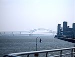
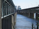
| Quebec Bridge Quebec Bridge right|thumb|Lifting the centre span in place was considered to be a major engineering achievement. Photo caption from [[Popular Mechanics]] Magazine, December 1917... |
1917 | (N) Quebec City (Sainte-Foy) | Route 175 Quebec route 175 Route 175 is a major north/south highway on both sides of the St. Lawrence River in Quebec, Canada. Its southern terminus is in Saint-Lambert-de-Lauzon at the junction of Route 218 and its northern terminus is in Saguenay at the junction of Route 172, in the former city of Chicoutimi... Via Rail VIA Rail Via Rail Canada is an independent crown corporation offering intercity passenger rail services in Canada. It is headquartered near Montreal Central Station at 3 Place Ville-Marie in Montreal, Quebec.... Canadian National Railway Canadian National Railway The Canadian National Railway Company is a Canadian Class I railway headquartered in Montreal, Quebec. CN's slogan is "North America's Railroad".... Route Verte Route Verte The Route Verte is a network of bicycling and multiuse trails and designated roads, lanes, and surfaces, spanning 4036 kilometres as of October 31, 2008, in the Canadian province of Quebec, inaugurated on August 10, 2007... 6 |
Quebec City Quebec City Quebec , also Québec, Quebec City or Québec City is the capital of the Canadian province of Quebec and is located within the Capitale-Nationale region. It is the second most populous city in Quebec after Montreal, which is about to the southwest... |
46°44′46"N 71°17′16"W | |
| (S) Lévis (Charny Charny, Quebec Charny is a community in central Quebec, Canada, south of Quebec City. It is located on the south shore of the St. Lawrence River. Formerly an independent city, Charny was merged with Lévis on January 1, 2002.-History:... ) |
||||||
| Pierre Laporte Bridge Pierre Laporte Bridge The Pierre Laporte Bridge is the longest main span suspension bridge in Canada. It crosses the Saint Lawrence River approximately west of the famous Quebec Bridge between historic Quebec City and Lévis, Quebec.... |
 |
1970 | (N) Quebec City (Sainte-Foy) |  Autoroute 73 Autoroute 73Quebec Autoroute 73 Autoroute 73 is an important Autoroute in east-central Quebec, Canada... |
Pierre Laporte Pierre Laporte Pierre Laporte was a Canadian lawyer, journalist and politician who was the Deputy Premier and Minister of Labour of the province of Quebec before being kidnapped and killed by members of the group Front de libération du Québec during the October Crisis. Mr... (1921–1970), Vice-Premier of Quebec Premier of Quebec The Premier of Quebec is the first minister of the Canadian province of Quebec. The Premier is the province's head of government and his title is Premier and President of the Executive Council.... . |
46°44′42"N 71°17′25"W |
| (S) Lévis (Charny) | ||||||
| Laviolette Bridge Laviolette Bridge The Laviolette Bridge is an arch bridge connecting the city of Trois-Rivières, Quebec, Canada to Bécancour on the south shore of the Saint Lawrence River via Autoroute 55.-Overview:... |
 |
1967 | (N) Trois-Rivières Trois-Rivières Trois-Rivières means three rivers in French and may refer to:in Canada*Trois-Rivières, the largest city in the Mauricie region of Quebec, Canada*Circuit Trois-Rivières, a racetrack in Trois-Rivières, Quebec... |
 Autoroute 55 Autoroute 55Quebec Autoroute 55 Autoroute 55 Autoroute 55 Autoroute 55 (also called Autoroute de l'Énergie (North of the Autoroute 20) and Autoroute Joseph-Armand Bombardier (South part) is an important north-south Autoroute and the only one running in that direction in central Quebec. It is the longest north-south Autoroute,... |
Sieur de Laviolette Sieur de Laviolette The Sieur de Laviolette was the founder of Trois-Rivières, a city in Central Québec.... (real name disputed), widely acknowledged as the founder of Trois-Rivières Trois-Rivières Trois-Rivières means three rivers in French and may refer to:in Canada*Trois-Rivières, the largest city in the Mauricie region of Quebec, Canada*Circuit Trois-Rivières, a racetrack in Trois-Rivières, Quebec... . |
46°18′23"N 72°33′36"W |
| (S) Bécancour Bécancour, Quebec Bécancour is a town in the Centre-du-Québec region of Québec, Canada; it is the seat of the Bécancour Regional County Municipality. It is located on the south shore of the Saint Lawrence River at the confluence of the Bécancour River, opposite Trois-Rivières.Wôlinak, an Abenaki Indian reserve, is... |
||||||
| Sorel-St Ignace de Loyola Ferry | (N) Berthierville Berthierville, Quebec Berthierville is a Canadian town located between Montreal and Trois-Rivières on the north shore of the Saint Lawrence River in the province of Quebec. Berthierville is the seat of D'Autray Regional County Municipality, and is served by Autoroute 40, and is the junction of Routes 138 and 158... (Saint Ignace de Loyola) |
Route 158 Quebec route 158 Route 158 is an east-west arterial road running between Lachute and Berthierville, north of the Ottawa and Saint Lawrence rivers, in the Laurentides region.... |
46°3′34"N 73°7′33"W | |||
| (S) Sorel-Tracy Sorel-Tracy, Quebec Sorel-Tracy is a city in southwestern Quebec, Canada and the geographical end point of the Lake Champlain Valley at the confluence of the Richelieu River and the St. Lawrence River, on the western edge of Lac Saint-Pierre downstream and east of nearby Montreal. The population as of the Canada 2006... |
46°2′52"N 73°6′49"W | |||||
Island of Montreal
| Crossing | Picture | Year built | Communities linked | Carries | Name origin | Coordinates Geographic coordinate system A geographic coordinate system is a coordinate system that enables every location on the Earth to be specified by a set of numbers. The coordinates are often chosen such that one of the numbers represent vertical position, and two or three of the numbers represent horizontal position... |
|---|---|---|---|---|---|---|
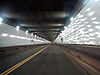
| Louis Hippolyte Lafontaine Tunnel | 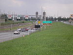 |
1967 | (N) Borough of Mercier–Hochelaga-Maisonneuve Mercier–Hochelaga-Maisonneuve Mercier–Hochelaga-Maisonneuve is a borough of Montreal, Quebec.-History:In 1860, Hochelaga developed as a village counting a little more than 1000 inhabitants. In 1874, Hudon — a cotton factory- moved in... |
 Quebec Autoroute 25 Autoroute 25 is an Autoroute in the Lanaudière region of Quebec. It is currently long.... |
Louis-Hippolyte Lafontaine Louis-Hippolyte Lafontaine Sir Louis-Hippolyte Lafontaine , 1st Baronet, KCMG was the first Canadian to become Prime Minister of the United Province of Canada and the first head of a responsible government in Canada. He was born in Boucherville, Lower Canada in 1807... (1807–1864), Prime Minister Joint Premiers of the Province of Canada Joint Premiers of the Province of Canada were the leaders of the Province of Canada, from the 1841 unification of Upper Canada and Lower Canada until Confederation in 1867.... of the United Province of Canada |
45°35′0"N 73°29′51"W |
| (I) Île Charron (Îles de Boucherville) (exit) | ||||||
| (S) Longueuil, borough of Vieux-Longueuil | ||||||
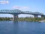
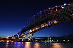
| Jacques Cartier Bridge Jacques Cartier Bridge The Jacques Cartier Bridge is a steel truss cantilever bridge crossing the Saint Lawrence River from Montreal Island, Montreal, Quebec to the south shore at Longueuil, Quebec, Canada... |
1930 | (N) Borough of Ville-Marie | Route 134 Quebec route 134 Route 134 is a highway in the province of Quebec, running from Candiac on the South Shore of the Saint Lawrence River to Montreal, crossing the river on Jacques Cartier Bridge. On the South Shore, Route 134 is named Taschereau Boulevard , after the prominent Quebec family that included former... Pedestrians and bicycles |
Jacques Cartier Jacques Cartier Jacques Cartier was a French explorer of Breton origin who claimed what is now Canada for France. He was the first European to describe and map the Gulf of Saint Lawrence and the shores of the Saint Lawrence River, which he named "The Country of Canadas", after the Iroquois names for the two big... (1491–1557), French explorer |
45°31′17"N 73°32′28"W | |
| (I) Île Sainte-Hélène (exit) and Île Notre-Dame | ||||||
| (S) Longueuil, borough of Vieux-Longueuil | ||||||
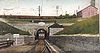
| Montreal Metro Tunnel | 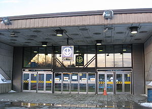 |
1966 | (N) Borough of Ville-Marie (Berri-UQAM Berri-UQAM (Montreal Metro) Berri-UQAM is the central station of the Montreal Metro rapid transit system operated by the Société de transport de Montréal . It is located in the Quartier Latin, in the borough of Ville-Marie, in Montreal, Quebec, Canada. The station opened on October 14, 1966, as part of the original network... station) |
Line 4 Yellow Line 4 Yellow (Montreal Metro) The Yellow line is one of the metro's four routes operating in Montreal, Quebec, Canada. It was popular when it opened for service because it connected Montreal's city centre with the Expo 67 exhibition and La Ronde on Île-Sainte-Hélène. Line 4 has three stations, and travels under the St.... |
45°30′N 73°32′W | |
| (I) Île Sainte-Hélène (Jean-Drapeau Jean-Drapeau (Montreal Metro) Jean-Drapeau is a station on the Yellow Line of the Montreal Metro rapid transit system, operated by the Société de transport de Montréal... station) and Île Notre-Dame |
||||||
| (S) Longueuil Longueuil, Quebec Longueuil is a city in the province of Quebec, Canada. It is the seat of the Montérégie administrative region and sits on the south shore of the Saint Lawrence River directly across from Montreal. The population as of the Canada 2006 Census totaled 229,330, making it the third largest city in... , borough of Vieux-Longueuil (Longueuil–Université-de-Sherbrooke Longueuil–Université-de-Sherbrooke (Montreal Metro) Longueuil–Université-de-Sherbrooke is a station at the southern terminus of the Yellow Line of the Montreal Metro rapid transit system, operated by the Société de transport de Montréal . It is located in the city of Longueuil, Quebec, Canada.... station) |
||||||
| Pont de la Concorde Bridge Concorde Bridge The Concordia Bridge carries Avenue Pierre-Dupuy across the St. Lawrence River between Cité du Havre , Montreal, and Parc Jean-Drapeau on Saint Helen's Island. A majority of its traffic is motorists driving to the Montreal Casino on Île Notre-Dame, continuing on Pierre Dupuy Avenue across Pont des... |
 |
1965 | (N) Borough of Ville-Marie | Pierre-Dupuy Avenue and Route Verte Route Verte The Route Verte is a network of bicycling and multiuse trails and designated roads, lanes, and surfaces, spanning 4036 kilometres as of October 31, 2008, in the Canadian province of Quebec, inaugurated on August 10, 2007... 1 and 2 |
Reference to Montreal's motto, Concordia salus | 45°30′22"N 73°32′17"W (Pont de la Concorde) 45°30′28"N 73°31′49"W (Pont des Îles) |
| (I) Île Sainte-Hélène and Île Notre-Dame Île Notre-Dame Île Notre-Dame is an artificial island built in 10 months from 15 million tons of rock excavated for the Montreal Metro in 1965. It was created for Expo 67 to celebrate Canada's centennial. The island is part of the city of Montreal and forms part of the Hochelaga Archipelago... (Parc Jean-Drapeau Parc Jean-Drapeau Parc Jean-Drapeau is situated to the east of downtown Montreal, Quebec, Canada, in the Saint Lawrence River. It comprises two islands, Saint Helen's Island and the artificial island Île Notre-Dame.... ), borough of Ville-Marie, Montreal |
||||||
| Victoria Bridge | 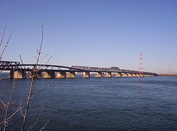 |
1898 | (N) Borough of Le Sud-Ouest Le Sud-Ouest Le Sud-Ouest is a borough of the city of Montreal, Quebec, Canada.-Geography:Le Sud-Ouest is an amalgam of several neighbourhoods with highly distinct histories and identities, mainly with working-class and industrial origins, grouped around the Lachine Canal... |
Route 112 Quebec route 112 Route 112 is a busy east/west highway on the south shore of the Saint Lawrence River in Quebec, Canada. Its eastern terminus is in Frampton at the junction of Route 275, and the western terminus is in Downtown Montreal , after crossing the Victoria Bridge... Canadian National Railway Canadian National Railway The Canadian National Railway Company is a Canadian Class I railway headquartered in Montreal, Quebec. CN's slogan is "North America's Railroad".... (CN) AMT Agence métropolitaine de transport The Agence métropolitaine de transport is the umbrella organization that plans, integrates, and coordinates public transportation services across Canada's Greater Montreal Region, including the Island of Montreal, Laval , and communities along both the North Shore of the Rivière des Mille-Îles... Mont-Saint-Hilaire Line commuter train Commuter rail in North America Commuter rail services in the United States, Canada, and Mexico provide common carrier passenger transportation along railway tracks, with scheduled service on fixed routes on a non-reservation basis primarily for short-distance travel between a central business district and adjacent suburbs and... Via Rail VIA Rail Via Rail Canada is an independent crown corporation offering intercity passenger rail services in Canada. It is headquartered near Montreal Central Station at 3 Place Ville-Marie in Montreal, Quebec.... and Amtrak Adirondack (Amtrak) The Adirondack is a passenger train operated daily by Amtrak between New York City and Montreal. The trip takes approximately 11 hours to cover a published distance of , traveling through the scenic Hudson Valley and the Adirondack Mountains... passenger trains |
Queen Victoria of the United Kingdom Victoria of the United Kingdom Victoria was the monarch of the United Kingdom of Great Britain and Ireland from 20 June 1837 until her death. From 1 May 1876, she used the additional title of Empress of India.... (1819–1901) |
45°29′29"N 73°31′46"W |
| (S) Saint-Lambert Saint-Lambert, Quebec Saint-Lambert is a Canadian city in the province of Quebec located opposite Montreal on the south shore of the St. Lawrence River. Saint-Lambert was named for either the early French Canadian hunter Lambert Closse or for Roman Catholic Bishop Lambert of Maastricht... |
||||||
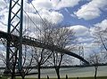
| Champlain Bridge Champlain Bridge (Montreal) The Champlain Bridge is a steel truss cantilever bridge with approach viaducts constructed of prestressed concrete beams supporting a prestressed concrete deck paved with asphalt... |
 |
1962 | (N) Borough of Verdun |    Autoroutes 10 Quebec Autoroute 10 Autoroute 10 is an Autoroute in southern Quebec, Canada... , 15 Quebec Autoroute 15 Autoroute 15 is a highway in western Quebec, Canada... , and 20 Quebec Autoroute 20 Autoroute 20 is a major Quebec Autoroute, following the Saint Lawrence River through one of the more densely-populated parts of Canada, and is part of the Trans-Canada Highway. At , it is the longest Autoroute in Quebec... |
Samuel de Champlain Samuel de Champlain Samuel de Champlain , "The Father of New France", was a French navigator, cartographer, draughtsman, soldier, explorer, geographer, ethnologist, diplomat, and chronicler. He founded New France and Quebec City on July 3, 1608.... (c. 1580–1635), founder of Quebec City Quebec City Quebec , also Québec, Quebec City or Québec City is the capital of the Canadian province of Quebec and is located within the Capitale-Nationale region. It is the second most populous city in Quebec after Montreal, which is about to the southwest... |
45°28′7"N 73°31′15"W |
| (I) Île des Sœurs (exit) | ||||||
| (S) Brossard Brossard Brossard is a suburban area, located on the south shore of the Saint Lawrence River, opposite the island and city of Montreal.Brossard is subdivided into many smaller sections. These sections are characterized by having street names that all begin with the same letter of the alphabet... |
||||||
| Champlain Bridge Ice Structure | 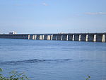 |
1964 | (I) Île des Sœurs | Route Verte Route Verte The Route Verte is a network of bicycling and multiuse trails and designated roads, lanes, and surfaces, spanning 4036 kilometres as of October 31, 2008, in the Canadian province of Quebec, inaugurated on August 10, 2007... 1 and 2 |
45°27′57"N 73°31′11"W | |
| (S) St. Lawrence Seaway levee Levee A levee, levée, dike , embankment, floodbank or stopbank is an elongated naturally occurring ridge or artificially constructed fill or wall, which regulates water levels... |
||||||
| Honoré Mercier Bridge Honoré Mercier Bridge The Honoré Mercier Bridge in Quebec, Canada, connects the Montreal borough of LaSalle on the Island of Montreal with the Mohawk reserve of Kahnawake and the suburb of Châteauguay on the south shore of the Saint Lawrence River. It is the most direct southerly route from the island of Montreal toward... |
 |
1934, 1963 | (N) Borough of LaSalle |  Quebec route 138 Route 138 is a major highway in the Canadian province of Quebec, following the entire north shore of the Saint Lawrence River past Montreal to the eastern terminus in Natashquan on the Gulf of Saint Lawrence. The western terminus is in Elgin, at the border with New York State south-west of Montreal... |
Honoré Mercier Honoré Mercier Honoré Mercier was a lawyer, journalist and politician in Quebec, Canada. He was the ninth Premier of Quebec from January 27, 1887 to December 21, 1891, as leader of the Parti National or Quebec Liberal Party .... (1840–1894), Premier of Quebec |
45°25′0"N 73°39′18"W |
| (S) Kahnawake Mohawk Reserve | ||||||
| Saint-Laurent Railway Bridge Saint-Laurent Railway Bridge The Saint-Laurent Railway Bridge is a Canadian Pacific railway bridge linking LaSalle to the Kahnawake Mohawk Reserve, just upstream of the Mercier Bridge. It is used by the AMT... |
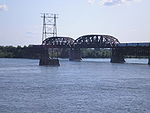 |
1886 | (N) Borough of LaSalle | Canadian Pacific Railway Canadian Pacific Railway The Canadian Pacific Railway , formerly also known as CP Rail between 1968 and 1996, is a historic Canadian Class I railway founded in 1881 and now operated by Canadian Pacific Railway Limited, which began operations as legal owner in a corporate restructuring in 2001... (CPR) Agence métropolitaine de transport Agence métropolitaine de transport The Agence métropolitaine de transport is the umbrella organization that plans, integrates, and coordinates public transportation services across Canada's Greater Montreal Region, including the Island of Montreal, Laval , and communities along both the North Shore of the Rivière des Mille-Îles... (AMT) Delson-Candiac Line (commuter train Commuter rail in North America Commuter rail services in the United States, Canada, and Mexico provide common carrier passenger transportation along railway tracks, with scheduled service on fixed routes on a non-reservation basis primarily for short-distance travel between a central business district and adjacent suburbs and... ) |
Saint Lawrence River Saint Lawrence River The Saint Lawrence is a large river flowing approximately from southwest to northeast in the middle latitudes of North America, connecting the Great Lakes with the Atlantic Ocean. It is the primary drainage conveyor of the Great Lakes Basin... |
45°25′8"N 73°39′34"W |
| (S) Kahnawake Mohawk Mohawk nation Mohawk are the most easterly tribe of the Iroquois confederation. They call themselves Kanien'gehaga, people of the place of the flint... Reserve Indian reserve In Canada, an Indian reserve is specified by the Indian Act as a "tract of land, the legal title to which is vested in Her Majesty, that has been set apart by Her Majesty for the use and benefit of a band." The Act also specifies that land reserved for the use and benefit of a band which is not... |
||||||
| Île-Dorval ferry | (N) Dorval | 45°26′17"N 73°44′22"W | ||||
| (I) Dorval Island L'Île-Dorval, Quebec L'Île-Dorval is a municipality and an island in southwestern Quebec, Canada, in Lac Saint-Louis off the Island of Montreal.A cottaging spot, it had only two permanent residents as of the 1996 census, making it the smallest municipality in Canada both in area and population. By the 2001 census the... |
45°26′0"N 73°44′32"W | |||||
Upper Saint Lawrence and Beauharnois Canal
| Crossing | Picture | Year built | Communities linked | Carries | Name origin | Coordinates Geographic coordinate system A geographic coordinate system is a coordinate system that enables every location on the Earth to be specified by a set of numbers. The coordinates are often chosen such that one of the numbers represent vertical position, and two or three of the numbers represent horizontal position... |
|---|---|---|---|---|---|---|
| Boulevard Edgar Hébert Bridge (Beauharnois Canal Saint Lawrence Seaway The Saint Lawrence Seaway , , is the common name for a system of locks, canals and channels that permits ocean-going vessels to travel from the Atlantic Ocean to the North American Great Lakes, as far as Lake Superior. Legally it extends from Montreal to Lake Erie, including the Welland Canal... ) |
(I) Melocheville | Route 132 Quebec route 132 Route 132 is the longest highway in Quebec. It follows the south shore of the Saint Lawrence River from the border with the state of New York in the hamlet of Dundee , west of Montreal to the Gulf of Saint Lawrence and circles the Gaspé Peninsula... |
Edgar Hébert (1911–1984), MNA National Assembly of Quebec The National Assembly of Quebec is the legislative body of the Province of Quebec. The Lieutenant Governor and the National Assembly compose the Parliament of Quebec, which operates in a fashion similar to those of other British-style parliamentary systems.The National Assembly was formerly the... for Beauharnois Beauharnois (provincial electoral district) Beauharnois is a provincial electoral district in Quebec, Canada, that elects members to the National Assembly of Quebec. The riding was created in 2001 from parts of Beauharnois-Huntingdon, Châteauguay and Salaberry-Soulanges. The Beauharnois riding also existed from 1867 to 1989... (1948–1962). |
45°18′57"N 73°54′28"W | ||
| (S) Beauharnois Beauharnois, Quebec Beauharnois is a city located in the Beauharnois-Salaberry Regional County Municipality of southwestern Quebec, Canada and is part of Greater Montreal Area. The city's population as of the Canada 2006 Census was 11,918... |
||||||
| (Future bridge) (Back channel) | (N) Vaudreuil-Dorion |  Autoroute 30 Autoroute 30Quebec Autoroute 30 Autoroute 30 is a superhighway in Quebec, Canada.There are three segments currently open for travel:... (future) |
45°18′N 73°59′W | |||
| (I) Melocheville | ||||||
| (Future bridge) (Beauharnois Canal Saint Lawrence Seaway The Saint Lawrence Seaway , , is the common name for a system of locks, canals and channels that permits ocean-going vessels to travel from the Atlantic Ocean to the North American Great Lakes, as far as Lake Superior. Legally it extends from Montreal to Lake Erie, including the Welland Canal... ) |
45°17′N 73°55′W | |||||
| (S) Beauharnois | ||||||
| Pied-du-Canal Bridge | (I) Melocheville | CSX Rail CSX Transportation CSX Transportation operates a Class I railroad in the United States known as the CSX Railroad. It is the main subsidiary of the CSX Corporation. The company is headquartered in Jacksonville, Florida, and owns approximately 21,000 route miles... |
Reference to the position of the bridge, close to the canal's downstream end. | 45°17′58"N 73°55′13"W | ||
| (S) Beauharnois | ||||||
| St. Louis Bridge (Beauharnois Canal) | (I) Salaberry-de-Valleyfield (Saint-Timothée) | Boulevard Pie-XII (Salaberry) Rue du Pont (Saint-Louis) |
Municipality of Saint-Louis-de-Gonzague Saint-Louis-de-Gonzague, Quebec In Quebec, Saint-Louis-de-Gonzague may refer to one of three communities:*Saint-Louis-de-Gonzague, Chaudière-Appalaches, Quebec, a municipality in Les Etchemins Regional County Municipality... . |
45°13′50"N 74°0′4"W | ||
| (S) Saint-Louis-de-Gonzague Saint-Louis-de-Gonzague, Quebec In Quebec, Saint-Louis-de-Gonzague may refer to one of three communities:*Saint-Louis-de-Gonzague, Chaudière-Appalaches, Quebec, a municipality in Les Etchemins Regional County Municipality... |
||||||
| Larocque Bridge (Beauharnois Canal) | (I) Salaberry-de-Valleyfield | Route 201 Quebec Route 201 Route 201 is a north/south provincial highway within the Canadian province of Quebec, running between Route 202 in Franklin and Route 342 in Rigaud. Its total length is approximately 70 kilometres.... Route 132 Quebec route 132 Route 132 is the longest highway in Quebec. It follows the south shore of the Saint Lawrence River from the border with the state of New York in the hamlet of Dundee , west of Montreal to the Gulf of Saint Lawrence and circles the Gaspé Peninsula... Autoroute 30Quebec Autoroute 30 Autoroute 30 is a superhighway in Quebec, Canada.There are three segments currently open for travel:... (current)  Autoroute 530 (future) Autoroute 530 (future) |
Larocque Street in Salaberry-de-Valleyfield. The origin of the name Larocque is unknown. | 45°13′23"N 74°6′57"W | ||
| (S) Saint-Stanislas-de-Kostka Saint-Stanislas-de-Kostka, Quebec Saint-Stanislas-de-Kostka is a municipality of Quebec, located within the Beauharnois-Salaberry Regional County Municipality in the Montérégie administrative region. The population as of the Canada 2006 Census was 1,668.-Population:Population trend... |
||||||
| Monseigneur Langlois Bridge (Back channel) | (N) Coteau du Lac Coteau-du-Lac, Quebec Coteau-du-Lac is a small town in southwestern Quebec, Canada. It is on the north shore of the St. Lawrence River in the Vaudreuil-Soulanges Regional County Municipality.... |
Route 201 Quebec Route 201 Route 201 is a north/south provincial highway within the Canadian province of Quebec, running between Route 202 in Franklin and Route 342 in Rigaud. Its total length is approximately 70 kilometres.... |
Origin unknown. | 45°16′21"N 74°10′53"W | ||
| (I) Salaberry-de-Valleyfield (Grande-Île) | ||||||
| Coteau Railway Bridge (Back Channel) | (N) Coteau du Lac | Canadian National Railway Canadian National Railway The Canadian National Railway Company is a Canadian Class I railway headquartered in Montreal, Quebec. CN's slogan is "North America's Railroad".... |
Les Coteaux, Quebec Les Coteaux, Quebec Les Coteaux is a municipality located in the Montérégie region of Quebec, north of the Saint Lawrence River and Salaberry-de-Valleyfield.-Population:Population trend-Language:Mother tongue language -References:... |
45°15′30"N 74°10′57"W | ||
| (I) Salaberry-de-Valleyfield (Grande-Île) | ||||||
Upper Saint Lawrence River
| Crossing | Picture | Year built | Communities linked | Carries | Name origin | Coordinates Geographic coordinate system A geographic coordinate system is a coordinate system that enables every location on the Earth to be specified by a set of numbers. The coordinates are often chosen such that one of the numbers represent vertical position, and two or three of the numbers represent horizontal position... |
|---|---|---|---|---|---|---|
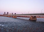
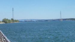
| Three Nations Crossing (North Channel Bridge) |  |
1962 | (N) Cornwall, Ontario Cornwall, Ontario Cornwall is a city in Eastern Ontario, Canada and the seat of the United Counties of Stormont, Dundas and Glengarry, Ontario. Cornwall is Ontario's easternmost city, located on the St... |
 Brookdale Avenue/ON 138 Brookdale Avenue/ON 138Highway 138 (Ontario) King's Highway 138, commonly referred to as Highway 138, is a provincially maintained highway in eastern Ontario. It extends from the former Highway 2 in Cornwall, north to Highway 417 east of Casselman. Highway 138 provides access to the Seaway International Bridge, connecting Cornwall... Access to  NY 37 NY 37New York State Route 37 New York State Route 37 is a state highway in the North Country of New York in the United States, extending for on a west–east axis. The western terminus of the route is at an intersection with U.S. Route 11 in Watertown, Jefferson County... |
Mohawks of Akwesasne Akwesasne The Mohawk Nation of Akwesasne is a Mohawk Nation territory that straddles the intersection of international and provincial borders on both banks of the Saint Lawrence River. Most of the land is in what is otherwise the United States... |
45°0′29"N 74°44′22"W |
| (I) Akwesasne Akwesasne The Mohawk Nation of Akwesasne is a Mohawk Nation territory that straddles the intersection of international and provincial borders on both banks of the Saint Lawrence River. Most of the land is in what is otherwise the United States... (Cornwall Island) |
||||||
| Three Nations Crossing (South Channel Bridge) | http://www.flickr.com/photos/bridgink/1252494224/ | 1958 | 44°59′23"N 74°44′22"W | |||
| (S) Massena, New York Massena (town), New York Massena is a town in St. Lawrence County, New York, United States. The town is on the northern border of the county and is nicknamed "The Gateway to the Fourth Coast". The population was 13,121 at the 2000 census. The town of Massena contains a village also called Massena... |
||||||
| Ogdensburg-Prescott International Bridge Ogdensburg-Prescott International Bridge The Ogdensburg–Prescott International Bridge, also known as the St. Lawrence Bridge and the Seaway Skyway, is a suspension bridge connecting Ogdensburg, New York in the United States to Johnstown, Ontario in Canada... |
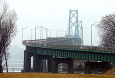 |
1960 | (N) Johnstown, Ontario Johnstown, Leeds and Grenville United Counties, Ontario Johnstown is a community in the United Counties of Leeds and Grenville, in eastern Ontario, Canada, part of the township of Edwardsburgh/Cardinal. It is located at the Canadian terminus of the Ogdensburg-Prescott International Bridge and at the southern terminus of Highway 416 and Highway... |
 NY 812 NY 812New York State Route 812 New York State Route 812 is a state highway in the North Country of New York in the United States. The southern terminus of the route is at an intersection with NY 12 and NY 26 in the Lewis County village of Lowville...  ON 416 ON 416Highway 416 (Ontario) King's Highway 416, commonly referred to as Highway 416 and as the Veterans Memorial Highway, is a 400-series highway in the Canadian province of Ontario which connects Highway 417 in Ottawa with Highway 401 between Brockville and Cornwall... |
Ogdensburg, New York Ogdensburg, New York Ogdensburg is a city in St. Lawrence County, New York, United States. The population was 11,128 at the 2010 census. In the late 18th century, European-American settlers named the community after American land owner and developer Samuel Ogden.... , Prescott, Ontario Prescott, Ontario Prescott is a town of approximately 4,180 people on the north shore of the Saint Lawrence River in Leeds and Grenville United Counties, Ontario, Canada. The Ogdensburg-Prescott International Bridge, 5 km east of Prescott in Johnstown, connects it with Ogdensburg, New York... |
44°44′7"N 75°27′35"W |
| (S) Ogdensburg, New York Ogdensburg, New York Ogdensburg is a city in St. Lawrence County, New York, United States. The population was 11,128 at the 2010 census. In the late 18th century, European-American settlers named the community after American land owner and developer Samuel Ogden.... |
||||||
| Thousand Islands Bridge Thousand Islands Bridge The Thousand Islands Bridge is an international bridge system over the Saint Lawrence River connecting northern New York in the United States with southeastern Ontario in Canada. Constructed in 1937, with additions in 1959, the bridges span the United States-Canada border in the middle of the... |
1938 | (N) Ivy Lea, Ontario Leeds and the Thousand Islands, Ontario Leeds and the Thousand Islands is a township in the Canadian province of Ontario, located within Leeds and Grenville United Counties.-Communities:... |
 Interstate 81 Interstate 81Interstate 81 Interstate 81 is an Interstate Highway in the eastern part of the United States. Its southern terminus is at Interstate 40 in Dandridge, Tennessee; its northern terminus is on Wellesley Island at the Canadian border, where the Thousand Islands Bridge connects it to Highway 401, the main freeway...  ON 137 ON 137Highway 137 (Ontario) King's Highway 137, also known as Highway 137, is a provincially maintained highway in the Canadian province of Ontario which serves to connect the northern end of Interstate 81 in New York with Highway 401, via the Canadian span of the Thousand Islands Bridge... |
Thousand Islands Thousand Islands The Thousand Islands is the name of an archipelago of islands that straddle the Canada-U.S. border in the Saint Lawrence River as it emerges from the northeast corner of Lake Ontario. They stretch for about downstream from Kingston, Ontario. The Canadian islands are in the province of Ontario, the... |
44°20′51"N 75°59′1"W | |
| (I) Wellesley Island Wellesley Island Wellesley Island in Jefferson County, New York, USA is partially in the Town of Orleans and partially in the Town of Alexandria.-Geography:... |
||||||
| (S) Orleans, New York Orleans, New York Orleans is a town in Jefferson County, New York, USA. The population was 2,789 at the 2010 census. The town is located in the northern part of the county and is north of Watertown. Orleans is named after the commune of Orléans in France.- History :... |
||||||
| Murray Isle Ferry | (I) Murray Isle Murray Isle Murray Isle is an island in the Thousand Islands region of the St. Lawrence River in the U.S. state of New York. The island is near the east town line of the Town of Clayton in the northern part of Jefferson County.... |
|||||
| (S) Mason Point, New York Clayton (town), New York Clayton is a town in Jefferson County, New York, USA. The population was 5,153 at the 2010 census. The town is named after John M. Clayton, a federal political leader from Delaware.The Town of Clayton contains a village named Clayton... |
||||||
| Grindstone Island Ferry | (I) Grindstone Island Grindstone Island Grindstone Island is the fourth largest of the Thousand Islands in the St. Lawrence River and the second largest American island. The island lies near Lake Ontario and is part of the United States of America. In particular, the island is in the Town of Clayton in Jefferson County, New York... |
|||||
| (S) Clayton, New York Clayton (village), New York Clayton is a village located in the Town of Clayton in Jefferson County, New York, USA. The population was 1,821 at the 2000 census. The name is derived from the name of the town.... |
||||||
| Howe Island Township Ferry | (N) Gananoque, Ontario Gananoque, Ontario Gananoque is a town in Leeds and Grenville County, Ontario, Canada. The town had a population of 5,287 year-round residents in the Canada 2006 Census, as well as summer residents sometimes referred to as "Islanders" because of the Thousand Islands in the St. Lawrence River, Gananoque's most... |
|||||
| (I) Howe Island Howe Island Howe Island is an island located in the St. Lawrence River west of Kingston in Frontenac County, Ontario, Canada. It is part of the Thousand Islands chain... |
||||||
| Howe Island County Ferry | (N) Pitt's Ferry Pittsburg, Ontario Pittsburgh is a former township in Ontario, Canada. Located within Frontenac County, it was named for Pittsburgh, Pennsylvania and founded January 1, 1850. The township was amalgamated into the city of Kingston effective January 1, 1998... |
|||||
| (I) Howe Island Howe Island Howe Island is an island located in the St. Lawrence River west of Kingston in Frontenac County, Ontario, Canada. It is part of the Thousand Islands chain... |
||||||
| Carleton Island Ferry | (I) Carleton Island Carleton Island Carleton Island is located in the St Lawrence River in upstate New York. It was the location of Fort Haldimand, controlled by the British during the American Revolution, and of great strategic importance, as well as being a center of shipbuilding. The ruins of the fort can still be seen at the... |
|||||
| (S) Cape Vincent, New York Cape Vincent (town), New York Cape Vincent is a town in Jefferson County, New York, USA. The population was 2,777 at the 2010 census.The Town of Cape Vincent is located in the northwest part of the county. In the town is a village also called Cape Vincent. Both town and village are northwest of Watertown.- History :The town... |
||||||
| Kingston-Wolfe Island Ferry Wolfe Islander III The Wolfe Islander III is the ferry currently serving between Kingston, Ontario and Wolfe Island . It can hold approximately 55 cars, and is end-loading. The length of car deck is 61 metres . The vehicle height restriction is 4.4 m . Crossing time is approximately 20 minutes... |
(N) Kingston, Ontario Kingston, Ontario Kingston, Ontario is a Canadian city located in Eastern Ontario where the St. Lawrence River flows out of Lake Ontario. Originally a First Nations settlement called "Katarowki," , growing European exploration in the 17th Century made it an important trading post... |
Frontenac County Frontenac County, Ontario Frontenac County, as defined by Statistics Canada, is a census division of the Canadian province of Ontario. It is located in the eastern portion of Southern Ontario. The City of Kingston is included in the census division, but is politically separated from the County of Frontenac. It has a land... Road 95 |
44°13′55"N 76°28′34"W | |||
| (I) Wolfe Island (Ontario) Wolfe Island (Ontario) Wolfe Island is an island located at the entrance to the Saint Lawrence River in Lake Ontario near Kingston, Ontario. Wolfe Island is part of Frontenac County, Ontario. Together with Howe Island, Simcoe Island, and Hickory Island forms the Township of Frontenac Islands. It is the largest of the... |
44°11′38"N 76°26′34"W | |||||
| Horne's Ferry | 44°8′7"N 76°21′14"W | |||||
| (S) Cape Vincent, New York Cape Vincent (town), New York Cape Vincent is a town in Jefferson County, New York, USA. The population was 2,777 at the 2010 census.The Town of Cape Vincent is located in the northwest part of the county. In the town is a village also called Cape Vincent. Both town and village are northwest of Watertown.- History :The town... |
44°7′48"N 76°20′6"W | |||||
Lake Ontario and Niagara River
| Crossing | Picture | Year built | Communities linked | Carries | Name origin | Coordinates Geographic coordinate system A geographic coordinate system is a coordinate system that enables every location on the Earth to be specified by a set of numbers. The coordinates are often chosen such that one of the numbers represent vertical position, and two or three of the numbers represent horizontal position... |
|---|---|---|---|---|---|---|
| Burlington Bay James N. Allan Skyway Burlington Bay James N. Allan Skyway The Burlington Bay James N. Allan Skyway, originally called the Burlington Bay Skyway, is a pair of high-level freeway bridges located in Hamilton and Burlington, Ontario, Canada... |
 |
(N) Burlington, Ontario Burlington, Ontario Burlington , is a city located in Halton Region at the western end of Lake Ontario. Burlington is part of the Greater Toronto Area, and is also included in the Hamilton Census Metropolitan Area. Physically, Burlington lies between the north shore of Lake Ontario and the Niagara Escarpment... |
 Queen Elizabeth Way Queen Elizabeth WayQueen Elizabeth Way The Queen Elizabeth Way, commonly abbreviated as the QEW, is a 400-Series highway in the Canadian province of Ontario. The freeway links Buffalo, New York and the Niagara Peninsula with Toronto. It begins at the Peace Bridge in Fort Erie and travels around the western shore of Lake Ontario, ending... |
James Noble Allan (1894-1992), Ontario Minister of Highways and Chairman of the Niagara Parks Commission Niagara Parks Commission The Niagara Parks Commission, or Niagara Parks for short, is an agency of government of Ontario which maintains the Ontario shoreline of the Niagara River.- History :... . |
43°17′52"N 79°47′48"W | |
| (N) Hamilton, Ontario Hamilton, Ontario Hamilton is a port city in the Canadian province of Ontario. Conceived by George Hamilton when he purchased the Durand farm shortly after the War of 1812, Hamilton has become the centre of a densely populated and industrialized region at the west end of Lake Ontario known as the Golden Horseshoe... |
||||||
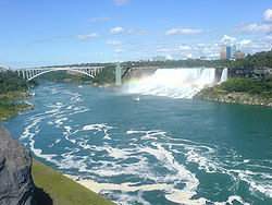
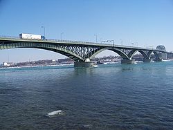
| Lewiston-Queenston Bridge Lewiston-Queenston Bridge The Lewiston–Queenston Bridge is an arch bridge that crosses the Niagara River gorge just south of the Niagara Escarpment. The bridge was officially opened on November 1, 1962. It is an international bridge between the United States and Canada. It connects Interstate 190 in the town of Lewiston,... |
 |
(N) Queenston ON Queenston, Ontario Queenston is located 5 km north of Niagara Falls, Ontario in the Town of Niagara-on-the-Lake. The community is bordered by Highway 405 and the Niagara River; its location on the Niagara Escarpment led to the establishment of the now-defunct Queenston Quarry in the area... |
 I-190 I-190Interstate 190 (New York) Interstate 190 runs 28.34 miles from Interstate 90 near Buffalo, New York to Lewiston, New York via Niagara Falls. Parts of this highway were built on the former rights-of-way of the Lehigh Valley Railroad and the Erie Canal. It is referred to by locals as The One-Ninety...  Highway 405 Highway 405 |
Lewiston, New York Lewiston, New York Lewiston is a village in Niagara County, New York, United States. The population was 2,781 at the 2000 census. The village is named after Morgan Lewis, an early 19th-century governor of New York. It is part of the Buffalo–Niagara Falls Metropolitan Statistical Area.The Village of Lewiston,... Queenston ON Queenston, Ontario Queenston is located 5 km north of Niagara Falls, Ontario in the Town of Niagara-on-the-Lake. The community is bordered by Highway 405 and the Niagara River; its location on the Niagara Escarpment led to the establishment of the now-defunct Queenston Quarry in the area... |
43°09′11"N 79°02′41"W | |
| (S) Lewiston, NY Lewiston, New York Lewiston is a village in Niagara County, New York, United States. The population was 2,781 at the 2000 census. The village is named after Morgan Lewis, an early 19th-century governor of New York. It is part of the Buffalo–Niagara Falls Metropolitan Statistical Area.The Village of Lewiston,... |
||||||
| Whirlpool Rapids Bridge Whirlpool Rapids Bridge The Whirlpool Rapids Bridge, commonly called the Whirlpool Bridge, and until 1937, known as the Lower Steel Arch Bridge, is a spandrel braced, riveted, two-hinged arch bridge. It crosses the international border between Canada and the United States, connecting the commercial downtown districts of... |
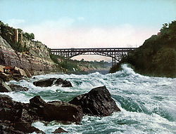 |
(N) Niagara Falls, Ontario Niagara Falls, Ontario Niagara Falls is a Canadian city on the Niagara River in the Golden Horseshoe region of Southern Ontario. The municipality was incorporated on June 12, 1903... |
Road (for NEXUS users only) and Amtrak Amtrak The National Railroad Passenger Corporation, doing business as Amtrak , is a government-owned corporation that was organized on May 1, 1971, to provide intercity passenger train service in the United States. "Amtrak" is a portmanteau of the words "America" and "track". It is headquartered at Union... /Via VIA Rail Via Rail Canada is an independent crown corporation offering intercity passenger rail services in Canada. It is headquartered near Montreal Central Station at 3 Place Ville-Marie in Montreal, Quebec.... passenger trains |
Whirlpool Rapids Niagara Gorge Niagara Gorge is a gorge carved by the Niagara River along the US-Canadian border in New York and Ontario. As Niagara Falls recedes upstream toward Lake Erie, the river has gouged the hard dolomitic limestone of the Niagara escarpment to form the gorge... |
43°06′33"N 79°03′30"W | |
| (S) Niagara Falls, New York Niagara Falls, New York Niagara Falls is a city in Niagara County, New York, United States. As of the 2010 census, the city had a total population of 50,193, down from the 55,593 recorded in the 2000 census. It is across the Niagara River from Niagara Falls, Ontario , both named after the famed Niagara Falls which they... |
||||||
| Michigan Central Railway Bridge Michigan Central Railway Bridge The Michigan Central Railway Bridge is a steel arch bridge spanning the Niagara Gorge between Niagara Falls, Ontario and Niagara Falls, New York. The bridge was designed by William Perry Taylor, Chief Engineer J.L. Delming and consulting Norwegian-born engineer Olaf Hoff.Construction on the bridge... |
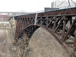 |
(N) Niagara Falls, Ontario | Disused (was Canadian National Railway Canadian National Railway The Canadian National Railway Company is a Canadian Class I railway headquartered in Montreal, Quebec. CN's slogan is "North America's Railroad".... ) |
Michigan Central Railroad Michigan Central Railroad The Michigan Central Railroad was originally incorporated in 1846 to establish rail service between Detroit, Michigan and St. Joseph, Michigan. The railroad later operated in the states of Michigan, Indiana, and Illinois in the United States, and the province of Ontario in Canada... , which originally built the bridge. |
43°06′30.80"N 79°03′29.76"W | |
| (S) Niagara Falls, New York | ||||||
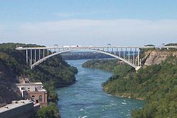
| Rainbow Bridge Rainbow Bridge (Niagara Falls) The Rainbow Bridge at Niagara Falls is an international steel arch bridge across the Niagara River gorge, and is a world-famous tourist site. It connects the cities of Niagara Falls, New York, United States , and Niagara Falls, Ontario, Canada .-Construction:The Rainbow Bridge was built near the... |
 |
(N) Niagara Falls, Ontario | Access to Highway 420 Highway 420(not open to commercial trucks) |
Rainbow Rainbow A rainbow is an optical and meteorological phenomenon that causes a spectrum of light to appear in the sky when the Sun shines on to droplets of moisture in the Earth's atmosphere. It takes the form of a multicoloured arc... s forming over Niagara Falls Niagara Falls The Niagara Falls, located on the Niagara River draining Lake Erie into Lake Ontario, is the collective name for the Horseshoe Falls and the adjacent American Falls along with the comparatively small Bridal Veil Falls, which combined form the highest flow rate of any waterfalls in the world and has... , which can be seen from the bridge. |
43°05′25"N 79°04′04"W | |
| (S) Niagara Falls, New York | ||||||
| North Grand Island Bridge North Grand Island Bridge The North Grand Island Bridge carries Interstate 190 across the Niagara River between Grand Island, New York and Niagara Falls, New York. The toll plaza are found on the Grand Island, New York side of the bridge.... |
 |
(I) Grand Island, New York Grand Island, New York Grand Island is a town and an island in Erie County, New York, USA. As of the 2010 census, the town population is 20,374. This represents an increase of 9.41% from the 2000 census figure . The current town name derives from the French name La Grande Île, as Grand Island is the largest island in... |
I-190 Interstate 190 (New York) Interstate 190 runs 28.34 miles from Interstate 90 near Buffalo, New York to Lewiston, New York via Niagara Falls. Parts of this highway were built on the former rights-of-way of the Lehigh Valley Railroad and the Erie Canal. It is referred to by locals as The One-Ninety... |
Grand Island, New York Grand Island, New York Grand Island is a town and an island in Erie County, New York, USA. As of the 2010 census, the town population is 20,374. This represents an increase of 9.41% from the 2000 census figure . The current town name derives from the French name La Grande Île, as Grand Island is the largest island in... . |
43°04′08"N 78°59′27"W | |
| (S) Niagara Falls, New York | ||||||
| South Grand Island Bridge South Grand Island Bridge The South Grand Island Bridge carries Interstate 190 across the Niagara River between Tonawanda, New York and Grand Island, New York. The toll plaza is found on the Tonawanda side of the bridge; Only 2 booths are EZ-Pass, the remainder are manned booths.The twin Truss arch bridges crosses from... |
 |
(I) Grand Island, New York | 42°59′55"N 78°56′13"W | |||
| (S) Tonawanda, New York Tonawanda, New York Tonawanda may refer to:*Glacial Lake Tonawanda*North Tonawanda, New York, a city in Niagara County, north across Tonawanda Creek from the City and Town*Tonawanda , New York, consisting of the Town of Tonawanda less the Village of Kenmore... |
||||||
| Peace Bridge Peace Bridge The Peace Bridge is an international bridge between Canada and the United States at the east end of Lake Erie at the source of the Niagara River, about upriver of Niagara Falls. It connects the City of Buffalo, New York, in the United States to the Town of Fort Erie, Ontario, in Canada... |
 |
(N) Fort Erie, ON Fort Erie, Ontario Fort Erie is a town on the Niagara River in the Niagara Region, Ontario, Canada. It is located directly across the river from Buffalo, New York.... |
Queen Elizabeth Way Queen Elizabeth Way The Queen Elizabeth Way, commonly abbreviated as the QEW, is a 400-Series highway in the Canadian province of Ontario. The freeway links Buffalo, New York and the Niagara Peninsula with Toronto. It begins at the Peace Bridge in Fort Erie and travels around the western shore of Lake Ontario, ending... |
100 years of peace between the United States and Canada. | 42°54′25"N 78°54′21"W | |
| (S) Buffalo, NY Buffalo, New York Buffalo is the second most populous city in the state of New York, after New York City. Located in Western New York on the eastern shores of Lake Erie and at the head of the Niagara River across from Fort Erie, Ontario, Buffalo is the seat of Erie County and the principal city of the... |
||||||
Detroit and St. Clair Rivers
| Crossing | Picture | Year built | Communities linked | Carries | Name origin | Coordinates Geographic coordinate system A geographic coordinate system is a coordinate system that enables every location on the Earth to be specified by a set of numbers. The coordinates are often chosen such that one of the numbers represent vertical position, and two or three of the numbers represent horizontal position... |
|---|---|---|---|---|---|---|
| Wayne County Bridge Wayne County Bridge The Wayne County Bridge is a swing bridge that crosses the Trenton Channel in the Detroit River. Located in Wayne County, it connects Grosse Ile Township to mainland Trenton. It is one of two bridges connecting the island of Grosse Ile to the mainland — the other being the tolled Grosse Ile Toll... |
(I) Trenton, Michigan Trenton, Michigan Trenton is a small city in Wayne County in the southeast portion of the U.S. state of Michigan. As of the 2010 census, the city population was 18,853... |
Grosse Ile Parkway | Grosse Ile Grosse Ile (Michigan) Grosse Ile is the largest island in the Detroit River and is the most populated island in the state of Michigan. It is on the American side of the river and is part of Wayne County. The island is approximately 9.6 mi² and has a population of 10,894... |
42°07′39"N 83°10′31"W | ||
| (S) Riverview, Michigan Riverview, Michigan Riverview is a city in Wayne County in the U.S. state of Michigan. The population was 12,486 at the time of the 2010 census.The city is a suburb in the Metro Detroit area, located along the shore of the Detroit River. Riverview incorporated as a village in 1922 and as a city in 1959... |
||||||
| Grosse Ile Toll Bridge Grosse Ile Toll Bridge The Grosse Ile Toll Bridge is a swing bridge that crosses the Trenton Channel of the Detroit River connecting Grosse Ile Township, Michigan to the mainland in Riverview, Michigan which is located in Wayne County, Michigan.-History:... |
(I) Riverview, Michigan Riverview, Michigan Riverview is a city in Wayne County in the U.S. state of Michigan. The population was 12,486 at the time of the 2010 census.The city is a suburb in the Metro Detroit area, located along the shore of the Detroit River. Riverview incorporated as a village in 1922 and as a city in 1959... |
Bridge Road | Grosse Ile Grosse Ile (Michigan) Grosse Ile is the largest island in the Detroit River and is the most populated island in the state of Michigan. It is on the American side of the river and is part of Wayne County. The island is approximately 9.6 mi² and has a population of 10,894... |
42°10′20"N 83°09′34"W | ||
| (S) Riverview, Michigan Riverview, Michigan Riverview is a city in Wayne County in the U.S. state of Michigan. The population was 12,486 at the time of the 2010 census.The city is a suburb in the Metro Detroit area, located along the shore of the Detroit River. Riverview incorporated as a village in 1922 and as a city in 1959... |
||||||
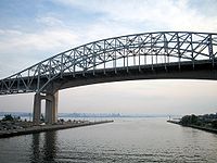
| Ambassador Bridge Ambassador Bridge The Ambassador Bridge is a suspension bridge that connects Detroit, Michigan, in the United States, with Windsor, Ontario, in Canada. It is the busiest international border crossing in North America in terms of trade volume: more than 25 percent of all merchandise trade between the United States... |
 |
(N) Windsor, Ontario Windsor, Ontario Windsor is the southernmost city in Canada and is located in Southwestern Ontario at the western end of the heavily populated Quebec City – Windsor Corridor. It is within Essex County, Ontario, although administratively separated from the county government. Separated by the Detroit River, Windsor... |
 Interstate 96 Interstate 96Interstate 96 Interstate 96 is an intrastate Interstate Highway that is entirely within the US state of Michigan. Its western terminus is at an interchange with US Highway 31 and Business US Highway 31 , on the western boundary of Norton Shores southeast of Muskegon. Its eastern terminus is at I-75 near the... |
42°18′43"N 83°04′27"W | ||
| (S) Detroit, Michigan Detroit, Michigan Detroit is the major city among the primary cultural, financial, and transportation centers in the Metro Detroit area, a region of 5.2 million people. As the seat of Wayne County, the city of Detroit is the largest city in the U.S. state of Michigan and serves as a major port on the Detroit River... |
||||||
| Michigan Central Railway Tunnel Michigan Central Railway Tunnel The Michigan Central Railway Tunnel is a railroad tunnel under the Detroit River connecting Detroit, Michigan, USA with Windsor, Ontario, Canada. The U.S. entrance is south of Porter St. and Vermont St. near Rosa Parks Blvd. The Canadian entrance is south of Wyandotte St. W. between Cameron Ave.... |
(N) Windsor, Ontario | Canadian Pacific Railway Canadian Pacific Railway The Canadian Pacific Railway , formerly also known as CP Rail between 1968 and 1996, is a historic Canadian Class I railway founded in 1881 and now operated by Canadian Pacific Railway Limited, which began operations as legal owner in a corporate restructuring in 2001... |
Michigan Central Railroad Michigan Central Railroad The Michigan Central Railroad was originally incorporated in 1846 to establish rail service between Detroit, Michigan and St. Joseph, Michigan. The railroad later operated in the states of Michigan, Indiana, and Illinois in the United States, and the province of Ontario in Canada... , which originally built the tunnel. |
42°19′15"N 83°03′05"W | ||
| (S) Detroit, Michigan | ||||||
| Detroit–Windsor Tunnel Detroit–Windsor Tunnel The Detroit–Windsor Tunnel is an underwater highway tunnel connecting Detroit, Michigan in the United States, with Windsor, Ontario in Canada. It was completed in 1930.... |
 |
(N) Windsor, Ontario |  Interstate 375 Interstate 375Interstate 375 (Michigan) The unsigned Business Spur Interstate 375 , which is long, continues west on Jefferson Avenue from the southern end of I-375, ending at the entrance to the Detroit–Windsor Tunnel at Randolph Street . Jefferson Avenue past that intersection is M-10, quickly becoming the Lodge Freeway. BS I-375 runs... |
Detroit, Michigan Detroit, Michigan Detroit is the major city among the primary cultural, financial, and transportation centers in the Metro Detroit area, a region of 5.2 million people. As the seat of Wayne County, the city of Detroit is the largest city in the U.S. state of Michigan and serves as a major port on the Detroit River... , Windsor, Ontario Windsor, Ontario Windsor is the southernmost city in Canada and is located in Southwestern Ontario at the western end of the heavily populated Quebec City – Windsor Corridor. It is within Essex County, Ontario, although administratively separated from the county government. Separated by the Detroit River, Windsor... . |
42°19′28"N 83°02′24"W | |
| (S) Detroit, Michigan | ||||||
| MacArthur Bridge MacArthur Bridge (Detroit) The MacArthur Bridge is a bridge that spans the Detroit River between Detroit, Michigan and Belle Isle. The bridge, which features nineteen total arches across , provides main access to Belle Isle. Completed in 1923 for $2,635,000 USD, it replaced a mostly wooden bridge that accidentally caught... |
.jpg) |
(I) Belle Isle, Michigan | Grand Boulevard | General Douglas MacArthur Douglas MacArthur General of the Army Douglas MacArthur was an American general and field marshal of the Philippine Army. He was a Chief of Staff of the United States Army during the 1930s and played a prominent role in the Pacific theater during World War II. He received the Medal of Honor for his service in the... , who led American troops in the Philippines Campaign during World War II World War II World War II, or the Second World War , was a global conflict lasting from 1939 to 1945, involving most of the world's nations—including all of the great powers—eventually forming two opposing military alliances: the Allies and the Axis... . |
42°20′33"N 82°59′54"W | |
| (S) Detroit, Michigan | ||||||
| St. Clair Tunnel St. Clair Tunnel The St. Clair Tunnel is the name for two separate rail tunnels which were built under the St. Clair River between Sarnia, Ontario and Port Huron, Michigan. It was the first full-size subaqueous tunnel built in North America. -First tunnel :The St. Clair Tunnel Company opened the first tunnel in... |
 |
(N) Sarnia, Ontario Sarnia, Ontario Sarnia is a city in Southern Ontario, Canada . It is the largest city on Lake Huron and is located where the upper Great Lakes empty into the St. Clair River.... |
Canadian National Railway Canadian National Railway The Canadian National Railway Company is a Canadian Class I railway headquartered in Montreal, Quebec. CN's slogan is "North America's Railroad".... |
St. Clair River St. Clair River The St. Clair River is a river in central North America which drains Lake Huron into Lake St Clair, forming part of the international boundary between the Canadian province of Ontario and the U.S. state of Michigan... |
42°57′30"N 82°24′38"W | |
| (S) Port Huron, Michigan Port Huron, Michigan Port Huron is a city in the U.S. state of Michigan and the county seat of St. Clair County. The population was 30,184 at the 2010 census. The city is adjacent to Port Huron Township but is administratively autonomous. It is joined by the Blue Water Bridge over the St. Clair River to Sarnia,... |
||||||
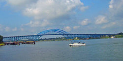
| Blue Water Bridge Blue Water Bridge The Blue Water Bridge is a twin-span international bridge across the St. Clair River that links Port Huron, Michigan, USA and Sarnia, Ontario, Canada... |
 |
(N) Sarnia, Ontario |  Highway 402 Highway 402  Interstates 69 Interstates 69Interstate 69 Interstate 69 is an Interstate Highway in the United States. It exists in two parts: a completed highway from Indianapolis, Indiana, northeast to the Canadian border in Port Huron, Michigan, and a mostly proposed extension southwest to the Mexican border in Texas... /94 Interstate 94 Interstate 94 is the northernmost east–west Interstate Highway, connecting the Great Lakes and Intermountain regions of the United States. I-94's western terminus is in Billings, Montana at a junction with Interstate 90; its eastern terminus is the U.S... |
42°59′54"N 82°25′24"W | ||
| (S) Port Huron, Michigan | ||||||
Upper Lakes
| Crossing | Picture | Year built | Communities linked | Carries | Name origin | Coordinates Geographic coordinate system A geographic coordinate system is a coordinate system that enables every location on the Earth to be specified by a set of numbers. The coordinates are often chosen such that one of the numbers represent vertical position, and two or three of the numbers represent horizontal position... |
|---|---|---|---|---|---|---|
| Sault Ste. Marie International Bridge Sault Ste. Marie International Bridge The Sault Ste. Marie International Bridge, often known just as the International Bridge, spans the St. Marys River between the United States and Canada connecting the twin cities of Sault Ste. Marie, Michigan and Sault Ste. Marie, Ontario. It serves as the northern terminus of Interstate 75... |
(N) Sault Ste. Marie, Ontario Sault Ste. Marie, Ontario Sault Ste. Marie is a city on the St. Marys River in Algoma District, Ontario, Canada. It is the third largest city in Northern Ontario, after Sudbury and Thunder Bay, with a population of 74,948. The community was founded as a French religious mission: Sault either means "jump" or "rapids" in... |
 Interstate 75 Interstate 75 |
Sault Ste. Marie, twin cities in Ontario Sault Ste. Marie, Ontario Sault Ste. Marie is a city on the St. Marys River in Algoma District, Ontario, Canada. It is the third largest city in Northern Ontario, after Sudbury and Thunder Bay, with a population of 74,948. The community was founded as a French religious mission: Sault either means "jump" or "rapids" in... and Michigan Sault Ste. Marie, Michigan Sault Ste. Marie is a city in and the county seat of Chippewa County in the U.S. state of Michigan. It is in the north-eastern end of Michigan's Upper Peninsula, on the Canadian border, separated from its twin city of Sault Ste. Marie, Ontario, by the St. Marys River... |
46°30′12"N 84°21′45"W | ||
| (I) Sault Ste. Marie, Michigan Sault Ste. Marie, Michigan Sault Ste. Marie is a city in and the county seat of Chippewa County in the U.S. state of Michigan. It is in the north-eastern end of Michigan's Upper Peninsula, on the Canadian border, separated from its twin city of Sault Ste. Marie, Ontario, by the St. Marys River... |
||||||
| Mackinac Bridge Mackinac Bridge The Mackinac Bridge is a suspension bridge spanning the Straits of Mackinac to connect the non-contiguous Upper and Lower peninsulas of the U.S. state of Michigan. Opened in 1957, the bridge is the third longest in total suspension in the world and the longest suspension bridge between anchorages... |
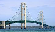 |
(I) St. Ignace, Michigan St. Ignace, Michigan Saint Ignace, usually written as St. Ignace, is a city in the U.S. state of Michigan. As of the 2000 census, the city population was 2,678. It is the county seat of Mackinac County. From the Lower Peninsula, St. Ignace is the gateway to the Upper Peninsula.St... |
Straits of Mackinac Straits of Mackinac The Straits of Mackinac is the strip of water that connects two of the Great Lakes, Lake Michigan and Lake Huron, and separates the Lower Peninsula of Michigan from the Upper Peninsula of Michigan. It is a shipping lane providing passage for raw materials and finished goods, connecting, for... |
45°49′02"N 84°43′39"W | ||
| (S) Mackinaw City, Michigan Mackinaw City, Michigan Mackinaw City is a village in Emmet and Cheboygan counties in the U.S. state of Michigan. At the 2000 census the population was 859. The name "Mackinaw City" is a bit of a misnomer as it is actually a village... |
||||||
See also
- List of crossings of the Rivière des Mille Îles
- List of crossings of the Rivière des Prairies
- List of bridges in Montreal
- List of crossings of the Ottawa River