

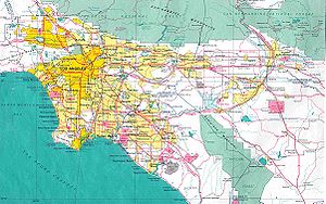
List of districts and neighborhoods of Los Angeles
Encyclopedia
Overview
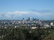
Los Angeles, California
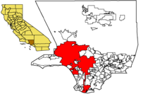
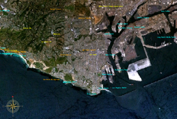
Los Angeles , with a population at the 2010 United States Census of 3,792,621, is the most populous city in California, USA and the second most populous in the United States, after New York City. It has an area of , and is located in Southern California...
possess a degree of diversity that is befitting the second-largest city in the United States
United States
The United States of America is a federal constitutional republic comprising fifty states and a federal district...
. Much of this is an artifact of the city's history of growth by annexation
Annexation
Annexation is the de jure incorporation of some territory into another geo-political entity . Usually, it is implied that the territory and population being annexed is the smaller, more peripheral, and weaker of the two merging entities, barring physical size...
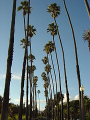
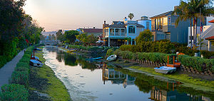
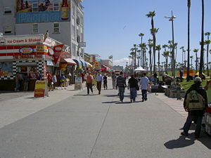
and horizontal development, which allowed distinct environments to arise in many areas; indeed, many districts of Los Angeles, such as Venice
Venice, Los Angeles, California
Venice is a beachfront district on the Westside of Los Angeles, California, United States. It is known for its canals, beaches and circus-like Ocean Front Walk, a two-and-a-half mile pedestrian-only promenade that features performers, fortune-tellers, artists, and vendors...
, Hancock Park
Hancock Park, Los Angeles, California
Hancock Park is a historic and affluent urban neighborhood in Los Angeles, California roughly bounded by Van Ness Avenue to the East, Melrose Avenue to the North, La Brea Avenue to the West, and Wilshire Boulevard to the South.-History:...
, Silver Lake
Silver Lake, Los Angeles, California
Silver Lake is a hilly neighborhood in the city of Los Angeles, California east of Hollywood and northwest of Downtown Los Angeles. Silver Lake is inhabited by a wide variety of ethnic and socioeconomic groups, but it is best known as an eclectic gathering of hipsters and the creative class.The...
and Boyle Heights
Boyle Heights, Los Angeles, California
Boyle Heights is a neighborhood east of Downtown Los Angeles on the East Side of Los Angeles. For much of the twentieth century, Boyle Heights was a gateway for new immigrants. This resulted in diverse demographics, including Jewish American, Japanese American and Mexican American populations,...
are somewhat culturally-distinctive communities.
Many of the districts of Los Angeles have their own post office
Post office
A post office is a facility forming part of a postal system for the posting, receipt, sorting, handling, transmission or delivery of mail.Post offices offer mail-related services such as post office boxes, postage and packaging supplies...
s of the U.S. Postal Service, and these post offices are officially designated by the names of their districts. For example, to mail a letter to someone in Canoga Park, California, Tarzana, California, or Van Nuys, California, that is the last line that one needs to write in the address, and it is not necessary to include anything about Los Angeles, Los Angeles County, or United States. Likewise, in telephoning to summon a policeman, an ambulance, or the fire department to some location, it is not necessary to say anything more than its street address and words such as Brentwood, Hollywood, Northridge, Panorama City, or Studio City.
The writer Dorothy Parker
Dorothy Parker
Dorothy Parker was an American poet, short story writer, critic and satirist, best known for her wit, wisecracks, and eye for 20th century urban foibles....
once described Los Angeles as "72 suburbs in search of a city." Bob Pool of the Los Angeles Times
Los Angeles Times
The Los Angeles Times is a daily newspaper published in Los Angeles, California, since 1881. It was the second-largest metropolitan newspaper in circulation in the United States in 2008 and the fourth most widely distributed newspaper in the country....
said "it's not surprising that residents take their neighborhood names so seriously. Those designations are part tradition and history -- but also part economic and political." Pool added that many area residents see a significant difference in property values if a place is considered to be within the wealthy Hancock Park
Hancock Park, Los Angeles, California
Hancock Park is a historic and affluent urban neighborhood in Los Angeles, California roughly bounded by Van Ness Avenue to the East, Melrose Avenue to the North, La Brea Avenue to the West, and Wilshire Boulevard to the South.-History:...
versus if a place was considered to be in the working class Mid-City
Mid-City, Los Angeles, California
Mid-City is a district in Los Angeles, California. It is 2.5 miles south of Hollywood and 3.5 miles west of downtown Los Angeles. The Lafayette Square, Victoria Park, Wellington Square, and Vineyard neighborhoods are part of the district.-Geography and history:Mid-City's boundaries are roughly...
area. In the San Fernando Valley
San Fernando Valley
The San Fernando Valley is an urbanized valley located in the Los Angeles metropolitan area of southern California, United States, defined by the dramatic mountains of the Transverse Ranges circling it...
some communities separated from existing communities to form new ones. For instance two portions of Van Nuys
Van Nuys, Los Angeles, California
Van Nuys is a neighborhood in the San Fernando Valley region of Los Angeles, California.-History:Look at the two photos of Van Nuys' first year—and then listen to what the Los Angeles Times wrote on February 23, 1911, the day after the Van Nuys town lot auction--"Between dawn and dusk, in the...
renamed themselves Lake Balboa
Lake Balboa, Los Angeles, California
Lake Balboa is a district in the San Fernando Valley region of the city of Los Angeles, California.It is bordered by the following Los Angeles communities: Encino to the south, Van Nuys to the east, Reseda to the west, and Northridge and North Hills to the north.There was debate about the official...
and Valley Glen
Valley Glen, Los Angeles, California
Valley Glen is a community in the southeastern portion of the San Fernando Valley district of the City of Los Angeles, California, United States. It is home to Los Angeles Valley College, Ulysses S...
, and one portion of Canoga Park
Canoga Park, Los Angeles, California
Canoga Park is a district in the San Fernando Valley region of Los Angeles, California, United States about 25 miles northwest of Downtown Los Angeles....
renamed itself West Hills
West Hills, Los Angeles, California
West Hills is an affluent community and district in the western San Fernando Valley region of Los Angeles, California, United States.West Hills is bordered by Chatsworth and the Chatsworth Reservoir to the north, Canoga Park to the east, Woodland Hills to the south, Hidden Hills to the southwest,...
. The City of Los Angeles posted signs indicating names of communities within the city, but the city has not officially defined the boundaries of those communities. On February 19, 2009, the Los Angeles Times
Los Angeles Times
The Los Angeles Times is a daily newspaper published in Los Angeles, California, since 1881. It was the second-largest metropolitan newspaper in circulation in the United States in 2008 and the fourth most widely distributed newspaper in the country....
newspaper
Newspaper
A newspaper is a scheduled publication containing news of current events, informative articles, diverse features and advertising. It usually is printed on relatively inexpensive, low-grade paper such as newsprint. By 2007, there were 6580 daily newspapers in the world selling 395 million copies a...
published its map of neighborhood boundaries in Los Angeles, and the creation of this map had been a project in progress for three years.
The City of Los Angeles began in what is now downtown
Downtown Los Angeles
Downtown Los Angeles is the central business district of Los Angeles, California, United States, located close to the geographic center of the metropolitan area...
, in what had first been a Tongva village named Yang-na located in what is now the Los Angeles State Historic Park near Chinatown
Chinatown
A Chinatown is an ethnic enclave of overseas Chinese people, although it is often generalized to include various Southeast Asian people. Chinatowns exist throughout the world, including East Asia, Southeast Asia, the Americas, Australasia, and Europe. Binondo's Chinatown located in Manila,...
. It later became a Spanish pueblo and eventually grew to a metropolis based on manufacturing, aerospace, and entertainment industries. The city, and indeed the county, radiated outward from downtown, and geographic names referencing cardinal points or relative directions tend to be determined by their relationship to downtown rather than directions proper. For example, East L.A.
East Los Angeles (region)
East Los Angeles is the portion of the City of Los Angeles that lies east of Downtown Los Angeles, the Los Angeles River and the unincorporated areas of Lincoln Heights, west of the San Gabriel Valley, East Los Angeles and City Terrace, south of Cypress Park, and north of Vernon, California and...
is not all of the city east of West L.A.
West Los Angeles (region)
The Los Angeles Westside is an urban region in western Los Angeles County, California, United States. It has no official definition, but, according to the Los Angeles Times, it comprises , encompassing 18 districts in the city of Los Angeles and two unincorporated neighborhoods, plus the cities of...
, but rather the portion of the city east of downtown (and the Los Angeles River
Los Angeles River
The Los Angeles River is a river that starts in the San Fernando Valley, in the Simi Hills and Santa Susana Mountains, and flows through Los Angeles County, California, from Canoga Park in the western end of the San Fernando Valley, nearly southeast to its mouth in Long Beach...
in its proximity).
The origins of L.A. neighborhoods are varied. Angelino Heights, for example, with its 1880s-era Victorian houses, was within view and walking distance (although a long one) from downtown Los Angeles, while distant Playa Vista is the city's newest manufactured neighborhood, conceived and birthed by developers. Chinatown
Chinatown, Los Angeles
Chinatown in Los Angeles, California is located in the city's downtown area. Built in 1938, it is the second Chinatown to be constructed in Los Angeles. The original historic Chinatown was founded in the late 19th century, but was demolished to make room for Union Station, the city's major rail...
was originally an ethnic-based community whose population and businesses were forced to move wholesale from a few miles away when L.A.'s newly built Union Station displaced Old Chinatown in the 1930s. San Pedro
San Pedro, Los Angeles, California
San Pedro is a port district of the city of Los Angeles, California, United States. It was annexed in 1909 and is a major seaport of the area...
was once an independent city that voted to be annexed to Los Angeles: San Pedro benefited from L.A.'s access to water and the larger city got access to San Pedro's harbor.
The City of Los Angeles is covered by several different telephone
Telephone
The telephone , colloquially referred to as a phone, is a telecommunications device that transmits and receives sounds, usually the human voice. Telephones are a point-to-point communication system whose most basic function is to allow two people separated by large distances to talk to each other...
Area Codes. Area code 213
Area code 213
North American area code 213 is a Californian telephone area code which contains downtown Los Angeles and its immediate environs. It was one of California's original three area codes created in October 1947 and has historically been associated with Southern California and Los Angeles.Originally,...
includes Downtown L.A. and its neighborhood. Most remaining areas of central L.A. fall within Area code 323
Area code 323
North American area code 323 is a California telephone area code which covers, roughly, the area of central Los Angeles . 323 also includes several gateway cities of the region, including Bell and Huntington Park...
, including Hollywood, Mid-Wilshire
Mid-Wilshire
Mid-Wilshire is a district in the City of Los Angeles, California. It is part of the Wilshire region.It mostly encompasses the area bounded by La Cienega Boulevard to the west, Melrose Avenue to the north, Hoover Street to the east and the Santa Monica Freeway to the south, although some...
, and South Los Angeles
South Los Angeles
South Los Angeles, often abbreviated as South L.A. and formerly South Central Los Angeles, is the official name for a large geographic and cultural portion lying to the southwest and southeast of downtown Los Angeles, California. The area was formerly called South Central, and is still widely known...
. Area code 310
Area code 310
North American telephone area codes 310 and 424 are the California telephone area codes which are roughly coterminous with the West Los Angeles and South Bay areas of Los Angeles County, including Santa Catalina Island . It also includes a small portion of Ventura County...
and area code 424 cover western Los Angeles, other towns on the westside, and the Harbor Area
Harbor Area
The Harbor Area is the area along the Port of Los Angeles. It contains neighborhoods of Los Angeles .-Standalone cities in the Harbor Area:*Carson*Long Beach-Los Angeles city neighborhoods in the Harbor Area:...
. Area code 818 covers the San Fernando Valley
San Fernando Valley
The San Fernando Valley is an urbanized valley located in the Los Angeles metropolitan area of southern California, United States, defined by the dramatic mountains of the Transverse Ranges circling it...
and its neighborhood.
Downtown Los Angeles
Downtown Los Angeles marks the geographic, governmental, and historic center of Los Angeles. Although it is the smallest region of Los Angeles by area, it includes a great variety of diverse neighborhoods, ranging from several modern skyscraper
Skyscraper
A skyscraper is a tall, continuously habitable building of many stories, often designed for office and commercial use. There is no official definition or height above which a building may be classified as a skyscraper...
s of the Financial District
Financial District, Los Angeles, California
The Financial District is a neighborhood in Downtown Los Angeles on the redeveloped section of Bunker Hill. The area is dominated by upscale corporate office skyscrapers, hotels and related services as well as banks, law firms, and real estate companies...
to the historic structures of the Historic Core
Historic Core, Los Angeles, California
The Historic Core is a neighborhood in Downtown Los Angeles between Hill and Main streets on the west and east, and 3rd and 9th street on the north and south. It overlaps with the Jewelry District on its western end and Skid Row on its eastern end. It was the center of the city before World War II...
to the ethnic enclaves of Chinatown and Little Tokyo. It also contains many cultural attractions and entertainment venues. Downtown is also a center for local and regional transportation, with several freeways passing through and Union Station
Union Station (Los Angeles)
Los Angeles Union Station is the main railway station in Los Angeles, California. The station has rail services by Amtrak and Amtrak California and Metrolink; light rail/subways are the Metro Rail Red Line, Purple Line, Gold Line. Bus rapid transport runs on the Silver Line...
connecting regional trains to local buses and the Metro Line
Los Angeles County Metro Rail
Metro Rail is the rapid transit rail system consisting of five separate lines serving 70 stations in the Los Angeles County, California area. The new Expo line is due to enter service in early 2012. It connects with the Metro liner bus rapid transit system and also with the Metrolink commuter...
.
- Arts District
- Bunker Hill
- ChinatownChinatown, Los AngelesChinatown in Los Angeles, California is located in the city's downtown area. Built in 1938, it is the second Chinatown to be constructed in Los Angeles. The original historic Chinatown was founded in the late 19th century, but was demolished to make room for Union Station, the city's major rail...
- Civic Center
- Fashion District
- Financial District
- Flower District
- Furniture and Decorative Arts District
- Gallery Row
- Historic Core
- Jewelry District
- Little Tokyo
- Skid Row
- South Park
- Old Bank District
- Toy District
- Wholesale District
East and Northeast Los Angeles
- See also: East Los Angeles, CaliforniaEast Los Angeles, CaliforniaEast Los Angeles is an unincorporated area and census-designated place in Los Angeles County, California, United States...
. (an unincorporated area)
To the east and northeast of Downtown Los Angeles and the Los Angeles River
Los Angeles River
The Los Angeles River is a river that starts in the San Fernando Valley, in the Simi Hills and Santa Susana Mountains, and flows through Los Angeles County, California, from Canoga Park in the western end of the San Fernando Valley, nearly southeast to its mouth in Long Beach...
lies East Los Angeles
East Los Angeles (region)
East Los Angeles is the portion of the City of Los Angeles that lies east of Downtown Los Angeles, the Los Angeles River and the unincorporated areas of Lincoln Heights, west of the San Gabriel Valley, East Los Angeles and City Terrace, south of Cypress Park, and north of Vernon, California and...
. The region may sometimes be defined to include adjacent areas outside of the city boundaries of Los Angeles, such as Montebello
Montebello, California
Montebello is a city in Los Angeles County, California, United States, in the southwestern part of the San Gabriel Valley. It is located on of land just east of downtown Los Angeles. It is considered part of the Gateway Cities, and the city is a member of the Gateway Cities Council of...
and East Los Angeles
East Los Angeles, California
East Los Angeles is an unincorporated area and census-designated place in Los Angeles County, California, United States...
. The communities listed here, however, all lie within the City of Los Angeles.
Many of the neighborhoods of Eastern Los Angeles house large Latino populations, although several neighborhoods, especially in northeast L.A., have more mixed populations. Many of the neighborhoods house very diverse residents. In the northern portions of Montecito Heights there are white populations of Italian and French descent. Eagle Rock also houses significant Latino, White, and Asian
Asia
Asia is the world's largest and most populous continent, located primarily in the eastern and northern hemispheres. It covers 8.7% of the Earth's total surface area and with approximately 3.879 billion people, it hosts 60% of the world's current human population...
(in particular those of Filipino
Philippines
The Philippines , officially known as the Republic of the Philippines , is a country in Southeast Asia in the western Pacific Ocean. To its north across the Luzon Strait lies Taiwan. West across the South China Sea sits Vietnam...
descent) populations and is one of the most diverse neighborhoods in Los Angeles County. In Monterrey Hills nearly half of the population is white. The population also ranges from working-class to affluent. The predominantly residential neighborhoods of the region contain many hills, especially in northern regions.
Northeast Los Angeles neighborhoods
- Boyle Heights
- El Sereno
- University Hills
- Atwater Village
- Cypress Park
- Eagle Rock
- Garvanza
- Glassell Park
- Hermon
- Highland Park
- Lincoln Heights
- Montecito Heights
- Monterey Hills
- Mt. Washington
Echo Park and Westlake
Immediately west of Downtown Los Angeles lie some of the city's earliest suburbs. Angelino Heights and Echo Park were the locations of some of the first film studios west of the Mississippi RiverMississippi River
The Mississippi River is the largest river system in North America. Flowing entirely in the United States, this river rises in western Minnesota and meanders slowly southwards for to the Mississippi River Delta at the Gulf of Mexico. With its many tributaries, the Mississippi's watershed drains...
. Now mostly populated by Latino immigrants, a great amount of distinctive architecture has been preserved from the early 20th century, including the restored Victorian homes in Angelino Heights. This region is one of the most densely populated areas in Los Angeles and serves as the former site of Chavez Ravine
Chávez Ravine
Chavez Ravine is an area in Sulfir Canyon that is the current site of Dodger Stadium in Los Angeles, California.It was named after Julian Chavez, a Los Angeles Councilman in the 19th century.-History:...
which was historically a Latino neighborhood until it was demolished in the 1950s in order to construct Dodger Stadium
Dodger Stadium
Dodger Stadium, also sometimes called Chavez Ravine, is a stadium in Los Angeles. Located adjacent to Downtown Los Angeles, Dodger Stadium has been the home ballpark of Major League Baseball's Los Angeles Dodgers team since 1962...
.
- Angelino Heights
- Franklin Hills
- Echo Park
- EdendaleEdendaleEdendale may refer to:*Edendale, former name of Eden Landing, California*Edendale, Los Angeles, California, historical district in Los Angeles*Edendale, Merced County, California, former community*Edendale, New Zealand, town in the Southland region...
- Victor HeightsVictor HeightsVictor Heights, nicknamed "Forgotten Edge" by long time residents, is an eclectic and hilly neighborhood in the city of Los Angeles making up the most eastern section of Echo Park, a neighborhood located just northwest of Downtown Los Angeles. It is situated north of Sunset Blvd., northeast of...
- Historic Filipinotown
- Temple-Beaudry
- Elysian Heights
- Edendale
- Mission Junction
- Pico-Union
- Westlake
- MacArthur ParkMacArthur ParkMacArthur Park is a park in the Westlake neighborhood of Los Angeles, California, named after General Douglas MacArthur and designated city of Los Angeles Historic Cultural Monument #100.- Geography :...
- MacArthur Park
- Elysian Park
- Solano Canyon
- Elysian Valley
Hollywood

Town
A town is a human settlement larger than a village but smaller than a city. The size a settlement must be in order to be called a "town" varies considerably in different parts of the world, so that, for example, many American "small towns" seem to British people to be no more than villages, while...
s. Tourists flock to Hollywood Boulevard to gaze up to the Hollywood sign in the Santa Monica Mountains
Santa Monica Mountains
The Santa Monica Mountains are a Transverse Range in Southern California, along the coast of the Pacific Ocean in the United States.-Geography:...
. The last decade has brought new life to the once-struggling parts of the Hollywood district, with various developments taking advantage of new subway stations. The wealth of the neighborhoods here is strongly influenced by elevation; some of the wealthiest tracts in the country are up in the Hollywood Hills, with gradually less affluent population leading to pockets of large working-class and transient populations further southeast.
- Hollywood
- Beachwood Canyon
- Cahuenga PassCahuenga PassThe Cahuenga Pass is a mountain pass through the eastern end of the Santa Monica Mountains in the Hollywood district of the City of Los Angeles, California....
- Hollywood HillsHollywood HillsThe Hollywood Hills is an affluent and exclusive neighborhood of Los Angeles, California, in the southeastern Santa Monica Mountains. It is bound by Laurel Canyon Boulevard to the west, Vermont Avenue to the east, Mulholland Drive to the north, and Sunset Boulevard to the south.-Hollywood Hills...
- Hollywood Dell
- Whitley Heights
- Hollywood Heights
- Laurel Canyon
- Mount Olympus
- Nichols Canyon
- Outpost Estates
- Sunset Hills
- East Hollywood
- Little Armenia
- Thai Town
- Virgil Village
- Melrose District
- Melrose Hill
- Sierra Vista
- Spaulding Square
- Yucca Corridor
Harbor Area
Following the Harbor Gateway south to the port leads to the Harbor area
Harbor Area
The Harbor Area is the area along the Port of Los Angeles. It contains neighborhoods of Los Angeles .-Standalone cities in the Harbor Area:*Carson*Long Beach-Los Angeles city neighborhoods in the Harbor Area:...
, an enclave of Los Angeles that is surrounded by various cities and towns. The land of the Harbor Gateway was annexed to the City of Los Angeles so that it would have a contiguious land connection with its seaport. The most prominent neighborhood of the harbor area is called San Pedro
San Pedro, Los Angeles, California
San Pedro is a port district of the city of Los Angeles, California, United States. It was annexed in 1909 and is a major seaport of the area...
.
- Harbor City
- Harbor Pines
- Harbor Gateway
- San Pedro
- Palisades
- Port of Los AngelesPort of Los AngelesThe Port of Los Angeles, also called Los Angeles Harbor and WORLDPORT L.A, is a port complex that occupies of land and water along of waterfront. The port is located on San Pedro Bay in the San Pedro neighborhood of Los Angeles, approximately south of downtown...
- Point Fermin
- South Shores
- Vista del Oro
- The Gardens
- Rolling Hills Highlands
- Vinegar Hill
- Terminal IslandTerminal IslandTerminal Island is an island located in Los Angeles County, California between Los Angeles Harbor and Long Beach Harbor. Originally a mudflat known to the Spanish as Isla Raza de Buena Gente, and later called Rattlesnake Island, it has officially been Terminal Island since 1918...
- Wilmington
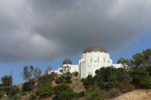
Los Feliz and Silver Lake
Los Angeles River
The Los Angeles River is a river that starts in the San Fernando Valley, in the Simi Hills and Santa Susana Mountains, and flows through Los Angeles County, California, from Canoga Park in the western end of the San Fernando Valley, nearly southeast to its mouth in Long Beach...
are a group of the city's older residential neighborhoods that houses Griffith Park
Griffith Park
Griffith Park is a large municipal park at the eastern end of the Santa Monica Mountains in the Los Feliz neighborhood of Los Angeles, California. The park covers of land, making it one of the largest urban parks in North America...
, one of the nation's largest public parks.
Similar to most of the city, communities in this area are significantly wealthier closer to the hills. In this fashion, Los Feliz
Los Feliz, Los Angeles, California
Los Feliz, also Rancho Los Feliz is an affluent, hilly neighborhood in the Hollywood district of Los Angeles, California, named after its land grantee José Vicente Feliz....
retained its expensive reputation while other districts further south and closer to Westlake were plagued by gang wars or crime. In the last decade, the area particularly around the Silver Lake Reservoir and now Sunset Boulevard
Sunset Boulevard
Sunset Boulevard is a street in the western part of Los Angeles County, California, that stretches from Figueroa Street in downtown Los Angeles to the Pacific Coast Highway at the Pacific Ocean in the Pacific Palisades...
has become closely associated with gentrification
Gentrification
Gentrification and urban gentrification refer to the changes that result when wealthier people acquire or rent property in low income and working class communities. Urban gentrification is associated with movement. Consequent to gentrification, the average income increases and average family size...
, a process which has pushed working class families out due to high housing costs.
- Los Feliz
- Franklin Hills
- Silver Lake
- Sunset Junction
South Los Angeles

South Los Angeles
South Los Angeles
South Los Angeles, often abbreviated as South L.A. and formerly South Central Los Angeles, is the official name for a large geographic and cultural portion lying to the southwest and southeast of downtown Los Angeles, California. The area was formerly called South Central, and is still widely known...
, formerly called "South Central Los Angeles", Many of the neighborhoods of South Los Angeles
South Los Angeles
South Los Angeles, often abbreviated as South L.A. and formerly South Central Los Angeles, is the official name for a large geographic and cultural portion lying to the southwest and southeast of downtown Los Angeles, California. The area was formerly called South Central, and is still widely known...
house African americans, includes most of the city directly south of downtown, Interstate Highway 10 (the Santa Monica Freeway, and Wilshire Boulevard
Wilshire Boulevard
Wilshire Boulevard is one of the principal east-west arterial roads in Los Angeles, California, United States. It was named for Henry Gaylord Wilshire , an Ohio native who made and lost fortunes in real estate, farming, and gold mining. Henry Wilshire initiated what was to become Wilshire...
, but not those areas as far southeast as the Harbor Gateway, the Harbor Area
Harbor Area
The Harbor Area is the area along the Port of Los Angeles. It contains neighborhoods of Los Angeles .-Standalone cities in the Harbor Area:*Carson*Long Beach-Los Angeles city neighborhoods in the Harbor Area:...
, or the Port of Los Angeles
Port of Los Angeles
The Port of Los Angeles, also called Los Angeles Harbor and WORLDPORT L.A, is a port complex that occupies of land and water along of waterfront. The port is located on San Pedro Bay in the San Pedro neighborhood of Los Angeles, approximately south of downtown...
.
- Arlington Park
- Athens on the Hill
- Baldwin Hills
- Baldwin Hills Estates
- Baldwin Village
- Baldwin Vista
- Broadway Square
- Cameo Plaza
- Canterbury KnollsCanterbury Knolls, Los AngelesCanterbury Knolls is a neighborhood in Los Angeles, California.-External links:* *...
- Century Palms
- Chesterfield Square
- Crenshaw
- Crenshaw Manor
- Exposition ParkExposition Park (Los Angeles)Exposition Park is located in University Park, Los Angeles, California, across the street from the University of Southern California. Exposition Park houses the following:* Los Angeles Memorial Coliseum* Los Angeles Memorial Sports Arena...
- Gramercy Park
- Green Meadows
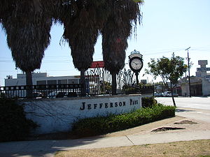
- Jefferson Park
- King Estates
- Leimert Park
- Magnolia Square
- Manchester Square
- Morningside Circle
- Park Mesa Heights
- Hyde Park
- Angeles Mesa
- View Heights
- Vermont Knolls
- Vermont Park
- Vermont Square
- Village GreenVillage Green, Los AngelesThe Village Green is a condominium complex in Baldwin Hills, a Los Angeles neighborhood. It is located between Rodeo Road and Coliseum Street, west of La Brea Avenue. The complex was built in 1942 as one of the most ambitiously planned communities in Los Angeles at the time...
- Watts
- West Adams
- Kinney Heights
- North University ParkNorth University Park, Los Angeles, CaliforniaNorth University Park is a subdistrict district of West Adams, Los Angeles, California a few miles south of Downtown Los Angeles. North University Park refers to the area immediately north of the University of Southern California, bordering University Park. It includes Mount St...
- Figueroa Corridor
- University Park
- West Alameda
- West Park Terrace
San Fernando Valley
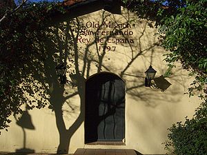
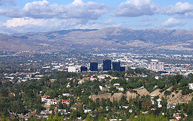
The largest region of the city is the San Fernando Valley, often referred to as "the Valley," and which includes portions of the Crescenta Valley
Crescenta Valley
The Crescenta Valley is a small inland valley in Los Angeles County, California lying between the San Gabriel Mountains on the northeast and the Verdugo Mountains and San Rafael Hills on the southwest. It opens into the San Fernando Valley at the northwest and the San Gabriel Valley at the southeast...
. It is mainly suburban, and houses a wide-range of socioeconomic groups. It comprises almost half of the city's land area and about forty percent of the city's population. Mulholland Drive
Mulholland Drive
Mulholland Drive is a street and road in the eastern Santa Monica Mountains of Southern California. It is named after Los Angeles pioneer civil engineer William Mulholland...
in the Santa Monica Mountains
Santa Monica Mountains
The Santa Monica Mountains are a Transverse Range in Southern California, along the coast of the Pacific Ocean in the United States.-Geography:...
forms its southern boundary. It has gone through periodic clashes with the rest of the city over policy, culminating in a failed effort to incorporate as a city in 2002.
- Arleta
- Balboa Park
- Canoga Park
- Chatsworth
- Encino
- Granada HillsGranada Hills, Los AngelesGranada Hills is a district in the San Fernando Valley region of the City of Los Angeles.It is located just north of the North Hills and Northridge districts, west of the Mission Hills and Sylmar districts, and just east of the Porter Ranch district. It is accessible by the Ronald Reagan , San...
- Balboa Highlands
- Hansen Hills
- Knollwood
- Lake View Terrace
- Lake Balboa
- La Tuna Canyon
- Rancho La Tuna Canyon
- Mission Hills
- North Hills
- North Hollywood
- NoHo Arts District
- Northridge
- Pacoima
- Panorama City
- Porter Ranch
- Reseda
- Reseda Ranch
- Shadow Hills
- Stonehurst
- Sherman Oaks
- Sherman Village
- Studio City
- Colfax Meadows
- Silver Triangle
- Sun Valley
- SunlandSunland-Tujunga, Los AngelesSunland-Tujunga is a community served by two post offices in the northeasternmost corner of Los Angeles, California. Though Sunland and Tujunga began as separate settlements, they are today linked through a single police station, branch library, neighborhood council. chamber of commerce, City...
- Sylmar
- Olive View
- Kagel Canyon
- Tarzana
- Melody Acres
- Toluca Lake
- Toluca Woods
- West Toluca
- TujungaSunland-Tujunga, Los AngelesSunland-Tujunga is a community served by two post offices in the northeasternmost corner of Los Angeles, California. Though Sunland and Tujunga began as separate settlements, they are today linked through a single police station, branch library, neighborhood council. chamber of commerce, City...
- Valley Village
- Van Nuys
- Valley Glen
- Cameron Woods
- Valley Glen
- Ventura Business District
- Warner Center
- West Hills
- Winnetka
- Woodland Hills
West Los Angeles (The Westside)
Beverly Hills, California
Beverly Hills is an affluent city located in Los Angeles County, California, United States. With a population of 34,109 at the 2010 census, up from 33,784 as of the 2000 census, it is home to numerous Hollywood celebrities. Beverly Hills and the neighboring city of West Hollywood are together...
and Wilshire on the east, and Santa Monica
Santa Monica, California
Santa Monica is a beachfront city in western Los Angeles County, California, US. Situated on Santa Monica Bay, it is surrounded on three sides by the city of Los Angeles — Pacific Palisades on the northwest, Brentwood on the north, West Los Angeles on the northeast, Mar Vista on the east, and...
and the Pacific Ocean
Pacific Ocean
The Pacific Ocean is the largest of the Earth's oceanic divisions. It extends from the Arctic in the north to the Southern Ocean in the south, bounded by Asia and Australia in the west, and the Americas in the east.At 165.2 million square kilometres in area, this largest division of the World...
on the west, the Santa Monica Mountains
Santa Monica Mountains
The Santa Monica Mountains are a Transverse Range in Southern California, along the coast of the Pacific Ocean in the United States.-Geography:...
on the north, and Culver City
Culver City, California
Culver City is a city in western Los Angeles County, California. As of the 2010 census, the city had a population of 38,883, up from 38,816 at the 2000 census. It is mostly surrounded by the city of Los Angeles, but also shares a border with unincorporated areas of Los Angeles County. Culver...
and El Segundo
El Segundo, California
El Segundo is a city in Los Angeles County, California, United States. Located on the Santa Monica Bay, it was incorporated on January 18, 1917, and is one of the Beach Cities of Los Angeles County and part of the South Bay Cities Council of Governments...
on the south.
While the area is inhabited by a wide range of socioeconomic groups, it undoubtedly houses the largest concentration of wealth in the city. Attracted by its rolling hills on the north end, and close proximity to the ocean, early developers succeeded in establishing some of the most upscale residential districts in the city and the county. Pre-eminent among these are Bel-Air and Pacific Palisades. Yet further south, pockets of working class areas remain in those areas closest to former industrial areas like those near South LA
South Los Angeles
South Los Angeles, often abbreviated as South L.A. and formerly South Central Los Angeles, is the official name for a large geographic and cultural portion lying to the southwest and southeast of downtown Los Angeles, California. The area was formerly called South Central, and is still widely known...
and Culver City
Culver City, California
Culver City is a city in western Los Angeles County, California. As of the 2010 census, the city had a population of 38,883, up from 38,816 at the 2000 census. It is mostly surrounded by the city of Los Angeles, but also shares a border with unincorporated areas of Los Angeles County. Culver...
.
The term Westside, though often debated, refers to both the western parts of the city of Los Angeles as well as adjacent cities and towns, such as Santa Monica, Beverly Hills, and West Hollywood. West L.A. or West Los Angeles also refers to a specific neighborhood south of Brentwood and east of Santa Monica.
- Bel-Air
- Roscomare Valley
- Beverly Glen http://www.latimes.com/classified/realestate/news/communities/2003/la-re-guide20apr20,0,5718954.story?coll=la-realestate-communities-2003
- East Gate Old Bel AirEast Gate Bel Air, Los AngelesEast Gate Bel Air is a very small and very wealthy area within the Bel Air section of Los Angeles, California...
- West Gate Bel Air
- Upper Bel Air
- Benedict Canyon
- Beverly Crest
- Beverlywood
- La Cienega Heights
- Brentwood
- Brentwood Circle
- Brentwood Glen
- Brentwood Hills
- Brentwood Park
- Brentwood Village
- Bundy Canyon
- Kenter Canyon
- Crestwood Hills
- Mandeville Canyon
- Westridge Heights
- South Brentwood
- Westgate
- Century City
- Cheviot Hills
- Castle Heights
- Crestview
- Del Rey
- Mar Vista
- Westdale
- Marina Peninsula
- Pacific Palisades
- Castellammare
- Marquez Knolls
- Huntington Palisades
- Palisades Highlands
- Santa Monica Canyon
- Rustic Canyon
- Palisades del ReyPalisades del Rey, CaliforniaPalisades del Rey is a former settlement in Los Angeles County, California. It lay at an elevation of 135 feet ....
(defunct neighborhood) - Palms
- Westside Village
- Playa del Rey
- Playa Vista
- Rancho Park
- Home Junction
- Regent Square
- South Robertson
- Reynier Village
- Venice
- Westchester
- Kentwood
- Los Angeles International AirportLos Angeles International AirportLos Angeles International Airport is the primary airport serving the Greater Los Angeles Area, the second-most populated metropolitan area in the United States. It is most often referred to by its IATA airport code LAX, with the letters pronounced individually...
- Loyola Village
- Manchester Square
- Westport Heights
- West Los Angeles
- Sawtelle
- Westwood
- Holmby Hills
- Little Persia
- Westwood Village
- Westwood North Village
Wilshire

The Wilshire area lies north of the Santa Monica Freeway (Interstate 10
Interstate 10
Interstate 10 is the fourth-longest Interstate Highway in the United States, after I-90, I-80, and I-40. It is the southernmost east–west, coast-to-coast Interstate Highway, although I-4 and I-8 are further south. It stretches from the Pacific Ocean at State Route 1 in Santa Monica,...
), east of Beverly Hills, west of Downtown
Downtown Los Angeles
Downtown Los Angeles is the central business district of Los Angeles, California, United States, located close to the geographic center of the metropolitan area...
, and south of Hollywood.
The Wilshire area is a collection of wealthy, middle, and working-class neighborhoods that cluster around Wilshire Boulevard
Wilshire Boulevard
Wilshire Boulevard is one of the principal east-west arterial roads in Los Angeles, California, United States. It was named for Henry Gaylord Wilshire , an Ohio native who made and lost fortunes in real estate, farming, and gold mining. Henry Wilshire initiated what was to become Wilshire...
. Unlike other parts of Los Angeles the wealthier neighborhoods are set not in the hills, but rather on leveled land north and south of Wilshire Boulevard, east of Beverly Hills such as Larchmont
Larchmont, Los Angeles, California
Larchmont is the commercial heart of an area in mid-city Los Angeles, California. The area's geographical location within the Windsor Square neighborhood receives patronage from nearby Hancock Park, located to the west, and Hollywood adjacent to the north...
, Hancock Park
Hancock Park
Hancock Park is a park in the Miracle Mile, Los Angeles, California, area, which is the location of the La Brea Tar Pits, the George C. Page Museum of La Brea Discoveries, and the Los Angeles County Museum of Art . The park does not, however, lie within the Hancock Park neighborhood which is...
, and Fremont Place. Koreatown
Koreatown, Los Angeles, California
Koreatown is a neighborhood in the Mid-Wilshire district of the city of Los Angeles, California known for its concentration of Korean American people and institutions...
is an example of a neighborhood undergoing a revival, with new condominiums being constructed on Wilshire Boulevard.
- Carthay
- Carthay Circle
- Carthay Square
- South Carthay
- Little Ethiopia
- Sycamore Square
- Fairfax District
- Olympic Park
- West Pico
- Picfair Village
- Pico Del Mar
- Pico Park
- Wilshire Highlands
- Wilshire Vista
- Arlington Heights
- Western Heights
- Country Club Park
- Greater Hancock Park
- Brookside Park
- Fremont Place
- Hancock Park
- Larchmont
- Larchmont Village
- Windsor Square
- La Brea-Hancock
- Ridgewood-Wilton
- Oxford Square
- St. Andrews Square
- Wilshire Park
- Longwood Highlands
- Park Mile
- Windsor Village
- Harvard Heights
- Victoria Park
- Lafayette Square
- Wellington Square
- Miracle Mile
- Miracle Mile North
- Miracle Mile South
- Park La Brea
- Wilshire Center
- Koreatown
- Little Bangladesh
- Catalina Heights
- Koreatown
City maps and data
- Map - Individual Communities within the City of Los Angeles (Detailed View)
- The Los Angeles Times: Data Desk: Mapping L.A.: Neighborhoods
- Southern California Association of Governments analysis of 2006 census data
- Flickr: LA City Neighborhood Signs
Other areas in Los Angeles County
- Other cities and towns in Los Angeles County
- Other areas of Los Angeles County, which are census-recognized but unincorporated
External links
- Los Angeles Times: L.A. neighborhoods, you're on the map An online map of the boundaries of 87 communities.
- Mapping Los Angeles Downtown Districts
- South Park The municipal park at 50th Street and Avalon Boulevard.