
List of waterfalls of Australia
Encyclopedia

Australia
Australia , officially the Commonwealth of Australia, is a country in the Southern Hemisphere comprising the mainland of the Australian continent, the island of Tasmania, and numerous smaller islands in the Indian and Pacific Oceans. It is the world's sixth-largest country by total area...
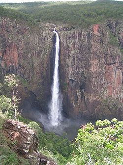
. Wallaman Falls
Wallaman Falls
The Wallaman Falls are notable for their single-drop of 268 metres, which is Australia's highest permanent waterfall. The pool at the end of the waterfall is 20 metres deep....
, located in Queensland
Queensland
Queensland is a state of Australia, occupying the north-eastern section of the mainland continent. It is bordered by the Northern Territory, South Australia and New South Wales to the west, south-west and south respectively. To the east, Queensland is bordered by the Coral Sea and Pacific Ocean...
, are Australia's tallest permanent waterfall with a plunge of nearly 300 metres. Wollomombi Falls
Wollomombi Falls
Wollomombi Falls , from an Aboriginal word, are located in the Oxley Wild Rivers National Park, 40 km due east of Armidale, New South Wales and 1 km off the Waterfall Way.At one time they were believed to be the tallest in Australia...
in New South Wales
New South Wales
New South Wales is a state of :Australia, located in the east of the country. It is bordered by Queensland, Victoria and South Australia to the north, south and west respectively. To the east, the state is bordered by the Tasman Sea, which forms part of the Pacific Ocean. New South Wales...
are second with a 220 metre combined drop and Ellenborough Falls
Ellenborough Falls
Ellenborough Falls is a waterfall on the headwaters of the Ellenborough River in New South Wales, Australia. It is situated in the Greater Taree area and is near Elands and Comboyne, on the Bulga Plateau.-Features:...
, also in New South Wales, is third plunging 160 metres as a single drop.
| Image | Waterfall | State/Territory | Location | Drop | Type | Coordinates |
|---|---|---|---|---|---|---|
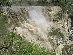 |
Apsley Falls Apsley Falls The Apsley Falls are two waterfalls on the Apsley River on the Northern Tablelands, New South Wales, Australia. The falls are located about east of Walcha, and 1 kilometre off the Oxley Highway in a deep gorge, that is part of the Oxley Wild Rivers National Park... |
New South Wales New South Wales New South Wales is a state of :Australia, located in the east of the country. It is bordered by Queensland, Victoria and South Australia to the north, south and west respectively. To the east, the state is bordered by the Tasman Sea, which forms part of the Pacific Ocean. New South Wales... |
Oxley Wild Rivers National Park Oxley Wild Rivers National Park Oxley Wild Rivers National Park is in New South Wales, Australia, 445 kilometres north of Sydney and is named in memory of the Australian explorer John Oxley, who passed through the area in 1818... |
31.04954°S 151.76818°E | ||
| Bangalore Falls | New South Wales New South Wales New South Wales is a state of :Australia, located in the east of the country. It is bordered by Queensland, Victoria and South Australia to the north, south and west respectively. To the east, the state is bordered by the Tasman Sea, which forms part of the Pacific Ocean. New South Wales... |
Bindarri National Park Bindarri National Park Bindarri National Park is a national park in New South Wales, Australia, 431 km northeast of Sydney.-External Links:*... |
30.267°S 152.925°E | |||
| Beauchamp Falls | New South Wales New South Wales New South Wales is a state of :Australia, located in the east of the country. It is bordered by Queensland, Victoria and South Australia to the north, south and west respectively. To the east, the state is bordered by the Tasman Sea, which forms part of the Pacific Ocean. New South Wales... |
Blue Mountains National Park Blue Mountains National Park The Blue Mountains National Park is a national park in New South Wales, Australia, 81 km west of Sydney, and located in the Blue Mountains region of the Great Dividing Range. The park covers 268,987 hectares. The boundary of the park is quite irregular as it is broken up by roads, urban areas... |
10 metres (32.8 ft) | 33.655316°S 150.327237°E | ||
| Belmore Falls Belmore Falls Belmore Falls are one of three waterfalls descending into the northern end of Kangaroo Valley and part of the Morton National Park in south eastern New South Wales, Australia. They waterfall is accessible via a short walk from a road leading out of Burrawang.... |
New South Wales New South Wales New South Wales is a state of :Australia, located in the east of the country. It is bordered by Queensland, Victoria and South Australia to the north, south and west respectively. To the east, the state is bordered by the Tasman Sea, which forms part of the Pacific Ocean. New South Wales... |
Morton National Park Morton National Park Morton is a national park in New South Wales , 170 km southwest of Sydney.The most notable attractions are the Fitzroy Falls, just off the main road from the Highlands to Kangaroo Valley and Pigeon House Mountain west of Milton. The park consists mostly of a flat plateau dissected by steep... |
||||
| Black Banksia Falls Black Banksia Falls Black Banksia Falls is a waterfall in New South Wales. It is located at 33° 56' S 150° 01' E, within the Kanangra-Boyd National Park.-References:* in the Gazetteer of Australia... |
New South Wales New South Wales New South Wales is a state of :Australia, located in the east of the country. It is bordered by Queensland, Victoria and South Australia to the north, south and west respectively. To the east, the state is bordered by the Tasman Sea, which forms part of the Pacific Ocean. New South Wales... |
Kanangra-Boyd National Park Kanangra-Boyd National Park Kanangra-Boyd is a national park in New South Wales, Australia, 100 km west of Sydney. It lies to the southwest of and is contiguous with the Blue Mountains National Park, and is part of the Greater Blue Mountains Area World Heritage Site .... |
33°56′S 150°01′E | |||
| Boundary Falls Boundary Falls Boundary Falls are located within the Gibraltar Range National Park, on the Gwydir Highway between Glenn Innes and Grafton in New South Wales, Australia.... |
New South Wales New South Wales New South Wales is a state of :Australia, located in the east of the country. It is bordered by Queensland, Victoria and South Australia to the north, south and west respectively. To the east, the state is bordered by the Tasman Sea, which forms part of the Pacific Ocean. New South Wales... |
Gibraltar Range National Park Gibraltar Range National Park Gibraltar Range is a national park in north-eastern New South Wales, Australia, 79 km north-east of Glen Innes and 493 km north of Sydney... |
||||
| Browns Falls | New South Wales New South Wales New South Wales is a state of :Australia, located in the east of the country. It is bordered by Queensland, Victoria and South Australia to the north, south and west respectively. To the east, the state is bordered by the Tasman Sea, which forms part of the Pacific Ocean. New South Wales... |
east of Killarney Killarney Killarney is a town in County Kerry, southwestern Ireland. The town is located north of the MacGillicuddy Reeks, on the northeastern shore of the Lough Lein/Leane which are part of Killarney National Park. The town and its surrounding region are home to St... |
28.348806°S 152.351704°E | |||
| Carrington Falls Carrington Falls Carrington Falls are located where the Kangaroo River crosses the western escarpment of the Budderoo Plateau to descend to the Kangaroo Valley in New South Wales, Australia. Protected within the Budderoo National Park, viewing platforms of the falls are wheelchair accessible.... |
New South Wales New South Wales New South Wales is a state of :Australia, located in the east of the country. It is bordered by Queensland, Victoria and South Australia to the north, south and west respectively. To the east, the state is bordered by the Tasman Sea, which forms part of the Pacific Ocean. New South Wales... |
Budderoo National Park Budderoo National Park Budderoo is a national park in New South Wales, Australia, 99 km southwest of Sydney, best known for the timber boardwalk through the Minnamurra rainforest... |
34.624486°S 150.654788°E | |||
| Chandler Falls | New South Wales New South Wales New South Wales is a state of :Australia, located in the east of the country. It is bordered by Queensland, Victoria and South Australia to the north, south and west respectively. To the east, the state is bordered by the Tasman Sea, which forms part of the Pacific Ocean. New South Wales... |
Oxley Wild Rivers National Park Oxley Wild Rivers National Park Oxley Wild Rivers National Park is in New South Wales, Australia, 445 kilometres north of Sydney and is named in memory of the Australian explorer John Oxley, who passed through the area in 1818... |
||||
| Crystal Shower Falls | New South Wales New South Wales New South Wales is a state of :Australia, located in the east of the country. It is bordered by Queensland, Victoria and South Australia to the north, south and west respectively. To the east, the state is bordered by the Tasman Sea, which forms part of the Pacific Ocean. New South Wales... |
Dorrigo National Park Dorrigo National Park Dorrigo National Park is a national park in New South Wales , 580 km north of Sydney on Dome Road off the Waterfall Way, 5 km east of the town of Dorrigo.... , Waterfall Way Waterfall Way The Waterfall Way is a road and State Highway 78 in New South Wales, Australia. It runs east-west from the Pacific Highway to the New England Highway at Armidale. The route passes through some of New South Wales' most scenic countryside and has become well known as New South Wales best and... |
30.377911°S 152.733908°E | |||
| Daggs Falls | New South Wales New South Wales New South Wales is a state of :Australia, located in the east of the country. It is bordered by Queensland, Victoria and South Australia to the north, south and west respectively. To the east, the state is bordered by the Tasman Sea, which forms part of the Pacific Ocean. New South Wales... |
east of Killarney Killarney Killarney is a town in County Kerry, southwestern Ireland. The town is located north of the MacGillicuddy Reeks, on the northeastern shore of the Lough Lein/Leane which are part of Killarney National Park. The town and its surrounding region are home to St... |
28.340496°S 152.345867°E | |||
| Dangar Falls | New South Wales New South Wales New South Wales is a state of :Australia, located in the east of the country. It is bordered by Queensland, Victoria and South Australia to the north, south and west respectively. To the east, the state is bordered by the Tasman Sea, which forms part of the Pacific Ocean. New South Wales... |
near Dorrigo Dorrigo, New South Wales Dorrigo is a small town located on the Waterfall Way in northern New South Wales, Australia. It is approximately 580 kilometres north of the state capital, Sydney via the Pacific Highway, and 60 kilometres from the coastal city of Coffs Harbour. The town is situated on the Dorrigo Plateau near the... |
30.327694°S 152.714596°E | |||
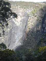 |
Dangars Falls | New South Wales New South Wales New South Wales is a state of :Australia, located in the east of the country. It is bordered by Queensland, Victoria and South Australia to the north, south and west respectively. To the east, the state is bordered by the Tasman Sea, which forms part of the Pacific Ocean. New South Wales... |
Oxley Wild Rivers National Park Oxley Wild Rivers National Park Oxley Wild Rivers National Park is in New South Wales, Australia, 445 kilometres north of Sydney and is named in memory of the Australian explorer John Oxley, who passed through the area in 1818... |
120 metres (393.7 ft) | ||
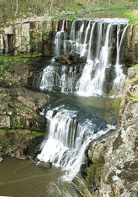 |
Ebor Falls Ebor Falls Ebor Falls are located on the Guy Fawkes River near Ebor and about 37 kilometres north-east of Wollomombi on Waterfall Way in the New England region of New South Wales, Australia.... |
New South Wales New South Wales New South Wales is a state of :Australia, located in the east of the country. It is bordered by Queensland, Victoria and South Australia to the north, south and west respectively. To the east, the state is bordered by the Tasman Sea, which forms part of the Pacific Ocean. New South Wales... |
Guy Fawkes River National Park Guy Fawkes River National Park Guy Fawkes River National Park is on Waterfall Way near Ebor, New South Wales, 50 kilometres west of Dorrigo and 80 km north-east of Armidale in Australia... , Waterfall Way Waterfall Way The Waterfall Way is a road and State Highway 78 in New South Wales, Australia. It runs east-west from the Pacific Highway to the New England Highway at Armidale. The route passes through some of New South Wales' most scenic countryside and has become well known as New South Wales best and... |
30.402287°S 152.341576°E | ||
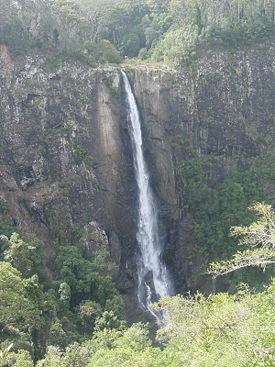 |
Ellenborough Falls Ellenborough Falls Ellenborough Falls is a waterfall on the headwaters of the Ellenborough River in New South Wales, Australia. It is situated in the Greater Taree area and is near Elands and Comboyne, on the Bulga Plateau.-Features:... |
New South Wales New South Wales New South Wales is a state of :Australia, located in the east of the country. It is bordered by Queensland, Victoria and South Australia to the north, south and west respectively. To the east, the state is bordered by the Tasman Sea, which forms part of the Pacific Ocean. New South Wales... |
near Tapin Tops National Park Tapin Tops National Park Tapin Tops is a national park in New South Wales, Australia, 264 km northeast of Sydney.... |
31.61236°N 152.29431°W | ||
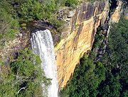 |
Fitzroy Falls | New South Wales New South Wales New South Wales is a state of :Australia, located in the east of the country. It is bordered by Queensland, Victoria and South Australia to the north, south and west respectively. To the east, the state is bordered by the Tasman Sea, which forms part of the Pacific Ocean. New South Wales... |
Morton National Park Morton National Park Morton is a national park in New South Wales , 170 km southwest of Sydney.The most notable attractions are the Fitzroy Falls, just off the main road from the Highlands to Kangaroo Valley and Pigeon House Mountain west of Milton. The park consists mostly of a flat plateau dissected by steep... |
34°39′S 150°29′E | ||
| Forgotten Waterfalls | New South Wales New South Wales New South Wales is a state of :Australia, located in the east of the country. It is bordered by Queensland, Victoria and South Australia to the north, south and west respectively. To the east, the state is bordered by the Tasman Sea, which forms part of the Pacific Ocean. New South Wales... |
Dorrigo National Park Dorrigo National Park Dorrigo National Park is a national park in New South Wales , 580 km north of Sydney on Dome Road off the Waterfall Way, 5 km east of the town of Dorrigo.... , Waterfall Way Waterfall Way The Waterfall Way is a road and State Highway 78 in New South Wales, Australia. It runs east-west from the Pacific Highway to the New England Highway at Armidale. The route passes through some of New South Wales' most scenic countryside and has become well known as New South Wales best and... |
30.388128°S 152.762232°E | |||
| Kalang Falls | New South Wales New South Wales New South Wales is a state of :Australia, located in the east of the country. It is bordered by Queensland, Victoria and South Australia to the north, south and west respectively. To the east, the state is bordered by the Tasman Sea, which forms part of the Pacific Ocean. New South Wales... |
Kanangra-Boyd National Park Kanangra-Boyd National Park Kanangra-Boyd is a national park in New South Wales, Australia, 100 km west of Sydney. It lies to the southwest of and is contiguous with the Blue Mountains National Park, and is part of the Greater Blue Mountains Area World Heritage Site .... |
33.980022°S 150.101395°E | |||
| Kanangra Falls Kanangra Falls Kanangra Falls is located in the Kanangra-Boyd National Park. The total water fall height is reported as being 225 metres or 738 feet in two sections.... |
New South Wales New South Wales New South Wales is a state of :Australia, located in the east of the country. It is bordered by Queensland, Victoria and South Australia to the north, south and west respectively. To the east, the state is bordered by the Tasman Sea, which forms part of the Pacific Ocean. New South Wales... |
Kanangra-Boyd National Park Kanangra-Boyd National Park Kanangra-Boyd is a national park in New South Wales, Australia, 100 km west of Sydney. It lies to the southwest of and is contiguous with the Blue Mountains National Park, and is part of the Greater Blue Mountains Area World Heritage Site .... |
225 metres (738.2 ft) | |||
| Katoomba Falls | New South Wales New South Wales New South Wales is a state of :Australia, located in the east of the country. It is bordered by Queensland, Victoria and South Australia to the north, south and west respectively. To the east, the state is bordered by the Tasman Sea, which forms part of the Pacific Ocean. New South Wales... |
near Katoomba | 33.727909°S 150.304095°E | |||
| Minyon Falls Minyon Falls Minyon Falls is a waterfall in the Nightcap National Park, New South Wales, Australia. Standing at over high, this waterfall is a popular visitor attraction and is located within easy reach of the nearby town of Byron Bay.... |
New South Wales New South Wales New South Wales is a state of :Australia, located in the east of the country. It is bordered by Queensland, Victoria and South Australia to the north, south and west respectively. To the east, the state is bordered by the Tasman Sea, which forms part of the Pacific Ocean. New South Wales... |
Nightcap National Park Nightcap National Park Nightcap National Park is in New South Wales, Australia, 35 km north of Lismore. It is classed by the IUCN World Commission on Protected Areas as Category II... |
104 metres (341.2 ft) | 28.600197°S 153.38974°E | ||
| Newell Falls | New South Wales New South Wales New South Wales is a state of :Australia, located in the east of the country. It is bordered by Queensland, Victoria and South Australia to the north, south and west respectively. To the east, the state is bordered by the Tasman Sea, which forms part of the Pacific Ocean. New South Wales... |
Dorrigo National Park Dorrigo National Park Dorrigo National Park is a national park in New South Wales , 580 km north of Sydney on Dome Road off the Waterfall Way, 5 km east of the town of Dorrigo.... , Waterfall Way Waterfall Way The Waterfall Way is a road and State Highway 78 in New South Wales, Australia. It runs east-west from the Pacific Highway to the New England Highway at Armidale. The route passes through some of New South Wales' most scenic countryside and has become well known as New South Wales best and... |
30.393607°S 152.745667°E | |||
| Protestors Falls | New South Wales New South Wales New South Wales is a state of :Australia, located in the east of the country. It is bordered by Queensland, Victoria and South Australia to the north, south and west respectively. To the east, the state is bordered by the Tasman Sea, which forms part of the Pacific Ocean. New South Wales... |
Nightcap National Park Nightcap National Park Nightcap National Park is in New South Wales, Australia, 35 km north of Lismore. It is classed by the IUCN World Commission on Protected Areas as Category II... |
25 metres (82 ft) | 28.569937°S 153.304596°E | ||
| Sherrard Falls | New South Wales New South Wales New South Wales is a state of :Australia, located in the east of the country. It is bordered by Queensland, Victoria and South Australia to the north, south and west respectively. To the east, the state is bordered by the Tasman Sea, which forms part of the Pacific Ocean. New South Wales... |
Dorrigo National Park Dorrigo National Park Dorrigo National Park is a national park in New South Wales , 580 km north of Sydney on Dome Road off the Waterfall Way, 5 km east of the town of Dorrigo.... , Waterfall Way Waterfall Way The Waterfall Way is a road and State Highway 78 in New South Wales, Australia. It runs east-west from the Pacific Highway to the New England Highway at Armidale. The route passes through some of New South Wales' most scenic countryside and has become well known as New South Wales best and... |
30.386277°S 152.74086°E | |||
| Tin Mine Falls Tin Mine Falls Tin Mine Falls is a waterfall located in the remote Pilot Wilderness Area, part of Kosciuszko National Park in southern New South Wales, Australia. Described from top to bottom, the falls consist of non-segmented tiered cascades over bedrock with a few smaller plunges, followed by a single large... |
New South Wales New South Wales New South Wales is a state of :Australia, located in the east of the country. It is bordered by Queensland, Victoria and South Australia to the north, south and west respectively. To the east, the state is bordered by the Tasman Sea, which forms part of the Pacific Ocean. New South Wales... |
Kosciuszko National Park Kosciuszko National Park Kosciuszko National Park covers 690,000 hectares and contains mainland Australia's highest peak, Mount Kosciuszko for which it is named, and Cabramurra the highest town in Australia... |
||||
| Tianjara Falls | New South Wales New South Wales New South Wales is a state of :Australia, located in the east of the country. It is bordered by Queensland, Victoria and South Australia to the north, south and west respectively. To the east, the state is bordered by the Tasman Sea, which forms part of the Pacific Ocean. New South Wales... |
Yarramunmun Creek | ||||
| Valentine Falls | New South Wales New South Wales New South Wales is a state of :Australia, located in the east of the country. It is bordered by Queensland, Victoria and South Australia to the north, south and west respectively. To the east, the state is bordered by the Tasman Sea, which forms part of the Pacific Ocean. New South Wales... |
Kosciuszko National Park Kosciuszko National Park Kosciuszko National Park covers 690,000 hectares and contains mainland Australia's highest peak, Mount Kosciuszko for which it is named, and Cabramurra the highest town in Australia... |
||||
| Wentworth Falls Wentworth Falls (waterfall) Wentworth Falls is a three-tiered seasonal waterfall fed by the Kedumba Creek, near the Blue Mountains town of Wentworth Falls in New South Wales, Australia. The falls are accessible via the National Pass and the Overcliff/Undercliff Walk... |
New South Wales New South Wales New South Wales is a state of :Australia, located in the east of the country. It is bordered by Queensland, Victoria and South Australia to the north, south and west respectively. To the east, the state is bordered by the Tasman Sea, which forms part of the Pacific Ocean. New South Wales... |
Wentworth Falls Wentworth Falls, New South Wales Wentworth Falls is a town in the Blue Mountains, New South Wales located 100 kilometres west of Sydney, and about 8 kilometres east of Katoomba, Australia on the Great Western Highway, with a Wentworth Falls railway station on the Main Western line. The town is situated at an elevation of... |
33.7272°N 150.3740°W | |||
| Wollomombi Falls Wollomombi Falls Wollomombi Falls , from an Aboriginal word, are located in the Oxley Wild Rivers National Park, 40 km due east of Armidale, New South Wales and 1 km off the Waterfall Way.At one time they were believed to be the tallest in Australia... |
New South Wales New South Wales New South Wales is a state of :Australia, located in the east of the country. It is bordered by Queensland, Victoria and South Australia to the north, south and west respectively. To the east, the state is bordered by the Tasman Sea, which forms part of the Pacific Ocean. New South Wales... |
Oxley Wild Rivers National Park Oxley Wild Rivers National Park Oxley Wild Rivers National Park is in New South Wales, Australia, 445 kilometres north of Sydney and is named in memory of the Australian explorer John Oxley, who passed through the area in 1818... , Waterfall Way Waterfall Way The Waterfall Way is a road and State Highway 78 in New South Wales, Australia. It runs east-west from the Pacific Highway to the New England Highway at Armidale. The route passes through some of New South Wales' most scenic countryside and has become well known as New South Wales best and... |
30.532121°N 152.039752°W | |||
| Edith Falls Edith Falls Edith Falls is a series of waterfalls and pools in Nitmiluk National Park, located about 60 km north of Katherine, Northern Territory, Australia. The falls are part of Edith River. There are trails to the top of the escarpment, allowing visitors to view the waterfalls. Edith Falls is... |
Northern Territory Northern Territory The Northern Territory is a federal territory of Australia, occupying much of the centre of the mainland continent, as well as the central northern regions... |
Nitmiluk National Park Nitmiluk National Park Nitmiluk National Park which is in the Northern Territory of Australia, 244 km southeast of Darwin, has been established around a series of gorges on the Katherine River and Edith Falls... |
14.180362°S 132.191899°E | |||
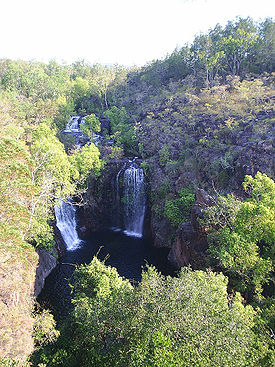 |
Florence Falls Florence Falls Florence Falls are located in the Litchfield National Park in the Northern Territory of Australia. Accessed by sealed road, the falls are found near the northern boundary of the park, 80 km south of Darwin as the crow flies.... |
Northern Territory Northern Territory The Northern Territory is a federal territory of Australia, occupying much of the centre of the mainland continent, as well as the central northern regions... |
Litchfield National Park Litchfield National Park Litchfield National Park, covering approximately 1500 km2, is near the township of Batchelor, 100 km south-west of Darwin, in the Northern Territory of Australia... |
13.096282°S 130.783567°E | ||
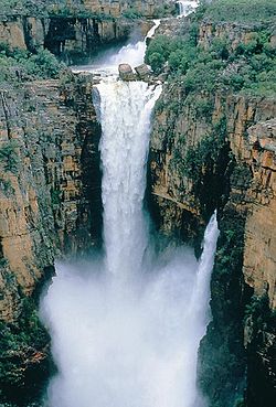 |
Jim Jim Falls Jim Jim Falls Jim Jim Falls is a 200 m high waterfall located in the Kakadu National Park, in the Northern Territory, Australia. It is believed that 140 million years ago much of Kakadu was under a shallow sea. The prominent escarpment wall formed sea cliffs and the Arnhem Land plateau formed a flat land... |
Northern Territory Northern Territory The Northern Territory is a federal territory of Australia, occupying much of the centre of the mainland continent, as well as the central northern regions... |
Kakadu National Park Kakadu National Park Kakadu National Park is in the Northern Territory of Australia, 171 km southeast of Darwin.Kakadu National Park is located within the Alligator Rivers Region of the Northern Territory of Australia. It covers an area of , extending nearly 200 kilometres from north to south and over 100 kilometres... |
13°16′21.16"S 132°50′22.79"E | ||
| Surprise Creek Falls | Northern Territory Northern Territory The Northern Territory is a federal territory of Australia, occupying much of the centre of the mainland continent, as well as the central northern regions... |
Litchfield National Park Litchfield National Park Litchfield National Park, covering approximately 1500 km2, is near the township of Batchelor, 100 km south-west of Darwin, in the Northern Territory of Australia... |
||||
| Tjaynera Falls | Northern Territory Northern Territory The Northern Territory is a federal territory of Australia, occupying much of the centre of the mainland continent, as well as the central northern regions... |
|||||
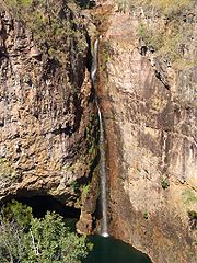 |
Tolmer Falls | Northern Territory Northern Territory The Northern Territory is a federal territory of Australia, occupying much of the centre of the mainland continent, as well as the central northern regions... |
Litchfield National Park Litchfield National Park Litchfield National Park, covering approximately 1500 km2, is near the township of Batchelor, 100 km south-west of Darwin, in the Northern Territory of Australia... |
13.203787°S 130.714431°E | ||
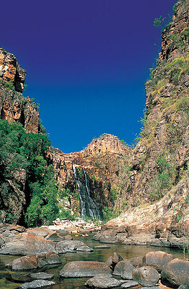 |
Twin Falls | Northern Territory Northern Territory The Northern Territory is a federal territory of Australia, occupying much of the centre of the mainland continent, as well as the central northern regions... |
Kakadu National Park Kakadu National Park Kakadu National Park is in the Northern Territory of Australia, 171 km southeast of Darwin.Kakadu National Park is located within the Alligator Rivers Region of the Northern Territory of Australia. It covers an area of , extending nearly 200 kilometres from north to south and over 100 kilometres... |
13.321°S 132.781°E | ||
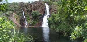 |
Wangi Falls Wangi Falls Wangi Falls are located in the Litchfield National Park in the Northern Territory of Australia. Accessed by sealed road, the falls are found near the western boundary of the park, 80 km south of Darwin as the crow flies.-See also:* Florence Falls... |
Northern Territory Northern Territory The Northern Territory is a federal territory of Australia, occupying much of the centre of the mainland continent, as well as the central northern regions... |
Litchfield National Park Litchfield National Park Litchfield National Park, covering approximately 1500 km2, is near the township of Batchelor, 100 km south-west of Darwin, in the Northern Territory of Australia... |
13.161731°S 130.684605°E | ||
| Alcheringa Falls | Queensland Queensland Queensland is a state of Australia, occupying the north-eastern section of the mainland continent. It is bordered by the Northern Territory, South Australia and New South Wales to the west, south-west and south respectively. To the east, Queensland is bordered by the Coral Sea and Pacific Ocean... |
Lamington National Park Lamington National Park Lamington is a national park in Queensland, Australia, lying on the Lamington Plateau of the McPherson Range on the Queensland/New South Wales border... |
28.27139°S 153.168415°E | |||
| Annan Gorge Falls | Queensland Queensland Queensland is a state of Australia, occupying the north-eastern section of the mainland continent. It is bordered by the Northern Territory, South Australia and New South Wales to the west, south-west and south respectively. To the east, Queensland is bordered by the Coral Sea and Pacific Ocean... |
Cooktown | ||||
| Ballanjui Falls | Queensland Queensland Queensland is a state of Australia, occupying the north-eastern section of the mainland continent. It is bordered by the Northern Territory, South Australia and New South Wales to the west, south-west and south respectively. To the east, Queensland is bordered by the Coral Sea and Pacific Ocean... |
Lamington National Park Lamington National Park Lamington is a national park in Queensland, Australia, lying on the Lamington Plateau of the McPherson Range on the Queensland/New South Wales border... |
28.214567°S 153.201857°E | |||
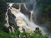 |
Barron Falls Barron Falls Barron Falls is where the Barron River makes its descent from the Atherton Tablelands to the Cairns coastal plain, in Queensland, Australia. Protected within the Barron Gorge National Park, the volume of water seen in the upper photo only occurs after substantial rainfall during the wet season... |
Queensland Queensland Queensland is a state of Australia, occupying the north-eastern section of the mainland continent. It is bordered by the Northern Territory, South Australia and New South Wales to the west, south-west and south respectively. To the east, Queensland is bordered by the Coral Sea and Pacific Ocean... |
Barron Gorge National Park Barron Gorge National Park Barron Gorge National Park is a national park in Queensland , 1,404 km northwest of Brisbane and 2 km from Kuranda. Barron Gorge is part of the Wet Tropics World Heritage Area. The Kuranda Scenic Railway line passes through the park with a station at Barron Falls. One train runs from... |
16°50′4"S 145°38′37"E | ||
| Big Mowbray Falls | Queensland Queensland Queensland is a state of Australia, occupying the north-eastern section of the mainland continent. It is bordered by the Northern Territory, South Australia and New South Wales to the west, south-west and south respectively. To the east, Queensland is bordered by the Coral Sea and Pacific Ocean... |
Mowbray National Park Mowbray National Park Mowbray is a national park in Queensland, Australia, 1441 km northwest of Brisbane.-See also:* Protected areas of Queensland... |
||||
| Binda Falls | Queensland Queensland Queensland is a state of Australia, occupying the north-eastern section of the mainland continent. It is bordered by the Northern Territory, South Australia and New South Wales to the west, south-west and south respectively. To the east, Queensland is bordered by the Coral Sea and Pacific Ocean... |
Wooroonooran National Park Wooroonooran National Park Wooroonooran is a national park in Queensland , 1367 km northwest of Brisbane, between Innisfail and Cairns.The park is one of the Wet Tropics World Heritage Area series of national parks, and is a gazetted World Heritage site... |
17.628481°S 145.77261°E | |||
| Birthday Creek Falls | Queensland Queensland Queensland is a state of Australia, occupying the north-eastern section of the mainland continent. It is bordered by the Northern Territory, South Australia and New South Wales to the west, south-west and south respectively. To the east, Queensland is bordered by the Coral Sea and Pacific Ocean... |
Paluma Range National Park Paluma Range National Park Paluma Range is a national park located between Ingham and Townsville, in north Queensland, Australia. The park is 1188 km north of Brisbane. The park contains the Jourama Falls, Crystal Creek and Lake Paluma... |
||||
| Blencoe Falls Blencoe Falls Blencoe Falls are located on Blencoe Creek, a tributary of the Herbert River, 2 km north of a confluence, within the Girringun National Park in Queensland, Australia... |
Queensland Queensland Queensland is a state of Australia, occupying the north-eastern section of the mainland continent. It is bordered by the Northern Territory, South Australia and New South Wales to the west, south-west and south respectively. To the east, Queensland is bordered by the Coral Sea and Pacific Ocean... |
Girringun National Park Girringun National Park Girrungun National Park is a National Park in Queensland , approximately 50 km southwest of Ingham, 110 km north of Townsville and 1,290 km northwest of Brisbane. The park was formerly named Lumholtz National Park when it was created in 1994. The Blencoe Falls Section was gazetted as... |
90 metres (295.3 ft) | 18.22383°S 145.53971°E | ||
| Bloomfield Falls Bloomfield Falls The Bloomfield Falls are near Cape Tribulation, close to Wujal Wujal, north of the Daintree National Park in Queensland, Australia.The waterfall is on the Bloomfield River.... |
Queensland Queensland Queensland is a state of Australia, occupying the north-eastern section of the mainland continent. It is bordered by the Northern Territory, South Australia and New South Wales to the west, south-west and south respectively. To the east, Queensland is bordered by the Coral Sea and Pacific Ocean... |
near Wujal Wujal Wujal Wujal Wujal Wujal is in northern Queensland, Australia. Wujal Wujal is the name of a relatively small Aboriginal community on the north and south sides of the Bloomfield River. It has an area of 19.94 square kilometres of land. At the 2006 census, Wujal Wujal had a population of 326.It is located... , north of the Daintree National Park Daintree National Park Daintree is a national park in Far North Queensland, Australia, northwest of Brisbane and northwest of Cairns. It was founded in 1981 and is part of the Wet Tropics of Queensland. In 1988 it was granted listing as a World Heritage List... |
15.95881°S 145.3195°E | |||
| Box Log Falls | Queensland Queensland Queensland is a state of Australia, occupying the north-eastern section of the mainland continent. It is bordered by the Northern Territory, South Australia and New South Wales to the west, south-west and south respectively. To the east, Queensland is bordered by the Coral Sea and Pacific Ocean... |
Lamington National Park Lamington National Park Lamington is a national park in Queensland, Australia, lying on the Lamington Plateau of the McPherson Range on the Queensland/New South Wales border... |
28.242321°S 153.153448°E | |||
| Browns Falls | Queensland Queensland Queensland is a state of Australia, occupying the north-eastern section of the mainland continent. It is bordered by the Northern Territory, South Australia and New South Wales to the west, south-west and south respectively. To the east, Queensland is bordered by the Coral Sea and Pacific Ocean... |
|||||
| Buderim Falls | Queensland Queensland Queensland is a state of Australia, occupying the north-eastern section of the mainland continent. It is bordered by the Northern Territory, South Australia and New South Wales to the west, south-west and south respectively. To the east, Queensland is bordered by the Coral Sea and Pacific Ocean... |
Buderim Forest Park | 26.67783°S 153.0472°E | |||
| Cannabullen Falls | Queensland Queensland Queensland is a state of Australia, occupying the north-eastern section of the mainland continent. It is bordered by the Northern Territory, South Australia and New South Wales to the west, south-west and south respectively. To the east, Queensland is bordered by the Coral Sea and Pacific Ocean... |
Tully Gorge National Park Tully Gorge National Park Tully Gorge is a national park in Queensland, Australia, 1338 km northwest of Brisbane.- Waterfalls :Follow Tully Falls Road to the Tully Gorge Lookout. Tully Falls only run in a big wet season, but the walls of rock and rainforest which plunge 300 m down to the Tully River are still an... |
||||
| Carter Falls | Queensland Queensland Queensland is a state of Australia, occupying the north-eastern section of the mainland continent. It is bordered by the Northern Territory, South Australia and New South Wales to the west, south-west and south respectively. To the east, Queensland is bordered by the Coral Sea and Pacific Ocean... |
Tully Gorge National Park Tully Gorge National Park Tully Gorge is a national park in Queensland, Australia, 1338 km northwest of Brisbane.- Waterfalls :Follow Tully Falls Road to the Tully Gorge Lookout. Tully Falls only run in a big wet season, but the walls of rock and rainforest which plunge 300 m down to the Tully River are still an... |
||||
| Chalahn Falls | Queensland Queensland Queensland is a state of Australia, occupying the north-eastern section of the mainland continent. It is bordered by the Northern Territory, South Australia and New South Wales to the west, south-west and south respectively. To the east, Queensland is bordered by the Coral Sea and Pacific Ocean... |
Lamington National Park Lamington National Park Lamington is a national park in Queensland, Australia, lying on the Lamington Plateau of the McPherson Range on the Queensland/New South Wales border... |
28.245874°S 153.165722°E | |||
| Clamshell Falls Clamshell Falls Clamshell Falls are found on Behana Creek, below Whites Falls, in the Wooroonooran National Park, in Queensland, Australia.... |
Queensland Queensland Queensland is a state of Australia, occupying the north-eastern section of the mainland continent. It is bordered by the Northern Territory, South Australia and New South Wales to the west, south-west and south respectively. To the east, Queensland is bordered by the Coral Sea and Pacific Ocean... |
|||||
| Coomera Falls Coomera Falls The Coomera Falls are found on the upper Coomera River in South East Queensland, Australia. The height of the waterfall is 64 m.The Coomera Falls drop into Coomera Gorge. Access is via graded walking tracks in Lamington National Park from Binna Burra.... |
Queensland Queensland Queensland is a state of Australia, occupying the north-eastern section of the mainland continent. It is bordered by the Northern Territory, South Australia and New South Wales to the west, south-west and south respectively. To the east, Queensland is bordered by the Coral Sea and Pacific Ocean... |
Lamington National Park Lamington National Park Lamington is a national park in Queensland, Australia, lying on the Lamington Plateau of the McPherson Range on the Queensland/New South Wales border... |
64 metres (210 ft) | 28.233473°S 153.190849°E | ||
| Cowley Falls | Queensland Queensland Queensland is a state of Australia, occupying the north-eastern section of the mainland continent. It is bordered by the Northern Territory, South Australia and New South Wales to the west, south-west and south respectively. To the east, Queensland is bordered by the Coral Sea and Pacific Ocean... |
Wooroonooran National Park Wooroonooran National Park Wooroonooran is a national park in Queensland , 1367 km northwest of Brisbane, between Innisfail and Cairns.The park is one of the Wet Tropics World Heritage Area series of national parks, and is a gazetted World Heritage site... |
17.634043°S 145.801363°E | |||
| Crystal Cascades Crystal Cascades The Crystal Cascades is a relatively unspoilt section of Freshwater Creek, with numerous waterfalls and swimming holes popular with locals and tourists... |
Queensland Queensland Queensland is a state of Australia, occupying the north-eastern section of the mainland continent. It is bordered by the Northern Territory, South Australia and New South Wales to the west, south-west and south respectively. To the east, Queensland is bordered by the Coral Sea and Pacific Ocean... |
near Cairns | 16°57′42"S 145°40′46"E | |||
| Daggs Falls | Queensland Queensland Queensland is a state of Australia, occupying the north-eastern section of the mainland continent. It is bordered by the Northern Territory, South Australia and New South Wales to the west, south-west and south respectively. To the east, Queensland is bordered by the Coral Sea and Pacific Ocean... |
|||||
| Darraboola Falls | Queensland Queensland Queensland is a state of Australia, occupying the north-eastern section of the mainland continent. It is bordered by the Northern Territory, South Australia and New South Wales to the west, south-west and south respectively. To the east, Queensland is bordered by the Coral Sea and Pacific Ocean... |
Lamington National Park Lamington National Park Lamington is a national park in Queensland, Australia, lying on the Lamington Plateau of the McPherson Range on the Queensland/New South Wales border... |
28.223321°S 153.137226°E | |||
| Davies Creek Falls Davies Creek Falls Davies Creek Falls are located within Davies Creek National Park, south west of Cairns, in Queensland, Australia.... |
Queensland Queensland Queensland is a state of Australia, occupying the north-eastern section of the mainland continent. It is bordered by the Northern Territory, South Australia and New South Wales to the west, south-west and south respectively. To the east, Queensland is bordered by the Coral Sea and Pacific Ocean... |
Kennedy Highway Kennedy Highway The Kennedy Highway is a highway in northern Queensland, Australia. It runs for approximately 250 km from Smithfield, on the northern outskirts of Cairns, to the Gulf Development Road in the vicinity of Forty Mile Scrub and Undara Volcanic national parks, about 40 kilometres south of Mount... southwest of Cairns |
17°00′29"S 145°34′51"E | |||
| Dinner Falls Dinner Falls Dinner Falls is a waterfall on the upper Barron River in Far North Queensland, Australia.The waterfall is located south of Atherton on the Atherton Tableland near the Mount Hypipamee Crater in... |
Queensland Queensland Queensland is a state of Australia, occupying the north-eastern section of the mainland continent. It is bordered by the Northern Territory, South Australia and New South Wales to the west, south-west and south respectively. To the east, Queensland is bordered by the Coral Sea and Pacific Ocean... |
Mount Hypipamee National Park Mount Hypipamee National Park Mount Hypipamee is a national park in Queensland, Australia, 1358 km northwest of Brisbane.... |
17.426342°S 145.488338°E | |||
| Echo Falls | Queensland Queensland Queensland is a state of Australia, occupying the north-eastern section of the mainland continent. It is bordered by the Northern Territory, South Australia and New South Wales to the west, south-west and south respectively. To the east, Queensland is bordered by the Coral Sea and Pacific Ocean... |
Lamington National Park Lamington National Park Lamington is a national park in Queensland, Australia, lying on the Lamington Plateau of the McPherson Range on the Queensland/New South Wales border... |
28.270294°S 153.161237°E | |||
| Elabana Falls Elabana Falls Elabana Falls are located within Lamington National Park in South East Queensland, Australia. Access to the falls is via tracks from Binna Burra.-References:... |
Queensland Queensland Queensland is a state of Australia, occupying the north-eastern section of the mainland continent. It is bordered by the Northern Territory, South Australia and New South Wales to the west, south-west and south respectively. To the east, Queensland is bordered by the Coral Sea and Pacific Ocean... |
Lamington National Park Lamington National Park Lamington is a national park in Queensland, Australia, lying on the Lamington Plateau of the McPherson Range on the Queensland/New South Wales border... |
28.243294°S 153.152976°E | |||
| Elizabeth Grant Falls | Queensland Queensland Queensland is a state of Australia, occupying the north-eastern section of the mainland continent. It is bordered by the Northern Territory, South Australia and New South Wales to the west, south-west and south respectively. To the east, Queensland is bordered by the Coral Sea and Pacific Ocean... |
Tully Gorge National Park Tully Gorge National Park Tully Gorge is a national park in Queensland, Australia, 1338 km northwest of Brisbane.- Waterfalls :Follow Tully Falls Road to the Tully Gorge Lookout. Tully Falls only run in a big wet season, but the walls of rock and rainforest which plunge 300 m down to the Tully River are still an... |
||||
| Ellinjaa Falls | Queensland Queensland Queensland is a state of Australia, occupying the north-eastern section of the mainland continent. It is bordered by the Northern Territory, South Australia and New South Wales to the west, south-west and south respectively. To the east, Queensland is bordered by the Coral Sea and Pacific Ocean... |
Atherton Tablelands Waterfall Circuit | 17.494279°S 145.656824°E | |||
| Elliot (Indian Head) Falls | Queensland Queensland Queensland is a state of Australia, occupying the north-eastern section of the mainland continent. It is bordered by the Northern Territory, South Australia and New South Wales to the west, south-west and south respectively. To the east, Queensland is bordered by the Coral Sea and Pacific Ocean... |
Jardine River National Park Jardine River National Park The Jardine River National Park is a national park Queensland, Australia, 2137 km northwest of Brisbane and about 900 km northwest of Cairns, on the tip of Cape York Peninsula.... |
||||
| Emerald Creek Falls | Queensland Queensland Queensland is a state of Australia, occupying the north-eastern section of the mainland continent. It is bordered by the Northern Territory, South Australia and New South Wales to the west, south-west and south respectively. To the east, Queensland is bordered by the Coral Sea and Pacific Ocean... |
Kennedy Highway Kennedy Highway The Kennedy Highway is a highway in northern Queensland, Australia. It runs for approximately 250 km from Smithfield, on the northern outskirts of Cairns, to the Gulf Development Road in the vicinity of Forty Mile Scrub and Undara Volcanic national parks, about 40 kilometres south of Mount... southwest of Cairns |
17.055636°S 145.541039°E | |||
| Endeavour Falls | Queensland Queensland Queensland is a state of Australia, occupying the north-eastern section of the mainland continent. It is bordered by the Northern Territory, South Australia and New South Wales to the west, south-west and south respectively. To the east, Queensland is bordered by the Coral Sea and Pacific Ocean... |
Cooktown | ||||
| Fishery Falls | Queensland Queensland Queensland is a state of Australia, occupying the north-eastern section of the mainland continent. It is bordered by the Northern Territory, South Australia and New South Wales to the west, south-west and south respectively. To the east, Queensland is bordered by the Coral Sea and Pacific Ocean... |
Wooroonooran National Park Wooroonooran National Park Wooroonooran is a national park in Queensland , 1367 km northwest of Brisbane, between Innisfail and Cairns.The park is one of the Wet Tropics World Heritage Area series of national parks, and is a gazetted World Heritage site... |
17.16769°S 145.83385°E | |||
| Fruit Bat Falls | Queensland Queensland Queensland is a state of Australia, occupying the north-eastern section of the mainland continent. It is bordered by the Northern Territory, South Australia and New South Wales to the west, south-west and south respectively. To the east, Queensland is bordered by the Coral Sea and Pacific Ocean... |
Jardine River National Park Jardine River National Park The Jardine River National Park is a national park Queensland, Australia, 2137 km northwest of Brisbane and about 900 km northwest of Cairns, on the tip of Cape York Peninsula.... |
||||
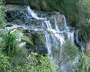 |
Goomoolahra Falls Goomoolahra Falls Goomoolahra Falls are found within the Springbrook section of Springbrook National Park in Springbrook, part of the Gold Coast hinterland district of South East Queensland, Australia.... |
Queensland Queensland Queensland is a state of Australia, occupying the north-eastern section of the mainland continent. It is bordered by the Northern Territory, South Australia and New South Wales to the west, south-west and south respectively. To the east, Queensland is bordered by the Coral Sea and Pacific Ocean... |
Springbrook National Park Springbrook National Park Springbrook National Park is a national park at Springbrook on the McPherson Range in the Gold Coast hinterland of Queensland, , 96 km south of Brisbane. It is part of the Shield Volcano Group of the World Heritage site Gondwana Rainforests of Australia... |
28.222773°S 153.284898°E | ||
| Home Rule Falls | Queensland Queensland Queensland is a state of Australia, occupying the north-eastern section of the mainland continent. It is bordered by the Northern Territory, South Australia and New South Wales to the west, south-west and south respectively. To the east, Queensland is bordered by the Coral Sea and Pacific Ocean... |
Cooktown | ||||
| Herbert River Falls Herbert River Falls Herbert River Falls are on the Herbert River on the northern boundary of the Girringun National Park, west of Cardwell, in Queensland, Australia.... |
Queensland Queensland Queensland is a state of Australia, occupying the north-eastern section of the mainland continent. It is bordered by the Northern Territory, South Australia and New South Wales to the west, south-west and south respectively. To the east, Queensland is bordered by the Coral Sea and Pacific Ocean... |
Girringun National Park Girringun National Park Girrungun National Park is a National Park in Queensland , approximately 50 km southwest of Ingham, 110 km north of Townsville and 1,290 km northwest of Brisbane. The park was formerly named Lumholtz National Park when it was created in 1994. The Blencoe Falls Section was gazetted as... |
18.233754°S 145.369892°E | |||
| Isabella Falls | Queensland Queensland Queensland is a state of Australia, occupying the north-eastern section of the mainland continent. It is bordered by the Northern Territory, South Australia and New South Wales to the west, south-west and south respectively. To the east, Queensland is bordered by the Coral Sea and Pacific Ocean... |
Cooktown | ||||
| JC Slaughter Falls | Queensland Queensland Queensland is a state of Australia, occupying the north-eastern section of the mainland continent. It is bordered by the Northern Territory, South Australia and New South Wales to the west, south-west and south respectively. To the east, Queensland is bordered by the Coral Sea and Pacific Ocean... |
Mount Coot-tha Reserve, Brisbane Brisbane Brisbane is the capital and most populous city in the Australian state of Queensland and the third most populous city in Australia. Brisbane's metropolitan area has a population of over 2 million, and the South East Queensland urban conurbation, centred around Brisbane, encompasses a population of... |
||||
| Jones Falls Jones Falls The Jones Falls is a stream in Maryland. It is impounded to create Lake Roland before running through the city of Baltimore and finally emptying into the Baltimore Inner Harbor.... |
Queensland Queensland Queensland is a state of Australia, occupying the north-eastern section of the mainland continent. It is bordered by the Northern Territory, South Australia and New South Wales to the west, south-west and south respectively. To the east, Queensland is bordered by the Coral Sea and Pacific Ocean... |
Wooroonooran National Park Wooroonooran National Park Wooroonooran is a national park in Queensland , 1367 km northwest of Brisbane, between Innisfail and Cairns.The park is one of the Wet Tropics World Heritage Area series of national parks, and is a gazetted World Heritage site... |
||||
| Josephine Falls Josephine Falls Josephine Falls are located at the foot of the southern face of Mount Bartle Frere in the Wooroonooran National Park, in Queensland, Australia. The falls are a popular recreation site among locals as the water flows over a large rock to form a natural waterslide.Josephine Falls are located on... |
Queensland Queensland Queensland is a state of Australia, occupying the north-eastern section of the mainland continent. It is bordered by the Northern Territory, South Australia and New South Wales to the west, south-west and south respectively. To the east, Queensland is bordered by the Coral Sea and Pacific Ocean... |
Wooroonooran National Park Wooroonooran National Park Wooroonooran is a national park in Queensland , 1367 km northwest of Brisbane, between Innisfail and Cairns.The park is one of the Wet Tropics World Heritage Area series of national parks, and is a gazetted World Heritage site... |
17.433446°S 145.862753°E | |||
| Jourama Falls | Queensland Queensland Queensland is a state of Australia, occupying the north-eastern section of the mainland continent. It is bordered by the Northern Territory, South Australia and New South Wales to the west, south-west and south respectively. To the east, Queensland is bordered by the Coral Sea and Pacific Ocean... |
Paluma Range National Park Paluma Range National Park Paluma Range is a national park located between Ingham and Townsville, in north Queensland, Australia. The park is 1188 km north of Brisbane. The park contains the Jourama Falls, Crystal Creek and Lake Paluma... |
||||
| Kalgamahla Falls | Queensland Queensland Queensland is a state of Australia, occupying the north-eastern section of the mainland continent. It is bordered by the Northern Territory, South Australia and New South Wales to the west, south-west and south respectively. To the east, Queensland is bordered by the Coral Sea and Pacific Ocean... |
Lamington National Park Lamington National Park Lamington is a national park in Queensland, Australia, lying on the Lamington Plateau of the McPherson Range on the Queensland/New South Wales border... |
28.229239°S 153.145938°E | |||
| Kearneys Falls Kearneys Falls Kearneys Falls are found on a tributary of the Mulgrave River, in the Wooroonooran National Park, in Goldsborough Valley of Far North Queensland, Australia.Access to the falls is via a 1.6 km walking track.... |
Queensland Queensland Queensland is a state of Australia, occupying the north-eastern section of the mainland continent. It is bordered by the Northern Territory, South Australia and New South Wales to the west, south-west and south respectively. To the east, Queensland is bordered by the Coral Sea and Pacific Ocean... |
Wooroonooran National Park Wooroonooran National Park Wooroonooran is a national park in Queensland , 1367 km northwest of Brisbane, between Innisfail and Cairns.The park is one of the Wet Tropics World Heritage Area series of national parks, and is a gazetted World Heritage site... |
17.24099°S 145.778103°E | |||
| Kondalilla Falls | Queensland Queensland Queensland is a state of Australia, occupying the north-eastern section of the mainland continent. It is bordered by the Northern Territory, South Australia and New South Wales to the west, south-west and south respectively. To the east, Queensland is bordered by the Coral Sea and Pacific Ocean... |
near Mapleton Mapleton, Queensland Mapleton is a small town in Queensland's Sunshine Coast hinterland, with a population of around 2,000 people. It includes the Lilyponds, the Mapleton Tavern and historic Seaview House , and is well known for its 180 degree panoramic views of the Sunshine Coast.The town is located high on the... |
||||
| Leichhardt Falls Leichhardt Falls Leichhardt Falls are waterfalls found on the Leichhardt River, approximately 50 kilometres upstream from the point where the river discharges into the Gulf of Carpentaria, in Queensland, Australia. Like the river, the falls are named for Ludwig Leichhardt. The falls are not renowned for their... |
Queensland Queensland Queensland is a state of Australia, occupying the north-eastern section of the mainland continent. It is bordered by the Northern Territory, South Australia and New South Wales to the west, south-west and south respectively. To the east, Queensland is bordered by the Coral Sea and Pacific Ocean... |
|||||
| Little Millstream Falls | Queensland Queensland Queensland is a state of Australia, occupying the north-eastern section of the mainland continent. It is bordered by the Northern Territory, South Australia and New South Wales to the west, south-west and south respectively. To the east, Queensland is bordered by the Coral Sea and Pacific Ocean... |
Atherton Tableland Atherton Tableland The Atherton Tableland is a fertile plateau which is part of the Great Dividing Range in Queensland, Australia. It is located west to south-south-west inland from Cairns, well into the tropics, but its elevated position provides a climate suitable for dairy farming. It has an area of around... |
17.622591°S 145.475593°E | |||
| Malanda Falls Malanda Falls The Malanda Falls are located just out of the Malanda on the North Johnstone River, on the Atherton Tableland in Far North Queensland, Australia. They are not as spectacular as some of the surrounding falls on the Tablelands, however are a very popular swimming spot for residents of the area. The... |
Queensland Queensland Queensland is a state of Australia, occupying the north-eastern section of the mainland continent. It is bordered by the Northern Territory, South Australia and New South Wales to the west, south-west and south respectively. To the east, Queensland is bordered by the Coral Sea and Pacific Ocean... |
Atherton Tableland Atherton Tableland The Atherton Tableland is a fertile plateau which is part of the Great Dividing Range in Queensland, Australia. It is located west to south-south-west inland from Cairns, well into the tropics, but its elevated position provides a climate suitable for dairy farming. It has an area of around... |
17°21′18"S 145°35′11"E | |||
| Mena Creek Falls | Queensland Queensland Queensland is a state of Australia, occupying the north-eastern section of the mainland continent. It is bordered by the Northern Territory, South Australia and New South Wales to the west, south-west and south respectively. To the east, Queensland is bordered by the Coral Sea and Pacific Ocean... |
near Innisfail Innisfail, Queensland Innisfail is a town located in the far north of the state of Queensland, Australia. It is the major township of the Cassowary Coast and is well renowned for its sugar and banana industries, as well as for being one of Australia's wettest towns... |
||||
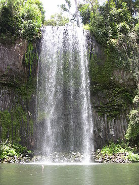 |
Millaa Millaa Falls Millaa Millaa Falls The Millaa Millaa Falls are adjacent to the town of Millaa Millaa, on the Atherton Tableland in Far North Queensland, Australia. Millaa Millaa is an Aboriginal word meaning plenty of water or waterfall. A popular destination of international tour operators, the falls are 18.3 metres high with a... |
Queensland Queensland Queensland is a state of Australia, occupying the north-eastern section of the mainland continent. It is bordered by the Northern Territory, South Australia and New South Wales to the west, south-west and south respectively. To the east, Queensland is bordered by the Coral Sea and Pacific Ocean... |
Atherton Tableland Atherton Tableland The Atherton Tableland is a fertile plateau which is part of the Great Dividing Range in Queensland, Australia. It is located west to south-south-west inland from Cairns, well into the tropics, but its elevated position provides a climate suitable for dairy farming. It has an area of around... Waterfall Circuit |
17°29′44"S 145°36′36"E | ||
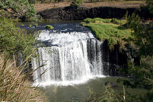 |
Millstream Falls Millstream Falls Millstream Falls is found on a tributary to the Herbert River known as The Millstream, 15 km southwest of Ravenshoe, on the Atherton Tableland in Far North Queensland, Australia. Protected within the Millstream Falls National Park, the falls are accessible by road from the Kennedy... |
Queensland Queensland Queensland is a state of Australia, occupying the north-eastern section of the mainland continent. It is bordered by the Northern Territory, South Australia and New South Wales to the west, south-west and south respectively. To the east, Queensland is bordered by the Coral Sea and Pacific Ocean... |
Atherton Tableland Atherton Tableland The Atherton Tableland is a fertile plateau which is part of the Great Dividing Range in Queensland, Australia. It is located west to south-south-west inland from Cairns, well into the tropics, but its elevated position provides a climate suitable for dairy farming. It has an area of around... |
17°38′35"S 145°27′27"E | ||
| Milmilgee Falls Milmilgee Falls Milmilgee Falls are found near the head of the Freshwater Creek, below the Copperlode Dam, west of Cairns, in Queensland, Australia.-See also:* List of waterfalls of Australia... |
Queensland Queensland Queensland is a state of Australia, occupying the north-eastern section of the mainland continent. It is bordered by the Northern Territory, South Australia and New South Wales to the west, south-west and south respectively. To the east, Queensland is bordered by the Coral Sea and Pacific Ocean... |
near Cairns | 16°57′42"S 145°40′46"E | |||
| Morans Falls Morans Falls Morans Falls are located within Lamington National Park in South East Queensland, Australia. The waterfall is accessed via the Morans Falls Track, a six km walk.-References:... |
Queensland Queensland Queensland is a state of Australia, occupying the north-eastern section of the mainland continent. It is bordered by the Northern Territory, South Australia and New South Wales to the west, south-west and south respectively. To the east, Queensland is bordered by the Coral Sea and Pacific Ocean... |
Lamington National Park Lamington National Park Lamington is a national park in Queensland, Australia, lying on the Lamington Plateau of the McPherson Range on the Queensland/New South Wales border... |
28°13.837′S 153°07.491′E | |||
| Mungalli Falls | Queensland Queensland Queensland is a state of Australia, occupying the north-eastern section of the mainland continent. It is bordered by the Northern Territory, South Australia and New South Wales to the west, south-west and south respectively. To the east, Queensland is bordered by the Coral Sea and Pacific Ocean... |
Wooroonooran National Park Wooroonooran National Park Wooroonooran is a national park in Queensland , 1367 km northwest of Brisbane, between Innisfail and Cairns.The park is one of the Wet Tropics World Heritage Area series of national parks, and is a gazetted World Heritage site... |
17.537946°S 145.682058°E | |||
| Murray Falls Murray Falls Murray Falls are located in Girramay National Park off the Bruce Highway between Tully and Cardwell, in Queensland, Australia. The falls drop 30 metres and may be viewed from a boardwalk and viewing platform... |
Queensland Queensland Queensland is a state of Australia, occupying the north-eastern section of the mainland continent. It is bordered by the Northern Territory, South Australia and New South Wales to the west, south-west and south respectively. To the east, Queensland is bordered by the Coral Sea and Pacific Ocean... |
Murray Upper National Park | 18.152275°S 145.815847°E | |||
| Nandroya Falls | Queensland Queensland Queensland is a state of Australia, occupying the north-eastern section of the mainland continent. It is bordered by the Northern Territory, South Australia and New South Wales to the west, south-west and south respectively. To the east, Queensland is bordered by the Coral Sea and Pacific Ocean... |
Wooroonooran National Park Wooroonooran National Park Wooroonooran is a national park in Queensland , 1367 km northwest of Brisbane, between Innisfail and Cairns.The park is one of the Wet Tropics World Heritage Area series of national parks, and is a gazetted World Heritage site... |
17.583771°S 145.747075°E | |||
| Natural Bridge Falls | Queensland Queensland Queensland is a state of Australia, occupying the north-eastern section of the mainland continent. It is bordered by the Northern Territory, South Australia and New South Wales to the west, south-west and south respectively. To the east, Queensland is bordered by the Coral Sea and Pacific Ocean... |
Springbrook National Park Springbrook National Park Springbrook National Park is a national park at Springbrook on the McPherson Range in the Gold Coast hinterland of Queensland, , 96 km south of Brisbane. It is part of the Shield Volcano Group of the World Heritage site Gondwana Rainforests of Australia... |
28.196886°S 153.239923°E | |||
| Parrot Falls | Queensland Queensland Queensland is a state of Australia, occupying the north-eastern section of the mainland continent. It is bordered by the Northern Territory, South Australia and New South Wales to the west, south-west and south respectively. To the east, Queensland is bordered by the Coral Sea and Pacific Ocean... |
Cooktown | ||||
| Pepina Falls | Queensland Queensland Queensland is a state of Australia, occupying the north-eastern section of the mainland continent. It is bordered by the Northern Territory, South Australia and New South Wales to the west, south-west and south respectively. To the east, Queensland is bordered by the Coral Sea and Pacific Ocean... |
Atherton Tablelands Waterfall Circuit | 17.585858°S 145.615969°E | |||
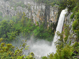 |
Purlingbrook Falls Purlingbrook Falls Purlingbrook Falls are found within the central section of Springbrook National Park, at Springbrook which is part of the Gold Coast hinterland, south-west of Surfers Paradise, in Queensland, Australia.... |
Queensland Queensland Queensland is a state of Australia, occupying the north-eastern section of the mainland continent. It is bordered by the Northern Territory, South Australia and New South Wales to the west, south-west and south respectively. To the east, Queensland is bordered by the Coral Sea and Pacific Ocean... |
Springbrook National Park Springbrook National Park Springbrook National Park is a national park at Springbrook on the McPherson Range in the Gold Coast hinterland of Queensland, , 96 km south of Brisbane. It is part of the Shield Volcano Group of the World Heritage site Gondwana Rainforests of Australia... |
28.189823°S 153.270907°E | ||
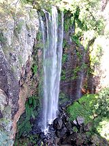 |
Queen Mary Falls Queen Mary Falls Queen Mary Falls are found in Main Range National Park on the McPherson Range near the New South Wales/Queensland border.The 40 m waterfall is located 50 km south-east of Warwick, 10 km east of the town of Killarney in Queensland, Australia... |
Queensland Queensland Queensland is a state of Australia, occupying the north-eastern section of the mainland continent. It is bordered by the Northern Territory, South Australia and New South Wales to the west, south-west and south respectively. To the east, Queensland is bordered by the Coral Sea and Pacific Ocean... |
Main Range National Park Main Range National Park Main Range is a mountain range and a national park in Queensland , 85 km southwest of Brisbane. It is part of the World Heritage Site Gondwana Rainforests of Australia . It protects the western part of a semicircle of mountains in South East Queensland known as the Scenic Rim... |
28.340005°S 152.372603°E | ||
| Roaring Meg Falls | Queensland Queensland Queensland is a state of Australia, occupying the north-eastern section of the mainland continent. It is bordered by the Northern Territory, South Australia and New South Wales to the west, south-west and south respectively. To the east, Queensland is bordered by the Coral Sea and Pacific Ocean... |
near Wujal Wujal Wujal Wujal Wujal Wujal is in northern Queensland, Australia. Wujal Wujal is the name of a relatively small Aboriginal community on the north and south sides of the Bloomfield River. It has an area of 19.94 square kilometres of land. At the 2006 census, Wujal Wujal had a population of 326.It is located... , north of the Daintree National Park Daintree National Park Daintree is a national park in Far North Queensland, Australia, northwest of Brisbane and northwest of Cairns. It was founded in 1981 and is part of the Wet Tropics of Queensland. In 1988 it was granted listing as a World Heritage List... |
||||
| Running Creek Falls | Queensland Queensland Queensland is a state of Australia, occupying the north-eastern section of the mainland continent. It is bordered by the Northern Territory, South Australia and New South Wales to the west, south-west and south respectively. To the east, Queensland is bordered by the Coral Sea and Pacific Ocean... |
Lamington National Park Lamington National Park Lamington is a national park in Queensland, Australia, lying on the Lamington Plateau of the McPherson Range on the Queensland/New South Wales border... |
28.316622°S 153.067532°E | |||
| Savo Falls | Queensland Queensland Queensland is a state of Australia, occupying the north-eastern section of the mainland continent. It is bordered by the Northern Territory, South Australia and New South Wales to the west, south-west and south respectively. To the east, Queensland is bordered by the Coral Sea and Pacific Ocean... |
Jardine River National Park Jardine River National Park The Jardine River National Park is a national park Queensland, Australia, 2137 km northwest of Brisbane and about 900 km northwest of Cairns, on the tip of Cape York Peninsula.... |
||||
| Silver Creek Falls | Queensland Queensland Queensland is a state of Australia, occupying the north-eastern section of the mainland continent. It is bordered by the Northern Territory, South Australia and New South Wales to the west, south-west and south respectively. To the east, Queensland is bordered by the Coral Sea and Pacific Ocean... |
Wooroonooran National Park Wooroonooran National Park Wooroonooran is a national park in Queensland , 1367 km northwest of Brisbane, between Innisfail and Cairns.The park is one of the Wet Tropics World Heritage Area series of national parks, and is a gazetted World Heritage site... |
17.58819°S 145.748191°E | |||
| Simpson Falls Simpson Falls Simpson Falls are located within the Mount Coot-tha Forest, in Brisbane, Queensland, Australia. The waterway formed by Simpson Falls is the western branch of the headwaters of Ithaca Creek.... |
Queensland Queensland Queensland is a state of Australia, occupying the north-eastern section of the mainland continent. It is bordered by the Northern Territory, South Australia and New South Wales to the west, south-west and south respectively. To the east, Queensland is bordered by the Coral Sea and Pacific Ocean... |
Mount Coot-tha Reserve, Brisbane Brisbane Brisbane is the capital and most populous city in the Australian state of Queensland and the third most populous city in Australia. Brisbane's metropolitan area has a population of over 2 million, and the South East Queensland urban conurbation, centred around Brisbane, encompasses a population of... |
||||
| Souita Falls | Queensland Queensland Queensland is a state of Australia, occupying the north-eastern section of the mainland continent. It is bordered by the Northern Territory, South Australia and New South Wales to the west, south-west and south respectively. To the east, Queensland is bordered by the Coral Sea and Pacific Ocean... |
Atherton Tableland Atherton Tableland The Atherton Tableland is a fertile plateau which is part of the Great Dividing Range in Queensland, Australia. It is located west to south-south-west inland from Cairns, well into the tropics, but its elevated position provides a climate suitable for dairy farming. It has an area of around... Waterfall Circuit |
17.564747°S 145.64558°E | |||
| Spring Creek Falls | Queensland Queensland Queensland is a state of Australia, occupying the north-eastern section of the mainland continent. It is bordered by the Northern Territory, South Australia and New South Wales to the west, south-west and south respectively. To the east, Queensland is bordered by the Coral Sea and Pacific Ocean... |
Mowbray Valley | ||||
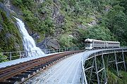 |
Stoney Creek Falls Stoney Creek Falls Stoney Creek Falls are found in the Barron Gorge National Park, north-east of Cairns, in Queensland, Australia. The falls are formed where Stoney Creek starts to descend in steps from the shoulders of the gorge. The falls are best known for the curved lattice railway bridge that passes in front of... |
Queensland Queensland Queensland is a state of Australia, occupying the north-eastern section of the mainland continent. It is bordered by the Northern Territory, South Australia and New South Wales to the west, south-west and south respectively. To the east, Queensland is bordered by the Coral Sea and Pacific Ocean... |
Barron Gorge National Park Barron Gorge National Park Barron Gorge National Park is a national park in Queensland , 1,404 km northwest of Brisbane and 2 km from Kuranda. Barron Gorge is part of the Wet Tropics World Heritage Area. The Kuranda Scenic Railway line passes through the park with a station at Barron Falls. One train runs from... |
|||
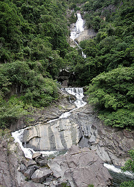 |
Surprise Creek Falls Surprise Creek Falls Surprise Creek Falls are found in the Barron Gorge National Park, north-east of Cairns, in Queensland, Australia. The falls are located near Barron Gorge Hydro and cascade 243 m into the gorge.... |
Queensland Queensland Queensland is a state of Australia, occupying the north-eastern section of the mainland continent. It is bordered by the Northern Territory, South Australia and New South Wales to the west, south-west and south respectively. To the east, Queensland is bordered by the Coral Sea and Pacific Ocean... |
Barron Gorge National Park Barron Gorge National Park Barron Gorge National Park is a national park in Queensland , 1,404 km northwest of Brisbane and 2 km from Kuranda. Barron Gorge is part of the Wet Tropics World Heritage Area. The Kuranda Scenic Railway line passes through the park with a station at Barron Falls. One train runs from... |
243 metres (797.2 ft) | Segmented | 18.173581°S 145.602837°E |
| Tanninaba Falls | Queensland Queensland Queensland is a state of Australia, occupying the north-eastern section of the mainland continent. It is bordered by the Northern Territory, South Australia and New South Wales to the west, south-west and south respectively. To the east, Queensland is bordered by the Coral Sea and Pacific Ocean... |
Springbrook National Park Springbrook National Park Springbrook National Park is a national park at Springbrook on the McPherson Range in the Gold Coast hinterland of Queensland, , 96 km south of Brisbane. It is part of the Shield Volcano Group of the World Heritage site Gondwana Rainforests of Australia... |
28.187487°S 153.267024°E | |||
| Tchupala Falls Tchupala Falls Tchupala Falls are located in the Palmerston Section of Wooroonooran National Park, North Queensland, Australia, about 20 km west of Innisfail, along the Palmerston Highway. While the walking trail to Tchupala Falls is only about 600 metres, the track in this section totals about 11... |
Queensland Queensland Queensland is a state of Australia, occupying the north-eastern section of the mainland continent. It is bordered by the Northern Territory, South Australia and New South Wales to the west, south-west and south respectively. To the east, Queensland is bordered by the Coral Sea and Pacific Ocean... |
Wooroonooran National Park Wooroonooran National Park Wooroonooran is a national park in Queensland , 1367 km northwest of Brisbane, between Innisfail and Cairns.The park is one of the Wet Tropics World Heritage Area series of national parks, and is a gazetted World Heritage site... |
17.600257°S 145.775099°E | |||
| Teviot Falls Teviot Falls Teviot Falls are found on the McPherson Range near Wilsons Peak in Queensland, Australia, close to the border with New South Wales.On the partially unsealed road up the range is the Teviot Gap, also known as The Head, and this is the best place to view the falls.There are another four waterfalls... |
Queensland Queensland Queensland is a state of Australia, occupying the north-eastern section of the mainland continent. It is bordered by the Northern Territory, South Australia and New South Wales to the west, south-west and south respectively. To the east, Queensland is bordered by the Coral Sea and Pacific Ocean... |
McPherson Range McPherson Range The McPherson Range is an extensive mountain range, a spur of the Great Dividing Range, heading in an easterly direction from near Wallangarra to the Pacific Ocean coastline. It forms part of the Scenic Rim on the border between the states of New South Wales and Queensland. Further west of the... near Wilson's Peak Wilson's Peak Wilsons Peak is a steep mountain in Queensland, Australia which is covered in dense rainforest. It marks the intersection of the Great Dividing Range with the McPherson Range in the Scenic Rim region... |
||||
| Tinaroo Falls Tinaroo Falls Tinaroo Falls lie at the head of the Barron River, beneath the Lake Tinaroo dam wall, in Queensland, Australia.-See also:* List of waterfalls of Australia... |
Queensland Queensland Queensland is a state of Australia, occupying the north-eastern section of the mainland continent. It is bordered by the Northern Territory, South Australia and New South Wales to the west, south-west and south respectively. To the east, Queensland is bordered by the Coral Sea and Pacific Ocean... |
near Cairns | 17°09′49"S 145°32′45"E | |||
| Toolona Falls | Queensland Queensland Queensland is a state of Australia, occupying the north-eastern section of the mainland continent. It is bordered by the Northern Territory, South Australia and New South Wales to the west, south-west and south respectively. To the east, Queensland is bordered by the Coral Sea and Pacific Ocean... |
Lamington National Park Lamington National Park Lamington is a national park in Queensland, Australia, lying on the Lamington Plateau of the McPherson Range on the Queensland/New South Wales border... |
28.247462°S 153.169498°E | |||
| Trevethan Falls | Queensland Queensland Queensland is a state of Australia, occupying the north-eastern section of the mainland continent. It is bordered by the Northern Territory, South Australia and New South Wales to the west, south-west and south respectively. To the east, Queensland is bordered by the Coral Sea and Pacific Ocean... |
Cooktown | ||||
| Tully Falls Tully Falls Tully Falls are found on the Tully River in the Tully Gorge National Park in Queensland, Australia. The height of the waterfall is .Access to the falls is via a graded track.... |
Queensland Queensland Queensland is a state of Australia, occupying the north-eastern section of the mainland continent. It is bordered by the Northern Territory, South Australia and New South Wales to the west, south-west and south respectively. To the east, Queensland is bordered by the Coral Sea and Pacific Ocean... |
Tully Gorge National Park Tully Gorge National Park Tully Gorge is a national park in Queensland, Australia, 1338 km northwest of Brisbane.- Waterfalls :Follow Tully Falls Road to the Tully Gorge Lookout. Tully Falls only run in a big wet season, but the walls of rock and rainforest which plunge 300 m down to the Tully River are still an... |
17.776437°S 145.559793°E | |||
| Twin Falls | Queensland Queensland Queensland is a state of Australia, occupying the north-eastern section of the mainland continent. It is bordered by the Northern Territory, South Australia and New South Wales to the west, south-west and south respectively. To the east, Queensland is bordered by the Coral Sea and Pacific Ocean... |
Jardine River National Park Jardine River National Park The Jardine River National Park is a national park Queensland, Australia, 2137 km northwest of Brisbane and about 900 km northwest of Cairns, on the tip of Cape York Peninsula.... |
||||
 |
Wallaman Falls Wallaman Falls The Wallaman Falls are notable for their single-drop of 268 metres, which is Australia's highest permanent waterfall. The pool at the end of the waterfall is 20 metres deep.... |
Queensland Queensland Queensland is a state of Australia, occupying the north-eastern section of the mainland continent. It is bordered by the Northern Territory, South Australia and New South Wales to the west, south-west and south respectively. To the east, Queensland is bordered by the Coral Sea and Pacific Ocean... |
Girringun National Park Girringun National Park Girrungun National Park is a National Park in Queensland , approximately 50 km southwest of Ingham, 110 km north of Townsville and 1,290 km northwest of Brisbane. The park was formerly named Lumholtz National Park when it was created in 1994. The Blencoe Falls Section was gazetted as... |
18.6°S 145.8°E | ||
| Wallicher Falls | Queensland Queensland Queensland is a state of Australia, occupying the north-eastern section of the mainland continent. It is bordered by the Northern Territory, South Australia and New South Wales to the west, south-west and south respectively. To the east, Queensland is bordered by the Coral Sea and Pacific Ocean... |
Wooroonooran National Park Wooroonooran National Park Wooroonooran is a national park in Queensland , 1367 km northwest of Brisbane, between Innisfail and Cairns.The park is one of the Wet Tropics World Heritage Area series of national parks, and is a gazetted World Heritage site... |
17.603284°S 145.770636°E | |||
| Whites Falls Whites Falls Whites Falls are found on Behana Creek, above Clamshell Falls, in the Wooroonooran National Park, in Queensland, Australia.... |
Queensland Queensland Queensland is a state of Australia, occupying the north-eastern section of the mainland continent. It is bordered by the Northern Territory, South Australia and New South Wales to the west, south-west and south respectively. To the east, Queensland is bordered by the Coral Sea and Pacific Ocean... |
Wooroonooran National Park Wooroonooran National Park Wooroonooran is a national park in Queensland , 1367 km northwest of Brisbane, between Innisfail and Cairns.The park is one of the Wet Tropics World Heritage Area series of national parks, and is a gazetted World Heritage site... |
17.196954°S 145.835481°E | |||
| Wongalee Falls Wongalee Falls Wongalee Falls are a part of the Crystal Cascades found near the head of the Freshwater Creek, downstream from Milmilgee Falls, northwest of Cairns near Redlynch, in Queensland, Australia.- References :... |
Queensland Queensland Queensland is a state of Australia, occupying the north-eastern section of the mainland continent. It is bordered by the Northern Territory, South Australia and New South Wales to the west, south-west and south respectively. To the east, Queensland is bordered by the Coral Sea and Pacific Ocean... |
near Cairns | 16°57′42"S 145°40′46"E | |||
| Yamanie Falls | Queensland Queensland Queensland is a state of Australia, occupying the north-eastern section of the mainland continent. It is bordered by the Northern Territory, South Australia and New South Wales to the west, south-west and south respectively. To the east, Queensland is bordered by the Coral Sea and Pacific Ocean... |
Girringun National Park Girringun National Park Girrungun National Park is a National Park in Queensland , approximately 50 km southwest of Ingham, 110 km north of Townsville and 1,290 km northwest of Brisbane. The park was formerly named Lumholtz National Park when it was created in 1994. The Blencoe Falls Section was gazetted as... |
||||
| Yanbacoochie Falls | Queensland Queensland Queensland is a state of Australia, occupying the north-eastern section of the mainland continent. It is bordered by the Northern Territory, South Australia and New South Wales to the west, south-west and south respectively. To the east, Queensland is bordered by the Coral Sea and Pacific Ocean... |
Lamington National Park Lamington National Park Lamington is a national park in Queensland, Australia, lying on the Lamington Plateau of the McPherson Range on the Queensland/New South Wales border... |
28.235799°S 153.151281°E | |||
| Yarrabilgong Falls Yarrbilgong Falls Yarrbilgong Falls are located within Lamington National Park in South East Queensland, Australia. Access to the falls is along the main Coomera Track that links Binna Burra and O'Reilly's Guesthouse. The height of the falls are 150 m.... |
Queensland Queensland Queensland is a state of Australia, occupying the north-eastern section of the mainland continent. It is bordered by the Northern Territory, South Australia and New South Wales to the west, south-west and south respectively. To the east, Queensland is bordered by the Coral Sea and Pacific Ocean... |
Lamington National Park Lamington National Park Lamington is a national park in Queensland, Australia, lying on the Lamington Plateau of the McPherson Range on the Queensland/New South Wales border... |
28.231999°S 153.190355°E | |||
| Zillie Falls | Queensland Queensland Queensland is a state of Australia, occupying the north-eastern section of the mainland continent. It is bordered by the Northern Territory, South Australia and New South Wales to the west, south-west and south respectively. To the east, Queensland is bordered by the Coral Sea and Pacific Ocean... |
Atherton Tableland Atherton Tableland The Atherton Tableland is a fertile plateau which is part of the Great Dividing Range in Queensland, Australia. It is located west to south-south-west inland from Cairns, well into the tropics, but its elevated position provides a climate suitable for dairy farming. It has an area of around... Waterfall Circuit |
17.474754°S 145.656996°E | |||
| Ferntree Falls | South Australia South Australia South Australia is a state of Australia in the southern central part of the country. It covers some of the most arid parts of the continent; with a total land area of , it is the fourth largest of Australia's six states and two territories.South Australia shares borders with all of the mainland... |
Flinders Ranges National Park Flinders Ranges National Park The Flinders Ranges National Park is situated approximately 400 km north of Adelaide in the northern central part of South Australia's largest mountain range, the Flinders Ranges. The park covers an area of 912 km², northeast of the small town of Hawker... , Rawnsley Park |
||||
| First Falls | South Australia South Australia South Australia is a state of Australia in the southern central part of the country. It covers some of the most arid parts of the continent; with a total land area of , it is the fourth largest of Australia's six states and two territories.South Australia shares borders with all of the mainland... |
Morialta Conservation Park Morialta Conservation Park Morialta Conservation Park is a public reserve 10 km north-east of Adelaide, in the state of South Australia, Australia. The park is in a rugged bush environment, with a narrow gorge set with three waterfalls, bounded by steep ridges and cliffs... |
23 metres (75.5 ft) | |||
 |
First Falls - Seventh Falls | South Australia South Australia South Australia is a state of Australia in the southern central part of the country. It covers some of the most arid parts of the continent; with a total land area of , it is the fourth largest of Australia's six states and two territories.South Australia shares borders with all of the mainland... |
Waterfall Gully Waterfall Gully, South Australia Waterfall Gully is an outer suburb of the South Australian capital city of Adelaide. It is located in the foothills of the Mount Lofty Ranges around east-south-east of Adelaide's central business district . For the most part, the suburb encompasses one long gully with First Creek at its centre and... , Cleland Conservation Park Cleland Conservation Park Cleland Conservation Park is a conservation park in the Adelaide Hills, South Australia. from Adelaide City centre. Cleland Conservation Park conserves a significant area of natural bushland on the Adelaide Hills face and includes the internationally popular Cleland Wildlife Park and the popular... |
|||
| Glenora Falls | South Australia South Australia South Australia is a state of Australia in the southern central part of the country. It covers some of the most arid parts of the continent; with a total land area of , it is the fourth largest of Australia's six states and two territories.South Australia shares borders with all of the mainland... |
|||||
| Hay Flat Waterfall | South Australia South Australia South Australia is a state of Australia in the southern central part of the country. It covers some of the most arid parts of the continent; with a total land area of , it is the fourth largest of Australia's six states and two territories.South Australia shares borders with all of the mainland... |
|||||
| Hindmarsh Falls | South Australia South Australia South Australia is a state of Australia in the southern central part of the country. It covers some of the most arid parts of the continent; with a total land area of , it is the fourth largest of Australia's six states and two territories.South Australia shares borders with all of the mainland... |
|||||
| Ingalalla Waterfalls | South Australia South Australia South Australia is a state of Australia in the southern central part of the country. It covers some of the most arid parts of the continent; with a total land area of , it is the fourth largest of Australia's six states and two territories.South Australia shares borders with all of the mainland... |
35.531144°S 138.342805°E | ||||
| Kanalla Falls | South Australia South Australia South Australia is a state of Australia in the southern central part of the country. It covers some of the most arid parts of the continent; with a total land area of , it is the fourth largest of Australia's six states and two territories.South Australia shares borders with all of the mainland... |
Flinders Ranges National Park Flinders Ranges National Park The Flinders Ranges National Park is situated approximately 400 km north of Adelaide in the northern central part of South Australia's largest mountain range, the Flinders Ranges. The park covers an area of 912 km², northeast of the small town of Hawker... |
||||
| Kapinka Falls | South Australia South Australia South Australia is a state of Australia in the southern central part of the country. It covers some of the most arid parts of the continent; with a total land area of , it is the fourth largest of Australia's six states and two territories.South Australia shares borders with all of the mainland... |
|||||
| Lower Waterfall | South Australia South Australia South Australia is a state of Australia in the southern central part of the country. It covers some of the most arid parts of the continent; with a total land area of , it is the fourth largest of Australia's six states and two territories.South Australia shares borders with all of the mainland... |
|||||
| Malloga Falls | South Australia South Australia South Australia is a state of Australia in the southern central part of the country. It covers some of the most arid parts of the continent; with a total land area of , it is the fourth largest of Australia's six states and two territories.South Australia shares borders with all of the mainland... |
Flinders Ranges National Park Flinders Ranges National Park The Flinders Ranges National Park is situated approximately 400 km north of Adelaide in the northern central part of South Australia's largest mountain range, the Flinders Ranges. The park covers an area of 912 km², northeast of the small town of Hawker... , near Wilpena |
||||
| Mannum Waterfall | South Australia South Australia South Australia is a state of Australia in the southern central part of the country. It covers some of the most arid parts of the continent; with a total land area of , it is the fourth largest of Australia's six states and two territories.South Australia shares borders with all of the mainland... |
|||||
| Morialta Falls | South Australia South Australia South Australia is a state of Australia in the southern central part of the country. It covers some of the most arid parts of the continent; with a total land area of , it is the fourth largest of Australia's six states and two territories.South Australia shares borders with all of the mainland... |
Morialta Conservation Park Morialta Conservation Park Morialta Conservation Park is a public reserve 10 km north-east of Adelaide, in the state of South Australia, Australia. The park is in a rugged bush environment, with a narrow gorge set with three waterfalls, bounded by steep ridges and cliffs... |
||||
| Petalinka Waterfall | South Australia South Australia South Australia is a state of Australia in the southern central part of the country. It covers some of the most arid parts of the continent; with a total land area of , it is the fourth largest of Australia's six states and two territories.South Australia shares borders with all of the mainland... |
|||||
| Second Falls | South Australia South Australia South Australia is a state of Australia in the southern central part of the country. It covers some of the most arid parts of the continent; with a total land area of , it is the fourth largest of Australia's six states and two territories.South Australia shares borders with all of the mainland... |
Morialta Conservation Park Morialta Conservation Park Morialta Conservation Park is a public reserve 10 km north-east of Adelaide, in the state of South Australia, Australia. The park is in a rugged bush environment, with a narrow gorge set with three waterfalls, bounded by steep ridges and cliffs... > 15 metres (49.2 ft) |
||||
| Strepara Waterfall | South Australia South Australia South Australia is a state of Australia in the southern central part of the country. It covers some of the most arid parts of the continent; with a total land area of , it is the fourth largest of Australia's six states and two territories.South Australia shares borders with all of the mainland... |
|||||
| The Waterfall | South Australia South Australia South Australia is a state of Australia in the southern central part of the country. It covers some of the most arid parts of the continent; with a total land area of , it is the fourth largest of Australia's six states and two territories.South Australia shares borders with all of the mainland... |
|||||
| The Waterfalls | South Australia South Australia South Australia is a state of Australia in the southern central part of the country. It covers some of the most arid parts of the continent; with a total land area of , it is the fourth largest of Australia's six states and two territories.South Australia shares borders with all of the mainland... |
|||||
| Third Falls | South Australia South Australia South Australia is a state of Australia in the southern central part of the country. It covers some of the most arid parts of the continent; with a total land area of , it is the fourth largest of Australia's six states and two territories.South Australia shares borders with all of the mainland... |
Morialta Conservation Park Morialta Conservation Park Morialta Conservation Park is a public reserve 10 km north-east of Adelaide, in the state of South Australia, Australia. The park is in a rugged bush environment, with a narrow gorge set with three waterfalls, bounded by steep ridges and cliffs... |
13 metres (42.7 ft) | |||
| Upper Waterfall | South Australia South Australia South Australia is a state of Australia in the southern central part of the country. It covers some of the most arid parts of the continent; with a total land area of , it is the fourth largest of Australia's six states and two territories.South Australia shares borders with all of the mainland... |
|||||
| Wadella Falls | South Australia South Australia South Australia is a state of Australia in the southern central part of the country. It covers some of the most arid parts of the continent; with a total land area of , it is the fourth largest of Australia's six states and two territories.South Australia shares borders with all of the mainland... |
near Tumby Bay | ||||
| Waukarie Falls | South Australia South Australia South Australia is a state of Australia in the southern central part of the country. It covers some of the most arid parts of the continent; with a total land area of , it is the fourth largest of Australia's six states and two territories.South Australia shares borders with all of the mainland... |
Mount Brown Conservation Park Mount Brown Conservation Park Mount Brown Conservation Park is a national park in the in the Southern Flinders Ranges of South Australia. The park has established walking trails, including a section of the Heysen trail. The park is managed by the Department of Environmental and Natural Resources; entry is free... |
||||
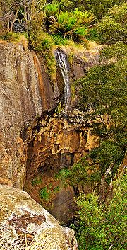 |
Delaneys Falls Delaneys Falls Delaneys Falls is a waterfall situated out of Guns Plains, Tasmania. The falls is incorrectly signposted as Preston Falls on the road however. There is a well kept track down to the lookout. It's also possible to walk to the base but there isn't any track in place.... |
Tasmania Tasmania Tasmania is an Australian island and state. It is south of the continent, separated by Bass Strait. The state includes the island of Tasmania—the 26th largest island in the world—and the surrounding islands. The state has a population of 507,626 , of whom almost half reside in the greater Hobart... |
Guns Plains | |||
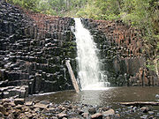 |
Dip Falls Dip Falls Dip Falls are found on the Dip River on the north-west coast of Tasmania, Australia.... |
Tasmania Tasmania Tasmania is an Australian island and state. It is south of the continent, separated by Bass Strait. The state includes the island of Tasmania—the 26th largest island in the world—and the surrounding islands. The state has a population of 507,626 , of whom almost half reside in the greater Hobart... |
41.035082°S 145.3759°E | |||
| Guide Falls Guide Falls thumb|Guide falls mid summer 2007Guide Falls are situated closely to the back of Burnie, Tasmania.Head out of Burnie on the same road to cradle mountain then turn right just outside the Ridgley boundary and continue down into the gully and turn left when you get to the posted gate sign... |
Tasmania Tasmania Tasmania is an Australian island and state. It is south of the continent, separated by Bass Strait. The state includes the island of Tasmania—the 26th largest island in the world—and the surrounding islands. The state has a population of 507,626 , of whom almost half reside in the greater Hobart... |
41.156557°S 145.804024°E | ||||
 |
Horseshoe Falls Horseshoe Falls (Tasmania) Horseshoe Falls are located upstream of Russell Falls at Mount Field National Park, in Tasmania, Australia. The falls are a popular tourist attraction.Horseshoe Falls are composed of horizontal marine Permian siltstone benches, as are Russell Falls.... |
Tasmania Tasmania Tasmania is an Australian island and state. It is south of the continent, separated by Bass Strait. The state includes the island of Tasmania—the 26th largest island in the world—and the surrounding islands. The state has a population of 507,626 , of whom almost half reside in the greater Hobart... |
42.675767°N 146.711463°W | |||
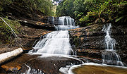 |
Lady Barron Falls Lady Barron Falls Lady Barron Falls is a cascading waterfall located within a few kilometres of Russell Falls in the Mount Field National Park. The waterfall is named after Lady Clara Barron, wife of Sir Harry Barron.... |
Tasmania Tasmania Tasmania is an Australian island and state. It is south of the continent, separated by Bass Strait. The state includes the island of Tasmania—the 26th largest island in the world—and the surrounding islands. The state has a population of 507,626 , of whom almost half reside in the greater Hobart... |
Mount Field National Park Mount Field National Park Mount Field National Park is a national park in Tasmania, Australia, 64 km northwest of Hobart. The landscape ranges from eucalyptus temperate rainforest to alpine moorland, rising to 1,434 metres at the summit of Mount Field West.... |
42.69104°N 146.695279°W | ||
| Liffey Cascade | Tasmania Tasmania Tasmania is an Australian island and state. It is south of the continent, separated by Bass Strait. The state includes the island of Tasmania—the 26th largest island in the world—and the surrounding islands. The state has a population of 507,626 , of whom almost half reside in the greater Hobart... |
near Liffey Liffey, Tasmania Liffey is a town and river located south west of Launceston, Tasmania, Australia. It was named by , from Ireland. The town is situated in rainforest, on the Liffey River at the foot of the Great Western Tiers. Nearby towns are Bracknell and Blackwood Creek.The most notable attraction in the area... |
41.698491°S 146.761272°E | |||
| Liffey Falls Liffey Falls Liffey Falls are found near the head of the Liffey River, upstream of the town of Liffey in Tasmania, Australia.... |
Tasmania Tasmania Tasmania is an Australian island and state. It is south of the continent, separated by Bass Strait. The state includes the island of Tasmania—the 26th largest island in the world—and the surrounding islands. The state has a population of 507,626 , of whom almost half reside in the greater Hobart... |
near Liffey Liffey, Tasmania Liffey is a town and river located south west of Launceston, Tasmania, Australia. It was named by , from Ireland. The town is situated in rainforest, on the Liffey River at the foot of the Great Western Tiers. Nearby towns are Bracknell and Blackwood Creek.The most notable attraction in the area... |
41.698347°S 146.764327°E | |||
| Montezuma Falls Montezuma Falls Montezuma Falls are located on a minor tributary to Lake Pieman, north-east of Zeehan, on West Coast Tasmania, Australia.In historical context - on the route of the former North East Dundas Tramway not far from the old mining town of Williamsford at the foot of Mount Read. With a fall of 104... |
Tasmania Tasmania Tasmania is an Australian island and state. It is south of the continent, separated by Bass Strait. The state includes the island of Tasmania—the 26th largest island in the world—and the surrounding islands. The state has a population of 507,626 , of whom almost half reside in the greater Hobart... |
41°50′S 145°28′E | ||||
| Nelson Falls | Tasmania Tasmania Tasmania is an Australian island and state. It is south of the continent, separated by Bass Strait. The state includes the island of Tasmania—the 26th largest island in the world—and the surrounding islands. The state has a population of 507,626 , of whom almost half reside in the greater Hobart... |
42°6′S 145°44′E | ||||
| Russell Falls Russell Falls Russell Falls are located on the eastern boundary of Mount Field National Park, in Tasmania, Australia. Accessible by a paved walking track, the falls are a popular tourist attraction.... |
Tasmania Tasmania Tasmania is an Australian island and state. It is south of the continent, separated by Bass Strait. The state includes the island of Tasmania—the 26th largest island in the world—and the surrounding islands. The state has a population of 507,626 , of whom almost half reside in the greater Hobart... |
42.676993°N 146.712445°W | ||||
| Spout Falls | Tasmania Tasmania Tasmania is an Australian island and state. It is south of the continent, separated by Bass Strait. The state includes the island of Tasmania—the 26th largest island in the world—and the surrounding islands. The state has a population of 507,626 , of whom almost half reside in the greater Hobart... |
near Liffey Liffey, Tasmania Liffey is a town and river located south west of Launceston, Tasmania, Australia. It was named by , from Ireland. The town is situated in rainforest, on the Liffey River at the foot of the Great Western Tiers. Nearby towns are Bracknell and Blackwood Creek.The most notable attraction in the area... |
41.698603°S 146.762366°E | |||
| Agnes Falls | Victoria Victoria (Australia) Victoria is the second most populous state in Australia. Geographically the smallest mainland state, Victoria is bordered by New South Wales, South Australia, and Tasmania on Boundary Islet to the north, west and south respectively.... |
Toora | 59 metres (193.6 ft) | |||
| Beauchamp Falls | Victoria Victoria (Australia) Victoria is the second most populous state in Australia. Geographically the smallest mainland state, Victoria is bordered by New South Wales, South Australia, and Tasmania on Boundary Islet to the north, west and south respectively.... |
Otway Forest Park, near Beech Forest | 38.650897°N 143.607488°W | |||
| Carisbrook Falls | Victoria Victoria (Australia) Victoria is the second most populous state in Australia. Geographically the smallest mainland state, Victoria is bordered by New South Wales, South Australia, and Tasmania on Boundary Islet to the north, west and south respectively.... |
Great Otway National Park, near Wongarra | 38.69226°N 143.809286°W | |||
| Cora Lynn Cascades | Victoria Victoria (Australia) Victoria is the second most populous state in Australia. Geographically the smallest mainland state, Victoria is bordered by New South Wales, South Australia, and Tasmania on Boundary Islet to the north, west and south respectively.... |
Great Otway National Park, Angahook section | 38.508415°N 143.927078°W | |||
| Cumberland Falls | Victoria Victoria (Australia) Victoria is the second most populous state in Australia. Geographically the smallest mainland state, Victoria is bordered by New South Wales, South Australia, and Tasmania on Boundary Islet to the north, west and south respectively.... |
|||||
| Currawong Falls | Victoria Victoria (Australia) Victoria is the second most populous state in Australia. Geographically the smallest mainland state, Victoria is bordered by New South Wales, South Australia, and Tasmania on Boundary Islet to the north, west and south respectively.... |
|||||
| Dandongadale Falls | Victoria Victoria (Australia) Victoria is the second most populous state in Australia. Geographically the smallest mainland state, Victoria is bordered by New South Wales, South Australia, and Tasmania on Boundary Islet to the north, west and south respectively.... |
Alpine National Park Alpine National Park The Alpine National Park is a national park in Victoria , northeast of Melbourne. It covers much of the higher areas of the Great Dividing Range in Victoria, including Victoria's highest point, Mount Bogong and the associated subalpine woodland and grassland of the Bogong High Plains... , western section |
255m | plunge | ||
| Erskine Falls | Victoria Victoria (Australia) Victoria is the second most populous state in Australia. Geographically the smallest mainland state, Victoria is bordered by New South Wales, South Australia, and Tasmania on Boundary Islet to the north, west and south respectively.... |
Great Otway National Park, Angahook section | 30 metres (98.4 ft) | 38.493369°N 143.901672°W | ||
| Henderson Falls | Victoria Victoria (Australia) Victoria is the second most populous state in Australia. Geographically the smallest mainland state, Victoria is bordered by New South Wales, South Australia, and Tasmania on Boundary Islet to the north, west and south respectively.... |
Great Otway National Park, Angahook section | 8 metres (26.2 ft) | 38.537961°N 143.960724°W | ||
 |
Hopetoun Falls Hopetoun Falls Hopetoun Falls is located five kilometres south of Beech Forest, Victoria, Australia.Much attention has been given to preserving the natural characteristics of Hopetoun Falls while allowing ample access for visitors.... |
Victoria Victoria (Australia) Victoria is the second most populous state in Australia. Geographically the smallest mainland state, Victoria is bordered by New South Wales, South Australia, and Tasmania on Boundary Islet to the north, west and south respectively.... |
Great Otway National Park, near Beech Forest | 38.657097°N 143.579636°W | ||
| Kalimna Falls | Victoria Victoria (Australia) Victoria is the second most populous state in Australia. Geographically the smallest mainland state, Victoria is bordered by New South Wales, South Australia, and Tasmania on Boundary Islet to the north, west and south respectively.... |
Great Otway National Park, Angahook section | ||||
| Lal Lal Falls | Victoria Victoria (Australia) Victoria is the second most populous state in Australia. Geographically the smallest mainland state, Victoria is bordered by New South Wales, South Australia, and Tasmania on Boundary Islet to the north, west and south respectively.... |
near Ballarat | ||||
| Little Aire Falls | Victoria Victoria (Australia) Victoria is the second most populous state in Australia. Geographically the smallest mainland state, Victoria is bordered by New South Wales, South Australia, and Tasmania on Boundary Islet to the north, west and south respectively.... |
Great Otway National Park | ||||
| Little River Falls Little River Falls Little River Falls is located within the Little River Canyon National Preserve and marks the beginning of the Little River Canyon.... |
Victoria Victoria (Australia) Victoria is the second most populous state in Australia. Geographically the smallest mainland state, Victoria is bordered by New South Wales, South Australia, and Tasmania on Boundary Islet to the north, west and south respectively.... |
Snowy River National Park Snowy River National Park Snowy River is a national park in Victoria , 323 km east of Melbourne.Much of the park is classified as wilderness area, where vehicles are unable to visit. The park provides one of the last natural habitats at the Little River Gorge for the endangered brush-tailed rock wallaby... |
||||
| Loddon Falls | Victoria Victoria (Australia) Victoria is the second most populous state in Australia. Geographically the smallest mainland state, Victoria is bordered by New South Wales, South Australia, and Tasmania on Boundary Islet to the north, west and south respectively.... |
near Daylesford Daylesford, Victoria Daylesford is a town located in the Shire of Hepburn, Victoria, Australia. It is a former goldmining town about 115 kilometres north-west of Melbourne, in the foothills of the Great Dividing Range. At the 2006 census, Daylesford had a population of 3,073... |
||||
| Masons Falls | Victoria Victoria (Australia) Victoria is the second most populous state in Australia. Geographically the smallest mainland state, Victoria is bordered by New South Wales, South Australia, and Tasmania on Boundary Islet to the north, west and south respectively.... |
Kinglake National Park Kinglake National Park Kinglake is a national park in Victoria, Australia, 50 kilometres northeast of Melbourne. The park includes tracks , and camping facilities.... (Sugarloaf Block), near Kinglake |
45m (incl. 20m straight drop) | |||
| Marriners Falls | Victoria Victoria (Australia) Victoria is the second most populous state in Australia. Geographically the smallest mainland state, Victoria is bordered by New South Wales, South Australia, and Tasmania on Boundary Islet to the north, west and south respectively.... |
Great Otway National Park | 10 metres (32.8 ft) | 38.705874°N 143.640747°W | ||
| Nigretta Falls Nigretta Falls The Nigretta Falls are waterfalls located in the Southern Grampians Shire, 16 km west of Hamilton, Victoria, Australia. The Falls are fed by the Wannon River that has its head waters in the Grampians mountains... |
Victoria Victoria (Australia) Victoria is the second most populous state in Australia. Geographically the smallest mainland state, Victoria is bordered by New South Wales, South Australia, and Tasmania on Boundary Islet to the north, west and south respectively.... |
near Coleraine Coleraine Coleraine is a large town near the mouth of the River Bann in County Londonderry, Northern Ireland. It is northwest of Belfast and east of Derry, both of which are linked by major roads and railway connections... |
37.656016°N 141.924477°W | |||
| Phantom Falls Phantom Falls Phantom Falls or Coal Canyon Falls is a waterfall at Coal Canyon near Oroville, California, within the North Table Mountain Ecological Reserve. The waterfall is high and runs off the edge of Coal Canyon, in front of a grotto. A small pool at the bottom is home to a California newt subspecies, the... |
Victoria Victoria (Australia) Victoria is the second most populous state in Australia. Geographically the smallest mainland state, Victoria is bordered by New South Wales, South Australia, and Tasmania on Boundary Islet to the north, west and south respectively.... |
Great Otway National Park, Angahook section | 15 metres (49.2 ft) | 38.549827°N 143.959801°W | ||
| Piemans Falls | Victoria Victoria (Australia) Victoria is the second most populous state in Australia. Geographically the smallest mainland state, Victoria is bordered by New South Wales, South Australia, and Tasmania on Boundary Islet to the north, west and south respectively.... |
Alpine National Park Alpine National Park The Alpine National Park is a national park in Victoria , northeast of Melbourne. It covers much of the higher areas of the Great Dividing Range in Victoria, including Victoria's highest point, Mount Bogong and the associated subalpine woodland and grassland of the Bogong High Plains... , western section |
234m | |||
| Rainbow Falls | Victoria Victoria (Australia) Victoria is the second most populous state in Australia. Geographically the smallest mainland state, Victoria is bordered by New South Wales, South Australia, and Tasmania on Boundary Islet to the north, west and south respectively.... |
|||||
| Sabine Falls | Victoria Victoria (Australia) Victoria is the second most populous state in Australia. Geographically the smallest mainland state, Victoria is bordered by New South Wales, South Australia, and Tasmania on Boundary Islet to the north, west and south respectively.... |
Great Otway National Park, near Wongarra | 130m | 38.662459°N 143.753357°W | ||
| Sheoak Falls | Victoria Victoria (Australia) Victoria is the second most populous state in Australia. Geographically the smallest mainland state, Victoria is bordered by New South Wales, South Australia, and Tasmania on Boundary Islet to the north, west and south respectively.... |
Great Otway National Park, Angahook section | ||||
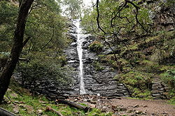 |
Silverband Falls Silverband Falls The Silverband Falls are waterfalls located in Grampians National Park, Victoria, Australia.The Falls are fed by Dairy Creek. A narrow band of water tumbles over a small rock face and then disappears into a rocky base... |
Victoria Victoria (Australia) Victoria is the second most populous state in Australia. Geographically the smallest mainland state, Victoria is bordered by New South Wales, South Australia, and Tasmania on Boundary Islet to the north, west and south respectively.... |
Grampians National Park Grampians National Park The Grampians National Park is a national park in Victoria, Australia, 235 kilometres west of Melbourne. The Park was listed on the Australian National Heritage List on 15 December 2006 for its outstanding natural beauty and being one of the richest indigenous rock art sites in south-eastern... |
37°9′9.56"S 142°31′39.7"E | ||
| Steavenson Falls Steavenson Falls Steavenson Falls are one of the tallest in Victoria, with 5 cascades, a total descent of 122 metres, the last having a clear drop of more than 21 metres.... |
Victoria Victoria (Australia) Victoria is the second most populous state in Australia. Geographically the smallest mainland state, Victoria is bordered by New South Wales, South Australia, and Tasmania on Boundary Islet to the north, west and south respectively.... |
near Marysville Marysville, Victoria Marysville is a small town, 34 kilometres north-east of Healesville, in the Shire of Murrindindi in Victoria, Australia. The town, which previously had a population of around 500 people, was devastated by the Murrindindi Mill bushfire on 7 February 2009. On 19 February 2009 the official death toll... |
122 metres (400.3 ft) | 37.5327°S 145.7737°E | ||
| Stevenson Falls | Victoria Victoria (Australia) Victoria is the second most populous state in Australia. Geographically the smallest mainland state, Victoria is bordered by New South Wales, South Australia, and Tasmania on Boundary Islet to the north, west and south respectively.... |
Otway Forest Park, near Barramunga | 38.552461°N 143.657227°W | |||
| Straw Falls | Victoria Victoria (Australia) Victoria is the second most populous state in Australia. Geographically the smallest mainland state, Victoria is bordered by New South Wales, South Australia, and Tasmania on Boundary Islet to the north, west and south respectively.... |
Great Otway National Park, Angahook section | ||||
| Toorongo Falls Toorongo Falls Reserve The Toorongo Falls Reserve protects two waterfalls on the Toorongo River and the Little Toorongo River in Gippsland, Victoria, Australia. It is located approximately north-east of the town of Noojee, approximately east of Melbourne.-Flora and fauna:... |
Victoria Victoria (Australia) Victoria is the second most populous state in Australia. Geographically the smallest mainland state, Victoria is bordered by New South Wales, South Australia, and Tasmania on Boundary Islet to the north, west and south respectively.... |
Noojee | 37°50′57"S 146°2′46"E | |||
| Triplet Falls Triplet Falls Triplet Falls are waterfalls located in the Great Otway National Park, Victoria, Australia. The Falls are fed by the Young Creek and as the name suggests there are three falls that cascade over a lush rainforest to the floor of the valley... |
Victoria Victoria (Australia) Victoria is the second most populous state in Australia. Geographically the smallest mainland state, Victoria is bordered by New South Wales, South Australia, and Tasmania on Boundary Islet to the north, west and south respectively.... |
Great Otway National Park, Marreeyn section | 38.659242°N 143.493805°W | |||
| Wannon Falls Wannon Falls Wannon Falls are waterfalls located in the Southern Grampians Shire, 19 km west of Hamilton, Victoria, Australia. The Falls are fed by the Wannon River that has its head waters in the Grampians mountains. The Falls plunge over a lava basalt cliff dropping into a large pool 30 metres below.... |
Victoria Victoria (Australia) Victoria is the second most populous state in Australia. Geographically the smallest mainland state, Victoria is bordered by New South Wales, South Australia, and Tasmania on Boundary Islet to the north, west and south respectively.... |
near Coleraine Coleraine Coleraine is a large town near the mouth of the River Bann in County Londonderry, Northern Ireland. It is northwest of Belfast and east of Derry, both of which are linked by major roads and railway connections... |
37.676263°N 141.840835°W | |||
| Won Wondha Falls | Victoria Victoria (Australia) Victoria is the second most populous state in Australia. Geographically the smallest mainland state, Victoria is bordered by New South Wales, South Australia, and Tasmania on Boundary Islet to the north, west and south respectively.... |
Great Otway National Park, Angahook section | ||||
| Baden Powell Water Spout | Western Australia Western Australia Western Australia is a state of Australia, occupying the entire western third of the Australian continent. It is bounded by the Indian Ocean to the north and west, the Great Australian Bight and Indian Ocean to the south, the Northern Territory to the north-east and South Australia to the south-east... |
Murray River near Dwellingup Dwellingup, Western Australia Dwellingup is a town in Western Australia, located in a timber and fruitgrowing area in the Darling Range east-south-east of Pinjarra. At the 2006 census, Dwellingup had a population of 346.-Name:... |
||||
| Big Mertens Falls | Western Australia Western Australia Western Australia is a state of Australia, occupying the entire western third of the Australian continent. It is bounded by the Indian Ocean to the north and west, the Great Australian Bight and Indian Ocean to the south, the Northern Territory to the north-east and South Australia to the south-east... |
Mitchell Plateau in the Kimberley | ||||
| Beedalup Falls | Western Australia Western Australia Western Australia is a state of Australia, occupying the entire western third of the Australian continent. It is bounded by the Indian Ocean to the north and west, the Great Australian Bight and Indian Ocean to the south, the Northern Territory to the north-east and South Australia to the south-east... |
Beedalup National Park near Pemberton Pemberton, Western Australia Pemberton is a town located in the South West region of Western Australia, named after the early settler Pemberton Walcott. It is the home of the karri tree, the largest tree in Western Australia and the third largest hardwood tree in the world... |
||||
| Black Rock Falls | Western Australia Western Australia Western Australia is a state of Australia, occupying the entire western third of the Australian continent. It is bounded by the Indian Ocean to the north and west, the Great Australian Bight and Indian Ocean to the south, the Northern Territory to the north-east and South Australia to the south-east... |
near Kununurra Kununurra, Western Australia Kununurra is a town in far northern Western Australia located at the eastern extremity of the Kimberley Region approximately from the border with the Northern Territory. Kununurra was initiated to service the Ord River Irrigation scheme.... |
||||
| The Cascades | Western Australia Western Australia Western Australia is a state of Australia, occupying the entire western third of the Australian continent. It is bounded by the Indian Ocean to the north and west, the Great Australian Bight and Indian Ocean to the south, the Northern Territory to the north-east and South Australia to the south-east... |
Gloucester National Park Gloucester National Park Gloucester National Park is a national park in Western Australia , 281 km south of Perth and about 3 km from Pemberton, Western Australia.... |
||||
| Eagle Rock Falls | Western Australia Western Australia Western Australia is a state of Australia, occupying the entire western third of the Australian continent. It is bounded by the Indian Ocean to the north and west, the Great Australian Bight and Indian Ocean to the south, the Northern Territory to the north-east and South Australia to the south-east... |
near Newman Newman, Western Australia Newman, located about 1186 km north of Perth and 9 km north of the Tropic of Capricorn, is a town in the Pilbara region. It can be reached by the Great Northern Highway... |
||||
| Fernhook Falls | Western Australia Western Australia Western Australia is a state of Australia, occupying the entire western third of the Australian continent. It is bounded by the Indian Ocean to the north and west, the Great Australian Bight and Indian Ocean to the south, the Northern Territory to the north-east and South Australia to the south-east... |
|||||
| Fortescue Falls | Western Australia Western Australia Western Australia is a state of Australia, occupying the entire western third of the Australian continent. It is bounded by the Indian Ocean to the north and west, the Great Australian Bight and Indian Ocean to the south, the Northern Territory to the north-east and South Australia to the south-east... |
Karijini National Park Karijini National Park Karijini National Park is a National Park centred in the Hamersley Ranges of the Pilbara region in northwestern Western Australia . It is just north of the Tropic of Capricorn, approximately 1055 km from the State's capital city, Perth... |
||||
| Gladstone Falls | Western Australia Western Australia Western Australia is a state of Australia, occupying the entire western third of the Australian continent. It is bounded by the Indian Ocean to the north and west, the Great Australian Bight and Indian Ocean to the south, the Northern Territory to the north-east and South Australia to the south-east... |
|||||
| Hovea Falls | Western Australia Western Australia Western Australia is a state of Australia, occupying the entire western third of the Australian continent. It is bounded by the Indian Ocean to the north and west, the Great Australian Bight and Indian Ocean to the south, the Northern Territory to the north-east and South Australia to the south-east... |
John Forrest National Park John Forrest National Park John Forrest National Park is a national park in the Darling Scarp, 24 km east of Perth, Western Australia. It was the first national park in Western Australia and the second in Australia after Royal National Park.- Name :... |
||||
| Joffre Falls | Western Australia Western Australia Western Australia is a state of Australia, occupying the entire western third of the Australian continent. It is bounded by the Indian Ocean to the north and west, the Great Australian Bight and Indian Ocean to the south, the Northern Territory to the north-east and South Australia to the south-east... |
Karijini National Park Karijini National Park Karijini National Park is a National Park centred in the Hamersley Ranges of the Pilbara region in northwestern Western Australia . It is just north of the Tropic of Capricorn, approximately 1055 km from the State's capital city, Perth... |
||||
| Kalamina Falls | Western Australia Western Australia Western Australia is a state of Australia, occupying the entire western third of the Australian continent. It is bounded by the Indian Ocean to the north and west, the Great Australian Bight and Indian Ocean to the south, the Northern Territory to the north-east and South Australia to the south-east... |
Karijini National Park Karijini National Park Karijini National Park is a National Park centred in the Hamersley Ranges of the Pilbara region in northwestern Western Australia . It is just north of the Tropic of Capricorn, approximately 1055 km from the State's capital city, Perth... |
||||
| King George Falls | Western Australia Western Australia Western Australia is a state of Australia, occupying the entire western third of the Australian continent. It is bounded by the Indian Ocean to the north and west, the Great Australian Bight and Indian Ocean to the south, the Northern Territory to the north-east and South Australia to the south-east... |
King George River | ||||
| Kings Cascade | Western Australia Western Australia Western Australia is a state of Australia, occupying the entire western third of the Australian continent. It is bounded by the Indian Ocean to the north and west, the Great Australian Bight and Indian Ocean to the south, the Northern Territory to the north-east and South Australia to the south-east... |
Prince Regent River Prince Regent River The Prince Regent River is a river in the Kimberley of Western Australia.The headwaters of the river rise in the Caroline Range near Mount Agnes then flow in a north westerly direction... near Wyndham Wyndham, Western Australia Wyndham is the oldest and northernmost town in the Kimberley region of Western Australia, located on the Great Northern Highway, northeast of Perth. It was established in 1885 as a result of a gold rush at Halls Creek, and it is now a port and service centre for the east Kimberley with a... |
||||
| Lane-Poole Falls | Western Australia Western Australia Western Australia is a state of Australia, occupying the entire western third of the Australian continent. It is bounded by the Indian Ocean to the north and west, the Great Australian Bight and Indian Ocean to the south, the Northern Territory to the north-east and South Australia to the south-east... |
Northcliffe Northcliffe, Western Australia Northcliffe is a town located in the lower South West region of Western Australia, about south of the town of Pemberton. At the 2006 census, Northcliffe had a population of 412.... |
34.696391°S 116.250286°E | |||
| Lesmurdie Falls | Western Australia Western Australia Western Australia is a state of Australia, occupying the entire western third of the Australian continent. It is bounded by the Indian Ocean to the north and west, the Great Australian Bight and Indian Ocean to the south, the Northern Territory to the north-east and South Australia to the south-east... |
Lesmurdie Falls National Park Lesmurdie Falls National Park Lesmurdie Falls National Park is a national park in Western Australia , 22 km east of Perth.It is located on the western edge of the Darling Scarp and has commanding views of the Swan Coastal Plain, the city of Perth and surrounding suburbs.... |
31.994246°S 116.03425°E | |||
| Marrinup Falls | Western Australia Western Australia Western Australia is a state of Australia, occupying the entire western third of the Australian continent. It is bounded by the Indian Ocean to the north and west, the Great Australian Bight and Indian Ocean to the south, the Northern Territory to the north-east and South Australia to the south-east... |
near Marrinup | ||||
| Mitchell Falls | Western Australia Western Australia Western Australia is a state of Australia, occupying the entire western third of the Australian continent. It is bounded by the Indian Ocean to the north and west, the Great Australian Bight and Indian Ocean to the south, the Northern Territory to the north-east and South Australia to the south-east... |
The Kimberley | 14.81667°S 125.68330°E | |||
| National Park Falls | Western Australia Western Australia Western Australia is a state of Australia, occupying the entire western third of the Australian continent. It is bounded by the Indian Ocean to the north and west, the Great Australian Bight and Indian Ocean to the south, the Northern Territory to the north-east and South Australia to the south-east... |
John Forrest National Park John Forrest National Park John Forrest National Park is a national park in the Darling Scarp, 24 km east of Perth, Western Australia. It was the first national park in Western Australia and the second in Australia after Royal National Park.- Name :... |
||||
| Noble Falls | Western Australia Western Australia Western Australia is a state of Australia, occupying the entire western third of the Australian continent. It is bounded by the Indian Ocean to the north and west, the Great Australian Bight and Indian Ocean to the south, the Northern Territory to the north-east and South Australia to the south-east... |
near Gidgegannup Gidgegannup, Western Australia Gidgegannup is a township northeast of Perth, the capital city of Western Australia. The name Gidgegannup comes from a Noongar word meaning "Place where spears are made", and was first recorded by passing surveyors in 1852.... |
||||
| Quinninup Falls | Western Australia Western Australia Western Australia is a state of Australia, occupying the entire western third of the Australian continent. It is bounded by the Indian Ocean to the north and west, the Great Australian Bight and Indian Ocean to the south, the Northern Territory to the north-east and South Australia to the south-east... |
near Yallingup Yallingup, Western Australia Yallingup is a town in the South West region of Western Australia, south of Perth. Yallingup is a popular tourist destination because of its beaches and limestone caves, and proximity to Leeuwin-Naturaliste National Park.-History and industry:... |
||||
| Serpentine Falls | Western Australia Western Australia Western Australia is a state of Australia, occupying the entire western third of the Australian continent. It is bounded by the Indian Ocean to the north and west, the Great Australian Bight and Indian Ocean to the south, the Northern Territory to the north-east and South Australia to the south-east... |
Serpentine National Park Serpentine National Park Serpentine National Park is a national park in Western Australia , located on the Darling Scarp, approximately 50 km southeast of Perth.... |
||||
| Spa Pool | Western Australia Western Australia Western Australia is a state of Australia, occupying the entire western third of the Australian continent. It is bounded by the Indian Ocean to the north and west, the Great Australian Bight and Indian Ocean to the south, the Northern Territory to the north-east and South Australia to the south-east... |
Karijini National Park Karijini National Park Karijini National Park is a National Park centred in the Hamersley Ranges of the Pilbara region in northwestern Western Australia . It is just north of the Tropic of Capricorn, approximately 1055 km from the State's capital city, Perth... |
||||
| Paradise Falls Paradise Falls Paradise Falls is a weekly soap opera shown nationally on the Showcase channel in Canada, starting in 2001. It is set in a summer cottage community in Central Ontario.... |
Victoria Victoria (Australia) Victoria is the second most populous state in Australia. Geographically the smallest mainland state, Victoria is bordered by New South Wales, South Australia, and Tasmania on Boundary Islet to the north, west and south respectively.... |
Alpine National Park Alpine National Park The Alpine National Park is a national park in Victoria , northeast of Melbourne. It covers much of the higher areas of the Great Dividing Range in Victoria, including Victoria's highest point, Mount Bogong and the associated subalpine woodland and grassland of the Bogong High Plains... |

