

Little Butte Creek (Rogue River)
Encyclopedia
Little Butte Creek is a 17 miles (27.4 km) long tributary
of the Rogue River
located in the U.S. state
of Oregon
. Its drainage basin
consists of approximately 354 square miles (916.9 km²) of Jackson County
, and another 19 square miles (49.2 km²) in Klamath County
. The north fork of the creek begins at Fish Lake
, while the south fork begins near Brown Mountain
. The two forks flow generally west until they meet near Lake Creek
. The creek then flows through the communities of Brownsboro, Eagle Point
, and White City
, finally emptying into the Rogue River about 3 miles (4.8 km) west of Eagle Point.
Little Butte Creek's watershed was originally settled by the Takelma
, and possibly the Shasta
tribes of Native Americans
. In the Rogue River Wars
of the 1850s, most of the Native Americans were either killed or forced onto Indian reservation
s. Early settlers named Little Butte Creek due to its close proximity to Mount McLoughlin
, formerly known as Snowy Butte. In the late 19th century, the watershed was primarily used for agriculture and lumber. The city of Eagle Point was incorporated
in 1911, and remains the only incorporated town within the watershed's boundaries.
Large amounts of water are diverted from Little Butte Creek to aid in irrigation and water storage. Systems of canals deliver the water to nearby Howard Prairie Lake
and the Klamath River
watershed, Agate Lake
, and the Rogue Valley
.
Despite being moderately polluted, the creek is known to be one of the best salmon producing tributaries of the Rogue River. Coho
and Chinook salmon
migrate
up the creek each year; however, several dams hinder their travel upstream. A fish ladder was built in 2005 to help fish swim past a dam constructed in Eagle Point in the 1880s, but was destroyed by flooding three months later. It was rebuilt in 2008. Plans to restore a 1.3 miles (2.1 km) section of the creek below Eagle Point that was bulldozed in 1955 have also been proposed.
The north fork begins at Fish Lake, near Mount McLoughlin. It flows west, collecting only minor tributaries, before merging with the south fork. The south fork's headwaters
are just south of the 7311 feet (2,228.4 m) tall Brown Mountain. The Pacific Crest Trail
passes through this area. It flows west, receiving Beaver Dam Creek and Dead Indian Creek on the left bank. Beaver Dam Creek drains approximately 28 square miles (72.5 km²), while Dead Indian Creek has a watershed of about 22 square miles (57 km²). The Dead Indian Soda Springs
are located on Dead Indian Creek, about a mile south of its confluence with the south fork. The south fork then turns northwest, collecting water from Lost Creek on the left, near the Lost Creek Bridge
, built in 1919. Lost Creek drains about 17 square miles (44 km²).
Just after the two forks merge about 15 miles (24.1 km) northeast of Medford
, Little Butte Creek receives Lake Creek on the left bank, flowing through the community of the same name at river mile
(RM) 17 or river kilometer (RK) 27. Lake Creek drains 15 square miles (38.8 km²). The creek is crossed by South Fork Little Butte Creek Road in Lake Creek. Water is diverted here into the Joint System Canal to provide irrigation for the Medford region and to fill Agate Lake. A few miles west, it receives Salt Creek and Lick Creek on the right bank, which have watersheds of 17 and 16 sq mi (44 and 41.4 km2), respectively. Oregon Route 140 crosses the creek at RM 10 (RK 16).
The creek turns southwest, flowing through Eagle Point. Two roads span the stream in Eagle Point: East Main Street at RM 5 (RK 8), and Oregon Route 62 at RM 4 (RK 6). Near RM 3 (RK 5), Little Butte Creek receives Antelope Creek on the left. Antelope Creek is its largest tributary, draining 58 square miles (150.2 km²). Agate Lake on Dry Creek is located in the Antelope Creek watershed. At RM 1.5 (RK 2.4) the creek is crossed by Agate Road. It then flows into the Rogue River 132 miles (212.4 km) from its mouth at the Pacific Ocean
. Little Butte Creek's mouth is located approximately 3 miles (4.8 km) south of Eagle Point, and about 1 miles (1.6 km) southeast of Upper Table Rock
, in the Denman Wildlife Area
.
monitored the flow of Little Butte Creek at seven different stream gauge
s: two on the south fork, three on the north fork, and two on the main stem
. The first was opened in 1908 at the newly constructed Fish Lake Dam on the north fork, while the last was opened in 1927 near the Big Elk Ranger Station on the south fork. By 1989, all seven were closed. The data recorded by the lowermost gauges of both forks and the main stem are listed below.
. Farmland accounts for about 32 percent of the total area of the watershed, while 65 percent is forested. The remaining three percent is within the Eagle Point city limits
. Elevations range from 1204 feet (367 m) at the mouth
of the creek to 9495 feet (2,894.1 m) at the summit of Mount McLoughlin, with an average of 3496 feet (1,065.6 m). Forty-eight percent of the watershed is federally owned
, 50 percent is privately owned, and Eagle Point accounts for the remaining two percent. Over 10,000 people live within the watershed's boundaries.
Temperatures average from 90 °F (32.2 °C) in the summer to 20 °F (-6.7 °C) in the winter. The climate in the region is Mediterranean
. The average precipitation
in the area ranges from 19 inches (482.6 mm) in the lower regions to over 50 inches (1,270 mm) in the upper reaches. July through October are the driest months, while December through April are the wettest. Thirty-four percent of the surface runoff
in the watershed is collected from rain, 31 percent from rain on snow, and 35 percent from snowmelt
.
As of 2003, there were 581 water right
s recorded in the watershed, 394 of them for various types of irrigation. 466 water diversions were also recorded. These factors have led to frequent water shortages along the lower portion of the creek. In the summer, many streams in the watershed have more rights to water than there is water in the stream.
The two main geologic regions in the Little Butte Creek watershed are the High Cascades
and the western Cascades
. The western Cascades make up the western two thirds of the watershed, generally below 4800 feet (1,463 m) in elevation. Steep, rugged canyons are common in this region. The lower stretches of the watershed contain soils such as decomposed lava
s, clay
, and gravel
. The High Cascades are located in the eastern third of the watershed, including volcanoes such as Brown Mountain and Mount McLoughlin, and plateau
s made of lava. In some places, streams descend over 300 feet per mile (56.9 m/km). Nearby watersheds include two Rogue River tributaries—Big Butte Creek
to the north and Bear Creek to the south—and small Klamath River
tributaries to the east.
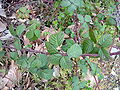
 The flora in the Little Butte Creek watershed is predominately temperate coniferous forest, which makes up approximately 65 percent of the total area. The lower regions are covered with chaparral
, and the upper regions by fir
forests. The chaparral region is inhabited by oak
s such as Garry Oak and California Black Oak, with an understory
of Buckbrush
and Manzanita
. Coast Douglas-fir
, Sugar Pine
, Ponderosa Pine
, California Incense-cedar
, and White Fir are the most common trees found in the mixed coniferous forest. Shasta Red Fir, White Fir, and the Noble Fir grow in the higher elevations of the watershed. Mountain Hemlock, Lodgepole Pine
, Sitka Mountain-ash
, and Squashberry
also grow in this region. Chinquapin
can be found around Fish Lake. The most common species of plants above 6000 feet (1,829 m) near the tree line on Mount McLoughlin and Brown Mountain include Whitebark Pine
, Mountain Hemlock, Coast Range Supalpine Fir, Heather
, and Mountain Heather
.
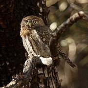
Many species of birds have been spotted in the Little Butte Creek region. Twenty-two species are known to breed
in the chaparral region, including several species of wren
s, blackbird
s, and sparrow
s. The mixed coniferous forest is home to White-headed Woodpecker
s, Pygmy Nuthatch
es, Green-tailed Towhee
s, Northern Pygmy-owls, Vaux's Swift
s, Winter Wren
s, and MacGillivray's Warbler
s. The American Coot
has also been spotted in several places along the creek. Williamson's Sapsucker
s, Black-backed Woodpecker
s, Gray Jay
s, and Hermit Warbler
s frequent the higher elevations. The near threatened
Olive-sided Flycatcher
and Cassin's Finch
also live in this area. The Eurasian Three-toed Woodpecker
and Clark's Nutcracker
have been spotted near the tree line. The endangered
Townsend's big-eared bat
is also known to live in the watershed.
Little Butte Creek is known to be one of the best salmon producing tributaries of the Rogue River, and is also one of only a few streams in the Upper Rogue watershed to support salmon populations. The most common anadromous fish
inhabiting the creek include Chinook salmon
, Coho salmon
, and sea-run cutthroat trout
. Coho salmon are federally listed as a threatened species
, and are known to spawn
in 46 miles (74 km) of streams in the Little Butte Creek watershed. The estimated population of Coho salmon in the creek was 35,131 in 2002. Resident fish include cutthroat trout
, sculpins
, rainbow trout
, and brook trout
.
, and possibly the Shasta
tribe of Native American
s. By the 1850s, the land was primarily used for agriculture
and lumber
in the upper regions. The first European American
settlers arrived in the Eagle Point region in 1852. Little Butte Creek was named by the early settlers for its close proximity to Mount McLoughlin (also known as Snowy Butte), as was nearby Big Butte Creek. Due to conflicts
with the Rogue River Indians
, Major J. A. Lupton gathered 35 men from Jacksonville
on October 8, 1855, and attacked the Native Americans near the mouth of Little Butte Creek, killing about 30 of them. Lupton was also killed, and eleven of his men were injured. On December 24 of the same year, Captain Miles Alcorn discovered and attacked a Native American camp on the north fork, killing eight. On Christmas
the following day, another band of Native Americans were attacked near Little Butte Creek's mouth; some fled, while the rest were either captured or killed.
A sawmill
was built on the north fork in the 1870s. In 1901, the Sunnyside Hotel was built by Alfred Howlett on the banks of the creek in Eagle Point. Eagle Point was later incorporated
in 1911, and remains the only incorporated town in the watershed. In 1917, manganese
ore was discovered near the confluence of the south fork of Little Butte Creek and its tributary Lost Creek. Mined nodules
weighed up to 50 lbs, consisting of approximately 55 percent manganese. Cinnabar
was also discovered in the area. In 1922, the 58 feet (17.7 m) long Antelope Creek Covered Bridge
was constructed on Antelope Creek. It was moved to Little Butte Creek in Eagle Point in 1987.
and to supplement Bear Creek, both roughly 15 miles (24.1 km) to the southwest. In the late 19th century, many orchard
s were planted near Ashland
. They were initially irrigated by Bear Creek, however, there was not enough water to satisfy the orchards' needs. In 1898, the Fish Lake Water Company was established to correct the situation. The company proposed to create Fourmile Lake
and enlarge Fish Lake by impounding Fourmile Creek and the north fork of Little Butte Creek, respectively, and connecting them via the Cascade Canal
. Construction of the temporary Fish Lake Dam began in 1902. Around this time, construction of the Joint System Canal to the west also began. Construction of Fourmile Lake Dam started in 1906, along with the Cascade Canal. Many other small canals, such as Hopkins Canal and the Medford Canal, were also built in the Rogue Valley around this time. Fish Lake Dam was completed in 1908, creating the 7836 acre.ft reservoir.
The Cascade Canal was completed in 1915, delivering about 5462 acre.ft of water from Fourmile Lake in the Klamath River watershed 4.5 miles (7.2 km) to Fish Lake in the Rogue River Watershed. The temporary Fish Lake Dam was also replaced by a permanent earthfill dam
. It was later modified in 1922 and 1955. In 1996 an auxiliary spillway
was added. The dam stands 50 feet (15.2 m) high and has a length of 960 feet (292.6 m).
In 1956, the United States Bureau of Reclamation
awarded a contract to Lord Brothers, from Portland, Oregon
, to build the Deadwood Tunnel. The tunnel was finished in 1957. Howard Prairie Lake
was completed in 1958, and is located about 18 miles (29 km) east of Ashland. Excess water is diverted from the south fork, Beaver Dam Creek, and two of its tributaries 8.6 miles (13.8 km) south into the Deadwood Tunnel to supplement the lake and the surrounding regions. Dead Indian Creek is also diverted into Howard Prairie Lake. About 21.4 ft3/s annually, or about 16500 acre.ft, was diverted into the Klamath River watershed between 1962 and 1999.
The Howard Prairie Delivery Canal was completed in 1959, along with Keene Creek Reservoir, Cascade Tunnel, and Greensprings Tunnel. Water from Howard Prairie Lake is diverted into the canal west to Keene Creek Reservoir, about 16 miles (25.7 km) east of Ashland. Nearby Hyatt Reservoir
also provides water. It is then piped through the 1 miles (1.6 km) long Cascade Tunnel to the Greensprings Power Plant, which generates about 18 megawatts of power. Afterward, the water is conveyed from the power plant 2 miles (3.2 km) through the Greensprings Tunnel into Emigrant Creek, a tributary of Bear Creek. An average of approximately 38620 acre.ft of water flows through the tunnel. The water eventually ends up in Emigrant Lake, about 8 miles (12.9 km) southeast of Ashland, where it either continues along Bear Creek, or is diverted for irrigation.
was built in the 1880s to provide water for the turbine
that powers the mill. This dam has been rated as the fifth worst fish barrier in the watershed. In 2005, the Rogue Basin Fish Access Team built a $250,000 concrete fish ladder
to allow fish past the dam. A small weir
made of boulders was built at the base of the ladder creating a 9 inches (22.9 cm) jump between the creek and the ladder, however the boulders were washed away in a severe storm just three months later, making the distance between them over 2 foot (0.6096 m). The weir was rebuilt in 2008 for about $122,500. This time, it was built with concrete instead of boulders.
The mill is now included on the National Register of Historic Places
, and is the only gristmill
in Oregon to still grind flour
. It is also the oldest water-powered gristmill west of the Mississippi River
.
, and the meander
s in Little Butte Creek between Eagle Point and the Rogue River were blamed for severe erosion
in the region. The 1.3 miles (2.1 km) section of the creek was subsequently bulldozed and straightened in the late 1950s and early 1960s. The straightness of the creek forced water downward instead of outward, scouring the stream bed
down to bedrock
, creating an unsuitable habitat for wild salmon. In 2007, a plan to recreate the old meanders of the creek and extend it by half a mile (0.8 km) was proposed. It involves building riffle
s, engineered log jam
s, and adding boulders, and is predicted to cost around $550,000. The project is expected to be completed as early as the mid-2011.
 The Oregon Department of Environmental Quality
(DEQ) has monitored Little Butte Creek for eight different parameters that affect water quality: temperature, oxygen saturation
, pH
, nutrient
s, bacteria
, chemical contaminants such as pesticide
s and metal
s, turbidity
, and alkalinity
. Streams that exceed the standard level are then placed on the DEQ 303d list in accordance with the Clean Water Act
. About 40 percent of the streams in the Little Butte Creek watershed were listed on the 2002 DEQ 303d list. The entire mainstem exceeded the standard level for temperature, oxygen saturation, fecal coliforms
(bacteria), and turbidity. The lower 6.5 miles (10.5 km) of the north fork were listed for high temperature and elevated levels of Escherichia coli
(E. coli), while the upper region was affected by chlorophyll a
and pH levels. The south fork was listed for turbidity and temperature.
Overall, high temperature is the most common problem in the Little Butte Creek watershed. This is most likely caused by depleted riparian zone
s and water diversion. High temperature can be very harmful to anadromous fish. High concentration of bacteria is also an issue. Approximately 53 percent of riparian zones in the watershed are depleted due to agriculture or deforestation
, while 43 percent are classified as healthy. Another threat to healthy riparian zones are invasive
blackberries
, which provide little shade. In 2003, the Little Butte Creek Watershed Council rated the health of the Little Butte Creek watershed on a scale of 1 (slightly degraded) to 5 (severely degraded). Overall, the watershed received 2.95, or moderately degraded.
On the Oregon Water Quality Index (OWQI) used by DEQ, water quality scores can vary from 10 (worst) to 100 (ideal). The average for Little Butte Creek at RM 1.4 (RK 2.3) between 1998 and 2007 was 72 (poor) in the summer and 82 (fair) in the fall, winter, and spring.
. Popular activities in and around Fish Lake include fishing, swimming, and boating. Two campground
s are located on the banks of the lake: Doe Point and the Fish Lake Resort. Several trails in the area lead to the much larger Pacific Crest Trail. During the winter, two snowparks
are located on Oregon Route 140.
The Eagle Point Golf Course is located in the watershed, built in 1995 by the world renowned golf course architect Robert Trent Jones, Jr.
Another course, Stone Ridge Golf Course, is near Agate Lake. The Butte Creek Mill and the Antelope and Lost Creek covered bridges are also popular attractions. Several historic structures can be found in Eagle Point, including the Eagle Point Museum, built in 1925 as the Long Mountain School, and the Walter Wood House, constructed in 1879. The Denman Wildlife Area
is located at the mouth of Little Butte Creek, as is nearby TouVelle State Park
.
Tributary
A tributary or affluent is a stream or river that flows into a main stem river or a lake. A tributary does not flow directly into a sea or ocean...
of the Rogue River
Rogue River (Oregon)
The Rogue River in southwestern Oregon in the United States flows about in a generally westward direction from the Cascade Range to the Pacific Ocean. Known for its salmon runs, whitewater rafting, and rugged scenery, it was one of the original eight rivers named in the Wild and Scenic Rivers Act...
located in the U.S. state
U.S. state
A U.S. state is any one of the 50 federated states of the United States of America that share sovereignty with the federal government. Because of this shared sovereignty, an American is a citizen both of the federal entity and of his or her state of domicile. Four states use the official title of...
of Oregon
Oregon
Oregon is a state in the Pacific Northwest region of the United States. It is located on the Pacific coast, with Washington to the north, California to the south, Nevada on the southeast and Idaho to the east. The Columbia and Snake rivers delineate much of Oregon's northern and eastern...
. Its drainage basin
Drainage basin
A drainage basin is an extent or an area of land where surface water from rain and melting snow or ice converges to a single point, usually the exit of the basin, where the waters join another waterbody, such as a river, lake, reservoir, estuary, wetland, sea, or ocean...
consists of approximately 354 square miles (916.9 km²) of Jackson County
Jackson County, Oregon
-National protected areas:* Cascade–Siskiyou National Monument* Crater Lake National Park * Klamath National Forest * Rogue River-Siskiyou National Forest * Umpqua National Forest -Demographics:...
, and another 19 square miles (49.2 km²) in Klamath County
Klamath County, Oregon
-National protected areas:* Bear Valley National Wildlife Refuge* Crater Lake National Park * Deschutes National Forest * Fremont National Forest * Klamath Marsh National Wildlife Refuge* Lower Klamath National Wildlife Refuge...
. The north fork of the creek begins at Fish Lake
Fish Lake (Jackson County, Oregon)
Fish Lake is a reservoir located above sea level in Jackson County, Oregon, United States. It is northeast of Medford.Originally a natural lake, it was enlarged by the tall Fish Lake Dam, which impounds the north fork of Little Butte Creek, in the Rogue River watershed.-Geology:Fish Lake is...
, while the south fork begins near Brown Mountain
Brown Mountain (Klamath County, Oregon)
Brown Mountain is a small cinder cone on top of a shield volcano located in Cascade Volcanic Arc in Klamath and Jackson counties, Oregon. Most of the mountain, including its peak, is in western Klamath County, but its western flanks trail off into eastern Jackson County...
. The two forks flow generally west until they meet near Lake Creek
Lake Creek, Oregon
Lake Creek is an unincorporated community located approximately 20 miles east of Medford, in Jackson County, Oregon, United States. The community takes its name from an important local stream.The shortest covered bridge in Oregon is located near Lake Creek...
. The creek then flows through the communities of Brownsboro, Eagle Point
Eagle Point, Oregon
Eagle Point is a city in Jackson County, Oregon, United States. The population was 8,469 at the 2010 census.-Geography:According to the United States Census Bureau, the city has a total area of , all of it land.-2000 Census data:...
, and White City
White City, Oregon
White City is an unincorporated community in Jackson County, Oregon, United States. For statistical purposes, the United States Census Bureau has defined White City as a census-designated place . The census definition of the area may not precisely correspond to local understanding of the area with...
, finally emptying into the Rogue River about 3 miles (4.8 km) west of Eagle Point.
Little Butte Creek's watershed was originally settled by the Takelma
Takelma
The Takelma were a Native American people that lived in the Rogue Valley of interior southwest Oregon, with most of their villages sited along the Rogue River. The name Takelma means Along the River.-History:...
, and possibly the Shasta
Shasta (tribe)
The Shasta are an indigenous people of Northern California and Southern Oregon in the United States. They spoke one of the Shastan languages....
tribes of Native Americans
Indigenous peoples of the Americas
The indigenous peoples of the Americas are the pre-Columbian inhabitants of North and South America, their descendants and other ethnic groups who are identified with those peoples. Indigenous peoples are known in Canada as Aboriginal peoples, and in the United States as Native Americans...
. In the Rogue River Wars
Rogue River Wars
The Rogue River Wars was an armed conflict between the US Army, local militias and volunteers, and the Native American tribes commonly grouped under the designation of Rogue River Indians, in the Rogue River Valley area of what today is southern Oregon in 1855–56...
of the 1850s, most of the Native Americans were either killed or forced onto Indian reservation
Indian reservation
An American Indian reservation is an area of land managed by a Native American tribe under the United States Department of the Interior's Bureau of Indian Affairs...
s. Early settlers named Little Butte Creek due to its close proximity to Mount McLoughlin
Mount McLoughlin
Mount McLoughlin is a steep-sided lava cone built on top of a shield volcano in the Cascade Range of southern Oregon and within the Sky Lakes Wilderness area. It is one of the volcanic peaks in the Cascade Volcanic Arc. The mountain is north of Mount Shasta, south of Crater Lake, and west of Upper...
, formerly known as Snowy Butte. In the late 19th century, the watershed was primarily used for agriculture and lumber. The city of Eagle Point was incorporated
Municipal corporation
A municipal corporation is the legal term for a local governing body, including cities, counties, towns, townships, charter townships, villages, and boroughs. Municipal incorporation occurs when such municipalities become self-governing entities under the laws of the state or province in which...
in 1911, and remains the only incorporated town within the watershed's boundaries.
Large amounts of water are diverted from Little Butte Creek to aid in irrigation and water storage. Systems of canals deliver the water to nearby Howard Prairie Lake
Howard Prairie Lake
Howard Prairie Lake is a reservoir located above sea level in Jackson County, Oregon, United States. It is east of Ashland. The lake is formed by the tall Howard Prairie Dam, which impounds Beaver Creek, in the Klamath River watershed.-History:...
and the Klamath River
Klamath River
The Klamath River is an American river that flows southwest through Oregon and northern California, cutting through the Cascade Range to empty into the Pacific Ocean. The river drains an extensive watershed of almost that stretches from the high desert country of the Great Basin to the temperate...
watershed, Agate Lake
Agate Lake
Agate Lake is a reservoir located above sea level in Jackson County, Oregon, United States. It is northeast of Medford,just north of Roxy Ann Peak...
, and the Rogue Valley
Rogue Valley
The Rogue Valley is a farming and timber-producing region in southwestern Oregon in the United States. Located along the middle Rogue River and its tributaries in Josephine and Jackson counties, the valley forms the cultural and economic heart of Southern Oregon near the California border. The...
.
Despite being moderately polluted, the creek is known to be one of the best salmon producing tributaries of the Rogue River. Coho
Coho salmon
The Coho salmon, Oncorhynchus kisutch, is a species of anadromous fish in the salmon family. Coho salmon are also known as silver salmon or "silvers". It is the state animal of Chiba, Japan.-Description:...
and Chinook salmon
Chinook salmon
The Chinook salmon, Oncorhynchus tshawytscha, is the largest species in the pacific salmon family. Other commonly used names for the species include King salmon, Quinnat salmon, Spring salmon and Tyee salmon...
migrate
Fish migration
Many types of fish migrate on a regular basis, on time scales ranging from daily to annually or longer, and over distances ranging from a few metres to thousands of kilometres...
up the creek each year; however, several dams hinder their travel upstream. A fish ladder was built in 2005 to help fish swim past a dam constructed in Eagle Point in the 1880s, but was destroyed by flooding three months later. It was rebuilt in 2008. Plans to restore a 1.3 miles (2.1 km) section of the creek below Eagle Point that was bulldozed in 1955 have also been proposed.
Course
Little Butte Creek begins in the Cascade Range near Mount McLoughlin and Brown Mountain. It flows generally west over approximately 17 miles (27.4 km) to its confluence with the Rogue River. There are two main forks of Little Butte Creek: the north fork and the south fork. The south fork of the creek drops from 5713 feet (1,741.3 m) above sea level at its source, the north fork from 4638 feet (1,413.7 m). They meet each other at 1647 feet (502 m). The creek's mouth is located at 1204 feet (367 m). Overall, Little Butte Creek drops approximately 25 feet per mile (4.8 m/km).The north fork begins at Fish Lake, near Mount McLoughlin. It flows west, collecting only minor tributaries, before merging with the south fork. The south fork's headwaters
Source (river or stream)
The source or headwaters of a river or stream is the place from which the water in the river or stream originates.-Definition:There is no universally agreed upon definition for determining a stream's source...
are just south of the 7311 feet (2,228.4 m) tall Brown Mountain. The Pacific Crest Trail
Pacific Crest Trail
The Pacific Crest Trail is a long-distance mountain hiking and equestrian trail on the Western Seaboard of the United States. The southern terminus is at the California border with Mexico...
passes through this area. It flows west, receiving Beaver Dam Creek and Dead Indian Creek on the left bank. Beaver Dam Creek drains approximately 28 square miles (72.5 km²), while Dead Indian Creek has a watershed of about 22 square miles (57 km²). The Dead Indian Soda Springs
Dead Indian Soda Springs
The Dead Indian Soda Springs are an assortment of small mineral springs that feed into Dead Indian Creek near Eagle Point, Oregon, United States...
are located on Dead Indian Creek, about a mile south of its confluence with the south fork. The south fork then turns northwest, collecting water from Lost Creek on the left, near the Lost Creek Bridge
Lost Creek Bridge
The Lost Creek Bridge is a wooden covered bridge located near Lake Creek, Oregon, United States, about 15 miles ENE of Medford. The bridge is about 11.89 meters long, making it the shortest covered bridge in Oregon....
, built in 1919. Lost Creek drains about 17 square miles (44 km²).
Just after the two forks merge about 15 miles (24.1 km) northeast of Medford
Medford, Oregon
Medford is a city in Jackson County, Oregon, United States. As of the 2010 US Census, the city had a total population of 74,907 and a metropolitan area population of 207,010, making the Medford MSA the 4th largest metro area in Oregon...
, Little Butte Creek receives Lake Creek on the left bank, flowing through the community of the same name at river mile
River mile
In the United States, a River mile is a measure of distance in miles along a river from its mouth. River mile numbers begin at zero and increase further upstream. The corresponding metric unit using kilometers is the River kilometer...
(RM) 17 or river kilometer (RK) 27. Lake Creek drains 15 square miles (38.8 km²). The creek is crossed by South Fork Little Butte Creek Road in Lake Creek. Water is diverted here into the Joint System Canal to provide irrigation for the Medford region and to fill Agate Lake. A few miles west, it receives Salt Creek and Lick Creek on the right bank, which have watersheds of 17 and 16 sq mi (44 and 41.4 km2), respectively. Oregon Route 140 crosses the creek at RM 10 (RK 16).
The creek turns southwest, flowing through Eagle Point. Two roads span the stream in Eagle Point: East Main Street at RM 5 (RK 8), and Oregon Route 62 at RM 4 (RK 6). Near RM 3 (RK 5), Little Butte Creek receives Antelope Creek on the left. Antelope Creek is its largest tributary, draining 58 square miles (150.2 km²). Agate Lake on Dry Creek is located in the Antelope Creek watershed. At RM 1.5 (RK 2.4) the creek is crossed by Agate Road. It then flows into the Rogue River 132 miles (212.4 km) from its mouth at the Pacific Ocean
Pacific Ocean
The Pacific Ocean is the largest of the Earth's oceanic divisions. It extends from the Arctic in the north to the Southern Ocean in the south, bounded by Asia and Australia in the west, and the Americas in the east.At 165.2 million square kilometres in area, this largest division of the World...
. Little Butte Creek's mouth is located approximately 3 miles (4.8 km) south of Eagle Point, and about 1 miles (1.6 km) southeast of Upper Table Rock
Upper and Lower Table Rock
Upper Table Rock and Lower Table Rock are two prominent volcanic plateaus located just north of the Rogue River in Jackson County, Oregon. Created by an andesitic lava flow approximately seven million years ago and shaped by erosion, they now stand about above the surrounding valley...
, in the Denman Wildlife Area
Denman Wildlife Area
The Denman Wildlife Area is a wildlife management area located near Eagle Point, Oregon, in the United States...
.
Discharge
The United States Geological SurveyUnited States Geological Survey
The United States Geological Survey is a scientific agency of the United States government. The scientists of the USGS study the landscape of the United States, its natural resources, and the natural hazards that threaten it. The organization has four major science disciplines, concerning biology,...
monitored the flow of Little Butte Creek at seven different stream gauge
Stream gauge
A stream gauge, stream gage or gauging station is a location used by hydrologists or environmental scientists to monitor and test terrestrial bodies of water. Hydrometric measurements of water surface elevation and/or volumetric discharge are generally taken and observations of biota may also be...
s: two on the south fork, three on the north fork, and two on the main stem
Main Stem
"Main Stem" is 1942 instrumental by Duke Ellington and His Famous Orchestra. Although recorded in 1942, the single would not be released until 1944 where it was Duke Ellington's last of four number one's on the Harlem Hit Parade. "Main Stem" would also peak at number twenty on the pop chart"Main...
. The first was opened in 1908 at the newly constructed Fish Lake Dam on the north fork, while the last was opened in 1927 near the Big Elk Ranger Station on the south fork. By 1989, all seven were closed. The data recorded by the lowermost gauges of both forks and the main stem are listed below.
| Location | Drainage basin | Years recorded | Average flow | Maximum flow | Minimum flow | |
|---|---|---|---|---|---|---|
| North fork | 1 miles (1.6 km) above mouth | 52 sq mi (135 km²) | 1922–1931 | 57 ft3/s | 1750 ft3/s (December 22, 1964) |
0 ft3/s (14 months in 1922–1968) |
| South fork | 1 miles (1.6 km) above mouth | 138 sq mi (357 km²) | 1922–1982 | 97.3 ft3/s | 6280 ft3/s (May 25, 1942) |
3 ft3/s (July–August 1931) |
| Mainstem | RM 4 (RK 6.5) | 293 sq mi (759 km²) | 1908–1950 | 232.3 ft3/s | 10000 ft3/s (January 7, 1948) |
5.8 ft3/s (June 6, 1926) |
Watershed
Little Butte Creek drains approximately 373 square miles (966.1 km²) of southern OregonSouthern Oregon
Southern Oregon is a region of the U.S. state of Oregon south of Lane County and generally west of the Cascade Range, excluding the southern Oregon Coast. Counties include Douglas, Jackson, Klamath, and Josephine. It includes the Southern Oregon American Viticultural Area, which consists of the...
. Farmland accounts for about 32 percent of the total area of the watershed, while 65 percent is forested. The remaining three percent is within the Eagle Point city limits
City limits
The terms city limits and city boundary refer to the defined boundary or border of a city. The area within the city limits is sometimes called the city proper. The terms town limits/boundary and village limits/boundary mean the same as city limits/boundary, but apply to towns and villages...
. Elevations range from 1204 feet (367 m) at the mouth
Mouth (water stream)
A river mouth or stream mouth is a part of a stream where it flows into another stream, river, lake, reservoir, sea, or ocean.* River delta* Estuary* Liman...
of the creek to 9495 feet (2,894.1 m) at the summit of Mount McLoughlin, with an average of 3496 feet (1,065.6 m). Forty-eight percent of the watershed is federally owned
Federal government of the United States
The federal government of the United States is the national government of the constitutional republic of fifty states that is the United States of America. The federal government comprises three distinct branches of government: a legislative, an executive and a judiciary. These branches and...
, 50 percent is privately owned, and Eagle Point accounts for the remaining two percent. Over 10,000 people live within the watershed's boundaries.
Temperatures average from 90 °F (32.2 °C) in the summer to 20 °F (-6.7 °C) in the winter. The climate in the region is Mediterranean
Mediterranean climate
A Mediterranean climate is the climate typical of most of the lands in the Mediterranean Basin, and is a particular variety of subtropical climate...
. The average precipitation
Precipitation (meteorology)
In meteorology, precipitation In meteorology, precipitation In meteorology, precipitation (also known as one of the classes of hydrometeors, which are atmospheric water phenomena is any product of the condensation of atmospheric water vapor that falls under gravity. The main forms of precipitation...
in the area ranges from 19 inches (482.6 mm) in the lower regions to over 50 inches (1,270 mm) in the upper reaches. July through October are the driest months, while December through April are the wettest. Thirty-four percent of the surface runoff
Surface runoff
Surface runoff is the water flow that occurs when soil is infiltrated to full capacity and excess water from rain, meltwater, or other sources flows over the land. This is a major component of the water cycle. Runoff that occurs on surfaces before reaching a channel is also called a nonpoint source...
in the watershed is collected from rain, 31 percent from rain on snow, and 35 percent from snowmelt
Snowmelt
In hydrology, snowmelt is surface runoff produced from melting snow. It can also be used to describe the period or season during which such runoff is produced. Water produced by snowmelt is an important part of the annual water cycle in many parts of the world, in some cases contributing high...
.
As of 2003, there were 581 water right
Water right
Water right in water law refers to the right of a user to use water from a water source, e.g., a river, stream, pond or source of groundwater. In areas with plentiful water and few users, such systems are generally not complicated or contentious...
s recorded in the watershed, 394 of them for various types of irrigation. 466 water diversions were also recorded. These factors have led to frequent water shortages along the lower portion of the creek. In the summer, many streams in the watershed have more rights to water than there is water in the stream.
The two main geologic regions in the Little Butte Creek watershed are the High Cascades
Cascade Range
The Cascade Range is a major mountain range of western North America, extending from southern British Columbia through Washington and Oregon to Northern California. It includes both non-volcanic mountains, such as the North Cascades, and the notable volcanoes known as the High Cascades...
and the western Cascades
Western Cascades
Portions of this article include public domain text from the USFS .The Western Cascades is a region of Oregon, USA containing many shield volcanoes, cinder cones and lava flows. The region was volcanically active from approximately 5-0.5 million years ago...
. The western Cascades make up the western two thirds of the watershed, generally below 4800 feet (1,463 m) in elevation. Steep, rugged canyons are common in this region. The lower stretches of the watershed contain soils such as decomposed lava
Lava
Lava refers both to molten rock expelled by a volcano during an eruption and the resulting rock after solidification and cooling. This molten rock is formed in the interior of some planets, including Earth, and some of their satellites. When first erupted from a volcanic vent, lava is a liquid at...
s, clay
Clay
Clay is a general term including many combinations of one or more clay minerals with traces of metal oxides and organic matter. Geologic clay deposits are mostly composed of phyllosilicate minerals containing variable amounts of water trapped in the mineral structure.- Formation :Clay minerals...
, and gravel
Gravel
Gravel is composed of unconsolidated rock fragments that have a general particle size range and include size classes from granule- to boulder-sized fragments. Gravel can be sub-categorized into granule and cobble...
. The High Cascades are located in the eastern third of the watershed, including volcanoes such as Brown Mountain and Mount McLoughlin, and plateau
Plateau
In geology and earth science, a plateau , also called a high plain or tableland, is an area of highland, usually consisting of relatively flat terrain. A highly eroded plateau is called a dissected plateau...
s made of lava. In some places, streams descend over 300 feet per mile (56.9 m/km). Nearby watersheds include two Rogue River tributaries—Big Butte Creek
Big Butte Creek
Big Butte Creek is a long tributary of the Rogue River located in the U.S. state of Oregon. It drains approximately of Jackson County. The north fork of the creek begins on Rustler Peak and the south fork's headwaters are near Mount McLoughlin...
to the north and Bear Creek to the south—and small Klamath River
Klamath River
The Klamath River is an American river that flows southwest through Oregon and northern California, cutting through the Cascade Range to empty into the Pacific Ocean. The river drains an extensive watershed of almost that stretches from the high desert country of the Great Basin to the temperate...
tributaries to the east.
Flora and fauna
Chaparral
Chaparral is a shrubland or heathland plant community found primarily in the U.S. state of California and in the northern portion of the Baja California peninsula, Mexico...
, and the upper regions by fir
Fir
Firs are a genus of 48–55 species of evergreen conifers in the family Pinaceae. They are found through much of North and Central America, Europe, Asia, and North Africa, occurring in mountains over most of the range...
forests. The chaparral region is inhabited by oak
Oak
An oak is a tree or shrub in the genus Quercus , of which about 600 species exist. "Oak" may also appear in the names of species in related genera, notably Lithocarpus...
s such as Garry Oak and California Black Oak, with an understory
Understory
Understory is the term for the area of a forest which grows at the lowest height level below the forest canopy. Plants in the understory consist of a mixture of seedlings and saplings of canopy trees together with understory shrubs and herbs...
of Buckbrush
Ceanothus cuneatus
Ceanothus cuneatus is a species of flowering shrub known by the common names Buckbrush and wedgeleaf ceanothus.-Distribution:...
and Manzanita
Arctostaphylos viscida
Arctostaphylos viscida, with the common names Whiteleaf manzanita and Sticky manzanita, is a species of manzanita.-Distribution:...
. Coast Douglas-fir
Coast Douglas-fir
Pseudotsuga menziesii, known as Douglas-fir, Oregon Pine, or Douglas spruce, is an evergreen conifer species native to western North America. Its variety Pseudotsuga menziesii var. menziesii, also known as coast Douglas-fir grows in the coastal regions, from west-central British Columbia, Canada...
, Sugar Pine
Sugar Pine
Pinus lambertiana, commonly known as the sugar pine or sugar cone pine, is the tallest and most massive pine, with the longest cones of any conifer...
, Ponderosa Pine
Ponderosa Pine
Pinus ponderosa, commonly known as the Ponderosa Pine, Bull Pine, Blackjack Pine, or Western Yellow Pine, is a widespread and variable pine native to western North America. It was first described by David Douglas in 1826, from eastern Washington near present-day Spokane...
, California Incense-cedar
Calocedrus
Calocedrus is a genus of three species of coniferous trees in the cypress family Cupressaceae.The generic name means "beautiful cedar".-Description:...
, and White Fir are the most common trees found in the mixed coniferous forest. Shasta Red Fir, White Fir, and the Noble Fir grow in the higher elevations of the watershed. Mountain Hemlock, Lodgepole Pine
Lodgepole Pine
Lodgepole Pine, Pinus contorta, also known as Shore Pine, is a common tree in western North America. Like all pines, it is evergreen.-Subspecies:...
, Sitka Mountain-ash
Sorbus sitchensis
Sorbus sitchensis, also known as Sitka Mountain-ash, is a small shrub of the western United States.-Description:A multistemmed shrub, it is indigenous to the Pacific Coast of North America, from Alaska to northern California and eastward to Idaho and western Montana.The otherwise similar Sorbus...
, and Squashberry
Viburnum
Viburnum is a genus of about 150–175 species of shrubs or small trees in the moschatel family, Adoxaceae. Its current classification is based on molecular phylogeny...
also grow in this region. Chinquapin
Chrysolepis
Chrysolepis is a small genus in the beech family Fagaceae, endemic to the western United States. Its two species have the common name chinquapin...
can be found around Fish Lake. The most common species of plants above 6000 feet (1,829 m) near the tree line on Mount McLoughlin and Brown Mountain include Whitebark Pine
Whitebark Pine
Pinus albicaulis, known commonly as Whitebark Pine, Pitch Pine, Scrub Pine, and Creeping Pine occurs in the mountains of the Western United States and Canada, specifically the subalpine areas of the Sierra Nevada, the Cascade Range, the Pacific Coast Ranges, and the northern Rocky Mountains –...
, Mountain Hemlock, Coast Range Supalpine Fir, Heather
Cassiope
Cassiope is a genus of 9-12 small shrubby species in the family Ericaceae. They are native to the Arctic and north temperate montane regions. Common names, shared with several other similar related genera, include heather and heath....
, and Mountain Heather
Phyllodoce
Phyllodoce is a small genus of plants which includes the mountainheaths or mountain heathers. These are low matting shrubs with distinctive leaves which roll under themselves so tightly they resemble pine needles. They bear attractive flowers in shades of pink and purple...
.
Many species of birds have been spotted in the Little Butte Creek region. Twenty-two species are known to breed
Breeding in the wild
Breeding in the wild is the natural process of animal reproduction occurring in the natural habitat of a given species. This terminology is distinct from animal husbandry or breeding of species in captivity...
in the chaparral region, including several species of wren
Wren
The wrens are passerine birds in the mainly New World family Troglodytidae. There are approximately 80 species of true wrens in approximately 20 genera....
s, blackbird
New World blackbird
The New World blackbirds consist of 26 species of icterid birds that share the name blackbird but do not correspond with a formal taxon...
s, and sparrow
Sparrow
The sparrows are a family of small passerine birds, Passeridae. They are also known as true sparrows, or Old World sparrows, names also used for a genus of the family, Passer...
s. The mixed coniferous forest is home to White-headed Woodpecker
White-headed Woodpecker
The White-headed Woodpecker is a non-migratory woodpecker that resides in pine forests of the mountains of western North America. It has a black body and white head. It has white primary feathers that form a crescent in flight...
s, Pygmy Nuthatch
Pygmy Nuthatch
The Pygmy Nuthatch is a tiny songbird, about 10 cm long and about 10 grams in weight. It ranges from southern British Columbia south through various discontinuous parts of the western U.S. , to central Mexico...
es, Green-tailed Towhee
Green-tailed Towhee
The Green-tailed Towhee, Pipilo chlorurus, is the smallest towhee, but is still one of the larger members of the "American sparrow" family Emberizidae....
s, Northern Pygmy-owls, Vaux's Swift
Vaux's Swift
Vaux's Swift is a small swift native to North America and northern South America. It was named for the American scientist William Sansom Vaux.-Description:...
s, Winter Wren
Winter Wren
The Winter Wren is a very small North American bird and a member of the mainly New World wren family Troglodytidae. It was once lumped with Troglodytes pacificus of western North America and Troglodytes troglodytes of Eurasia under the name Winter Wren.It breeds in coniferous forests from British...
s, and MacGillivray's Warbler
MacGillivray's Warbler
The MacGillivray's Warbler, Oporornis tolmiei, is a small species of New World warbler. Like all members of the genus Oporornis, these birds are sluggish and heavy warblers with short tails, preferring to spend most of their time on, or near the ground, except when singing.The MacGillivray's...
s. The American Coot
American Coot
The American Coot is a bird of the family Rallidae, inhabiting wetlands and open water bodies. Measuring in length and across the wings, adults have a short thick white bill and white frontal shield, which usually has a reddish-brown spot near the top of the bill between the eyes...
has also been spotted in several places along the creek. Williamson's Sapsucker
Williamson's Sapsucker
Williamson's Sapsucker, Sphyrapicus thyroideus, is a medium-sized woodpecker belonging to the genus Sphyrapicus .-Habitat and range:...
s, Black-backed Woodpecker
Black-backed Woodpecker
The Black-backed Woodpecker also known as the Arctic Three-toed Woodpecker is a medium-sized woodpecker inhabiting the forests of North America. It is a medium sized woodpecker ....
s, Gray Jay
Gray Jay
The Gray Jay , also Grey Jay, Canada Jay, or Whiskey Jack, is a member of the crow and jay family found in the boreal forests across North America north to the tree-line and in subalpine forests of the Rocky Mountains south to New Mexico and Arizona...
s, and Hermit Warbler
Hermit Warbler
The Hermit Warbler, Dendroica occidentalis, is a small perching bird. It is a species of New World warbler.Mature Hermit Warblers normally grow to be 4½ to 5 inches long. Hermit Warblers are dark gray in coloration on top, and white below, and their flanks are streaked with black. The wings...
s frequent the higher elevations. The near threatened
Near Threatened
Near Threatened is a conservation status assigned to species or lower taxa that may be considered threatened with extinction in the near future, although it does not currently qualify for the threatened status...
Olive-sided Flycatcher
Olive-sided Flycatcher
The Olive-sided Flycatcher, Contopus cooperi, is a passerine bird. It is a medium-sized tyrant flycatcher.- Description :Adults are dark olive on the face, upperparts and flanks. They have light underparts, a large dark bill and a short tail....
and Cassin's Finch
Cassin's Finch
Cassin's Finch is a bird in the finch family Fringillidae. This species and the other "American rosefinches" are usually placed in the rosefinch genus Carpodacus, but they likely belong in a distinct genus Burrica....
also live in this area. The Eurasian Three-toed Woodpecker
Eurasian Three-toed Woodpecker
The Three-toed Woodpecker, Picoides tridactylus, is a medium-sized woodpecker.The adult is 21.5-24 cm in length. It is black on the head, wings and rump, and white from the throat to the belly; the flanks are white with black bars. The back is white with black bars, and the tail is black with the...
and Clark's Nutcracker
Clark's Nutcracker
Clark's Nutcracker , sometimes referred to as Clark's Crow or Woodpecker Crow, is a passerine bird in the family Corvidae. It is slightly smaller than its Eurasian relative the Spotted Nutcracker . It is ashy-grey all over except for the black-and-white wings and central tail feathers...
have been spotted near the tree line. The endangered
Endangered species
An endangered species is a population of organisms which is at risk of becoming extinct because it is either few in numbers, or threatened by changing environmental or predation parameters...
Townsend's big-eared bat
Townsend's big-eared bat
Townsend's Big-Eared Bat is a species of vesper bat in the Vespertilionidae family.- Description :The Townsend's Big-Eared Bat is a medium-sized bat with extremely long, flexible ears and small yet noticeable lumps on each side of the snout. Its upperparts are similar to dark brown on the back,...
is also known to live in the watershed.
Little Butte Creek is known to be one of the best salmon producing tributaries of the Rogue River, and is also one of only a few streams in the Upper Rogue watershed to support salmon populations. The most common anadromous fish
Fish migration
Many types of fish migrate on a regular basis, on time scales ranging from daily to annually or longer, and over distances ranging from a few metres to thousands of kilometres...
inhabiting the creek include Chinook salmon
Chinook salmon
The Chinook salmon, Oncorhynchus tshawytscha, is the largest species in the pacific salmon family. Other commonly used names for the species include King salmon, Quinnat salmon, Spring salmon and Tyee salmon...
, Coho salmon
Coho salmon
The Coho salmon, Oncorhynchus kisutch, is a species of anadromous fish in the salmon family. Coho salmon are also known as silver salmon or "silvers". It is the state animal of Chiba, Japan.-Description:...
, and sea-run cutthroat trout
Coastal cutthroat trout
The coastal cutthroat trout also known as the sea run cutthroat, or harvest trout are a subspecies of cutthroat trout with an anadromous life history....
. Coho salmon are federally listed as a threatened species
Threatened species
Threatened species are any speciesg animals, plants, fungi, etc.) which are vulnerable to endangerment in the near future.The World Conservation Union is the foremost authority on threatened species, and treats threatened species not as a single category, but as a group of three categories,...
, and are known to spawn
Spawn (biology)
Spawn refers to the eggs and sperm released or deposited, usually into water, by aquatic animals. As a verb, spawn refers to the process of releasing the eggs and sperm, also called spawning...
in 46 miles (74 km) of streams in the Little Butte Creek watershed. The estimated population of Coho salmon in the creek was 35,131 in 2002. Resident fish include cutthroat trout
Cutthroat trout
The cutthroat trout is a species of freshwater fish in the salmon family of order Salmoniformes. It is one of the many fish species colloquially known as trout...
, sculpins
Cottidae
The Cottidae is a family of demersal fish in the order Scorpaeniformes, suborder Cottoidei . There are about 300 species in 70 genera of Cottidae that are mostly marine and found in shallow coastal waters in the northern and arctic regions...
, rainbow trout
Rainbow trout
The rainbow trout is a species of salmonid native to tributaries of the Pacific Ocean in Asia and North America. The steelhead is a sea run rainbow trout usually returning to freshwater to spawn after 2 to 3 years at sea. In other words, rainbow trout and steelhead trout are the same species....
, and brook trout
Brook trout
The brook trout, Salvelinus fontinalis, is a species of fish in the salmon family of order Salmoniformes. In many parts of its range, it is known as the speckled trout or squaretail. A potamodromous population in Lake Superior are known as coaster trout or, simply, as coasters...
.
History
The Little Butte Creek area was originally settled by the TakelmaTakelma
The Takelma were a Native American people that lived in the Rogue Valley of interior southwest Oregon, with most of their villages sited along the Rogue River. The name Takelma means Along the River.-History:...
, and possibly the Shasta
Shasta (tribe)
The Shasta are an indigenous people of Northern California and Southern Oregon in the United States. They spoke one of the Shastan languages....
tribe of Native American
Indigenous peoples of the Americas
The indigenous peoples of the Americas are the pre-Columbian inhabitants of North and South America, their descendants and other ethnic groups who are identified with those peoples. Indigenous peoples are known in Canada as Aboriginal peoples, and in the United States as Native Americans...
s. By the 1850s, the land was primarily used for agriculture
Agriculture
Agriculture is the cultivation of animals, plants, fungi and other life forms for food, fiber, and other products used to sustain life. Agriculture was the key implement in the rise of sedentary human civilization, whereby farming of domesticated species created food surpluses that nurtured the...
and lumber
Lumber
Lumber or timber is wood in any of its stages from felling through readiness for use as structural material for construction, or wood pulp for paper production....
in the upper regions. The first European American
European American
A European American is a citizen or resident of the United States who has origins in any of the original peoples of Europe...
settlers arrived in the Eagle Point region in 1852. Little Butte Creek was named by the early settlers for its close proximity to Mount McLoughlin (also known as Snowy Butte), as was nearby Big Butte Creek. Due to conflicts
Rogue River Wars
The Rogue River Wars was an armed conflict between the US Army, local militias and volunteers, and the Native American tribes commonly grouped under the designation of Rogue River Indians, in the Rogue River Valley area of what today is southern Oregon in 1855–56...
with the Rogue River Indians
Rogue River (tribe)
Rogue River is the name of a Native American group originally located in southern Oregon in the United States. Rogue River was not a single tribe, but a conglomeration of many affiliated and related tribal groups. The total estimated population of these tribes in 1850 was about 9,500...
, Major J. A. Lupton gathered 35 men from Jacksonville
Jacksonville, Oregon
Jacksonville is a city in Jackson County, Oregon, United States, a few miles west of Medford. It was named for Jackson Creek, which runs through the community and was the site of one of the first placer gold claims in the area. It includes Jacksonville Historic District which was designated a U.S....
on October 8, 1855, and attacked the Native Americans near the mouth of Little Butte Creek, killing about 30 of them. Lupton was also killed, and eleven of his men were injured. On December 24 of the same year, Captain Miles Alcorn discovered and attacked a Native American camp on the north fork, killing eight. On Christmas
Christmas
Christmas or Christmas Day is an annual holiday generally celebrated on December 25 by billions of people around the world. It is a Christian feast that commemorates the birth of Jesus Christ, liturgically closing the Advent season and initiating the season of Christmastide, which lasts twelve days...
the following day, another band of Native Americans were attacked near Little Butte Creek's mouth; some fled, while the rest were either captured or killed.
A sawmill
Sawmill
A sawmill is a facility where logs are cut into boards.-Sawmill process:A sawmill's basic operation is much like those of hundreds of years ago; a log enters on one end and dimensional lumber exits on the other end....
was built on the north fork in the 1870s. In 1901, the Sunnyside Hotel was built by Alfred Howlett on the banks of the creek in Eagle Point. Eagle Point was later incorporated
Municipal corporation
A municipal corporation is the legal term for a local governing body, including cities, counties, towns, townships, charter townships, villages, and boroughs. Municipal incorporation occurs when such municipalities become self-governing entities under the laws of the state or province in which...
in 1911, and remains the only incorporated town in the watershed. In 1917, manganese
Manganese
Manganese is a chemical element, designated by the symbol Mn. It has the atomic number 25. It is found as a free element in nature , and in many minerals...
ore was discovered near the confluence of the south fork of Little Butte Creek and its tributary Lost Creek. Mined nodules
Nodule (geology)
A nodule in petrology or mineralogy is a secondary structure, generally spherical or irregularly rounded in shape. Nodules are typically solid replacement bodies of chert or iron oxides formed during diagenesis of a sedimentary rock...
weighed up to 50 lbs, consisting of approximately 55 percent manganese. Cinnabar
Cinnabar
Cinnabar or cinnabarite , is the common ore of mercury.-Word origin:The name comes from κινναβαρι , a Greek word most likely applied by Theophrastus to several distinct substances...
was also discovered in the area. In 1922, the 58 feet (17.7 m) long Antelope Creek Covered Bridge
Antelope Creek Bridge
The Antelope Creek Bridge is a wooden covered bridge that once crossed Antelope Creek near Medford, Oregon. It was listed on the National Register of Historic Places in 1979 but was delisted in 1988....
was constructed on Antelope Creek. It was moved to Little Butte Creek in Eagle Point in 1987.
Diversions and dams
Some of the water in the Little Butte Creek watershed is diverted for irrigation in the Rogue ValleyRogue Valley
The Rogue Valley is a farming and timber-producing region in southwestern Oregon in the United States. Located along the middle Rogue River and its tributaries in Josephine and Jackson counties, the valley forms the cultural and economic heart of Southern Oregon near the California border. The...
and to supplement Bear Creek, both roughly 15 miles (24.1 km) to the southwest. In the late 19th century, many orchard
Orchard
An orchard is an intentional planting of trees or shrubs that is maintained for food production. Orchards comprise fruit or nut-producing trees which are grown for commercial production. Orchards are also sometimes a feature of large gardens, where they serve an aesthetic as well as a productive...
s were planted near Ashland
Ashland, Oregon
Ashland is a city in Jackson County, Oregon, United States, near Interstate 5 and the California border, and located in the south end of the Rogue Valley. It was named after Ashland County, Ohio, point of origin of Abel Helman and other founders, and secondarily for Ashland, Kentucky, where other...
. They were initially irrigated by Bear Creek, however, there was not enough water to satisfy the orchards' needs. In 1898, the Fish Lake Water Company was established to correct the situation. The company proposed to create Fourmile Lake
Fourmile Lake
Fourmile Lake is a reservoir located above sea level in Klamath County, Oregon, United States. It is northeast of Medford....
and enlarge Fish Lake by impounding Fourmile Creek and the north fork of Little Butte Creek, respectively, and connecting them via the Cascade Canal
Cascade Canal
The Cascade Canal is a canal located in Klamath and Jackson counties, in the U.S. State of Oregon. It delivers water from Fourmile Lake in the Klamath River watershed over the Cascade Divide to Fish Lake in the Rogue River watershed....
. Construction of the temporary Fish Lake Dam began in 1902. Around this time, construction of the Joint System Canal to the west also began. Construction of Fourmile Lake Dam started in 1906, along with the Cascade Canal. Many other small canals, such as Hopkins Canal and the Medford Canal, were also built in the Rogue Valley around this time. Fish Lake Dam was completed in 1908, creating the 7836 acre.ft reservoir.
The Cascade Canal was completed in 1915, delivering about 5462 acre.ft of water from Fourmile Lake in the Klamath River watershed 4.5 miles (7.2 km) to Fish Lake in the Rogue River Watershed. The temporary Fish Lake Dam was also replaced by a permanent earthfill dam
Embankment dam
An embankment dam is a massive artificial water barrier. It is typically created by the emplacement and compaction of a complex semi-plastic mound of various compositions of soil, sand, clay and/or rock. It has a semi-permanent waterproof natural covering for its surface, and a dense, waterproof...
. It was later modified in 1922 and 1955. In 1996 an auxiliary spillway
Spillway
A spillway is a structure used to provide the controlled release of flows from a dam or levee into a downstream area, typically being the river that was dammed. In the UK they may be known as overflow channels. Spillways release floods so that the water does not overtop and damage or even destroy...
was added. The dam stands 50 feet (15.2 m) high and has a length of 960 feet (292.6 m).
In 1956, the United States Bureau of Reclamation
United States Bureau of Reclamation
The United States Bureau of Reclamation , and formerly the United States Reclamation Service , is an agency under the U.S...
awarded a contract to Lord Brothers, from Portland, Oregon
Portland, Oregon
Portland is a city located in the Pacific Northwest, near the confluence of the Willamette and Columbia rivers in the U.S. state of Oregon. As of the 2010 Census, it had a population of 583,776, making it the 29th most populous city in the United States...
, to build the Deadwood Tunnel. The tunnel was finished in 1957. Howard Prairie Lake
Howard Prairie Lake
Howard Prairie Lake is a reservoir located above sea level in Jackson County, Oregon, United States. It is east of Ashland. The lake is formed by the tall Howard Prairie Dam, which impounds Beaver Creek, in the Klamath River watershed.-History:...
was completed in 1958, and is located about 18 miles (29 km) east of Ashland. Excess water is diverted from the south fork, Beaver Dam Creek, and two of its tributaries 8.6 miles (13.8 km) south into the Deadwood Tunnel to supplement the lake and the surrounding regions. Dead Indian Creek is also diverted into Howard Prairie Lake. About 21.4 ft3/s annually, or about 16500 acre.ft, was diverted into the Klamath River watershed between 1962 and 1999.
The Howard Prairie Delivery Canal was completed in 1959, along with Keene Creek Reservoir, Cascade Tunnel, and Greensprings Tunnel. Water from Howard Prairie Lake is diverted into the canal west to Keene Creek Reservoir, about 16 miles (25.7 km) east of Ashland. Nearby Hyatt Reservoir
Hyatt Reservoir
Hyatt Reservoir is a reservoir in Jackson County, Oregon, United States, 20 miles east of Ashland. It is at an elevation of , and contains several fish species, such as bass, trout, bluegill, and crappie.There is also a winter resort nearby....
also provides water. It is then piped through the 1 miles (1.6 km) long Cascade Tunnel to the Greensprings Power Plant, which generates about 18 megawatts of power. Afterward, the water is conveyed from the power plant 2 miles (3.2 km) through the Greensprings Tunnel into Emigrant Creek, a tributary of Bear Creek. An average of approximately 38620 acre.ft of water flows through the tunnel. The water eventually ends up in Emigrant Lake, about 8 miles (12.9 km) southeast of Ashland, where it either continues along Bear Creek, or is diverted for irrigation.
Butte Creek Mill
The Butte Creek Mill, originally named Snowy Butte Mill, was built on the banks of Little Butte Creek about 5.5 miles (8.9 km) from its mouth in 1872. A diversion damDiversion dam
A diversion dam is the term for a dam that diverts all or a portion of the flow of a river from its natural course. Diversion dams do not generally impound water in a reservoir...
was built in the 1880s to provide water for the turbine
Turbine
A turbine is a rotary engine that extracts energy from a fluid flow and converts it into useful work.The simplest turbines have one moving part, a rotor assembly, which is a shaft or drum with blades attached. Moving fluid acts on the blades, or the blades react to the flow, so that they move and...
that powers the mill. This dam has been rated as the fifth worst fish barrier in the watershed. In 2005, the Rogue Basin Fish Access Team built a $250,000 concrete fish ladder
Fish ladder
A fish ladder, also known as a fishway, fish pass or fish steps, is a structure on or around artificial barriers to facilitate diadromous fishes' natural migration. Most fishways enable fish to pass around the barriers by swimming and leaping up a series of relatively low steps into the waters on...
to allow fish past the dam. A small weir
Weir
A weir is a small overflow dam used to alter the flow characteristics of a river or stream. In most cases weirs take the form of a barrier across the river that causes water to pool behind the structure , but allows water to flow over the top...
made of boulders was built at the base of the ladder creating a 9 inches (22.9 cm) jump between the creek and the ladder, however the boulders were washed away in a severe storm just three months later, making the distance between them over 2 foot (0.6096 m). The weir was rebuilt in 2008 for about $122,500. This time, it was built with concrete instead of boulders.
The mill is now included on the National Register of Historic Places
National Register of Historic Places
The National Register of Historic Places is the United States government's official list of districts, sites, buildings, structures, and objects deemed worthy of preservation...
, and is the only gristmill
Gristmill
The terms gristmill or grist mill can refer either to a building in which grain is ground into flour, or to the grinding mechanism itself.- Early history :...
in Oregon to still grind flour
Flour
Flour is a powder which is made by grinding cereal grains, other seeds or roots . It is the main ingredient of bread, which is a staple food for many cultures, making the availability of adequate supplies of flour a major economic and political issue at various times throughout history...
. It is also the oldest water-powered gristmill west of the Mississippi River
Mississippi River
The Mississippi River is the largest river system in North America. Flowing entirely in the United States, this river rises in western Minnesota and meanders slowly southwards for to the Mississippi River Delta at the Gulf of Mexico. With its many tributaries, the Mississippi's watershed drains...
.
Restoration
In 1955, intense flooding occurred throughout the Rogue ValleyRogue Valley
The Rogue Valley is a farming and timber-producing region in southwestern Oregon in the United States. Located along the middle Rogue River and its tributaries in Josephine and Jackson counties, the valley forms the cultural and economic heart of Southern Oregon near the California border. The...
, and the meander
Meander
A meander in general is a bend in a sinuous watercourse. A meander is formed when the moving water in a stream erodes the outer banks and widens its valley. A stream of any volume may assume a meandering course, alternately eroding sediments from the outside of a bend and depositing them on the...
s in Little Butte Creek between Eagle Point and the Rogue River were blamed for severe erosion
Erosion
Erosion is when materials are removed from the surface and changed into something else. It only works by hydraulic actions and transport of solids in the natural environment, and leads to the deposition of these materials elsewhere...
in the region. The 1.3 miles (2.1 km) section of the creek was subsequently bulldozed and straightened in the late 1950s and early 1960s. The straightness of the creek forced water downward instead of outward, scouring the stream bed
Stream bed
A stream bed is the channel bottom of a stream, river or creek; the physical confine of the normal water flow. The lateral confines or channel margins, during all but flood stage, are known as the stream banks or river banks. In fact, a flood occurs when a stream overflows its banks and flows onto...
down to bedrock
Bedrock
In stratigraphy, bedrock is the native consolidated rock underlying the surface of a terrestrial planet, usually the Earth. Above the bedrock is usually an area of broken and weathered unconsolidated rock in the basal subsoil...
, creating an unsuitable habitat for wild salmon. In 2007, a plan to recreate the old meanders of the creek and extend it by half a mile (0.8 km) was proposed. It involves building riffle
Riffle
A Riffle is a short, relatively shallow and coarse-bedded length of stream over which the stream flows at higher velocity and higher turbulence than it normally does in comparison to a pool....
s, engineered log jam
Log jam
A log jam is an accumulation of Large Woody Debris that can span an entire stream or river channel.-Effects on stream/river geomorphology:...
s, and adding boulders, and is predicted to cost around $550,000. The project is expected to be completed as early as the mid-2011.
Pollution
Oregon Department of Environmental Quality
The Oregon Department of Environmental Quality is the chief regulatory agency of the government of the U.S. state of Oregon responsible for protecting and enhancing the state's natural resources and managing sanitary and toxic waste disposal. The agency employs approximately 700 scientists,...
(DEQ) has monitored Little Butte Creek for eight different parameters that affect water quality: temperature, oxygen saturation
Oxygen saturation
Oxygen saturation or dissolved oxygen is a relative measure of the amount of oxygen that is dissolved or carried in a given medium. It can be measured with a dissolved oxygen probe such as an oxygen sensor or an optode in liquid media, usually water.It has particular significance in medicine and...
, pH
PH
In chemistry, pH is a measure of the acidity or basicity of an aqueous solution. Pure water is said to be neutral, with a pH close to 7.0 at . Solutions with a pH less than 7 are said to be acidic and solutions with a pH greater than 7 are basic or alkaline...
, nutrient
Nutrient
A nutrient is a chemical that an organism needs to live and grow or a substance used in an organism's metabolism which must be taken in from its environment. They are used to build and repair tissues, regulate body processes and are converted to and used as energy...
s, bacteria
Bacteria
Bacteria are a large domain of prokaryotic microorganisms. Typically a few micrometres in length, bacteria have a wide range of shapes, ranging from spheres to rods and spirals...
, chemical contaminants such as pesticide
Pesticide
Pesticides are substances or mixture of substances intended for preventing, destroying, repelling or mitigating any pest.A pesticide may be a chemical unicycle, biological agent , antimicrobial, disinfectant or device used against any pest...
s and metal
Metal
A metal , is an element, compound, or alloy that is a good conductor of both electricity and heat. Metals are usually malleable and shiny, that is they reflect most of incident light...
s, turbidity
Turbidity
Turbidity is the cloudiness or haziness of a fluid caused by individual particles that are generally invisible to the naked eye, similar to smoke in air. The measurement of turbidity is a key test of water quality....
, and alkalinity
Alkalinity
Alkalinity or AT measures the ability of a solution to neutralize acids to the equivalence point of carbonate or bicarbonate. The alkalinity is equal to the stoichiometric sum of the bases in solution...
. Streams that exceed the standard level are then placed on the DEQ 303d list in accordance with the Clean Water Act
Clean Water Act
The Clean Water Act is the primary federal law in the United States governing water pollution. Commonly abbreviated as the CWA, the act established the goals of eliminating releases of high amounts of toxic substances into water, eliminating additional water pollution by 1985, and ensuring that...
. About 40 percent of the streams in the Little Butte Creek watershed were listed on the 2002 DEQ 303d list. The entire mainstem exceeded the standard level for temperature, oxygen saturation, fecal coliforms
Fecal coliforms
A fecal coliform is a facultatively-anaerobic, rod-shaped, gram-negative, non-sporulating bacterium. Fecal coliforms are capable of growth in the presence of bile salts or similar surface agents, are oxidase negative, and produce acid and gas from lactose within 48 hours at 44 ± 0.5°C.Coliform...
(bacteria), and turbidity. The lower 6.5 miles (10.5 km) of the north fork were listed for high temperature and elevated levels of Escherichia coli
Escherichia coli
Escherichia coli is a Gram-negative, rod-shaped bacterium that is commonly found in the lower intestine of warm-blooded organisms . Most E. coli strains are harmless, but some serotypes can cause serious food poisoning in humans, and are occasionally responsible for product recalls...
(E. coli), while the upper region was affected by chlorophyll a
Chlorophyll a
Chlorophyll a is a specific form of chlorophyll used in oxygenic photosynthesis. It absorbs most energy from wavelengths of violet-blue and orange-red light. This photosynthetic pigment is essential for photosynthesis in eukaryotes, cyanobacteria and prochlorophytes because of its role as primary...
and pH levels. The south fork was listed for turbidity and temperature.
Overall, high temperature is the most common problem in the Little Butte Creek watershed. This is most likely caused by depleted riparian zone
Riparian zone
A riparian zone or riparian area is the interface between land and a river or stream. Riparian is also the proper nomenclature for one of the fifteen terrestrial biomes of the earth. Plant habitats and communities along the river margins and banks are called riparian vegetation, characterized by...
s and water diversion. High temperature can be very harmful to anadromous fish. High concentration of bacteria is also an issue. Approximately 53 percent of riparian zones in the watershed are depleted due to agriculture or deforestation
Deforestation
Deforestation is the removal of a forest or stand of trees where the land is thereafter converted to a nonforest use. Examples of deforestation include conversion of forestland to farms, ranches, or urban use....
, while 43 percent are classified as healthy. Another threat to healthy riparian zones are invasive
Invasive species
"Invasive species", or invasive exotics, is a nomenclature term and categorization phrase used for flora and fauna, and for specific restoration-preservation processes in native habitats, with several definitions....
blackberries
Blackberry
The blackberry is an edible fruit produced by any of several species in the Rubus genus of the Rosaceae family. The fruit is not a true berry; botanically it is termed an aggregate fruit, composed of small drupelets. The plants typically have biennial canes and perennial roots. Blackberries and...
, which provide little shade. In 2003, the Little Butte Creek Watershed Council rated the health of the Little Butte Creek watershed on a scale of 1 (slightly degraded) to 5 (severely degraded). Overall, the watershed received 2.95, or moderately degraded.
On the Oregon Water Quality Index (OWQI) used by DEQ, water quality scores can vary from 10 (worst) to 100 (ideal). The average for Little Butte Creek at RM 1.4 (RK 2.3) between 1998 and 2007 was 72 (poor) in the summer and 82 (fair) in the fall, winter, and spring.
Recreation
The Little Butte Creek watershed contains several points of interestPoint of interest
A point of interest, or POI, is a specific point location that someone may find useful or interesting. An example is a point on the Earth representing the location of the Space Needle, or a point on Mars representing the location of the mountain, Olympus Mons.The term is widely used in...
. Popular activities in and around Fish Lake include fishing, swimming, and boating. Two campground
Campsite
A campsite or camping pitch is a place used for overnight stay in the outdoors. In British English a campsite is an area, usually divided into a number of pitches, where people can camp overnight using tents or camper vans or caravans; this British English use of the word is synonymous with the...
s are located on the banks of the lake: Doe Point and the Fish Lake Resort. Several trails in the area lead to the much larger Pacific Crest Trail. During the winter, two snowparks
Sledding
Sledding , sledging , sleding or tobogganing is a common activity in wintry areas, similar to sliding, but in a prone or seated position requiring a device or vehicle generically known in the US as a sled or in other countries as a sledge or toboggan...
are located on Oregon Route 140.
The Eagle Point Golf Course is located in the watershed, built in 1995 by the world renowned golf course architect Robert Trent Jones, Jr.
Robert Trent Jones, Jr.
Robert Trent "Bobby" Jones, Jr. is a noted golf course architect. He is the son of legendary golf course designer Robert Trent Jones and the brother of golf course designer Rees Jones....
Another course, Stone Ridge Golf Course, is near Agate Lake. The Butte Creek Mill and the Antelope and Lost Creek covered bridges are also popular attractions. Several historic structures can be found in Eagle Point, including the Eagle Point Museum, built in 1925 as the Long Mountain School, and the Walter Wood House, constructed in 1879. The Denman Wildlife Area
Denman Wildlife Area
The Denman Wildlife Area is a wildlife management area located near Eagle Point, Oregon, in the United States...
is located at the mouth of Little Butte Creek, as is nearby TouVelle State Park
TouVelle State Recreation Site
TouVelle State Recreation Site is a state park, administered by Oregon Parks and Recreation Department, and located in Jackson County, Oregon, United States, north of Medford, where Table Rock Road crosses the Rogue River. This park is used for fishing, birding, hiking , picnicking and swimming...
.