

London Borough of Lambeth
Encyclopedia
The London Borough of Lambeth is a London borough
in south
London
, England and forms part of Inner London
. The local authority is Lambeth London Borough Council
.
and the Metropolitan Borough of Southwark
should be merged to form a new borough, with the southern and eastern section of the Metropolitan Borough of Wandsworth
(including Clapham
, Streatham
and Tooting
) forming another. The Town Clerk of South Shields, R.S. Young was commissioned to make final recommendations to the Government on the shape of the future London boroughs, and he noted that Wandsworth council opposed partition of their borough. However Wandsworth's suggestion of merging Lambeth with the Metropolitan Borough of Battersea
was rejected by both of the councils involved. Young held that in Clapham and Streatham, people must be more familiar with Brixton than with Wandsworth, and therefore recommended that a new borough be formed from the Metropolitan Borough of Lambeth together with six wards and parts of two others from the Metropolitan Borough of Wandsworth.
. This protest resulted in 32 councillors being ordered to repay to the council the interest the council had lost as a result of budgeting delays, and also being disqualified from office.
1991 saw Joan Twelves’s regime both failed to collect the poll tax and openly opposed the war in the Persian Gulf
. Joan Twelves, and 12 other councillors were subsequently suspended from the labour party’s local group by regional officials for advocating non- payment of the poll tax and other radical ideas in 1992. Joan's equally militant deputy leader in this era was John Harrison.
Between 1978 and 2002, the council comprised 64 members elected in 20 three-member and 2 two-member wards. Prior to this, the council had 60 members elected in 20 three-member wards. Immediately prior to the 2010 election, the political balance of the council was 37 Labour members, 18 Liberal Democrats, 7 Conservatives and 1 Green, giving a Labour majority of eleven. At the 2010 Lambeth Council election
Labour gained seats and the Liberal Democrats, Conservatives and Green party lost seats.
, Brixton
, Vauxhall
, Clapham
and West Norwood
.
According to the 2001 census
, Lambeth has a population of 266,169. 62% of the borough is White, 12% Black Caribbean and 12% Black African. 37% of householders are owner–occupiers. Lambeth has the highest population density of the Inner London boroughs.
In the northern end of the borough are the central London
districts of the South Bank
and Lambeth
which have a developing tourist economy while at the very south of the borough are the leafy suburbs of Gipsy Hill
, Tulse Hill
, West Dulwich
and West Norwood
. In between the two are built-up and inner-city districts of Brixton
, Brixton Hill
, Streatham Hill, Clapham
, Clapham Park
, Herne Hill
, Stockwell
and Kennington
which are each at different stages of gentrification
and have elements of suburban and urban settlement while Vauxhall
and South Lambeth are central districts being redeveloped with high density business and residential properties. Streatham sits somewhere between suburban London and inner-city Brixton with the partly suburban and partly built-up areas of Streatham
, Streatham Hill and Streatham Vale.
and Brockwell Lido
, Streatham Common
, half of Clapham Common
, and West Norwood Cemetery
.
a tourist area has developed around the former GLC
headquarters of County Hall
and the Royal Festival Hall
and National Theatre
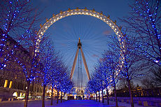
. Also on the river is the London Eye
and Hayward Gallery
, to the east of which is the Oxo Tower
wharf and adjacent areas redeveloped by the Coin Street Community Builders
. Nearby and also in the north of the borough is St Thomas' Hospital
, Lambeth Palace
and the Florence Nightingale Museum
.
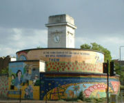
A prominent landmark in the middle of the borough is the Art Deco
Sunlight Laundry on Acre Lane SW2. Near this is Brixton
, home to Lambeth Town Hall and to the Brixton Murals
, although one of these is actually in Stockwell
(see picture below).
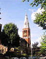
 Prominent Church buildings include:
 The Oval cricket ground
and its neighbouring gas holders are known throughout the world due to television coverage of Test matches.
Lambeth is also the birth place of famous talent scout Simon Cowell.
has had 63 members elected in 21 three-member wards, by means of a plurality bloc voting
system. Since 7 May 2010 Labour hold 44 seats, the Liberal Democrats 15 and the Conservative Party 4 seats.
The wards are Bishop's
, Brixton Hill
, Clapham Common
, Clapham Town
, Coldharbour, Ferndale, Gipsy Hill
, Herne Hill
, Knight's Hill
, Larkhall, Oval
, Prince's
, Saint Leonard's
, Stockwell
, Streatham Hill
, Streatham South
, Streatham Wells
, Thornton
, Thurlow Park
, Tulse Hill
, Vassall
.
, chaired by council leader Cllr Steve Reed
. All members of the Cabinet are from the ruling Labour Party. The Leader of the Opposition is Cllr Ashley Lumsden (Liberal Democrat) and the Leader of the Conservative Opposition is Cllr John Whelan. The Chief Executive is Derrick Anderson CBE, formerly Chief Executive at Wolverhampton Council.
with the addition of two gold stars (mullets) in the second and third quarters of the shield to indicate the addition of the parishes of Clapham and Streatham. The motto is Spectemur Agendo
.
and its successor have been twinned
with the Vincennes
district of Paris
in France
since 1955. Lambeth also has twinning arrangements with Bluefields
in Nicaragua
; Moskvoretsky in Russia
(although this is abeyance since changes to the city government of Moscow); Brooklyn, New York in the United States
; Shinjuku in Japan
; and Spanish Town
in Jamaica
.

London borough
The administrative area of Greater London contains thirty-two London boroughs. Inner London comprises twelve of these boroughs plus the City of London. Outer London comprises the twenty remaining boroughs of Greater London.-Functions:...
in south
South London
South London is the southern part of London, England, United Kingdom.According to the 2011 official Boundary Commission for England definition, South London includes the London boroughs of Bexley, Bromley, Croydon, Greenwich, Kingston, Lambeth, Lewisham, Merton, Southwark, Sutton and...
London
London
London is the capital city of :England and the :United Kingdom, the largest metropolitan area in the United Kingdom, and the largest urban zone in the European Union by most measures. Located on the River Thames, London has been a major settlement for two millennia, its history going back to its...
, England and forms part of Inner London
Inner London
Inner London is the name for the group of London boroughs which form the interior part of Greater London and are surrounded by Outer London. The area was first officially defined in 1965 and for purposes such as statistics, the definition has changed over time. The terms Inner London and Central...
. The local authority is Lambeth London Borough Council
Lambeth London Borough Council
Lambeth London Borough Council is the local authority for the London Borough of Lambeth in Greater London, England. It is a London borough council, one of 32 in the United Kingdom capital of London...
.
Origins
When drawing up boundaries for the London Boroughs, the Government had initially suggested that Metropolitan Borough of LambethMetropolitan Borough of Lambeth
The Metropolitan Borough of Lambeth was a Metropolitan borough under London County Council from 1900 to 1965.-History:The borough covered the area of the former Lambeth parish vestry. In addition to the historic riverside area of Lambeth, this included Kennington, Vauxhall, Stockwell, Brixton, the...
and the Metropolitan Borough of Southwark
Metropolitan Borough of Southwark
The Metropolitan Borough of Southwark was a metropolitan borough in the County of London from 1900 to 1965. It was created to cover the western section of the ancient borough of Southwark and formed the northwestern part of the current London Borough of Southwark. In common with the rest of inner...
should be merged to form a new borough, with the southern and eastern section of the Metropolitan Borough of Wandsworth
Metropolitan Borough of Wandsworth
The Metropolitan Borough of Wandsworth was a Metropolitan borough under the London County Council, from 1900 to 1965.The borough was formed from five civil parishes: Clapham, Putney, Streatham, Tooting Graveney and Wandsworth...
(including Clapham
Clapham
Clapham is a district in south London, England, within the London Borough of Lambeth.Clapham covers the postcodes of SW4 and parts of SW9, SW8 and SW12. Clapham Common is shared with the London Borough of Wandsworth, although Lambeth has responsibility for running the common as a whole. According...
, Streatham
Streatham
Streatham is a district in Surrey, England, located in the London Borough of Lambeth. It is situated south of Charing Cross. The area is identified in the London Plan as one of 35 major centres in Greater London.-History:...
and Tooting
Tooting
Tooting is a district in south London, England, located in the London Borough of Wandsworth. It is situated south south-west of Charing Cross. The area is identified in the London Plan as one of 35 major centres in Greater London.-History:...
) forming another. The Town Clerk of South Shields, R.S. Young was commissioned to make final recommendations to the Government on the shape of the future London boroughs, and he noted that Wandsworth council opposed partition of their borough. However Wandsworth's suggestion of merging Lambeth with the Metropolitan Borough of Battersea
Metropolitan Borough of Battersea
Battersea was a civil parish and metropolitan borough in the County of London, England. In 1965 the borough was abolished and its area combined with parts of the Metropolitan Borough of Wandsworth to form the London Borough of Wandsworth...
was rejected by both of the councils involved. Young held that in Clapham and Streatham, people must be more familiar with Brixton than with Wandsworth, and therefore recommended that a new borough be formed from the Metropolitan Borough of Lambeth together with six wards and parts of two others from the Metropolitan Borough of Wandsworth.
Political events
In 1979 the administration of Edward "Red Ted" Knight organised the borough’s first public demonstration against the Thatcher government. In 1985, the left-wing Labour administration of Ted Knight was subjected to 'rate-capping' with its budget restricted by the Government. Knight and most of the Labour councillors protested by refusing to set any budgetRate-capping rebellion
The rate-capping rebellion was a campaign within English local councils in 1985 which aimed to force the Conservative government of Margaret Thatcher to withdraw powers to restrict the spending of councils. The affected councils were almost all run by left-wing Labour Party leaderships...
. This protest resulted in 32 councillors being ordered to repay to the council the interest the council had lost as a result of budgeting delays, and also being disqualified from office.
1991 saw Joan Twelves’s regime both failed to collect the poll tax and openly opposed the war in the Persian Gulf
Persian Gulf
The Persian Gulf, in Southwest Asia, is an extension of the Indian Ocean located between Iran and the Arabian Peninsula.The Persian Gulf was the focus of the 1980–1988 Iran-Iraq War, in which each side attacked the other's oil tankers...
. Joan Twelves, and 12 other councillors were subsequently suspended from the labour party’s local group by regional officials for advocating non- payment of the poll tax and other radical ideas in 1992. Joan's equally militant deputy leader in this era was John Harrison.
Between 1978 and 2002, the council comprised 64 members elected in 20 three-member and 2 two-member wards. Prior to this, the council had 60 members elected in 20 three-member wards. Immediately prior to the 2010 election, the political balance of the council was 37 Labour members, 18 Liberal Democrats, 7 Conservatives and 1 Green, giving a Labour majority of eleven. At the 2010 Lambeth Council election
Lambeth Council election, 2010
-Summary of results:-References:...
Labour gained seats and the Liberal Democrats, Conservatives and Green party lost seats.
Geography
Lambeth is a long, thin borough (approximately 3 miles (4.8 km) wide and 7 miles (11.3 km) long). Brixton is the civic centre of the borough and there are other town centres. The largest shopping areas are (in order of size) StreathamStreatham
Streatham is a district in Surrey, England, located in the London Borough of Lambeth. It is situated south of Charing Cross. The area is identified in the London Plan as one of 35 major centres in Greater London.-History:...
, Brixton
Brixton
Brixton is a district in the London Borough of Lambeth in south London, England. It is south south-east of Charing Cross. The area is identified in the London Plan as one of 35 major centres in Greater London....
, Vauxhall
Vauxhall
-Demography:Many Vauxhall residents live in social housing. There are several gentrified areas, and areas of terraced townhouses on streets such as Fentiman Road and Heyford Avenue have higher property values in the private market, however by far the most common type of housing stock within...
, Clapham
Clapham
Clapham is a district in south London, England, within the London Borough of Lambeth.Clapham covers the postcodes of SW4 and parts of SW9, SW8 and SW12. Clapham Common is shared with the London Borough of Wandsworth, although Lambeth has responsibility for running the common as a whole. According...
and West Norwood
West Norwood
West Norwood is a place in the London Borough of Lambeth.It is primarily a residential suburb of south London but with some light industry near Knights Hill in the south....
.
According to the 2001 census
United Kingdom Census 2001
A nationwide census, known as Census 2001, was conducted in the United Kingdom on Sunday, 29 April 2001. This was the 20th UK Census and recorded a resident population of 58,789,194....
, Lambeth has a population of 266,169. 62% of the borough is White, 12% Black Caribbean and 12% Black African. 37% of householders are owner–occupiers. Lambeth has the highest population density of the Inner London boroughs.
In the northern end of the borough are the central London
Central London
Central London is the innermost part of London, England. There is no official or commonly accepted definition of its area, but its characteristics are understood to include a high density built environment, high land values, an elevated daytime population and a concentration of regionally,...
districts of the South Bank
South Bank
South Bank is an area of London, England located immediately adjacent to the south side of the River Thames. It forms a long and narrow section of riverside development that is within the London Borough of Lambeth to the border with the London Borough of Southwark and was formerly simply known as...
and Lambeth
Lambeth
Lambeth is a district of south London, England, and part of the London Borough of Lambeth. It is situated southeast of Charing Cross.-Toponymy:...
which have a developing tourist economy while at the very south of the borough are the leafy suburbs of Gipsy Hill
Gipsy Hill
Gipsy Hill is an area of South London near Upper Norwood, it is considered to be part of Crystal Palace. This area of Gipsy Hill also includes the Central Hill estate...
, Tulse Hill
Tulse Hill
Tulse Hill is a district in the London Borough of Lambeth in South London, England. It lies to the south of Brixton, east of Brixton Hill, north of West Norwood and west of West Dulwich.-History:...
, West Dulwich
West Dulwich
West Dulwich is an area in southeast London, England, that straddles the London Borough of Lambeth and the London Borough of Southwark. Croxted Road and South Croxted Road mark the boundary between London Borough of Southwark on the east and London Borough of Lambeth to the west...
and West Norwood
West Norwood
West Norwood is a place in the London Borough of Lambeth.It is primarily a residential suburb of south London but with some light industry near Knights Hill in the south....
. In between the two are built-up and inner-city districts of Brixton
Brixton
Brixton is a district in the London Borough of Lambeth in south London, England. It is south south-east of Charing Cross. The area is identified in the London Plan as one of 35 major centres in Greater London....
, Brixton Hill
Brixton Hill
Brixton Hill is the name given to a 1 km section of road between Brixton and Streatham Hill in south London, England. It slopes downhill towards central London.Brixton Hill and Streatham Hill form part of the traditional main London to Brighton road...
, Streatham Hill, Clapham
Clapham
Clapham is a district in south London, England, within the London Borough of Lambeth.Clapham covers the postcodes of SW4 and parts of SW9, SW8 and SW12. Clapham Common is shared with the London Borough of Wandsworth, although Lambeth has responsibility for running the common as a whole. According...
, Clapham Park
Clapham Park
Clapham Park is an area in the Borough of Lambeth in London, to the south of central Clapham and west of Brixton.The original Clapham Park estate was a speculative development by Thomas Cubitt, who bought of Bleak Hall Farm in 1825, and marked out plots for building around the new broad,...
, Herne Hill
Herne Hill
Herne Hill is located in the London Borough of Lambeth and the London Borough of Southwark in Greater London. There is a road of the same name which continues the A215 north of Norwood Road and was called Herne Hill Road.-History:...
, Stockwell
Stockwell
Stockwell is a district in inner south west London, England, located in the London Borough of Lambeth.It is situated south south-east of Charing Cross. Brixton, Clapham, Vauxhall and Kennington all border Stockwell...
and Kennington
Kennington
Kennington is a district of South London, England, mainly within the London Borough of Lambeth, although part of the area is within the London Borough of Southwark....
which are each at different stages of gentrification
Gentrification
Gentrification and urban gentrification refer to the changes that result when wealthier people acquire or rent property in low income and working class communities. Urban gentrification is associated with movement. Consequent to gentrification, the average income increases and average family size...
and have elements of suburban and urban settlement while Vauxhall
Vauxhall
-Demography:Many Vauxhall residents live in social housing. There are several gentrified areas, and areas of terraced townhouses on streets such as Fentiman Road and Heyford Avenue have higher property values in the private market, however by far the most common type of housing stock within...
and South Lambeth are central districts being redeveloped with high density business and residential properties. Streatham sits somewhere between suburban London and inner-city Brixton with the partly suburban and partly built-up areas of Streatham
Streatham
Streatham is a district in Surrey, England, located in the London Borough of Lambeth. It is situated south of Charing Cross. The area is identified in the London Plan as one of 35 major centres in Greater London.-History:...
, Streatham Hill and Streatham Vale.
Parks and green spaces
Despite the Borough's high population density, it contains some open spaces of Metropolitan importance including Brockwell ParkBrockwell Park
Brockwell Park is a 50.8 hectare park located between Brixton, Herne Hill and Tulse Hill, bordered by Brixton Water Lane, Norwood Road, Tulse Hill , and Dulwich Road in South London....
and Brockwell Lido
Brockwell Lido
Brockwell Lido is a large lido in Brockwell Park, Herne Hill, London. It opened in July 1937, closed in 1990 and after a local campaign was re-opened in 1994.- History :...
, Streatham Common
Streatham Common
Streatham Common is a large open space on the southern edge of Streatham, London.It is one of two former areas of common land in the former parish of Streatham. The other is now known as Tooting Bec Common After inclosure, the Common was purchased for use as a public open space under the powers...
, half of Clapham Common
Clapham Common
Clapham Common is an 89 hectare triangular area of grassland situated in south London, England. It was historically common land for the parishes of Battersea and Clapham, but was converted to parkland under the terms of the Metropolitan Commons Act 1878.43 hectares of the common are within the...
, and West Norwood Cemetery
West Norwood Cemetery
West Norwood Cemetery is a cemetery in West Norwood in London, England. It was also known as the South Metropolitan Cemetery.One of the first private landscaped cemeteries in London, it is one of the Magnificent Seven cemeteries of London, and is a site of major historical, architectural and...
.
Landmarks
Along and around the South BankSouth Bank
South Bank is an area of London, England located immediately adjacent to the south side of the River Thames. It forms a long and narrow section of riverside development that is within the London Borough of Lambeth to the border with the London Borough of Southwark and was formerly simply known as...
a tourist area has developed around the former GLC
Greater London Council
The Greater London Council was the top-tier local government administrative body for Greater London from 1965 to 1986. It replaced the earlier London County Council which had covered a much smaller area...
headquarters of County Hall
County Hall, London
County Hall is a building in Lambeth, London, which was the headquarters of London County Council and later the Greater London Council . The building is on the bank of the River Thames, just north of Westminster Bridge, facing west toward the City of Westminster, and close to the Palace of...
and the Royal Festival Hall
Royal Festival Hall
The Royal Festival Hall is a 2,900-seat concert, dance and talks venue within Southbank Centre in London. It is situated on the South Bank of the River Thames, not far from Hungerford Bridge. It is a Grade I listed building - the first post-war building to become so protected...
and National Theatre
Royal National Theatre
The Royal National Theatre in London is one of the United Kingdom's two most prominent publicly funded theatre companies, alongside the Royal Shakespeare Company...
. Also on the river is the London Eye
London Eye
The London Eye is a tall giant Ferris wheel situated on the banks of the River Thames, in London, England.It is the tallest Ferris wheel in Europe, and the most popular paid tourist attraction in the United Kingdom, visited by over 3.5 million people annually...
and Hayward Gallery
Hayward Gallery
The Hayward Gallery is an art gallery within the Southbank Centre, part of an area of major arts venues on the South Bank of the River Thames, in central London, England. It is sited adjacent to the other Southbank Centre buildings and also the Royal National Theatre and British Film Institute...
, to the east of which is the Oxo Tower
OXO Tower
The OXO Tower is a building with a prominent tower on the south bank of the River Thames in London. The building currently has a set of bijou arts and crafts shops on the ground and first floors. A well-known restaurant is located on the 8th floor, which is the roof top level of the main building...
wharf and adjacent areas redeveloped by the Coin Street Community Builders
Coin Street Community Builders
Coin Street Community Builders is a development trust and social enterprise based on the South Bank of the River Thames between Waterloo Bridge and Blackfriars Bridge in London, England.-History:...
. Nearby and also in the north of the borough is St Thomas' Hospital
St Thomas' Hospital
St Thomas' Hospital is a large NHS hospital in London, England. It is administratively a part of Guy's & St Thomas' NHS Foundation Trust. It has provided health care freely or under charitable auspices since the 12th century and was originally located in Southwark.St Thomas' Hospital is accessible...
, Lambeth Palace
Lambeth Palace
Lambeth Palace is the official London residence of the Archbishop of Canterbury in England. It is located in Lambeth, on the south bank of the River Thames a short distance upstream of the Palace of Westminster on the opposite shore. It was acquired by the archbishopric around 1200...
and the Florence Nightingale Museum
Florence Nightingale Museum
The Florence Nightingale Museum is located at St Thomas' Hospital, which faces the Palace of Westminster across the River Thames in South Bank, central London, England. It is open to the public seven days a week...
.
A prominent landmark in the middle of the borough is the Art Deco
Art Deco
Art deco , or deco, is an eclectic artistic and design style that began in Paris in the 1920s and flourished internationally throughout the 1930s, into the World War II era. The style influenced all areas of design, including architecture and interior design, industrial design, fashion and...
Sunlight Laundry on Acre Lane SW2. Near this is Brixton
Brixton
Brixton is a district in the London Borough of Lambeth in south London, England. It is south south-east of Charing Cross. The area is identified in the London Plan as one of 35 major centres in Greater London....
, home to Lambeth Town Hall and to the Brixton Murals
Brixton murals
The Brixton murals are a series of murals by local artists in the Brixton area, in London, UK. Most of the murals were funded by Lambeth London Borough Council and the Greater London Council after the Brixton riots in 1981....
, although one of these is actually in Stockwell
Stockwell
Stockwell is a district in inner south west London, England, located in the London Borough of Lambeth.It is situated south south-east of Charing Cross. Brixton, Clapham, Vauxhall and Kennington all border Stockwell...
(see picture below).
- St Mary Lambeth (now home to the Museum of Garden HistoryMuseum of Garden HistoryThe Garden Museum, formerly known as the Museum of Garden History, is based in the deconsecrated parish church of St Mary-at-Lambeth adjacent to Lambeth Palace on the south bank of the River Thames in London, located on Lambeth Road...
) - the four "Waterloo Churches" within the former Lambeth Parish:
- St Matthew, Brixton (now also home to Mass nightclub)
- St Mark, Kennington
- St Luke, West Norwood
- St John, Waterloo
- Holy Trinity, Clapham
- St Leonard, Streatham
- Christ Church, Streatham Hill
- Christ ChurchChrist Church Brixton RoadChrist Church on Brixton Road in Lambeth SW9 is an Art Nouveau and Byzantine-style Grade II* listed building built in 1902 by Beresford Pite.-External links:*...
, Brixton Road, North Brixton - All Saints' Church, West Dulwich
- Holy Trinity, Trinity Rise, Tulse Hill
- St John the Divine, Vassall Road
The Oval
The Kia Oval, still commonly referred to by its original name of The Oval, is an international cricket ground in Kennington, in the London Borough of Lambeth. In the past it was also sometimes called the Kennington Oval...
and its neighbouring gas holders are known throughout the world due to television coverage of Test matches.
Arts
- South London TheatreSouth London TheatreThe South London Theatre is a Community theatre in West Norwood in the London Borough of Lambeth, England. The first play opened in October 1967, and it is now a busy theatrical venue, presenting more than 22 shows annually in two auditoria: the 100-seater proscenium arch "Bell Theatre" and a...
a busy community theatre in the South of the borough
Lambeth is also the birth place of famous talent scout Simon Cowell.
Borough Council
Since 2002, Lambeth Borough CouncilLambeth London Borough Council
Lambeth London Borough Council is the local authority for the London Borough of Lambeth in Greater London, England. It is a London borough council, one of 32 in the United Kingdom capital of London...
has had 63 members elected in 21 three-member wards, by means of a plurality bloc voting
Plurality-at-large voting
Plurality-at-large voting is a non-proportional voting system for electing several representatives from a single multimember electoral district using a series of check boxes and tallying votes similar to a plurality election...
system. Since 7 May 2010 Labour hold 44 seats, the Liberal Democrats 15 and the Conservative Party 4 seats.
The wards are Bishop's
Bishop's ward
Bishop's ward is an administrative division of the London Borough of Lambeth, United Kingdom. It is located in the north of the borough, bounded by the river Thames, and contains many well known London sites including the Southbank Centre, the London Eye, the Old and New Vic theatres, County Hall...
, Brixton Hill
Brixton Hill ward
Brixton Hill ward is an administrative division of the London Borough of Lambeth, United Kingdom. It contains part of the road known as Brixton Hill...
, Clapham Common
Clapham Common ward
Clapham Common is an administrative division of the London Borough of Lambeth, United Kingdom.The ward contains stretches South from Clapham Park Road to the boundary with Wandsworth at Balham Hill. It contains roads such as the A24 Clapham Common Southside and Abbeville Road...
, Clapham Town
Clapham Town ward
Clapham Town is an administrative division of the London Borough of Lambeth, United Kingdom.The ward contains much of Clapham including part of Clapham Common and Clapham Common tube stationThe ward is located in the Vauxhall parliamentary constituency....
, Coldharbour, Ferndale, Gipsy Hill
Gipsy Hill ward
Gipsy Hill ward is an administrative division of the London Borough of Lambeth, United Kingdom.The ward contains much of West Norwood as well as Norwood park and West Norwood Cemetery...
, Herne Hill
Herne Hill ward
Herne Hill ward is an administrative division of the London Borough of Lambeth, United Kingdom. It is located in Herne Hill and contains Brockwell park, Ruskin park, and Kings College Hospital....
, Knight's Hill
Knight's Hill
Knights Hill is a ward and main road on the A215 in West Norwood, London and a mound to the north adjoining Tulse Hill.-The Road:The road itself starts in the north at West Norwood in the Norwood Triangle. It ends in the south at a junction with the A214 at Crown Lane and Crown Dale. Knights Hill...
, Larkhall, Oval
Oval ward
Oval ward is an administrative area in the London Borough of Lambeth, United Kingdom. Its name refers to The Oval, a cricket ground in the ward and the Oval neighbourhood around it....
, Prince's
Prince's ward
Prince's ward is an is an administrative division of the London Borough of Lambeth, United Kingdom. It is located in the North of the borough, bounded by the river Thames and Kennington Park Road...
, Saint Leonard's
St Leonard's ward
St Leonard's ward is an administrative division of the London Borough of Lambeth, United Kingdom. It is located in the South West of the borough and shares a border with Wandsworth...
, Stockwell
Stockwell ward
Stockwell ward is an administrative division of the London Borough of Lambeth, United Kingdom. It contains much of the area known as StockwellStockwell tube station is located in the ward.Stockwell ward is located in the Vauxhall Parliamentary constituency....
, Streatham Hill
Streatham Hill ward
Streatham Hill ward is an administrative division of the London Borough of Lambeth, United Kingdom. It includes the neighbourhoods in the northern part of Streatham either side of the road of the same name...
, Streatham South
Streatham South ward
Streatham South ward is an administrative division of the London Borough of Lambeth, United Kingdom. It is the most southerly ward of the borough and has borders with Croydon, Merton, and Wandsworth...
, Streatham Wells
Streatham Wells ward
Streatham Wells ward is an administrative division of the London Borough of Lambeth, United Kingdom. It contains part of Streatham town centre to the east of the A23 Streatham High Road....
, Thornton
Thornton ward
Thornton ward is an administrative division of the London Borough of Lambeth, United Kingdom.The ward comprises the communities of Clapham Park and the Hyde Farm Estate. The ward shares the borough's western boundary with Wandsworth along Cavendish Road and Emmanuel Road alongside Tooting Bec...
, Thurlow Park
Thurlow Park ward
Thurlow Park ward is an administrative division of the London Borough of Lambeth, United KingdomIt is located towards the South of the borough containing much of West Norwood and Tulse Hill including Tulse Hill railway station...
, Tulse Hill
Tulse Hill ward
Tulse Hill ward is an administrative division of the London Borough of Lambeth, United Kingdom. It stretches up from Brixton town centre to the South Circular road...
, Vassall
Vassall ward
Vassall ward is an administrative division of the London Borough of Lambeth, United Kingdom. It is located in the North of borough bordering Southwark, in the SW9 and SE5 postcode area...
.
Mayor
Lambeth is unusual in that since 1994 the mayor is elected unanimously by their fellow councillors with each of the three political parties supplying a candidate in rotation. The Lambeth Borough website states this underlines the apolitical nature of the mayor’s role and enables them to represent all the citizens of the borough however some have criticised this arrangement as the council ignoring the political mandate of the voters.Executive and Opposition
The council is run by a Leader and CabinetCabinet-style council
A Cabinet-style Council is a type of local government which has been introduced in the United Kingdom for Local Councils following the introduction of the Local Government Act 2000....
, chaired by council leader Cllr Steve Reed
Steve Reed (politician)
Councillor Steve Reed is a Labour Party councillor for Brixton Hill Ward and has been Leader of Lambeth Council since May 2006 when Lambeth was the only council in the country Labour won back from opposition...
. All members of the Cabinet are from the ruling Labour Party. The Leader of the Opposition is Cllr Ashley Lumsden (Liberal Democrat) and the Leader of the Conservative Opposition is Cllr John Whelan. The Chief Executive is Derrick Anderson CBE, formerly Chief Executive at Wolverhampton Council.
Coat of arms
The coat of arms is that of the former Metropolitan Borough of LambethMetropolitan Borough of Lambeth
The Metropolitan Borough of Lambeth was a Metropolitan borough under London County Council from 1900 to 1965.-History:The borough covered the area of the former Lambeth parish vestry. In addition to the historic riverside area of Lambeth, this included Kennington, Vauxhall, Stockwell, Brixton, the...
with the addition of two gold stars (mullets) in the second and third quarters of the shield to indicate the addition of the parishes of Clapham and Streatham. The motto is Spectemur Agendo
Spectemur agendo
-Source:It comes originally from Book XIII of Ovid's Metamorphoses where it is attributed to the hero Ajax:Denique spectemur agendo! which most literal translations render as...
.
Westminster Parliament
The borough is covered by three parliamentary constituencies:- Dulwich and West Norwood (shared with London Borough of SouthwarkLondon Borough of SouthwarkThe London Borough of Southwark is a London borough in south east London, England. It is directly south of the River Thames and the City of London, and forms part of Inner London.-History:...
) - StreathamStreatham (UK Parliament constituency)Streatham is a borough constituency represented in the House of Commons of the Parliament of the United Kingdom. It elects one Member of Parliament by the first past the post system of election.-Boundaries:...
- VauxhallVauxhall (UK Parliament constituency)-Elections in the 1980s:-Elections in the 1970s:-Elections in the 1960s:-Notes and references:...
Twinning
The former Metropolitan Borough of LambethMetropolitan Borough of Lambeth
The Metropolitan Borough of Lambeth was a Metropolitan borough under London County Council from 1900 to 1965.-History:The borough covered the area of the former Lambeth parish vestry. In addition to the historic riverside area of Lambeth, this included Kennington, Vauxhall, Stockwell, Brixton, the...
and its successor have been twinned
Town twinning
Twin towns and sister cities are two of many terms used to describe the cooperative agreements between towns, cities, and even counties in geographically and politically distinct areas to promote cultural and commercial ties.- Terminology :...
with the Vincennes
Vincennes
Vincennes is a commune in the Val-de-Marne department in the eastern suburbs of Paris, France. It is located from the centre of Paris. It is one of the most densely populated municipalities in Europe.-History:...
district of Paris
Paris
Paris is the capital and largest city in France, situated on the river Seine, in northern France, at the heart of the Île-de-France region...
in France
France
The French Republic , The French Republic , The French Republic , (commonly known as France , is a unitary semi-presidential republic in Western Europe with several overseas territories and islands located on other continents and in the Indian, Pacific, and Atlantic oceans. Metropolitan France...
since 1955. Lambeth also has twinning arrangements with Bluefields
Bluefields
Bluefields is the capital of the municipality of the same name, and of Región Autónoma del Atlántico Sur in Nicaragua. It was also capital of the former Zelaya Department, which was divided into North and South Atlantic Autonomous Regions...
in Nicaragua
Nicaragua
Nicaragua is the largest country in the Central American American isthmus, bordered by Honduras to the north and Costa Rica to the south. The country is situated between 11 and 14 degrees north of the Equator in the Northern Hemisphere, which places it entirely within the tropics. The Pacific Ocean...
; Moskvoretsky in Russia
Russia
Russia or , officially known as both Russia and the Russian Federation , is a country in northern Eurasia. It is a federal semi-presidential republic, comprising 83 federal subjects...
(although this is abeyance since changes to the city government of Moscow); Brooklyn, New York in the United States
United States
The United States of America is a federal constitutional republic comprising fifty states and a federal district...
; Shinjuku in Japan
Japan
Japan is an island nation in East Asia. Located in the Pacific Ocean, it lies to the east of the Sea of Japan, China, North Korea, South Korea and Russia, stretching from the Sea of Okhotsk in the north to the East China Sea and Taiwan in the south...
; and Spanish Town
Spanish Town
Spanish Town is the capital and the largest town in the parish of St. Catherine in the county of Middlesex, Jamaica. It was the former Spanish and English capital of Jamaica from the 16th to the 19th century...
in Jamaica
Jamaica
Jamaica is an island nation of the Greater Antilles, in length, up to in width and 10,990 square kilometres in area. It is situated in the Caribbean Sea, about south of Cuba, and west of Hispaniola, the island harbouring the nation-states Haiti and the Dominican Republic...
.
Lambeth areas
- BalhamBalhamBalham is a district of London, EnglandBalham can also refer to:*Balham, Ardennes, a commune in France*Balham station, railway and tube station in Balham, London*Balaam, a Biblical figure...
- BrixtonBrixtonBrixton is a district in the London Borough of Lambeth in south London, England. It is south south-east of Charing Cross. The area is identified in the London Plan as one of 35 major centres in Greater London....
- ClaphamClaphamClapham is a district in south London, England, within the London Borough of Lambeth.Clapham covers the postcodes of SW4 and parts of SW9, SW8 and SW12. Clapham Common is shared with the London Borough of Wandsworth, although Lambeth has responsibility for running the common as a whole. According...
- Crystal PalaceCrystal Palace, LondonCrystal Palace is a residential area in south London, England named from the former local landmark, The Crystal Palace, which occupied the area from 1854 to 1936. The area is located approximately 8 miles south east of Charing Cross, and offers impressive views over the capital...
- Gipsy HillGipsy HillGipsy Hill is an area of South London near Upper Norwood, it is considered to be part of Crystal Palace. This area of Gipsy Hill also includes the Central Hill estate...
- Herne HillHerne HillHerne Hill is located in the London Borough of Lambeth and the London Borough of Southwark in Greater London. There is a road of the same name which continues the A215 north of Norwood Road and was called Herne Hill Road.-History:...
- KenningtonKenningtonKennington is a district of South London, England, mainly within the London Borough of Lambeth, although part of the area is within the London Borough of Southwark....
- Knight's HillKnight's HillKnights Hill is a ward and main road on the A215 in West Norwood, London and a mound to the north adjoining Tulse Hill.-The Road:The road itself starts in the north at West Norwood in the Norwood Triangle. It ends in the south at a junction with the A214 at Crown Lane and Crown Dale. Knights Hill...
- LambethLambethLambeth is a district of south London, England, and part of the London Borough of Lambeth. It is situated southeast of Charing Cross.-Toponymy:...
- Loughborough JunctionLoughborough JunctionLoughborough Junction is an area of South London, in the Borough of Lambeth, which lies on the borderline of Brixton and Camberwell. It is centred at a junction which consists of 6 railway bridges which can all be seen at once from the centre of the junction. Loughborough Junction can be found...
- OvalOval, LondonOval is a geographically small area of Kennington, South London, in the London Borough of Lambeth. It is situated 2.1 miles to the south-east of Charing Cross. Oval straddles the border of south-west London and south-east London, and is where the postcode SE11 converges with the postcode SW8...
and The Oval Cricket GroundThe OvalThe Kia Oval, still commonly referred to by its original name of The Oval, is an international cricket ground in Kennington, in the London Borough of Lambeth. In the past it was also sometimes called the Kennington Oval... - StockwellStockwellStockwell is a district in inner south west London, England, located in the London Borough of Lambeth.It is situated south south-east of Charing Cross. Brixton, Clapham, Vauxhall and Kennington all border Stockwell...
- StreathamStreathamStreatham is a district in Surrey, England, located in the London Borough of Lambeth. It is situated south of Charing Cross. The area is identified in the London Plan as one of 35 major centres in Greater London.-History:...
- Tulse HillTulse HillTulse Hill is a district in the London Borough of Lambeth in South London, England. It lies to the south of Brixton, east of Brixton Hill, north of West Norwood and west of West Dulwich.-History:...
- VauxhallVauxhall-Demography:Many Vauxhall residents live in social housing. There are several gentrified areas, and areas of terraced townhouses on streets such as Fentiman Road and Heyford Avenue have higher property values in the private market, however by far the most common type of housing stock within...
- West DulwichWest DulwichWest Dulwich is an area in southeast London, England, that straddles the London Borough of Lambeth and the London Borough of Southwark. Croxted Road and South Croxted Road mark the boundary between London Borough of Southwark on the east and London Borough of Lambeth to the west...
- West NorwoodWest NorwoodWest Norwood is a place in the London Borough of Lambeth.It is primarily a residential suburb of south London but with some light industry near Knights Hill in the south....
Bridges and tunnels
- Waterloo BridgeWaterloo BridgeWaterloo Bridge is a road and foot traffic bridge crossing the River Thames in London, England between Blackfriars Bridge and Hungerford Bridge. The name of the bridge is in memory of the British victory at the Battle of Waterloo in 1815...
incorporating the NFT - Hungerford BridgeHungerford BridgeThe Hungerford Bridge crosses the River Thames in London, and lies between Waterloo Bridge and Westminster Bridge. It is a steel truss railway bridge—sometimes known as the Charing Cross Bridge—flanked by two more recent, cable-stayed, pedestrian bridges that share the railway bridge's...
and the two accompanying pedestrian spans known as the Golden Jubilee Bridges. - Lambeth BridgeLambeth BridgeLambeth Bridge is a road traffic and footbridge crossing the River Thames in an east-west direction in central London, England; the river flows north at the crossing point...
- Westminster BridgeWestminster BridgeWestminster Bridge is a road and foot traffic bridge over the River Thames between Westminster on the north side and Lambeth on the south side, in London, England....
- Vauxhall BridgeVauxhall BridgeVauxhall Bridge is a Grade II* listed steel and granite deck arch bridge in central London. It crosses the River Thames in a south–east north–west direction between Vauxhall on the south bank and Pimlico on the north bank...
Railway stations
- Brixton railway stationBrixton railway stationBrixton Railway Station is a commuter railway station in the centre of Brixton, inSouth London, UK. It is on the Chatham Main Line which runs from London Victoria to Orpington. Trains are operated by Southeastern. The typical service is one train every 15 minutes in both directions.Brixton Railway...
- Clapham High Street railway stationClapham High Street railway stationClapham High Street railway station is on the South London Line from London Victoria to .It is close to station and interchange between the two is counted as an Out of Station Interchange on Oyster, so journeys involving a change between the two are charged as through journeys and not two...
- Gipsy Hill railway stationGipsy Hill railway stationGipsy Hill railway station is in the London Borough of Lambeth in south London. It is situated on the outer route of the South London Line. The station, and all trains serving it, are operated by Southern, and it is in Travelcard Zone 3....
- Herne Hill railway stationHerne Hill railway stationHerne Hill railway station is in Herne Hill, a location in the London Borough of Lambeth, South London, England. Its location is .The station is above road level near the junction of five main roads, between Railton Road and Milkwood Road. There is no entrance in Milkwood Road, but there is a...
- Loughborough Junction railway stationLoughborough Junction railway stationLoughborough Junction railway station is in Brixton in the London Borough of Lambeth. It is between Elephant & Castle and Herne Hill stations and is served by First Capital Connect and at peak hours by Southeastern.-History:...
- Streatham railway stationStreatham railway stationStreatham railway station is a station in central Streatham in south London. It is off Streatham High Road, and is in Travelcard Zone 3.Services are provided by First Capital Connect and Southern. First Capital Connect services go north to Luton and Bedford via Blackfriars, the City and St Pancras,...
- Streatham Common railway stationStreatham Common railway stationStreatham Common railway station is in Streatham in south London miles from Victoria, and is in Travelcard Zone 3.The station is managed by Southern who also operate trains from the station...
- Streatham Hill railway stationStreatham Hill railway stationStreatham Hill railway station is one of three stations serving the suburb of Streatham, in the London Borough of Lambeth. The wooden station building at street level faces the busy Streatham High Road at the junction with Leigham Court Road...
- Tulse Hill railway stationTulse Hill railway stationTulse Hill railway station is in the London Borough of Lambeth in south London, between railway bridges over the A205, South Circular Road and the A215, Norwood Road...
- Vauxhall stationVauxhall stationVauxhall station is a National Rail, London Underground and London Buses interchange station in central London. It is at the Vauxhall Cross road junction opposite the southern approach to Vauxhall Bridge over the River Thames in the London district of Vauxhall...
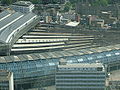
- Waterloo stationWaterloo stationWaterloo station, also known as London Waterloo, is a central London railway terminus and London Underground complex. The station is owned and operated by Network Rail and is close to the South Bank of the River Thames, and in Travelcard Zone 1....
- Wandsworth Road railway stationWandsworth Road railway stationWandsworth Road railway station is on the South London Line from London Victoria to .It is operated by Southern. The next stations are to the west, towards Victoria and to the east, towards London Bridge.-History:...
- West Norwood railway stationWest Norwood railway stationWest Norwood railway station is in the London Borough of Lambeth in West Norwood, south London. The station, and all trains serving it, is operated by Southern, and it is in Travelcard Zone 3. Services from Platform 1 go to London Victoria and London Bridge via Tulse Hill...
Tube stations
- Brixton tube stationBrixton tube stationBrixton tube station, a station on the London Underground opened on July 23, 1971, is the southern terminus of the Victoria line.It is located in Brixton Road, and is about 100m from Brixton railway station . From the ticket hall, three escalators take passengers to and from the platforms...
- Clapham Common tube stationClapham Common tube stationClapham Common tube station is a station on London Underground's Northern Line. It lies between Clapham North and Clapham South stations and is in Travelcard Zone 2.-History:...
- Clapham North tube stationClapham North tube stationClapham North tube station is an Underground station in Clapham, London. It is on the Northern Line between Clapham Common and Stockwell. The station is in Travelcard Zone 2 and is close to Clapham High Street railway station, although there is no direct interchange link...
- Lambeth North tube stationLambeth North tube stationLambeth North tube station is a London Underground station in the neighbourhood of Lambeth, at the junction of Westminster Bridge Road and Baylis Road. It is on the Bakerloo line, between Elephant & Castle and Waterloo, and is in Travelcard Zone 1...
- Oval tube stationOval tube stationOval tube station in Kennington is a station on the Northern line of the London Underground between Stockwell and Kennington stations. It is the only station on the Morden branch of the Northern line whose name begins with a vowel and is one of only two stations on the London Underground with only...
- Stockwell tube stationStockwell tube stationStockwell tube station is a London Underground station in Stockwell, in the London Borough of Lambeth. It is located on the Northern Line between Oval and Clapham North, and on the Victoria Line between Brixton and Vauxhall. It is the southernmost station on the London Undergound that serves more...
- Vauxhall stationVauxhall stationVauxhall station is a National Rail, London Underground and London Buses interchange station in central London. It is at the Vauxhall Cross road junction opposite the southern approach to Vauxhall Bridge over the River Thames in the London district of Vauxhall...
- Waterloo stationWaterloo stationWaterloo station, also known as London Waterloo, is a central London railway terminus and London Underground complex. The station is owned and operated by Network Rail and is close to the South Bank of the River Thames, and in Travelcard Zone 1....
External links
- Lambeth.gov.uk London Borough of Lambeth Official Website
- Mayor of Lambeth Mayor of Lambeth Official Website
- electionmemory.com Independent Lambeth Council Elections Forum
- General information on Lambeth parks and green spaces
- Community Police Consultative Group for Lambeth Independent forum for community and statutory agencies to address community safety and policing issues.
- Lambeth Freecycle