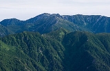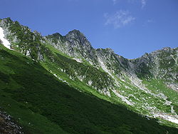
Mount Kisokoma
Encyclopedia
is a mountain located in Miyada
, Kamiina District
, and Kiso
and Agematsu
, Kiso District
, Nagano Prefecture
, in the Chūbu region
of Japan
. It is 2956 m (9,698 ft) tall and is the tallest peak in the Kiso Mountains
. It is also included on the list of "100 Famous Japanese Mountains." Sometimes its name is just shortened to Kisokoma. Alternative kanji
for the name are 木曾駒ヶ岳 (Kisokoma-ga-take).
is referred to as the eastern one. The mountain consists of Granite
. The upper part of the mountain range is the Tree line, and a lot of Alpine plant
grow naturally. Leontopodium shinanense of Leontopodium
is the Endemism around Mount Kisokoma. It is called in Japanese. Also, Siberian Dwarf Pine
can be seen around the top of the mountain.
The Komagatake Ropeway
will take hikers from the base of the mountain up the Senjōjiki Col, a large cirque
located 2650 m (8,694 ft) above sea level, leaving just the last few hundreds meters of the mountain to be scaled.
that become the sources flows to the Ise Bay
and the Pacific Ocean
.
Miyada, Nagano
is a village located in Kamiina District, Nagano, Japan.As of 2003, the village has an estimated population of 8,870 and a density of 162.69 persons per km². The total area is 54.52 km²....
, Kamiina District
Kamiina District, Nagano
Kamiina is a district located in Nagano, Japan.As of May, 2008, the district has an estimated Population of 86,453 and a Density of 168 persons/km²...
, and Kiso
Kiso, Nagano (town)
is a town located in Kiso District, Nagano Prefecture, Japan.The town was founded on November 1, 2005, when the town of Kisofukushima was merged with three villages , all from Kiso District....
and Agematsu
Agematsu, Nagano
is a town located in Kiso District, Nagano, Japan.As of 2003, the town has an estimated population of 6,034 and a density of 35.82 persons per km². The total area is 168.47 km².-External links:*...
, Kiso District
Kiso District, Nagano
is a district located in Nagano Prefecture, Japan.As of November 1, 2005, the district has an estimated population of 34,759. The total area is 1,546.26 km².Historically, the district was once known as Nishichikuma District until May 1, 1968....
, Nagano Prefecture
Nagano Prefecture
is a prefecture of Japan located in the Chūbu region of the island of Honshū. The capital is the city of Nagano.- History :Nagano was formerly known as the province of Shinano...
, in the Chūbu region
Chubu region
The is the central region of Honshū, Japan's main island. Chūbu has a population estimate of 21,886,324 as of 2008.Chūbu, which means "central region", encompasses nine prefectures : Aichi, Fukui, Gifu, Ishikawa, Nagano, Niigata, Shizuoka, Toyama, Yamanashi, and often Mie.It is located directly...
of Japan
Japan
Japan is an island nation in East Asia. Located in the Pacific Ocean, it lies to the east of the Sea of Japan, China, North Korea, South Korea and Russia, stretching from the Sea of Okhotsk in the north to the East China Sea and Taiwan in the south...
. It is 2956 m (9,698 ft) tall and is the tallest peak in the Kiso Mountains
Kiso Mountains
are a mountain range in Nagano and Gifu prefectures in Japan. They are also called the and they combine with the Hida Mountains and the Akaishi Mountains to form a group collectively known as the Japanese Alps.- Outline :...
. It is also included on the list of "100 Famous Japanese Mountains." Sometimes its name is just shortened to Kisokoma. Alternative kanji
Kanji
Kanji are the adopted logographic Chinese characters hanzi that are used in the modern Japanese writing system along with hiragana , katakana , Indo Arabic numerals, and the occasional use of the Latin alphabet...
for the name are 木曾駒ヶ岳 (Kisokoma-ga-take).
Geography
The Ina Valley is located between the "two Koma Mountains." Mount Kisokoma is referred to as the western of the two mountains, while Mount KaikomaMount Kaikoma
is a mountain located on the border between Hokuto, Yamanashi Prefecture, and Ina, Nagano Prefecture, in the Chūbu region of Japan. It is tall and part of the Akaishi Mountains...
is referred to as the eastern one. The mountain consists of Granite
Granite
Granite is a common and widely occurring type of intrusive, felsic, igneous rock. Granite usually has a medium- to coarse-grained texture. Occasionally some individual crystals are larger than the groundmass, in which case the texture is known as porphyritic. A granitic rock with a porphyritic...
. The upper part of the mountain range is the Tree line, and a lot of Alpine plant
Alpine plant
Alpine plants are plants that grow in the alpine climate, which occurs at high elevation and above the tree line. Alpine plants grow together as a plant community in alpine tundra.-Alpine plant diversity:...
grow naturally. Leontopodium shinanense of Leontopodium
Leontopodium
Leontopodium is a genus of plants in the daisy family, which includes edelweiss , a well-known plant from the mountains of Europe. The term edelweiss can, more rarely, refer to other members of the genus...
is the Endemism around Mount Kisokoma. It is called in Japanese. Also, Siberian Dwarf Pine
Siberian Dwarf Pine
Pinus pumila is a native to northeastern Asia, including the islands of Japan. This shrubby pine ranges from 1–3 m in height, exceptionally up to 5 m, but may have individual branches that extend farther along the ground in length...
can be seen around the top of the mountain.
The Komagatake Ropeway
Komagatake Ropeway
is an aerial lift line in Nagano Prefecture, Japan. This is the only line operates. The company, a member of Meitetsu Group, also operates hotels and ski resorts. The line, opened in 1967, climbs...
will take hikers from the base of the mountain up the Senjōjiki Col, a large cirque
Cirque
Cirque may refer to:* Cirque, a geological formation* Makhtesh, an erosional landform found in the Negev desert of Israel and Sinai of Egypt*Cirque , an album by Biosphere* Cirque Corporation, a company that makes touchpads...
located 2650 m (8,694 ft) above sea level, leaving just the last few hundreds meters of the mountain to be scaled.
Rivers that become source
The following riversRiver
A river is a natural watercourse, usually freshwater, flowing towards an ocean, a lake, a sea, or another river. In a few cases, a river simply flows into the ground or dries up completely before reaching another body of water. Small rivers may also be called by several other names, including...
that become the sources flows to the Ise Bay
Ise Bay
Ise Bay is a bay located at the mouth of the Kiso River between Mie and Aichi Prefectures in Japan. Ise Bay has an average depth of 19.5 metres and a maximum depth of 30 metres toward the centre. The mouth of the bay is 9 kilometres wide and is connected to the smaller Mikawa Bay by two channels:...
and the Pacific Ocean
Pacific Ocean
The Pacific Ocean is the largest of the Earth's oceanic divisions. It extends from the Arctic in the north to the Southern Ocean in the south, bounded by Asia and Australia in the west, and the Americas in the east.At 165.2 million square kilometres in area, this largest division of the World...
.
- Name River, Shōzawa River (TributaryTributaryA tributary or affluent is a stream or river that flows into a main stem river or a lake. A tributary does not flow directly into a sea or ocean...
of Kiso RiverKiso RiverThe is a river in Japan roughly 193 km long, flowing through the prefectures of Nagano, Gifu, Aichi, and Mie before emptying into Ise Bay a short distance away from the city of Nagoya. It is the main river of the Kiso Three Rivers and forms a major part of the Nōbi Plain...
) - Odagiri River, Ōtagiri River (Tributary of Tenryū RiverTenryu RiverThe is a river arising from Lake Suwa in Okaya, Nagano Prefecture, grazing Aichi Prefecture and flowing through western Shizuoka Prefecture in central Honshū, Japan. With a length of , it is Japan's ninth longest river.-Geography:...
)
Mountaineering and Lodgings
There is the Komagatake Ropeway in the east side of Mount Kisokoma. A lot of tourists and hiker visit the station on the top. There are five mountain huts and one hotel located on the mountain. The hotel is named "Hotel Senjōjiki," after the cirque on the mountain. There is one campground near the lodge between Mount Kisokoma and Mount Naka. There are a lot of mountain climbing trails in the surrounding.Scenery of Mount Kisokoma
 |
|||
| Kiso Mountains and Mountain hut and campground seen from east (Mount Naka) |
Mount Kisokoma seen from west (Mount Mugikusa) spring |
Mt. Kisokoma and Mt. Hōken and Autumn leaf color Autumn leaf color Autumn leaf color is a phenomenon that affects the normally green leaves of many deciduous trees and shrubs by which they take on, during a few weeks in the autumn season, one or many colors that range from red to yellow... seen from north (Mount Shōgigashira) autumn |
Senjōjiki Curl Curl In vector calculus, the curl is a vector operator that describes the infinitesimal rotation of a 3-dimensional vector field. At every point in the field, the curl is represented by a vector... at Mount Hōken summer |
See also
- Kiso MountainsKiso Mountainsare a mountain range in Nagano and Gifu prefectures in Japan. They are also called the and they combine with the Hida Mountains and the Akaishi Mountains to form a group collectively known as the Japanese Alps.- Outline :...
- Komagatake RopewayKomagatake Ropewayis an aerial lift line in Nagano Prefecture, Japan. This is the only line operates. The company, a member of Meitetsu Group, also operates hotels and ski resorts. The line, opened in 1967, climbs...
- 100 Famous Japanese Mountains

