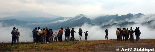
Pangsau pass
Encyclopedia

Pangsau Pass, 3727 feet (1,136 m) in altitude, lies on the crest of the Patkai
Patkai
The Pat-kai meaning to Cut Chicken in Tai Ahom language are the hills on India's North Eastern border with Burma. They were created by the same tectonic processes that resulted in the formation of the Himalayain the Mesozoic . They are not as rugged as the Himalayas and its peaks are much lower...
Hills on the India
India
India , officially the Republic of India , is a country in South Asia. It is the seventh-largest country by geographical area, the second-most populous country with over 1.2 billion people, and the most populous democracy in the world...
-Burma (Myanmar) border. The reputed route of the 13th century invasion of Assam
Assam
Assam , also, rarely, Assam Valley and formerly the Assam Province , is a northeastern state of India and is one of the most culturally and geographically distinct regions of the country...
in India by the Ahoms, a Shan tribe, the pass offers one of the easiest routes into Burma from the Assam plains. Prospected by the British
United Kingdom
The United Kingdom of Great Britain and Northern IrelandIn the United Kingdom and Dependencies, other languages have been officially recognised as legitimate autochthonous languages under the European Charter for Regional or Minority Languages...
in the late 19th Century as a possible railway route from India to Myitkyina
Myitkyina
Myitkyina is the capital city of Kachin State in Myanmar , located from Yangon, and from Mandalay. In Burmese it means "near the big river", and in fact "Myitkyina" lies on the west bank of the Ayeyarwady River, just below from Myit-son of its two headstreams...
in north Burma through the Hukawng Valley
Hukawng Valley
The Hukawng Valley is an isolated valley in Burma, roughly in area. It is located in Tanaing Township in the Myitkyina District of Kachin State in the northernmost part of the country.-Rivers:...
, the pass became famous during World War II
World War II
World War II, or the Second World War , was a global conflict lasting from 1939 to 1945, involving most of the world's nations—including all of the great powers—eventually forming two opposing military alliances: the Allies and the Axis...
for being the initial obstacle encountered by American
United States
The United States of America is a federal constitutional republic comprising fifty states and a federal district...
General "Vinegar Joe" Stilwell
Joseph Stilwell
General Joseph Warren Stilwell was a United States Army four-star General known for service in the China Burma India Theater. His caustic personality was reflected in the nickname "Vinegar Joe"...
's forces in their effort to build a land route to isolated China
China
Chinese civilization may refer to:* China for more general discussion of the country.* Chinese culture* Greater China, the transnational community of ethnic Chinese.* History of China* Sinosphere, the area historically affected by Chinese culture...
after the fall of Burma to the Japan
Japan
Japan is an island nation in East Asia. Located in the Pacific Ocean, it lies to the east of the Sea of Japan, China, North Korea, South Korea and Russia, stretching from the Sea of Okhotsk in the north to the East China Sea and Taiwan in the south...
ese. The Ledo Road
Ledo Road
The Ledo Road was built during World War II so that the Western Allies could supply the Chinese as an alternative to the Burma Road which had been cut by the Japanese in 1942. It was renamed the Stilwell Road in early 1945 at the suggestion of Chiang Kai-shek...
began at Ledo, the railhead, and passed through Lekhapani, Jagun, Jairampur
Jairampur
Jairampur is a census town in Changlang district in the Indian state of Arunachal Pradesh.-Demographics:Jairampur is a ADC HQ of Changlang district . A small hilly town along the Indo-Myanmar border and Namchik basin is covered with evergreen tropical rain forest...
(the Assam
Assam
Assam , also, rarely, Assam Valley and formerly the Assam Province , is a northeastern state of India and is one of the most culturally and geographically distinct regions of the country...
-Arunachal Pradesh
Arunachal Pradesh
Arunachal Pradesh is a state of India, located in the far northeast. It borders the states of Assam and Nagaland to the south, and shares international borders with Burma in the east, Bhutan in the west, and the People's Republic of China in the north. The majority of the territory is claimed by...
boundary and beginning of Inner Line), and Nampong before switchbacking steeply upwards through densely forested hills to the pass, 12 km away. The distance from Ledo
Ledo
Ledo may refer to:* Ledo, Assam, India* Ledo, Goa, India* Ledo Road* Ledo Degtinė* Ledo , a Croatian ice cream producer...
to Pangsau Pass is 61 km (37.9 mi). Because of the fierce gradients and the mud which made getting up to the pass difficult, it was nicknamed "Hell Pass" during the war
World War II
World War II, or the Second World War , was a global conflict lasting from 1939 to 1945, involving most of the world's nations—including all of the great powers—eventually forming two opposing military alliances: the Allies and the Axis...
. The first Burmese village, Pangsau, lies 2 km beyond the pass to the east.

