Zlatibor
Encyclopedia

Serbia
Serbia , officially the Republic of Serbia , is a landlocked country located at the crossroads of Central and Southeast Europe, covering the southern part of the Carpathian basin and the central part of the Balkans...
, a part of the Dinaric Alps
Dinaric Alps
The Dinaric Alps or Dinarides form a mountain chain in Southern Europe, spanning areas of Slovenia, Croatia, Bosnia and Herzegovina, Serbia, Kosovo, Albania and Montenegro....
.
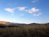
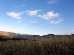
The mountain range spreads over an area of 300 km², 27 miles in length, southeast to northwest, and up to 23 miles in width. The highest peak is Tornik at 1496 m. Zlatibor is situated between 43° 31' N, and 43° 51' N, and between 19° 28' E, and 19° 56' E.
Zlatibor is administratively divided into three municipalities within Serbia: Čajetina
Cajetina
Čajetina is a town and municipality in western Serbia, residing in the Zlatibor District. In 2011, the town has a total population of 3,342, while municipality has 14,762 inhabitants. Its coordinates are 43.75°N and 19.72°E...
, Užice
Užice
Užice is a city and municipality in western Serbia, located at the banks of the Đetinja river. It is the administrative center of the Zlatibor District...
and Nova Varoš
Nova Varoš
Nova Varoš is a town and municipality in Zlatibor District of Serbia. According to the 1991 census, the municipality of Nova Varoš had a population of 21,812, while according to the 2011 census, the number of inhabitants in the municipality was 16,758...
, in the Zlatibor District
Zlatibor District
Zlatibor District is a district in the western, mountainous part of the Republic of Serbia. The district was named after the mountain region of Zlatibor. According to the 2011 Census Data, the Zlatibor District has a population of 284,729 people...
. The railroad Belgrade-Bar passes through Zlatibor.
The southern and the eastern border of Zlatibor are natural - the rivers Uvac
Uvac
The Uvac is the river in southwestern Serbia and Republika Srpska, 119 km long right and major tributary of the Lim, loosely making the northern border of the Sandžak/Raška region...
and Veliki Rzav. In the west Zlatibor borders Bosnia
Bosnia (region)
Bosnia is a eponomous region of Bosnia and Herzegovina. It lies mainly in the Dinaric Alps, ranging to the southern borders of the Pannonian plain, with the rivers Sava and Drina marking its northern and eastern borders. The other eponomous region, the southern, other half of the country is...
- its villages of Mokra Gora
Mokra Gora
Mokra Gora , meaning the Wet Mountain in English, is a village in Serbia on the northern slopes of mountain Zlatibor. Emphasis on historical reconstruction has made it into a popular tourist center with unique attractions....
, Semegnjevo
Semegnjevo
Semegnjevo is a village in the municipality of Čajetina, western Serbia. According to the 2002 census, the village has a population of 300 people.-References:...
and Jablanica mark the border. Zlatibor is located in the northern part of the Stari Vlah
Stari Vlah
Stari Vlah is a historic and geographical region in Southwestern Serbia.-Geography:Stari Vlah contains 7 municipalities of Serbia: Priboj, Nova Varoš, Prijepolje, Užice, Ivanjica, Čajetina, and Arilje...
region, a historical border region between Raška, Herzegovina
Herzegovina
Herzegovina is the southern region of Bosnia and Herzegovina. While there is no official border distinguishing it from the Bosnian region, it is generally accepted that the borders of the region are Croatia to the west, Montenegro to the south, the canton boundaries of the Herzegovina-Neretva...
and Bosnia. The hill called Cigla near the village of Jablanica still has some borderline markings of the Kingdom of Serbia
Kingdom of Serbia
The Kingdom of Serbia was created when Prince Milan Obrenović, ruler of the Principality of Serbia, was crowned King in 1882. The Principality of Serbia was ruled by the Karađorđevic dynasty from 1817 onwards . The Principality, suzerain to the Porte, had expelled all Ottoman troops by 1867, de...
, Austria-Hungary
Austria-Hungary
Austria-Hungary , more formally known as the Kingdoms and Lands Represented in the Imperial Council and the Lands of the Holy Hungarian Crown of Saint Stephen, was a constitutional monarchic union between the crowns of the Austrian Empire and the Kingdom of Hungary in...
and the Ottoman Empire
Ottoman Empire
The Ottoman EmpireIt was usually referred to as the "Ottoman Empire", the "Turkish Empire", the "Ottoman Caliphate" or more commonly "Turkey" by its contemporaries...
. In the Middle Ages
Middle Ages
The Middle Ages is a periodization of European history from the 5th century to the 15th century. The Middle Ages follows the fall of the Western Roman Empire in 476 and precedes the Early Modern Era. It is the middle period of a three-period division of Western history: Classic, Medieval and Modern...
, Zlatibor was known as Rujno, a župa
Župa
A Župa is a Slavic term, used historically among the Southern and Western branches of the Slavs, originally denoting various territorial and other sub-units, usually a small administrative division, especially a gathering of several villages...
that was part of Raška. The name Zlatibor started to be used in the 18th century, but its etymology is uncertain. It probably stems from the Serbian words zlatni (golden) and bor (pine) — a particular type of a pine
Pine
Pines are trees in the genus Pinus ,in the family Pinaceae. They make up the monotypic subfamily Pinoideae. There are about 115 species of pine, although different authorities accept between 105 and 125 species.-Etymology:...
originates from the mountain, whose Latin name is Pinus sylvestris var. zlatiborica, and today is endangered.
Tourism in Zlatibor

Resort
A resort is a place used for relaxation or recreation, attracting visitors for holidays or vacations. Resorts are places, towns or sometimes commercial establishment operated by a single company....
, characterized by a cool mountain
Mountain
Image:Himalaya_annotated.jpg|thumb|right|The Himalayan mountain range with Mount Everestrect 58 14 160 49 Chomo Lonzorect 200 28 335 52 Makalurect 378 24 566 45 Mount Everestrect 188 581 920 656 Tibetan Plateaurect 250 406 340 427 Rong River...
climate, clean air, long periods of sunshine during the summer and a heavy snow cover in winter. Tourist facilities include modern hotels, holiday centers and cottage
Cottage
__toc__In modern usage, a cottage is usually a modest, often cozy dwelling, typically in a rural or semi-rural location. However there are cottage-style dwellings in cities, and in places such as Canada the term exists with no connotations of size at all...
s, sports grounds and ski
Ski
A ski is a long, flat device worn on the foot, usually attached through a boot, designed to help the wearer slide smoothly over snow. Originally intended as an aid to travel in snowy regions, they are now mainly used for recreational and sporting purposes...
ing.
Medical services are provided by the staff of the Special Institute for the Prevention and Treatment of Thyroid Gland Disorders and the Rehabilitation of Patients. Modern methods of treatment are being utilized, including ultrasound
Ultrasound
Ultrasound is cyclic sound pressure with a frequency greater than the upper limit of human hearing. Ultrasound is thus not separated from "normal" sound based on differences in physical properties, only the fact that humans cannot hear it. Although this limit varies from person to person, it is...
techniques, stimulator's, diathermy and iodized and galvanic baths.
Notable successes have been achieved in the diagnosis
Diagnosis
Diagnosis is the identification of the nature and cause of anything. Diagnosis is used in many different disciplines with variations in the use of logics, analytics, and experience to determine the cause and effect relationships...
, treatment, rehabilitation
Physical therapy
Physical therapy , often abbreviated PT, is a health care profession. Physical therapy is concerned with identifying and maximizing quality of life and movement potential within the spheres of promotion, prevention, diagnosis, treatment/intervention,and rehabilitation...
, and prevention of different kinds and stages of thyroid
Thyroid
The thyroid gland or simply, the thyroid , in vertebrate anatomy, is one of the largest endocrine glands. The thyroid gland is found in the neck, below the thyroid cartilage...
gland
Gland
A gland is an organ in an animal's body that synthesizes a substance for release of substances such as hormones or breast milk, often into the bloodstream or into cavities inside the body or its outer surface .- Types :...
diseases.
See also
- ČajetinaCajetinaČajetina is a town and municipality in western Serbia, residing in the Zlatibor District. In 2011, the town has a total population of 3,342, while municipality has 14,762 inhabitants. Its coordinates are 43.75°N and 19.72°E...
(administrative centre of Mt. Zlatibor) - Mokra GoraMokra GoraMokra Gora , meaning the Wet Mountain in English, is a village in Serbia on the northern slopes of mountain Zlatibor. Emphasis on historical reconstruction has made it into a popular tourist center with unique attractions....
(a village at Mt. Zlatibor) - SirogojnoSirogojnoSirogojno is a village in Serbia located on Mt. Zlatibor. Sirogojno offers a variety of interesting activities including fashion shows of knitwear hand-made by women living on Mt...
(a ethno-village at Mt. Zlatibor) - KremnaKremnaKremna is a village located in the Užice municipality of Serbia. In the 2002 census, Kremna had a population of 722 people. Kremna is well known for world famous prophets Miloš Tarabić and his nephew Mitar Tarabić...
, home of the world famous Prophecy from KremnaProphecy from KremnaThe Kremna Prophecies or Prophecy from Kremna are a collection of prophecies purporting to have been written before twentieth-century events that they describe... - Užice-Ponikve AirportUžice-Ponikve AirportUžice-Ponikve Airport also known as Lepa Glava is an airport in the western part of Serbia...
(nearby airport) - Zlatibor DistrictZlatibor DistrictZlatibor District is a district in the western, mountainous part of the Republic of Serbia. The district was named after the mountain region of Zlatibor. According to the 2011 Census Data, the Zlatibor District has a population of 284,729 people...
External links
- / Zlatibor Mountain Travel Guide Zlatibor Info Web site
- MSN Map
- -> Everything about Zlatibor in one place Everything about Zlatibor in one place

