

Mossel Bay
Encyclopedia
Mossel Bay is a harbour town of about 130,000 people on the Southern Cape (or Garden Route
) of South Africa
. It is an important tourism and farming region of the Western Cape Province. Mossel Bay lies 400 kilometres east of the country's seat of parliament, Cape Town
(which is also the capital city of the Western Cape Province), and 400 km west of Port Elizabeth, the largest city in the Eastern Cape Province.
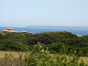
The older parts of the town occupy the north-facing side of the Cape St Blaize Peninsula, whilst the newer suburbs straddle the Peninsula and have spread eastwards along the sandy shore of the Bay.
The warm waters of the Indian Ocean
to the south, and the protective barrier of the Outeniqua Mountains
to the north, act together to create almost idyllic weather patterns that, combined with kilometre after kilometre of sandy beaches, have given Mossel Bay the reputation for having the finest weather in South Africa. The town is, therefore, indisputably one of South Africa's favourite beach holiday destinations, not least because its weather is conducive to enjoying the beach throughout the year.
Tourism
remains one of the most important drivers of Mossel Bay's economy.
The town's economy relied heavily on farming, fishing and its commercial harbour (the smallest in the Transnet Port Authority's stable of South African commercial harbours), until the 1969 discovery of natural offshore gas fields led to the development of the gas-to-liquids refinery
operated by PetroSA (Pty) Ltd.
 Although it is today best known as the place at which the first Europeans landed on South African soil (Bartolomeu Dias
and his crew arrived on 3 February 1488), Mossel Bay’s human history can - as local archaeological deposits have revealed - be traced back more than 164,000 years.
, all people alive today evolved from a core population of about 600 individuals who lived on the African Continent between 100,000 and 200,000 years ago. The Mossel Bay Archaeology Project (MAP) has shown that the Southern Cape Coast was most probably the point where modern behaviour first emerged about 164,000 years ago.
The Mossel Bay Archaeology Project was created to examine the ancient middens in the Pinnacle Point Caves, most of which lie about 12 km east of Cape St Blaize.
The discovery was made during routine archaeological surveys conducted prior to the development of the Pinnacle Point Beach and Golf Resort, and excavations began in the year 2000 under the leadership of Professor Curtis Marean (a palaeoanthropologist with the Institute of Human Origins at the Arizona State University
), and by Dr. Peter Nilssen, of the Iziko South African Museum
. The scientific team includes researchers from South Africa (the University of Cape Town
), Australia (the University of New South Wales
and the University of Wollongong
), as well as Israel and France. Funding for the project was obtained from the National Science Foundation
(USA); the Hyse Family Trust; the Iziko South African Museum
; the University of Cape Town
; and the Dias Museum in Mossel Bay.
The Project focuses on a series of caves cut into the sea-facing cliffs on the southern boundary of the Pinnacle Point Beach and Golf Resort, which were occupied between 170,000 and 40,000 years ago by Middle Stone Age people.
The excavations have revealed the earliest evidence for the systematic exploitation of marine resources such as shellfish (which would have provided the Omega-3 fatty acids required for the development of the modern human brain); the earliest evidence for the use of dyes in symbolling (particularly the use of ochre, possibly for body painting or decorative arts); the use of advanced bladelet technology (embedding smaller blades into larger strata to create complex tools); and the earliest evidence for the use of heat treatment in the manufacture of stone tools.
The significance of the finds is increased by the presence of fossilised carbon isotopes in the dripstone formations (stalactite
s) hanging from the roofs of the caves, which contain a record of the composition of the water that seeped into the caves over a period beginning about 400,000 years ago. As part of their work, the scientists on the Bay Archaeology Project are studying this evidence in order to create a portrait of the climate of the area over the period 400,000 to 30,000 years ago so as to be able to correlate the evidence of human behaviour on the floor of the caves with climate patterns, and thus learn how man has adapted to climate change over the ages.
The findings of the Mossel Bay Archaeology Project have been brought to school children in the Western Cape Province through the work of the SACP4 Education Project (South African Coastal Palaeoanthropology, Palaeoclimates, Palaeoenvironments and Palaeoecology Project), which offers field trips to the Dias Museum Complex and its mock archaeology dig.
Professor Marean delivered the opening address to the 44th Nobel Conference at the Gustavus Adolphus College
in St. Peter, Minnesota
, on October 7, 2008. His lecture, ‘The African Evidence for the Origins of Modern Human Behavior’ explained his thesis that the climate, vegetation and geography of the Mossel Bay area provided perfect living conditions for the core population of about 600 individuals who were the progenitors of modern humankind.
The Cave has revealed deposits dating from about 200,000 years ago to the pre-colonial period, during which time middens were laid down by herders of the San or Khoekhoen people.
. This art, which is now associated with shamanistic
practices (in which the rock itself is thought to have been considered the veil between this world and the spirit world), was created by the San people, and specimens may date back as far as 27,000 years.
The rock art sites surrounding Mossel Bay are generally located on private land, and are therefore only accessible to the public in the company of registered guides, who will ensure that the integrity of the pieces remains intact.
landed with his men at a point close to the site of the modern-day Dias Museum Complex. Here they found a spring from which to replenish their water supplies. Dias had been appointed to search for a trading route to India by King John II of Portugal
, and, without realising it, actually rounded the Cape of Good Hope
before landing at Mossel Bay - which he named Angra dos Vaquieros (The Bay of Cowherds). Dias is also credited with having given the Cape the name Cabo das Tormentas (the ‘Cape of Storms’), although King John II later changed this to Cabo da Boa Esperança (the Cape of Good Hope).
Dias’ excursion ashore ended hastily when the local people chased him off in a hail of stones.
By the time the Portuguese explorer Vasco da Gama
reached the area in 1497, the Bay had been marked on the maps as Aguada de São Brás, (the Watering Place of St Blaize - whose feast is celebrated on the 3rd of February).
Da Gama bartered successfully for cattle with the local Khoe people in what is generally regarded as the first commercial transaction between Europeans and the indigenous people of South Africa.
In 1501, another Portuguese navigator, Pedro d'Ataide, sought shelter in Mossel Bay after losing much of his fleet in a storm. He left an account of the disaster hidden in an old shoe which he suspended from a milkwood tree (Sideroxylon inerme
) near the spring from which Dias had drawn his water. The report was found by the explorer to whom it was addressed — João da Nova
— and the tree served as a kind post office for decades thereafter. (More recently, a boot-shaped post box has been erected under the now famous Post Office Tree, and letters posted there are franked with a commemorative stamp. This has ensured that the tree has remained one of the town’s biggest tourist attractions.)
João da Nova erected a small shrine near the Post Office Tree, and although no traces of it remain, it is considered the first place of Christian worship in South Africa.
The origin of the name Mossel Bay (the Bay of Mussels) has to do with the ascendancy of the Dutch shipping merchants in the late 16th and the early 17th Centuries. In one account, the explorer Cornelis de Houtman
named the place Mosselbaai when he stopped there in 1595, whilst in another, the Dutch Admiral Paulus van Caerden
named it when he came ashore on the 8th of July 1601. Whatever the case, though, the mussels and oyster
s on the shore would have been a welcome addition to the limited diet on which ship’s crews were expected to survive in those days.
Although the Dutch governor of the Cape Colony, Jan de la Fontaine, visited Mossel Bay and erected a possession stone here in 1734, the first permanent European building — a fortress-like granary
— was built only in 1787. In July of the following year, the first shipment of wheat grown in the area was shipped from the Bay.
Although a British force had invaded the Cape in 1806, and Britain had taken permanent possession of the Colony in 1814, the Mossel Bay area retained its Dutch-given name until its declaration as a magistracy in 1848, when it was renamed Aliwal South, after the Battle of Aliwal
in India, where the then governor of the British-held Cape Colony, Harry Smith, had won victory over the Sikhs on the 8th of January 1846. The name Aliwal South never stuck, however — even when the town was officially proclaimed in 1848, and when it became a Municipality in 1852.
From the earliest days of the Dutch settlers, Mossel Bay acted as the major port serving the Southern Cape region and its hinterland, the arid Klein (or Little) Karoo, and during the ostrich feather boom of the late 19th and early 20th centuries, more than 800,000 kg of feathers were exported through the port every year — which may have been the impetus that led to the construction of the first breakwater in 1912.
Fishing and farming remained the main activities of the area during the early years of the 20th Century, and the growth of the port reflected this. The discovery of natural gas fields offshore in 1969, of the FA gas field in the Bredasdorp Basin (also off the Southern Cape coast) in 1980, and of the nearby EM field in 1983, led to the development of the Mossgas gas-to-liquids refinery (commissioned in 1987 and renamed the PetroSA Refinery in 2002).
This changed the nature of the port so that its major business now comes from serving supply ships for PetroSA’s offshore platforms, and from export via its offshore single point (or single buoy) mooring
, which is located in about 21 metres of water in an unsheltered roadstead at Voorbaai, in the lee of the St Blaize Peninsula.
The development of the refinery led to a marked increase in property development in Mossel Bay, with the number of houses growing rapidly to accommodate the work force during the construction period.
Many of the people who came to work on the project remained in the town after commissioning, and it would appear from the changing economy of the town that they found work in tourism, light industry or commerce.
Whilst the Port and the Refinery have, of course, had a major influence on the development of Mossel Bay, they have always worked in tandem with the growth of tourism and general commerce so that the town now boasts a balanced and vibrant economy. Tourism in particular has influenced much of the growth since 1994, although the town has been a popular resort destination for South Africans since as early as the late 1800s.
The (ATKV or Afrikaans Language and Cultural Society) bought the farm Hartenbos
, east of what was then the town of Mossel Bay, in 1936, and developed it as a holiday resort (now known as the ATKV Hartenbos Resort, and considered the biggest self-catering resort in the Western Cape Province). This was a significant step in the development of the town’s tourism economy as it positioned Mossel Bay as a beach holiday destination - and beach tourism remains a major focus for incoming tourism in the 21st Century.
South Africa
installed its first democratically elected government
in 1994, which brought about sweeping changes in the structure of local government throughout the country - one of the results of which was that Mossel Bay merged with the smaller, neighbouring villages of Friemersheim, Great (or Groot) Brak River
and Herbertsdale to form the present-day Municipality of Mossel Bay in December 2000.
of the Indian Ocean
to the south, and by the presence of the Outeniqua Mountains
to the north. Mossel Bay receives 80% of its rainfall at night.
Frost is rare or almost absent and snow has never been recorded on the coastal platform. Snow does, however, occasionally fall on the mountain peaks and can be seen from the town on rare occasions. Prevailing winds are westerly in winter (May - August) and easterly in summer (September - April), and rarely reach storm- or gale-force strength. The average days of sunshine are 320 days per year.
, which form part of the Cape Fold Belt
, lie to the north of the municipal area. These mountains of sandstone and shale are characterised by gentle slopes to the seaward side (which are generally covered by montane fynbos
and grasslands), and rise to a height of 1,578 m at Cradock Peak, near George (40 km feast of Mossel Bay), and 1,675 metres at Formosa Peak near Plettenberg Bay (150 km east of Mossel Bay).
To the east, the land slopes upwards towards the wave-cut platform
(average elevation 245 metres) that characterises the more lush all-year-round rainfall area of the Garden Route. Here the land is mostly covered by grass and farmlands. The deep sandy soils of the western portion of the municipal area also give way to grass and farm-lands, with large stands of typically dry fynbos which are characterised by, amongst others, the Aloe ferox
(also known as the bitter aloe, Cape aloe or red aloe) from which skin-care products are made locally, and the Chondropetalum tectorum (Cape or thatching reed
) which is used for the roofing of traditional Cape-Dutch buildings
.
The municipal area’s boundaries are the Gouritz River in the west, the Outeniqua Mountains to the north, the Maalgate River in the east, and the Indian Ocean to the south. The municipal offices are situated at latitude -34.18179 and longitude 22.139262.34.18179°N 22.139262°W
Glentana 34.047806°N 22.314434°W, Outeniqua Strand (Outeniqua Beach) 34.048224°N 22.288299°W, and Botha Strand (Botha’s Beach) 34.050446°N 22.269244°W
These places relatively recently developed residential areas are popular for their beaches, and are well known for their excellent whale and dolphin watching — hence the establishment of a number of guest houses, bed and breakfasts, and self-catering units.
Great Brak River (Afrikaans: Groot Brakrivier) 34.040107°N 22.221394°W
This is a historic village built around the Great Brak River Lagoon, about 27 km east of Mossel Bay’s CBD. It was founded by the Searle family of Surrey, England — of which the elder brother, Richard (originally a labourer), emigrated to South Africa under a Government-sponsored scheme in 1845. He arrived in Great Brak River to work for the Central Road Board in 1850. Richard’s brother, Charles, and sister-in-law, Pamela, are credited with founding the village in 1859.
The Searle family went on to become toll keepers (toll houses were operated by private contractors during the 1800s), and would establish shopping, accommodation, shoe-making and timber businesses in the village.
Today, Great Brak River is chiefly a holiday destination, with beaches and the Lagoon providing the major attractions. The Island residential area is still linked to the mainland by its original, single lane bridge. 34.053388°N 22.239118°W
Other highlights in Great Brak River include a local history museum, historic buildings built between 1852 and the mid 1930s, the Wolwedans Dam
, and a restored power station
dating back to the early 1900s.
The 4-star Botlierskop Private Game Reserve is the biggest commercial attraction in the Great Brak area.
Tergniet 34.065245°N 22.192211°W, Reebok 34.076514°N 22.169466°W, and Little Brak River (Klein Brakrivier) 34.085791°N 22.15466°W
Like Outeniqua Strand and Botha Strand, the suburbs of Tergniet, Reebok, and Little Brak River are popular for their beaches, their excellent whale and dolphin watching, and guest houses, bed and breakfasts, and self-catering units.
Hartenbos
34.124062°N 22.111444°W
Hartenbos (probably from the Dutch ‘hart en bosch’ — or ‘deer and bush’) is a both a residential area, and the home of one of South Africa’s most popular holiday resorts — the ATKV Hartenbos (ATKV: , or Afrikaans Language and Cultural Society).
Hartenbos traces its history as a holiday destination to 1933, when the then South African Railways and Harbours (SAR&H - now separate divisions of Transnet) opened a holiday resort for its lower-ranking employees.
The land was bought in 1936 by the ATKV, and the resort expanded and grew to the point where it now offers more than 900 beds in self-catering units, as well as 570 serviced caravan stands. It also boasts an Amphitheater that’s used for Afrikaans cultural events, for annual Christmas carols, and for a Christmas morning service that’s attended by thousands.
Hartenbos borders five kilometers of beach, and the Hartenbos River. Attractions and facilities include paddle boats, a ‘waterwurm’ (super tube or water slide), a fun park, and a heated swimming pool, as well as flea markets, conference facilities for up to 1,800 people (The Whale Hall), and the Hartenbos Museum, which highlights the Great trek
of 1838 (during which the Boers fled the Cape Colony en masse), the Commemorative Trek of 1938, and the history of Hartenbos. See below.
Voorbaai 34.146743°N 22.103548°W
Voorbaai is an industrial area and site of the Mossel Bay’s largest shopping centre - the Langeberg Mall.
kwaNonqaba 34.173926°N 22.087584°W
kwaNonqaba is a large, lower income dormitory suburb.
D'Almeida 34.17856°N 22.115049°W
D'Almeida is a historically important suburb that commands particularly good views of the Bay, and is characterised by stone cottages -made from material mined on the site of each home using large bonfires which were doused with water to crack the underlying rock.
Da Nova 34.180575°N 22.130799°W
Da Nova is a dormitory suburb largely for the lower middle class.
Fraaiuitsig 34.172839°N 22.115575°W
Fraaiuitsig is a large, middle- to upper class suburb overlooking the Bay (the name Fraaiuitsig means Beautiful View).
De Bakke 34.165489°N 22.112678°W
De Bakke is the suburb closest to De Bakke Beach, and characterised by the large, shady De Bakke Caravan Park, which is situated on the ocean’s edge.
Bay Vew 34.181631°N 22.133117°W
Bay Vew is a middle-to upper class suburb.
Mossel Bay CBD 34.182279°N 22.141786°W
Mossel Bay CBD is a business and residential area on the slopes above Mossel Bay Harbour; characterised by beautiful Victorian and Edwardian stone buildings built by Cornish masons who settled in the area.
Mossel Bay Extension 1 34.182563°N 22.15297°W
Mossel Bay Extension 1 is a middle-to upper-class suburb on the slopes above the CBD.
The Point Area 34.184213°N 22.157804°W
The Point Area, on a small plateau at the foot of the Cape St Blaize Lighthouse, is a historic and popular focus of the tourism industry; it’s grassy Point Caravan Park is surrounded by 6 pubs and restaurants, the 4-star The Point Hotel, a shark research and exhibition aquarium, mini golf, and Mossel Bay’s art deco-style war memorial. It’s also the site of Milkwood Primary School, is a popular surfing spot (Inner Pool), and boasts two tidal pools (the natural rock pool in front of The Point Hotel is said to be the longest on the South African Coast).
Linkside 34.187293°N 22.147107°W
Linkside is a middle and upper class suburb adjoining Mossel Bay Golf Course.
Mossel Bay Golf Estate 34.191021°N 22.126851°W
Mossel Bay Golf Estate is a middle and upper class housing between the fairways of the Mossel Bay Golf Course.
Mossel Bay Extension 15 34.185128°N 22.121272°W
Mossel Bay Extension 15 is a middle class dormitory suburb.
Pinnacle Point 34.202823°N 22.086811°W
Pinnacle Point is an up-market gated residential estate interwoven with the fairways of the Pinnacle Point Golf Course.
Dana Bay 34.201332°N 22.047071°W
Dana Bay is a middle-to upper class dormitory suburb and a declared conservancy on the beachfront west of Cape St Blaize .
Nautilus Bay 34.214322°N 21.97463°W
Nautilus Bay is a resort suburb set in the Fynbos
(Cape macchia) and overlooking the ocean.
Boggoms Bay 34.266261°N 21.910686°W
Boggoms Bay is a resort suburb characterised by whitewashed, thatched Cape-Dutch style cottages on the beachside. Forms part of the Fransmanshoek Conservancy.
Vleesbaai 34.291882°N 21.914377°W
Vleesbaai is a beachside resort Village and part of the Fransmanshoek Conservancy.
Mossdustria 34.162067°N 21.997633°W
Mossdustria is an industrial area originally developed to serve PetroSA’s (previously Mosgas’) Gas-to-Liquids Refinery. Now a locus for general light engineering and manufacturing.
Herbertsdale 34.016758°N 21.764216°W
Herbertsdale is a village and farming area north west (inland, about 60 km by road) of Mossel Bay’s CBD.
Brandwag 34.048997°N 22.055504°W
Brandwag is a low income housing off the R328 (the main road from Mossel Bay to Oudtshoorn), and 20 km from Mossel Bay’s CBC.
Ruiterbos 33.984666°N 22.04514°W
Ruiterbos is a rural area northwards of Mossel Bay’s CBD (inland, along the R328, about 25 km from the centre of town). The Ruiterbos Valley is a tourism hub offering 4x4 trails, hiking trails, arts and crafts galleries, guest farms, horse riding (including the Outeniqua Moon Percheron Stud, home to the largest herd of Percheron
draft horses in South Africa), and a historic country hotel — Eight Bells Mountain Inn.
Friemersheim 33.955571°N 22.141314°W
Friemersheim is an historic mission station
about 20 km north east of Mossel Bay’s CBD. Various small and micro enterprises specialising in furniture, art and crafts, soft furnishing, etc. welcome visitors.
is the regional capital of the Eden District Municipality, which incorporates the Garden Route coastal area, and the Klein Karoo (largest town: Oudtshoorn), the semi-arid area in the rain shadow of the Outeniqua Mountains
.
Albertinia (34.209318°N 21.595516°W) About 53 km the west of Mossel Bay, Albertinia
is best known for its aloe factories, (Organic Aloe Pty. Ltd., and Aloe Ferox), and as a popular game viewing destination (Garden Route Game Lodge). It is also a source of thatching reeds.
Oudtshoorn (33.579073°N 22.198162°W). About 78 km north-north-east of Mossel Bay, Oudtshoorn is the centre of the Klein (or Little) Karoo ostrich
farming region. It’s also an important tourism hub, famous for its Cango Caves
, game viewing (Buffelsdrift Game Lodge), and its ostrich show farms — Cango Ostrich Show Farm; Chandelier Game Farm; Highgate Ostrich Show Farm
; and Safari Ostrich Show Farm. Oudtshoorn is also featured on the Route 62 Wine Route.
(ANC) has 7. The Mossel Bay Council is led by executive mayor Alderlady Marie Ferreira, of the DA, who took office after the March 2006 local government elections. No single party obtained an outright majority in those elections. In Mossel Bay, the DA won 10 seats, the ANC won 8, and the Independent Civic Organisation of South Africa (ICOSA), won 3. The DA therefore formed a coalition with ICOSA. However, during the floor-crossing window of September 2007, the DA gained an outright majority — 13 seats — when two councillors defected from ICOSA, and one defected from the ANC. ICOSA subsequently lost its representation in the council when its last ward councillor became independent.
The Municipality is responsible for the following services:
Electricity: (supplied to 31,709 consumers in the 2009/2010 financial year): the Municipality resells electricity generated by the national utility, Eskom
.
Water: the municipality’s main source of supply is the Wolwedans Dam, which is managed by the Department of Water Affairs. The Municipality also draws water from its own Ernst Robertson and Klipheuwel Dams, as well as from a network of boreholes, and an effluent water purification plant with a capacity of 5 Ml/day. A seawater desalination plant with a capacity of 15 Ml/day is under construction.
Sewerage: the majority of households in Mossel Bay are serviced by a water-borne, flush sanitation system.
Environmental health: including cleansing services, and refuse removal.
Fire, rescue and safety services: as well as law enforcement and community protection services.
Roads: the municipality is responsible for the planning, construction and maintenance of its urban road networks. The current network includes 417,9 km of paved and concreted roads, and 24 km of gravel roads.
Housing: the municipality seeks to address the housing needs of low- and middle-income families who do not have access to the commercial bond market. It acts as an agent for the South African Department of Housing in identifying potential beneficiaries, and identifying and securing suitable land for housing development. It is also active in sourcing funding, and project management. At the end of June 2010, the waiting list for housing contained 12,543 families.
Libraries: the municipality acts as the agent for the Provincial Government of the Western Cape in the management of eleven libraries (including one mobile library) in the municipal area.
Urban development and control: this includes spatial development planning, control over development and building activities, and the provision of information to property owners and developers.
Vehicle services: vehicle registration, the issue of drivers licenses, etc.
Approximately 73.17% spoke Afrikaans at home, 18.83% spoke IsiXhosa
, 5.17% spoke English
, 0.34% spoke Sesotho
, 0.09% spoke Setswana, 0.06% spoke IsiZulu, 0.03% spoke Sepedi, 0.02% spoke Tshivenda, and 0.01% spoke SiSwati.
The population lived in 15,419 households, of which 78.86% were formal dwellings, 48.32% had telephones in the home, 87.86% had electricity, 89.24% had sanitation, and 68.47% had piped water to their dwellings.
The major attractions were then, and (to a large extent) still are, the dry, warm and stable weather, and the Indian Ocean
and its beaches. However, with good roads, modern vehicles and the development of inland accommodation, the broader environment of the area (including the Outeniqua Mountains
to the north, and large stands of fynbos
or Cape macchia to the west) is now vital to the tourism economy. In addition, the history of the town (Mossel Bay was the site of the first contact between European explorers and indigenous people), and its cultural attractions are important draw cards.
Mossel Bay is situated exactly half way between Cape Town
(and the Cape Winelands) and Port Elizabeth (with its game reserves), and is therefore a popular stopping-off and resting point on the itineraries of international visitors to the Western and Eastern Cape Provinces.
The ATKV-Hartenbos (which can accommodate about 8,000 people) is the largest camping, caravanning, and self-catering resort in the Western Cape Province.
— which was commissioned as Mossgas in 1987 — is situated about 13 km to the west of the town’s central business district.
This is one of the world’s largest Gas to liquids
(GTL) refineries, and has always been a leader in the challenge of commercialising the GTL processes. It produces 36000 barrels (5,723.5 m³) per day (bbl/d) — a crude oil equivalent of 45000 oilbbl/d — using the Fischer-Tropsch process
of converting natural gas
(which is piped from offshore fields via PetroSA’s FA Platform).
Mossel Bay’s GTL plant serves up to 15 percent of South Africa’s transport fuels requirements. It produces unleaded gasoline
, ultra low sulphur diesel, kerosene
, low aromatic distillates, drilling fluids, liquid petroleum gas, low sulphur fuel oil
, anhydrous alcohols, liquid oxygen
, liquid nitrogen
, carbon dioxide
, and waxes.
in the Western Cape Province
, to Durban
in KwaZulu-Natal Province
. (Using this route, Mossel Bay lies exactly at the mid-point between Cape Town and the Eastern Cape Province’s
capital of Port Elizabeth — 400 km each way).
The Municipality of Mossel Bay maintains 417,9 km of paved and concreted roads, and 24 km of gravel roads. Mossel Bay is a stopping point for all major road transport operators licensed for this region.
The depth of the entrance channel is 8 metres, while the maximum permissible draught inside the harbour is 6.5 metres. Pilotage is compulsory from a point 2 nautical miles (3.7 km) northeast of Cape St Blaize.
Bunkering is available on the jetty and at quays 2, 3, and 5. Quay 4 can accommodate vessels of up to 130m, with a draught of 6.5m. A ship repair slipway can accommodate vessels of up to 200 tonnes. Ship chandler and stevedore services are available, as are diving services for hull cleaning, underwater inspection, salvage, etc.
The harbour has two offshore mooring buoys inside port limits: a catenary buoy mooring that caters for ships of up to 32,000DWT (maximum length 204m, draught 12m); and a single point mooring (SPM) marine tanker terminal that’s connected to three hoses for the export of products from PetroSA’s gas-to-fuel
refinery, which is situated inland (about 13 km) and directly west of Mossel Bay. The SPM is located off Voorbaai in an open, unsheltered roadstead in about 21 metres of water.
During the 2008/09 financial year Mossel Bay served 1,567 vessels (mostly South African trawlers) with a combined gross tonnage of 3,317,364-gt, and
handled a total of 2,014,185 tonnes of cargo (1,940,310t of bulk cargo — mostly oil products — and 73,875t of break-bulk). 773,267 tonnes of cargo was landed, and 1,240,918t was shipped.
15000 people worked on the synthol & refinery plant in Mossel Bay from 1998-2002 from all over the world - changing the landscape of the perception of
South Africa Garden Route & giving major credence to South Africa & multi-relations to the world.
(IATA code GRJ), which is situated 40 km east of Mossel Bay’s CBD and is owned and managed by the Airports Company of South Africa (ACSA). George Airport offers scheduled flights to and from Cape Town International Airport
, Durban’s King Shaka International Airport
, and Johannesburg’s OR Tambo International Airport.
(CAA) for use by non-scheduled flights and private planes. Air traffic is controlled by George Airport
.
Facilities: control tower, taxiways, runway lights, fueling facilities, and complimentary tie-down facilities. The airfield is the home of the Mossel Bay Aero Club, which has a clubhouse lounge with bar and kitchen, and braai (BBQ) areas for members’ and guests’ use. Flight training and tandem skydiving are offered.
Originally designed to celebrate the arrival of Dias and his crews on 3 February 1488, and to protect the Post Office Tree, the Complex now offers a wider look at the history of Mossel Bay from environmental, archaeological, and cultural perspectives.
The complex has seven main components:
The Post Office Tree
The Dias Museum Complex centres around an old milkwood tree (Sideroxylon inerme
) that’s been used as a kind of post office since 1501.
In 1500 the Portuguese noble, military commander, navigator and explorer Pedro Álvares Cabral
(c. 1467 – c. 1520) headed an expedition bound for India
. His aim was to create opportunities to by-pass Italian, Arab, and Turkish
monopolies on the spice trade
. His fleet of 13 ships first travelled westward to land to Brazil
(which Cabral claimed for the Portuguese Crown), before re-provisioning, and sailing south and eastwards around the Cape of Good Hope
to India.
After landing at the city of Calicut, (now Kozhikode
), Cabral and his men initially established good relations with the local ruler (the Zamorin or Samoothiri), but these quickly soured, and the explorers decamped.
On the return Journey, one of the ships, under Pêro de Ataíde
, (1450–1504), became separated from the fleet off Mozambique
, and made for Aguada de São Brás (Mossel Bay), where de Ateide hoped to meet up with the others. Not finding them there, he wrote a letter explaining the situation in India to João da Nova
(1460–1509) (whom he knew to be sailing for the east) and left it behind in the milkwood tree
that would later become known as the Old Post Office Tree. (Some believe the letter was hidden in an old boot, some in an iron pot).
da Nova was the commander of the Third India Armada
, which King Manuel I of Portugal
had assembled in 1501 for the purposes of trade.
de Ateide’s letter must have had some effect, because the 3rd Armada, which was credited with the discovery of the uninhabited islands of Ascension
and Saint Helena
, also waged Portugal’s first significant naval battle in the Indian Ocean: the defeat of the Calicut
fleet off Cannanore
on December 31, 1501.
A post box in the shape of an old boot has now been erected under the tree, and the tree declared a national heritage site
(previously ‘national monument’). Letters and cards posted here are stamped with a special commemorative frank.
It has become a tradition for visitors to Mossel Bay to send cards from the Post Office Tree, which is now one of the town’s biggest cultural attractions.
The Maritime Museum
The building that now houses the Maritime Museum was erected in 1901 as a grain and sawmill, and was re-designed in the early 1980s as a permanent exhibition space for a life-sized replica of the caravel
which Bartolomeu Dias
sailed into the Bay in 1488. The feasibility study (completed in 1982) and design for the redevelopment were conducted by Cape Town Architect Gawie Fagan.
The Maritime Museum also displays various aspects of the maritime history of the early Portuguese
, Dutch, and English navigators, and houses a collection of local memorabilia.
The Caravel "Bartolomeu Dias"
The Caravel is one of the two most important draw-cards for the Dias Museum Complex (the Post Office Tree being the other).
Portugal
’s Bartolomeu Dias (1451 – 24 May 1500) was the first European explorer known to have sailed round the Cape of Good Hope
, which he named ‘The Cape of Storms’ (one of which would, in fact, claim his life), and the first European navigator to land on South African shores.
Dias was a nobleman and superintendent of the royal warehouses in the court of John II of Portugal. On the 10th of October, 1486, he was appointed to head an expedition to sail around the southern tip of Africa in the hope of finding both a trade route to India and the lands ruled by Prester John
, the (fabled, as it would turn out) Christian priest and African leader.
In the end, Dias managed neither of his tasks, although his expedition was considered a success because it opened the way for Vasco da Gama
’s 1497 voyage to India, during which he visited Mossel Bay, and became the first European to barter with the indigenous Khoisan
people. (Vasco da Gama, later the 1st Count of Vidigueira
and, for a short while in 1524, the Governor or Viceroy
of Portuguese India
, was a Portuguese explorer who sailed from Lisbon
on the 8th of July, 1497, with a fleet of four ships and a crew of 170 men. He became the first navigator to make a direct voyage to India
when he arrived in Kappad
near Calicut
, now Kozhikode
, on the 20th of May 1498).
The caravel on display here was built at the shipyard of Samuel & Filhos, Lda. at Vila do Conde, in Portugal and was lunched by Portugal’s First Lady, Maria de Jesus Simões Barroso Soares
, on the 14th of June, 1987.
No accurate plans of any original caravels exist, so the drawings for this replica had to be extrapolated from archaeological evidence, old documents, and even mosaics of the time, a task that was undertaken by the Aporvela (the Portuguese Sail Training Association).
What was known was that the carvel was a lateen-rigged, shallow-draft vessel, probably developed along the lines of 14th and 15th Century Arabic dhows of the Mediterranean Sea
. The replica was built at the suggestion of a Mr. Gerald Rose, and sailed to South Africa to commemorate the 500th anniversary of Dias’ voyage.
The crew of the replica was made up of South African and Portuguese residents. The South Africans were Captain Emilio Carlos de Sousa (commander), Gawie Fagan (sailing master), Andrew Blake (navigator), Antonio Farinho, Justin Fox, Charles Latham, and Faustino Lavarhinas, while the Portuguese sailors were José Batista, Rui Casimiro, Jorge Chagas, António Gaspar, António Hipoloto, Luis Levy, Francisco Neves, Luís Pino, José Luís Rangel, and Henrique Vasconcelos.
Named the "Bartolomeu Dias", the replica left Lisbon on the 8th of November, 1987, and arrived in Mossel Bay on schedule on the 3rd of February, 1988, where she took part in the local celebrations of the nation-wide Dias88 Festival. During the festival she also visited the South African
cities of Cape Town
(on 24 January 1988) Port Elizabeth, East London, Port Edward
, and Durban
before returning to Mossel Bay, where she was dry-docked in the Maritime Museum.
Other exhibits
Navigational instruments
used by the explorers of the Age of Discovery
are displayed on the wall alongside the ramp leading to the bridge onto the caravel.
A large collection of maps by early cartographers includes a copy of the Cantino planisphere
(1502), which is displayed in the entrance foyer. It is the oldest surviving map of Portuguese discoveries, shows the routes of the three most prominent explorers, and features a fragment of the Brazilian coast which Pedro Álvares Cabral
explored in 1500. The collection also includes a copy of the Martellus Map (by Henricus Martellus Germanus
), and various other early charts.
A blue and white ceramic mural
in the foyer depicts the mythical figure of Adamastor
, and was inspired by the epic poem Os Lusíadas
(1572), by the Portuguese writer Luís de Camões
(c. 1524 – June 10, 1580).
Adamastor, expelled from Olympus
for his rebellion against the Gods, and condemned to be transformed into a rugged mountain at the southern tip of Africa, is both a symbol of the forces of nature, which the Portuguese explorers were forced to overcome during their voyages, and the hideous phantom known as the "Spirit of the Cape", which threatened to ruin Vasco da Gama
and anyone else foolish enough to enter the Indian Ocean
(which Adamastor saw as his own domain).
The mural was created by a Portuguese artist known only as ‘Gilberto’. It was completed in 1988.
An exhibition of local history
occupies the top floor of the Maritime Museum.
Auditorium
The Maritime Museum is fitted with tiered bench-seating, and has excellent acoustics
. It is often used for lectures and meetings, and for concerts and recitals by local and international musicians.
The Shell Museum
The Shell Museum occupies the old Shirley Building, which is named for Joe Shirley, who once used it for his plumbing business. It was built in 1902 as an extension to the old mill and served as a store house, furniture factory, and motor garage. Old concrete slabs uncovered during renovations indicated that it might also have been used as a wheelwright’s
workshop at one time. It was restored to its present condition during the development of the Dias Museum Complex, and was opened as a shell museum in 1988.
The displays have been arranged in a spiral
pattern to emulate the interior shape of a gastropod.
Displays on the lower level include various aquaria
containing seashell
s and other marine invertebrates
, shell-less molluscs such as sea-hares (Aplysiomorpha) nudibranch
s, and marine bony fishes, as well as squid
and octopi (cephalopods). A model of a giant squid (Architeuthis sp) which washed ashore at Sea Point
(in Cape Town
) hangs above the cephalopod tank. A touch tank provides an interactive experience of marine life along South Africa’s shores, whilst an exhibition entitled ‘Man and Mollusc’ portrays a history of man’s use of shells
.
The upper-level of the Shell Museum houses South Africa’s largest collection of terrestrial, fresh water, and marine shells (collected from around the world) as well as a whale
and dolphin
exhibit.
The Granary
The Granary is used as the Dias Museum Complex’s reception, information, and educational centre. It is a multifunction conference room occupies about a third of the available space.
The Granary is a replica of the building that was erected on the site in 1786 by the Dutch East India Company
( or VOC) to serve the local grain
and wool
trades. The original granary was demolished in 1949 or 1950 when a large warehouse was erected on the site for the local farmer’s co-op (Suidwestelike Landbou Ko-operasie Bpk.). When that was demolished in 1986, the foundations of the original granary were rediscovered, and the present building was erected on these.
The Granary presently houses an exhibition of the mountain passes of the Southern Cape. A live specimen table is stocked with examples of plants and flowers (mostly of the fynbos
or Cape macchia) that grow in the Mossel Bay area.
The Munro’s Hoek Cottages
The two Cape Dutch style
cottages in the Dias Museum Complex’s gardens are replicas, built on the original foundations, of houses which Alexander Munro built here in about 1830. Munro ran a seamen’s canteen in one of these buildings, and his family later operated a seal hunting and whaling station from the adjacent beach.
The buildings are now occupied by the Mossel Bay Archaeology Project
, and are not open to the public.
The Spring
The fresh water spring which arises downhill from the Post Office Tree is the one from which Bartolomeu Dias
, João da Nova
, and other early explorers drew water when they put in at Mossel Bay.
Dias named it ‘Aguada de São Bras’ ("The Watering Place of St Blaize") since he landed in Mossel Bay on the 3rd of February, which is the Feast of St Blaize.
The Portuguese historian, Gaspar Correa, described the spring in 1512 as ‘flowing over a rocky verge into a small dam’. which is much the way it looks today.
The Ethno-botanic Garden, Braille Trail, and Field Gardens
The Ethno-botanic Garden (in the area immediately surrounding The Granary and the Maritime Museum) contains a collection of plants that occur naturally in the Mossel Bay area and which have been used by the Khoi, San, Coloured, (mixed-race), and the Xhosa people, and by European settlers, for shelter, food, magic, and medicinal purposes.
A Braille trail follows the edges of the planting area, and makes it possible for the visually impaired to read about, feel, and smell the plants in the collection.
The valley and beach north and east of the Post Office Tree are known collectively as Munro’s Bay. The natural garden of the area preserves the original vegetation that the early explorers would have found here, with milkwoods (Sideroxylon inerme
) and wild olives (Olea capensis
) the most common tree species.
The garden features a statue of Bartolomeu Dias, a grassed amphitheatre
, and mock archaeology digs which are used by the SACP-4 project (South African Paleoclimate, Paleoenvironment, Paleoecology
, Paleoanthropology
Project) to introduce local school children to the science of archaeology
.
Malay Graves
The Malay graves in the grounds of the Dias Museum Complex were discovered in 1968. They face Mecca
and are situated close to the Post Office Tree on land that’s indicated in the records as having been granted as a burial ground for Muslims more than 100 years previously.
One of the graves may be that of an Imam
or similarly important person who was buried here after dying on board ship.
of 1838 (when the Boers, dissatisfied with British rule, left the Cape Colony en mass), as well as the Symbolic Ox Wagon Trek of 1938 (a re-enactment and centenary celebration of the original event), and the history of Hartenbos itself.
The Museum is well stocked with ox wagons
, weapons, and other historic artefacts, and is divided into ten halls depicting various aspects of the overall theme:
, with particular emphasis on the founding family, the Searles. Its collections include photographs dating from 1881 to the present, as well as household and military artefacts.
The Mossel Bay Pavilion (34.176607°N 22.136279°W) is a replica of the Brighton
pier head was built on Santos Beach around 1916. It now houses a restaurant and private apartments.
The Maritime Museum (34.180015°N 22.141861°W) is part of the Dias Museum Complex. Built as a grain and wood-mill in 1901 and converted into a museum (designed by architect Gawie Fagan) in 1988 to house a replica of the caravel
in which Bartolomeu Dias
became the first European navigator
to round the Cape of Good Hope
, and also the first European to land on South Africa
n soil (which he did at Mossel Bay on 3 February 1488). The caravel was completed in Portugal 1987, and dry docked here in 1988.
The Shell Museum (34.180674°N 22.141394°W) was built as a grain store in 1902 and converted into a museum in 1988. Known as the Shirley Building because it once housed a plumbing business belonging to a Joe Shirley. The renovation and museum were designed by architect Gawie Fagan.
The Granary (34.180353°N 22.142338°W) is a replica of a building that was erected here in 1786 by the Dutch East India Company
( or VOC) to serve the local grain
and wool
trades. The present building was erected in 1988, and stands on the foundations of the original granary. It serves as the reception, information, and education centre for the Dias Museum Complex.
The Ochre Barn] (34.180055°N 22.142856°W) was built in 1849 for the horses of Barry & Nephews (merchants) and restored in 2000 and 2007. It is; now part of the Protea Hotel Mossel Bay.
The 1st Municipal Building (34.180031°N 22.143422°W; now the tourism office annex) was erected in 1858 and saw service as a dance hall, telegraph office, wool store, auction house, stage coach stop, and library. The larger, 2nd building (34.180102°N 22.143615°W; now the Crafts Art Workshop, a self-help project for local talent) was erected in 1879 and was used by the Municipality until it became a local history museum in 1975. The museum closed in 2001.
Mossel Bay Advertiser Building (34.180761°N 22.143025°W) was built as the Standard Bank in 1902 by Cape Town architects Milne & Sladdin, and used by the bank until 1950. Now houses Mossel Bay’s weekly newspaper, the Mossel Bay Advertiser.
The Vintcent Building (34.181431°N 22.143411°W) was originally a single storey general dealers. Built between 1820 and 1824 and bought by Prince, Collison & Co. in 1850. Named the Vintcent Building after Joseph Vintcent, who bought a partnership in the company and enlarged the building in about 1859. Now houses shops and offices.
Searle's Manor (34.18158°N 22.146461°W) was built in 1902 as a warehouse for Searle & Co. (merchants) of Great Brak River. Restored in 2005–6, it is now used for apartments and offices.
The Customs House (34.181502°N 22.147303°W) was built 1874. The ‘wagon stone’ on the south corner was placed there to protect the building from damage by ox wagons
.
Mossel Bay Boating Co. Offices (34.181415°N 22.147571°W) was built 1901 for the company that owned and ran the harbour. The clock tower is said to have been used to time how quickly ships were loaded and unloaded. The adjoining Goods Shed (34.181404°N 22.148019°W; built in 1900, with a clear span of 90 x 15 metres) was used as a cargo store and was at one time used as an indoor flea market.
St. Blaize Terrace houses (34.183164°N 22.153349°W) was built in 1909 and renovated in 1986.
Cape St. Blaize Lighthouse (34.186028°N 22.156152°W) was built 1864 to designs by the Colonial engineer, R. Robinson. The original light (on a masonry tower 20.5 metres in height) was stationary, but in 1897 a revolving, clock-work light, which required winding every three hours, was fitted. This was used until the late 1970s. The light is now fully automated.
Cape St Blaize Cave (34.185871°N 22.157214°W) is considered one of the most significant archaeological sites] in South Africa
because it was from the findings that he made here in the 1920s that A.J.H (John) Goodwin described the Mossel Bay industry of the middle stone age
(the cave was first excavated in 1888 by Sir George Leith). It remains a popular look-out spot for whale and dolphin watching
because of its elevated position and easy accessibility. The St Blaize Cave marks the start of the 12.5 km St Blaize Hiking Trail, which follows a contour path along the cliffs to the west.
The War Memorial (34.185412°N 22.158061°W) was designed by W.J. Delbridge of the Royal Institute of British Architects
(ARIBA), in the style of the art deco
period, and probably modeled on the cenotaph
in London
], Mossel Bay’s War Memorial was unveiled on the 28th of September, 1928. Plaques commemorate combatants who fell in the First and Second World Wars as well as in the Korean War
, and in the South African Border War
.
. A number of private commercial galleries exhibit and sell painting
s, oils, sculpture
s, etc.
The Craft Arts Workshop, (34.180102°N 22.143615°W) a project piloted by Mossel Bay Tourism, provides collective work space for about 12 local artists and crafters, all of whom are involved in the training, development and mentoring of colleagues from disadvantaged sectors of the local community. The Craft Arts Workshop, also provides exhibition and sales space for about 50 non-resident local artists.
A number of small theatres, including The Barnyard Mossel Bay offer performances throughout the year.
Garden Route
The Garden Route is a popular stretch of the south-eastern coast of South Africa. It stretches from Heidelberg in the Western Cape to the Storms River which is crossed along the N2 coastal highway over the Paul Sauer Bridge in the extreme western reach of the neighbouring Eastern Cape...
) of South Africa
South Africa
The Republic of South Africa is a country in southern Africa. Located at the southern tip of Africa, it is divided into nine provinces, with of coastline on the Atlantic and Indian oceans...
. It is an important tourism and farming region of the Western Cape Province. Mossel Bay lies 400 kilometres east of the country's seat of parliament, Cape Town
Cape Town
Cape Town is the second-most populous city in South Africa, and the provincial capital and primate city of the Western Cape. As the seat of the National Parliament, it is also the legislative capital of the country. It forms part of the City of Cape Town metropolitan municipality...
(which is also the capital city of the Western Cape Province), and 400 km west of Port Elizabeth, the largest city in the Eastern Cape Province.
The older parts of the town occupy the north-facing side of the Cape St Blaize Peninsula, whilst the newer suburbs straddle the Peninsula and have spread eastwards along the sandy shore of the Bay.
The warm waters of the Indian Ocean
Indian Ocean
The Indian Ocean is the third largest of the world's oceanic divisions, covering approximately 20% of the water on the Earth's surface. It is bounded on the north by the Indian Subcontinent and Arabian Peninsula ; on the west by eastern Africa; on the east by Indochina, the Sunda Islands, and...
to the south, and the protective barrier of the Outeniqua Mountains
Outeniqua Mountains
The Outeniqua Mountains are a mountain range located in the Western Cape of South Africa. They run in a north-easterly direction from the George area.-Nomenclature:...
to the north, act together to create almost idyllic weather patterns that, combined with kilometre after kilometre of sandy beaches, have given Mossel Bay the reputation for having the finest weather in South Africa. The town is, therefore, indisputably one of South Africa's favourite beach holiday destinations, not least because its weather is conducive to enjoying the beach throughout the year.
Tourism
Tourism
Tourism is travel for recreational, leisure or business purposes. The World Tourism Organization defines tourists as people "traveling to and staying in places outside their usual environment for not more than one consecutive year for leisure, business and other purposes".Tourism has become a...
remains one of the most important drivers of Mossel Bay's economy.
The town's economy relied heavily on farming, fishing and its commercial harbour (the smallest in the Transnet Port Authority's stable of South African commercial harbours), until the 1969 discovery of natural offshore gas fields led to the development of the gas-to-liquids refinery
Gas to liquids
Gas to liquids is a refinery process to convert natural gas or other gaseous hydrocarbons into longer-chain hydrocarbons such as gasoline or diesel fuel...
operated by PetroSA (Pty) Ltd.
History
Bartolomeu Dias
Bartolomeu Dias , a nobleman of the Portuguese royal household, was a Portuguese explorer who sailed around the southernmost tip of Africa in 1488, the first European known to have done so.-Purposes of the Dias expedition:...
and his crew arrived on 3 February 1488), Mossel Bay’s human history can - as local archaeological deposits have revealed - be traced back more than 164,000 years.
Pinnacle Point Caves
According to the presently accepted theory of the Recent African Origin of Modern HumansRecent African origin of modern humans
In paleoanthropology, the recent African origin of modern humans is the most widely accepted model describing the origin and early dispersal of anatomically modern humans...
, all people alive today evolved from a core population of about 600 individuals who lived on the African Continent between 100,000 and 200,000 years ago. The Mossel Bay Archaeology Project (MAP) has shown that the Southern Cape Coast was most probably the point where modern behaviour first emerged about 164,000 years ago.
The Mossel Bay Archaeology Project was created to examine the ancient middens in the Pinnacle Point Caves, most of which lie about 12 km east of Cape St Blaize.
The discovery was made during routine archaeological surveys conducted prior to the development of the Pinnacle Point Beach and Golf Resort, and excavations began in the year 2000 under the leadership of Professor Curtis Marean (a palaeoanthropologist with the Institute of Human Origins at the Arizona State University
Arizona State University
Arizona State University is a public research university located in the Phoenix Metropolitan Area of the State of Arizona...
), and by Dr. Peter Nilssen, of the Iziko South African Museum
Iziko South African Museum
The Iziko SA Museum is a South African national museum located in Cape Town. The museum was founded in 1825, the first in the country. It has been on its present site in the Company's Garden since 1897...
. The scientific team includes researchers from South Africa (the University of Cape Town
University of Cape Town
The University of Cape Town is a public research university located in Cape Town in the Western Cape province of South Africa. UCT was founded in 1829 as the South African College, and is the oldest university in South Africa and the second oldest extant university in Africa.-History:The roots of...
), Australia (the University of New South Wales
University of New South Wales
The University of New South Wales , is a research-focused university based in Kensington, a suburb in Sydney, New South Wales, Australia...
and the University of Wollongong
University of Wollongong
The University of Wollongong is a public university located in the coastal city of Wollongong, New South Wales, Australia, approximately 80 kilometres south of Sydney...
), as well as Israel and France. Funding for the project was obtained from the National Science Foundation
National Science Foundation
The National Science Foundation is a United States government agency that supports fundamental research and education in all the non-medical fields of science and engineering. Its medical counterpart is the National Institutes of Health...
(USA); the Hyse Family Trust; the Iziko South African Museum
Iziko South African Museum
The Iziko SA Museum is a South African national museum located in Cape Town. The museum was founded in 1825, the first in the country. It has been on its present site in the Company's Garden since 1897...
; the University of Cape Town
University of Cape Town
The University of Cape Town is a public research university located in Cape Town in the Western Cape province of South Africa. UCT was founded in 1829 as the South African College, and is the oldest university in South Africa and the second oldest extant university in Africa.-History:The roots of...
; and the Dias Museum in Mossel Bay.
The Project focuses on a series of caves cut into the sea-facing cliffs on the southern boundary of the Pinnacle Point Beach and Golf Resort, which were occupied between 170,000 and 40,000 years ago by Middle Stone Age people.
The excavations have revealed the earliest evidence for the systematic exploitation of marine resources such as shellfish (which would have provided the Omega-3 fatty acids required for the development of the modern human brain); the earliest evidence for the use of dyes in symbolling (particularly the use of ochre, possibly for body painting or decorative arts); the use of advanced bladelet technology (embedding smaller blades into larger strata to create complex tools); and the earliest evidence for the use of heat treatment in the manufacture of stone tools.
The significance of the finds is increased by the presence of fossilised carbon isotopes in the dripstone formations (stalactite
Stalactite
A stalactite , "to drip", and meaning "that which drips") is a type of speleothem that hangs from the ceiling of limestone caves. It is a type of dripstone...
s) hanging from the roofs of the caves, which contain a record of the composition of the water that seeped into the caves over a period beginning about 400,000 years ago. As part of their work, the scientists on the Bay Archaeology Project are studying this evidence in order to create a portrait of the climate of the area over the period 400,000 to 30,000 years ago so as to be able to correlate the evidence of human behaviour on the floor of the caves with climate patterns, and thus learn how man has adapted to climate change over the ages.
The findings of the Mossel Bay Archaeology Project have been brought to school children in the Western Cape Province through the work of the SACP4 Education Project (South African Coastal Palaeoanthropology, Palaeoclimates, Palaeoenvironments and Palaeoecology Project), which offers field trips to the Dias Museum Complex and its mock archaeology dig.
Professor Marean delivered the opening address to the 44th Nobel Conference at the Gustavus Adolphus College
Gustavus Adolphus College
Gustavus Adolphus College is a private liberal arts college affiliated with the Evangelical Lutheran Church in America located in St. Peter, Minnesota, United States. A coeducational, four-year, residential institution, it was founded in 1862 by Swedish Americans. To this day the school is firmly...
in St. Peter, Minnesota
St. Peter, Minnesota
St. Peter is a city in Nicollet County, Minnesota, United States. The population was 11,196 at the 2010 census. It is the county seat of Nicollet County.St...
, on October 7, 2008. His lecture, ‘The African Evidence for the Origins of Modern Human Behavior’ explained his thesis that the climate, vegetation and geography of the Mossel Bay area provided perfect living conditions for the core population of about 600 individuals who were the progenitors of modern humankind.
Cape St Blaize Cave
The Cape St Blaize Cave (34.185871°N 22.157214°W) is situated directly under the Cape St Blaize Lighthouse, is the site of one of South Africa’s oldest archaeological excavations. It was first excavated in 1888 by George Leith, then by T. Rupert Jones in 1899, and by A.J.H (John) Goodwin in the 1920s. Goodwin is said to have described the Middle Stone Age Mossel Bay Industry from his findings at Cape St Blaize .The Cave has revealed deposits dating from about 200,000 years ago to the pre-colonial period, during which time middens were laid down by herders of the San or Khoekhoen people.
Rock Art
The mountains to the north of Mossel Bay are an important repository of South African rock artRock art
Rock art is a term used in archaeology for any human-made markings made on natural stone. They can be divided into:*Petroglyphs - carvings into stone surfaces*Pictographs - rock and cave paintings...
. This art, which is now associated with shamanistic
Shamanism
Shamanism is an anthropological term referencing a range of beliefs and practices regarding communication with the spiritual world. To quote Eliade: "A first definition of this complex phenomenon, and perhaps the least hazardous, will be: shamanism = technique of ecstasy." Shamanism encompasses the...
practices (in which the rock itself is thought to have been considered the veil between this world and the spirit world), was created by the San people, and specimens may date back as far as 27,000 years.
The rock art sites surrounding Mossel Bay are generally located on private land, and are therefore only accessible to the public in the company of registered guides, who will ensure that the integrity of the pieces remains intact.
Modern history
The modern history of Mossel Bay began on the 3rd of February, 1488, when the Portuguese explorer Bartolomeu DiasBartolomeu Dias
Bartolomeu Dias , a nobleman of the Portuguese royal household, was a Portuguese explorer who sailed around the southernmost tip of Africa in 1488, the first European known to have done so.-Purposes of the Dias expedition:...
landed with his men at a point close to the site of the modern-day Dias Museum Complex. Here they found a spring from which to replenish their water supplies. Dias had been appointed to search for a trading route to India by King John II of Portugal
John II of Portugal
John II , the Perfect Prince , was the thirteenth king of Portugal and the Algarves...
, and, without realising it, actually rounded the Cape of Good Hope
Cape of Good Hope
The Cape of Good Hope is a rocky headland on the Atlantic coast of the Cape Peninsula, South Africa.There is a misconception that the Cape of Good Hope is the southern tip of Africa, because it was once believed to be the dividing point between the Atlantic and Indian Oceans. In fact, the...
before landing at Mossel Bay - which he named Angra dos Vaquieros (The Bay of Cowherds). Dias is also credited with having given the Cape the name Cabo das Tormentas (the ‘Cape of Storms’), although King John II later changed this to Cabo da Boa Esperança (the Cape of Good Hope).
Dias’ excursion ashore ended hastily when the local people chased him off in a hail of stones.
By the time the Portuguese explorer Vasco da Gama
Vasco da Gama
Vasco da Gama, 1st Count of Vidigueira was a Portuguese explorer, one of the most successful in the Age of Discovery and the commander of the first ships to sail directly from Europe to India...
reached the area in 1497, the Bay had been marked on the maps as Aguada de São Brás, (the Watering Place of St Blaize - whose feast is celebrated on the 3rd of February).
Da Gama bartered successfully for cattle with the local Khoe people in what is generally regarded as the first commercial transaction between Europeans and the indigenous people of South Africa.
In 1501, another Portuguese navigator, Pedro d'Ataide, sought shelter in Mossel Bay after losing much of his fleet in a storm. He left an account of the disaster hidden in an old shoe which he suspended from a milkwood tree (Sideroxylon inerme
Sideroxylon
Sideroxylon is a genus of flowering plants in the family Sapotaceae. There are about 70 species, collectively known as bully trees. The generic name is derived from the Greek words σιδηρος , meaning "iron", and ξύλον , meaning "wood."-Distribution:The genus is distributed mainly in the neotropics,...
) near the spring from which Dias had drawn his water. The report was found by the explorer to whom it was addressed — João da Nova
João da Nova
João da Nova , Xoán de Novoa or Joam de Nôvoa galician spellings, Juan de Nova, Spanish spelling, was a Galician explorer of the Atlantic and Indian Oceans at the service of Portugal...
— and the tree served as a kind post office for decades thereafter. (More recently, a boot-shaped post box has been erected under the now famous Post Office Tree, and letters posted there are franked with a commemorative stamp. This has ensured that the tree has remained one of the town’s biggest tourist attractions.)
João da Nova erected a small shrine near the Post Office Tree, and although no traces of it remain, it is considered the first place of Christian worship in South Africa.
The origin of the name Mossel Bay (the Bay of Mussels) has to do with the ascendancy of the Dutch shipping merchants in the late 16th and the early 17th Centuries. In one account, the explorer Cornelis de Houtman
Cornelis de Houtman
Cornelis de Houtman , brother of Frederick de Houtman, was a Dutch explorer who discovered a new sea route from Europe to Indonesia and managed to begin the Dutch spice trade...
named the place Mosselbaai when he stopped there in 1595, whilst in another, the Dutch Admiral Paulus van Caerden
Paulus van Caerden
Paulus van Caerden was a Dutch admiral in service of the Dutch East India Company. He was governor of the Maluku Islands for one month....
named it when he came ashore on the 8th of July 1601. Whatever the case, though, the mussels and oyster
Oyster
The word oyster is used as a common name for a number of distinct groups of bivalve molluscs which live in marine or brackish habitats. The valves are highly calcified....
s on the shore would have been a welcome addition to the limited diet on which ship’s crews were expected to survive in those days.
Although the Dutch governor of the Cape Colony, Jan de la Fontaine, visited Mossel Bay and erected a possession stone here in 1734, the first permanent European building — a fortress-like granary
Granary
A granary is a storehouse for threshed grain or animal feed. In ancient or primitive granaries, pottery is the most common use of storage in these buildings. Granaries are often built above the ground to keep the stored food away from mice and other animals.-Early origins:From ancient times grain...
— was built only in 1787. In July of the following year, the first shipment of wheat grown in the area was shipped from the Bay.
Although a British force had invaded the Cape in 1806, and Britain had taken permanent possession of the Colony in 1814, the Mossel Bay area retained its Dutch-given name until its declaration as a magistracy in 1848, when it was renamed Aliwal South, after the Battle of Aliwal
Battle of Aliwal
The Battle of Aliwal was fought on 28 January 1846 between the British and the Sikhs. The British were led by Sir Harry Smith, while the Sikhs were led by Ranjodh Singh Majithia...
in India, where the then governor of the British-held Cape Colony, Harry Smith, had won victory over the Sikhs on the 8th of January 1846. The name Aliwal South never stuck, however — even when the town was officially proclaimed in 1848, and when it became a Municipality in 1852.
From the earliest days of the Dutch settlers, Mossel Bay acted as the major port serving the Southern Cape region and its hinterland, the arid Klein (or Little) Karoo, and during the ostrich feather boom of the late 19th and early 20th centuries, more than 800,000 kg of feathers were exported through the port every year — which may have been the impetus that led to the construction of the first breakwater in 1912.
Fishing and farming remained the main activities of the area during the early years of the 20th Century, and the growth of the port reflected this. The discovery of natural gas fields offshore in 1969, of the FA gas field in the Bredasdorp Basin (also off the Southern Cape coast) in 1980, and of the nearby EM field in 1983, led to the development of the Mossgas gas-to-liquids refinery (commissioned in 1987 and renamed the PetroSA Refinery in 2002).
This changed the nature of the port so that its major business now comes from serving supply ships for PetroSA’s offshore platforms, and from export via its offshore single point (or single buoy) mooring
Single buoy mooring
Single Point Mooring is a loading buoy anchored offshore that serves as a mooring point and interconnect for tankers loading or offloading gas or liquid products. SPMs are the link between geostatic subsea manifold connections and weathervaning tankers...
, which is located in about 21 metres of water in an unsheltered roadstead at Voorbaai, in the lee of the St Blaize Peninsula.
The development of the refinery led to a marked increase in property development in Mossel Bay, with the number of houses growing rapidly to accommodate the work force during the construction period.
Many of the people who came to work on the project remained in the town after commissioning, and it would appear from the changing economy of the town that they found work in tourism, light industry or commerce.
Whilst the Port and the Refinery have, of course, had a major influence on the development of Mossel Bay, they have always worked in tandem with the growth of tourism and general commerce so that the town now boasts a balanced and vibrant economy. Tourism in particular has influenced much of the growth since 1994, although the town has been a popular resort destination for South Africans since as early as the late 1800s.
The (ATKV or Afrikaans Language and Cultural Society) bought the farm Hartenbos
Hartenbos
Hartenbos is a town in the Western Cape province of South Africa. It is located some 45 kilometres outside George, South Africa. It belongs, together with 20 other settlements, to the municipality of Mossel Bay...
, east of what was then the town of Mossel Bay, in 1936, and developed it as a holiday resort (now known as the ATKV Hartenbos Resort, and considered the biggest self-catering resort in the Western Cape Province). This was a significant step in the development of the town’s tourism economy as it positioned Mossel Bay as a beach holiday destination - and beach tourism remains a major focus for incoming tourism in the 21st Century.
South Africa
South Africa
The Republic of South Africa is a country in southern Africa. Located at the southern tip of Africa, it is divided into nine provinces, with of coastline on the Atlantic and Indian oceans...
installed its first democratically elected government
Government of South Africa
The Republic of South Africa is a constitutional democracy with a three-tier system of government and an independent judiciary, operating in a nearly unique system that combines aspects of parliamentary and presidential systems. Legislative authority is held by the Parliament of South Africa...
in 1994, which brought about sweeping changes in the structure of local government throughout the country - one of the results of which was that Mossel Bay merged with the smaller, neighbouring villages of Friemersheim, Great (or Groot) Brak River
Groot Brak River (Western Cape)
Groot Brak River , The mouth of the Great Brak River lies at the town of Great Brak River which falls under the Mossel Bay municipality . The nearest large towns are Mossel Bay, 24km to the west, and George, 34 km to the east by road...
and Herbertsdale to form the present-day Municipality of Mossel Bay in December 2000.
Climate
Mossel Bay’s climate is mild throughout the year as the town is situated in the area where the winter rainfall and all-year rainfall regions of the Western Cape Province meet. Its weather is influenced by the Agulhas CurrentAgulhas Current
The Agulhas Current is the Western Boundary Current of the southwest Indian Ocean. It flows down the east coast of Africa from 27°S to 40°S. It is narrow, swift and strong...
of the Indian Ocean
Indian Ocean
The Indian Ocean is the third largest of the world's oceanic divisions, covering approximately 20% of the water on the Earth's surface. It is bounded on the north by the Indian Subcontinent and Arabian Peninsula ; on the west by eastern Africa; on the east by Indochina, the Sunda Islands, and...
to the south, and by the presence of the Outeniqua Mountains
Outeniqua Mountains
The Outeniqua Mountains are a mountain range located in the Western Cape of South Africa. They run in a north-easterly direction from the George area.-Nomenclature:...
to the north. Mossel Bay receives 80% of its rainfall at night.
Frost is rare or almost absent and snow has never been recorded on the coastal platform. Snow does, however, occasionally fall on the mountain peaks and can be seen from the town on rare occasions. Prevailing winds are westerly in winter (May - August) and easterly in summer (September - April), and rarely reach storm- or gale-force strength. The average days of sunshine are 320 days per year.
| Average temperatures | ||
|---|---|---|
| Season | Day time | Night time |
| Summer (September - April) | 26°C | 12°C |
| Winter (May - August) | 19°C | 8°C |
Topography
Mossel Bay straddles the Cape St Blaize peninsula (which rises to an average height of 96 metres), and spreads out along the sandy shores of the Indian Ocean, eastwards towards the town of George. The Outeniqua MountainsOuteniqua Mountains
The Outeniqua Mountains are a mountain range located in the Western Cape of South Africa. They run in a north-easterly direction from the George area.-Nomenclature:...
, which form part of the Cape Fold Belt
Cape Fold Belt
The Cape Fold Belt is the folded sedimentary sequence of rocks in the southwestern corner of South Africa. It is related to the Ventana Mountains near Bahía Blanca in Argentina...
, lie to the north of the municipal area. These mountains of sandstone and shale are characterised by gentle slopes to the seaward side (which are generally covered by montane fynbos
Fynbos
Fynbos is the natural shrubland or heathland vegetation occurring in a small belt of the Western Cape of South Africa, mainly in winter rainfall coastal and mountainous areas with a Mediterranean climate...
and grasslands), and rise to a height of 1,578 m at Cradock Peak, near George (40 km feast of Mossel Bay), and 1,675 metres at Formosa Peak near Plettenberg Bay (150 km east of Mossel Bay).
To the east, the land slopes upwards towards the wave-cut platform
Wave-cut platform
A wave-cut platform, or shore platform is the narrow flat area often found at the base of a sea cliff or along the shoreline of a lake, bay, or sea that was created by the action of waves. Wave-cut platforms are often most obvious at low tide when they become visible as huge areas of flat rock...
(average elevation 245 metres) that characterises the more lush all-year-round rainfall area of the Garden Route. Here the land is mostly covered by grass and farmlands. The deep sandy soils of the western portion of the municipal area also give way to grass and farm-lands, with large stands of typically dry fynbos which are characterised by, amongst others, the Aloe ferox
Aloe ferox
Aloe ferox, also known as Cape Aloe, Bitter Aloe, Red Aloe and Tap Aloe, is a species of aloe indigenous to South Africa's Western Cape, Eastern Cape, Free State, KwaZulu-Natal, and Lesotho....
(also known as the bitter aloe, Cape aloe or red aloe) from which skin-care products are made locally, and the Chondropetalum tectorum (Cape or thatching reed
Thatching
Thatching is the craft of building a roof with dry vegetation such as straw, water reed, sedge , rushes, or heather, layering the vegetation so as to shed water away from the inner roof. It is a very old roofing method and has been used in both tropical and temperate climates...
) which is used for the roofing of traditional Cape-Dutch buildings
Cape Dutch architecture
-Introduction:Cape Dutch architecture is an architectural style found in the Western Cape of South Africa. The style was prominent in the early days of the Cape Colony, and the name derives from the fact that the initial settlers of the Cape were primarily Dutch...
.
The municipal area’s boundaries are the Gouritz River in the west, the Outeniqua Mountains to the north, the Maalgate River in the east, and the Indian Ocean to the south. The municipal offices are situated at latitude -34.18179 and longitude 22.139262.34.18179°N 22.139262°W
Neighbourhoods
The municipality of Mossel Bay administers an area of 2007 km² (774.9 sq mi), an area that includes the following suburbs and villages:Glentana 34.047806°N 22.314434°W, Outeniqua Strand (Outeniqua Beach) 34.048224°N 22.288299°W, and Botha Strand (Botha’s Beach) 34.050446°N 22.269244°W
These places relatively recently developed residential areas are popular for their beaches, and are well known for their excellent whale and dolphin watching — hence the establishment of a number of guest houses, bed and breakfasts, and self-catering units.
Great Brak River (Afrikaans: Groot Brakrivier) 34.040107°N 22.221394°W
This is a historic village built around the Great Brak River Lagoon, about 27 km east of Mossel Bay’s CBD. It was founded by the Searle family of Surrey, England — of which the elder brother, Richard (originally a labourer), emigrated to South Africa under a Government-sponsored scheme in 1845. He arrived in Great Brak River to work for the Central Road Board in 1850. Richard’s brother, Charles, and sister-in-law, Pamela, are credited with founding the village in 1859.
The Searle family went on to become toll keepers (toll houses were operated by private contractors during the 1800s), and would establish shopping, accommodation, shoe-making and timber businesses in the village.
Today, Great Brak River is chiefly a holiday destination, with beaches and the Lagoon providing the major attractions. The Island residential area is still linked to the mainland by its original, single lane bridge. 34.053388°N 22.239118°W
Other highlights in Great Brak River include a local history museum, historic buildings built between 1852 and the mid 1930s, the Wolwedans Dam
Wolwedans Dam
Wolwedans Dam is a dam in South Africa on the Great Brak River near Mossel Bay, Western Cape, South Africa. It was established in 1990. The dam is the main source of water for the municipality of Mossel Bay as well as the gas-to-liquids refinery PetroSA....
, and a restored power station
Power station
A power station is an industrial facility for the generation of electric energy....
dating back to the early 1900s.
The 4-star Botlierskop Private Game Reserve is the biggest commercial attraction in the Great Brak area.
Tergniet 34.065245°N 22.192211°W, Reebok 34.076514°N 22.169466°W, and Little Brak River (Klein Brakrivier) 34.085791°N 22.15466°W
Like Outeniqua Strand and Botha Strand, the suburbs of Tergniet, Reebok, and Little Brak River are popular for their beaches, their excellent whale and dolphin watching, and guest houses, bed and breakfasts, and self-catering units.
Hartenbos
Hartenbos
Hartenbos is a town in the Western Cape province of South Africa. It is located some 45 kilometres outside George, South Africa. It belongs, together with 20 other settlements, to the municipality of Mossel Bay...
34.124062°N 22.111444°W
Hartenbos (probably from the Dutch ‘hart en bosch’ — or ‘deer and bush’) is a both a residential area, and the home of one of South Africa’s most popular holiday resorts — the ATKV Hartenbos (ATKV: , or Afrikaans Language and Cultural Society).
Hartenbos traces its history as a holiday destination to 1933, when the then South African Railways and Harbours (SAR&H - now separate divisions of Transnet) opened a holiday resort for its lower-ranking employees.
The land was bought in 1936 by the ATKV, and the resort expanded and grew to the point where it now offers more than 900 beds in self-catering units, as well as 570 serviced caravan stands. It also boasts an Amphitheater that’s used for Afrikaans cultural events, for annual Christmas carols, and for a Christmas morning service that’s attended by thousands.
Hartenbos borders five kilometers of beach, and the Hartenbos River. Attractions and facilities include paddle boats, a ‘waterwurm’ (super tube or water slide), a fun park, and a heated swimming pool, as well as flea markets, conference facilities for up to 1,800 people (The Whale Hall), and the Hartenbos Museum, which highlights the Great trek
Great Trek
The Great Trek was an eastward and north-eastward migration away from British control in the Cape Colony during the 1830s and 1840s by Boers . The migrants were descended from settlers from western mainland Europe, most notably from the Netherlands, northwest Germany and French Huguenots...
of 1838 (during which the Boers fled the Cape Colony en masse), the Commemorative Trek of 1938, and the history of Hartenbos. See below.
Voorbaai 34.146743°N 22.103548°W
Voorbaai is an industrial area and site of the Mossel Bay’s largest shopping centre - the Langeberg Mall.
kwaNonqaba 34.173926°N 22.087584°W
kwaNonqaba is a large, lower income dormitory suburb.
D'Almeida 34.17856°N 22.115049°W
D'Almeida is a historically important suburb that commands particularly good views of the Bay, and is characterised by stone cottages -made from material mined on the site of each home using large bonfires which were doused with water to crack the underlying rock.
Da Nova 34.180575°N 22.130799°W
Da Nova is a dormitory suburb largely for the lower middle class.
Fraaiuitsig 34.172839°N 22.115575°W
Fraaiuitsig is a large, middle- to upper class suburb overlooking the Bay (the name Fraaiuitsig means Beautiful View).
De Bakke 34.165489°N 22.112678°W
De Bakke is the suburb closest to De Bakke Beach, and characterised by the large, shady De Bakke Caravan Park, which is situated on the ocean’s edge.
Bay Vew 34.181631°N 22.133117°W
Bay Vew is a middle-to upper class suburb.
Mossel Bay CBD 34.182279°N 22.141786°W
Mossel Bay CBD is a business and residential area on the slopes above Mossel Bay Harbour; characterised by beautiful Victorian and Edwardian stone buildings built by Cornish masons who settled in the area.
Mossel Bay Extension 1 34.182563°N 22.15297°W
Mossel Bay Extension 1 is a middle-to upper-class suburb on the slopes above the CBD.
The Point Area 34.184213°N 22.157804°W
The Point Area, on a small plateau at the foot of the Cape St Blaize Lighthouse, is a historic and popular focus of the tourism industry; it’s grassy Point Caravan Park is surrounded by 6 pubs and restaurants, the 4-star The Point Hotel, a shark research and exhibition aquarium, mini golf, and Mossel Bay’s art deco-style war memorial. It’s also the site of Milkwood Primary School, is a popular surfing spot (Inner Pool), and boasts two tidal pools (the natural rock pool in front of The Point Hotel is said to be the longest on the South African Coast).
Linkside 34.187293°N 22.147107°W
Linkside is a middle and upper class suburb adjoining Mossel Bay Golf Course.
Mossel Bay Golf Estate 34.191021°N 22.126851°W
Mossel Bay Golf Estate is a middle and upper class housing between the fairways of the Mossel Bay Golf Course.
Mossel Bay Extension 15 34.185128°N 22.121272°W
Mossel Bay Extension 15 is a middle class dormitory suburb.
Pinnacle Point 34.202823°N 22.086811°W
Pinnacle Point is an up-market gated residential estate interwoven with the fairways of the Pinnacle Point Golf Course.
Dana Bay 34.201332°N 22.047071°W
Dana Bay is a middle-to upper class dormitory suburb and a declared conservancy on the beachfront west of Cape St Blaize .
Nautilus Bay 34.214322°N 21.97463°W
Nautilus Bay is a resort suburb set in the Fynbos
Fynbos
Fynbos is the natural shrubland or heathland vegetation occurring in a small belt of the Western Cape of South Africa, mainly in winter rainfall coastal and mountainous areas with a Mediterranean climate...
(Cape macchia) and overlooking the ocean.
Boggoms Bay 34.266261°N 21.910686°W
Boggoms Bay is a resort suburb characterised by whitewashed, thatched Cape-Dutch style cottages on the beachside. Forms part of the Fransmanshoek Conservancy.
Vleesbaai 34.291882°N 21.914377°W
Vleesbaai is a beachside resort Village and part of the Fransmanshoek Conservancy.
Mossdustria 34.162067°N 21.997633°W
Mossdustria is an industrial area originally developed to serve PetroSA’s (previously Mosgas’) Gas-to-Liquids Refinery. Now a locus for general light engineering and manufacturing.
Herbertsdale 34.016758°N 21.764216°W
Herbertsdale is a village and farming area north west (inland, about 60 km by road) of Mossel Bay’s CBD.
Brandwag 34.048997°N 22.055504°W
Brandwag is a low income housing off the R328 (the main road from Mossel Bay to Oudtshoorn), and 20 km from Mossel Bay’s CBC.
Ruiterbos 33.984666°N 22.04514°W
Ruiterbos is a rural area northwards of Mossel Bay’s CBD (inland, along the R328, about 25 km from the centre of town). The Ruiterbos Valley is a tourism hub offering 4x4 trails, hiking trails, arts and crafts galleries, guest farms, horse riding (including the Outeniqua Moon Percheron Stud, home to the largest herd of Percheron
Percheron
The Percheron is a breed of draft horse that originated in the Perche valley in northern France. Percherons are usually gray or black in color. They are well-muscled, and known for their intelligence and willingness to work. Although their exact origins are unknown, the ancestors of the breed were...
draft horses in South Africa), and a historic country hotel — Eight Bells Mountain Inn.
Friemersheim 33.955571°N 22.141314°W
Friemersheim is an historic mission station
Mission Station
Mission Station is the eastern terminus station on the West Coast Express commuter rail line connecting Vancouver to Mission, British Columbia, Canada. The station is located on the north side of the Canadian Pacific Railway tracks in Mission on North Railway Avenue. The station opened in 1995,...
about 20 km north east of Mossel Bay’s CBD. Various small and micro enterprises specialising in furniture, art and crafts, soft furnishing, etc. welcome visitors.
Surrounding municipalities
George (33.9618°N 22.457085°W) 50 km to the east of Mossel Bay, GeorgeGeorge, Western Cape
George is a city with 203,253 inhabitants in South Africa's Western Cape province. The city is a popular holiday and conference centre and the administrative and commercial hub of the Garden Route.- Location :...
is the regional capital of the Eden District Municipality, which incorporates the Garden Route coastal area, and the Klein Karoo (largest town: Oudtshoorn), the semi-arid area in the rain shadow of the Outeniqua Mountains
Outeniqua Mountains
The Outeniqua Mountains are a mountain range located in the Western Cape of South Africa. They run in a north-easterly direction from the George area.-Nomenclature:...
.
Albertinia (34.209318°N 21.595516°W) About 53 km the west of Mossel Bay, Albertinia
Albertinia, Western Cape
Albertinia, Western Cape is a settlement in Eden District Municipality in the Western Cape province of South Africa....
is best known for its aloe factories, (Organic Aloe Pty. Ltd., and Aloe Ferox), and as a popular game viewing destination (Garden Route Game Lodge). It is also a source of thatching reeds.
Oudtshoorn (33.579073°N 22.198162°W). About 78 km north-north-east of Mossel Bay, Oudtshoorn is the centre of the Klein (or Little) Karoo ostrich
Ostrich
The Ostrich is one or two species of large flightless birds native to Africa, the only living member of the genus Struthio. Some analyses indicate that the Somali Ostrich may be better considered a full species apart from the Common Ostrich, but most taxonomists consider it to be a...
farming region. It’s also an important tourism hub, famous for its Cango Caves
Cango Caves
The Cango Caves are located in Precambrian limestones at the foothills of the Swartberg range near the town of Oudtshoorn in the Western Cape Province of South Africa. The principal cave is one of the country's finest, best known and most popular tourist caves and attracts many visitors from overseas...
, game viewing (Buffelsdrift Game Lodge), and its ostrich show farms — Cango Ostrich Show Farm; Chandelier Game Farm; Highgate Ostrich Show Farm
Highgate Ostrich Show Farm
The Highgate Ostrich Show Farm is an ostrich farm located 10 kilometres south of Oudtshoorn in South Africa.This large farm specializes in the breeding of ostriches and is open to visitors providing specialized information about the various stages of the birds development, provided with the...
; and Safari Ostrich Show Farm. Oudtshoorn is also featured on the Route 62 Wine Route.
Government
The Municipal council has 23 members. The Democratic Alliance (DA) holds a majority of 13 seats in the council, while the African National CongressAfrican National Congress
The African National Congress is South Africa's governing Africanist political party, supported by its tripartite alliance with the Congress of South African Trade Unions and the South African Communist Party , since the establishment of non-racial democracy in April 1994. It defines itself as a...
(ANC) has 7. The Mossel Bay Council is led by executive mayor Alderlady Marie Ferreira, of the DA, who took office after the March 2006 local government elections. No single party obtained an outright majority in those elections. In Mossel Bay, the DA won 10 seats, the ANC won 8, and the Independent Civic Organisation of South Africa (ICOSA), won 3. The DA therefore formed a coalition with ICOSA. However, during the floor-crossing window of September 2007, the DA gained an outright majority — 13 seats — when two councillors defected from ICOSA, and one defected from the ANC. ICOSA subsequently lost its representation in the council when its last ward councillor became independent.
The Municipality is responsible for the following services:
Electricity: (supplied to 31,709 consumers in the 2009/2010 financial year): the Municipality resells electricity generated by the national utility, Eskom
Eskom
Eskom is a South African electricity public utility, established in 1923 as the Electricity Supply Commission by the government of South Africa in terms of the Electricity Act . It was also known by its Afrikaans name Elektrisiteitsvoorsieningskommissie . The two acronyms were combined in 1986 and...
.
Water: the municipality’s main source of supply is the Wolwedans Dam, which is managed by the Department of Water Affairs. The Municipality also draws water from its own Ernst Robertson and Klipheuwel Dams, as well as from a network of boreholes, and an effluent water purification plant with a capacity of 5 Ml/day. A seawater desalination plant with a capacity of 15 Ml/day is under construction.
Sewerage: the majority of households in Mossel Bay are serviced by a water-borne, flush sanitation system.
Environmental health: including cleansing services, and refuse removal.
Fire, rescue and safety services: as well as law enforcement and community protection services.
Roads: the municipality is responsible for the planning, construction and maintenance of its urban road networks. The current network includes 417,9 km of paved and concreted roads, and 24 km of gravel roads.
Housing: the municipality seeks to address the housing needs of low- and middle-income families who do not have access to the commercial bond market. It acts as an agent for the South African Department of Housing in identifying potential beneficiaries, and identifying and securing suitable land for housing development. It is also active in sourcing funding, and project management. At the end of June 2010, the waiting list for housing contained 12,543 families.
Libraries: the municipality acts as the agent for the Provincial Government of the Western Cape in the management of eleven libraries (including one mobile library) in the municipal area.
Urban development and control: this includes spatial development planning, control over development and building activities, and the provision of information to property owners and developers.
Vehicle services: vehicle registration, the issue of drivers licenses, etc.
Demography
Although the number of residents is believed to have grown to about 130,000 today, the latest available official figures come from the census of 2001, which showed that there were then 71,439 people living in the municipal area, of which 48.51% were coloured (mixed race), 28.46%, were white, 22.67% were black African, and 0.36% were Indian or Asian. About 77% of counted individuals were employed, and less than 8.5% were illiterate.Approximately 73.17% spoke Afrikaans at home, 18.83% spoke IsiXhosa
Xhosa language
Xhosa is one of the official languages of South Africa. Xhosa is spoken by approximately 7.9 million people, or about 18% of the South African population. Like most Bantu languages, Xhosa is a tonal language, that is, the same sequence of consonants and vowels can have different meanings when said...
, 5.17% spoke English
English language
English is a West Germanic language that arose in the Anglo-Saxon kingdoms of England and spread into what was to become south-east Scotland under the influence of the Anglian medieval kingdom of Northumbria...
, 0.34% spoke Sesotho
Sesotho language
The Sotho language, also known as Sesotho, Southern Sotho, or Southern Sesotho, is a Bantu language spoken primarily in South Africa, where it is one of the 11 official languages, and in Lesotho, where it is the national language...
, 0.09% spoke Setswana, 0.06% spoke IsiZulu, 0.03% spoke Sepedi, 0.02% spoke Tshivenda, and 0.01% spoke SiSwati.
The population lived in 15,419 households, of which 78.86% were formal dwellings, 48.32% had telephones in the home, 87.86% had electricity, 89.24% had sanitation, and 68.47% had piped water to their dwellings.
Tourism
Mossel Bay has a strong tourism economy. The summer holiday season (from about mid-December to mid-January) is the busiest time of the year, and, in December 2010, the Municipality estimated that the town provided accommodation for between 50,000 and 60,000 holidaymakers per night during this period.Attractions
Mossel Bay has been a beach holiday destination for South Africans for more than a century — a situation that received a particular boost after the Afrikaanse Taal en Kultuur Vereniging (ATKV) bought the farm Hartenbos in the 1930s, and began developing it as a holiday resort for its members.The major attractions were then, and (to a large extent) still are, the dry, warm and stable weather, and the Indian Ocean
Indian Ocean
The Indian Ocean is the third largest of the world's oceanic divisions, covering approximately 20% of the water on the Earth's surface. It is bounded on the north by the Indian Subcontinent and Arabian Peninsula ; on the west by eastern Africa; on the east by Indochina, the Sunda Islands, and...
and its beaches. However, with good roads, modern vehicles and the development of inland accommodation, the broader environment of the area (including the Outeniqua Mountains
Outeniqua Mountains
The Outeniqua Mountains are a mountain range located in the Western Cape of South Africa. They run in a north-easterly direction from the George area.-Nomenclature:...
to the north, and large stands of fynbos
Fynbos
Fynbos is the natural shrubland or heathland vegetation occurring in a small belt of the Western Cape of South Africa, mainly in winter rainfall coastal and mountainous areas with a Mediterranean climate...
or Cape macchia to the west) is now vital to the tourism economy. In addition, the history of the town (Mossel Bay was the site of the first contact between European explorers and indigenous people), and its cultural attractions are important draw cards.
Mossel Bay is situated exactly half way between Cape Town
Cape Town
Cape Town is the second-most populous city in South Africa, and the provincial capital and primate city of the Western Cape. As the seat of the National Parliament, it is also the legislative capital of the country. It forms part of the City of Cape Town metropolitan municipality...
(and the Cape Winelands) and Port Elizabeth (with its game reserves), and is therefore a popular stopping-off and resting point on the itineraries of international visitors to the Western and Eastern Cape Provinces.
Accommodation
Mossel Bay offers a wide range of accommodation, and is unique in that it offers beach-front accommodation for every budget — from camping and caravan sites, through self-catering apartments and resorts, to bed-and-breakfast houses, guest lodges, and luxury hotels.The ATKV-Hartenbos (which can accommodate about 8,000 people) is the largest camping, caravanning, and self-catering resort in the Western Cape Province.
Natural gas and oil
The PetroSA (Petroleum, Oil and Gas Corporation of South Africa Pty Limited) RefineryRefinery
A refinery is a production facility composed of a group of chemical engineering unit processes and unit operations refining certain materials or converting raw material into products of value.-Types of refineries:Different types of refineries are as follows:...
— which was commissioned as Mossgas in 1987 — is situated about 13 km to the west of the town’s central business district.
This is one of the world’s largest Gas to liquids
Gas to liquids
Gas to liquids is a refinery process to convert natural gas or other gaseous hydrocarbons into longer-chain hydrocarbons such as gasoline or diesel fuel...
(GTL) refineries, and has always been a leader in the challenge of commercialising the GTL processes. It produces 36000 barrels (5,723.5 m³) per day (bbl/d) — a crude oil equivalent of 45000 oilbbl/d — using the Fischer-Tropsch process
Fischer-Tropsch process
The Fischer–Tropsch process is a set of chemical reactions that convert a mixture of carbon monoxide and hydrogen into liquid hydrocarbons. The process, a key component of gas to liquids technology, produces a petroleum substitute, typically from coal, natural gas, or biomass for use as synthetic...
of converting natural gas
Natural gas
Natural gas is a naturally occurring gas mixture consisting primarily of methane, typically with 0–20% higher hydrocarbons . It is found associated with other hydrocarbon fuel, in coal beds, as methane clathrates, and is an important fuel source and a major feedstock for fertilizers.Most natural...
(which is piped from offshore fields via PetroSA’s FA Platform).
Mossel Bay’s GTL plant serves up to 15 percent of South Africa’s transport fuels requirements. It produces unleaded gasoline
Gasoline
Gasoline , or petrol , is a toxic, translucent, petroleum-derived liquid that is primarily used as a fuel in internal combustion engines. It consists mostly of organic compounds obtained by the fractional distillation of petroleum, enhanced with a variety of additives. Some gasolines also contain...
, ultra low sulphur diesel, kerosene
Kerosene
Kerosene, sometimes spelled kerosine in scientific and industrial usage, also known as paraffin or paraffin oil in the United Kingdom, Hong Kong, Ireland and South Africa, is a combustible hydrocarbon liquid. The name is derived from Greek keros...
, low aromatic distillates, drilling fluids, liquid petroleum gas, low sulphur fuel oil
Fuel oil
Fuel oil is a fraction obtained from petroleum distillation, either as a distillate or a residue. Broadly speaking, fuel oil is any liquid petroleum product that is burned in a furnace or boiler for the generation of heat or used in an engine for the generation of power, except oils having a flash...
, anhydrous alcohols, liquid oxygen
Liquid oxygen
Liquid oxygen — abbreviated LOx, LOX or Lox in the aerospace, submarine and gas industries — is one of the physical forms of elemental oxygen.-Physical properties:...
, liquid nitrogen
Liquid nitrogen
Liquid nitrogen is nitrogen in a liquid state at a very low temperature. It is produced industrially by fractional distillation of liquid air. Liquid nitrogen is a colourless clear liquid with density of 0.807 g/mL at its boiling point and a dielectric constant of 1.4...
, carbon dioxide
Carbon dioxide
Carbon dioxide is a naturally occurring chemical compound composed of two oxygen atoms covalently bonded to a single carbon atom...
, and waxes.
Road transport
Mossel Bay straddles the N2 national highway, which is South Africa’s main coastal road from Cape TownCape Town
Cape Town is the second-most populous city in South Africa, and the provincial capital and primate city of the Western Cape. As the seat of the National Parliament, it is also the legislative capital of the country. It forms part of the City of Cape Town metropolitan municipality...
in the Western Cape Province
Western Cape
The Western Cape is a province in the south west of South Africa. The capital is Cape Town. Prior to 1994, the region that now forms the Western Cape was part of the much larger Cape Province...
, to Durban
Durban
Durban is the largest city in the South African province of KwaZulu-Natal and the third largest city in South Africa. It forms part of the eThekwini metropolitan municipality. Durban is famous for being the busiest port in South Africa. It is also seen as one of the major centres of tourism...
in KwaZulu-Natal Province
KwaZulu-Natal
KwaZulu-Natal is a province of South Africa. Prior to 1994, the territory now known as KwaZulu-Natal was made up of the province of Natal and the homeland of KwaZulu....
. (Using this route, Mossel Bay lies exactly at the mid-point between Cape Town and the Eastern Cape Province’s
Eastern Cape
The Eastern Cape is a province of South Africa. Its capital is Bhisho, but its two largest cities are Port Elizabeth and East London. It was formed in 1994 out of the "independent" Xhosa homelands of Transkei and Ciskei, together with the eastern portion of the Cape Province...
capital of Port Elizabeth — 400 km each way).
The Municipality of Mossel Bay maintains 417,9 km of paved and concreted roads, and 24 km of gravel roads. Mossel Bay is a stopping point for all major road transport operators licensed for this region.
Harbour
The Port of Mossel Bay (34.180047°N 22.146034°W) is the smallest commercial harbour on the South African coast. It caters mostly for the oil industry (off-shore gas was discovered in late 1980s), and for a small fishing fleet, and is owned and managed by the Transnet National Ports Authority, which falls directly under South Africa’s Department of Public Enterprises.The depth of the entrance channel is 8 metres, while the maximum permissible draught inside the harbour is 6.5 metres. Pilotage is compulsory from a point 2 nautical miles (3.7 km) northeast of Cape St Blaize.
Bunkering is available on the jetty and at quays 2, 3, and 5. Quay 4 can accommodate vessels of up to 130m, with a draught of 6.5m. A ship repair slipway can accommodate vessels of up to 200 tonnes. Ship chandler and stevedore services are available, as are diving services for hull cleaning, underwater inspection, salvage, etc.
The harbour has two offshore mooring buoys inside port limits: a catenary buoy mooring that caters for ships of up to 32,000DWT (maximum length 204m, draught 12m); and a single point mooring (SPM) marine tanker terminal that’s connected to three hoses for the export of products from PetroSA’s gas-to-fuel
refinery, which is situated inland (about 13 km) and directly west of Mossel Bay. The SPM is located off Voorbaai in an open, unsheltered roadstead in about 21 metres of water.
During the 2008/09 financial year Mossel Bay served 1,567 vessels (mostly South African trawlers) with a combined gross tonnage of 3,317,364-gt, and
handled a total of 2,014,185 tonnes of cargo (1,940,310t of bulk cargo — mostly oil products — and 73,875t of break-bulk). 773,267 tonnes of cargo was landed, and 1,240,918t was shipped.
15000 people worked on the synthol & refinery plant in Mossel Bay from 1998-2002 from all over the world - changing the landscape of the perception of
South Africa Garden Route & giving major credence to South Africa & multi-relations to the world.
Rail
Mossel Bay is connected to the national rail network via a branch line to George. The line celebrated its centenary on 25 September, 2007.Air: scheduled flights
Scheduled flights serving the Garden Route region use the George AirportGeorge Airport
George Airport is an airport located in George, South Africa. It was formerly known as P.W. Botha Airport, named after the state president who lived in this part of the country.In 2004, the airport served 199,000 passengers, up from 154,000 in 2003....
(IATA code GRJ), which is situated 40 km east of Mossel Bay’s CBD and is owned and managed by the Airports Company of South Africa (ACSA). George Airport offers scheduled flights to and from Cape Town International Airport
Cape Town International Airport
Cape Town International Airport is the primary airport serving the city of Cape Town, and is the second busiest airport in South Africa and third busiest in Africa. Located approximately from the city centre, the airport was opened in 1954 to replace Cape Town's previous airport in the suburb of...
, Durban’s King Shaka International Airport
King Shaka International Airport
King Shaka International Airport, also known as La Mercy Airport and abbreviated as KSIA, is the primary airport serving Durban, South Africa. Located at La Mercy, approximately north of the city centre of Durban, it opened its doors to passengers on May 1, 2010, just over a month before the...
, and Johannesburg’s OR Tambo International Airport.
Mossel Bay airfield
Mossel Bay airfield is certified by the South African Civil Aviation AuthoritySouth African Civil Aviation Authority
The South African Civil Aviation Authority is the South African national aviation authority, overseeing civil aviation and governing investigations of aviation accidents and incidents. It is headquartered in the Midrand community of Johannesburg.-External links:* *...
(CAA) for use by non-scheduled flights and private planes. Air traffic is controlled by George Airport
George Airport
George Airport is an airport located in George, South Africa. It was formerly known as P.W. Botha Airport, named after the state president who lived in this part of the country.In 2004, the airport served 199,000 passengers, up from 154,000 in 2003....
.
|
|
Facilities: control tower, taxiways, runway lights, fueling facilities, and complimentary tie-down facilities. The airfield is the home of the Mossel Bay Aero Club, which has a clubhouse lounge with bar and kitchen, and braai (BBQ) areas for members’ and guests’ use. Flight training and tandem skydiving are offered.
Dias Museum complex
The Bartolomeu Dias museum complex is the largest of the museums in Mossel Bay. It was opened on 3 February 1988. A precursor, the Mossel Bay museum (later the Post Tree Museum Complex), was opened in the 1960s.Originally designed to celebrate the arrival of Dias and his crews on 3 February 1488, and to protect the Post Office Tree, the Complex now offers a wider look at the history of Mossel Bay from environmental, archaeological, and cultural perspectives.
The complex has seven main components:
The Post Office Tree
The Dias Museum Complex centres around an old milkwood tree (Sideroxylon inerme
Sideroxylon inerme
Sideroxylon inerme is a Southern African coastal tree, with dense foliage, black berries and small, dainty white flowers. The tree's formal name means "Iron-wood" in Greek, referring to its very hard timber....
) that’s been used as a kind of post office since 1501.
In 1500 the Portuguese noble, military commander, navigator and explorer Pedro Álvares Cabral
Pedro Álvares Cabral
Pedro Álvares Cabral was a Portuguese noble, military commander, navigator and explorer regarded as the discoverer of Brazil. Cabral conducted the first substantial exploration of the northeast coast of South America and claimed it for Portugal. While details of Cabral's early life are sketchy, it...
(c. 1467 – c. 1520) headed an expedition bound for India
India
India , officially the Republic of India , is a country in South Asia. It is the seventh-largest country by geographical area, the second-most populous country with over 1.2 billion people, and the most populous democracy in the world...
. His aim was to create opportunities to by-pass Italian, Arab, and Turkish
Ottoman Empire
The Ottoman EmpireIt was usually referred to as the "Ottoman Empire", the "Turkish Empire", the "Ottoman Caliphate" or more commonly "Turkey" by its contemporaries...
monopolies on the spice trade
Spice trade
Civilizations of Asia were involved in spice trade from the ancient times, and the Greco-Roman world soon followed by trading along the Incense route and the Roman-India routes...
. His fleet of 13 ships first travelled westward to land to Brazil
Brazil
Brazil , officially the Federative Republic of Brazil , is the largest country in South America. It is the world's fifth largest country, both by geographical area and by population with over 192 million people...
(which Cabral claimed for the Portuguese Crown), before re-provisioning, and sailing south and eastwards around the Cape of Good Hope
Cape of Good Hope
The Cape of Good Hope is a rocky headland on the Atlantic coast of the Cape Peninsula, South Africa.There is a misconception that the Cape of Good Hope is the southern tip of Africa, because it was once believed to be the dividing point between the Atlantic and Indian Oceans. In fact, the...
to India.
After landing at the city of Calicut, (now Kozhikode
Kozhikode
Kozhikode During Classical antiquity and the Middle Ages, Kozhikkode was dubbed the "City of Spices" for its role as the major trading point of eastern spices. Kozhikode was once the capital of an independent kingdom of the same name and later of the erstwhile Malabar District...
), Cabral and his men initially established good relations with the local ruler (the Zamorin or Samoothiri), but these quickly soured, and the explorers decamped.
On the return Journey, one of the ships, under Pêro de Ataíde
Pêro de Ataíde
Pêro de Ataíde or Pedro d'Ataíde , nicknamed O Inferno , was a Portuguese sea captain in the Indian Ocean active in the early 1500s...
, (1450–1504), became separated from the fleet off Mozambique
Mozambique
Mozambique, officially the Republic of Mozambique , is a country in southeastern Africa bordered by the Indian Ocean to the east, Tanzania to the north, Malawi and Zambia to the northwest, Zimbabwe to the west and Swaziland and South Africa to the southwest...
, and made for Aguada de São Brás (Mossel Bay), where de Ateide hoped to meet up with the others. Not finding them there, he wrote a letter explaining the situation in India to João da Nova
João da Nova
João da Nova , Xoán de Novoa or Joam de Nôvoa galician spellings, Juan de Nova, Spanish spelling, was a Galician explorer of the Atlantic and Indian Oceans at the service of Portugal...
(1460–1509) (whom he knew to be sailing for the east) and left it behind in the milkwood tree
Sideroxylon inerme
Sideroxylon inerme is a Southern African coastal tree, with dense foliage, black berries and small, dainty white flowers. The tree's formal name means "Iron-wood" in Greek, referring to its very hard timber....
that would later become known as the Old Post Office Tree. (Some believe the letter was hidden in an old boot, some in an iron pot).
da Nova was the commander of the Third India Armada
Portuguese India Armadas
The Portuguese India armadas were the fleets of ships, organized by the Portuguese crown and dispatched on an annual basis from Portugal to India, principally Goa...
, which King Manuel I of Portugal
Manuel I of Portugal
Manuel I , the Fortunate , 14th king of Portugal and the Algarves was the son of Infante Ferdinand, Duke of Viseu, , by his wife, Infanta Beatrice of Portugal...
had assembled in 1501 for the purposes of trade.
de Ateide’s letter must have had some effect, because the 3rd Armada, which was credited with the discovery of the uninhabited islands of Ascension
Ascension Island
Ascension Island is an isolated volcanic island in the equatorial waters of the South Atlantic Ocean, around from the coast of Africa and from the coast of South America, which is roughly midway between the horn of South America and Africa...
and Saint Helena
Saint Helena
Saint Helena , named after St Helena of Constantinople, is an island of volcanic origin in the South Atlantic Ocean. It is part of the British overseas territory of Saint Helena, Ascension and Tristan da Cunha which also includes Ascension Island and the islands of Tristan da Cunha...
, also waged Portugal’s first significant naval battle in the Indian Ocean: the defeat of the Calicut
History of Kozhikode
Kozhikode , also known as Calicut, is a city in the southern Indian state of Kerala. It is the third largest city in Kerala and the headquarters of Kozhikode district....
fleet off Cannanore
Kannur
Kannur , also known as Cannanore, is a city in Kannur district in the Indian state of Kerala. It is the administrative headquarters of the District of Kannur and 518km north of state capital Trivandrum. During British rule in India, Kannur was known by its old name Cannanore, which is still in...
on December 31, 1501.
A post box in the shape of an old boot has now been erected under the tree, and the tree declared a national heritage site
National heritage sites (South Africa)
National heritage sites in South Africa are structures or defined areas of land declared to be of historic or cultural importance and granted certain legal protections...
(previously ‘national monument’). Letters and cards posted here are stamped with a special commemorative frank.
It has become a tradition for visitors to Mossel Bay to send cards from the Post Office Tree, which is now one of the town’s biggest cultural attractions.
The Maritime Museum
The building that now houses the Maritime Museum was erected in 1901 as a grain and sawmill, and was re-designed in the early 1980s as a permanent exhibition space for a life-sized replica of the caravel
Caravel
A caravel is a small, highly maneuverable sailing ship developed in the 15th century by the Portuguese to explore along the West African coast and into the Atlantic Ocean. The lateen sails gave her speed and the capacity for sailing to windward...
which Bartolomeu Dias
Bartolomeu Dias
Bartolomeu Dias , a nobleman of the Portuguese royal household, was a Portuguese explorer who sailed around the southernmost tip of Africa in 1488, the first European known to have done so.-Purposes of the Dias expedition:...
sailed into the Bay in 1488. The feasibility study (completed in 1982) and design for the redevelopment were conducted by Cape Town Architect Gawie Fagan.
The Maritime Museum also displays various aspects of the maritime history of the early Portuguese
Portugal in the Age of Discovery
During the history of Portugal between 1415 and 1578, Portugal discovered an eastern route to India that rounded the Cape of Good Hope, discovered Brazil, established trading routes throughout most of southern Asia, colonized selected areas of Africa, and sent the first direct European maritime...
, Dutch, and English navigators, and houses a collection of local memorabilia.
The Caravel "Bartolomeu Dias"
The Caravel is one of the two most important draw-cards for the Dias Museum Complex (the Post Office Tree being the other).
Portugal
Portugal
Portugal , officially the Portuguese Republic is a country situated in southwestern Europe on the Iberian Peninsula. Portugal is the westernmost country of Europe, and is bordered by the Atlantic Ocean to the West and South and by Spain to the North and East. The Atlantic archipelagos of the...
’s Bartolomeu Dias (1451 – 24 May 1500) was the first European explorer known to have sailed round the Cape of Good Hope
Cape of Good Hope
The Cape of Good Hope is a rocky headland on the Atlantic coast of the Cape Peninsula, South Africa.There is a misconception that the Cape of Good Hope is the southern tip of Africa, because it was once believed to be the dividing point between the Atlantic and Indian Oceans. In fact, the...
, which he named ‘The Cape of Storms’ (one of which would, in fact, claim his life), and the first European navigator to land on South African shores.
Dias was a nobleman and superintendent of the royal warehouses in the court of John II of Portugal. On the 10th of October, 1486, he was appointed to head an expedition to sail around the southern tip of Africa in the hope of finding both a trade route to India and the lands ruled by Prester John
Prester John
The legends of Prester John were popular in Europe from the 12th through the 17th centuries, and told of a Christian patriarch and king said to rule over a Christian nation lost amidst the Muslims and pagans in the Orient. Written accounts of this kingdom are variegated collections of medieval...
, the (fabled, as it would turn out) Christian priest and African leader.
In the end, Dias managed neither of his tasks, although his expedition was considered a success because it opened the way for Vasco da Gama
Vasco da Gama
Vasco da Gama, 1st Count of Vidigueira was a Portuguese explorer, one of the most successful in the Age of Discovery and the commander of the first ships to sail directly from Europe to India...
’s 1497 voyage to India, during which he visited Mossel Bay, and became the first European to barter with the indigenous Khoisan
Khoisan
Khoisan is a unifying name for two ethnic groups of Southern Africa, who share physical and putative linguistic characteristics distinct from the Bantu majority of the region. Culturally, the Khoisan are divided into the foraging San and the pastoral Khoi...
people. (Vasco da Gama, later the 1st Count of Vidigueira
Count of Vidigueira
Count of Vidigueira was a Portuguese count title of nobility awarded by King Manuel I of Portugal to Dom Vasco da Gama, who discovered the maritime route from Europe to India...
and, for a short while in 1524, the Governor or Viceroy
Viceroy
A viceroy is a royal official who runs a country, colony, or province in the name of and as representative of the monarch. The term derives from the Latin prefix vice-, meaning "in the place of" and the French word roi, meaning king. A viceroy's province or larger territory is called a viceroyalty...
of Portuguese India
Portuguese India
The Portuguese Viceroyalty of India , later the Portuguese State of India , was the aggregate of Portugal's colonial holdings in India.The government started in 1505, six years after the discovery of a sea route to India by Vasco da Gama, with the nomination of the first Viceroy Francisco de...
, was a Portuguese explorer who sailed from Lisbon
Lisbon
Lisbon is the capital city and largest city of Portugal with a population of 545,245 within its administrative limits on a land area of . The urban area of Lisbon extends beyond the administrative city limits with a population of 3 million on an area of , making it the 9th most populous urban...
on the 8th of July, 1497, with a fleet of four ships and a crew of 170 men. He became the first navigator to make a direct voyage to India
India
India , officially the Republic of India , is a country in South Asia. It is the seventh-largest country by geographical area, the second-most populous country with over 1.2 billion people, and the most populous democracy in the world...
when he arrived in Kappad
Kappad
Kappad, or Kappakadavu locally, is famous as the beach near Kozhikode , India, where the Portuguese explorer Vasco Da Gama landed on May 20, 1498. His voyage established the sea route from Europe to India...
near Calicut
History of Kozhikode
Kozhikode , also known as Calicut, is a city in the southern Indian state of Kerala. It is the third largest city in Kerala and the headquarters of Kozhikode district....
, now Kozhikode
Kozhikode
Kozhikode During Classical antiquity and the Middle Ages, Kozhikkode was dubbed the "City of Spices" for its role as the major trading point of eastern spices. Kozhikode was once the capital of an independent kingdom of the same name and later of the erstwhile Malabar District...
, on the 20th of May 1498).
The caravel on display here was built at the shipyard of Samuel & Filhos, Lda. at Vila do Conde, in Portugal and was lunched by Portugal’s First Lady, Maria de Jesus Simões Barroso Soares
Maria Barroso
Maria de Jesus Simões Barroso Soares, GCL is a Portuguese actress, daughter of Alfredo José Barroso and wife Maria da Encarnação Simões.É prima do pai do Dr...
, on the 14th of June, 1987.
No accurate plans of any original caravels exist, so the drawings for this replica had to be extrapolated from archaeological evidence, old documents, and even mosaics of the time, a task that was undertaken by the Aporvela (the Portuguese Sail Training Association).
What was known was that the carvel was a lateen-rigged, shallow-draft vessel, probably developed along the lines of 14th and 15th Century Arabic dhows of the Mediterranean Sea
Mediterranean Sea
The Mediterranean Sea is a sea connected to the Atlantic Ocean surrounded by the Mediterranean region and almost completely enclosed by land: on the north by Anatolia and Europe, on the south by North Africa, and on the east by the Levant...
. The replica was built at the suggestion of a Mr. Gerald Rose, and sailed to South Africa to commemorate the 500th anniversary of Dias’ voyage.
The crew of the replica was made up of South African and Portuguese residents. The South Africans were Captain Emilio Carlos de Sousa (commander), Gawie Fagan (sailing master), Andrew Blake (navigator), Antonio Farinho, Justin Fox, Charles Latham, and Faustino Lavarhinas, while the Portuguese sailors were José Batista, Rui Casimiro, Jorge Chagas, António Gaspar, António Hipoloto, Luis Levy, Francisco Neves, Luís Pino, José Luís Rangel, and Henrique Vasconcelos.
Named the "Bartolomeu Dias", the replica left Lisbon on the 8th of November, 1987, and arrived in Mossel Bay on schedule on the 3rd of February, 1988, where she took part in the local celebrations of the nation-wide Dias88 Festival. During the festival she also visited the South African
South African Republic
The South African Republic , often informally known as the Transvaal Republic, was an independent Boer-ruled country in Southern Africa during the second half of the 19th century. Not to be confused with the present-day Republic of South Africa, it occupied the area later known as the South African...
cities of Cape Town
Cape Town
Cape Town is the second-most populous city in South Africa, and the provincial capital and primate city of the Western Cape. As the seat of the National Parliament, it is also the legislative capital of the country. It forms part of the City of Cape Town metropolitan municipality...
(on 24 January 1988) Port Elizabeth, East London, Port Edward
Port Edward, KwaZulu-Natal
Port Edward is a small resort town situated on the south coast of KwaZulu-Natal in South Africa, right on the Eastern Cape Province border.Port Edward is a tourist resort for seasonal visitors from more affluent regions of South Africa...
, and Durban
Durban
Durban is the largest city in the South African province of KwaZulu-Natal and the third largest city in South Africa. It forms part of the eThekwini metropolitan municipality. Durban is famous for being the busiest port in South Africa. It is also seen as one of the major centres of tourism...
before returning to Mossel Bay, where she was dry-docked in the Maritime Museum.
Other exhibits
Navigational instruments
Navigational instruments
Navigational instruments refers to the instruments used by nautical navigators and pilots as tools of their trade. The purpose of navigation is to ascertain the present position and to determine the speed, direction etc...
used by the explorers of the Age of Discovery
Age of Discovery
The Age of Discovery, also known as the Age of Exploration and the Great Navigations , was a period in history starting in the early 15th century and continuing into the early 17th century during which Europeans engaged in intensive exploration of the world, establishing direct contacts with...
are displayed on the wall alongside the ramp leading to the bridge onto the caravel.
A large collection of maps by early cartographers includes a copy of the Cantino planisphere
Cantino planisphere
The Cantino planisphere is the earliest surviving map showing Portuguese Discoveries in the east and west. It is named after Alberto Cantino, an agent for the Duke of Ferrara, who successfully smuggled it from Portugal to Italy in 1502...
(1502), which is displayed in the entrance foyer. It is the oldest surviving map of Portuguese discoveries, shows the routes of the three most prominent explorers, and features a fragment of the Brazilian coast which Pedro Álvares Cabral
Pedro Álvares Cabral
Pedro Álvares Cabral was a Portuguese noble, military commander, navigator and explorer regarded as the discoverer of Brazil. Cabral conducted the first substantial exploration of the northeast coast of South America and claimed it for Portugal. While details of Cabral's early life are sketchy, it...
explored in 1500. The collection also includes a copy of the Martellus Map (by Henricus Martellus Germanus
Henricus Martellus Germanus
Henricus Martellus Germanus is the latinized name of Heinrich Hammer, a German cartographer who lived and worked in Florence from 1480 to 1496....
), and various other early charts.
A blue and white ceramic mural
Mural
A mural is any piece of artwork painted or applied directly on a wall, ceiling or other large permanent surface. A particularly distinguishing characteristic of mural painting is that the architectural elements of the given space are harmoniously incorporated into the picture.-History:Murals of...
in the foyer depicts the mythical figure of Adamastor
Adamastor
Adamastor is a Greek-type mythological character famed by the Portuguese poet Luís de Camões in his epic poem Os Lusíadas , as a symbol of the forces of nature Portuguese navigators had to overcome during their discoveries...
, and was inspired by the epic poem Os Lusíadas
Os Lusíadas
Os Lusíadas , usually translated as The Lusiads, is a Portuguese epic poem by Luís Vaz de Camões ....
(1572), by the Portuguese writer Luís de Camões
Luís de Camões
Luís Vaz de Camões is considered Portugal's and the Portuguese language's greatest poet. His mastery of verse has been compared to that of Shakespeare, Vondel, Homer, Virgil and Dante. He wrote a considerable amount of lyrical poetry and drama but is best remembered for his epic work Os Lusíadas...
(c. 1524 – June 10, 1580).
Adamastor, expelled from Olympus
Mount Olympus
Mount Olympus is the highest mountain in Greece, located on the border between Thessaly and Macedonia, about 100 kilometres away from Thessaloniki, Greece's second largest city. Mount Olympus has 52 peaks. The highest peak Mytikas, meaning "nose", rises to 2,917 metres...
for his rebellion against the Gods, and condemned to be transformed into a rugged mountain at the southern tip of Africa, is both a symbol of the forces of nature, which the Portuguese explorers were forced to overcome during their voyages, and the hideous phantom known as the "Spirit of the Cape", which threatened to ruin Vasco da Gama
Vasco da Gama
Vasco da Gama, 1st Count of Vidigueira was a Portuguese explorer, one of the most successful in the Age of Discovery and the commander of the first ships to sail directly from Europe to India...
and anyone else foolish enough to enter the Indian Ocean
Indian Ocean
The Indian Ocean is the third largest of the world's oceanic divisions, covering approximately 20% of the water on the Earth's surface. It is bounded on the north by the Indian Subcontinent and Arabian Peninsula ; on the west by eastern Africa; on the east by Indochina, the Sunda Islands, and...
(which Adamastor saw as his own domain).
The mural was created by a Portuguese artist known only as ‘Gilberto’. It was completed in 1988.
An exhibition of local history
Local history
Local history is the study of history in a geographically local context and it often concentrates on the local community. It incorporates cultural and social aspects of history...
occupies the top floor of the Maritime Museum.
Auditorium
The Maritime Museum is fitted with tiered bench-seating, and has excellent acoustics
Acoustics
Acoustics is the interdisciplinary science that deals with the study of all mechanical waves in gases, liquids, and solids including vibration, sound, ultrasound and infrasound. A scientist who works in the field of acoustics is an acoustician while someone working in the field of acoustics...
. It is often used for lectures and meetings, and for concerts and recitals by local and international musicians.
The Shell Museum
The Shell Museum occupies the old Shirley Building, which is named for Joe Shirley, who once used it for his plumbing business. It was built in 1902 as an extension to the old mill and served as a store house, furniture factory, and motor garage. Old concrete slabs uncovered during renovations indicated that it might also have been used as a wheelwright’s
Wheelwright
A wheelwright is a person who builds or repairs wheels. The word is the combination of "wheel" and the archaic word "wright", which comes from the Old English word "wryhta", meaning a worker or maker...
workshop at one time. It was restored to its present condition during the development of the Dias Museum Complex, and was opened as a shell museum in 1988.
The displays have been arranged in a spiral
Spiral
In mathematics, a spiral is a curve which emanates from a central point, getting progressively farther away as it revolves around the point.-Spiral or helix:...
pattern to emulate the interior shape of a gastropod.
Displays on the lower level include various aquaria
Aquarium
An aquarium is a vivarium consisting of at least one transparent side in which water-dwelling plants or animals are kept. Fishkeepers use aquaria to keep fish, invertebrates, amphibians, marine mammals, turtles, and aquatic plants...
containing seashell
Seashell
A seashell or sea shell, also known simply as a shell, is a hard, protective outer layer created by an animal that lives in the sea. The shell is part of the body of the animal. Empty seashells are often found washed up on beaches by beachcombers...
s and other marine invertebrates
Marine invertebrates
Marine invertebrates are animals that inhabit a marine environment and are invertebrates, lacking a vertebral column. In order to protect themselves, they may have evolved a shell or a hard exoskeleton, but this is not always the case....
, shell-less molluscs such as sea-hares (Aplysiomorpha) nudibranch
Nudibranch
A nudibranch is a member of what is now a taxonomic clade, and what was previously a suborder, of soft-bodied, marine gastropod mollusks which shed their shell after their larval stage. They are noted for their often extraordinary colors and striking forms...
s, and marine bony fishes, as well as squid
Squid
Squid are cephalopods of the order Teuthida, which comprises around 300 species. Like all other cephalopods, squid have a distinct head, bilateral symmetry, a mantle, and arms. Squid, like cuttlefish, have eight arms arranged in pairs and two, usually longer, tentacles...
and octopi (cephalopods). A model of a giant squid (Architeuthis sp) which washed ashore at Sea Point
Sea Point
Sea Point is one of Cape Town's most affluent and densely populated suburbs, situated between Signal Hill and the Atlantic Ocean, a few kilometres to the west of Cape Town's Central Business District . Moving from Sea Point to the CBD, one passes through first the small suburb of Three Anchor Bay,...
(in Cape Town
Cape Town
Cape Town is the second-most populous city in South Africa, and the provincial capital and primate city of the Western Cape. As the seat of the National Parliament, it is also the legislative capital of the country. It forms part of the City of Cape Town metropolitan municipality...
) hangs above the cephalopod tank. A touch tank provides an interactive experience of marine life along South Africa’s shores, whilst an exhibition entitled ‘Man and Mollusc’ portrays a history of man’s use of shells
Seashell
A seashell or sea shell, also known simply as a shell, is a hard, protective outer layer created by an animal that lives in the sea. The shell is part of the body of the animal. Empty seashells are often found washed up on beaches by beachcombers...
.
The upper-level of the Shell Museum houses South Africa’s largest collection of terrestrial, fresh water, and marine shells (collected from around the world) as well as a whale
Whale
Whale is the common name for various marine mammals of the order Cetacea. The term whale sometimes refers to all cetaceans, but more often it excludes dolphins and porpoises, which belong to suborder Odontoceti . This suborder also includes the sperm whale, killer whale, pilot whale, and beluga...
and dolphin
Dolphin
Dolphins are marine mammals that are closely related to whales and porpoises. There are almost forty species of dolphin in 17 genera. They vary in size from and , up to and . They are found worldwide, mostly in the shallower seas of the continental shelves, and are carnivores, mostly eating...
exhibit.
The Granary
The Granary is used as the Dias Museum Complex’s reception, information, and educational centre. It is a multifunction conference room occupies about a third of the available space.
The Granary is a replica of the building that was erected on the site in 1786 by the Dutch East India Company
Dutch East India Company
The Dutch East India Company was a chartered company established in 1602, when the States-General of the Netherlands granted it a 21-year monopoly to carry out colonial activities in Asia...
( or VOC) to serve the local grain
GRAIN
GRAIN is a small international non-profit organisation that works to support small farmers and social movements in their struggles for community-controlled and biodiversity-based food systems. Our support takes the form of independent research and analysis, networking at local, regional and...
and wool
Wool
Wool is the textile fiber obtained from sheep and certain other animals, including cashmere from goats, mohair from goats, qiviut from muskoxen, vicuña, alpaca, camel from animals in the camel family, and angora from rabbits....
trades. The original granary was demolished in 1949 or 1950 when a large warehouse was erected on the site for the local farmer’s co-op (Suidwestelike Landbou Ko-operasie Bpk.). When that was demolished in 1986, the foundations of the original granary were rediscovered, and the present building was erected on these.
The Granary presently houses an exhibition of the mountain passes of the Southern Cape. A live specimen table is stocked with examples of plants and flowers (mostly of the fynbos
Fynbos
Fynbos is the natural shrubland or heathland vegetation occurring in a small belt of the Western Cape of South Africa, mainly in winter rainfall coastal and mountainous areas with a Mediterranean climate...
or Cape macchia) that grow in the Mossel Bay area.
The Munro’s Hoek Cottages
The two Cape Dutch style
Cape Dutch architecture
-Introduction:Cape Dutch architecture is an architectural style found in the Western Cape of South Africa. The style was prominent in the early days of the Cape Colony, and the name derives from the fact that the initial settlers of the Cape were primarily Dutch...
cottages in the Dias Museum Complex’s gardens are replicas, built on the original foundations, of houses which Alexander Munro built here in about 1830. Munro ran a seamen’s canteen in one of these buildings, and his family later operated a seal hunting and whaling station from the adjacent beach.
The buildings are now occupied by the Mossel Bay Archaeology Project
Pinnacle Point Man
Pinnacle Point is a small promontory immediately south of Mossel Bay, a town on the southern coast of South Africa. Excavations since the year 2000 of a series of caves at Pinnacle Point have revealed occupation by Middle Stone Age people between 170,000 and 40,000 years ago...
, and are not open to the public.
The Spring
The fresh water spring which arises downhill from the Post Office Tree is the one from which Bartolomeu Dias
Bartolomeu Dias
Bartolomeu Dias , a nobleman of the Portuguese royal household, was a Portuguese explorer who sailed around the southernmost tip of Africa in 1488, the first European known to have done so.-Purposes of the Dias expedition:...
, João da Nova
João da Nova
João da Nova , Xoán de Novoa or Joam de Nôvoa galician spellings, Juan de Nova, Spanish spelling, was a Galician explorer of the Atlantic and Indian Oceans at the service of Portugal...
, and other early explorers drew water when they put in at Mossel Bay.
Dias named it ‘Aguada de São Bras’ ("The Watering Place of St Blaize") since he landed in Mossel Bay on the 3rd of February, which is the Feast of St Blaize.
The Portuguese historian, Gaspar Correa, described the spring in 1512 as ‘flowing over a rocky verge into a small dam’. which is much the way it looks today.
The Ethno-botanic Garden, Braille Trail, and Field Gardens
The Ethno-botanic Garden (in the area immediately surrounding The Granary and the Maritime Museum) contains a collection of plants that occur naturally in the Mossel Bay area and which have been used by the Khoi, San, Coloured, (mixed-race), and the Xhosa people, and by European settlers, for shelter, food, magic, and medicinal purposes.
A Braille trail follows the edges of the planting area, and makes it possible for the visually impaired to read about, feel, and smell the plants in the collection.
The valley and beach north and east of the Post Office Tree are known collectively as Munro’s Bay. The natural garden of the area preserves the original vegetation that the early explorers would have found here, with milkwoods (Sideroxylon inerme
Sideroxylon inerme
Sideroxylon inerme is a Southern African coastal tree, with dense foliage, black berries and small, dainty white flowers. The tree's formal name means "Iron-wood" in Greek, referring to its very hard timber....
) and wild olives (Olea capensis
Olea capensis
Olea capensis, the Black Ironwood tree, is an African tree species belonging to the olive family . Olea capensis is widespread in Africa. It is found almost throughout Africa south of the Sahara desert from the east in Somalia, Ethiopia and Sudan, south to the tip of South Africa, and west to...
) the most common tree species.
The garden features a statue of Bartolomeu Dias, a grassed amphitheatre
Amphitheatre
An amphitheatre is an open-air venue used for entertainment and performances.There are two similar, but distinct, types of structure for which the word "amphitheatre" is used: Ancient Roman amphitheatres were large central performance spaces surrounded by ascending seating, and were commonly used...
, and mock archaeology digs which are used by the SACP-4 project (South African Paleoclimate, Paleoenvironment, Paleoecology
Paleoecology
Paleoecology uses data from fossils and subfossils to reconstruct the ecosystems of the past. It involves the study of fossil organisms and their associated remains, including their life cycle, living interactions, natural environment, and manner of death and burial to reconstruct the...
, Paleoanthropology
Paleoanthropology
Paleoanthropology, which combines the disciplines of paleontology and physical anthropology, is the study of ancient humans as found in fossil hominid evidence such as petrifacted bones and footprints.-19th century:...
Project) to introduce local school children to the science of archaeology
Archaeology
Archaeology, or archeology , is the study of human society, primarily through the recovery and analysis of the material culture and environmental data that they have left behind, which includes artifacts, architecture, biofacts and cultural landscapes...
.
Malay Graves
The Malay graves in the grounds of the Dias Museum Complex were discovered in 1968. They face Mecca
Mecca
Mecca is a city in the Hijaz and the capital of Makkah province in Saudi Arabia. The city is located inland from Jeddah in a narrow valley at a height of above sea level...
and are situated close to the Post Office Tree on land that’s indicated in the records as having been granted as a burial ground for Muslims more than 100 years previously.
One of the graves may be that of an Imam
Imam
An imam is an Islamic leadership position, often the worship leader of a mosque and the Muslim community. Similar to spiritual leaders, the imam is the one who leads Islamic worship services. More often, the community turns to the mosque imam if they have a religious question...
or similarly important person who was buried here after dying on board ship.
ATKV Hartenbos Museum
The ATKV Hartenbos Museum concentrates on the Great TrekGreat Trek
The Great Trek was an eastward and north-eastward migration away from British control in the Cape Colony during the 1830s and 1840s by Boers . The migrants were descended from settlers from western mainland Europe, most notably from the Netherlands, northwest Germany and French Huguenots...
of 1838 (when the Boers, dissatisfied with British rule, left the Cape Colony en mass), as well as the Symbolic Ox Wagon Trek of 1938 (a re-enactment and centenary celebration of the original event), and the history of Hartenbos itself.
The Museum is well stocked with ox wagons
Ox-wagon
An ox-wagon or bullock wagon is a four-wheeled vehicle pulled by oxen . It was a traditional form of transport, especially in Southern Africa but also in New Zealand and Australia. Ox-wagons were also used in the United States...
, weapons, and other historic artefacts, and is divided into ten halls depicting various aspects of the overall theme:
- Hall 1: Preparation for the Great TrekGreat TrekThe Great Trek was an eastward and north-eastward migration away from British control in the Cape Colony during the 1830s and 1840s by Boers . The migrants were descended from settlers from western mainland Europe, most notably from the Netherlands, northwest Germany and French Huguenots...
; - Hall 2: Outspan (camping and relaxing) at the end of a day’s journey;
- Hall 3: Repairing the ox wagonsOx-wagonAn ox-wagon or bullock wagon is a four-wheeled vehicle pulled by oxen . It was a traditional form of transport, especially in Southern Africa but also in New Zealand and Australia. Ox-wagons were also used in the United States...
; - Hall 4: Building the laager (a camp with the wagons drawn into a circle for protections against attack);
- Hall 5: Relaxation during the Great Trek
- Hall 6: Daily activities (baking bread, candle making);
- Hall 7: Settling after the journey (featuring family worship in a Boer homestead);
- Hall 8: The voortrekkers’VoortrekkersThe Voortrekkers were emigrants during the 1830s and 1840s who left the Cape Colony moving into the interior of what is now South Africa...
freedom struggle; - Hall 9: The Symbolic Ox Wagon Trek of 1938;
- Hall 10: The History of HartenbosHartenbosHartenbos is a town in the Western Cape province of South Africa. It is located some 45 kilometres outside George, South Africa. It belongs, together with 20 other settlements, to the municipality of Mossel Bay...
.
Great Brak River Museum
The Great Brak River Museum celebrates the history of the village of Great Brak RiverGroot Brak River (Western Cape)
Groot Brak River , The mouth of the Great Brak River lies at the town of Great Brak River which falls under the Mossel Bay municipality . The nearest large towns are Mossel Bay, 24km to the west, and George, 34 km to the east by road...
, with particular emphasis on the founding family, the Searles. Its collections include photographs dating from 1881 to the present, as well as household and military artefacts.
Historic buildings
Many old stone buildings are preserved in the old quarter of Mossel Bay (the area between Santos Beach and The Point; 34.177743°N 22.142794°W) many of these were built by Cornish stonemasons who emigrated here in the late 19th century. Some of the more noteworthy examples are:The Mossel Bay Pavilion (34.176607°N 22.136279°W) is a replica of the Brighton
Brighton
Brighton is the major part of the city of Brighton and Hove in East Sussex, England on the south coast of Great Britain...
pier head was built on Santos Beach around 1916. It now houses a restaurant and private apartments.
The Maritime Museum (34.180015°N 22.141861°W) is part of the Dias Museum Complex. Built as a grain and wood-mill in 1901 and converted into a museum (designed by architect Gawie Fagan) in 1988 to house a replica of the caravel
Caravel
A caravel is a small, highly maneuverable sailing ship developed in the 15th century by the Portuguese to explore along the West African coast and into the Atlantic Ocean. The lateen sails gave her speed and the capacity for sailing to windward...
in which Bartolomeu Dias
Bartolomeu Dias
Bartolomeu Dias , a nobleman of the Portuguese royal household, was a Portuguese explorer who sailed around the southernmost tip of Africa in 1488, the first European known to have done so.-Purposes of the Dias expedition:...
became the first European navigator
Age of Discovery
The Age of Discovery, also known as the Age of Exploration and the Great Navigations , was a period in history starting in the early 15th century and continuing into the early 17th century during which Europeans engaged in intensive exploration of the world, establishing direct contacts with...
to round the Cape of Good Hope
Cape of Good Hope
The Cape of Good Hope is a rocky headland on the Atlantic coast of the Cape Peninsula, South Africa.There is a misconception that the Cape of Good Hope is the southern tip of Africa, because it was once believed to be the dividing point between the Atlantic and Indian Oceans. In fact, the...
, and also the first European to land on South Africa
South Africa
The Republic of South Africa is a country in southern Africa. Located at the southern tip of Africa, it is divided into nine provinces, with of coastline on the Atlantic and Indian oceans...
n soil (which he did at Mossel Bay on 3 February 1488). The caravel was completed in Portugal 1987, and dry docked here in 1988.
The Shell Museum (34.180674°N 22.141394°W) was built as a grain store in 1902 and converted into a museum in 1988. Known as the Shirley Building because it once housed a plumbing business belonging to a Joe Shirley. The renovation and museum were designed by architect Gawie Fagan.
The Granary (34.180353°N 22.142338°W) is a replica of a building that was erected here in 1786 by the Dutch East India Company
Dutch East India Company
The Dutch East India Company was a chartered company established in 1602, when the States-General of the Netherlands granted it a 21-year monopoly to carry out colonial activities in Asia...
( or VOC) to serve the local grain
GRAIN
GRAIN is a small international non-profit organisation that works to support small farmers and social movements in their struggles for community-controlled and biodiversity-based food systems. Our support takes the form of independent research and analysis, networking at local, regional and...
and wool
Wool
Wool is the textile fiber obtained from sheep and certain other animals, including cashmere from goats, mohair from goats, qiviut from muskoxen, vicuña, alpaca, camel from animals in the camel family, and angora from rabbits....
trades. The present building was erected in 1988, and stands on the foundations of the original granary. It serves as the reception, information, and education centre for the Dias Museum Complex.
The Ochre Barn] (34.180055°N 22.142856°W) was built in 1849 for the horses of Barry & Nephews (merchants) and restored in 2000 and 2007. It is; now part of the Protea Hotel Mossel Bay.
The 1st Municipal Building (34.180031°N 22.143422°W; now the tourism office annex) was erected in 1858 and saw service as a dance hall, telegraph office, wool store, auction house, stage coach stop, and library. The larger, 2nd building (34.180102°N 22.143615°W; now the Crafts Art Workshop, a self-help project for local talent) was erected in 1879 and was used by the Municipality until it became a local history museum in 1975. The museum closed in 2001.
Mossel Bay Advertiser Building (34.180761°N 22.143025°W) was built as the Standard Bank in 1902 by Cape Town architects Milne & Sladdin, and used by the bank until 1950. Now houses Mossel Bay’s weekly newspaper, the Mossel Bay Advertiser.
The Vintcent Building (34.181431°N 22.143411°W) was originally a single storey general dealers. Built between 1820 and 1824 and bought by Prince, Collison & Co. in 1850. Named the Vintcent Building after Joseph Vintcent, who bought a partnership in the company and enlarged the building in about 1859. Now houses shops and offices.
Searle's Manor (34.18158°N 22.146461°W) was built in 1902 as a warehouse for Searle & Co. (merchants) of Great Brak River. Restored in 2005–6, it is now used for apartments and offices.
The Customs House (34.181502°N 22.147303°W) was built 1874. The ‘wagon stone’ on the south corner was placed there to protect the building from damage by ox wagons
Ox-wagon
An ox-wagon or bullock wagon is a four-wheeled vehicle pulled by oxen . It was a traditional form of transport, especially in Southern Africa but also in New Zealand and Australia. Ox-wagons were also used in the United States...
.
Mossel Bay Boating Co. Offices (34.181415°N 22.147571°W) was built 1901 for the company that owned and ran the harbour. The clock tower is said to have been used to time how quickly ships were loaded and unloaded. The adjoining Goods Shed (34.181404°N 22.148019°W; built in 1900, with a clear span of 90 x 15 metres) was used as a cargo store and was at one time used as an indoor flea market.
St. Blaize Terrace houses (34.183164°N 22.153349°W) was built in 1909 and renovated in 1986.
Cape St. Blaize Lighthouse (34.186028°N 22.156152°W) was built 1864 to designs by the Colonial engineer, R. Robinson. The original light (on a masonry tower 20.5 metres in height) was stationary, but in 1897 a revolving, clock-work light, which required winding every three hours, was fitted. This was used until the late 1970s. The light is now fully automated.
| Light Type | Automatic lamp-exchanger |
| Light Character | Group flashing, showing two flashes every 15 seconds |
| Light Range | 22 sea miles |
| Light Power | 450,000 CD |
| Height of focal Plane | 0 metres above high water |
| Position | 34 11 10 South, 22 09 25 East |
Cape St Blaize Cave (34.185871°N 22.157214°W) is considered one of the most significant archaeological sites] in South Africa
South Africa
The Republic of South Africa is a country in southern Africa. Located at the southern tip of Africa, it is divided into nine provinces, with of coastline on the Atlantic and Indian oceans...
because it was from the findings that he made here in the 1920s that A.J.H (John) Goodwin described the Mossel Bay industry of the middle stone age
Middle Stone Age
The Middle Stone Age was a period of African Prehistory between Early Stone Age and Late Stone Age. It is generally considered to have begun around 280,000 years ago and ended around 50-25,000 years ago. The beginnings of particular MSA stone tools have their origins as far back as 550-500,000...
(the cave was first excavated in 1888 by Sir George Leith). It remains a popular look-out spot for whale and dolphin watching
Whale watching
Whale watching is the practice of observing whales and other cetaceans in their natural habitat. Whales are watched most commonly for recreation but the activity can also serve scientific or educational purposes. A 2009 study, prepared for IFAW, estimated that 13 million people went whale watching...
because of its elevated position and easy accessibility. The St Blaize Cave marks the start of the 12.5 km St Blaize Hiking Trail, which follows a contour path along the cliffs to the west.
The War Memorial (34.185412°N 22.158061°W) was designed by W.J. Delbridge of the Royal Institute of British Architects
Royal Institute of British Architects
The Royal Institute of British Architects is a professional body for architects primarily in the United Kingdom, but also internationally.-History:...
(ARIBA), in the style of the art deco
Art Deco
Art deco , or deco, is an eclectic artistic and design style that began in Paris in the 1920s and flourished internationally throughout the 1930s, into the World War II era. The style influenced all areas of design, including architecture and interior design, industrial design, fashion and...
period, and probably modeled on the cenotaph
Cenotaph
A cenotaph is an "empty tomb" or a monument erected in honour of a person or group of people whose remains are elsewhere. It can also be the initial tomb for a person who has since been interred elsewhere. The word derives from the Greek κενοτάφιον = kenotaphion...
in London
London
London is the capital city of :England and the :United Kingdom, the largest metropolitan area in the United Kingdom, and the largest urban zone in the European Union by most measures. Located on the River Thames, London has been a major settlement for two millennia, its history going back to its...
], Mossel Bay’s War Memorial was unveiled on the 28th of September, 1928. Plaques commemorate combatants who fell in the First and Second World Wars as well as in the Korean War
Korean War
The Korean War was a conventional war between South Korea, supported by the United Nations, and North Korea, supported by the People's Republic of China , with military material aid from the Soviet Union...
, and in the South African Border War
South African Border War
The South African Border War, commonly referred to as the Angolan Bush War in South Africa, was a conflict that took place from 1966 to 1989 in South-West Africa and Angola between South Africa and its allied forces on the one side and the Angolan government, South-West Africa People's...
.
Visual arts
Mossel Bay has a proud tradition as a centre of excellence for the visual artsVisual arts
The visual arts are art forms that create works which are primarily visual in nature, such as ceramics, drawing, painting, sculpture, printmaking, design, crafts, and often modern visual arts and architecture...
. A number of private commercial galleries exhibit and sell painting
Painting
Painting is the practice of applying paint, pigment, color or other medium to a surface . The application of the medium is commonly applied to the base with a brush but other objects can be used. In art, the term painting describes both the act and the result of the action. However, painting is...
s, oils, sculpture
Sculpture
Sculpture is three-dimensional artwork created by shaping or combining hard materials—typically stone such as marble—or metal, glass, or wood. Softer materials can also be used, such as clay, textiles, plastics, polymers and softer metals...
s, etc.
The Craft Arts Workshop, (34.180102°N 22.143615°W) a project piloted by Mossel Bay Tourism, provides collective work space for about 12 local artists and crafters, all of whom are involved in the training, development and mentoring of colleagues from disadvantaged sectors of the local community. The Craft Arts Workshop, also provides exhibition and sales space for about 50 non-resident local artists.
Performing arts
Because of its position as the premier beach holiday resort town in South Africa, Mossel Bay attracts an extraordinary number of performing artists during the summer holiday period (mid-December to Mid-January). Programmes are published on Mossel Bay Tourism’s on-line diary.A number of small theatres, including The Barnyard Mossel Bay offer performances throughout the year.