

Scottish place names in Australia
Encyclopedia
This is a list of placenames in Scotland
which have subsequently been applied to parts of Australia
by Scottish emigrants or explorers.


Queensland
South Australia

Lobethal
was known as Tweedvale for a number of years, due to the World Wars.
Tasmania
Victoria
Ivanhoe
is named after the Walter Scott
novel, Ivanhoe
.
Western Australia

Scotland
Scotland is a country that is part of the United Kingdom. Occupying the northern third of the island of Great Britain, it shares a border with England to the south and is bounded by the North Sea to the east, the Atlantic Ocean to the north and west, and the North Channel and Irish Sea to the...
which have subsequently been applied to parts of Australia
Australia
Australia , officially the Commonwealth of Australia, is a country in the Southern Hemisphere comprising the mainland of the Australian continent, the island of Tasmania, and numerous smaller islands in the Indian and Pacific Oceans. It is the world's sixth-largest country by total area...
by Scottish emigrants or explorers.
Australian Capital Territory
- CampbellCampbell, Australian Capital TerritoryCampbell is a suburb of Canberra, Australian Capital Territory, Australia. Covering an area to the South East of the central business district, Campbell sits at the base of Mount Ainslie. On Census night 2006, Campbell had a population of 4,797 people...
(Robert Campbell) - DuntroonDuntroon, Australian Capital TerritoryDuntroon is a suburb of the city of Canberra in the Australian Capital Territory.-History:Robert Campbell's property Duntroon was situated on the limestone plains of New South Wales in the area that is now covered by the ACT....
- FraserFraser, Australian Capital TerritoryFraser is a suburb in the Canberra district of Belconnen. It lies at the north west end of Belconnen. The postcode is 2615. The suburb is named after James Reay Fraser, who was Member of the Australian House of Representatives for the Division of Australian Capital Territory from 1951 to 1970 and...
- LawsonLawson, Australian Capital TerritoryLawson is a suburb in the Canberra district of Belconnen. The postcode is 2617. It does not have any suburban houses, consisting only of part of Lake Ginninderra, the Belconnen Naval Radio Station, and an open area of grassland where there is a reservoir and substation. A bicycle path runs...
- MacgregorMacgregor, Australian Capital TerritoryMacgregor is a residential suburb in the Belconnen district of Canberra. It was gazetted on 9 September 1971. It lies next to the suburbs of Dunlop, Latham and Holt on the western side of Belconnen, with Florey Drive the boundary to the east, Ginninderra Drive on the north, and Southern Cross...
- MacquarieMacquarie, Australian Capital TerritoryMacquarie is a suburb of Canberra, Australian Capital Territory, Australia. Macquarie was gazetted as a division on 22 June 1967 in recognition of Major-General Lachlan Macquarie, a former Governor of New South Wales. Streets in Macquarie are named after contemporaries of Governor...
(Lachlan MacquarieLachlan MacquarieMajor-General Lachlan Macquarie CB , was a British military officer and colonial administrator. He served as the last autocratic Governor of New South Wales, Australia from 1810 to 1821 and had a leading role in the social, economic and architectural development of the colony...
) - MoncrieffMoncrieff, Australian Capital TerritoryMoncrieff is a designated suburb of Gungahlin, Canberra, the National Capital of Australia. The name was gazetted in April 1991 though no official announcement has to be made about the first land release. It is named after Gladys Moncrieff, an Australian singer of the 1920-30s musical era who was...
- StirlingStirling, Australian Capital TerritoryStirling is a suburb of Canberra, Australian Capital Territory, Australia. It is located in the Weston Creek district.The suburb is named after Sir James Stirling who was the first Governor of Western Australia between 1829–1839 and established settlements at Perth and Fremantle in 1829...
New South Wales
- AberdeenAberdeen, New South WalesAberdeen is a small town in the upper Hunter Valley region of New South Wales, Australia, in Upper Hunter Shire. It is located about 12 kilometres north of Muswellbrook on the New England Highway. Aberdeen is named after Aberdeen, Scotland. At the 2006 census, Aberdeen had a population of...
- AbermainAbermain, New South WalesAbermain is a town located 8 km ENE of Cessnock and 3 km west of Weston, in New South Wales, Australia. Abermain is adjacent to Werakata National Park.-Schools and Education:...
- AbernethyAbernethy, New South WalesAbernethy is a small town in the City of Cessnock, in the Hunter Region in the state of New South Wales, Australia. Abernethy is located 8 kilometres south-east of the town of Cessnock, NSW and is adjacent to Werakata National Park and the Aberdare State Forest...
- AppinAppin, New South WalesAppin is a town in the Macarthur Region of New South Wales, Australia in Wollondilly Shire. It is situated about 16 kilometres south of Campbelltown and 35 kilometres north west of Wollongong.-Early history:...
- ArmidaleArmidale, New South WalesArmidale is a city in the Northern Tablelands, New South Wales, Australia. Armidale Dumaresq Shire had a population of 19,485 people according to the 2006 census. It is the administrative centre for the Northern Tablelands region...
(Armadale), suburbs include "Ben VenueBen venueBen Venue is a mountain in the Trossachs area of Scotland. The name Ben Venue is derived from the Scottish Gaelic words meaning "the small mountain". The summit lies approximately 2 kilometres south-west of the pier at the southern end of Loch Katrine...
" - BalranaldBalranald, New South WalesBalranald is a town and local government area in the Riverina district of New South Wales, Australia. At the 2006 census the population was 1,216....
- Ben LomondBen Lomond, New South WalesBen Lomond is a village on the Northern Tablelands in the New England region of New South Wales, Australia. The village is situated 6 km off the New England Highway between Armidale and Glen Innes...
- BreadalbaneBreadalbane, New South WalesBreadalbane is a small village located in the Southern Tablelands of New South Wales, Australia in Upper Lachlan Shire. It is located on the Lachlan River headwaters and not far from Goulburn. This little town is also located nearby and adjacent to the major Hume Highway which links Sydney to...
- BuchananBuchanan, New South WalesBuchanan is a locality in the City of Maitland, New South Wales, Australia.It is the intended location of one of the interchanges on the proposed Hunter Expressway and the preferred location for a regional freight hub.-References:...
- CampbelltownCampbelltown, New South WalesCampbelltown is a suburb in south-western Sydney, in the state of New South Wales, Australia. Campbelltown is located 51 kilometres south-west of the Sydney central business district and is the administrative centre for the local government area of the City of Campbelltown.- History :Campbelltown...
- CarabostCarabost, New South WalesCarabost is a foresting community in the south east part of the Riverina. It is situated about 16 kilometres north west from Rosewood and 22 kilometres south east from Kyeamba.thumb|200px|left|Facilities at Carabost...
- CessnockCessnock, New South WalesCessnock is a city in the Hunter Region of New South Wales, Australia, about by road west of Newcastle. It is the administrative centre of the Cessnock City Council LGA and was named after an 1826 grant of land called Cessnock Estate, which was owned by John Campbell...
- DalgetyDalgety, New South WalesDalgety is a small town in New South Wales Australia, on the banks of the Snowy River between Melbourne and Sydney.The town is located at what was once an important river crossing along the Travelling Stock route from Gippsland to the Snowy Mountains High Country dating from the 1840s.- History...
- Duns CreekDuns Creek, New South WalesDuns Creek is a rural residential suburb in the Hunter Region of New South Wales, Australia, located near the historic village of Paterson in the north-western corner of the Port Stephens Council Local Government Area....
- Fingal BayFingal Bay, New South WalesFingal Bay is the eastern-most suburb of the Port Stephens Local Government Area in the Hunter Region of New South Wales, Australia. The only population centre is the township of the same name, which itself is named after the adjacent, small, semi-circular bay...
(FingalFingalFingal is a county in Ireland. It is one of three smaller counties into which County Dublin was divided in 1994. With its county seat located in Swords, it has a population of 239,992 according to the 2006 census...
, Scottish form of Finn MacCool) - Fingal Head
- GalstonGalston, New South WalesGalston is a suburb of northern Sydney, in the state of New South Wales, Australia. Galston is located 36 kilometres north-west of the Sydney central business district, in the local government area of Hornsby Shire and is part of the North Shore region....
- GlencoeGlencoe, New South WalesGlencoe is a village on the Northern Tablelands, New South Wales, Australia. It is part of the Glen Innes Severn Shire Council local government area. It has an elevation of about 1,150 metres. At the 2006 census, Glencoe had a population of 211 people....
- GlendaleGlendale, New South WalesGlendale is a suburb of Lake Macquarie, New South Wales, Australia, located west of Newcastle's central business district at the northern tip of Lake Macquarie...
- Glen InnesGlen Innes, New South WalesGlen Innes is a parish and town on the Northern Tablelands, in the New England region of New South Wales, Australia. It is the centre of the Glen Innes Severn Shire Council. The town is located at the intersection of the New England Highway and the Gwydir Highway...
and Glen Innes Severn CouncilGlen Innes Severn CouncilGlen Innes Severn Council is the name of the Local Government Area in the New England region of New South Wales, Australia. It is on the New England Highway. It was formed by the amalgamation of Severn Shire and Glen Innes City Council.- Demographics :... - GlenmoreElsmore, New South WalesElsmore is a rural village, with a population of 327 , in Gough County on the Northern Tablelands, New South Wales, Australia The village is situated 10 km east of Inverell, New South Wales, just north of the Macintyre River and is within Inverell Shire....
(now called "Elsmore") - HamiltonHamilton, New South WalesHamilton is a suburb of Newcastle, New South Wales, Australia, located from Newcastle's central business district. The main commercial centre is located around Beaumont Street and boasts a vibrant multicultural atmosphere providing an array of restaurants, retail, fashion and commercial outlets...
- InverellInverell, New South WalesInverell is a town in northern New South Wales, Australia, situated on the Macintyre River. It is also the centre of Inverell Shire. Inverell is located on the Gwydir Highway on the western slopes of the Northern Tablelands. It has a temperate climate...
and Inverell Shire - InvergowrieInvergowrie, New South WalesInvergowrie is a locality in the Uralla Shire Local Government Area on the Northern Tablelands of New South Wales, Australia. It is located about 16 km west of Armidale, about half-way between Sydney and Brisbane and approximately 200 km inland from Coffs Harbour on the Pacific coast....
- LargsLargs, New South WalesLargs, NSW is a small town located in the Hunter Valley, about 1 hours drive north of Sydney.In the pioneering days it was established by Cedar getters, before the Lang family settlement in 1921....
- LismoreLismore, New South WalesLismore is a subtropical town in northeastern New South Wales, Australia. Lismore is the main population centre in the City of Lismore local government area. Lismore is a regional centre in the Northern Rivers region of the State.-History:...
- LithgowLithgow, New South WalesLithgow is a city in the Central Tablelands of New South Wales, Australia and is the centre of the local political division City of Lithgow. It is located in a mountain valley named Lithgow's Valley by John Oxley in honour of William Lithgow, the first Auditor-General of New South Wales.Lithgow is...
- LochinvarLochinvar, New South WalesLochinvar is a small town in the Hunter Valley region of New South Wales, Australia in Maitland City Council. It is named after Lochinvar, a loch in southern Scotland....
- LornLorn, New South WalesLorn is a suburb of Maitland in New South Wales, Australia. It is located across the Hunter River from Maitland by the Belmore Bridge.-History:...
- MaitlandMaitland, New South WalesMaitland is a city in the Lower Hunter Valley of New South Wales, Australia and the seat of Maitland City Council, situated on the Hunter River approximately by road north of Sydney and north-west of Newcastle...
- MossgielMossgiel, New South WalesMossgiel is a location in New South Wales, Australia, in Carrathool Shire. It was a township on the coach route between the Lachlan and Darling Rivers , 50 kms south east of Ivanhoe near the junction with the road to Hillston. The settlement experienced a steady decline during the 20th century...
- Lake MacquarieLake MacquarieThe City of Lake Macquarie is a Local Government Area in New South Wales, Australia, approximately north of Sydney. It is immediately adjacent to the city of Newcastle and was proclaimed as a city from 7 September 1984.-The City of Lake Macquarie:...
- City of Lake Macquarie
- Balmoral, New South WalesBalmoral, New South Wales (Lake Macquarie)Balmoral is a suburb of the City of Lake Macquarie in New South Wales, Australia, and is located on the western shore of Lake Macquarie between the towns of Toronto and Morisset.It has a providing access to Secret Bay and Eraring Bay on Lake Macquarie....
- Macquarie Hills, New South WalesMacquarie Hills, New South WalesMacquarie Hills is a residential suburb of Newcastle, New South Wales, Australia, located west of Newcastle's central business district near the northern end of Lake Macquarie between the town centres of Cardiff and Warners Bay. It is part of the City of Lake Macquarie local government...
- PatersonPaterson, New South WalesPaterson is a small township in the lower Hunter Valley of New South Wales, Australia. Located within Dungog Shire it is situated on the Paterson River. At the 2006 census, Paterson had a population of 345 people...
(William Paterson (explorer)William Paterson (explorer)Colonel William Paterson, FRS was a Scottish soldier, explorer, Lieutenant governor and botanist best known for leading early settlement in Tasmania. This botanist is denoted by the author abbreviation Paterson when citing a botanical name.-Early years:A native of Montrose, Scotland, Paterson was...
) - Pitnacree
- SconeScone, New South WalesScone is a town in the Upper Hunter Shire in the Hunter Valley region of New South Wales, Australia. At the 2006 census, Scone had a population of 4,624 people. It is located on the New England Highway north of Muswellbrook about 270 kilometres north of Sydney, and is part of the Hunter and Upper...
- Scotland IslandScotland Island, New South WalesScotland Island is an island in the north of Sydney, in the state of New South Wales, Australia. Church Point, Scotland Island's major mainland service locality, is located 32 kilometres north of the Sydney central business district, in the local government area of Pittwater Council.- Geography and...
- Stuart TownStuart Town, New South WalesStuart Town, formerly known as Ironbark, is a small town on the Central Western Slopes of New South Wales, Australia in Wellington Council. It is located north-west of the state capital, Sydney. At the 2006 census, Stuart Town had a population of 104....
- SutherlandSutherland, New South WalesSutherland is a suburb in southern Sydney, in the state of New South Wales, Australia. Sutherland is located 26 kilometres south of the Sydney central business district and is the administrative centre for the local government area of the Sutherland Shire....
- Sutherland PointSutherland PointForby Sutherland was a member of the crew of the Endeavour during Captain Cook's voyage to New South Wales. He died while the ship was in Botany Bay, making him the first British subject to die in Australia and the first European to die in New South Wales....
- Sutherland ShireSutherland ShireThe Sutherland Shire is a Local Government Area in the Southern Sydney region of Sydney, Australia. Geographically, it is the area to the south of Botany Bay and the Georges River...
- Sutherland Point
- Tweed River
- Tweed HeadsTweed Heads, New South WalesTweed Heads is a town located on the Tweed River in north-eastern New South Wales, Australia in Tweed Shire. Tweed Heads is located next to the border with Queensland, adjacent to the "Twin Town" of Coolangatta, a suburb of the Gold Coast...
- Tweed Shire
- Tweed Valley
- Tweed VolcanoTweed VolcanoTweed Volcano was an early Miocene shield volcano in northeastern New South Wales, Australia. In the course of about three million years, Tweed Volcano was formed over the East Australia hotspot when this part of the continent passed over it around 23 million years ago...
- Tweed Heads
- Suburbs of Sydney
- AbbotfordAbbotsford, New South WalesAbbotsford is a suburb in the Inner West region of Sydney, in the state of New South Wales, Australia. Abbotsford is located 10 kilometres west of the Sydney central business district in the local government area of the City of Canada Bay...
- Alfords PointAlfords Point, New South WalesAlfords Point is a suburb in southern Sydney, in the state of New South Wales, Australia. Alfords Point is located 28 kilometres south of the Sydney central business district, in the local government area of the Sutherland Shire in the area commonly called Menai...
- AirdsAirds, New South WalesAirds is a suburb of Sydney, in the state of New South Wales, Australia. Airds is located 56 kilometres south-west of the Sydney central business district, in the local government area of the City of Campbelltown and is part of the Macarthur region....
- AnnandaleAnnandale, New South WalesAnnandale is a suburb of Inner West Sydney in the state of New South Wales, Australia. Annandale is located within 3-5 kilometres west of the Sydney central business district and is part of the local government area of the Municipality of Leichhardt. Annandale's northern end lies on Rozelle Bay,...
(Annandale) - AnnangroveAnnangrove, New South WalesAnnangrove is a suburb of Sydney, in the state of New South Wales, Australia. Annangrove is located 42 kilometres north-west of the Sydney central business district in the local government area of The Hills Shire and part of the Hills District region....
- BalmainBalmain, New South WalesBalmain is a suburb in the inner-west of Sydney, in the state of New South Wales, Australia. Balmain is located slightly west of the Sydney central business district, in the local government area of the Municipality of Leichhardt....
and Balmain EastBalmain East, New South WalesBalmain East is a small suburb in the inner-west of Sydney, in the state of New South Wales, Australia. Balmain East is located three kilometres west of the Sydney central business district, in the local government area of the Municipality of Leichhardt.... - BalmoralBalmoral, New South WalesBalmoral is an urban locality in the suburb of Mosman in Sydney, New South Wales, Australia. Balmoral is located in the local government area of the Municipality of Mosman and is part of the Lower North Shore....
- Blair AtholBlair Athol, New South WalesBlair Athol is a suburb of Sydney, in the state of New South Wales, Australia. Blair Athol is located 57 kilometres south-west of the Sydney central business district, in the local government area of the City of Campbelltown and is part of the Macarthur region....
- BlairmountBlairmount, New South WalesBlairmount is a suburb of Sydney, in the state of New South Wales, Australia. Blairmount is located 58 kilometres south-west of the Sydney central business district, in the local government area of the City of Campbelltown and is part of the Macarthur region...
- BonnyriggBonnyrigg, New South WalesBonnyrigg is a suburb of Sydney, in the state of New South Wales, Australia. Bonnyrigg is located 36 kilometres west of the Sydney central business district, in the local government area of the City of Fairfield and is part of the Greater Western Sydney region....
and Bonnyrigg HeightsBonnyrigg Heights, New South WalesBonnyrigg Heights is a suburb of Sydney, in the state of New South Wales, Australia. Bonnyrigg Heights is located 37 kilometres west of the Sydney central business district, in the local government area of the City of Fairfield and is part of the Greater Western Sydney region.-Geography:The... - BusbyBusby, New South WalesBusby is a suburb in south-western Sydney, in the state of New South Wales, Australia. Busby is located 37 kilometres south-west of the Sydney central business district, in the local government area of the City of Liverpool...
- CampbelltownCampbelltown, New South WalesCampbelltown is a suburb in south-western Sydney, in the state of New South Wales, Australia. Campbelltown is located 51 kilometres south-west of the Sydney central business district and is the administrative centre for the local government area of the City of Campbelltown.- History :Campbelltown...
- CamperdownCamperdown, New South WalesCamperdown is an inner-city suburb of Sydney, in the state of New South Wales, Australia. Camperdown is located 4 kilometres south-west of the Sydney central business district and is part of the Inner West region...
- CastlecragCastlecrag, New South WalesCastlecrag is a suburb on the lower North Shore of Sydney, in the state of New South Wales, Australia. Castlecrag is located 8 kilometres north of the Sydney central business district, in the local government area of the City of Willoughby....
(by architect Walter Burley Griffin, who named the suburb after a towering crag of rock overlooking Middle Harbour, known locally as Edinburgh CastleEdinburgh CastleEdinburgh Castle is a fortress which dominates the skyline of the city of Edinburgh, Scotland, from its position atop the volcanic Castle Rock. Human habitation of the site is dated back as far as the 9th century BC, although the nature of early settlement is unclear...
) - CawdorCawdor, New South WalesCawdor is a village of Wollondilly Shire, in the state of New South Wales, Australia.- External links :...
- ClydeClyde, New South WalesClyde is a suburb of Sydney, in the state of New South Wales, Australia. Clyde is located 21 kilometres west of the Sydney central business district in the local government area of the City of Parramatta...
- CowanCowan, New South WalesCowan is a suburb of northern Sydney, in the state of New South Wales, Australia. Cowan is located 40 kilometres north of the Sydney central business district, in the local government area of Hornsby Shire and is part of the North Shore region. Cowan shares the postcode of 2081 with Berowra...
- DavidsonDavidson, New South WalesDavidson is a suburb of northern Sydney, in the state of New South Wales, Australia. Davidson is located 20 kilometres north-east of the Sydney central business district, in the local government area of Warringah Council...
, suburb in the Northern Beaches area of Sydney and Electoral district of DavidsonElectoral district of DavidsonDavidson is an electoral district of the Legislative Assembly in the Australian state of New South Wales. It is represented by Jonathan O'Dea of the Liberal Party of Australia.-Members for Davidson:-Election results:...
, a seat in the New South Wales Legislative Assembly - DoonsideDoonside, New South WalesDoonside is a suburb of Sydney, in the state of New South Wales, Australia. Doonside is located 40 kilometres west of the Sydney central business district, in the local government area of the City of Blacktown and is part of the Greater Western Sydney region. Featherdale Wildlife Park and the...
- DundasDundas, New South WalesDundas is a suburb of Sydney, in the state of New South Wales, Australia. Dundas is located 22 kilometres north-west of the Sydney central business district in the local government area of the City of Parramatta.-History:...
and Dundas ValleyDundas Valley, New South WalesDundas Valley is a suburb of Sydney, in the state of New South Wales, Australia. Dundas Valley is located 21 kilometres north-west of the Sydney central business district in the local government area of the City of Parramatta.... - ElderslieElderslie, New South WalesElderslie is a suburb of the Macarthur Region of Sydney in the state of New South Wales, Australia in Camden Council. In addition, it is located on the east side of the Nepean River...
- ErskinevilleErskineville, New South WalesErskineville is an inner-city suburb of Sydney, in the state of New South Wales, Australia. Erskineville is located about 3 kilometres south of the Sydney central business district and is part of the local government area of the City of Sydney...
- Glenmore ParkGlenmore Park, New South WalesGlenmore Park is a suburb of Sydney, in the state of New South Wales, Australia. Glenmore Park is located 59 kilometres west of the Sydney central business district, in the local government area of the City of Penrith and is part of the Greater Western Sydney region.Glenmore Park is south of...
- GlenorieGlenorie, New South WalesGlenorie is a suburb of Sydney, in the state of New South Wales, Australia. Glenorie is located 44 kilometres north-west of the Sydney central business district in the local government areas of The Hills Shire and Hornsby Shire. Glenorie is part of the Hills District.-Aboriginal culture:The...
- MacdonaldtownMacdonaldtown, New South WalesMacdonaldtown is an urban locality in Sydney, in the state of New South Wales, Australia. Macdonaldtown is located 4 kilometres south-west of the Sydney central business district, within the suburb of Newtown and adjacent to Erskineville. Macdonaldtown is part of the local government area of the...
- Macquarie FieldsMacquarie Fields, New South WalesMacquarie Fields is a suburb of Sydney, in the state of New South Wales, Australia. Macquarie Fields is located 42 kilometres south-west of the Sydney central business district, in the local government area of the City of Campbelltown and is part of the Macarthur region.Macquarie Fields has a mix...
and Macquarie LinksMacquarie Links, New South WalesMacquarie Links is a suburb of Sydney, in the state of New South Wales, Australia. Macquarie Links is located 42 kilometres south-west of the Sydney central business district, in the local government area of the City of Campbelltown and is part of the Macarthur region.Macquarie Links is a gated...
and Macquarie ParkMacquarie Park, New South WalesMacquarie Park is a suburb in northern Sydney, in the state of New South Wales, Australia. Macquarie Park is located 12 kilometres north-west of the Sydney central business district in the local government area of the City of Ryde... - Melrose ParkMelrose Park, New South WalesMelrose Park is a suburb of Sydney, New South Wales, Australia. Melrose Park is located 17 kilometres north-west of the Sydney central business district, in the local government areas of the City of Ryde and is part of the Northern Suburbs area...
- MintoMinto, New South WalesMinto is a suburb of Sydney, in the state of New South Wales, Australia. Minto is located 48 kilometres south-west of the Sydney central business district, in the local government area of the City of Campbelltown and is part of the Macarthur region.-History:...
and Minto HeightsMinto Heights, New South WalesMinto Heights of Sydney, in the state of New South Wales, Australia. Minto Heights is located 50 kilometres south-west of the Sydney central business district, in the local government area of the City of Campbelltown and is part of the Macarthur region.... - Mount AnnanMount Annan, New South WalesMount Annan is a suburb of Sydney in the state of New South Wales, Australia. Mount Annan is located 60 kilometres south-west of the Sydney central business district, in the local government area of Camden Council and is part of the Macarthur region.-History:...
- SeaforthSeaforth, New South WalesSeaforth is a suburb of northern Sydney, in the state of New South Wales, Australia. Seaforth is located 12 kilometres north-east of the Sydney central business district in the local government area of Manly Council and is part of the Northern Beaches region....
and North SeaforthNorth Seaforth, New South WalesNorth Seaforth is a suburb of Sydney, in the state of New South Wales, Australia....
(Loch SeaforthLoch SeaforthLoch Seaforth is sea loch in the Outer Hebrides of Scotland. It forms the boundary between Lewis and Harris and formerly was the boundary between the traditional counties of Ross and Cromarty and Inverness-shire....
, Isle of Lewis) - Smeaton GrangeSmeaton Grange, New South WalesSmeaton Grange is an industrial suburb of Sydney, in the state of New South Wales, Australia. It is located in the Camden Council local government area. The suburb mainly consists of industrial buildings and warehouses.-History:...
- ZetlandZetland, New South WalesZetland is an inner-city suburb of Sydney, New South Wales, Australia. Zetland is located 4 kilometres south of the Sydney central business district, in the local government area of the City of Sydney....
(ZetlandZetland, New South WalesZetland is an inner-city suburb of Sydney, New South Wales, Australia. Zetland is located 4 kilometres south of the Sydney central business district, in the local government area of the City of Sydney....
- Abbotford
Northern Territory
- Cape CrawfordCape Crawford, Northern TerritoryCape Crawford is a location in the Northern Territory.Cape Crawford, 100 kilometres south-west of Borroloola in the Northern Territory in Australia, is surrounded by savannah woodland, rock escarpments, waterfalls and waterholes...
- Douglas / Daly Esplanade Conservation Area
- Douglas Hot Springs (Tjuwaliyn) Nature Park
- Glen Helen
- KintoreKintore, Northern TerritoryKintore is a remote settlement in the Northern Territory of Australia, located approximately 530 km west of Alice Springs and close to the border with Western Australia. At the 2001 census, Kintore had a population of 691, of which 95% identified themselves as Aboriginal...
- Kintore Caves Nature Park
- MacDonnell RangesMacDonnell RangesThe MacDonnell Ranges of the Northern Territory, are a long series of mountain ranges located in the centre of Australia , and consist of parallel ridges running to the east and west of Alice Springs...
- Lake MackayLake MackayLake Mackay is the largest of hundreds of ephemeral salt lakes scattered throughout Western Australia and the Northern Territory....
- Point Stuart Coastal Reserve
- Stuart HighwayStuart HighwayThe Stuart Highway is one of Australia's major highways. It is a segment of Australia's Highway 1 extending from Darwin, Northern Territory, in the north, via Tennant Creek and Alice Springs, to Port Augusta, South Australia, in the south—a distance of...
- Tennant CreekTennant Creek, Northern TerritoryTennant Creek is a town located in the Northern Territory of Australia. It is the fifth largest town in the Northern Territory and it is located on the Stuart Highway, just south of the intersection with the western terminus of the Barkly Highway....
QueenslandQueenslandQueensland is a state of Australia, occupying the north-eastern section of the mainland continent. It is bordered by the Northern Territory, South Australia and New South Wales to the west, south-west and south respectively. To the east, Queensland is bordered by the Coral Sea and Pacific Ocean...
- Abbotsford
- Abercorn
- Abergowrie
- Airdmillan
- Airlie Beach, QueenslandAirlie Beach, QueenslandAirlie Beach is a town in the Whitsunday Region of Queensland, Australia. At the 2006 census, the suburb of Airlie Beach itself had a population of 2,751. The greater Whitsunday region had a population of approximately 31,000...
- Albany CreekAlbany Creek, QueenslandAlbany Creek is a suburb located approximately 17 kilometres north-west of Brisbane, Australia; about a half hour drive to the central business district.- History :...
- Alloway
- Alva
- Argyll
- Armstrong Beach
- Athol
- AuchenflowerAuchenflower, QueenslandAuchenflower is an inner suburb of Brisbane, Queensland, Australia located 2.5 km west of the Brisbane CBD bordering the Brisbane River.-History:Between 1900 and 1962 Auchenflower was served by trams running along Milton Road from Toowong...
- AyrAyr, QueenslandAyr is a town in Queensland, Australia near the delta of the Burdekin River, named after the Scottish town of Ayr by the settlers from the United Kingdom...
- Balgowan
- Ballandean
- Ballogie
- Balmoral Ridge
- Balnagowan
- Bannockburn
- Barcaldine, QueenslandBarcaldine, QueenslandBarcaldine is a small town in Western Queensland, Australia, approximately by road west of the city of Rockhampton. The town is situated on Lagoon Creek, which flows into the Alice River approximately five kilometres south of the Barcaldine. This is the administrative centre of the Barcaldine...
(Barcaldine, ArgyllBarcaldine, ArgyllBarcaldine is a small settlement in Scotland centred on the historic Barcaldine House and located on the banks of Loch Creran between Oban and Ballachulish.There was formerly a railway station here....
) - Barlyne
- BirnamBirnam, QueenslandBirnam is a locality north of Toowoomba, Queensland. It is situated from the central business district.The area is named after a railway station in the area, which was named after the village of Birnam in Scotland. The boundaries were established on 12 February 1999, and amended in 2005....
- Blairmore
- Bogie
- Bon Accord, Queensland (Bon Accord, slogan of AberdeenAberdeenAberdeen is Scotland's third most populous city, one of Scotland's 32 local government council areas and the United Kingdom's 25th most populous city, with an official population estimate of ....
) - Braemore, Queensland
- Breadalbane, Queensland
- BrisbaneBrisbaneBrisbane is the capital and most populous city in the Australian state of Queensland and the third most populous city in Australia. Brisbane's metropolitan area has a population of over 2 million, and the South East Queensland urban conurbation, centred around Brisbane, encompasses a population of...
(Thomas BrisbaneThomas BrisbaneMajor-General Sir Thomas Makdougall Brisbane, 1st Baronet GCH, GCB, FRS, FRSE was a British soldier, colonial Governor and astronomer.-Early life:...
)- BalmoralBalmoral, QueenslandBalmoral is an inner suburb of Brisbane, Australia, located 9 kilometres east of the CBD.Balmoral is an anglicisation of Baile Mhoireil which is Scottish Gaelic for ‘beautiful residence’ or ‘majestic castle’....
- HamiltonHamilton, QueenslandHamilton is an inner northern suburb of Brisbane, Australia, lying on the north bank of the Brisbane River along Bulimba Reach. The area is hilly with views of the Brisbane central business district....
- Kelvin GroveKelvin Grove, QueenslandKelvin Grove is an inner northern suburb of Brisbane, Queensland, Australia located approximately 3 km from the CBD. This hilly suburb takes its name from Kelvingrove Park in Glasgow, Scotland. It is primarily residential with tree-lined streets and some commercial and light industrial...
(Kelvingrove ParkKelvingrove ParkKelvingrove Park is a public park located on the River Kelvin in the West End of the city of Glasgow, Scotland, containing the world-famous Kelvingrove Art Gallery and Museum.-History:...
) - KenmoreKenmore, QueenslandKenmore is a suburb of Brisbane, Australia located 10 km south-west of the Brisbane CBD. Kenmore is a leafy suburb with a high number of professional residents and families. It is dominated by detached housing - units and townhouses are rare...
and Kenmore HillsKenmore Hills, QueenslandKenmore Hills is a suburb of Brisbane, Australia approximately 10 km south-west of the CBD.Kenmore Hills originally formed part of Brookfield, but in 1975 the name was changed to Kenmore Hills, based on the nearby suburb of Kenmore.-External links:*... - MacgregorMacgregor, QueenslandMacgregor is a suburb in Brisbane, Queensland, Australia. Its postal code is 4109. It is in the Australian Federal electorate of Moreton and its current member is the Honourable Mr Graham Perrett MP. Most of Macgregor is in the Queensland state electorate of Sunnybank, with only the northern tip...
(William MacGregorWilliam MacGregorSir William MacGregor GCMG, CB was a Lieutenant-Governor of British New Guinea, Governor of Newfoundland and Governor of Queensland.-Early life:...
) - MackenzieMackenzie, QueenslandMackenzie is a small suburb located in the south-east of Brisbane, Queensland, Australia. This is an "out-back" suburb containing no large or small shopping centres. The area is partially covered by undeveloped bushland. Mount Petrie is located in Mackenzie....
- Balmoral
- Burnside, QueenslandBurnside, QueenslandBurnside is a suburb in the Sunshine Coast, Queensland, Australia....
- Cairns (of Irish origin)
- Bellenden Ker
- Buchan Point
- Glen Boughton
- GordonvaleGordonvale, QueenslandGordonvale is a small sugar-growing suburb situated in the southern end of Cairns on the Mulgrave River. At the 2006 census, Gordonvale had a population of 4,420....
- Macalister Range
- Campbell Creek
- Campbells Pocket, Queensland
- Charlestown
- Clinton
- CloseburnCloseburn, QueenslandCloseburn is part of the wider Samford valley located in South East Queensland, Australia. It is roughly 28 km north west of Brisbane. It is located in the Moreton Bay Region local government area....
- Colinton
- ConondaleConondale, QueenslandConondale is a town in the Sunshine Coast, Queensland hinterland region of Queensland, Australia. The town is located in the Sunshine Coast Region local government area and on the banks of the upper Mary River, north of the state capital, Brisbane. At the 2006 census, Conondale and the surrounding...
- Cowan Cowan
- Craiglie
- Craigslea
- Cromarty
- Crossdale
- DalbegDalbeg, QueenslandDalbeg is a tiny farming community located inland from the townships of Ayr and Home Hill. Situated on the banks of the Burdekin River, it is a fertile area famous for growing sugar cane and vegetables....
(Dail Beag) - Shire of DalrympleShire of DalrympleThe Shire of Dalrymple was a Local Government Area located in North Queensland, Australia, and surrounded but did not include the town of Charters Towers, at which its council and administrative centre was based...
- Dalrymple Heights
- Shire of DalrympleShire of DalrympleThe Shire of Dalrymple was a Local Government Area located in North Queensland, Australia, and surrounded but did not include the town of Charters Towers, at which its council and administrative centre was based...
(former) - Deuchar
- Shire of DouglasShire of DouglasThe Shire of Douglas was a Local Government Area in Far North Queensland. It was located on the coast north of the city of Cairns. The shire, administered from the town of Mossman, covered an area of , and existed as a local government entity from 1880 until 2008, when it amalgamated with the City...
- Dundas, Queensland
- DysartDysart, QueenslandDysart is a town in central Queensland, Australia, located in the Isaac Region. Established in 1973, Dysart is a service centre for the nearby Norwich Park and Saraji coal mines, as well as grazing properties in the district. Most residents are employed by the coal mines...
- EskEsk, QueenslandEsk is a town in the West Moreton region of South East Queensland, approximately 90 km northwest of Ipswich on the Brisbane Valley Highway. It was named after the River Esk in Scotland and England. It is the administrative centre of the Somerset Region...
and Esk IslandEsk IslandEsk Island is one of the islands in the Great Palm Island group. The nearest island is Great Palm Island, after which the group is named.The Aboriginal term for this island is Soopun Island.... - Fraser Island (Eliza FraserEliza FraserEliza Fraser was a Scottish woman whose ship was shipwrecked on the coast of Queensland, Australia, on 22 May 1836, and who was captured by Aborigines. Fraser Island is named after her....
) - Glen Allyn, Queensland
- Glenbar
- Glencoe
- Glendale, Queensland
- Glenella
- Glen Isla, Queensland
- Glenroy
- Glenwood
- Gordonstone
- Gowrie Junction, QueenslandGowrie Junction, QueenslandGowrie Junction is a town and locality north-west of Toowoomba. It contains a small shop, a school and a community hall. A shopping centre is also in the planning stages. The residents of Gowrie Junction funded and built the town recreational hall by themselves, largely through the efforts of the...
- Gowrie Mountain, Queensland
- Grahams Creek, Queensland
- HaigsleaHaigslea, QueenslandHaigslea is a suburb of Ipswich, Queensland, Australia.The origin of the suburb name is from General Douglas Haig. Originally in service within India in 1887, he was appointed as the regiment's adjutant in 1888 later being appointed as Commander-in-chief of the British Army in France during 1915-1918...
(Douglas HaigDouglas Haig, 1st Earl HaigField Marshal Douglas Haig, 1st Earl Haig, KT, GCB, OM, GCVO, KCIE, ADC, was a British senior officer during World War I. He commanded the British Expeditionary Force from 1915 to the end of the War...
) - Hamilton Island (Queensland)
- Hazeldean
- Irvinebank, Queensland
- Jardine Islet (Queensland)
- Kennedy, Queensland
- Kilbirnie
- Lamington, Queensland
- Lammermoor, Queensland
- LandsboroughLandsborough, QueenslandLandsborough is a small town on the Sunshine Coast hinterland of Queensland, Australia. It is situated north of the Glasshouse Mountains just off Steve Irwin Way, 82 km north of Brisbane...
(William Landsborough) - Logan City
- McEwens Beach, Queensland
- MackayMackay, QueenslandMackay is a city on the eastern coast of Queensland, Australia, about north of Brisbane, on the Pioneer River. Mackay is nicknamed the sugar capital of Australia because its region produces more than a third of Australia's cane sugar....
(See John Mackay (Australian Pioneer)John Mackay (Australian Pioneer)John Mackay was an explorer, sailor and harbourmaster, best known for founding the city of Mackay in Australia. He was associated with Henry Ling Roth....
)- Mackay Region
- Mackay Harbour
- North Mackay
- Mackay City
- West Mackay
- South Mackay
- East Mackay
- North Mackay
- Maclagan
- Maleny, QueenslandMaleny, QueenslandMaleny is a small, scenic town north of Brisbane on the Blackall Range overlooking the Sunshine Coast hinterland in Queensland, Australia. Nearby towns include Landsborough, Montville and Peachester...
- Mitchell, QueenslandMitchell, QueenslandMitchell is a town in the Western Downs region of Queensland, Australia. It is on the Warrego Highway, 587 kilometres west of Brisbane and 176 kilometres east of Charleville. At the 2006 census, Mitchell had a population of 944....
(Thomas Mitchell (explorer)) - Morayfield, Queensland
- Moreton BayMoreton BayMoreton Bay is a bay on the eastern coast of Australia 45 km from Brisbane, Queensland. It is one of Queensland's most important coastal resources...
, Moreton Bay Region and Moreton IslandMoreton IslandMoreton Island is a large sand island on the eastern side of Moreton Bay, on the coast of south-east Queensland, Australia. Moreton Island lies 58 kilometres northeast of the Queensland capital, Brisbane. The island is 95% National Park and a popular destination for four wheel driving, camping,...
(James Douglas, 14th Earl of MortonJames Douglas, 14th Earl of MortonJames Douglas, 14th Earl of Morton KT FRS was a Scottish astronomer and representative peer who was President of the Philosophical Society of Edinburgh from its foundation in 1737 until his death...
) - Mount Dalrymple
- Murray Upper, Queensland
- New Beith, Queensland
- North Maclean, Queensland
- OrmistonOrmiston, QueenslandFor the Ormiston in Scotland, see OrmistonOrmiston is a small suburb in Queensland, Australia. It is adjacent to the suburbs of Cleveland and Wellington Point.Ormiston is home to the Redlands Christian Reformed Church.-Pre settlement:...
- PentlandPentland, QueenslandPentland is a town in north-western Queensland. It is located in between Charters Towers and Hughenden.Pentland is about 140 km away from the town of Hughenden. Hughenden has about 2000 people and Charters Towers has about 9000. Pentland's population is estimated to be 400 people. Pentland...
- Port DouglasPort Douglas, QueenslandPort Douglas is a town in Far North Queensland, Australia, approximately north of Cairns. Its permanent population was 948 residents in 2006. The town's population can often double, however, with the influx of tourists during the peak tourism season May–September. The town is named in honour of...
- Scotchy Pocket
- Sinclair Island (Queensland)
- Strathpine, QueenslandStrathpine, QueenslandStrathpine is a suburb north of Brisbane, Queensland, Australia. Its Local Government Area is the Moreton Bay Region. It is home to the Pine Rivers District offices of the Moreton Bay Region as well as many businesses. The area contains a medium-sized Westfield shopping centre...
(Strath + pine) - TullyTully, QueenslandTully is a small town in Queensland, Australia, adjacent to the Bruce Highway approximately south of Cairns by road and north of Townsville. At the 2006 census, Tully had a population of 2,457....
- Westmar, Queensland
South AustraliaSouth AustraliaSouth Australia is a state of Australia in the southern central part of the country. It covers some of the most arid parts of the continent; with a total land area of , it is the fourth largest of Australia's six states and two territories.South Australia shares borders with all of the mainland...
- ArdrossanArdrossan, South AustraliaArdrossan is a small town on the east coast of the Yorke Peninsula, about 150 km from Adelaide, South Australia.The town was largely initiated by wheat farmers and wheat transporters in the late 19th century who needed infrastructure to ship their produce across the Gulf St. Vincent to Port...
- BalgowanBalgowan, South AustraliaBalgowan is a small coastal town on the western side of South Australia's Yorke Peninsula. It is located approximately 20 Kilometres west of Maitland. Like other tourist towns on this peninsula, it has a large number of shacks and holiday houses, as well as caravan facilities and a boat ramp...
- ButeBute, South AustraliaBute is a town located in the northern Yorke Peninsula, approximately 40 kilometres east of Wallaroo and 24 kilometres west of Snowtown. It was proclaimed as a town in 1884 and named after the Isle of Bute, in the Firth of Clyde, Scotland...
- CockburnCockburn, South AustraliaCockburn is a town on the border of South Australia and New South Wales near Broken Hill. The town population consists of roughly 25 people with a greater regional community of 180 as of 2005.-Town history:...
- HamiltonHamilton, South AustraliaHamilton is a small township in the Mount Lofty Ranges in South Australia. It is about 120 km northeast of Adelaide, South Australia, about 20 km north of Kapunda....
- JamestownJamestown, South AustraliaJamestown is a town in the Mid North region of South Australia north of Adelaide. It is on the banks of the Belalie Creek and on the railway line between Gladstone and Peterborough, and ultimately on the main line linking Adelaide and Perth to Sydney...
(James FergussonSir James Fergusson, 6th BaronetSir James Fergusson, 6th Baronet GCSI, PC was a British soldier, Conservative politician and colonial administrator.-Background and education:...
) - KeithKeith, South AustraliaKeith is a small farming town in the south-east of South Australia. It is approximately 225 km from Adelaide at the junction of the Dukes Highway and the Riddoch Highway. It is sometimes referred to as the 'lucerne capital of Australia' due to the high number of lucerne growers in the region...
- LochielLochiel, South AustraliaLochiel is a small town located in the Mid North of South Australia 125 km north of Adelaide at . The town lies beside on the western edge of Lake Bumbunga and at the eastern foot of the Hummocks Range...
- MaitlandMaitland, South AustraliaMaitland is a town in South Australia located 168 km west of Adelaide by road, 164 km south of Port Pirie and 46 km north of Minlaton known as the "heart of Yorke Peninsula" due to being near the center of the region...
- McLaren ValeMcLaren ValeMcLaren Vale is a wine region approximately 35 km south of Adelaide in South Australia. It has a population of about 2,000 and is internationally renowned for the wines it produces. The region was named after either David McLaren, the Colonial Manager of the South Australia Company or John...
- MelroseMelrose, South AustraliaMelrose is the oldest town in the Flinders Ranges. It is in the shadow of Mount Remarkable, 265 km north of Adelaide. At the 2006 census, Melrose had a population of 431....
- Port PiriePort Pirie, South Australia-Transport:Port Pirie is located off National Highway One. It is serviced by an airport five minutes out of the city.- Railways :The first railways in Port Pirie were of the narrow [3' 6"] gauge....
- Stenhouse BayStenhouse Bay, South AustraliaThe township of Stenhouse Bay is at the western tip of Yorke Peninsula in South Australia. It was named after Andrew Stenhouse, who in the 1920s had a business called the Permascite Manufacturing Company. He helped start the gypsum industry in this location....
- StirlingStirling, South AustraliaStirling is a town located in the Adelaide Hills. It is administered by the Adelaide Hills Council. Its population is about 2500, though the town has largely merged with neighbouring townships such as Crafers and Aldgate. The towns closely surrounding it are: Aldgate, Crafers, Bridgewater and...
- Talisker Conservation ParkTalisker Conservation ParkTalisker Conservation Park is located on the south-western area of the Fleurieu Peninsula, South Australia. It is close to the town of Cape Jervis and adjacent to Deep Creek Conservation Park. The park has an area of 212ha.-History:...
(Talisker, SkyeTalisker, SkyeTalisker is a settlement on the Minginish peninsula in the Isle of Skye.-History:Talisker was for centuries a possession of the Clan Macleod. For nearly two hundred years it was associated with a cadet branch of the chiefly line, founded by Sir Roderick Macleod, 1st of Talisker...
)
- Adelaide Suburbs
- Aberfoyle ParkAberfoyle Park, South AustraliaAberfoyle Park is a southern suburb of Adelaide in the City of Onkaparinga, South Australia. It has a shopping mall called "The Hub", several primary schools and a public high school, one of the biggest in the state.-Governance:...
- Athol ParkAthol Park, South AustraliaAthol Park is a north-western suburb of Adelaide, South Australia. It is located in the City of Charles Sturt.-Geography:The suburb lies at the western end of Grand Junction Road, which also forms its northern boundary...
, - Blair AtholBlair Athol, South AustraliaBlair Athol is located about north of the Adelaide, South Australia CBD. Blair Athol borders the suburbs of Gepps Cross, Enfield, Prospect and Kilburn. Blair Athol's main and longest street is Florence Avenue.-History:...
- BurnsideCity of BurnsideThe City of Burnside is a local government area with an estimated population of 44,300 people in the South Australian city of Adelaide. Burnside was founded in August 1856 as the District Council of Burnside, and was classed as a city in 1943. It is named after the property of an early settler and...
(named 1839 by Peter Anderson, a Scots migrant) - CampbelltownCampbelltown, South AustraliaCampbelltown is a suburb of Adelaide, South Australia in the City of Campbelltown.Campbelltown Post Office opened on 1 January 1855.-References:...
- CraigmoreCraigmore, South AustraliaCraigmore is a large suburb north of Adelaide, South Australia. It is located in the City of Playford local government area, just east of Elizabeth south of Gawler.-History:...
- EdinburghEdinburgh, South AustraliaEdinburgh is a northern suburb of Adelaide, South Australia. It is an industrial suburb dominated by RAAF Base Edinburgh and DSTO Edinburgh.It was split from the suburb of Salisbury in 1997 when the Department of Defence decided to rationalise the then "DSTO Salisbury" site and sell off about 70%...
(RAAF Base EdinburghRAAF Base EdinburghRAAF Base Edinburgh is located in Edinburgh, 25km north of the centre of Adelaide.It is primarily home to No 92 Wing's AP-3C Orion maritime patrol aircraft that conduct surveillance operations throughout Australia's airspace....
) - GlenaltaGlenalta, South AustraliaGlenalta is a southern suburb of Adelaide, South Australia located in the Adelaide Hills. The suburb is served by Glenalta railway station on the Belair railway line.-References:...
- GlenelgGlenelg, South AustraliaGlenelg is a popular beach-side suburb of the South Australian capital of Adelaide. Located on the shore of Holdfast Bay in Gulf St Vincent, it has become a popular tourist destination due to its beach and many attractions, home to several hotels and dozens of restaurants.Established in 1836, it is...
, Glenelg NorthGlenelg North, South AustraliaGlenelg North is a seaside suburb of Adelaide, South Australia. It is located in both the City of Holdfast Bay and the City of West Torrens.-Demographics:...
and Glenelg SouthGlenelg South, South Australia-References:... - GlengowrieGlengowrie, South AustraliaGlengowrie is a suburb of the Australian city of Adelaide, approximately 12 kilometres south west of the city centre. The name Glengowrie means "Glen of Gowrie", so called in honour of Lord Gowrie , Governor-General of Australia from 1936-1944.-Location:Located in the City of Marion, Glengowrie is...
- Glen OsmondGlen Osmond, South AustraliaGlen Osmond is a small suburb of Adelaide, South Australia in the City of Burnside located in the foothills of the Adelaide Hills.-References:...
- GlensideGlenside, South AustraliaGlenside is a suburb in the City of Burnside, Adelaide, South Australia, around 2 kilometres south-east of the Central business district, home to 2,985 people in a total land area of 1.40 km²....
- Largs BayLargs Bay, South AustraliaLargs Bay is a north-western suburb of Adelaide 16km from the CBD, on the LeFevre Peninsula, in the state of South Australia, Australia and falls under the City of Port Adelaide Enfield. It is adjacent to Largs North and Semaphore, Exeter and Peterhead. The post code for Largs Bay is 5016...
and Largs NorthLargs North, South AustraliaLargs North is a north-western suburb of Adelaide 17 km from the CBD, on the LeFevre Peninsula, in the state of South Australia, Australia and falls under the City of Port Adelaide Enfield. It is adjacent to Largs Bay and Taperoo. The post code for Largs North is 5016... - McLaren Flat and McLaren ValeMcLaren ValeMcLaren Vale is a wine region approximately 35 km south of Adelaide in South Australia. It has a population of about 2,000 and is internationally renowned for the wines it produces. The region was named after either David McLaren, the Colonial Manager of the South Australia Company or John...
- SkyeSkye, South AustraliaSkye is an eastern suburb of Adelaide, South Australia. It is located in the City of Burnside.-Geography:The suburb is located in the foothills of the Adelaide Hills. It is the easternmost suburb in the Burnside concil area.-Demographics:...
- St KildaSt Kilda, South AustraliaSt Kilda is a seaside suburb in Adelaide, South Australia that is home to an award-winning adventure playground, tram museum, mangrove forest walk and an abundance of birdlife. St Kilda has only a small number of houses and a 2006 population of 246...
- Aberfoyle Park
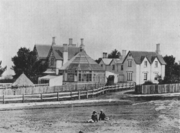
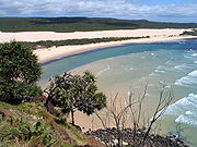
Lobethal
Lobethal, South Australia
Lobethal is a town in the Adelaide Hills area of South Australia. It is located in the Adelaide Hills Council local government area, and is nestled on the banks of a creek between the hills and up the sides of the valley. It was once the centre of the Adelaide Hills wool processing industry, which...
was known as Tweedvale for a number of years, due to the World Wars.
TasmaniaTasmaniaTasmania is an Australian island and state. It is south of the continent, separated by Bass Strait. The state includes the island of Tasmania—the 26th largest island in the world—and the surrounding islands. The state has a population of 507,626 , of whom almost half reside in the greater Hobart...
- Aberdeen
- Ben Lomond
- BreadalbaneBreadalbane, TasmaniaBreadalbane Situated on the Midlands Highway, from Launceston, Breadalbane was named by Governor Macquarie after the Earl of Breadalbane, his wife's cousin. Earlier the district was known as 'Cocked Hat', 'The Springs' and 'Brumby's Plain'....
- Calder
- Campbell TownCampbell Town, TasmaniaCampbell Town is a town in Tasmania, Australia, located on the Midland Highway. At the 2006 census, the town had a population of 772.Campbell Town was originally one of the four garrison towns linking Hobart and Launceston. Today, it acts as the only major rest area on the Midland Highway, with...
- CurrieCurrie, TasmaniaCurrie is the largest township on King Island, Tasmania, at the western entrance to Bass Strait. At the 2006 census, Currie had a population of 746.-Geography:...
- Douglas River
- Dysart
- Elderslie
- FingalFingal, TasmaniaFingal is a small Australian town located in Fingal Valley in the north-east of Tasmania, on the Esk Highway.-History:The Fingal area was surveyed in 1824 by Roderic O'Connor and John Helder Wedge, and is believed to have been named after Fingal's Cave in the Inner Hebrides of Scotland rather than...
- ForthForth, TasmaniaForth is a small village located in northwest Tasmania on the Forth River, west of Devonport and northwest of Launceston via the Bass Highway. Forth has a population of about 368...
- Glen Dhu (Glen Dhu = Gleann Dubh - black glen)
- Glengarry
- Gordon
- Gowrie Park
- Gretna
- InvermayInvermay, TasmaniaInvermay is a suburb of Launceston, which contains the minor suburb of Inveresk, it is located on the eastern side of the Tamar River and the northern side of the North Esk River, the suburb is most notable as being home to York Park ....
- Killiekrankie
- Lachlan
- Leith
- Macquarie and Macquarie Plains
- Macquarie Island
- Melrose
- Mount Murchison (Tasmania)Mount Murchison (Tasmania)Mount Murchison is the tallest mountain in the West Coast Range Tasmania, Australia.Like most of the mountains in the West Coast Range - the taller were named after opponents or critics of Charles Darwin, the smaller after his supporters.-References:...
- Patersonia, an old name for Launceston.
- PerthPerth, TasmaniaPerth is a town in the north-east of Tasmania, Australia. It lies 20 km south of Launceston, on the Midland Highway. The town has a population of 1,984 and is averaging a 1% increase per year . Perth is part of the Northern Midlands Council. Federal Lyons MHR Dick Adams also has an office...
- Port DalrympleGeorge Town, TasmaniaGeorge Town is one of the larger towns in north-east Tasmania, on the eastern bank of the mouth of the Tamar River. At the 2006 census, George Town had a population of 4,266. It is the regional centre of the George Town Council Local Government Area....
(DalrympleDalrymple, East AyrshireDalrymple is a village in East Ayrshire, Scotland. It is at the western-most point of East Ayrshire, around 8km south-east of Ayr. Dalrymple is in the Doon Valley, on the north bank of the River Doon. The population is 1,347....
), the old name for George Town. - Strathblane
- Upper Esk, North Esk RiverNorth Esk RiverThe North Esk River is a river in Tasmania, Australia. It is one of the tributaries of the Tamar River together with the South Esk River. It starts in the Northallerton Valley below Mt Ben Nevis in the states North East joining with the St Patricks River, flowing through Launceston. Launceston's...
and South Esk RiverSouth Esk RiverThe South Esk River is the longest river in Tasmania. It starts in the mountains near Fingal flowing through Avoca, Evandale, Longford, Hadspen and finally Launceston. The river is dammed at Trevallyn Dam near Launceston and used for the city's Hydro Electricity scheme...
- Suburbs of Hobart-Glenorchy-
- FirthsideFirthside, TasmaniaFirthside is a neighbourhood within the suburb of Kingston, in the greater Hobart area, capital of Tasmania, Australia. It is located on the northern edge of the Kingston urban area....
("FirthFirthFirth is the word in the Lowland Scots language and in English used to denote various coastal waters in Scotland and England. In mainland Scotland it is used to describe a large sea bay, or even a strait. In the Northern Isles it more usually refers to a smaller inlet...
") - GlenorchyGlenorchy, TasmaniaGlenorchy is a business district and suburb in the northern part of greater Hobart, capital of the state of Tasmania, Australia. The land was originally used for agriculture but is now a largely suburban, working-class area...
& City of GlenorchyCity of GlenorchyThe City of Glenorchy is a Local Government Area of Tasmania which covers several northern suburbs of Hobart including the suburb of Glenorchy by the same name. The city is managed by Glenorchy City Council. Current mayor is Stuart Slade.- History :... - GrantonGranton, TasmaniaGranton is a suburb of Hobart, capital city of Tasmania, Australia. It is the most northern suburb of the City of Glenorchy Local Government Area....
- HowdenHowden, TasmaniaHowden is a small, relatively isolated community on the shore of North West Bay in Tasmania Australia. Nestled between the majorly-developing township of Kingston and the smaller Margate, it verges on bushland but is only a half-hour drive away from Hobart, the capital city of Tasmania...
- LauderdaleLauderdale, TasmaniaLauderdale is a town on the outskirts of Hobart, capital of Tasmania, Australia. The population of Lauderdale is approximately 2,388 . It is in the local government area of City of Clarence. The town is situated on the eastern side of a thin Isthmus that connects the South Arm peninsula to the...
- MontroseMontrose, TasmaniaMontrose, is a suburb in the northern suburbs of Hobart, capital of Tasmania, Australia. The suburb is situated in close promity with Rosetta. Montrose is the suburb directly north of Glenorchy and lies within the local government area of City of Glenorchy...
- Firthside
VictoriaVictoria (Australia)Victoria is the second most populous state in Australia. Geographically the smallest mainland state, Victoria is bordered by New South Wales, South Australia, and Tasmania on Boundary Islet to the north, west and south respectively....
- AberfeldyAberfeldy, VictoriaAberfeldy is a small town in Victoria, Australia. It is located on Mount Lookout, north east of Lake Thomson, 125 kilometres east of Melbourne....
- BairnsdaleBairnsdale, VictoriaBairnsdale is a small city in Gippsland, Victoria, Australia. With a population at the 2006 census of 11,282, it is a major regional centre of eastern Victoria along with Traralgon and Sale....
(corruption of Bernisdale in Skye) - BalmoralBalmoral, VictoriaBalmoral is a township in the Shire of Southern Grampians in the Western District of Victoria, Australia. At the 2006 census, Balmoral and the surrounding area had a population of 542....
- BannockburnBannockburn, VictoriaBannockburn is a rural township near Geelong, Victoria, Australia, 93 km southwest of Melbourne. It is located in Golden Plains Shire. At the 2006 census, Bannockburn had a population of 2486....
- Bonnie DoonBonnie Doon, VictoriaBonnie Doon is a small village in Victoria, Australia. It is located on the Maroondah Highway, in the Shire of Mansfield. Bonnie Doon is 115 kilometres north-east from Melbourne. At the 2006 census, Bonnie Doon and the surrounding area had a population of 755....
- BuchanBuchan, VictoriaBuchan is a town in Victoria, Australia, located on Buchan Road, in the Shire of East Gippsland near the Snowy River. At the 2006 census, Buchan and the surrounding area had a population of 326....
- CardrossCardross, VictoriaCardross is a small town approximately 15 km south east of Mildura, in north western Victoria, Australia. At the 2006 census, Cardross and the surrounding area had a population of 739...
- CassilisCassilis, VictoriaCassilis is a ghost town in Gippsland, Victoria, Australia. It was named after a district and castle in Ayrshire, Scotland. In the late 19th century, at the peak of the gold boom, it was a thriving mining centre and home to more than 500 people.-History:...
- ClunesClunes, VictoriaClunes is a town in Victoria, Australia, located 36 kilometres north of Ballarat, in the Shire of Hepburn. At the 2006 census it had a population of 1,026.- History :...
- ClydeClyde, VictoriaClyde is a suburb in Melbourne, Victoria, Australia, 48 km south-east from Melbourne's central business district. Its Local Government Area is the City of Casey. At the 2006 Census, Clyde had a population of 1,224.-History:...
- Don ValleyDon Valley, VictoriaDon Valley is a town in Victoria, Australia, approximately 70 km east of Melbourne's central business district. Its Local Government Area is the Shire of Yarra Ranges...
(StrathdonStrathdonStrathdon is an area in Aberdeenshire, Scotland. It is situated in the strath of the River Don, 45 miles west of Aberdeen in the Highlands...
) - DonaldDonald, VictoriaDonald is a town in Victoria, Australia, located on the Richardson River, at the junction of Sunraysia Highway and Borung Highway, in the Shire of Buloke. The town is named after William Donald, a Scottish pastoralist who was the first settler in the area in 1844...
- DunkeldDunkeld, VictoriaDunkeld is a town in Victoria, Australia at the southern end of the Grampians National Park, in the Shire of Southern Grampians. It is approx 283 km west of Melbourne on the Glenelg Highway. The town's population is holding steady but ageing...
- EnsayEnsay, VictoriaEnsay is a small town located between Swifts Creek and Bruthen on the Great Alpine Road in East Gippsland, Victoria, Australia. Ensay is north of the major town of Bairnsdale and east of the state capital Melbourne...
- FingalFingal, VictoriaFingal is a rural locality of the Mornington Peninsula abutting Bass Strait along Gunnamatta Beach and lying between the suburbs of Rye and Cape Schanck. Its Local Government Area is the Shire of Mornington Peninsula.-References:...
- GlenburnGlenburn, VictoriaGlenburn is a small town in the Yarra Ranges region northeast of Melbourne, Victoria, Australia. It is in the Local Government Area of the Shire of Murrindindi. At the 2006 Census, Glenburn had a population of 179....
- GlenmaggieGlenmaggie, VictoriaGlenmaggie is a town in Victoria, Australia, located on the shores of Lake Glenmaggie, in the Shire of Wellington. At the 2006 census, Glenmaggie and the surrounding area had a population of 405....
- GlenrowanGlenrowan, VictoriaGlenrowan is a small town located in the Wangaratta Local Government Area of Victoria, Australia. It is 184 kilometres north-east of Melbourne and 14 kilometres from Wangaratta and located near the Warby Ranges and Mount Glenrowan...
- GlenthompsonGlenthompson, VictoriaGlenthompson is a town in the Australian state of Victoria. It lies on the Glenelg Highway between Hamilton and Ballarat, close to the Grampian mountain range...
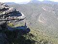
- Grampians National ParkGrampians National ParkThe Grampians National Park is a national park in Victoria, Australia, 235 kilometres west of Melbourne. The Park was listed on the Australian National Heritage List on 15 December 2006 for its outstanding natural beauty and being one of the richest indigenous rock art sites in south-eastern...
, home of the Grampian mountain range, - HamiltonHamilton, VictoriaHamilton is a city in western Victoria, Australia. It is located at the intersection of the Glenelg Highway and the Henty Highway...
- InvergordonInvergordon, VictoriaInvergordon is a town in northern Victoria, Australia.The town is located 31km from Numurkah and 37km from Shepparton .At the 2006 census, Invergordon and the surrounding area had a population of 862....
- InverlochInverloch, VictoriaInverloch is a seaside village in Victoria, Australia. It is located on the Bass Highway 143 kilometres southeast of Melbourne, at the mouth of Anderson Inlet, in the Bass Coast Shire and is located close to Australia’s southernmost stand of mangroves...
- JamiesonJamieson, VictoriaJamieson is a small town in Victoria, Australia. It is located at the junction of the Goulburn River and Jamieson River, north-east of Melbourne. The name is believed to have been derived from George Jamieson, a shepherd who grazed sheep in the area in the 1850s...
- KilmoreKilmore, VictoriaKilmore is a town in the Australian state of Victoria. Located north of Melbourne, it is contentiously claimed as Victoria's oldest inland settled town...
- LochLoch, VictoriaLoch is a town in the South Gippsland region of Victoria, Australia which was established in 1876. The town was named in honour of the Governor of Victoria, Henry Loch....
- LorneLorne, VictoriaLorne is a seaside town on Louttit Bay in Victoria, Australia. It is situated about the Erskine River and is a popular destination on the Great Ocean Road tourist route...
- NiddrieNiddrie, VictoriaNiddrie is a suburb in Melbourne, Victoria, Australia, 13 km north-west from Melbourne's central business district. Its Local Government Area is the City of Moonee Valley...
- OrbostOrbost, VictoriaOrbost is a town in the Shire of East Gippsland, Victoria, Australia, located east of Melbourne and south of Canberra where the Princes Highway crosses the Snowy River. It is about from the town of Marlo on the coast of Bass Strait. At the 2006 census, Orbost had a population of 2452...
- RutherglenRutherglen, VictoriaRutherglen is a small town in north-eastern Victoria, Australia, near the Murray River border with New South Wales. The town was named after the Scottish town of Rutherglen which lies just outside Glasgow...
- St Andrews
- ScotsburnScotsburn, VictoriaScotsburn is a town in Victoria, Australia. The town is approximately from Ballarat on the Midland Highway toward Geelong.Located at the foot of Mount Buninyong, it was named after the Scott family which settled in the area around 1840. Andrew and Celia Scott, who arrived in Australia in 1839,...
- SkyeSkye, VictoriaSkye is a suburb in Melbourne, Victoria, Australia, 38 km south-east from Melbourne's central business district. Its Local Government Area is the City of Frankston. At the 2006 Census, Skye had a population of 6898.-History:...
- StrathbogieStrathbogie, VictoriaStrathbogie is a town in Victoria, Australia. It is in the Shire of Strathbogie local government area. At the 2006 census, Strathbogie and the surrounding area had a population of 256.The Post Office opened on 10 July 1878....
- StrathmertonStrathmerton, VictoriaStrathmerton is a small country town in Victoria, Australia.It is located in the Shire of Moira Local Government Area on the Murray Valley Highway, about west of Cobram and previously known as the most northerly point in Victoria North of Melbourne at the start of the Goulburn Valley Highway...
- StrathmoreStrathmore, VictoriaStrathmore is a suburb in Melbourne, Victoria, Australia, 11 km north-west from Melbourne's central business district. Its Local Government Area is the City of Moonee Valley...
- Melbourne Suburbs
- AbbotsfordAbbotsford, VictoriaAbbotsford is a suburb in Melbourne, Victoria, Australia, 2 km east from Melbourne's central business district. Its Local Government Area is the City of Yarra. At the 2006 Census, Abbotsford had a population of 4,327....
- AberfeldieAberfeldie, VictoriaAberfeldie is a suburb 9 km north-west of Melbourne, Victoria, Australia. Its Local Government Area is the City of Moonee Valley. At the 2006 Census, Aberfeldie had a population of 3455....
- ArdeerArdeer, VictoriaArdeer is a suburb in Melbourne, Victoria, Australia, 16 km west from Melbourne's central business district. Its Local Government Area is the City of Brimbank. At the 2006 Census, Ardeer had a population of 2582....
- ArmadaleArmadale, VictoriaArmadale is a suburb in Melbourne, Victoria, Australia, 7 km south-east from Melbourne's central business district. Its Local Government Area is the City of Stonnington. At the 2006 Census, Armadale had a population of 8,467....
- Arthurs SeatArthurs Seat, VictoriaArthurs Seat is a hill and locality on the Mornington Peninsula, within the Shire of Mornington Peninsula, about 75 km south east of Melbourne, Australia....
(Arthur's SeatArthurs Seat, VictoriaArthurs Seat is a hill and locality on the Mornington Peninsula, within the Shire of Mornington Peninsula, about 75 km south east of Melbourne, Australia....
) - BaxterBaxter, VictoriaBaxter is a township and rural locality in Melbourne, Victoria, Australia, beyond the urban area. Its Local Government Area is the Shire of Mornington Peninsula...
- BlairgowrieBlairgowrie, VictoriaBlairgowrie is a seaside village approximately 87 km from Melbourne, Victoria, Australia. Its Local Government Area is the Shire of Mornington Peninsula.-History:...
- CairnleaCairnlea, VictoriaCairnlea is a suburb in Melbourne, Victoria, Australia, 17 km north-west from Melbourne's central business district. Its Local Government Area is the City of Brimbank...
- Calder ParkCalder Park, VictoriaCalder Park is a suburb in Melbourne, Victoria, Australia, 22 km north-west from Melbourne's central business district. Its Local Government Area is the City of Brimbank....
- CarnegieCarnegie, VictoriaCarnegie is a suburb in Melbourne, Victoria, Australia, 12 km south-east from Melbourne's central business district. Its Local Government Area is the City of Glen Eira. At the 2006 Census, Carnegie had a population of 15,084...
from Andrew CarnegieAndrew CarnegieAndrew Carnegie was a Scottish-American industrialist, businessman, and entrepreneur who led the enormous expansion of the American steel industry in the late 19th century... - CraigieburnCraigieburn, VictoriaCraigieburn is a suburb in Melbourne, Victoria, Australia, 26 km north from Melbourne's central business district. Its Local Government Area is the City of Hume. At the 2006 Census, Craigieburn had a population of 20,784....
- DallasDallas, VictoriaDallas is a suburb in Melbourne, Victoria, Australia, 18 km north from Melbourne's central business district. Its Local Government Area is the City of Hume. At the 2006 Census, Dallas had a population of 5,847....
- Glen EiraCity of Glen EiraThe City of Glen Eira is a Local Government Area in Victoria, Australia. It is located in the south-eastern suburbs of Melbourne. It has an area of 38.4 square kilometres and has a estimated population of 136,354 people...
- Glen HuntlyGlen Huntly, VictoriaGlen Huntly is a suburb in Melbourne, Victoria, Australia, 11 km south-east from Melbourne's central business district. Its Local Government Area is the City of Glen Eira. At the 2006 Census, Glen Huntly had a population of 4085....
- Glen IrisGlen Iris, VictoriaGlen Iris is a suburb in Melbourne, Victoria, Australia, 10 km south-east from Melbourne's central business district. Its Local Government Area are the Cities of Boroondara and Stonnington...
- Glen WaverleyGlen Waverley, VictoriaGlen Waverley is a suburb in Melbourne, Victoria, Australia, 19 km south-east from Melbourne's central business district. Its Local Government Area is the City of Monash...
(tribute to Scott, cf Ivanhoe, Victoria) - GlenroyGlenroy, VictoriaGlenroy is a suburb in Melbourne, Victoria, Australia, 13 km north from Melbourne's central business district. Its Local Government Area is the City of Moreland...
- KilsythKilsyth, VictoriaKilsyth is a suburb in Melbourne, Victoria, Australia, 31 km east from Melbourne's central business district. Its Local Government Area is the Shire of Yarra Ranges. At the 2006 Census, Kilsyth had a population of 10,022.-History:...
- KnoxfieldKnoxfield, VictoriaKnoxfield is a suburb in Melbourne, Victoria, Australia, 27 km south-east from Melbourne's central business district. Its Local Government Area is the City of Knox...
- MacleodMacleod, VictoriaMacleod is a suburb in Melbourne, Victoria, Australia, 14 km north-east from Melbourne's central business district. Its Local Government Area are the cities of Banyule and Darebin. At the 2006 Census, Macleod had a population of 8083...
- McCraeMcCrae, VictoriaMcCrae is a suburb in Melbourne, Victoria, Australia. Its Local Government Area is the Shire of Mornington Peninsula. McCrae is known for the McCrae Lighthouse...
- McKinnonMcKinnon, VictoriaMcKinnon is a suburb in Melbourne, Victoria, Australia, 12 km south-east from Melbourne's central business district. Its Local Government Area is the City of Glen Eira...
- MontroseMontrose, VictoriaMontrose is a suburb in Melbourne, Victoria, Australia, 33 km east from Melbourne's central business district. Its Local Government Area is the Shire of Yarra Ranges. At the 2006 Census, Montrose had a population of 6464....
- St KildaSt Kilda, VictoriaSt Kilda is an inner city suburb of Melbourne, Victoria, Australia, 6 km south from Melbourne's central business district. Its Local Government Area is the City of Port Phillip...
and St Kilda EastSt Kilda East, VictoriaSt Kilda East is a suburb in Melbourne, Victoria, Australia, 6 km south-east of Melbourne's central business district. It is located within the Local Government Areas of the City of Glen Eira and the City of Port Phillip. At the 2006 Census, it had a population of 12,188.St Kilda East is one...
- Abbotsford
Ivanhoe
Ivanhoe, Victoria
Ivanhoe is a suburb in Melbourne, Victoria, Australia, 10 km north-east from Melbourne's central business district. Its Local Government Area is the City of Banyule. At the 2006 Census, Ivanhoe had a population of 10,600.-History:...
is named after the Walter Scott
Walter Scott
Sir Walter Scott, 1st Baronet was a Scottish historical novelist, playwright, and poet, popular throughout much of the world during his time....
novel, Ivanhoe
Ivanhoe
Ivanhoe is a historical fiction novel by Sir Walter Scott in 1819, and set in 12th-century England. Ivanhoe is sometimes credited for increasing interest in Romanticism and Medievalism; John Henry Newman claimed Scott "had first turned men's minds in the direction of the middle ages," while...
.
Western AustraliaWestern AustraliaWestern Australia is a state of Australia, occupying the entire western third of the Australian continent. It is bounded by the Indian Ocean to the north and west, the Great Australian Bight and Indian Ocean to the south, the Northern Territory to the north-east and South Australia to the south-east...
- AlbanyAlbany, Western AustraliaAlbany is a port city in the Great Southern region of Western Australia, some 418 km SE of Perth, the state capital. As of 2009, Albany's population was estimated at 33,600, making it the 6th-largest city in the state....
(Albany an old name for Scotland, cf AlbaAlbaAlba is the Scottish Gaelic name for Scotland. It is cognate to Alba in Irish and Nalbin in Manx, the two other Goidelic Insular Celtic languages, as well as similar words in the Brythonic Insular Celtic languages of Cornish and Welsh also meaning Scotland.- Etymology :The term first appears in...
) - AgnewAgnew, Western AustraliaAgnew is a town in the Goldfields-Esperance region of Western Australia. It is located 982 km north-east of Perth and the closest populated town is Leinster....
- Lake ArgyleLake ArgyleLake Argyle is Australia's second largest artificial lake by volume. It is part of the Ord River Irrigation Scheme and is located near the East Kimberley town of Kununurra...
- Balfour Downs
- Bruce RockBruce Rock, Western AustraliaBruce Rock is a town located in the Eastern Wheatbelt region of Western Australia, approximately east of Perth and southwest of Merredin. It is the main town in the Shire of Bruce Rock....
- Carnegie
- ErskineErskine, Western AustraliaErskine is a suburb of Mandurah. It is bound by the Old Coast Road to the west and the Peel Inlet to the east...
- Geikie GorgeGeikie GorgeGeikie Gorge is a feature of the Napier Range and is located within the grounds of Geikie Gorge National Park, 20 km from Fitzroy Crossing, 1831 km northeast of Perth and 420 km east of Broome in the Kimberley Region of Western Australia...
- Glen Iris
- Lake MackayLake MackayLake Mackay is the largest of hundreds of ephemeral salt lakes scattered throughout Western Australia and the Northern Territory....
- Marvel LochMarvel Loch, Western AustraliaMarvel Loch is a small townsite of less than 100 people, some 401 km east of Perth, Western Australia. It is located 32 km south west of Southern Cross, along the Perth to Kalgoorlie Great Eastern Highway...
- MenziesMenzies, Western AustraliaMenzies is a town located in the Goldfields-Esperance region of Western Australia, east-northeast of the state capital, Perth, and north-northwest of the city of Kalgoorlie...
- Murchison and Murchison River, Western AustraliaMurchison River (Western Australia)The Murchison River is the second longest river in Western Australia. It flows for about from the southern edge of the Robinson Ranges to the Indian Ocean at Kalbarri. It has a mean annual flow of about 200 million cubic metres.-Course:...
- Murray StreetMurray Street, PerthMurray Street is one of four main east-west roads within the Perth central business district.The street, the central portion of which has become a pedestrian mall, was named after Sir George Murray, Secretary of State for War and the Colonies from 1828 to 1830.It is the one main road in Perth that...
- PerthPerth, Western AustraliaPerth is the capital and largest city of the Australian state of Western Australia and the fourth most populous city in Australia. The Perth metropolitan area has an estimated population of almost 1,700,000....
- Stirling RangeStirling RangeThe Stirling Range or Koikyennuruff is a range of mountains and hills in the Great Southern region of Western Australia, 337 km south-east of Perth. It is located at approximately and is over 60 km wide from west to east, stretching from the highway between Mount Barker and Cranbrook...
- Perth Suburbs
- ApplecrossApplecross, Western AustraliaApplecross is an affluent riverside suburb of Perth, Western Australia, bounded by Canning Highway and the Swan River. It is located within the City of Melville.Like the name Perth, the suburb of Applecross borrows its name from the region in Scotland...
- ArdrossArdross, Western AustraliaArdross is a suburb of Perth, Western Australia located within the City of Melville. It was once an area of land acquired by the Scotsman, Sir Alexander Percival Matheson in 1896...
- ArmadaleArmadale, Western AustraliaArmadale is a suburb within the City of Armadale, located on the south-eastern edge of Perth's metropolitan area. The major junction of the South Western and Albany Highways, which connect Perth with the South West and Great Southern regions of Western Australia respectively, is located within the...
and City of ArmadaleCity of ArmadaleThe City of Armadale is a Local Government Area in the south-eastern suburbs of the Western Australian capital city of Perth, located about southeast of Perth's central business district... - BassendeanBassendean, Western AustraliaBassendean is a northeastern suburb of Perth, Western Australia. Its Local Government Area is the Town of Bassendean.Bassendean is home to the Western Australian Rail Transport Museum. The display has a collection of Steam and Diesel Locomotives, most of these have been restored to operating...
- BrigadoonBrigadoon, Western AustraliaBrigadoon is a suburb of Perth, Western Australia. It is in the City of Swan local government area.It sits on the edge of the Darling Scarp adjacent to the entrance to the Avon Valley through which the Avon River flows. The Bells Rapids is a popular viewing location for the annual Avon Descent...
- Burns BeachBurns Beach, Western AustraliaBurns Beach is a suburb of Perth, Western Australia, located north of Perth's central business district at the northern fringe of the City of Joondalup...
- City of Cockburn and Cockburn CentralCockburn Central, Western AustraliaCockburn Central is a suburb of Perth, the capital city of Western Australia, and is located south of Perth's central business district along the Kwinana Freeway. Its Local Government Area is the City of Cockburn, and it is intended by the Government to serve as a regional centre for the area...
- CraigieCraigie, Western AustraliaCraigie is located in the northern suburbs of the Perth metropolitan area. Craigie was chosen as a suburb name in 1970 and honours an early councillor of the City of Wanneroo who did much work in developing the City...
- DalkeithDalkeith, Western AustraliaDalkeith is a suburb of Perth, Western Australia, located within the City of Nedlands. The suburb is surrounded on three sides by the Swan River and is home to some of Perth's finest mansions. The suburb takes its name from a cottage built in 1833 by Captain Adam Armstrong and his sons, early...
- DuncraigDuncraig, Western AustraliaDuncraig is a large northern suburb of Perth, the capital city of Western Australia, Australia, and is located north of Perth's central business district between Marmion Avenue and Mitchell Freeway...
- EglintonEglinton, Western AustraliaEglinton is an unpopulated locality in the Western Australian capital city of Perth, located approximately north of Perth's central business district on the Indian Ocean...
- Hamilton HillHamilton Hill, Western AustraliaHamilton Hill is a suburb of Perth, the capital city of Western Australia, and is located southwest of Perth's central business district. Its Local Government Area is the City of Cockburn.-History:...
- HendersonHenderson, Western AustraliaHenderson is a suburb of Perth, Western Australia, located within the City of Cockburn.-History:The suburb of Henderson comprises land resumed by the Commonwealth Government in 1915 for defence purposes. A large naval base was planned by Admiral Sir Reginald Henderson, and the was area sometimes...
- KinrossKinross, Western AustraliaKinross is a small suburb in the City of Joondalup located in the northern suburbs of Perth, Australia. Kinross was constructed around 1992-3 in various stages. It is bordered by Neerabup National Park, and is the City of Joondalup's most northerly suburb....
- MarmionMarmion, Western AustraliaMarmion is a northern coastal suburb of Perth, the capital city of Western Australia. Its Local Government Area is the City of Joondalup.-History:...
- MurdochMurdoch, Western AustraliaMurdoch is a suburb of Perth, Western Australia, located within the City of Melville. Murdoch University and St John of God Hospital Murdoch are located in Murdoch, as will be the proposed Fiona Stanley Hospital. The suburb is named after Sir Walter Murdoch....
- Port KennedyPort Kennedy, Western AustraliaPort Kennedy is an outer southern suburb of Perth, the capital city of Western Australia, located within the City of Rockingham.Port Kennedy is built on Becher Point and because of its geomorphological history it is home to an unusual wetland formation, called the Becher Wetland Suite...
- Queens ParkQueens Park, Western AustraliaQueens Park is a suburb of Perth, Western Australia, located within the City of Canning. Its postcode is 6107.-History:The suburb derives its name from the former Queens Park Road Board that was incorporated into the Canning and Belmont Road Boards....
- StirlingStirling, Western AustraliaThe City of Stirling is a Local Government Area in the northern suburbs of the Western Australian capital city of Perth, located about north of Perth's central business district...
and City of Stirling
- Applecross
See also
- Scottish AustralianScottish AustralianScottish Australians are residents of Australia who are of Scottish ancestry.According to the 2006 Australian census 130,204 Australian residents were born in Scotland, while 1,501,204 claimed Scottish ancestry, either alone or in combination with another ancestry.- History :The links between...
- Scottish place names in CanadaScottish place names in CanadaThis is a list of placenames in Scotland which have subsequently been applied to parts of Canada by Scottish emigrants or explorers.For Nova Scotian names in Scottish Gaelic see Canadian communities with Scottish Gaelic speakers and Scottish Gaelic placenames in CanadaNote that, unless otherwise...
- Scottish place names in New ZealandScottish place names in New ZealandThis is a list of placenames in Scotland which have subsequently been applied to parts of New Zealand by Scottish emigrants or explorers.The South Island also contains the Strath-Taieri and the Ben Ohau Range of mountains, both combining Scots Gaelic and Māori origins...
- Scottish place names in the United StatesScottish place names in the United StatesThis is a list of names of Scottish origin which have subsequently been applied to parts of the United States by Scottish emigrants or explorers. Unfortunately many of these placenames are now wrongly pronounced in the US e.g...
- English place names in Australia
- Australian place names changed from German namesAustralian place names changed from German namesDuring World War I, many German-sounding place names in Australia were changed because of Anti-German sentiment. The new names were often Anglicized , given Aboriginal names , names of famous people , or battlefields . This was done through an Act of Parliament, as well as by petition...