Stari Grad, Croatia
Encyclopedia
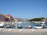
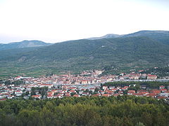
Stari Grad is a town on the northern side of the island of Hvar
in Dalmatia
, Croatia
. One of the oldest towns in Europe, its position at the end of a long, protected bay and next to prime agricultural land, has long made it attractive for human settlement. Stari Grad is also a municipality within the Split-Dalmatia County
.
The most ancient part of Stari Grad falls within the UNESCO
Protected World Heritage Site
of the Stari Grad Plain
, while the entire municipality lies within the surrounding buffer zone.
, who arrived in 384 BC. It is thought that the name may come from the previous inhabitants of the area. In Roman times, the town became known as Faria, which was turned into Hvar by the incoming Slav population. When the administrative capital of the island was moved to today's Hvar town
on the south coast, the old town became simply known as Stari Grad. ("Stari" translates as "old" and "grad" as "city" in Croatian.)
 Stari Grad lies on the north side of the island of Hvar
, at the end of the Stari Grad Bay, a deep water channel, protected to the north by the hills of the Kabal peninsula, and by the high mountain ridge of Hvar to the south.
The island's best agricultural land opens up to the east of Stari Grad town. This fertile plain has been farmed since pre-historic times, and the Greek field layout is still largely intact, thanks to continuing maintenance over the years of its dry stone walls. In 2008, the Stari Grad Plain
became a UNESCO
protected world heritage site.
tribes of the Hvar culture who occupied the island between 3500 and 2500 BC, and who traded with other settlements around the Mediterranean. Remains of their pottery and other artifacts
have been found, along with that of the Illyrian tribe that succeeded them. The settlement lay at the lower end of Stari Grad Bay, defended by two strongholds on the north and south hillsides overlooking the harbour (Glavica and Purkin Kuk).
In 384 BC, the town was formally founded by ancient Greeks from the island of Paros
in the Aegean Sea
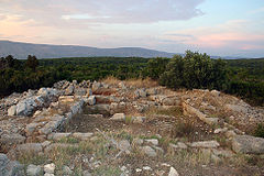
. They gave the name Faros (ΦAPOΣ) to their new settlement, an independent state permitted to mint its own money. The nearby plain was marked out with roads at right angles, and divided into fields of standard size. The Stari Grad Plain today represents one of the best-preserved examples of ancient Greek agriculture throughout the Mediterranean.
In 219 BC, the Romans defeated the Greek army at Faros, and the town became autonomous under the Roman Empire
. An inscription from the 2nd century BC, refers to the Farians and their delegation to the Greek island of Paros and the oracle at Delphi. It makes mention of the Roman senate and the people (who are) well disposed and benevolent towards the city of Faros from the times of their ancestors. Further inscriptions, mosaics, tombstones, stone reliefs, fine pottery, jewellery, coins, villae rusticae in the Plain tell the story of life in and around the ancient Roman town.
The first church was built in the 5th century, in the southeast corner of the town, close to the city walls, on the foundations of a prior Greek house. In the 6th century, a new church was built on the same site, a twin basilica with a baptistry dedicated to St Mary and St John.
In the 7th century, following the fall of Salona, the capital of the Roman province of Dalmatia, many of its people sought refuge in Faria and other Roman towns in the nearby islands, as noted by the historian Archdeacon Thomas of Split
(1200–1268) in his Historia Salonitana
.
Roman Faria was taken over by the Slavs at the beginning of the 8th century. At this point, the town received the name we know it by today - Hvar (the letter F not being part of the old slavonic alphabet
). During the 10th century, Hvar came under the Neretva
Principality – Pagania. Pirates from Omiš
on the mainland were raiding the coastal settlements, and new villages grew up in the foothills – Dol, Vrbanj and Pitve.
In 1278, the people of Hvar chose to put themselves under the protection of the Venetian Republic. As part of the contract, they undertook to expand the town on the south of the island, as a more suitable base for the Venetian fleet. This is the site of the present day town of Hvar
. The old town of Stari Grad, also referred to as “Old Hvar”, remained the centre of the most densely populated part of the island, the area surrounding the agricultural plain.
During the 16th century, the town was attacked by the Turks
, the first time repulsing them, but in 1571 they lost, and much of the town was burnt down. Following that loss, Stari Grad was slowly rebuilt from the ruins. During the 17th and 18th centuries, prosperity once again grew from sea-trade. The old waterfront (Stara Riva) was extended and the town underwent a major architectural and urban transformation, resulting in the town structure we see today.
In 1797 Napoleon overthrew the Venetian Republic, and Hvar briefly became part of the Austrian Empire
. When the French also took over Austria, they conferred the status of an autonomous province on the town of Stari Grad. With the fall of the Napoleonic Empire, Stari Grad became part of the Dalmatian Kingdom
, within the larger political body of the Austro-Hungarian Empire.
The 19th century was peaceful, and a time of prosperity for the entire island. However, the advent of phylloxera
destroyed the island's grapevines, and the town's sailing vessels could not compete with the new steam ships. Large numbers of people moved away to start a new life elsewhere. Today, Stari Grad is again rebuilding itself, this time with tourism as the main focus. The town has much to offer visitors - a beautiful location, glorious weather, fascinating history and a great base to explore from, by land and sea!
References


Hvar
- Climate :The climate of Hvar is characterized by mild winters and warm summers. The yearly average air temperature is , 686 mm of precipitation fall on the town of Hvar on average every year and the town has a total of 2800 sunshine hours per year. For comparison Hvar has an average of 7.7...
in Dalmatia
Dalmatia
Dalmatia is a historical region on the eastern coast of the Adriatic Sea. It stretches from the island of Rab in the northwest to the Bay of Kotor in the southeast. The hinterland, the Dalmatian Zagora, ranges from fifty kilometers in width in the north to just a few kilometers in the south....
, Croatia
Croatia
Croatia , officially the Republic of Croatia , is a unitary democratic parliamentary republic in Europe at the crossroads of the Mitteleuropa, the Balkans, and the Mediterranean. Its capital and largest city is Zagreb. The country is divided into 20 counties and the city of Zagreb. Croatia covers ...
. One of the oldest towns in Europe, its position at the end of a long, protected bay and next to prime agricultural land, has long made it attractive for human settlement. Stari Grad is also a municipality within the Split-Dalmatia County
Split-Dalmatia County
Split-Dalmatia County is the central-southern Dalmatian county in Croatia. The administrative center is Split. The population of the county is 455,242...
.
The most ancient part of Stari Grad falls within the UNESCO
UNESCO
The United Nations Educational, Scientific and Cultural Organization is a specialized agency of the United Nations...
Protected World Heritage Site
World Heritage Site
A UNESCO World Heritage Site is a place that is listed by the UNESCO as of special cultural or physical significance...
of the Stari Grad Plain
Stari Grad Plain
The Stari Grad Plain on the island of Hvar is an agricultural landscape that was set up by the ancient Greek colonists in the 4th century BC, and remains in use today. The plain is generally still in its original form...
, while the entire municipality lies within the surrounding buffer zone.
Name
Stari Grad was originally named Faros (Greek: ΦAPOΣ) by the Greek settlers from the island of ParosParos
Paros is an island of Greece in the central Aegean Sea. One of the Cyclades island group, it lies to the west of Naxos, from which it is separated by a channel about wide. It lies approximately south-east of Piraeus. The Municipality of Paros includes numerous uninhabited offshore islets...
, who arrived in 384 BC. It is thought that the name may come from the previous inhabitants of the area. In Roman times, the town became known as Faria, which was turned into Hvar by the incoming Slav population. When the administrative capital of the island was moved to today's Hvar town
Hvar (town)
Hvar is a city and port on the island of Hvar, part of Split-Dalmatia County, Croatia. The municipality has a population of 4,138 while the city itself is inhabited by 3,672 people, making it the largest settlement on the island of Hvar...
on the south coast, the old town became simply known as Stari Grad. ("Stari" translates as "old" and "grad" as "city" in Croatian.)
Stari Grad Municipality
The district (or municipality) of Stari Grad has a population of 2,817 (2001 Census), of which 1,906 live in the town itself. Four other settlements fall within the Stari Grad district, namely Dol (Pop. 348), Rudina (Pop. 54), Selca (Pop. 20) and Vrbanj (Pop. 489).Geography

Hvar
- Climate :The climate of Hvar is characterized by mild winters and warm summers. The yearly average air temperature is , 686 mm of precipitation fall on the town of Hvar on average every year and the town has a total of 2800 sunshine hours per year. For comparison Hvar has an average of 7.7...
, at the end of the Stari Grad Bay, a deep water channel, protected to the north by the hills of the Kabal peninsula, and by the high mountain ridge of Hvar to the south.
The island's best agricultural land opens up to the east of Stari Grad town. This fertile plain has been farmed since pre-historic times, and the Greek field layout is still largely intact, thanks to continuing maintenance over the years of its dry stone walls. In 2008, the Stari Grad Plain
Stari Grad Plain
The Stari Grad Plain on the island of Hvar is an agricultural landscape that was set up by the ancient Greek colonists in the 4th century BC, and remains in use today. The plain is generally still in its original form...
became a UNESCO
UNESCO
The United Nations Educational, Scientific and Cultural Organization is a specialized agency of the United Nations...
protected world heritage site.
History
The area around present day Stari Grad was settled by the neolithicNeolithic
The Neolithic Age, Era, or Period, or New Stone Age, was a period in the development of human technology, beginning about 9500 BC in some parts of the Middle East, and later in other parts of the world. It is traditionally considered as the last part of the Stone Age...
tribes of the Hvar culture who occupied the island between 3500 and 2500 BC, and who traded with other settlements around the Mediterranean. Remains of their pottery and other artifacts
Artifact (archaeology)
An artifact or artefact is "something made or given shape by man, such as a tool or a work of art, esp an object of archaeological interest"...
have been found, along with that of the Illyrian tribe that succeeded them. The settlement lay at the lower end of Stari Grad Bay, defended by two strongholds on the north and south hillsides overlooking the harbour (Glavica and Purkin Kuk).
In 384 BC, the town was formally founded by ancient Greeks from the island of Paros
Paros
Paros is an island of Greece in the central Aegean Sea. One of the Cyclades island group, it lies to the west of Naxos, from which it is separated by a channel about wide. It lies approximately south-east of Piraeus. The Municipality of Paros includes numerous uninhabited offshore islets...
in the Aegean Sea
Aegean Sea
The Aegean Sea[p] is an elongated embayment of the Mediterranean Sea located between the southern Balkan and Anatolian peninsulas, i.e., between the mainlands of Greece and Turkey. In the north, it is connected to the Marmara Sea and Black Sea by the Dardanelles and Bosporus...
. They gave the name Faros (ΦAPOΣ) to their new settlement, an independent state permitted to mint its own money. The nearby plain was marked out with roads at right angles, and divided into fields of standard size. The Stari Grad Plain today represents one of the best-preserved examples of ancient Greek agriculture throughout the Mediterranean.
In 219 BC, the Romans defeated the Greek army at Faros, and the town became autonomous under the Roman Empire
Roman Empire
The Roman Empire was the post-Republican period of the ancient Roman civilization, characterised by an autocratic form of government and large territorial holdings in Europe and around the Mediterranean....
. An inscription from the 2nd century BC, refers to the Farians and their delegation to the Greek island of Paros and the oracle at Delphi. It makes mention of the Roman senate and the people (who are) well disposed and benevolent towards the city of Faros from the times of their ancestors. Further inscriptions, mosaics, tombstones, stone reliefs, fine pottery, jewellery, coins, villae rusticae in the Plain tell the story of life in and around the ancient Roman town.
The first church was built in the 5th century, in the southeast corner of the town, close to the city walls, on the foundations of a prior Greek house. In the 6th century, a new church was built on the same site, a twin basilica with a baptistry dedicated to St Mary and St John.
In the 7th century, following the fall of Salona, the capital of the Roman province of Dalmatia, many of its people sought refuge in Faria and other Roman towns in the nearby islands, as noted by the historian Archdeacon Thomas of Split
Thomas the Archdeacon
Thomas the Archdeacon was a medieval Dalmatian historian and Archdeacon of Split most remembered for Historia Salonitana, a chronicle of the Bishops and Archbishops of Split until 1266....
(1200–1268) in his Historia Salonitana
Historia Salonitana
Historia Salonitana by Thomas the Archdeacon is a historic chronicle from the 13th century which contains significant information about the early history of the Croats.It was first published by Ivan Lučić Lucius...
.
Roman Faria was taken over by the Slavs at the beginning of the 8th century. At this point, the town received the name we know it by today - Hvar (the letter F not being part of the old slavonic alphabet
Glagolitic alphabet
The Glagolitic alphabet , also known as Glagolitsa, is the oldest known Slavic alphabet. The name was not coined until many centuries after its creation, and comes from the Old Slavic glagolъ "utterance" . The verb glagoliti means "to speak"...
). During the 10th century, Hvar came under the Neretva
Neretva
Neretva is the largest river of the eastern part of the Adriatic basin. It has been harnessed and controlled to a large extent by four HE power-plants with large dams and their storage lakes, but it is still recognized for its natural beauty, diversity of its landscape and visual...
Principality – Pagania. Pirates from Omiš
Omiš
Omiš is a town and port in the Dalmatia region of Croatia, and is a municipality in the Split-Dalmatia County. The town is situated approximately south-east of Croatia's second largest city, Split. Its location is where the emerald-green Cetina River meets the Adriatic Sea...
on the mainland were raiding the coastal settlements, and new villages grew up in the foothills – Dol, Vrbanj and Pitve.
In 1278, the people of Hvar chose to put themselves under the protection of the Venetian Republic. As part of the contract, they undertook to expand the town on the south of the island, as a more suitable base for the Venetian fleet. This is the site of the present day town of Hvar
Hvar (town)
Hvar is a city and port on the island of Hvar, part of Split-Dalmatia County, Croatia. The municipality has a population of 4,138 while the city itself is inhabited by 3,672 people, making it the largest settlement on the island of Hvar...
. The old town of Stari Grad, also referred to as “Old Hvar”, remained the centre of the most densely populated part of the island, the area surrounding the agricultural plain.
During the 16th century, the town was attacked by the Turks
Ottoman Empire
The Ottoman EmpireIt was usually referred to as the "Ottoman Empire", the "Turkish Empire", the "Ottoman Caliphate" or more commonly "Turkey" by its contemporaries...
, the first time repulsing them, but in 1571 they lost, and much of the town was burnt down. Following that loss, Stari Grad was slowly rebuilt from the ruins. During the 17th and 18th centuries, prosperity once again grew from sea-trade. The old waterfront (Stara Riva) was extended and the town underwent a major architectural and urban transformation, resulting in the town structure we see today.
In 1797 Napoleon overthrew the Venetian Republic, and Hvar briefly became part of the Austrian Empire
Austrian Empire
The Austrian Empire was a modern era successor empire, which was centered on what is today's Austria and which officially lasted from 1804 to 1867. It was followed by the Empire of Austria-Hungary, whose proclamation was a diplomatic move that elevated Hungary's status within the Austrian Empire...
. When the French also took over Austria, they conferred the status of an autonomous province on the town of Stari Grad. With the fall of the Napoleonic Empire, Stari Grad became part of the Dalmatian Kingdom
History of Dalmatia
The History of Dalmatia concerns the history of the eastern coast of the Adriatic Sea and its inland regions, stretching from the 2nd century BC up to the present....
, within the larger political body of the Austro-Hungarian Empire.
The 19th century was peaceful, and a time of prosperity for the entire island. However, the advent of phylloxera
Phylloxera
Grape phylloxera ; originally described in France as Phylloxera vastatrix; equated to the previously described Daktulosphaira vitifoliae, Phylloxera vitifoliae; commonly just called phylloxera is a pest of commercial grapevines worldwide, originally native to eastern North America...
destroyed the island's grapevines, and the town's sailing vessels could not compete with the new steam ships. Large numbers of people moved away to start a new life elsewhere. Today, Stari Grad is again rebuilding itself, this time with tourism as the main focus. The town has much to offer visitors - a beautiful location, glorious weather, fascinating history and a great base to explore from, by land and sea!
References
Culture
- Croatian Town Music a society of local music enthusiasts, founded in 1876.
- Theatre "Petar Hektorović" Amateur theatre troop, dating from 1893, specialises in comic plays
- Town Library is the direct descendent of the "Croatian National Reading Room" founded in 1874. The Town Library is now located in the Town Hall, built 1893.
- Stari Grad Museum is housed in the former Palaca Biankini. Special exhibits show a reconstruction of an ancient Greek shipwreck, the archaeological collection from the Stari Grad Plain, and a 19th century Captain's room. In addition, the Museum houses an art collection and Juraj Plancic Gallery. (Website: www.stari-grad-museum.net)
- Music School "Toma Cecchini" is a branch of the Music School "Josip Hatze" in Split.
- Faros Kantaduri traditional Dalmatian singing group founded in 1995, blending Gregorian Chant with the multipart harmonies of Dalmatian KlapaKlapaThe klapa music is a form of traditional Croatian a cappella singing . The word klapa translates as "a group of friends" and traces its roots to littoral church singing . The motifs in general celebrate love, wine , country and sea...
. (Website: www.faroski-kantaduri.hr) - St. Stevens Church Singers, some of whom are also members of KlapaKlapaThe klapa music is a form of traditional Croatian a cappella singing . The word klapa translates as "a group of friends" and traces its roots to littoral church singing . The motifs in general celebrate love, wine , country and sea...
"Garmica", a traditional Dalmatian singing group. - During the summer months, art and cultural events are organized, such as workshops on ancient Faros, classical languages and culture, archaeological restoration of mosaics and pottery, open singing, puppetry and painting for children.
Archeology
The town itself, and the surrounding area are rich in archaeological sites dating from pre-history and classical times. Permanent exhibitions in the Stari Grad Museum display the collection of artifacts found at local sites, both on land and under the sea.- Old Town Walls
- Greek settlement
- Stari Grad PlainStari Grad PlainThe Stari Grad Plain on the island of Hvar is an agricultural landscape that was set up by the ancient Greek colonists in the 4th century BC, and remains in use today. The plain is generally still in its original form...
- Roman Villas (villa rusticae)
- Maslinovik - Greek tower in the Stari Grad Plain

- Glavica - Illyrian fort above Stari Grad
- Purkin Kuk - Illyrian fort above Stari Grad
Architecture
- Church of St John (sv. Ivan)
- Church of St Jerome (sv. Jerolima)
- Church of St Rok (sv. Rok)
- Church of St Peter (sv. Petar) church with Dominican monastery
- Church of St Luke (sv. Lucije) church with remains of the monastery of Dominican trećeretkinja (picokara)
- Church of St Nicholas (sv. Nikola)
- Church of St Stephan (sv. Stjepan)
- Chapel of Our Lady (Kapela Gospojica) in the Stari Grad Plain
- Chapel of St Helen (sv. Jelena) on the road to Dol
- Tvrdalj CastleTvrdalj CastleTvrdalj Castle is a castle in Stari Grad, on the island of Hvar, Croatia.Tvrdalj is the fortified summer residence of Petar Hektorović, the Croatian poet . During the 16th century, the island of Hvar came under attack from the Ottoman Turks...
- Residence of the Renaissance poet Petar Hektorović, built 16th century - Trg Škor - Baroque Square dating from 17th-18th century
- Palace Biankini - neorenaissance house with a court and garden, which today houses the Stari Grad Museum. (Website:Museum of Stari Grad)
- House and Mausoleum of Šime Ljubića, Classical style, built 1887
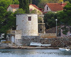
- Mill (Mlin na vjetar) - south side of the harbour

Notable inhabitants
- Ante Biankini (1860–1934), doctor to US President Woodrow Wilson
- Juraj Biankini (1874–1928), politician
- Petar Biankini (1856–1928), author
- Dinko Bogdanić, choreographer, ballet dancer
- Peruško Bogdanić, sculptor
- Nikola Dominik Budrović (1765–1847) theologist, historian
- Jakov Dulčić, marine biologist
- Petar HektorovićPetar HektorovicPetar Hektorović was a Croatian writer.Hektorović was born and died in Stari Grad, Hvar. He was a poet and collector of Hvar's fishermen songs, and an important figure of the Renaissance period in Croatian literature...
(1487–1572), poet, author of "Ribanja i ribarskog prigovaranjaFishing and Fishermen’s TalkFishing and Fishermen's Talk is the most important literary work of Croatian Renaissance poet Petar Hektorović, finished on January 14, 1566, and printed in 1568 in Venice...
" - Tomislav Kaljatić Maroević (1955), bishop
- Dinko Lupi, opera singer
- Šime Ljubić (1822–1896), archaeologist
- Janez Maroević, marathon runner
- Tonko Maroević, academician
- Ivo Maroević Špuntin (1937–2007), art historian
- Petar Nisiteo (1774–1866), historian, archaeologist
- Bartol Petrić (1899–1974), artist
- Josip Plančić (1888–1978), marine biology
- Juraj Plančić (1899–1930), artist
- Dinko Politeo (1854–1903), politician
- Ivo Politeo (1922-199?), agronomist
- Nikša Račić, historian
- Marin Sabić (1860–1922), writer
- Vinko Šoljan, athlete
- Tonko Šoljan, marine biologist
- Tonči Tadić, physicist and politician
- Ambroz Vranjicani Dobrinović (1801–1870), lawyer

