List of Roman amphitheatres
Encyclopedia
The remains of at least 230 amphitheatre
s have been found widely scattered areas of the Roman Empire
. These are usually oval, and are not to be confused with the more common "ordinary" theatres
, which are semicircular structures. There are, however, a number of buildings that have had a combined use as both theatre and amphitheatre, particularly in western Europe. Following is a list of Roman amphitheatre locations by country.
Related modern building structures
Amphitheatre
An amphitheatre is an open-air venue used for entertainment and performances.There are two similar, but distinct, types of structure for which the word "amphitheatre" is used: Ancient Roman amphitheatres were large central performance spaces surrounded by ascending seating, and were commonly used...
s have been found widely scattered areas of the Roman Empire
Roman Empire
The Roman Empire was the post-Republican period of the ancient Roman civilization, characterised by an autocratic form of government and large territorial holdings in Europe and around the Mediterranean....
. These are usually oval, and are not to be confused with the more common "ordinary" theatres
Roman theatre (structure)
The characteristics of Roman to those of the earlier Greek theatres due in large part to its influence on the Roman triumvir Gnaeus Pompeius Magnus. Much of the architectural influence on the Romans came from the Greeks, and theatre structural design was no different from other buildings...
, which are semicircular structures. There are, however, a number of buildings that have had a combined use as both theatre and amphitheatre, particularly in western Europe. Following is a list of Roman amphitheatre locations by country.
| City (Roman name) |
City (modern name) |
Country |
Coordinates |
Notes References |
Photograph |
|---|---|---|---|---|---|
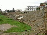
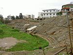
| Dyrrhachium | Durrës Durrës Durrës is the second largest city of Albania located on the central Albanian coast, about west of the capital Tirana. It is one of the most ancient and economically important cities of Albania. Durres is situated at one of the narrower points of the Adriatic Sea, opposite the Italian ports of Bari... |
Albania Albania Albania , officially known as the Republic of Albania , is a country in Southeastern Europe, in the Balkans region. It is bordered by Montenegro to the northwest, Kosovo to the northeast, the Republic of Macedonia to the east and Greece to the south and southeast. It has a coast on the Adriatic Sea... |
41.312186°N 19.445323°E | Durrës Amphitheatre Durrës Amphitheatre The Durrës Amphitheatre is a large Roman amphitheatre in the city of Durrës, Albania. Built in the 2nd century AD, it is located in the centre of the city and is only half unearthed. The Durrës Amphitheatre is one of the largest amphitheatres in the Balkan peninsula, once having a capacity of... |
 |
| Lambaesis Lambaesis Lambaesis, or Lambaesa, is a Roman ruin in Algeria, southeast of Batna and west of Timgad, located next to the modern village of Tazoult.-Remains:... |
Lambèse Lambaesis Lambaesis, or Lambaesa, is a Roman ruin in Algeria, southeast of Batna and west of Timgad, located next to the modern village of Tazoult.-Remains:... |
Algeria Algeria Algeria , officially the People's Democratic Republic of Algeria , also formally referred to as the Democratic and Popular Republic of Algeria, is a country in the Maghreb region of Northwest Africa with Algiers as its capital.In terms of land area, it is the largest country in Africa and the Arab... |
35.489247°N 6.259935°E | ||
| Colonia Claudia Caesarea | Cherchell Cherchell Cherchell is a seaport town in the Province of Tipaza, Algeria, 55 miles west of Algiers. It is the district seat of Cherchell District. As of 1998, it had a population of 24,400.-Ancient history:... |
Algeria Algeria Algeria , officially the People's Democratic Republic of Algeria , also formally referred to as the Democratic and Popular Republic of Algeria, is a country in the Maghreb region of Northwest Africa with Algiers as its capital.In terms of land area, it is the largest country in Africa and the Arab... |
36.608740°N 2.198826°E | ||
| Gemellae Gemellae Gemellae was a Roman fort and associated camp on the fringe of the Sahara Desert in what is today part of Algeria. It is now an archaeological site, 25 km south and 19 km west of Biskra, and 5 km southwest of the present-day village of M'Lili with which it probably shares an original... |
M'lili M'Lili M'Lili is a town and commune in Biskra Province, Algeria. According to the 1998 census it has a population of 5,151. During Roman times a large military settlement near the town was called Gemellae, though this may merely have been the Latin transliteration of the native name... |
Algeria Algeria Algeria , officially the People's Democratic Republic of Algeria , also formally referred to as the Democratic and Popular Republic of Algeria, is a country in the Maghreb region of Northwest Africa with Algiers as its capital.In terms of land area, it is the largest country in Africa and the Arab... |
34.635409°N 5.522764°E | http://ads.ahds.ac.uk/catalogue/adsdata/cbaresrep/pdf/051/05102002.pdf | |
| Theveste | Tébessa Tébessa Tébessa is the capital city of Tébessa Province, Algeria, 20 kilometers west from the border with Tunisia. Nearby is also a phosphate mine. The city is famous for the traditional Algerian carpets in the region, and is home to over 161,440 people.-History:... |
Algeria Algeria Algeria , officially the People's Democratic Republic of Algeria , also formally referred to as the Democratic and Popular Republic of Algeria, is a country in the Maghreb region of Northwest Africa with Algiers as its capital.In terms of land area, it is the largest country in Africa and the Arab... |
35.401246°N 8.123764°E | Aerial Photograph | |
| Tipasa Tipasa Tipaza is a Berber-speaking town on the coast of Algeria, capital of the Tipaza province. The modern town, founded in 1857, is remarkable chiefly for its sandy beach, and ancient ruins.-Ancient history:... |
Tipaza | Algeria Algeria Algeria , officially the People's Democratic Republic of Algeria , also formally referred to as the Democratic and Popular Republic of Algeria, is a country in the Maghreb region of Northwest Africa with Algiers as its capital.In terms of land area, it is the largest country in Africa and the Arab... |
36.593152°N 2.445456°E | Map of Tipasa |  |
| Carnuntum Carnuntum Carnuntum was a Roman army camp on the Danube in the Noricum province and after the 1st century the capital of the Upper Pannonia province... |
Petronell | Austria Austria Austria , officially the Republic of Austria , is a landlocked country of roughly 8.4 million people in Central Europe. It is bordered by the Czech Republic and Germany to the north, Slovakia and Hungary to the east, Slovenia and Italy to the south, and Switzerland and Liechtenstein to the... |
48.1101°N 16.8509°E 48.1269°N 16.8927°E |
2 amphitheatres | 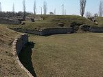 |
| Flavia Solva Flavia Solva Flavia Solva was a municipium in the ancient Roman province of Noricum. It was situated on the western banks of the Mur river, close to the modern cities of Wagna and Leibnitz in the southern parts of the Austrian province of Styria... |
Leibnitz Leibnitz Leibnitz is a city in the Austrian state of Styria and at the 2001 census had a population of approximately 7.577 .It is located to the south of the city of Graz, between the Mur and Sulm rivers.... |
Austria Austria Austria , officially the Republic of Austria , is a landlocked country of roughly 8.4 million people in Central Europe. It is bordered by the Czech Republic and Germany to the north, Slovakia and Hungary to the east, Slovenia and Italy to the south, and Switzerland and Liechtenstein to the... |
46.766744°N 15.567417°E | ||
| Virunum Virunum Claudium Virunum was a Roman city in the province of Noricum, on today's Zollfeld in the Austrian State of Carinthia. Virunum may also have been the name of the older Celtic-Roman settlement on the hilltop of Magdalensberg nearby.... |
Magdalensberg Magdalensberg Magdalensberg is a municipality in the district of Klagenfurt-Land in Carinthia in Austria.The municipality comprises 40 villages and hamlets: Christofberg, Deinsdorf, Dürnfeld, Eibelhof, Eixendorf, Farchern, Freudenberg, Gammersdorf, Geiersdorf, Göriach, Gottesbichl, Großgörtschach, Gundersdorf,... |
Austria Austria Austria , officially the Republic of Austria , is a landlocked country of roughly 8.4 million people in Central Europe. It is bordered by the Czech Republic and Germany to the north, Slovakia and Hungary to the east, Slovenia and Italy to the south, and Switzerland and Liechtenstein to the... |
46.697951°N 14.366943°E | 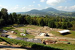 |
|
| Augusta Traiana | Stara Zagora Stara Zagora Stara Zagora is the sixth largest city in Bulgaria, and a nationally important economic center. Located in Southern Bulgaria, it is the administrative capital of the homonymous Stara Zagora Province... |
Bulgaria Bulgaria Bulgaria , officially the Republic of Bulgaria , is a parliamentary democracy within a unitary constitutional republic in Southeast Europe. The country borders Romania to the north, Serbia and Macedonia to the west, Greece and Turkey to the south, as well as the Black Sea to the east... |
|||
| Diocletianopolis | Hisarya | Bulgaria Bulgaria Bulgaria , officially the Republic of Bulgaria , is a parliamentary democracy within a unitary constitutional republic in Southeast Europe. The country borders Romania to the north, Serbia and Macedonia to the west, Greece and Turkey to the south, as well as the Black Sea to the east... |
42.502825°N 24.709776°E | ||
| Marcianopolis Marcianopolis Marcianopolis or Marcianople was an ancient Roman city in Thracia. It was located at the site of modern day Devnya, Bulgaria.-History:... |
Devnya Devnya Devnya is a town in Varna Province, Northeastern Bulgaria, located about 25 km away to the west from the city of Varna and The Black Sea Coast. It is the administrative centre of the homonymous Devnya Municipality... |
Bulgaria Bulgaria Bulgaria , officially the Republic of Bulgaria , is a parliamentary democracy within a unitary constitutional republic in Southeast Europe. The country borders Romania to the north, Serbia and Macedonia to the west, Greece and Turkey to the south, as well as the Black Sea to the east... |
|||
| Trimontium Plovdiv Plovdiv is the second-largest city in Bulgaria after Sofia with a population of 338,153 inhabitants according to Census 2011. Plovdiv's history spans some 6,000 years, with traces of a Neolithic settlement dating to roughly 4000 BC; it is one of the oldest cities in Europe... |
Plovdiv Plovdiv Plovdiv is the second-largest city in Bulgaria after Sofia with a population of 338,153 inhabitants according to Census 2011. Plovdiv's history spans some 6,000 years, with traces of a Neolithic settlement dating to roughly 4000 BC; it is one of the oldest cities in Europe... |
Bulgaria Bulgaria Bulgaria , officially the Republic of Bulgaria , is a parliamentary democracy within a unitary constitutional republic in Southeast Europe. The country borders Romania to the north, Serbia and Macedonia to the west, Greece and Turkey to the south, as well as the Black Sea to the east... |
Should be removed as only theatre & circus located in Plovdiv. | ||
| Serdica | Sofia Sofia Sofia is the capital and largest city of Bulgaria and the 12th largest city in the European Union with a population of 1.27 million people. It is located in western Bulgaria, at the foot of Mount Vitosha and approximately at the centre of the Balkan Peninsula.Prehistoric settlements were excavated... |
Bulgaria Bulgaria Bulgaria , officially the Republic of Bulgaria , is a parliamentary democracy within a unitary constitutional republic in Southeast Europe. The country borders Romania to the north, Serbia and Macedonia to the west, Greece and Turkey to the south, as well as the Black Sea to the east... |
42.697803°N 23.330031°E | In ground floor of Arena di Serdica Hotel. http://www.bnr.bg/RadioBulgaria/Emission_English/Theme_History_And_Religion/Material/amphitheatre_sofia.htm Amphitheatre of Serdica Amphitheatre of Serdica The Amphitheatre of Serdica was an amphitheatre in the Ancient Roman city of Ulpia Serdica, now Sofia, the capital of Bulgaria. Discovered in 2004 and the subject of excavations in 2005 and 2006, the ruins of the amphitheatre lie on two adjacent sites in the centre of modern Sofia... |
 |
| Pietas Iulia Pola | Pula Pula Pula is the largest city in Istria County, Croatia, situated at the southern tip of the Istria peninsula, with a population of 62,080 .Like the rest of the region, it is known for its mild climate, smooth sea, and unspoiled nature. The city has a long tradition of winemaking, fishing,... |
Croatia Croatia Croatia , officially the Republic of Croatia , is a unitary democratic parliamentary republic in Europe at the crossroads of the Mitteleuropa, the Balkans, and the Mediterranean. Its capital and largest city is Zagreb. The country is divided into 20 counties and the city of Zagreb. Croatia covers ... |
44.873176°N 13.850112°E | Pula Arena Pula amphitheatre |
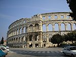 |
| Salonae | Solin | Croatia Croatia Croatia , officially the Republic of Croatia , is a unitary democratic parliamentary republic in Europe at the crossroads of the Mitteleuropa, the Balkans, and the Mediterranean. Its capital and largest city is Zagreb. The country is divided into 20 counties and the city of Zagreb. Croatia covers ... |
43.538469°N 16.473956°E | http://photoforum.istria.info/kroatien-foto-10496.htm | 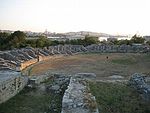 |
| Burnum Burnum Burnum or Burnum Municipium, an archaeological site, was a Roman Legion camp and town. It is located 2.5 km north of Kistanje, in inland Dalmatia, Croatia... |
Croatia Croatia Croatia , officially the Republic of Croatia , is a unitary democratic parliamentary republic in Europe at the crossroads of the Mitteleuropa, the Balkans, and the Mediterranean. Its capital and largest city is Zagreb. The country is divided into 20 counties and the city of Zagreb. Croatia covers ... |
44.0192°N 16.0182°E | Roman military camp near Šibenik Šibenik Šibenik is a historic town in Croatia, with population of 51,553 . It is located in central Dalmatia where the river Krka flows into the Adriatic Sea... , had a small amphitheatre, recently discovered |
||
| Augusta Paphus | Paphos Paphos Paphos , sometimes referred to as Pafos, is a coastal city in the southwest of Cyprus and the capital of Paphos District. In antiquity, two locations were called Paphos: Old Paphos and New Paphos. The currently inhabited city is New Paphos. It lies on the Mediterranean coast, about west of the... |
Cyprus Cyprus Cyprus , officially the Republic of Cyprus , is a Eurasian island country, member of the European Union, in the Eastern Mediterranean, east of Greece, south of Turkey, west of Syria and north of Egypt. It is the third largest island in the Mediterranean Sea.The earliest known human activity on the... |
34.754942°N 32.405344°E | ||
| Salamis Salamis, Cyprus Salamis was an ancient Greek city-state on the east coast of Cyprus, at the mouth of the river Pedieos, 6 km north of modern Famagusta. According to tradition the founder of Salamis was Teucer, son of Telamon, who could not return home after the Trojan war because he had failed to avenge his... |
Cyprus Cyprus Cyprus , officially the Republic of Cyprus , is a Eurasian island country, member of the European Union, in the Eastern Mediterranean, east of Greece, south of Turkey, west of Syria and north of Egypt. It is the third largest island in the Mediterranean Sea.The earliest known human activity on the... |
35.185522°N 33.90238°E | Amphitheatre almost vanished. | ||
| Baginton Baginton Baginton is a village and civil parish in the Warwick district of Warwickshire, England, and has a common border with the City of Coventry of the West Midlands county. With a population of 801 , Baginton village is four miles south of Coventry city centre and seven miles north of... |
England England England is a country that is part of the United Kingdom. It shares land borders with Scotland to the north and Wales to the west; the Irish Sea is to the north west, the Celtic Sea to the south west, with the North Sea to the east and the English Channel to the south separating it from continental... |
52.373395°N 1.496120°W | Lunt Roman Fort Probably a horse training ground. |
||
| Calleva Atrebatum | Silchester Silchester Silchester is a village and civil parish about north of Basingstoke in Hampshire. It is adjacent to the county boundary with Berkshire and about south-west of Reading.... |
England England England is a country that is part of the United Kingdom. It shares land borders with Scotland to the north and Wales to the west; the Irish Sea is to the north west, the Celtic Sea to the south west, with the North Sea to the east and the English Channel to the south separating it from continental... |
51.35885°N 1.07528°W | http://www.soil-net.com/album/Culture_Archaeology/slides/Silchester%20amphitheatre%2001.html http://www.soil-net.com/album/Culture_Archaeology/slides/Silchester%20amphitheatre%2002.html |  |
| Camulodunum Camulodunum Camulodunum is the Roman name for the ancient settlement which is today's Colchester, a town in Essex, England. Camulodunum is claimed to be the oldest town in Britain as recorded by the Romans, existing as a Celtic settlement before the Roman conquest, when it became the first Roman town, and... |
Colchester Colchester Colchester is an historic town and the largest settlement within the borough of Colchester in Essex, England.At the time of the census in 2001, it had a population of 104,390. However, the population is rapidly increasing, and has been named as one of Britain's fastest growing towns. As the... |
England England England is a country that is part of the United Kingdom. It shares land borders with Scotland to the north and Wales to the west; the Irish Sea is to the north west, the Celtic Sea to the south west, with the North Sea to the east and the English Channel to the south separating it from continental... |
Located in 2005 (near Circular Road North) | ||
| Corinium Dobunnorum Corinium Dobunnorum Corinium Dobunnorum was the second largest town in the Roman province of Britannia. Today it is known as Cirencester, located in the English county of Gloucestershire.-Fortress:... |
Cirencester Cirencester Cirencester is a market town in east Gloucestershire, England, 93 miles west northwest of London. Cirencester lies on the River Churn, a tributary of the River Thames, and is the largest town in the Cotswold District. It is the home of the Royal Agricultural College, the oldest agricultural... |
England England England is a country that is part of the United Kingdom. It shares land borders with Scotland to the north and Wales to the west; the Irish Sea is to the north west, the Celtic Sea to the south west, with the North Sea to the east and the English Channel to the south separating it from continental... |
51.711500°N 1.972190°W | Cirencester Amphitheatre Cirencester Amphitheatre Cirencester Amphitheatre was a Roman amphitheatre located in Cirencester, Gloucestershire, England. Archeological digs have uncovered the earthworks, revealing the outline of the construction, which is still visible, with the banking reaching 25 feet from the bottom of the arena. The arena itself... |
 |
| Deva Victrix Deva Victrix Deva Victrix, or simply Deva, was a legionary fortress and town in the Roman province of Britannia. The settlement evolved into Chester, the county town of Cheshire, England... |
Chester Chester Chester is a city in Cheshire, England. Lying on the River Dee, close to the border with Wales, it is home to 77,040 inhabitants, and is the largest and most populous settlement of the wider unitary authority area of Cheshire West and Chester, which had a population of 328,100 according to the... |
England England England is a country that is part of the United Kingdom. It shares land borders with Scotland to the north and Wales to the west; the Irish Sea is to the north west, the Celtic Sea to the south west, with the North Sea to the east and the English Channel to the south separating it from continental... |
53.189191°N 2.887027°W | Chester Roman Amphitheatre Chester Roman Amphitheatre Chester Amphitheatre is a Roman amphitheatre in Chester, Cheshire. The site is managed by English Heritage; it has been designated as a Grade I listed building, and a scheduled monument. The ruins currently exposed are those of a large stone amphitheatre, similar to those found in Continental... http://www.bwpics.co.uk/amphitheatre.html |
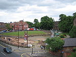 |
| Durnovaria Durnovaria Durnovaria is the Latin form of the Brythonic name for the Roman town of Dorchester in the modern English county of Dorset.-Romans at Maiden Castle:... |
Dorchester | England England England is a country that is part of the United Kingdom. It shares land borders with Scotland to the north and Wales to the west; the Irish Sea is to the north west, the Celtic Sea to the south west, with the North Sea to the east and the English Channel to the south separating it from continental... |
50.70790°N 2.44039°W | Maumbury Rings Maumbury Rings Maumbury Rings is a Neolithic henge in the south of Dorchester town in Dorset, England. It is a large circular earthwork, 85 metres in diameter, with a single bank and internal ditch and an entrance to the north east. The ditch was created by digging a series of funnel-shaped shafts, each 10... |
 |
| Frilford Frilford Frilford is a hamlet and civil parish about west of Abingdon, at the junction of the A415 and A338 roads. It was part of Berkshire until the 1974 Boundary Changes transferred it to Oxfordshire.-Archaeology:... |
England England England is a country that is part of the United Kingdom. It shares land borders with Scotland to the north and Wales to the west; the Irish Sea is to the north west, the Celtic Sea to the south west, with the North Sea to the east and the English Channel to the south separating it from continental... |
Debated http://www.berkshirehistory.com/villages/frilford_roman.html | |||
| Iscalis Charterhouse Roman Town Charterhouse Roman Town was a town in the Roman province of Britannia. Its site is located just to the west of the village of Charterhouse-on-Mendip in the English county of Somerset.... (?) |
Charterhouse Charterhouse, Somerset Charterhouse, also known as Charterhouse-on-Mendip, is a hamlet in the Mendip Hills Area of Outstanding Natural Beauty in the English county of Somerset... |
England England England is a country that is part of the United Kingdom. It shares land borders with Scotland to the north and Wales to the west; the Irish Sea is to the north west, the Celtic Sea to the south west, with the North Sea to the east and the English Channel to the south separating it from continental... |
51.3054°N 2.72032°W | ||
| Isurium Brigantum Isurium Brigantum Isurium Brigantum was a town in the Roman province of Britannia. Today it is known as Aldborough, in North Yorkshire, England.-Possible Roman fort:... |
Aldborough Aldborough, North Yorkshire Aldborough is a village in the civil parish of Boroughbridge, part of the Borough of Harrogate in North Yorkshire, England.Historically a part of the West Riding of Yorkshire, what is now known as Aldborough was built on the site of a major Romano-British town, Isurium Brigantum... |
England England England is a country that is part of the United Kingdom. It shares land borders with Scotland to the north and Wales to the west; the Irish Sea is to the north west, the Celtic Sea to the south west, with the North Sea to the east and the English Channel to the south separating it from continental... |
54.088179°N 1.381325°W | ||
| Londinium Londinium The city of London was established by the Romans around AD 43. It served as a major imperial commercial centre until its abandonment during the 5th century.-Origins and language:... |
London London London is the capital city of :England and the :United Kingdom, the largest metropolitan area in the United Kingdom, and the largest urban zone in the European Union by most measures. Located on the River Thames, London has been a major settlement for two millennia, its history going back to its... |
England England England is a country that is part of the United Kingdom. It shares land borders with Scotland to the north and Wales to the west; the Irish Sea is to the north west, the Celtic Sea to the south west, with the North Sea to the east and the English Channel to the south separating it from continental... |
51.515546°N 0.092215°W | Guildhall Art Gallery Guildhall Art Gallery The Guildhall Art Gallery houses the art collection of the City of London, England. It occupies a building that was completed in 1999 to replace an earlier building destroyed in The Blitz in 1941... |
|
| Noviomagus Reginorum Noviomagus Reginorum Noviomagus Reginorum was the Roman town which is today called Chichester, situated in the modern English county of West Sussex. Alternative versions of the name include Noviomagus Regnorum, Regnentium and Regentium..-Development:... |
Chichester Chichester Chichester is a cathedral city in West Sussex, within the historic County of Sussex, South-East England. It has a long history as a settlement; its Roman past and its subsequent importance in Anglo-Saxon times are only its beginnings... |
England England England is a country that is part of the United Kingdom. It shares land borders with Scotland to the north and Wales to the west; the Irish Sea is to the north west, the Celtic Sea to the south west, with the North Sea to the east and the English Channel to the south separating it from continental... |
50.835448°N 0.772496°W | ||
| Rutupiae Rutupiae Richborough Castle contains the ruined remains of a Roman Saxon Shore Fort. It situated in Richborough near Sandwich, Kent.The site has many phases of Roman remains, collectively known as Richborough Fort or Richborough Roman Fort, still visible today and under the care of English Heritage.Rutupiæ ... |
Richborough Richborough Richborough is a settlement north of Sandwich on the east coast of the county of Kent, England. Richborough lies close to the Isle of Thanet.... |
England England England is a country that is part of the United Kingdom. It shares land borders with Scotland to the north and Wales to the west; the Irish Sea is to the north west, the Celtic Sea to the south west, with the North Sea to the east and the English Channel to the south separating it from continental... |
51.290171°N 1.326534°E | ||
| Viroconium Cornoviorum | Wroxeter Wroxeter Wroxeter is a village in Shropshire, England. It forms part of the civil parish of Wroxeter and Uppington and is located in the Severn Valley about south-east of Shrewsbury.-History:... |
England England England is a country that is part of the United Kingdom. It shares land borders with Scotland to the north and Wales to the west; the Irish Sea is to the north west, the Celtic Sea to the south west, with the North Sea to the east and the English Channel to the south separating it from continental... |
No confirmed amphitheatre found at Wroxeter. Speculation as to purpose of cropmark enclosure includes such. | ||
| Venta Icenorum Venta Icenorum Venta Icenorum, probably meaning "Market Town of the Iceni", located at modern-day Caistor St Edmund in the English county of Norfolk, was the civitas or capital of the Iceni tribe, who inhabited the flatlands and marshes of that county and earned immortality for their revolt against Roman rule... |
Caistor St Edmund | England England England is a country that is part of the United Kingdom. It shares land borders with Scotland to the north and Wales to the west; the Irish Sea is to the north west, the Celtic Sea to the south west, with the North Sea to the east and the English Channel to the south separating it from continental... |
52.579979°N 1.288262°E | http://www.norfarchtrust.org.uk/caistor/caistor_st_edmund7.htm | |
| Verulamium Verulamium Verulamium was an ancient town in Roman Britain. It was sited in the southwest of the modern city of St Albans in Hertfordshire, Great Britain. A large portion of the Roman city remains unexcavated, being now park and agricultural land, though much has been built upon... |
St Albans St Albans St Albans is a city in southern Hertfordshire, England, around north of central London, which forms the main urban area of the City and District of St Albans. It is a historic market town, and is now a sought-after dormitory town within the London commuter belt... |
England England England is a country that is part of the United Kingdom. It shares land borders with Scotland to the north and Wales to the west; the Irish Sea is to the north west, the Celtic Sea to the south west, with the North Sea to the east and the English Channel to the south separating it from continental... |
51°45′14.56"N 0°21′29.88"W | Theatre that had been used as an amphitheatre - note almost oval shape. | |
| Agedincum | Sens Sens Sens is a commune in the Yonne department in Burgundy in north-central France.Sens is a sub-prefecture of the department. It is crossed by the Yonne and the Vanne, which empties into the Yonne here.-History:... |
France France The French Republic , The French Republic , The French Republic , (commonly known as France , is a unitary semi-presidential republic in Western Europe with several overseas territories and islands located on other continents and in the Indian, Pacific, and Atlantic oceans. Metropolitan France... |
48.200036°N 3.292997°E | ||
| Aginnum | Agen Agen Agen is a commune in the Lot-et-Garonne department in Aquitaine in south-western France. It lies on the river Garonne southeast of Bordeaux. It is the capital of the department.-Economy:The town has a higher level of unemployment than the national average... |
France France The French Republic , The French Republic , The French Republic , (commonly known as France , is a unitary semi-presidential republic in Western Europe with several overseas territories and islands located on other continents and in the Indian, Pacific, and Atlantic oceans. Metropolitan France... |
44.204938°N 0.613258°E | ||
| Alalia | Aléria Aléria Aléria is a commune in the Haute-Corse department of France on the island of Corsica... |
France France The French Republic , The French Republic , The French Republic , (commonly known as France , is a unitary semi-presidential republic in Western Europe with several overseas territories and islands located on other continents and in the Indian, Pacific, and Atlantic oceans. Metropolitan France... |
Corsica | ||
| Apta Julia | Apt Apt, Vaucluse Apt is a commune in the Vaucluse department in the Provence-Alpes-Côte d'Azur region in southeastern France.It lies on the left bank of the Calavon, east of Avignon... |
France France The French Republic , The French Republic , The French Republic , (commonly known as France , is a unitary semi-presidential republic in Western Europe with several overseas territories and islands located on other continents and in the Indian, Pacific, and Atlantic oceans. Metropolitan France... |
43.876569°N 5.397437°E | No remains of Amphitheatre located. This is the theatre. | |
| Arelate | Arles Arles Arles is a city and commune in the south of France, in the Bouches-du-Rhône department, of which it is a subprefecture, in the former province of Provence.... |
France France The French Republic , The French Republic , The French Republic , (commonly known as France , is a unitary semi-presidential republic in Western Europe with several overseas territories and islands located on other continents and in the Indian, Pacific, and Atlantic oceans. Metropolitan France... |
43°40′39.92"N 4°37′51.37"E | Arles Amphitheatre Arles Amphitheatre The Arles Amphitheatre is a Roman amphitheatre in the southern French town of Arles. This two-tiered Roman Amphitheatre is probably the most prominent tourist attraction in the city of Arles, which thrived in Roman times.... |
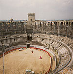 |
| Argentomagus Argentomagus The Roman city of Argentomagus was located in the Mersans plateau of central France, at the strategic point where a Roman bridge once traversed the River Creuse... |
Argenton-sur-Creuse Argenton-sur-Creuse Argenton-sur-Creuse is a commune in the Indre department in central France. It lies on the Creuse River, 19 m. SSW of Châteauroux, close to the A20 motorway.-History:... |
France France The French Republic , The French Republic , The French Republic , (commonly known as France , is a unitary semi-presidential republic in Western Europe with several overseas territories and islands located on other continents and in the Indian, Pacific, and Atlantic oceans. Metropolitan France... |
46.599061°N 1.509718°E | Theatre used also as amphitheatre. | |
| Augustodunum | Autun Autun Autun is a commune in the Saône-et-Loire department in Burgundy in eastern France. It was founded during the early Roman Empire as Augustodunum. Autun marks the easternmost extent of the Umayyad campaign in Europe.-Early history:... |
France France The French Republic , The French Republic , The French Republic , (commonly known as France , is a unitary semi-presidential republic in Western Europe with several overseas territories and islands located on other continents and in the Indian, Pacific, and Atlantic oceans. Metropolitan France... |
|||
| Augustomagus | Senlis Senlis, Oise Senlis is a French commune located in the Oise department near Paris. It has a long and rich heritage, having traversed centuries of history. This medieval town has welcomed some of the most renowned figures in French history, including Hugh Capet, Louis IX, the Marshall of France, Anne of Kiev and... |
France France The French Republic , The French Republic , The French Republic , (commonly known as France , is a unitary semi-presidential republic in Western Europe with several overseas territories and islands located on other continents and in the Indian, Pacific, and Atlantic oceans. Metropolitan France... |
49.205191°N 2.575768°E | Theatre used as amphitheatre. Photograph | |
| Augustoritum | Limoges Limoges Limoges |Limousin]] dialect of Occitan) is a city and commune, the capital of the Haute-Vienne department and the administrative capital of the Limousin région in west-central France.... |
France France The French Republic , The French Republic , The French Republic , (commonly known as France , is a unitary semi-presidential republic in Western Europe with several overseas territories and islands located on other continents and in the Indian, Pacific, and Atlantic oceans. Metropolitan France... |
45.830446°N 1.251743°E | ||
| Avaricum Avaricum Avaricum was an oppidum in ancient Gaul, near what is now the city of Bourges. Avaricum, situated in the lands of the Bituriges, was the largest and best-fortified town within their territory, situated on very fertile lands... |
Bourges Bourges Bourges is a city in central France on the Yèvre river. It is the capital of the department of Cher and also was the capital of the former province of Berry.-History:... |
France France The French Republic , The French Republic , The French Republic , (commonly known as France , is a unitary semi-presidential republic in Western Europe with several overseas territories and islands located on other continents and in the Indian, Pacific, and Atlantic oceans. Metropolitan France... |
47.0845°N 2.39087°E | ||
| Beaumont-sur-Oise Beaumont-sur-Oise Beaumont-sur-Oise is a commune in the Val-d'Oise department in Île-de-France in northern France.-References:** -External links:* * *... |
France France The French Republic , The French Republic , The French Republic , (commonly known as France , is a unitary semi-presidential republic in Western Europe with several overseas territories and islands located on other continents and in the Indian, Pacific, and Atlantic oceans. Metropolitan France... |
49.146210°N 2.296752°E |  |
||
| Burdigala | Bordeaux Bordeaux Bordeaux is a port city on the Garonne River in the Gironde department in southwestern France.The Bordeaux-Arcachon-Libourne metropolitan area, has a population of 1,010,000 and constitutes the sixth-largest urban area in France. It is the capital of the Aquitaine region, as well as the prefecture... |
France France The French Republic , The French Republic , The French Republic , (commonly known as France , is a unitary semi-presidential republic in Western Europe with several overseas territories and islands located on other continents and in the Indian, Pacific, and Atlantic oceans. Metropolitan France... |
44°50′51.81"N 0°34′57.57"W | 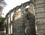 |
|
| Caesarodunum | Tours Tours Tours is a city in central France, the capital of the Indre-et-Loire department.It is located on the lower reaches of the river Loire, between Orléans and the Atlantic coast. Touraine, the region around Tours, is known for its wines, the alleged perfection of its local spoken French, and for the... |
France France The French Republic , The French Republic , The French Republic , (commonly known as France , is a unitary semi-presidential republic in Western Europe with several overseas territories and islands located on other continents and in the Indian, Pacific, and Atlantic oceans. Metropolitan France... |
47.3953°N 0.696394°E | ||
| Cassinomagus Cassinomagus Chassenon is a commune in the Charente department in southwestern France.-History:The ancient name of the village was Cassinomagus.Situated on the Agrippan Way , Cassinomagus was, in the Roman times, important enough to be mentioned on the mediaeval Peutinger map as one of the two secondary towns... |
Chassenon | France France The French Republic , The French Republic , The French Republic , (commonly known as France , is a unitary semi-presidential republic in Western Europe with several overseas territories and islands located on other continents and in the Indian, Pacific, and Atlantic oceans. Metropolitan France... |
45.850565°N 0.768990°E | ||
| Cemenelum | Nice Nice Nice is the fifth most populous city in France, after Paris, Marseille, Lyon and Toulouse, with a population of 348,721 within its administrative limits on a land area of . The urban area of Nice extends beyond the administrative city limits with a population of more than 955,000 on an area of... |
France France The French Republic , The French Republic , The French Republic , (commonly known as France , is a unitary semi-presidential republic in Western Europe with several overseas territories and islands located on other continents and in the Indian, Pacific, and Atlantic oceans. Metropolitan France... |
43°43′11.84"N 7°16′31.42"E | 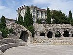 |
|
| Derventum | Drevant Drevant -Places of interest:* The church of St.Pierre, dating from the twelfth century.* The chapel of the eleventh century priory.* Considerable Gallo-Roman remains, including an amphitheatre, baths, villas and an aqueduct.-External links:*... |
France France The French Republic , The French Republic , The French Republic , (commonly known as France , is a unitary semi-presidential republic in Western Europe with several overseas territories and islands located on other continents and in the Indian, Pacific, and Atlantic oceans. Metropolitan France... |
46.693051°N 2.522388°E | Theatre that had been adapted for gladiatorial events | |
| Divodurum | Metz Metz Metz is a city in the northeast of France located at the confluence of the Moselle and the Seille rivers.Metz is the capital of the Lorraine region and prefecture of the Moselle department. Located near the tripoint along the junction of France, Germany, and Luxembourg, Metz forms a central place... |
France France The French Republic , The French Republic , The French Republic , (commonly known as France , is a unitary semi-presidential republic in Western Europe with several overseas territories and islands located on other continents and in the Indian, Pacific, and Atlantic oceans. Metropolitan France... |
49.119631°N 6.172198°E | ||
| Forum Iulium | Fréjus Fréjus Fréjus is a commune in the Var department in the Provence-Alpes-Côte d'Azur region in southeastern France.It neighbours Saint-Raphaël, effectively forming one town... |
France France The French Republic , The French Republic , The French Republic , (commonly known as France , is a unitary semi-presidential republic in Western Europe with several overseas territories and islands located on other continents and in the Indian, Pacific, and Atlantic oceans. Metropolitan France... |
43°26′4.01"N 6°43′42.60"E | 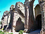 |
|
| Geinum | Gennes Gennes, Maine-et-Loire Gennes is a commune in the Maine-et-Loire department in western France.-History:Gennes was the scene of a World War II battle in June 1940, during the last stages of the Battle of France... |
France France The French Republic , The French Republic , The French Republic , (commonly known as France , is a unitary semi-presidential republic in Western Europe with several overseas territories and islands located on other continents and in the Indian, Pacific, and Atlantic oceans. Metropolitan France... |
47°20′6.75"N 0°14′19.44"W | ||
| Grannus Grannus In the Celtic polytheism of classical antiquity, Grannus was a deity associated with spas, healing thermal and mineral springs, and the sun. He was regularly identified with Apollo as Apollo Grannus... |
Grand Grand, Vosges Grand is a commune in the Vosges department in Lorraine in northeastern France.Grand is known for its Roman amphitheatre, mosaics and aqueduct.- External links :*... |
France France The French Republic , The French Republic , The French Republic , (commonly known as France , is a unitary semi-presidential republic in Western Europe with several overseas territories and islands located on other continents and in the Indian, Pacific, and Atlantic oceans. Metropolitan France... |
48.385268°N 5.491047°E | http://marlac.free.fr/escapade_elgr_sitgrand.htm A "half amphitheatre", distinguished from a normal theatre by its oval layout. |
 |
| Julia Baeterrae Septimanorum | Béziers Béziers Béziers is a town in Languedoc in southern France. It is a sub-prefecture of the Hérault department. Béziers hosts the famous Feria de Béziers, centred around bullfighting, every August. A million visitors are attracted to the five-day event... |
France France The French Republic , The French Republic , The French Republic , (commonly known as France , is a unitary semi-presidential republic in Western Europe with several overseas territories and islands located on other continents and in the Indian, Pacific, and Atlantic oceans. Metropolitan France... |
43.3396°N 3.2141°E | 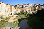 |
|
| Juliobona | Lillebonne Lillebonne Lillebonne is a commune in the Seine-Maritime department in the Haute-Normandie region in northern France. It lies miles north of the Seine and east of Le Havre by railway.-History:... |
France France The French Republic , The French Republic , The French Republic , (commonly known as France , is a unitary semi-presidential republic in Western Europe with several overseas territories and islands located on other continents and in the Indian, Pacific, and Atlantic oceans. Metropolitan France... |
49.517815°N 0.536603°E | A half-amphitheatre. | 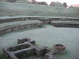 |
| Limonum | Poitiers Poitiers Poitiers is a city on the Clain river in west central France. It is a commune and the capital of the Vienne department and of the Poitou-Charentes region. The centre is picturesque and its streets are interesting for predominant remains of historical architecture, especially from the Romanesque... |
France France The French Republic , The French Republic , The French Republic , (commonly known as France , is a unitary semi-presidential republic in Western Europe with several overseas territories and islands located on other continents and in the Indian, Pacific, and Atlantic oceans. Metropolitan France... |
46.5781°N 0.33965°E | http://vieuxpoitiers.free.fr/htm/Amphi2.htm | |
| Lugdunum Lugdunum Colonia Copia Claudia Augusta Lugdunum was an important Roman city in Gaul. The city was founded in 43 BC by Lucius Munatius Plancus. It served as the capital of the Roman province Gallia Lugdunensis. To 300 years after its foundation Lugdunum was the most important city to the west part of Roman... |
Lyon Lyon Lyon , is a city in east-central France in the Rhône-Alpes region, situated between Paris and Marseille. Lyon is located at from Paris, from Marseille, from Geneva, from Turin, and from Barcelona. The residents of the city are called Lyonnais.... |
France France The French Republic , The French Republic , The French Republic , (commonly known as France , is a unitary semi-presidential republic in Western Europe with several overseas territories and islands located on other continents and in the Indian, Pacific, and Atlantic oceans. Metropolitan France... |
45°46′13.79"N 4°49′50.15"E | Amphitheatre of the Three Gauls Amphitheatre of the Three Gauls The Amphitheatre of the Three Gauls of Lugdunum was part of the federal sanctuary of the three Gauls dedicated to the cult of Rome and Augustus celebrated by the 60 Gallic tribes when they gathered at Lugdunum... |
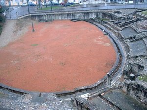 |
| Lutetia Lutetia Lutetia was a town in pre-Roman and Roman Gaul. The Gallo-Roman city was a forerunner of the re-established Merovingian town that is the ancestor of present-day Paris... |
Paris Paris Paris is the capital and largest city in France, situated on the river Seine, in northern France, at the heart of the Île-de-France region... |
France France The French Republic , The French Republic , The French Republic , (commonly known as France , is a unitary semi-presidential republic in Western Europe with several overseas territories and islands located on other continents and in the Indian, Pacific, and Atlantic oceans. Metropolitan France... |
48°50′41.99"N 2°21′10.46"E | Arènes de Lutèce Arènes de Lutèce The Arènes de Lutèce are among the most important remains from the Gallo-Roman era in Paris , together with the Thermes de Cluny... |
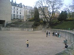 |
| Mediolanum Santonum Mediolanum Santonum Mediolanum Santonum was a Roman town of southwestern Gaul, now Saintes. It was founded in about 20 BC in connection with an expansion of the network of Roman roads serving Burdigala... |
Saintes Saintes Saintes is a French commune located in Poitou-Charentes, in the southwestern Charente-Maritime department of which it is a sub-prefecture. Its inhabitants are called Saintaises and Saintais.... |
France France The French Republic , The French Republic , The French Republic , (commonly known as France , is a unitary semi-presidential republic in Western Europe with several overseas territories and islands located on other continents and in the Indian, Pacific, and Atlantic oceans. Metropolitan France... |
45.745892°N 0.644060°W | http://penelope.uchicago.edu/Thayer/E/Gazetteer/Places/Europe/France/Poitou-Charentes/17_Charente-Maritime/Saintes_100/Roman/amphitheatre.html | 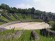 |
| Montbouy Montbouy Montbouy is a commune in the Loiret department in north-central France.-See also:*Communes of the Loiret department... |
France France The French Republic , The French Republic , The French Republic , (commonly known as France , is a unitary semi-presidential republic in Western Europe with several overseas territories and islands located on other continents and in the Indian, Pacific, and Atlantic oceans. Metropolitan France... |
47.872894°N 2.819046°E | |||
| Narbo Martius | Narbonne Narbonne Narbonne is a commune in southern France in the Languedoc-Roussillon region. It lies from Paris in the Aude department, of which it is a sub-prefecture. Once a prosperous port, it is now located about from the shores of the Mediterranean Sea... |
France France The French Republic , The French Republic , The French Republic , (commonly known as France , is a unitary semi-presidential republic in Western Europe with several overseas territories and islands located on other continents and in the Indian, Pacific, and Atlantic oceans. Metropolitan France... |
No amphitheatre has ever been located at Narbonne | ||
| Nemausus Nemausus Deus Nemausus is often said to have been the Celtic patron god of Nemausus . The god does not seem to have been worshipped outside of this locality... |
Nîmes Nîmes Nîmes is the capital of the Gard department in the Languedoc-Roussillon region in southern France. Nîmes has a rich history, dating back to the Roman Empire, and is a popular tourist destination.-History:... |
France France The French Republic , The French Republic , The French Republic , (commonly known as France , is a unitary semi-presidential republic in Western Europe with several overseas territories and islands located on other continents and in the Indian, Pacific, and Atlantic oceans. Metropolitan France... |
43°50′5.69"N 4°21′34.75"E |  |
|
| Samarobriva Samarobriva Samarobriva was the name of Amiens during the Gallo-Roman era.-Origin of the name:Its Gallo-Roman name was Samarobriva, meaning in the prior local language « Bridge on the Somme ».... |
Amiens Amiens Amiens is a city and commune in northern France, north of Paris and south-west of Lille. It is the capital of the Somme department in Picardy... |
France France The French Republic , The French Republic , The French Republic , (commonly known as France , is a unitary semi-presidential republic in Western Europe with several overseas territories and islands located on other continents and in the Indian, Pacific, and Atlantic oceans. Metropolitan France... |
49.534020°N 2.174333°E | http://morel.and.co.free.fr/amiens.html Now underground and buried | |
| Sanxay Sanxay Sanxay is a commune in the Vienne department in the Poitou-Charentes region in western France.-See also:*Communes of the Vienne departmentSanxay is a beautiful little village, with splendid Roman remains... |
France France The French Republic , The French Republic , The French Republic , (commonly known as France , is a unitary semi-presidential republic in Western Europe with several overseas territories and islands located on other continents and in the Indian, Pacific, and Atlantic oceans. Metropolitan France... |
46.294189°N 0.12021°E | http://en.tourisme-vienne.com/sites-juniors.php?cle=86ABSOR101004&zone=%25&nature=%25 |  |
|
| Segodunum | Rodez Rodez Rodez is a town and commune in southern France, in the Aveyron department, of which it is the capital. Its inhabitants are called Ruthénois.-History:Existing from at least the 5th century BC, Rodez was founded by the Celts... |
France France The French Republic , The French Republic , The French Republic , (commonly known as France , is a unitary semi-presidential republic in Western Europe with several overseas territories and islands located on other continents and in the Indian, Pacific, and Atlantic oceans. Metropolitan France... |
44.3518°N 2.56939°E | ||
| Tolosa Toulouse Toulouse is a city in the Haute-Garonne department in southwestern FranceIt lies on the banks of the River Garonne, 590 km away from Paris and half-way between the Atlantic Ocean and the Mediterranean Sea... |
Toulouse Toulouse Toulouse is a city in the Haute-Garonne department in southwestern FranceIt lies on the banks of the River Garonne, 590 km away from Paris and half-way between the Atlantic Ocean and the Mediterranean Sea... |
France France The French Republic , The French Republic , The French Republic , (commonly known as France , is a unitary semi-presidential republic in Western Europe with several overseas territories and islands located on other continents and in the Indian, Pacific, and Atlantic oceans. Metropolitan France... |
43.614780°N 1.397841°E | ||
| Vesontio | Besançon Besançon Besançon , is the capital and principal city of the Franche-Comté region in eastern France. It had a population of about 237,000 inhabitants in the metropolitan area in 2008... |
France France The French Republic , The French Republic , The French Republic , (commonly known as France , is a unitary semi-presidential republic in Western Europe with several overseas territories and islands located on other continents and in the Indian, Pacific, and Atlantic oceans. Metropolitan France... |
47.239279°N 6.015977°E |  |
|
| Vesuna Petrucorriorum | Perigueux Périgueux Périgueux is a commune in the Dordogne department in Aquitaine in southwestern France.Périgueux is the prefecture of the department and the capital of the region... |
France France The French Republic , The French Republic , The French Republic , (commonly known as France , is a unitary semi-presidential republic in Western Europe with several overseas territories and islands located on other continents and in the Indian, Pacific, and Atlantic oceans. Metropolitan France... |
45.1827°N 0.7134°E | ||
| Augusta Treverorum | Trier Trier Trier, historically called in English Treves is a city in Germany on the banks of the Moselle. It is the oldest city in Germany, founded in or before 16 BC.... |
Germany Germany Germany , officially the Federal Republic of Germany , is a federal parliamentary republic in Europe. The country consists of 16 states while the capital and largest city is Berlin. Germany covers an area of 357,021 km2 and has a largely temperate seasonal climate... |
49.748019°N 6.649105°E |  |
|
| Castra Vetera | Germany Germany Germany , officially the Federal Republic of Germany , is a federal parliamentary republic in Europe. The country consists of 16 states while the capital and largest city is Berlin. Germany covers an area of 357,021 km2 and has a largely temperate seasonal climate... |
51.637517°N 6.472900°E | Near Xanten | ||
| Ulpia Traiana | Xanten Xanten Xanten is a historic town in the North Rhine-Westphalia state of Germany, located in the district of Wesel.Xanten is known for the Archaeological Park or archaeological open air museum , its medieval picturesque city centre with Xanten Cathedral and many museums, its large man-made lake for... |
Germany Germany Germany , officially the Federal Republic of Germany , is a federal parliamentary republic in Europe. The country consists of 16 states while the capital and largest city is Berlin. Germany covers an area of 357,021 km2 and has a largely temperate seasonal climate... |
51.667200°N 6.451251°E | _(archaeological_park_xanten,_germany,_2005-04-23).jpg) |
|
| Corinth Corinth Corinth is a city and former municipality in Corinthia, Peloponnese, Greece. Since the 2011 local government reform it is part of the municipality Corinth, of which it is the seat and a municipal unit... |
Corinth Corinth Corinth is a city and former municipality in Corinthia, Peloponnese, Greece. Since the 2011 local government reform it is part of the municipality Corinth, of which it is the seat and a municipal unit... |
Greece Greece Greece , officially the Hellenic Republic , and historically Hellas or the Republic of Greece in English, is a country in southeastern Europe.... |
37.909824°N 22.892078°E | ||
| Gortyn Gortyn Gortyn, Gortys or Gortyna is a municipality and an archaeological site on the Mediterranean island of Crete, 45 km away from the modern capital Heraklion. The seat of the municipality is the village Agioi Deka... |
Gortyn Gortyn Gortyn, Gortys or Gortyna is a municipality and an archaeological site on the Mediterranean island of Crete, 45 km away from the modern capital Heraklion. The seat of the municipality is the village Agioi Deka... |
Greece Greece Greece , officially the Hellenic Republic , and historically Hellas or the Republic of Greece in English, is a country in southeastern Europe.... |
35.058004°N 24.958405°E | Map of Gortyn, showing amphitheatre This is incorrect. It is a great theatre, long mistaken for an amphitheatre, but clearly D shaped from aerial photos. The actual amphitheatre lies under the church in the village of Agioi Deka, built over the arena where the 10 saints were martyred. The shape of the arena can be made out in surrounding buildings. | |
| Aquincum Aquincum The ancient city of Aquincum was situated on the North-Eastern borders of the Pannonia province within the Roman Empire. The ruins of the city can be found today in Budapest, the capital city of Hungary... |
Budapest Budapest Budapest is the capital of Hungary. As the largest city of Hungary, it is the country's principal political, cultural, commercial, industrial, and transportation centre. In 2011, Budapest had 1,733,685 inhabitants, down from its 1989 peak of 2,113,645 due to suburbanization. The Budapest Commuter... |
Hungary Hungary Hungary , officially the Republic of Hungary , is a landlocked country in Central Europe. It is situated in the Carpathian Basin and is bordered by Slovakia to the north, Ukraine and Romania to the east, Serbia and Croatia to the south, Slovenia to the southwest and Austria to the west. The... |
47.567577°N 19.047985°E 47.532947°N 19.039066°E |
(2 amphitheatres: the Nagyszombat utcai, the Katona városi) |  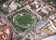 |
| Gorsium | Tác Tác Tác is a village in Hungary. In the time of Roman Empire it was known as Gorsium-Herculia. An open-air museum presents the ruins.- External links :* *... |
Hungary Hungary Hungary , officially the Republic of Hungary , is a landlocked country in Central Europe. It is situated in the Carpathian Basin and is bordered by Slovakia to the north, Ukraine and Romania to the east, Serbia and Croatia to the south, Slovenia to the southwest and Austria to the west. The... |
|||
| Caesarea Maritima | Caesarea | Israel Israel The State of Israel is a parliamentary republic located in the Middle East, along the eastern shore of the Mediterranean Sea... |
32.506568°N 34.897378°E | ||
| Eleutheropolis Eleutheropolis Eleutheropolis was the Greek name of a Roman city in Israel, some 53 km southwest of Jerusalem. Its remains still straddle the ancient road to Gaza. The site— already rendered as Baitogabra in Ptolemy's Geography— was called Beit Guvrin and Bet Gubrin in the Talmud... |
Beit Guvrin | Israel Israel The State of Israel is a parliamentary republic located in the Middle East, along the eastern shore of the Mediterranean Sea... |
31.6082°N 34.8939°E | http://198.62.75.1/www1/ofm/mad/legends/legends084.html | 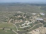 |
| Scythopolis | Bet She'an Bet She'an is a city in the North District of Israel which has played an important role historically due to its geographical location at the junction of the Jordan River Valley and Jezreel Valley... |
Israel Israel The State of Israel is a parliamentary republic located in the Middle East, along the eastern shore of the Mediterranean Sea... |
32.498508°N 35.501446°E | 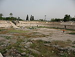 |
|
| Abella Abella Abella was a 14th century Italian physician who taught at the Salerno school of medicine. Abella wrote medical treatises in verse, and lectured on, among other topics, the nature of women. Her published medical treatises, De atrabile and De natura seminis humani , have not survived.-References:*... |
Avella Avella Avella is a city and comune in the province of Avellino, in the Campania region of Italy.-History:The ancient Abella was a medium importance center of the Samnites, and then the Romans, about 10 km northeast of Nola... |
Italy Italy Italy , officially the Italian Republic languages]] under the European Charter for Regional or Minority Languages. In each of these, Italy's official name is as follows:;;;;;;;;), is a unitary parliamentary republic in South-Central Europe. To the north it borders France, Switzerland, Austria and... |
40.961454°N 14.608316°E | Photograph | |
| Abellinum | Avellino Avellino Avellino is a town and comune, capital of the province of Avellino in the Campania region of southern Italy. It is situated in a plain surrounded by mountains 42 km north-east of Naples and is an important hub on the road from Salerno to Benevento.-History:Before the Roman conquest, the... |
Italy Italy Italy , officially the Italian Republic languages]] under the European Charter for Regional or Minority Languages. In each of these, Italy's official name is as follows:;;;;;;;;), is a unitary parliamentary republic in South-Central Europe. To the north it borders France, Switzerland, Austria and... |
|||
| Acelum | Asolo Asolo Asolo is a town and comune in the Veneto Region of Northern Italy. It is known as "The Pearl of the province of Treviso", and also as "The City of a Hundred Horizons" for its mountain settings.-History:... |
Italy Italy Italy , officially the Italian Republic languages]] under the European Charter for Regional or Minority Languages. In each of these, Italy's official name is as follows:;;;;;;;;), is a unitary parliamentary republic in South-Central Europe. To the north it borders France, Switzerland, Austria and... |
|||
| Alba Fucens Alba Fucens Alba Fucens was an ancient Italic town occupying a lofty situation at the foot of the Monte Velino, c. 6.5 km north of Avezzano, Abruzzo, central Italy. Its remains are today in the comune of Massa d'Albe.... |
Albe | Italy Italy Italy , officially the Italian Republic languages]] under the European Charter for Regional or Minority Languages. In each of these, Italy's official name is as follows:;;;;;;;;), is a unitary parliamentary republic in South-Central Europe. To the north it borders France, Switzerland, Austria and... |
42.0772°N 13.4123°E | Photograph | |
| Alba Longa Alba Longa Alba Longa – in Italian sources occasionally written Albalonga – was an ancient city of Latium in central Italy southeast of Rome in the Alban Hills. Founder and head of the Latin League, it was destroyed by Rome around the middle of the 7th century BC. In legend, Romulus and Remus, founders of... (?) |
Albano Laziale Albano Laziale Albano Laziale is a comune in the province of Rome, on the Alban Hills, in Latium, central Italy. It is also a suburb of Rome, which is 25 km distant. It is bounded by other communes of Castel Gandolfo, Rocca di Papa, Ariccia and Ardea. Located in the Castelli Romani area of Lazio... |
Italy Italy Italy , officially the Italian Republic languages]] under the European Charter for Regional or Minority Languages. In each of these, Italy's official name is as follows:;;;;;;;;), is a unitary parliamentary republic in South-Central Europe. To the north it borders France, Switzerland, Austria and... |
41.732720°N 12.664948°E | Photograph | 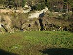 |
| Albingaunum | Albenga Albenga Albenga is a city and comune situated on the Gulf of Genoa on the Italian Riviera in the Province of Savona in Liguria, northern Italy.left|thumb|220px|Towers of Albenga.The economy is mostly based on tourism, local commerce and agriculture-History:... |
Italy Italy Italy , officially the Italian Republic languages]] under the European Charter for Regional or Minority Languages. In each of these, Italy's official name is as follows:;;;;;;;;), is a unitary parliamentary republic in South-Central Europe. To the north it borders France, Switzerland, Austria and... |
44.043859°N 8.211315°E | ||
| Altinum Altinum 260px|thumb|Remains of the Roman [[decumanus]].Altinum is the name of an ancient coastal town of the Veneti 15 km SE of the modern Treviso, northern Italy, on the edge of the lagoons... |
Altino Quarto d'Altino Quarto d'Altino is a town in the province of Venice, Veneto, Italy. SP41 goes through it.The name "Quarto D'Altino" is composed by the prefix "Quarto" because the town was a quarter of a mile from the Roman city Altinum.-Sources:*... |
Italy Italy Italy , officially the Italian Republic languages]] under the European Charter for Regional or Minority Languages. In each of these, Italy's official name is as follows:;;;;;;;;), is a unitary parliamentary republic in South-Central Europe. To the north it borders France, Switzerland, Austria and... |
45.5492°N 12.4001°E | http://www.telegraph.co.uk/news/worldnews/europe/italy/2975502/Ancestor-city-of-Venice-unearthed.html | |
| Amiternum Amiternum Amiternum, a traditional cradle of the Sabines, is an ancient Sabine prefecture in the Abruzzo region of modern Italy at 9 km from L'Aquila. Amiternum was the birthplace of the historian Sallust .It was stormed by the Romans in 293 BC... |
L'Aquila L'Aquila L'Aquila is a city and comune in central Italy, both the capital city of the Abruzzo region and of the Province of L'Aquila. , it has a population of 73,150 inhabitants, but has a daily presence in the territory of 100,000 people for study, tertiary activities, jobs and tourism... |
Italy Italy Italy , officially the Italian Republic languages]] under the European Charter for Regional or Minority Languages. In each of these, Italy's official name is as follows:;;;;;;;;), is a unitary parliamentary republic in South-Central Europe. To the north it borders France, Switzerland, Austria and... |
42.400513°N 13.306014°E | http://ing.univaq.it/manes/SomeL'AquilaPhotos/Photos_of_L'Aquila_04.html | |
| Ancona Ancona Ancona is a city and a seaport in the Marche region, in central Italy, with a population of 101,909 . Ancona is the capital of the province of Ancona and of the region.... |
Italy Italy Italy , officially the Italian Republic languages]] under the European Charter for Regional or Minority Languages. In each of these, Italy's official name is as follows:;;;;;;;;), is a unitary parliamentary republic in South-Central Europe. To the north it borders France, Switzerland, Austria and... |
43.6246°N 13.5119°E | |||
| Antium | Anzio Anzio Anzio is a city and comune on the coast of the Lazio region of Italy, about south of Rome.Well known for its seaside harbour setting, it is a fishing port and a departure point for ferries and hydroplanes to the Pontine Islands of Ponza, Palmarola and Ventotene... |
Italy Italy Italy , officially the Italian Republic languages]] under the European Charter for Regional or Minority Languages. In each of these, Italy's official name is as follows:;;;;;;;;), is a unitary parliamentary republic in South-Central Europe. To the north it borders France, Switzerland, Austria and... |
|||
| Aquileia Aquileia Aquileia is an ancient Roman city in what is now Italy, at the head of the Adriatic at the edge of the lagoons, about 10 km from the sea, on the river Natiso , the course of which has changed somewhat since Roman times... |
Italy Italy Italy , officially the Italian Republic languages]] under the European Charter for Regional or Minority Languages. In each of these, Italy's official name is as follows:;;;;;;;;), is a unitary parliamentary republic in South-Central Europe. To the north it borders France, Switzerland, Austria and... |
45.460736°N 13.215626°E | |||
| Aquinum | Aquino Aquino Aquino is a town and comune in the province of Frosinone, in the Lazio region of Italy, 12 km northwest of Cassino.-History:The ancient Aquinum was a municipium in the time of Cicero, and made a colony by the Triumviri... |
Italy Italy Italy , officially the Italian Republic languages]] under the European Charter for Regional or Minority Languages. In each of these, Italy's official name is as follows:;;;;;;;;), is a unitary parliamentary republic in South-Central Europe. To the north it borders France, Switzerland, Austria and... |
Now completely disappeared, buried beneath the Autostrada. | ||
| Ariminum | Rimini Rimini Rimini is a medium-sized city of 142,579 inhabitants in the Emilia-Romagna region of Italy, and capital city of the Province of Rimini. It is located on the Adriatic Sea, on the coast between the rivers Marecchia and Ausa... |
Italy Italy Italy , officially the Italian Republic languages]] under the European Charter for Regional or Minority Languages. In each of these, Italy's official name is as follows:;;;;;;;;), is a unitary parliamentary republic in South-Central Europe. To the north it borders France, Switzerland, Austria and... |
44.059939°N 12.574804°E | 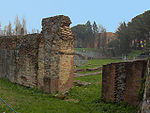 |
|
| Arretium | Arezzo Arezzo Arezzo is a city and comune in Central Italy, capital of the province of the same name, located in Tuscany. Arezzo is about 80 km southeast of Florence, at an elevation of 296 m above sea level. In 2011 the population was about 100,000.... |
Italy Italy Italy , officially the Italian Republic languages]] under the European Charter for Regional or Minority Languages. In each of these, Italy's official name is as follows:;;;;;;;;), is a unitary parliamentary republic in South-Central Europe. To the north it borders France, Switzerland, Austria and... |
43.460570°N 11.880326°E |  |
|
| Assisium | Assisi Assisi - Churches :* The Basilica of San Francesco d'Assisi is a World Heritage Site. The Franciscan monastery, il Sacro Convento, and the lower and upper church of St Francis were begun immediately after his canonization in 1228, and completed in 1253... |
Italy Italy Italy , officially the Italian Republic languages]] under the European Charter for Regional or Minority Languages. In each of these, Italy's official name is as follows:;;;;;;;;), is a unitary parliamentary republic in South-Central Europe. To the north it borders France, Switzerland, Austria and... |
43.071079°N 12.620270°E | http://penelope.uchicago.edu/Thayer/E/Gazetteer/Places/Europe/Italy/Umbria/Perugia/Assisi/Assisi/Roman/amphitheatre.html | |
| Augusta Bagiennorum Augusta Bagiennorum Augusta Bagiennorum was the chief town of the Ligurian tribe of the Bagienni. It was located in what is now the commune of Bene Vagienna, in the province of Cuneo , on the upper course of the Tanaro, about due south of Turin... |
Bene Vagienna Bene Vagienna Bene Vagienna is a comune in the Province of Cuneo in the Italian region Piedmont, located about 60 km south of Turin and about 30 km northeast of Cuneo.... |
Italy Italy Italy , officially the Italian Republic languages]] under the European Charter for Regional or Minority Languages. In each of these, Italy's official name is as follows:;;;;;;;;), is a unitary parliamentary republic in South-Central Europe. To the north it borders France, Switzerland, Austria and... |
44.556327°N 7.849728°E | ||
| Augusta Praetoria Salassorum | Aosta Aosta Aosta is the principal city of the bilingual Aosta Valley in the Italian Alps, north-northwest of Turin. It is situated near the Italian entrance of the Mont Blanc Tunnel, at the confluence of the Buthier and the Dora Baltea, and at the junction of the Great and Little St. Bernard routes... |
Italy Italy Italy , officially the Italian Republic languages]] under the European Charter for Regional or Minority Languages. In each of these, Italy's official name is as follows:;;;;;;;;), is a unitary parliamentary republic in South-Central Europe. To the north it borders France, Switzerland, Austria and... |
45.740766°N 7.323419°E | ||
| Beneventum | Benevento Benevento Benevento is a town and comune of Campania, Italy, capital of the province of Benevento, 50 km northeast of Naples. It is situated on a hill 130 m above sea-level at the confluence of the Calore Irpino and Sabato... |
Italy Italy Italy , officially the Italian Republic languages]] under the European Charter for Regional or Minority Languages. In each of these, Italy's official name is as follows:;;;;;;;;), is a unitary parliamentary republic in South-Central Europe. To the north it borders France, Switzerland, Austria and... |
41.132266°N 14.767640°E | http://www.sanniotradizioni.it/news2007/anfiteatro_romano_di_benevento.htm | |
| Caralis | Cagliari Cagliari Cagliari is the capital of the island of Sardinia, a region of Italy. Cagliari's Sardinian name Casteddu literally means castle. It has about 156,000 inhabitants, or about 480,000 including the outlying townships : Elmas, Assemini, Capoterra, Selargius, Sestu, Monserrato, Quartucciu, Quartu... |
Italy Italy Italy , officially the Italian Republic languages]] under the European Charter for Regional or Minority Languages. In each of these, Italy's official name is as follows:;;;;;;;;), is a unitary parliamentary republic in South-Central Europe. To the north it borders France, Switzerland, Austria and... |
39.223914°N 9.113216°E | Cagliari's amphitheatre | 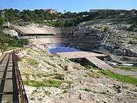 |
| Cales Cales Cales was an ancient city of Campania, in today's comune of Calvi Risorta in southern Italy, belonging originally to the Aurunci/Ausoni, on the Via Latina.The Romans captured it in 335 BC and established a colony with Latin rights of 2,500 citizens... |
Calvi Calvi (Italy) Calvi is a comune in the Province of Benevento in the southern Italian region Campania, located about 60 km northeast of Naples and about 10 km southeast of Benevento. It also belongs to the Samnium historical region... |
Italy Italy Italy , officially the Italian Republic languages]] under the European Charter for Regional or Minority Languages. In each of these, Italy's official name is as follows:;;;;;;;;), is a unitary parliamentary republic in South-Central Europe. To the north it borders France, Switzerland, Austria and... |
41.201408°N 14.137759°E | ||
| Canusium | Canosa di Puglia | Italy Italy Italy , officially the Italian Republic languages]] under the European Charter for Regional or Minority Languages. In each of these, Italy's official name is as follows:;;;;;;;;), is a unitary parliamentary republic in South-Central Europe. To the north it borders France, Switzerland, Austria and... |
41.222051°N 16.055983°E | ||
| Capua Capua Capua is a city and comune in the province of Caserta, Campania, southern Italy, situated 25 km north of Naples, on the northeastern edge of the Campanian plain. Ancient Capua was situated where Santa Maria Capua Vetere is now... |
Italy Italy Italy , officially the Italian Republic languages]] under the European Charter for Regional or Minority Languages. In each of these, Italy's official name is as follows:;;;;;;;;), is a unitary parliamentary republic in South-Central Europe. To the north it borders France, Switzerland, Austria and... |
41.085931°N 14.250105°E 41.084832°N 14.250187°E |
Just to the south, currently being excavated beneath the Piazza Adriano are the remains of another amphitheatre, believed to predate the standing one.Capua#Amphitheatre | 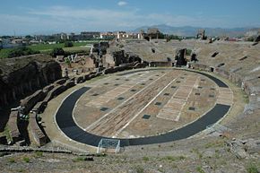 |
|
| Carsulae Carsulae Carsulae is an archaeological site in Umbria, central Italy, now one of the most important archaeological ruins in Italy. It is located c. 4 km north of San Gemini, a small comune in the province of Terni. Nearby is the comune of Montecastrilli .-Origins and history:Most historians fix the... |
Italy Italy Italy , officially the Italian Republic languages]] under the European Charter for Regional or Minority Languages. In each of these, Italy's official name is as follows:;;;;;;;;), is a unitary parliamentary republic in South-Central Europe. To the north it borders France, Switzerland, Austria and... |
42.6395°N 12.5591°E | http://penelope.uchicago.edu/Thayer/E/Gazetteer/Places/Europe/Italy/Umbria/Terni/San_Gemini/Carsulae/home.html | ||
| Casinum Casinum Casinum was an ancient town of Italy, probably of Volscian origin. Varro states that the name was Sabine, and meant forum vetus, and also that the town itself was Samnite, but he is probably wrong. When it came under Roman supremacy is not known, but it probably received the citizenship in 188 BC... |
Cassino | Italy Italy Italy , officially the Italian Republic languages]] under the European Charter for Regional or Minority Languages. In each of these, Italy's official name is as follows:;;;;;;;;), is a unitary parliamentary republic in South-Central Europe. To the north it borders France, Switzerland, Austria and... |
41.482732°N 13.823544°E | Photograph | |
| Catăna • Catĭna | Catania Catania Catania is an Italian city on the east coast of Sicily facing the Ionian Sea, between Messina and Syracuse. It is the capital of the homonymous province, and with 298,957 inhabitants it is the second-largest city in Sicily and the tenth in Italy.Catania is known to have a seismic history and... |
Italy Italy Italy , officially the Italian Republic languages]] under the European Charter for Regional or Minority Languages. In each of these, Italy's official name is as follows:;;;;;;;;), is a unitary parliamentary republic in South-Central Europe. To the north it borders France, Switzerland, Austria and... |
37.507335°N 15.085354°E |  |
|
| Civitas Camunnorum | Cividate Camuno Cividate Camuno Cividate Camuno is an Italian comune of 2,732 inhabitants in Val Camonica, province of Brescia, in Lombardy.-Geography:... |
Italy Italy Italy , officially the Italian Republic languages]] under the European Charter for Regional or Minority Languages. In each of these, Italy's official name is as follows:;;;;;;;;), is a unitary parliamentary republic in South-Central Europe. To the north it borders France, Switzerland, Austria and... |
45.9435°N 10.281°E | Estimated capacity: 5500 people. Civitas Camunnorum | |
| Cumae Cumae Cumae is an ancient Greek settlement lying to the northwest of Naples in the Italian region of Campania. Cumae was the first Greek colony on the mainland of Italy , and the seat of the Cumaean Sibyl... |
Italy Italy Italy , officially the Italian Republic languages]] under the European Charter for Regional or Minority Languages. In each of these, Italy's official name is as follows:;;;;;;;;), is a unitary parliamentary republic in South-Central Europe. To the north it borders France, Switzerland, Austria and... |
40.841929°N 14.055903°E | Photograph | ||
| Egnatia Gnatia Gnatia was an ancient city of the Messapii, and their frontier town towards the Salentini. located near the modern Fasano, Apulia, southern Italy.-History:... |
Anazzo | Italy Italy Italy , officially the Italian Republic languages]] under the European Charter for Regional or Minority Languages. In each of these, Italy's official name is as follows:;;;;;;;;), is a unitary parliamentary republic in South-Central Europe. To the north it borders France, Switzerland, Austria and... |
40.887799°N 17.391103°E | Photograph | |
| Eporedia | Ivrea Ivrea Ivrea is a town and comune of the province of Turin in the Piedmont region of northwestern Italy. Situated on the road leading to the Aosta Valley , it straddles the Dora Baltea and is regarded as the centre of the Canavese area. Ivrea lies in a basin that, in prehistoric times, formed a great lake... |
Italy Italy Italy , officially the Italian Republic languages]] under the European Charter for Regional or Minority Languages. In each of these, Italy's official name is as follows:;;;;;;;;), is a unitary parliamentary republic in South-Central Europe. To the north it borders France, Switzerland, Austria and... |
45.4678°N 7.88769°E | ||
| Fabrateria Nova | San Giovanni Incarico San Giovanni Incarico San Giovanni Incarico is a comune in the Province of Frosinone in the Italian region Lazio, located about 100 km southeast of Rome and about 20 km southeast of Frosinone... |
Italy Italy Italy , officially the Italian Republic languages]] under the European Charter for Regional or Minority Languages. In each of these, Italy's official name is as follows:;;;;;;;;), is a unitary parliamentary republic in South-Central Europe. To the north it borders France, Switzerland, Austria and... |
41.518807°N 13.552995°E | Photograph | |
| Falerio Picenus | Falerone Falerone Falerone is a town and comune in province of Fermo, in the Italian region of the Marche, southeast of Urbisaglia.-History:Almost nothing is known of the ancient town except from inscriptions, from which, and from the remains of its buildings, it appears to have been a centre of some importance in... |
Italy Italy Italy , officially the Italian Republic languages]] under the European Charter for Regional or Minority Languages. In each of these, Italy's official name is as follows:;;;;;;;;), is a unitary parliamentary republic in South-Central Europe. To the north it borders France, Switzerland, Austria and... |
43.1011°N 13.4964°E | ||
| Falerii Novi Falerii Novi Falerii Novi was a walled town in the Tiber River valley, about 50km north of Rome and 6km west of Civita Castellana. It was created by the Romans, who resettled the inhabitants of Falerii Veteres in this much less defensible position after a revolt in 241 BC... |
Italy Italy Italy , officially the Italian Republic languages]] under the European Charter for Regional or Minority Languages. In each of these, Italy's official name is as follows:;;;;;;;;), is a unitary parliamentary republic in South-Central Europe. To the north it borders France, Switzerland, Austria and... |
42.302694°N 12.360894°E | http://www.bsr.ac.uk/bsr/sub_arch/extra/BSR_Tiber_Roman_03.htm | ||
| Fidenae Fidenae Fidenae, or Fidenes, home of the Fidenates, was an ancient town of Latium, situated about 8 km north of Rome on the Via Salaria, which ran between it and the Tiber. As the Tiber was the border between Etruria and Latium, the left-bank settlement of Fidenae represented an extension of Etruscan... |
Italy Italy Italy , officially the Italian Republic languages]] under the European Charter for Regional or Minority Languages. In each of these, Italy's official name is as follows:;;;;;;;;), is a unitary parliamentary republic in South-Central Europe. To the north it borders France, Switzerland, Austria and... |
A wooden amphitheatre collapsed here in AD 27, killing at least 20,000. | |||
| Firmum Picenum | Fermo Fermo Fermo is a town and comune of the Marche, Italy, in the Province of Fermo.Fermo is located on a hill, the Sabulo with a fine view, on a branch from Porto San Giorgio on the Adriatic coast railway.... |
Italy Italy Italy , officially the Italian Republic languages]] under the European Charter for Regional or Minority Languages. In each of these, Italy's official name is as follows:;;;;;;;;), is a unitary parliamentary republic in South-Central Europe. To the north it borders France, Switzerland, Austria and... |
http://www.agap.ap.it/fermo.htm | ||
| Florentia Florentia Florentia is a commune in the Jura department in Franche-Comté in eastern France.- References :*... |
Florence Florence Florence is the capital city of the Italian region of Tuscany and of the province of Florence. It is the most populous city in Tuscany, with approximately 370,000 inhabitants, expanding to over 1.5 million in the metropolitan area.... |
Italy Italy Italy , officially the Italian Republic languages]] under the European Charter for Regional or Minority Languages. In each of these, Italy's official name is as follows:;;;;;;;;), is a unitary parliamentary republic in South-Central Europe. To the north it borders France, Switzerland, Austria and... |
43.769228°N 11.259521°E | ||
| Formiae | Formia Formia Formia is a city and comune in the province of Latina, on the Mediterranean coast of Lazio . It is located halfway between Rome and Naples, and lies on the Roman-era Appian Way.-History:... |
Italy Italy Italy , officially the Italian Republic languages]] under the European Charter for Regional or Minority Languages. In each of these, Italy's official name is as follows:;;;;;;;;), is a unitary parliamentary republic in South-Central Europe. To the north it borders France, Switzerland, Austria and... |
|||
| Forum Novum Forum Novum Forum Novum was a new Roman foundation which developed as a forum or market center during the Roman Republic period. By the early 1st century AD Forum Novum had been elevated to the status of municipium, appearing as such in Pliny's list of towns... |
Vescovio | Italy Italy Italy , officially the Italian Republic languages]] under the European Charter for Regional or Minority Languages. In each of these, Italy's official name is as follows:;;;;;;;;), is a unitary parliamentary republic in South-Central Europe. To the north it borders France, Switzerland, Austria and... |
http://www.bsr.ac.uk/bsr/sub_arch/extra/BSR_Tiber_Forum_amphi01.htm | ||
| Frusinum | Frosinone Frosinone Frosinone is a town and comune in Lazio, central Italy, the administrative seat of the Province of Frosinone. It is located about 75 km south-east of Rome close to the Rome-Naples Autostrada A1... |
Italy Italy Italy , officially the Italian Republic languages]] under the European Charter for Regional or Minority Languages. In each of these, Italy's official name is as follows:;;;;;;;;), is a unitary parliamentary republic in South-Central Europe. To the north it borders France, Switzerland, Austria and... |
41.639385°N 13.352968°E | ||
| Grumentum Grumentum Grumentum was an ancient town in the centre of Lucania, in what is now the comune of Grumento Nova, c. 50 km south of Potenza by the direct road through Anxia, and 80 km by the Via Herculia, at the point of divergence of a road eastward to Heraclea.-History:The first settlements, of the... |
Italy Italy Italy , officially the Italian Republic languages]] under the European Charter for Regional or Minority Languages. In each of these, Italy's official name is as follows:;;;;;;;;), is a unitary parliamentary republic in South-Central Europe. To the north it borders France, Switzerland, Austria and... |
40.287320°N 15.911550°E | |||
| Herdoniae | Ordona Ordona Ordona is a small town and comune of the province of Foggia in the region of Puglia in southern Italy.-Geography:Ascoli Satriano, Carapelle, Foggia, Orta Nova, Cerignola are nearby towns.-History:... |
Italy Italy Italy , officially the Italian Republic languages]] under the European Charter for Regional or Minority Languages. In each of these, Italy's official name is as follows:;;;;;;;;), is a unitary parliamentary republic in South-Central Europe. To the north it borders France, Switzerland, Austria and... |
41.3105°N 15.6231°E? | ||
| Himera Himera thumb|250px|Remains of the Temple of Victory.thumb|250px|Ideal reconstruction of the Temple of Victory.Himera , was an important ancient Greek city of Sicily, situated on the north coast of the island, at the mouth of the river of the same name , between Panormus and Cephaloedium... |
Termini Imerese Termini Imerese Termini Imerese is a town and comune in the province of Palermo on the northern coast of Sicily, southern Italy.-Ancient:The site where the town now sits has been populated since prehistoric times, as many archeologial excavations have shown through the years... |
Italy Italy Italy , officially the Italian Republic languages]] under the European Charter for Regional or Minority Languages. In each of these, Italy's official name is as follows:;;;;;;;;), is a unitary parliamentary republic in South-Central Europe. To the north it borders France, Switzerland, Austria and... |
37.987800°N 13.693664°E | Photograph | |
| Hispellum Hispellum Hispellum was an ancient town of Umbria, Italy, north of Fulginiae, on the road between it and Perusia.Hispellum is mentioned in Pliny , Strabo , and Ptolemy's Geography , but apparently by no earlier author: the town seems to have been established by Augustus, who at any rate founded a colony... |
Spello Spello Spello is an ancient town and comune of Italy, in the province of Perugia in east central Umbria, on the lower southern flank of Mt. Subasio. It is 6 km NNW of Foligno and 10 km SSE of Assisi.The old walled town lies on a regularly NW-SE sloping ridge that eventually meets the plain... |
Italy Italy Italy , officially the Italian Republic languages]] under the European Charter for Regional or Minority Languages. In each of these, Italy's official name is as follows:;;;;;;;;), is a unitary parliamentary republic in South-Central Europe. To the north it borders France, Switzerland, Austria and... |
42.995938°N 12.665265°E | http://penelope.uchicago.edu/Thayer/E/Gazetteer/Places/Europe/Italy/Umbria/Perugia/Spello/Spello/Roman/amphitheatre/home.html#ImageMapLocation | |
| Histonium | Vasto Vasto Vasto is a town and comune on the Adriatic coast of the Province of Chieti in southern Abruzzo, Italy. The population is now just over 40,000.-History:According to tradition, the town was founded by Diomedes, the Greek hero... |
Italy Italy Italy , officially the Italian Republic languages]] under the European Charter for Regional or Minority Languages. In each of these, Italy's official name is as follows:;;;;;;;;), is a unitary parliamentary republic in South-Central Europe. To the north it borders France, Switzerland, Austria and... |
42.111279°N 14.707821°E | ||
| Interamna Nahars | Terni Terni Terni is a city in southern Umbria, central Italy, capital of the province of Terni, located in the plain of the Nera river. It is 104 km N of Rome, 36 km NW of Rieti, and 29 km S of Spoleto.-History:... |
Italy Italy Italy , officially the Italian Republic languages]] under the European Charter for Regional or Minority Languages. In each of these, Italy's official name is as follows:;;;;;;;;), is a unitary parliamentary republic in South-Central Europe. To the north it borders France, Switzerland, Austria and... |
42.5598°N 12.6433°E | http://penelope.uchicago.edu/Thayer/E/Gazetteer/Places/Europe/Italy/Umbria/Terni/Terni/Terni/home.html | |
| Interamnia Praetutiana | Teramo Teramo Teramo is a city and comune in the central Italian region of Abruzzo, the capital of the province of Teramo.The city, from Rome, is situated between the highest mountains of the Apennines and the Adriatic coast... |
Italy Italy Italy , officially the Italian Republic languages]] under the European Charter for Regional or Minority Languages. In each of these, Italy's official name is as follows:;;;;;;;;), is a unitary parliamentary republic in South-Central Europe. To the north it borders France, Switzerland, Austria and... |
42.658115°N 13.703109°E | Photograph | |
| Lanuvium Lanuvium Lanuvium is an ancient city of Latium , some 32 km southeast of Rome, a little southwest of the Via Appia.... |
Lanuvio Lanuvio Lanuvio is a comune in the Province of Rome in the Italian region Latium, located about 30 km southeast of Rome, on the Alban Hills.Lanuvio borders the following municipalities: Aprilia, Ariccia, Genzano di Roma, Velletri.-History:... |
Italy Italy Italy , officially the Italian Republic languages]] under the European Charter for Regional or Minority Languages. In each of these, Italy's official name is as follows:;;;;;;;;), is a unitary parliamentary republic in South-Central Europe. To the north it borders France, Switzerland, Austria and... |
http://rome.wantedineurope.com/articles/complete_articles.php?id_art=530 Photograph | ||
| Larinum | Larino Larino Larino is a town and comune of approximately 8,200 inhabitants in Molise, province of Campobasso, southern Italy. It is located in the fertile valley of the Biferno River.... |
Italy Italy Italy , officially the Italian Republic languages]] under the European Charter for Regional or Minority Languages. In each of these, Italy's official name is as follows:;;;;;;;;), is a unitary parliamentary republic in South-Central Europe. To the north it borders France, Switzerland, Austria and... |
41.805529°N 14.916364°E | Photograph | 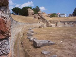 |
| Libarna | Italy Italy Italy , officially the Italian Republic languages]] under the European Charter for Regional or Minority Languages. In each of these, Italy's official name is as follows:;;;;;;;;), is a unitary parliamentary republic in South-Central Europe. To the north it borders France, Switzerland, Austria and... |
44.705942°N 8.867859°E | http://www.ilfiorile.com/le_attivita/libarna_romana_serravalle.htmlhttp://www.distrettonovese.it/index.php?method=press&action=struttura&id=606 | ||
| Liternum Liternum Liternum was an ancient town of Campania, Italy, on the low sandy coast between Cumae and the mouth of the Volturnus. It was probably once dependent on Cumae. In 194 BC it became a Roman colony.... |
Italy Italy Italy , officially the Italian Republic languages]] under the European Charter for Regional or Minority Languages. In each of these, Italy's official name is as follows:;;;;;;;;), is a unitary parliamentary republic in South-Central Europe. To the north it borders France, Switzerland, Austria and... |
||||
| Lucca Lucca Lucca is a city and comune in Tuscany, central Italy, situated on the river Serchio in a fertile plainnear the Tyrrhenian Sea. It is the capital city of the Province of Lucca... |
Italy Italy Italy , officially the Italian Republic languages]] under the European Charter for Regional or Minority Languages. In each of these, Italy's official name is as follows:;;;;;;;;), is a unitary parliamentary republic in South-Central Europe. To the north it borders France, Switzerland, Austria and... |
43.845320°N 10.506166°E | 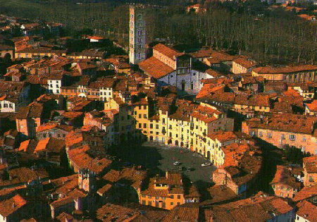 |
||
| Lucera Lucera Lucera is a town and comune in the Province of Foggia, in the Apulia region of southern Italy.-Ancient era and early Middle Ages :Lucera is an ancient city founded in Daunia, the centre of Dauni territory . Archeological excavations show the presence of a bronze age village inside the city boundaries... |
Italy Italy Italy , officially the Italian Republic languages]] under the European Charter for Regional or Minority Languages. In each of these, Italy's official name is as follows:;;;;;;;;), is a unitary parliamentary republic in South-Central Europe. To the north it borders France, Switzerland, Austria and... |
41.5083°N 15.3449°E | Lucera's amphitheatre | 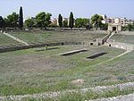 |
|
| Lucus Feroniae Lucus Feroniae Lucus Feroniae was an ancient sacred grove dedicated to the Sabine goddess Feronia. It was located in Etruria, across the ancient Via Tiberina, in what is now the territory of the modern commune of Capena, Lazio, next to the border with the neighbouring commune of Fiano Romano.It was visited both... |
Italy Italy Italy , officially the Italian Republic languages]] under the European Charter for Regional or Minority Languages. In each of these, Italy's official name is as follows:;;;;;;;;), is a unitary parliamentary republic in South-Central Europe. To the north it borders France, Switzerland, Austria and... |
42.129874°N 12.594746°E | |||
| Luna Luni, Italy Luni is a frazione of the comune of Ortonovo, province of La Spezia, in the easternmost end of the Liguria region of northern Italy... |
Luni Luni, Italy Luni is a frazione of the comune of Ortonovo, province of La Spezia, in the easternmost end of the Liguria region of northern Italy... |
Italy Italy Italy , officially the Italian Republic languages]] under the European Charter for Regional or Minority Languages. In each of these, Italy's official name is as follows:;;;;;;;;), is a unitary parliamentary republic in South-Central Europe. To the north it borders France, Switzerland, Austria and... |
44.062573°N 10.022085°E |  |
|
| Lupiae | Lecce Lecce Lecce is a historic city of 95,200 inhabitants in southern Italy, the capital of the province of Lecce, the second province in the region by population, as well as one of the most important cities of Puglia... |
Italy Italy Italy , officially the Italian Republic languages]] under the European Charter for Regional or Minority Languages. In each of these, Italy's official name is as follows:;;;;;;;;), is a unitary parliamentary republic in South-Central Europe. To the north it borders France, Switzerland, Austria and... |
40.352473°N 18.172944°E | 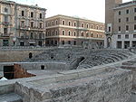 |
|
| Marruvium | San Benedetto dei Marsi San Benedetto dei Marsi San Benedetto dei Marsi is a comune and town in the province of L'Aquila in the Abruzzo region of Italy... |
Italy Italy Italy , officially the Italian Republic languages]] under the European Charter for Regional or Minority Languages. In each of these, Italy's official name is as follows:;;;;;;;;), is a unitary parliamentary republic in South-Central Europe. To the north it borders France, Switzerland, Austria and... |
42.0065°N 13.6276°E | ||
| Mediolanum Mediolanum Mediolanum, the ancient Milan, was an important Celtic and then Roman centre of northern Italy. This article charts the history of the city from its settlement by the Insubres around 600 BC, through its conquest by the Romans and its development into a key centre of Western Christianity and capital... |
Milan Milan Milan is the second-largest city in Italy and the capital city of the region of Lombardy and of the province of Milan. The city proper has a population of about 1.3 million, while its urban area, roughly coinciding with its administrative province and the bordering Province of Monza and Brianza ,... |
Italy Italy Italy , officially the Italian Republic languages]] under the European Charter for Regional or Minority Languages. In each of these, Italy's official name is as follows:;;;;;;;;), is a unitary parliamentary republic in South-Central Europe. To the north it borders France, Switzerland, Austria and... |
45.457026°N 9.178663°E | Milan amphitheatre |  |
| Mevania Mevania Mevania , an ancient Roman town and municipium of , in the Augustan Regio VI. It lay on the western branch of the Via Flaminia, 13 km WSW of Forum Flaminii where the branches rejoin.... |
Bevagna Bevagna Bevagna is a town and comune in the central part of the Italian province of Perugia, , in the flood plain of the Topino river.Bevagna is 25 km SE of Perugia, 8 km west of Foligno, 7 km north-north-west of Montefalco, 16 km south of Assisi and 15 km north-west of Trevi.It... |
Italy Italy Italy , officially the Italian Republic languages]] under the European Charter for Regional or Minority Languages. In each of these, Italy's official name is as follows:;;;;;;;;), is a unitary parliamentary republic in South-Central Europe. To the north it borders France, Switzerland, Austria and... |
42.936912°N 12.615350°E | http://penelope.uchicago.edu/Thayer/E/Gazetteer/Places/Europe/Italy/Umbria/Perugia/Bevagna/Bevagna/Roman/amphitheatre.html | |
| Minturnae | Minturno Minturno Minturno is a city and comune in the southern Lazio, Italy, situated on the north west bank of the Liris , with a suburb on the opposite bank c... |
Italy Italy Italy , officially the Italian Republic languages]] under the European Charter for Regional or Minority Languages. In each of these, Italy's official name is as follows:;;;;;;;;), is a unitary parliamentary republic in South-Central Europe. To the north it borders France, Switzerland, Austria and... |
41.241630°N 13.763832°E | http://www.atargatis.info/itinerari/index.php?ft=minturnoarcheologica | |
| Neapolis Naples Naples is a city in Southern Italy, situated on the country's west coast by the Gulf of Naples. Lying between two notable volcanic regions, Mount Vesuvius and the Phlegraean Fields, it is the capital of the region of Campania and of the province of Naples... |
Naples Naples Naples is a city in Southern Italy, situated on the country's west coast by the Gulf of Naples. Lying between two notable volcanic regions, Mount Vesuvius and the Phlegraean Fields, it is the capital of the region of Campania and of the province of Naples... |
Italy Italy Italy , officially the Italian Republic languages]] under the European Charter for Regional or Minority Languages. In each of these, Italy's official name is as follows:;;;;;;;;), is a unitary parliamentary republic in South-Central Europe. To the north it borders France, Switzerland, Austria and... |
40.851843°N 14.255639°E | http://faculty.ed.umuc.edu/~jmatthew/naples/Romampitheater.htm | |
| Nora Nora, Italy thumb|250px|The Punic Quarter in the archaeological site of Nora.Nora is an ancient Roman and pre-Roman town placed on a peninsula near Pula, near to Cagliari in Sardinia. According with the legend, Nora was founded by a group of Iberians led by Norax, a mythological hero son of Eriteide and the... |
Italy Italy Italy , officially the Italian Republic languages]] under the European Charter for Regional or Minority Languages. In each of these, Italy's official name is as follows:;;;;;;;;), is a unitary parliamentary republic in South-Central Europe. To the north it borders France, Switzerland, Austria and... |
Unexcavated | |||
| Nuvlana | Nola Nola Nola is a city and comune of Campania, southern Italy, in the province of Naples, situated in the plain between Mount Vesuvius and the Apennines... |
Italy Italy Italy , officially the Italian Republic languages]] under the European Charter for Regional or Minority Languages. In each of these, Italy's official name is as follows:;;;;;;;;), is a unitary parliamentary republic in South-Central Europe. To the north it borders France, Switzerland, Austria and... |
40.927722°N 14.520287°E | ||
| Ocriculum | Otricoli Otricoli Otricoli is a town and comune in the province of Terni, Umbria, Italy. It is located on the Via Flaminia, near the east bank of the Tiber, 44 miles north of Rome and 12 miles south of Narni.-History and landmarks:... |
Italy Italy Italy , officially the Italian Republic languages]] under the European Charter for Regional or Minority Languages. In each of these, Italy's official name is as follows:;;;;;;;;), is a unitary parliamentary republic in South-Central Europe. To the north it borders France, Switzerland, Austria and... |
42.411882°N 12.466898°E | http://www.bsr.ac.uk/bsr/sub_arch/extra/BSR_Tiber_Roman_05.htm http://penelope.uchicago.edu/Thayer/E/Gazetteer/Places/Europe/Italy/Umbria/Terni/Otricoli/Ocriculum/amphitheatre.html | |
| Ostia Ostia Antica Ostia Antica is a large archeological site, close to the modern suburb of Ostia , that was the location of the harbour city of ancient Rome, which is approximately 30 km to the northeast. "Ostia" in Latin means "mouth". At the mouth of the River Tiber, Ostia was Rome's seaport, but, due to... |
Ostia Antica Ostia Antica Ostia Antica is a large archeological site, close to the modern suburb of Ostia , that was the location of the harbour city of ancient Rome, which is approximately 30 km to the northeast. "Ostia" in Latin means "mouth". At the mouth of the River Tiber, Ostia was Rome's seaport, but, due to... |
Italy Italy Italy , officially the Italian Republic languages]] under the European Charter for Regional or Minority Languages. In each of these, Italy's official name is as follows:;;;;;;;;), is a unitary parliamentary republic in South-Central Europe. To the north it borders France, Switzerland, Austria and... |
New discovery http://www.google.com/hostednews/ap/article/ALeqM5gNsVSXbgNg9Tl15-yVL4-W4bmttAD9B2BQIG6http://news.bbc.co.uk/2/hi/in_pictures/8284478.stmhttp://www.timesonline.co.uk/tol/news/world/europe/article6856042.ece | ||
| Paestum Paestum Paestum is the classical Roman name of a major Graeco-Roman city in the Campania region of Italy. It is located in the north of Cilento, near the coast about 85 km SE of Naples in the province of Salerno, and belongs to the commune of Capaccio, officially also named... |
Italy Italy Italy , officially the Italian Republic languages]] under the European Charter for Regional or Minority Languages. In each of these, Italy's official name is as follows:;;;;;;;;), is a unitary parliamentary republic in South-Central Europe. To the north it borders France, Switzerland, Austria and... |
40.422409°N 15.006500°E |  |
||
| Patavium | Padua Padua Padua is a city and comune in the Veneto, northern Italy. It is the capital of the province of Padua and the economic and communications hub of the area. Padua's population is 212,500 . The city is sometimes included, with Venice and Treviso, in the Padua-Treviso-Venice Metropolitan Area, having... |
Italy Italy Italy , officially the Italian Republic languages]] under the European Charter for Regional or Minority Languages. In each of these, Italy's official name is as follows:;;;;;;;;), is a unitary parliamentary republic in South-Central Europe. To the north it borders France, Switzerland, Austria and... |
45.411630°N 11.879132°E | The arena has been built upon, its site commemorated in the Arena Chapel | 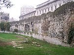 |
| Peltuinum Peltuinum Peltuinum was a Roman town of the Vestini, on the ancient Via Claudia Nova, 20 km east of L'Aquila, Italy, between the modern-day settlements of Prata d'Ansidonia and Castelnuovo. It was apparently the chief town of that portion of the Vestini who dwelt west of the main Apennine chain. Remains... |
Italy Italy Italy , officially the Italian Republic languages]] under the European Charter for Regional or Minority Languages. In each of these, Italy's official name is as follows:;;;;;;;;), is a unitary parliamentary republic in South-Central Europe. To the north it borders France, Switzerland, Austria and... |
42.286878°N 13.623418°E (?) | |||
| Pollentia Pollentia thumb|250px|Church of San Vittore at Pollenzo.Pollentia was an ancient city the left bank of the Tanaro, known today as Pollenzo, a frazione of Bra in the Province of Cuneo, Piedmont, northern Italy.... |
Pollenzo | Italy Italy Italy , officially the Italian Republic languages]] under the European Charter for Regional or Minority Languages. In each of these, Italy's official name is as follows:;;;;;;;;), is a unitary parliamentary republic in South-Central Europe. To the north it borders France, Switzerland, Austria and... |
44.684739°N 7.895866°E | ||
| Pompeii Pompeii The city of Pompeii is a partially buried Roman town-city near modern Naples in the Italian region of Campania, in the territory of the comune of Pompei. Along with Herculaneum, Pompeii was destroyed and completely buried during a long catastrophic eruption of the volcano Mount Vesuvius spanning... |
Italy Italy Italy , officially the Italian Republic languages]] under the European Charter for Regional or Minority Languages. In each of these, Italy's official name is as follows:;;;;;;;;), is a unitary parliamentary republic in South-Central Europe. To the north it borders France, Switzerland, Austria and... |
40.751264°N 14.494970°E | Amphitheatre of Pompeii Amphitheatre of Pompeii The Amphitheatre of Pompeii is the oldest surviving Roman amphitheatre. It is located in the ancient Roman city of Pompeii, and was buried by the eruption of Vesuvius in 79 CE, that also buried Pompeii itself, and neighbouring Herculaneum.... |
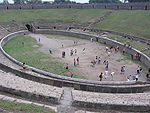 |
|
| Puteoli | Pozzuoli Pozzuoli Pozzuoli is a city and comune of the province of Naples, in the Italian region of Campania. It is the main city of the Phlegrean peninsula.-History:Pozzuoli began as the Greek colony of Dicaearchia... |
Italy Italy Italy , officially the Italian Republic languages]] under the European Charter for Regional or Minority Languages. In each of these, Italy's official name is as follows:;;;;;;;;), is a unitary parliamentary republic in South-Central Europe. To the north it borders France, Switzerland, Austria and... |
40.825919°N 14.125313°E 40.826231°N 14.127524°E |
Flavian Amphitheater Flavian Amphitheater (Pozzuoli) The Flavian Amphitheater , located in Pozzuoli, is the third largest Roman amphitheater in Italy. Only the Roman Colosseum and the Capuan Amphitheater are larger. It was likely built by the same architects who previously constructed the Roman Colosseum... ; a 2nd minor amphitheater buried beneath the nearby subway line. |
|
| Roma Rome Rome is the capital of Italy and the country's largest and most populated city and comune, with over 2.7 million residents in . The city is located in the central-western portion of the Italian Peninsula, on the Tiber River within the Lazio region of Italy.Rome's history spans two and a half... |
Rome Rome Rome is the capital of Italy and the country's largest and most populated city and comune, with over 2.7 million residents in . The city is located in the central-western portion of the Italian Peninsula, on the Tiber River within the Lazio region of Italy.Rome's history spans two and a half... |
Italy Italy Italy , officially the Italian Republic languages]] under the European Charter for Regional or Minority Languages. In each of these, Italy's official name is as follows:;;;;;;;;), is a unitary parliamentary republic in South-Central Europe. To the north it borders France, Switzerland, Austria and... |
41.890177°N 12.492395°E | Colosseum Colosseum The Colosseum, or the Coliseum, originally the Flavian Amphitheatre , is an elliptical amphitheatre in the centre of the city of Rome, Italy, the largest ever built in the Roman Empire... |
 |
| Roma Rome Rome is the capital of Italy and the country's largest and most populated city and comune, with over 2.7 million residents in . The city is located in the central-western portion of the Italian Peninsula, on the Tiber River within the Lazio region of Italy.Rome's history spans two and a half... |
Rome Rome Rome is the capital of Italy and the country's largest and most populated city and comune, with over 2.7 million residents in . The city is located in the central-western portion of the Italian Peninsula, on the Tiber River within the Lazio region of Italy.Rome's history spans two and a half... |
Italy Italy Italy , officially the Italian Republic languages]] under the European Charter for Regional or Minority Languages. In each of these, Italy's official name is as follows:;;;;;;;;), is a unitary parliamentary republic in South-Central Europe. To the north it borders France, Switzerland, Austria and... |
41.887569°N 12.515047°E | Amphitheatrum Castrense Amphitheatrum Castrense The Amphitheatrum Castrense is a Roman amphitheatre in Rome, next to the church of Santa Croce in Gerusalemme. It is the second ancient amphitheatre of Rome after the Colosseum.-History:... http://penelope.uchicago.edu/Thayer/E/Gazetteer/Places/Europe/Italy/Lazio/Roma/Rome/walls/Aurelian/Amphitheatrum_Castrense/home.html |
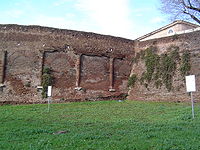 |
| Roma Rome Rome is the capital of Italy and the country's largest and most populated city and comune, with over 2.7 million residents in . The city is located in the central-western portion of the Italian Peninsula, on the Tiber River within the Lazio region of Italy.Rome's history spans two and a half... |
Rome Rome Rome is the capital of Italy and the country's largest and most populated city and comune, with over 2.7 million residents in . The city is located in the central-western portion of the Italian Peninsula, on the Tiber River within the Lazio region of Italy.Rome's history spans two and a half... |
Italy Italy Italy , officially the Italian Republic languages]] under the European Charter for Regional or Minority Languages. In each of these, Italy's official name is as follows:;;;;;;;;), is a unitary parliamentary republic in South-Central Europe. To the north it borders France, Switzerland, Austria and... |
41.889882°N 12.494881°E | Ludus Magnus Ludus Magnus The Ludus Magnus or The Great Gladiatorial Training School is the largest of the gladiatorial arenas in Rome, Italy. It was built by the emperor Domitian in the valley between the Esquiline and the Caelian hills, an area already occupied by Republican and Augustan structures... , a "training amphitheatre". No longer extant are the Amphitheater of Statilius Taurus Amphitheater of Statilius Taurus The Amphitheatre of Statilius Taurus was an amphitheatre in ancient Rome.The amphitheatre was built in 29 BC. Earlier arenas were temporary structures that were disassembled after the event. The amphitheatre was built by Titus Statilius Taurus, who paid for it from his own resources... or the Amphitheater of Nero. |
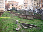 |
| Rudiae | Italy Italy Italy , officially the Italian Republic languages]] under the European Charter for Regional or Minority Languages. In each of these, Italy's official name is as follows:;;;;;;;;), is a unitary parliamentary republic in South-Central Europe. To the north it borders France, Switzerland, Austria and... |
40.3342°N 18.1473°E? | |||
| Rusellae Rusellae Rusellae was an ancient town of Etruria , which survived until the Middle Ages before being abandoned. The ruins lie in the modern frazione of Roselle in the comune of Grosseto.-Geography:... |
Roselle Rusellae Rusellae was an ancient town of Etruria , which survived until the Middle Ages before being abandoned. The ruins lie in the modern frazione of Roselle in the comune of Grosseto.-Geography:... |
Italy Italy Italy , officially the Italian Republic languages]] under the European Charter for Regional or Minority Languages. In each of these, Italy's official name is as follows:;;;;;;;;), is a unitary parliamentary republic in South-Central Europe. To the north it borders France, Switzerland, Austria and... |
42.828364°N 11.159210°E | http://penelope.uchicago.edu/Thayer/E/Gazetteer/Places/Europe/Italy/Toscana/Grosseto/Grosseto/Roselle/amphitheatre.html | |
| Scolacium | Borgia | Italy Italy Italy , officially the Italian Republic languages]] under the European Charter for Regional or Minority Languages. In each of these, Italy's official name is as follows:;;;;;;;;), is a unitary parliamentary republic in South-Central Europe. To the north it borders France, Switzerland, Austria and... |
38.82°N 16.5833°E | Photograph | |
| Segusium | Susa Susa, Italy Susa is a city and comune in Piedmont, Italy. It is situated on at the confluence of the Cenischia with the Dora Riparia, a tributary of the Po River, at the foot of the Cottian Alps, 51 km west of Turin.-History:... |
Italy Italy Italy , officially the Italian Republic languages]] under the European Charter for Regional or Minority Languages. In each of these, Italy's official name is as follows:;;;;;;;;), is a unitary parliamentary republic in South-Central Europe. To the north it borders France, Switzerland, Austria and... |
45.133356°N 7.045136°E | ||
| Spoletium | Spoleto Spoleto Spoleto is an ancient city in the Italian province of Perugia in east central Umbria on a foothill of the Apennines. It is S. of Trevi, N. of Terni, SE of Perugia; SE of Florence; and N of Rome.-History:... |
Italy Italy Italy , officially the Italian Republic languages]] under the European Charter for Regional or Minority Languages. In each of these, Italy's official name is as follows:;;;;;;;;), is a unitary parliamentary republic in South-Central Europe. To the north it borders France, Switzerland, Austria and... |
42.738489°N 12.739059°E | ||
| Suasa Suasa Suasa was an ancient Roman town in what is now the comune of Castelleone di Suasa, Marche, Italy. It is located in the Pian Volpello locality, in the valley of the Cesano River.-History:... |
Castelleone di Suasa Castelleone di Suasa Castelleone di Suasa is a town and comune within the Province of Ancona, in the Marche region of Italy.It is well known for the archaeological park of Suasa, an ancient Roman town.... |
Italy Italy Italy , officially the Italian Republic languages]] under the European Charter for Regional or Minority Languages. In each of these, Italy's official name is as follows:;;;;;;;;), is a unitary parliamentary republic in South-Central Europe. To the north it borders France, Switzerland, Austria and... |
43.6247°N 12.9867°E | 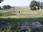 |
|
| Sutrium | Sutri Sutri Sutri is a town and comune in the province of Viterbo, about 50 km from Rome, and about 30 km south of Viterbo. It is picturesquely situated on a narrow tuff hill, surrounded by ravines, a narrow neck on the west alone connecting it with the surrounding country.thumb|220px|Entrance to the... |
Italy Italy Italy , officially the Italian Republic languages]] under the European Charter for Regional or Minority Languages. In each of these, Italy's official name is as follows:;;;;;;;;), is a unitary parliamentary republic in South-Central Europe. To the north it borders France, Switzerland, Austria and... |
42.239028°N 12.228974°E | 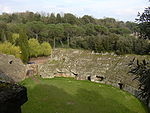 |
|
| Syracusae | Syracuse Syracuse, Italy Syracuse is a historic city in Sicily, the capital of the province of Syracuse. The city is notable for its rich Greek history, culture, amphitheatres, architecture, and as the birthplace of the preeminent mathematician and engineer Archimedes. This 2,700-year-old city played a key role in... |
Italy Italy Italy , officially the Italian Republic languages]] under the European Charter for Regional or Minority Languages. In each of these, Italy's official name is as follows:;;;;;;;;), is a unitary parliamentary republic in South-Central Europe. To the north it borders France, Switzerland, Austria and... |
37.074178°N 15.278904°E | 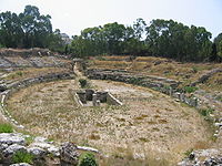 |
|
| Teate Marrucinorum | Chieti Chieti Chieti is a city and comune in Central Italy, 200 km northeast of Rome. It is the capital of the Province of Chieti in the Abruzzo region... |
Italy Italy Italy , officially the Italian Republic languages]] under the European Charter for Regional or Minority Languages. In each of these, Italy's official name is as follows:;;;;;;;;), is a unitary parliamentary republic in South-Central Europe. To the north it borders France, Switzerland, Austria and... |
42.345175°N 14.162512°E | ||
| Telesia | Telese Terme | Italy Italy Italy , officially the Italian Republic languages]] under the European Charter for Regional or Minority Languages. In each of these, Italy's official name is as follows:;;;;;;;;), is a unitary parliamentary republic in South-Central Europe. To the north it borders France, Switzerland, Austria and... |
41.223857°N 14.501014°E |  |
|
| Tibur | Tivoli Tivoli, Italy Tivoli , the classical Tibur, is an ancient Italian town in Lazio, about 30 km east-north-east of Rome, at the falls of the Aniene river where it issues from the Sabine hills... |
Italy Italy Italy , officially the Italian Republic languages]] under the European Charter for Regional or Minority Languages. In each of these, Italy's official name is as follows:;;;;;;;;), is a unitary parliamentary republic in South-Central Europe. To the north it borders France, Switzerland, Austria and... |
41.960705°N 12.798095°E | 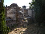 |
|
| Trebula Mutuesca | Monteleone Sabino Monteleone Sabino Monteleone Sabino is a comune in the Province of Rieti in the Italian region Latium, located about 45 km northeast of Rome and about 20 km south of Rieti.... |
Italy Italy Italy , officially the Italian Republic languages]] under the European Charter for Regional or Minority Languages. In each of these, Italy's official name is as follows:;;;;;;;;), is a unitary parliamentary republic in South-Central Europe. To the north it borders France, Switzerland, Austria and... |
42.228480°N 12.867593°E | Photograph | |
| Tusculum Tusculum Tusculum is a ruined Roman city in the Alban Hills, in the Latium region of Italy.-Location:Tusculum is one of the largest Roman cities in Alban Hills. The ruins of Tusculum are located on Tuscolo hill—more specifically on the northern edge of the outer crater ring of the Alban volcano... |
Italy Italy Italy , officially the Italian Republic languages]] under the European Charter for Regional or Minority Languages. In each of these, Italy's official name is as follows:;;;;;;;;), is a unitary parliamentary republic in South-Central Europe. To the north it borders France, Switzerland, Austria and... |
||||
| Tutere | Todi Todi Todi is a town and comune of the province of Perugia in central Italy. It is perched on a tall two-crested hill overlooking the east bank of the river Tiber, commanding distant views in every direction.In the 1990s, Richard S... |
Italy Italy Italy , officially the Italian Republic languages]] under the European Charter for Regional or Minority Languages. In each of these, Italy's official name is as follows:;;;;;;;;), is a unitary parliamentary republic in South-Central Europe. To the north it borders France, Switzerland, Austria and... |
42.778637°N 12.413282°E | ||
| Urbs Salvia | Urbisaglia Urbisaglia Urbisaglia is a comune in the province of Macerata, Marche, Italy. Its name comes from the ancient Roman town Urbs Salvia.-History:Situated in the Regio V Picenum, along the via Salaria Gallica, the town was founded during the 2nd century BC as a colonia... |
Italy Italy Italy , officially the Italian Republic languages]] under the European Charter for Regional or Minority Languages. In each of these, Italy's official name is as follows:;;;;;;;;), is a unitary parliamentary republic in South-Central Europe. To the north it borders France, Switzerland, Austria and... |
43.2009°N 13.3872°E | Picture (?) | |
| Veleia Veleia (Italy) Veleia, an ancient town of Aemilia, Italy, situated about 20 miles south of Placentia. It is mentioned by Pliny among the towns of the eighth region, though the Veleiates were Ligurians by race. Its inhabitants were, in the census of Vespasian, found to be remarkable for their longevity... |
Italy Italy Italy , officially the Italian Republic languages]] under the European Charter for Regional or Minority Languages. In each of these, Italy's official name is as follows:;;;;;;;;), is a unitary parliamentary republic in South-Central Europe. To the north it borders France, Switzerland, Austria and... |
44.785057°N 9.723301°E | |||
| Venafrum Venafrum Venafrum was an ancient town of Campania, Italy, close to the boundaries of both Latium adiectum and Samnium. Its site is occupied by the modern Venafro, a village on the railway from Isernia to Vairano, 25 km southwest of the former, 201 m above sea-level.Ancient authors tell us but little... |
Venafro Venafro Venafro is a comune in the province of Isernia, region of Molise, Italy. It has a population of around 12,000, having expanded quickly in the post-war period.-Geography:... |
Italy Italy Italy , officially the Italian Republic languages]] under the European Charter for Regional or Minority Languages. In each of these, Italy's official name is as follows:;;;;;;;;), is a unitary parliamentary republic in South-Central Europe. To the north it borders France, Switzerland, Austria and... |
41.482710°N 14.046255°E | ||
| Venusia | Venosa Venosa Venosa is a town and comune in the province of Potenza, in the Southern Italian region of Basilicata, in the Vulture area. It is bounded by the comuni of Barile, Ginestra, Lavello, Maschito, Montemilone, Palazzo San Gervasio, Rapolla and Spinazzola.... |
Italy Italy Italy , officially the Italian Republic languages]] under the European Charter for Regional or Minority Languages. In each of these, Italy's official name is as follows:;;;;;;;;), is a unitary parliamentary republic in South-Central Europe. To the north it borders France, Switzerland, Austria and... |
40.969681°N 15.826380°E | ||
| Verona | Italy Italy Italy , officially the Italian Republic languages]] under the European Charter for Regional or Minority Languages. In each of these, Italy's official name is as follows:;;;;;;;;), is a unitary parliamentary republic in South-Central Europe. To the north it borders France, Switzerland, Austria and... |
45.439006°N 10.994400°E | Verona Arena Verona Arena The Verona Arena is a Roman amphitheatre in Piazza Bra in Verona, Italy, which is internationally famous for the large-scale opera performances given there. It is one of the best preserved ancient structures of its kind.... |
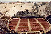 |
|
| Volsinii Volsinii Volsinii or Vulsinii , is the name of two ancient cities of Etruria, one situated on the shore of Lacus Volsiniensis , and the other on the Via Clodia, between Clusium and Forum Cassii... |
Bolsena Bolsena Bolsena is a town and comune of Italy, in the province of Viterbo in northern Lazio on the eastern shore of Lake Bolsena. It is 10 km north-north west of Montefiascone and 36 km north-west of Viterbo... |
Italy Italy Italy , officially the Italian Republic languages]] under the European Charter for Regional or Minority Languages. In each of these, Italy's official name is as follows:;;;;;;;;), is a unitary parliamentary republic in South-Central Europe. To the north it borders France, Switzerland, Austria and... |
42.650256°N 11.990112°E | ||
| Zagarolo Zagarolo Zagarolo is a town and comune in the province of Rome, in the region of Lazio of central Italy. It has 14,620 inhabitants, a total area of 28 km2.... |
Italy Italy Italy , officially the Italian Republic languages]] under the European Charter for Regional or Minority Languages. In each of these, Italy's official name is as follows:;;;;;;;;), is a unitary parliamentary republic in South-Central Europe. To the north it borders France, Switzerland, Austria and... |
41.858487°N 12.819272°E | |||
| Botrus | Batroun Batroun The coastal city of Batroun located in northern Lebanon is one of the oldest cities of the world. Batroun is home to a Lebanese Red Cross First Aid Center.- Etymology :... |
Lebanon Lebanon Lebanon , officially the Republic of LebanonRepublic of Lebanon is the most common term used by Lebanese government agencies. The term Lebanese Republic, a literal translation of the official Arabic and French names that is not used in today's world. Arabic is the most common language spoken among... |
|||
| Cyrene Cyrene, Libya Cyrene was an ancient Greek colony and then a Roman city in present-day Shahhat, Libya, the oldest and most important of the five Greek cities in the region. It gave eastern Libya the classical name Cyrenaica that it has retained to modern times.Cyrene lies in a lush valley in the Jebel Akhdar... |
Libya Libya Libya is an African country in the Maghreb region of North Africa bordered by the Mediterranean Sea to the north, Egypt to the east, Sudan to the southeast, Chad and Niger to the south, and Algeria and Tunisia to the west.... |
32.824585°N 21.850739°E |  |
||
| Leptis Magna Leptis Magna Leptis Magna also known as Lectis Magna , also called Lpqy, Neapolis, Lebida or Lebda to modern-day residents of Libya, was a prominent city of the Roman Empire. Its ruins are located in Khoms, Libya, east of Tripoli, on the coast where the Wadi Lebda meets the sea... |
Libya Libya Libya is an African country in the Maghreb region of North Africa bordered by the Mediterranean Sea to the north, Egypt to the east, Sudan to the southeast, Chad and Niger to the south, and Algeria and Tunisia to the west.... |
32.632251°N 14.309281°E | 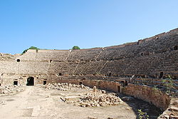 |
||
| Ptolemais Ptolemais (Cyrenaica) Ptolemais or Ptolemaida was one of the ancient capitals of Cyrenaica. It was probably named after Ptolemy III Euergetes. Its Latin name in Roman times was Tolmeta, from which the modern Libyan town of Tolmeitha derives its name.The town was most probably founded in 7th or 6th century BC by... |
Libya Libya Libya is an African country in the Maghreb region of North Africa bordered by the Mediterranean Sea to the north, Egypt to the east, Sudan to the southeast, Chad and Niger to the south, and Algeria and Tunisia to the west.... |
32.707946°N 20.945587°E | http://www.archeo.uw.edu.pl/survey/plan/sektor4.html | ||
| Sabratha Sabratha Sabratha, Sabratah or Siburata , in the Zawiya District in the northwestern corner of modern Libya, was the westernmost of the "three cities" of Tripolis. From 2001 to 2007 it was the capital of the former Sabratha wa Sorman District. It lies on the Mediterranean coast about west of Tripoli... |
Libya Libya Libya is an African country in the Maghreb region of North Africa bordered by the Mediterranean Sea to the north, Egypt to the east, Sudan to the southeast, Chad and Niger to the south, and Algeria and Tunisia to the west.... |
32.803934°N 12.494008°E | |||
| Lixus Lixus (ancient city) Lixus is the site of an ancient city located in Morocco just north of the modern seaport of Larache on the bank of the Loukkos River. The location was one of the main cities of the Roman province Mauretania Tingitana.-Geography:... |
Morocco Morocco Morocco , officially the Kingdom of Morocco , is a country located in North Africa. It has a population of more than 32 million and an area of 710,850 km², and also primarily administers the disputed region of the Western Sahara... |
35.199735°N 6.108586°W | http://filoumektoub.free.fr/maghreb/maroc/lixus1.htm | ||
| Ulpia Noviomagus Batavorum | Nijmegen | The Netherlands Netherlands The Netherlands is a constituent country of the Kingdom of the Netherlands, located mainly in North-West Europe and with several islands in the Caribbean. Mainland Netherlands borders the North Sea to the north and west, Belgium to the south, and Germany to the east, and shares maritime borders... |
51.861286°N 6.045742°E | No longer extant, but traced out in the street paving of the present-day Rembrandstraat with a few bits of its foundations still visible | |
| Bobadela Bobadela Bobadela is a civil parish in the northern municipality of Botica, with a population of less than 487 inhabitants, occupying an area of 14.7 km² in the northeast that extends into the Serra do Leiranco.-History:... |
Portugal Portugal Portugal , officially the Portuguese Republic is a country situated in southwestern Europe on the Iberian Peninsula. Portugal is the westernmost country of Europe, and is bordered by the Atlantic Ocean to the West and South and by Spain to the North and East. The Atlantic archipelagos of the... |
40.361098°N 7.893427°W | |||
| Conímbriga Conímbriga Conímbriga is one of the largest Roman settlements in Portugal, and is classified as a National Monument. Conímbriga lies 16 km from Coimbra and less than 2 km from Condeixa-a-Nova. The site also has a museum that displays objects found by archaeologists during their excavations,... |
Portugal Portugal Portugal , officially the Portuguese Republic is a country situated in southwestern Europe on the Iberian Peninsula. Portugal is the westernmost country of Europe, and is bordered by the Atlantic Ocean to the West and South and by Spain to the North and East. The Atlantic archipelagos of the... |
40.100360°N 8.495403°W | Conímbriga's amphitheatre | ||
| Tavira Tavira Tavira is a Portuguese city, situated at 37°07' north, 7°39' west in the east of the Algarve on the south coast of Portugal. It is 30 km east of Faro and 160 km west of Seville in Spain. The Gilão River meets the Atlantic Ocean in Tavira.... |
Portugal Portugal Portugal , officially the Portuguese Republic is a country situated in southwestern Europe on the Iberian Peninsula. Portugal is the westernmost country of Europe, and is bordered by the Atlantic Ocean to the West and South and by Spain to the North and East. The Atlantic archipelagos of the... |
||||
| Micia | Veţel Vetel Veţel is a commune in Hunedoara County, Romania. It is composed of ten villages: Boia Bârzii , Bretelin , Căoi , Herepeia , Leşnic , Mintia , Muncelu Mare , Muncelu Mic , Runcu Mic and Veţel.At the 2002 census, 91.6% of the population were... |
Romania Romania Romania is a country located at the crossroads of Central and Southeastern Europe, on the Lower Danube, within and outside the Carpathian arch, bordering on the Black Sea... |
45.914951°N 22.817234°E | ||
| Porolissum Porolissum Porolissum was an ancient Roman city in Dacia. Established as a military camp in 106 during Trajan's Dacian Wars, the city quickly grew through trade with the native Dacians and became the capital of the province Dacia Porolissensis in 124. The site is one of the largest and best-preserved... |
Moigrad-Porolissum | Romania Romania Romania is a country located at the crossroads of Central and Southeastern Europe, on the Lower Danube, within and outside the Carpathian arch, bordering on the Black Sea... |
47.177632°N 23.154054°E | ||
| Ulpia Traiana Sarmizegetusa Ulpia Traiana Sarmizegetusa Colonia Ulpia Traiana Augusta Dacica Sarmizegetusa was the capital and the largest city of Roman Dacia, later named Ulpia Traiana Sarmizegetusa after the former Dacian capital, located some 40 km away. Built on the ground of a camp of the Fifth Macedonian Legion, the city was populated with... |
Sarmizegetusa Sarmizegetusa (commune) Sarmizegetusa is a commune in Ţara Haţegului depression, Hunedoara County, Romania. It is composed of five villages: Breazova, Hobiţa-Grădişte, Păucineşti, Sarmizegetusa and Zeicani.... |
Romania Romania Romania is a country located at the crossroads of Central and Southeastern Europe, on the Lower Danube, within and outside the Carpathian arch, bordering on the Black Sea... |
45.516751°N 22.785838°E | 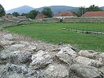 |
|
| Inveresk Inveresk Inveresk is a civil parish and was formerly a village that now forms the southern part of Musselburgh. It is situated on slightly elevated ground at the south of Musselburgh in East Lothian, Scotland... |
Scotland Scotland Scotland is a country that is part of the United Kingdom. Occupying the northern third of the island of Great Britain, it shares a border with England to the south and is bounded by the North Sea to the east, the Atlantic Ocean to the north and west, and the North Channel and Irish Sea to the... |
http://www.britarch.ac.uk/BA/ba25/ba25news.html | |||
| Trimontium | Newstead Newstead, Scottish Borders Newstead is a village in the Scottish Borders, just east of Melrose, coordinates 55.599704, -2.691987. It has a population of approximately 260, according to the 2001 census.It is reputedly the oldest continually inhabited settlement in Scotland... |
Scotland Scotland Scotland is a country that is part of the United Kingdom. Occupying the northern third of the island of Great Britain, it shares a border with England to the south and is bounded by the North Sea to the east, the Atlantic Ocean to the north and west, and the North Channel and Irish Sea to the... |
55.6026°N 2.6775°W | http://www.scran.ac.uk/packs/exhibitions/learning_materials/webs/56/Newstead.htm | |
| Viminacium Viminacium Viminacium was a major city and military camp of the Roman province of Moesia , and the capital of Moesia Superior. The archeological site occupies a total of 450 hectares. Viminacium is located 12 km from Kostolac, was devastated by Huns in the 5th century, but rebuilt by Justinian... |
Stari Kostolac | Serbia Serbia Serbia , officially the Republic of Serbia , is a landlocked country located at the crossroads of Central and Southeast Europe, covering the southern part of the Carpathian basin and the central part of the Balkans... |
44°43′N 21°10′E | Is this a theatre or amphitheatre? |  |
| Carmona Carmona, Spain Carmona is a town of south-western Spain, in the province of Seville; 33 km north-east of Seville.Carmona is built on a ridge overlooking the central plain of Andalusia, to the north is the Sierra Morena, to the south is the of peak of San Cristobal. The city is known for its thriving trade... |
Spain Spain Spain , officially the Kingdom of Spain languages]] under the European Charter for Regional or Minority Languages. In each of these, Spain's official name is as follows:;;;;;;), is a country and member state of the European Union located in southwestern Europe on the Iberian Peninsula... |
37.469600°N 5.650728°W | |||
| Carthago Nova | Cartagena Cartagena, Spain Cartagena is a Spanish city and a major naval station located in the Region of Murcia, by the Mediterranean coast, south-eastern Spain. As of January 2011, it has a population of 218,210 inhabitants being the Region’s second largest municipality and the country’s 6th non-Province capital... |
Spain Spain Spain , officially the Kingdom of Spain languages]] under the European Charter for Regional or Minority Languages. In each of these, Spain's official name is as follows:;;;;;;), is a country and member state of the European Union located in southwestern Europe on the Iberian Peninsula... |
37.600771°N 0.980048°W |  |
|
| Corduba | Córdoba Córdoba, Spain -History:The first trace of human presence in the area are remains of a Neanderthal Man, dating to c. 32,000 BC. In the 8th century BC, during the ancient Tartessos period, a pre-urban settlement existed. The population gradually learned copper and silver metallurgy... |
Spain Spain Spain , officially the Kingdom of Spain languages]] under the European Charter for Regional or Minority Languages. In each of these, Spain's official name is as follows:;;;;;;), is a country and member state of the European Union located in southwestern Europe on the Iberian Peninsula... |
37.884140°N 4.788804°W | http://doc.union.edu/Spain/Project/maps2004/roman/anfiteatro.htm | |
| Emerita Augusta Emerita Augusta The Archaeological Ensemble of Mérida is one of the largest and most extensive archaeological sites in Spain. Mainly of Emerita Augusta, ancient capital of Lusitania . It was declared a World Heritage Site by UNESCO in 1993.... |
Mérida Mérida, Spain Mérida is the capital of the autonomous community of Extremadura, western central Spain. It has a population of 57,127 . The Archaeological Ensemble of Mérida is a UNESCO World Heritage site since 1993.- Climate :... |
Spain Spain Spain , officially the Kingdom of Spain languages]] under the European Charter for Regional or Minority Languages. In each of these, Spain's official name is as follows:;;;;;;), is a country and member state of the European Union located in southwestern Europe on the Iberian Peninsula... |
38.915956°N 6.337893°W | Mérida amphitheatre Mérida amphitheatre The Amphitheatre of Merida, was built in the roman colony of Emerita Augusta, which was founded in 25 B.C. by Octavius Augustus, emeritus soldiers discharged from the Roman army, two veteran legions of the Cantabrian Wars: Legio V Alaudae and Legio X Gemina. The city was the capital of the Roman... |
 |
| Emporion | Ampurias Empúries Empúries , formerly known by its Spanish name Ampurias , was a town on the Mediterranean coast of the Catalan comarca of Alt Empordà in Catalonia, Spain. It was founded in 575 BC by Greek colonists from Phocaea with the name of Ἐμπόριον... |
Spain Spain Spain , officially the Kingdom of Spain languages]] under the European Charter for Regional or Minority Languages. In each of these, Spain's official name is as follows:;;;;;;), is a country and member state of the European Union located in southwestern Europe on the Iberian Peninsula... |
42.1301°N 3.11741°E? | ||
| Forum Municipii Flavii Caparensis | Caparra | Spain Spain Spain , officially the Kingdom of Spain languages]] under the European Charter for Regional or Minority Languages. In each of these, Spain's official name is as follows:;;;;;;), is a country and member state of the European Union located in southwestern Europe on the Iberian Peninsula... |
40.1643°N 6.09997°W | ||
| Italica Italica The city of Italica was founded in 206 BC by the Roman general Publius Cornelius Scipio Africanus in order to settle Roman soldiers wounded in the Battle of Ilipa, where the Carthaginian army was defeated during the Second Punic War... |
Spain Spain Spain , officially the Kingdom of Spain languages]] under the European Charter for Regional or Minority Languages. In each of these, Spain's official name is as follows:;;;;;;), is a country and member state of the European Union located in southwestern Europe on the Iberian Peninsula... |
37.443816°N 6.046670°W |  |
||
| Segobriga | Saelices Saelices Saelices is a municipality located in the province of Cuenca, Castile-La Mancha, Spain. According to the 2004 census , the municipality has a population of 649 inhabitants.... |
Spain Spain Spain , officially the Kingdom of Spain languages]] under the European Charter for Regional or Minority Languages. In each of these, Spain's official name is as follows:;;;;;;), is a country and member state of the European Union located in southwestern Europe on the Iberian Peninsula... |
39.8860°N 2.8140°W | http://www.nocturne.org/games/saga/mercury/segobriga.html |  |
| Sisapo | Almodovar del Campo Almodóvar del Campo Almodóvar del Campo is a town and municipality of Spain, in the province of Ciudad Real, some 14 km S.S.W. of Ciudad Real, on the northern side of the Sierra de Alcúdia. The etymological origin of Almodóvar is the Arabic المدوّر, al-mudawwar.Almodóvar was a Moorish fortress in the Middle... |
Spain Spain Spain , officially the Kingdom of Spain languages]] under the European Charter for Regional or Minority Languages. In each of these, Spain's official name is as follows:;;;;;;), is a country and member state of the European Union located in southwestern Europe on the Iberian Peninsula... |
38.6463°N 4.51827°W | Excavation began in 2009 |  |
| Tarraco Tarraco Tarraco is the ancient name of the current city of Tarragona . During the Roman Empire was one of the major cities of the Iberian Peninsula and capital of the Roman province called Hispania Citerior or Hispania Tarraconensis. The full name of the city at the time of the Roman Republic was Colonia... |
Tarragona Tarragona Tarragona is a city located in the south of Catalonia on the north-east of Spain, by the Mediterranean. It is the capital of the Spanish province of the same name and the capital of the Catalan comarca Tarragonès. In the medieval and modern times it was the capital of the Vegueria of Tarragona... |
Spain Spain Spain , officially the Kingdom of Spain languages]] under the European Charter for Regional or Minority Languages. In each of these, Spain's official name is as follows:;;;;;;), is a country and member state of the European Union located in southwestern Europe on the Iberian Peninsula... |
41.114547°N 1.258817°E | Tarragona Amphitheatre Tarragona Amphitheatre Tarragona Amphitheatre is a Roman amphitheatre in the city of Tarragona, in the Catalonia region of north-east Spain. It was built in the 2nd century AD, sited close to the forum of this provincial capital.... |
|
| Augusta Raurica Augusta Raurica Augusta Raurica is a Roman archaeological site and an open-air museum in Switzerland. Located on the south bank of the Rhine river about 20 km east of Basel near the villages of Augst and Kaiseraugst, it is the oldest known Roman colony on the Rhine.... |
Augst Augst Augst is a municipality in the district of Liestal in the canton of Basel-Country in Switzerland.It was known as Augusta Raurica in roman times-History:... |
Switzerland Switzerland Switzerland name of one of the Swiss cantons. ; ; ; or ), in its full name the Swiss Confederation , is a federal republic consisting of 26 cantons, with Bern as the seat of the federal authorities. The country is situated in Western Europe,Or Central Europe depending on the definition.... |
47.529313°N 7.720602°E | ||
| Aventicum Aventicum Aventicum was the largest town and capital of Roman Switzerland . Its remains are beside the modern town of Avenches.... |
Avenches Avenches Avenches is a Swiss municipality in the canton of Vaud, located in the district of Broye-Vully.-History:The roots of Avenches go back to the Celts... |
Switzerland Switzerland Switzerland name of one of the Swiss cantons. ; ; ; or ), in its full name the Swiss Confederation , is a federal republic consisting of 26 cantons, with Bern as the seat of the federal authorities. The country is situated in Western Europe,Or Central Europe depending on the definition.... |
46.881003°N 7.042657°E |  |
|
| Brenodurum (?) | Berne Berne The city of Bern or Berne is the Bundesstadt of Switzerland, and, with a population of , the fourth most populous city in Switzerland. The Bern agglomeration, which includes 43 municipalities, has a population of 349,000. The metropolitan area had a population of 660,000 in 2000... |
Switzerland Switzerland Switzerland name of one of the Swiss cantons. ; ; ; or ), in its full name the Swiss Confederation , is a federal republic consisting of 26 cantons, with Bern as the seat of the federal authorities. The country is situated in Western Europe,Or Central Europe depending on the definition.... |
46.975758°N 7.451130°E | Engehalbinsel | |
| Julia Equestris | Nyon Nyon Nyon is a municipality in the district of Nyon in the canton of Vaud in Switzerland. It is located some 25 kilometers north east of Geneva's city centre, and since the 1970s it has become part of the Geneva metropolitan area. It lies on the shores of Lake Geneva, and is the seat of the district of... |
Switzerland Switzerland Switzerland name of one of the Swiss cantons. ; ; ; or ), in its full name the Swiss Confederation , is a federal republic consisting of 26 cantons, with Bern as the seat of the federal authorities. The country is situated in Western Europe,Or Central Europe depending on the definition.... |
46.383451°N 6.241263°E | http://www.mrn.ch/English/Amphi.htm | |
| Octodurum | Martigny | Switzerland Switzerland Switzerland name of one of the Swiss cantons. ; ; ; or ), in its full name the Swiss Confederation , is a federal republic consisting of 26 cantons, with Bern as the seat of the federal authorities. The country is situated in Western Europe,Or Central Europe depending on the definition.... |
46.094365°N 7.073460°E |  |
|
| Vindonissa Vindonissa Vindonissa was a Roman legion camp at modern Windisch, Switzerland. It was probably established in 15 AD. In an expansion around 30, thermal baths were added.... |
Windisch Windisch Windisch is a municipality in the district of Brugg in the canton of Aargau in Switzerland.-History:Windisch is situated at the site of the Roman legion camp Vindonissa. In 1064 the current municipality was mentioned as Vinse, and in 1175 as Vindisse. Until the 19th Century the official name was... |
Switzerland Switzerland Switzerland name of one of the Swiss cantons. ; ; ; or ), in its full name the Swiss Confederation , is a federal republic consisting of 26 cantons, with Bern as the seat of the federal authorities. The country is situated in Western Europe,Or Central Europe depending on the definition.... |
47.476249°N 8.213603°E |  |
|
| Dura Europos | Syria Syria Syria , officially the Syrian Arab Republic , is a country in Western Asia, bordering Lebanon and the Mediterranean Sea to the West, Turkey to the north, Iraq to the east, Jordan to the south, and Israel to the southwest.... |
34.749855°N 40.728926°E | |||
| Nova Trajana Bostra | Bosra Bosra Bosra , also known as Bostra, Busrana, Bozrah, Bozra, Busra Eski Şam, Busra ash-Sham, and Nova Trajana Bostra, is an ancient city administratively belonging to the Daraa Governorate in southern Syria... |
Syria Syria Syria , officially the Syrian Arab Republic , is a country in Western Asia, bordering Lebanon and the Mediterranean Sea to the West, Turkey to the north, Iraq to the east, Jordan to the south, and Israel to the southwest.... |
32.517723°N 36.479888°E | :Image:Bostra map of Roman city.jpg | |
| Agbia | Tunisia Tunisia Tunisia , officially the Tunisian RepublicThe long name of Tunisia in other languages used in the country is: , is the northernmost country in Africa. It is a Maghreb country and is bordered by Algeria to the west, Libya to the southeast, and the Mediterranean Sea to the north and east. Its area... |
||||
| Acholla | Tunisia Tunisia Tunisia , officially the Tunisian RepublicThe long name of Tunisia in other languages used in the country is: , is the northernmost country in Africa. It is a Maghreb country and is bordered by Algeria to the west, Libya to the southeast, and the Mediterranean Sea to the north and east. Its area... |
35.0762°N 11.0188°E | |||
| Bararus | Tunisia Tunisia Tunisia , officially the Tunisian RepublicThe long name of Tunisia in other languages used in the country is: , is the northernmost country in Africa. It is a Maghreb country and is bordered by Algeria to the west, Libya to the southeast, and the Mediterranean Sea to the north and east. Its area... |
35.211842°N 10.791201°E | |||
| Belalis Maior | Hr. el Faouar | Tunisia Tunisia Tunisia , officially the Tunisian RepublicThe long name of Tunisia in other languages used in the country is: , is the northernmost country in Africa. It is a Maghreb country and is bordered by Algeria to the west, Libya to the southeast, and the Mediterranean Sea to the north and east. Its area... |
|||
| Bulla Regia Bulla Regia Bulla Regia is an archaeological site in northwestern Tunisia, a former Roman city near modern Jendouba. It is noted for its Hadrianic-era semi-subterranean housing, a protection from the fierce heat and effects of the sun. Many of the mosaic floors have been left in situ; others may be seen at the... |
Tunisia Tunisia Tunisia , officially the Tunisian RepublicThe long name of Tunisia in other languages used in the country is: , is the northernmost country in Africa. It is a Maghreb country and is bordered by Algeria to the west, Libya to the southeast, and the Mediterranean Sea to the north and east. Its area... |
36.560414°N 8.757769°E | |||
| Carpis | Tunisia Tunisia Tunisia , officially the Tunisian RepublicThe long name of Tunisia in other languages used in the country is: , is the northernmost country in Africa. It is a Maghreb country and is bordered by Algeria to the west, Libya to the southeast, and the Mediterranean Sea to the north and east. Its area... |
||||
| Carthago | Carthage Carthage Carthage , implying it was a 'new Tyre') is a major urban centre that has existed for nearly 3,000 years on the Gulf of Tunis, developing from a Phoenician colony of the 1st millennium BC... |
Tunisia Tunisia Tunisia , officially the Tunisian RepublicThe long name of Tunisia in other languages used in the country is: , is the northernmost country in Africa. It is a Maghreb country and is bordered by Algeria to the west, Libya to the southeast, and the Mediterranean Sea to the north and east. Its area... |
36.856336°N 10.314921°E |  |
|
| Colonia Julia Aurelia Commoda | Thuburbo Majus Thuburbo Majus Thuburbo Majus is a large Roman site in northern Tunisia. It is located roughly 60 km southwest of Carthage on a major African thoroughfare. This thoroughfare connects Carthage to the Sahara. Other towns along the way included Sbiba, Sufes, Sbeitla, and Sufetula. Parts of the old Roman road are... |
Tunisia Tunisia Tunisia , officially the Tunisian RepublicThe long name of Tunisia in other languages used in the country is: , is the northernmost country in Africa. It is a Maghreb country and is bordered by Algeria to the west, Libya to the southeast, and the Mediterranean Sea to the north and east. Its area... |
36.398212°N 9.905750°E | ||
| Hadrumentum | Sousse Sousse Sousse is a city in Tunisia. Located 140 km south of the capital Tunis, the city has 173,047 inhabitants . Sousse is in the central-east of the country, on the Gulf of Hammamet, which is a part of the Mediterranean Sea. The name may be of Berber origin: similar names are found in Libya and in... |
Tunisia Tunisia Tunisia , officially the Tunisian RepublicThe long name of Tunisia in other languages used in the country is: , is the northernmost country in Africa. It is a Maghreb country and is bordered by Algeria to the west, Libya to the southeast, and the Mediterranean Sea to the north and east. Its area... |
|||
| Jebel Moraba | Tunisia Tunisia Tunisia , officially the Tunisian RepublicThe long name of Tunisia in other languages used in the country is: , is the northernmost country in Africa. It is a Maghreb country and is bordered by Algeria to the west, Libya to the southeast, and the Mediterranean Sea to the north and east. Its area... |
36.597628°N 9.860814°E | |||
| Ksar Hellal Ksar Hellal -References:... |
Tunisia Tunisia Tunisia , officially the Tunisian RepublicThe long name of Tunisia in other languages used in the country is: , is the northernmost country in Africa. It is a Maghreb country and is bordered by Algeria to the west, Libya to the southeast, and the Mediterranean Sea to the north and east. Its area... |
||||
| Ksar Lemsa | Tunisia Tunisia Tunisia , officially the Tunisian RepublicThe long name of Tunisia in other languages used in the country is: , is the northernmost country in Africa. It is a Maghreb country and is bordered by Algeria to the west, Libya to the southeast, and the Mediterranean Sea to the north and east. Its area... |
36.034857°N 9.693440°E | http://looklex.com/tunisia/ksar_lemsa.htm | ||
| Leptis Minor | Tunisia Tunisia Tunisia , officially the Tunisian RepublicThe long name of Tunisia in other languages used in the country is: , is the northernmost country in Africa. It is a Maghreb country and is bordered by Algeria to the west, Libya to the southeast, and the Mediterranean Sea to the north and east. Its area... |
35.678313°N 10.866518°E | |||
| Mactaris | Tunisia Tunisia Tunisia , officially the Tunisian RepublicThe long name of Tunisia in other languages used in the country is: , is the northernmost country in Africa. It is a Maghreb country and is bordered by Algeria to the west, Libya to the southeast, and the Mediterranean Sea to the north and east. Its area... |
35.855562°N 9.206366°E | |||
| Municipium Aurelium Commodum | Henchir Bou Cha | Tunisia Tunisia Tunisia , officially the Tunisian RepublicThe long name of Tunisia in other languages used in the country is: , is the northernmost country in Africa. It is a Maghreb country and is bordered by Algeria to the west, Libya to the southeast, and the Mediterranean Sea to the north and east. Its area... |
36.5277°N 9.88918°E | http://www.inp.rnrt.tn/Carte_archeo/pdf/Fr/028BirMcherguaFr.pdf | |
| Pheradi Maius | Sidi Khalifa Sidi Khalifa Sidi Khalifa is a Basic People's Congress administrative division of Benghazi, Libya.... |
Tunisia Tunisia Tunisia , officially the Tunisian RepublicThe long name of Tunisia in other languages used in the country is: , is the northernmost country in Africa. It is a Maghreb country and is bordered by Algeria to the west, Libya to the southeast, and the Mediterranean Sea to the north and east. Its area... |
36.250003°N 10.397047°E | ||
| Pupput Pupput Pupput is an archaeological site near Hammamet, in northern Tunisia.A settlement existed here since as early as the 1st century BC , and was a simple village at the time of the rule of Roman emperor Antoninus Pius , it became a colony under Commodus... |
Hammamet, Tunisia | Tunisia Tunisia Tunisia , officially the Tunisian RepublicThe long name of Tunisia in other languages used in the country is: , is the northernmost country in Africa. It is a Maghreb country and is bordered by Algeria to the west, Libya to the southeast, and the Mediterranean Sea to the north and east. Its area... |
|||
| Seressi | Oum El Abouab | Tunisia Tunisia Tunisia , officially the Tunisian RepublicThe long name of Tunisia in other languages used in the country is: , is the northernmost country in Africa. It is a Maghreb country and is bordered by Algeria to the west, Libya to the southeast, and the Mediterranean Sea to the north and east. Its area... |
36.163516°N 9.775575°E | ||
| Sicca Veneria El Kef El Kef , also known as Le Kef, is a city in north western Tunisia and the capital of the Kef Governorate.Situated in the northwest of the country, to the west of Tunis and some east of the border between Algeria and Tunisia, El Kef has a population of . The old town is built on the cliff face... |
El Kef El Kef El Kef , also known as Le Kef, is a city in north western Tunisia and the capital of the Kef Governorate.Situated in the northwest of the country, to the west of Tunis and some east of the border between Algeria and Tunisia, El Kef has a population of . The old town is built on the cliff face... |
Tunisia Tunisia Tunisia , officially the Tunisian RepublicThe long name of Tunisia in other languages used in the country is: , is the northernmost country in Africa. It is a Maghreb country and is bordered by Algeria to the west, Libya to the southeast, and the Mediterranean Sea to the north and east. Its area... |
|||
| Simitthus | Chemtou Chemtou Chemtou or Chimtou is an ancient site in northwestern Tunisia, located 20 km from the city of Jendouba, near the Algerian border.Ancient Simitthu is known for its important marble quarries which were exploited from the 2nd century BC.The Chemtou Museum displays artifacts discovered in the... |
Tunisia Tunisia Tunisia , officially the Tunisian RepublicThe long name of Tunisia in other languages used in the country is: , is the northernmost country in Africa. It is a Maghreb country and is bordered by Algeria to the west, Libya to the southeast, and the Mediterranean Sea to the north and east. Its area... |
36.490397°N 8.580217°E | Map of Simitthus Photograph | |
| Sufetula | Sbeitla Sbeitla Sbeitla is a small town in north-central Tunisia. Nearby are the Roman ruins of Sufetula, containing the best preserved Forum temples in Tunisia... |
Tunisia Tunisia Tunisia , officially the Tunisian RepublicThe long name of Tunisia in other languages used in the country is: , is the northernmost country in Africa. It is a Maghreb country and is bordered by Algeria to the west, Libya to the southeast, and the Mediterranean Sea to the north and east. Its area... |
35.243627°N 9.114540°E | Map of Sufetula | |
| Thaenae | Tunisia Tunisia Tunisia , officially the Tunisian RepublicThe long name of Tunisia in other languages used in the country is: , is the northernmost country in Africa. It is a Maghreb country and is bordered by Algeria to the west, Libya to the southeast, and the Mediterranean Sea to the north and east. Its area... |
34.655531°N 10.673080°E | |||
| Thapsus Thapsus Thapsus was an ancient city in what is modern day Tunisia. Its ruins exist at Ras Dimas near Bekalta, approximately 200 km southeast of Carthage. Originally founded by Phoenicians, it served as a marketplace on the coast of the province Byzacena in Africa Propria... |
Tunisia Tunisia Tunisia , officially the Tunisian RepublicThe long name of Tunisia in other languages used in the country is: , is the northernmost country in Africa. It is a Maghreb country and is bordered by Algeria to the west, Libya to the southeast, and the Mediterranean Sea to the north and east. Its area... |
35.619145°N 11.042257°E | |||
| Thibaris | Tunisia Tunisia Tunisia , officially the Tunisian RepublicThe long name of Tunisia in other languages used in the country is: , is the northernmost country in Africa. It is a Maghreb country and is bordered by Algeria to the west, Libya to the southeast, and the Mediterranean Sea to the north and east. Its area... |
36.504680°N 9.081555°E | |||
| Thignica | Ain Tounga | Tunisia Tunisia Tunisia , officially the Tunisian RepublicThe long name of Tunisia in other languages used in the country is: , is the northernmost country in Africa. It is a Maghreb country and is bordered by Algeria to the west, Libya to the southeast, and the Mediterranean Sea to the north and east. Its area... |
36.527815°N 9.361791°E | ||
| Thimisua | Argoub | Tunisia Tunisia Tunisia , officially the Tunisian RepublicThe long name of Tunisia in other languages used in the country is: , is the northernmost country in Africa. It is a Maghreb country and is bordered by Algeria to the west, Libya to the southeast, and the Mediterranean Sea to the north and east. Its area... |
36.310720°N 9.319186°E | ||
| Thuburbo Minus | Tebourba Tebourba Tebourba is a town in Tunisia, located about 20 miles from the capital Tunis.-Thuburbo Minus:Historically Thuburbo Minus was a settlement in Africa Proconsularis, located at present-day Tebourba. Thuburbo Minus is mentioned in the Antonine Itinerary, 44, and the Tabula Peutinger... |
Tunisia Tunisia Tunisia , officially the Tunisian RepublicThe long name of Tunisia in other languages used in the country is: , is the northernmost country in Africa. It is a Maghreb country and is bordered by Algeria to the west, Libya to the southeast, and the Mediterranean Sea to the north and east. Its area... |
The amphitheatre here was destroyed at the end of the 17th century during the construction of a bridge. | ||
| Thugga | Tunisia Tunisia Tunisia , officially the Tunisian RepublicThe long name of Tunisia in other languages used in the country is: , is the northernmost country in Africa. It is a Maghreb country and is bordered by Algeria to the west, Libya to the southeast, and the Mediterranean Sea to the north and east. Its area... |
36.4242°N 9.21733°E | |||
| Thysdrus | El Djem El Djem Drifting sand is preserving the market city of Thysdrus and the refined suburban villas that once surrounded it. The amphiteatre occupies archaeologists' attention: no digging required... |
Tunisia Tunisia Tunisia , officially the Tunisian RepublicThe long name of Tunisia in other languages used in the country is: , is the northernmost country in Africa. It is a Maghreb country and is bordered by Algeria to the west, Libya to the southeast, and the Mediterranean Sea to the north and east. Its area... |
35.2964°N 10.7069°E 35.2901°N 10.7079°E |
2 amphitheatres |  |
| Uchi Maius | Tunisia Tunisia Tunisia , officially the Tunisian RepublicThe long name of Tunisia in other languages used in the country is: , is the northernmost country in Africa. It is a Maghreb country and is bordered by Algeria to the west, Libya to the southeast, and the Mediterranean Sea to the north and east. Its area... |
36.4123°N 9.08526°E | |||
| Ulissipira | Tunisia Tunisia Tunisia , officially the Tunisian RepublicThe long name of Tunisia in other languages used in the country is: , is the northernmost country in Africa. It is a Maghreb country and is bordered by Algeria to the west, Libya to the southeast, and the Mediterranean Sea to the north and east. Its area... |
35.958633°N 10.441163°E | |||
| Upenna | Enfida | Tunisia Tunisia Tunisia , officially the Tunisian RepublicThe long name of Tunisia in other languages used in the country is: , is the northernmost country in Africa. It is a Maghreb country and is bordered by Algeria to the west, Libya to the southeast, and the Mediterranean Sea to the north and east. Its area... |
Nothing now remains of Upenna amphitheatre. | ||
| Uthina Uthina Uthina was a Roman colony in Tunisia.It was the site of the Oudna airbase. It was also a titular see in the Roman Catholic Church.Uthina is mentioned by Ptolemy , Pliny , and the Peutinger Tables. Pliny and an inscription call it a colony... |
Oudna | Tunisia Tunisia Tunisia , officially the Tunisian RepublicThe long name of Tunisia in other languages used in the country is: , is the northernmost country in Africa. It is a Maghreb country and is bordered by Algeria to the west, Libya to the southeast, and the Mediterranean Sea to the north and east. Its area... |
36.608681°N 10.169365°E | http://lexicorient.com/tunisia/oudna.htm | |
| Utica Utica, Tunisia Utica is an ancient city northwest of Carthage near the outflow of the Medjerda River into the Mediterranean Sea, traditionally considered to be the first colony founded by the Phoenicians in North Africa... |
Tunisia Tunisia Tunisia , officially the Tunisian RepublicThe long name of Tunisia in other languages used in the country is: , is the northernmost country in Africa. It is a Maghreb country and is bordered by Algeria to the west, Libya to the southeast, and the Mediterranean Sea to the north and east. Its area... |
37.052482°N 10.057350°E 37.050833°N 10.061266°E |
2 amphitheatres | ||
| Anazarbus Anazarbus Anazarbus in Ancient Cilicia was an ancient Cilician city, situated in Anatolia in modern Turkey, in the present Çukurova about 15 km west of the main stream of the present Ceyhan River and near its tributary the Sempas Su.A lofty isolated ridge formed its acropolis... |
Turkey Turkey Turkey , known officially as the Republic of Turkey , is a Eurasian country located in Western Asia and in East Thrace in Southeastern Europe... |
37.244079°N 35.894983°E | http://www.britannica.com/EBchecked/topic/23173/Anazarbus | ||
| Pergamon Pergamon Pergamon , or Pergamum, was an ancient Greek city in modern-day Turkey, in Mysia, today located from the Aegean Sea on a promontory on the north side of the river Caicus , that became the capital of the Kingdom of Pergamon during the Hellenistic period, under the Attalid dynasty, 281–133 BC... |
Bergama Bergama Bergama is a populous district, as well as the center city of the same district, in İzmir Province in western Turkey. By excluding İzmir's metropolitan area, it is one of the prominent districts of the province in terms of population and is largely urbanized at the rate of 53,6 per cent... |
Turkey Turkey Turkey , known officially as the Republic of Turkey , is a Eurasian country located in Western Asia and in East Thrace in Southeastern Europe... |
39.125747°N 27.174432°E | Map | |
| Isca Augusta Isca Augusta Isca Augusta was a Roman legionary fortress and settlement, the remains of which lie beneath parts of the present-day village of Caerleon on the northern outskirts of the city of Newport in South Wales.-Name:... |
Caerleon Caerleon Caerleon is a suburban village and community, situated on the River Usk in the northern outskirts of the city of Newport, South Wales. Caerleon is a site of archaeological importance, being the site of a notable Roman legionary fortress, Isca Augusta, and an Iron Age hill fort... |
Wales Wales Wales is a country that is part of the United Kingdom and the island of Great Britain, bordered by England to its east and the Atlantic Ocean and Irish Sea to its west. It has a population of three million, and a total area of 20,779 km²... |
51.608056°N 2.956889°W | Caerleon amphitheatre |  |
| Moridunum Moridunum (Carmarthen) Moridunum was a Roman fort and town in the Roman province of Britannia. Today it is known as Carmarthen, located in the Welsh county of Carmarthenshire .-Fort:... |
Carmarthen Carmarthen Carmarthen is a community in, and the county town of, Carmarthenshire, Wales. It is sited on the River Towy north of its mouth at Carmarthen Bay. In 2001, the population was 14,648.... |
Wales Wales Wales is a country that is part of the United Kingdom and the island of Great Britain, bordered by England to its east and the Atlantic Ocean and Irish Sea to its west. It has a population of three million, and a total area of 20,779 km²... |
51.862004°N 4.296705°W |  |
|
| Tomen-y-Mur | Wales Wales Wales is a country that is part of the United Kingdom and the island of Great Britain, bordered by England to its east and the Atlantic Ocean and Irish Sea to its west. It has a population of three million, and a total area of 20,779 km²... |
52.931914°N 3.923463°W | near Llan Ffestiniog Llan Ffestiniog Llan Ffestiniog, also known as Ffestiniog or simply Llan is a village in Gwynedd , north Wales, lying south of Blaenau Ffestiniog.... http://www.castlewales.com/mur.html |
||
| Venta Silurum Venta Silurum Venta Silurum was a town in the Roman province of Britannia or Britain. Today it consists of remains in the village of Caerwent in Monmouthshire, south east Wales. Much of it has been archaeologically excavated and is on display to the public.... |
Caerwent Caerwent Caerwent is a village and community in Monmouthshire, Wales. It is located about five miles west of Chepstow and eleven miles east of Newport, and was founded by the Romans as the market town of Venta Silurum, an important settlement of the Brythonic Silures tribe. The modern village is built... |
Wales Wales Wales is a country that is part of the United Kingdom and the island of Great Britain, bordered by England to its east and the Atlantic Ocean and Irish Sea to its west. It has a population of three million, and a total area of 20,779 km²... |
51.612381°N 2.766406°W | ||
See also
- Roman architectureRoman architectureAncient Roman architecture adopted certain aspects of Ancient Greek architecture, creating a new architectural style. The Romans were indebted to their Etruscan neighbors and forefathers who supplied them with a wealth of knowledge essential for future architectural solutions, such as hydraulics...
- Roman theatre Roman theatre (structure)The characteristics of Roman to those of the earlier Greek theatres due in large part to its influence on the Roman triumvir Gnaeus Pompeius Magnus. Much of the architectural influence on the Romans came from the Greeks, and theatre structural design was no different from other buildings...
- Circus (building)Circus (building)The Roman circus was a large open-air venue used for public events in the ancient Roman Empire. The circuses were similar to the ancient Greek hippodromes, although serving varying purposes. Along with theatres and amphitheatres, Circuses were one of the main entertainment sites of the time...
- ArenaArenaAn arena is an enclosed area, often circular or oval-shaped, designed to showcase theater, musical performances, or sporting events. It is composed of a large open space surrounded on most or all sides by tiered seating for spectators. The key feature of an arena is that the event space is the...
- StadiumStadiumA modern stadium is a place or venue for outdoor sports, concerts, or other events and consists of a field or stage either partly or completely surrounded by a structure designed to allow spectators to stand or sit and view the event.)Pausanias noted that for about half a century the only event...
Related modern building structures
- List of contemporary amphitheatres
- List of association football stadiums by capacity
- List of indoor arenas
- List of stadiums
External links
- Aerial Photographs
- article "Amphitheatrum" (Smith's Dictionary of Greek and Roman Antiquities)
- Rome: Colosseum at LacusCurtius with Platner article
- Small list with details
- Several photographs
- Google Earth file containing several locations

