
List of places in the Western Isles
Encyclopedia
This List of places in the Western Isles is a list of links for any town
, village
, hamlet
, island
, port
, river
, harbour, historic house
, nature reserve
and other place of interest in the Western Isles of Scotland
, UK.





Town
A town is a human settlement larger than a village but smaller than a city. The size a settlement must be in order to be called a "town" varies considerably in different parts of the world, so that, for example, many American "small towns" seem to British people to be no more than villages, while...
, village
Village
A village is a clustered human settlement or community, larger than a hamlet with the population ranging from a few hundred to a few thousand , Though often located in rural areas, the term urban village is also applied to certain urban neighbourhoods, such as the West Village in Manhattan, New...
, hamlet
Hamlet
The Tragical History of Hamlet, Prince of Denmark, or more simply Hamlet, is a tragedy by William Shakespeare, believed to have been written between 1599 and 1601...
, island
Island
An island or isle is any piece of sub-continental land that is surrounded by water. Very small islands such as emergent land features on atolls can be called islets, cays or keys. An island in a river or lake may be called an eyot , or holm...
, port
Port
A port is a location on a coast or shore containing one or more harbors where ships can dock and transfer people or cargo to or from land....
, river
River
A river is a natural watercourse, usually freshwater, flowing towards an ocean, a lake, a sea, or another river. In a few cases, a river simply flows into the ground or dries up completely before reaching another body of water. Small rivers may also be called by several other names, including...
, harbour, historic house
Historic house
A historic house can be a stately home, the birthplace of a famous person, or a house with an interesting history or architecture.- Background :...
, nature reserve
Nature reserve
A nature reserve is a protected area of importance for wildlife, flora, fauna or features of geological or other special interest, which is reserved and managed for conservation and to provide special opportunities for study or research...
and other place of interest in the Western Isles of Scotland
Scotland
Scotland is a country that is part of the United Kingdom. Occupying the northern third of the island of Great Britain, it shares a border with England to the south and is bounded by the North Sea to the east, the Atlantic Ocean to the north and west, and the North Channel and Irish Sea to the...
, UK.


A
- AdabrocAdabrocAdabrock is a village in the area of Ness, Lewis, in Scotland's Western Isles. It is at the northern tip of the island, south-west of Port of Ness....
(Adabrog) - AignishAignishAignish is located northwest of Knock and east of Stornoway on the east coast of the Isle of Lewis. The township is at the island side of the isthmus connecting to the Eye peninsula....
(Aiginis) - AirdAird, Western IslesAird is a village in the Scottish council area of Eileanan Siar . It is located on the Eye Peninsula in the east coast of the Isle of Lewis...
(Àird an Rubha) - AllasdaleAllasdaleAllasdale is a village on Barra in the Western Isles, Scotland.In May 2007 Channel 4's Time Team came to investigate some prehistoric remains that had first been partly exposed when storms in October 2005 had blown away some sand dunes...
(Allathasdal) - Ardvay, South Harris
B
- BalallanBalallanBalallan has the distinction of being the longest village in Lewis . Straggled along the head of a long sea loch between Arivruach and Laxay, it developed due to a mixture of crofting along the loch shore and fishing...
(Baile Ailein) - BaleshareBaleshareBaleshare is a flat tidal island in the Outer Hebrides of Scotland.Baleshare lies to the south-west of North Uist. Its economics and community were boosted by the building of a causeway in 1962. The 350m causeway was built by William Tawse Ltd. The island is extremely flat by Hebridean standards,...
(Am Baile Sear), Barra - BalivanichBalivanichBalivanich is a village on the island of Benbecula in the Outer Hebrides off the west coast of Scotland. It is the main centre for Benbecula and the adjacent islands of North Uist, South Uist and several smaller islands...
(Baile a' Mhanaich), Benbecula - BallantrushalBallantrushalBallantrushal is a village on the Isle of Lewis in the West Side district, in the Outer Hebrides, Scotland. It is home to the Clach an Trushal and was the site of the last battle between the Lewis Macaulays and Morrison clans....
(Baile an Truiseil) - BarvasBarvasBarvas is a settlement, community and civil parish on the Isle of Lewis in Scotland.It developed around a road junction. North is the road to Ness; west takes the traveller to Carloway and the West Side; south runs the road to Stornoway...
(Barabhas) - Barpa LangassBarpa LangassBarpa Langass , is a chambered cairn on the Isle of North Uist in the Outer Hebrides. It measures about 72 feet in diameter by 18 feet in height, and it is attributable to the Neolithic age. The roof is constructed of two massive slabs with a third slab superimposed.The entrance is at the east side...
chambered cairnChambered cairnA chambered cairn is a burial monument, usually constructed during the Neolithic, consisting of a cairn of stones inside which a sizeable chamber was constructed. Some chambered cairns are also passage-graves....
(Barpa Langais), North Uist - BarraBarraThe island of Barra is a predominantly Gaelic-speaking island, and apart from the adjacent island of Vatersay, to which it is connected by a causeway, is the southernmost inhabited island of the Outer Hebrides in Scotland.-Geography:The 2001 census showed that the resident population was 1,078...
(Barraigh), Barra HeadBarra HeadBarra Head, also known as Berneray , is the southernmost of the Outer Hebrides in Scotland. Within the Outer Hebrides, it forms part of the Barra Isles archipelago. Originally, Barra Head only referred to the southernmost headland of Berneray but is now a common name for the entire island...
(Beàrnaraigh Cheann Bharraigh), Barra IslesBarra IslesThe Barra Isles, also known as the Bishop's Isles as they were historically owned by the Bishop of the Isles, are a small archipelago of islands in the Outer Hebrides of Scotland. They lie south of the island of Barra, for which they are named. The group consists of nine islands, and numerous... - BaybleBaybleBayble is a large village in Point , on the Isle of Lewis, 6 miles east of the town of Stornoway.There are around 400 people living in Bayble. It is separated into Upper and Lower Bayble by a burn at the bottom of the valley. Upper Bayble had a community shop, Murdo's, which has now closed after...
(Pabail) - Bayhead (Ceann a' Bhàigh), North Uist
- BenbeculaBenbeculaBenbecula is an island of the Outer Hebrides in the Atlantic Ocean off the west coast of Scotland. In the 2001 census it had a usually resident population of 1,249, with a sizable percentage of Roman Catholics. It forms part of the area administered by Comhairle nan Eilean Siar or the Western...
(Beinn nam Fadhla), Benbecula AirportBenbecula AirportBenbecula Airport is located on the island of Benbecula in the Outer Hebrides, off the West Coast of Scotland. It is a small rural airport owned and maintained by Highlands and Islands Airports Limited....
(Port-adhair Bheinn na Fadhla) - Berneray, North UistBerneray, North UistBerneray is an island and community in the Sound of Harris, Scotland. It is one of fifteen inhabited islands in the Outer Hebrides. It is famed for its rich and colourful history which has attracted much tourism....
(Beàrnaraigh) - BragarBragarBragar is a village on the west side of the Isle of Lewis in Scotland, 14 miles from the island's only town, Stornoway.Residents are mainly Gaelic speaking, and many work as crofters....
(Bràgar) - BreacleteBreacleteBreaclete is a village on Great Bernera in the Outer Hebrides, Scotland.It is home to a small museum, mini-mart & off licence, school, a post office, church, community centre with café, petrol station, fire station and doctor's surgery.Breaclete was the birthplace of Callum Macdonald...
(Breacleit) - Butt of LewisButt of LewisThe Butt of Lewis is the most northerly point of the Isle of Lewis in the Outer Hebrides. The headland, which lies in the North Atlantic, is frequently battered by heavy swells and storms.-Lighthouse:...
(Rubha Robhanais)
C
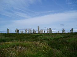
- CallanishCallanishCallanish is a village on the West Side of the Isle of Lewis, in the Outer Hebrides , Scotland. A linear settlement with a jetty, it is situated on a headland jutting into Loch Roag, a sea loch...
(Calanais), Callanish Stones, Callanish VIIICallanish VIIIThe Callanish VIII stone setting is one of many megalithic structures around the better-known Calanais I on the west coast of the isle of Lewis, in the Outer Hebrides , Scotland... - CalvayCalvayCalvay , is an uninhabited island situated in the Sound of Eriskay in the Outer Hebrides.It was here that the ship SS Politician ran aground with a cargo of whisky in 1941 and inadvertently provided the inspiration for Compton MacKenzie's 1947 novel Whiskey Galore.-Other uses:A second island of the...
(Calbhaigh) - CarinishCarinishCarinish , in North Uist, in the Western Isles of Scotland, is known for the Carinish Stone Circle and the Trinity Temple.-Carinish Stone Circle:Carinish Stone Circle is not in a good condition - it has a main road running almost through the middle of it...
(Càirinis), North Uist - CarlowayCarlowayCarloway is a district situated in the parish of Uig on the west coast of the Isle of Lewis, in the Outer Hebrides. The district has a population of around 500.- The District :...
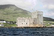
(Càrlabhagh) - CastlebayCastlebayCastlebay is the main village and a community council area on the island of Barra in the Outer Hebrides of Scotland. It is located on the south coast of the island, and overlooks a bay in the Atlantic Ocean dominated by Kisimul Castle, as well as nearby islands such as Vatersay.- Church :The...
(Bàgh a' Chaisteil), Barra - Cille Bharra
- Clach an TrushalClach an TrushalClach an Trushal is the tallest standing stone in Scotland at 5.8 metres tall. It is sited in the village of Ballantrushal on the west side of Lewis...
(Clach an Truiseil), Lewis - ClishamClishamThe Clisham is a mountain on the island of Harris in the Western Isles of Scotland. At it is the highest mountain in the Outer Hebrides and the archipelago's only Corbett....
(An Cliseam) - Comhairle nan Eilean SiarComhairle nan Eilean SiarComhairle nan Eilean Siar is the local government council for Na h-Eileanan Siar council area of Scotland.It is the only local council in Scotland to have a Gaelic-only name...
- Craigstrom (Creagastrom), Benbecula
- Creagory (Creag Ghoraidh), Benbecula
F
- Fiaraigh
- Finsbay (Fionnasbhagh), South Harris
- Fir BhrèigeFir BhreigeNa Fir Bhreige is a set of three standing stones on the Isle of North Uist in the Outer Hebrides. They lie on the northwestern slope of Blashaval....
standing stones, North Uist - FlodaighFlodaighFlodaigh is a tidal island lying to the north of Benbecula and south of Grimsay in the Outer Hebrides, Scotland. It is connected to Benbecula by a causeway....
- Flodday, Sound of Barra
- Flodabay (Fleòideabhagh), South Harris
- FudayFudayFuday is an uninhabited island of about in the Outer Hebrides of Scotland.It lies in the Sound of Barra, just east of Scurrival Point on Barra and west of Eriskay. Fuday is owned by the Scottish Government...
(Fùideigh) - Fuaigh BeagFuaigh BeagFuaigh Beag or Vuia Beg is an island in the Outer Hebrides. It is off the west coast of Lewis near Great Bernera in Loch Roag. Its name means "little Fuaigh", and is named in contrast to Fuaigh Mòr nearby.-History:...
- Fuaigh MòrFuaigh MòrFuaigh Mòr or Vuia Mòr is an island in the Outer Hebrides of Scotland. It is off the west coast of Lewis near Great Bernera in Loch Roag. It is and at its highest point.-History:...
G
- Geocrab (Geòcrab), South Harris
- GighayGighayGighay is one of a group of uninhabited islands off the northeast coast of Barra in the Outer Hebrides of Scotland.-Geography and geology:...
(Gioghaigh) - GravirGravirGravir , is a village on the shore of Loch Odhairn in the Park district of the Isle of Lewis. There is a church, a school and a voluntary fire station in the village. There is also a pier. Most of the plots of land used to be used for crofting, but this has declined in the last 50 years...
(Grabhair) - Great BerneraGreat BerneraGreat Bernera , often known just as Bernera is an island and community in the Outer Hebrides of Scotland. With an area of just over , it is the thirty-fourth largest Scottish island....
(Beàrnaraigh Ùig) - GrimsayGrimsayGrimsay is a tidal island in the Outer Hebrides of Scotland.Grimsay is the largest of the low-lying stepping-stones which convey the Oitir Mhòr causeway, a five mile arc of single track road linking North Uist and Benbecula via the western tip of Grimsay...
(Griomasaigh) - Grimsay, South East BenbeculaGrimsay, South East BenbeculaGrimsay, south east of Benbecula is a tidal island of the Outer Hebrides. It is connected to Benbecula by a causeway which carries the B891. In the 2001 census, Grimsay had a population of 19....
H
- HabostHabostHabost is the name of two crofting townships on the Isle of Lewis in the Outer Hebrides of Scotland.One is in the Ness area at the northern tip of the island at and is home to an arts and music centre....
(Tàbost) - Harris, Lewis and HarrisLewis and HarrisLewis and Harris in the Outer Hebrides make up the largest island in Scotland. This is the largest single island of the British Isles after Great Britain and Ireland.-Geography:...
, - HebridesHebridesThe Hebrides comprise a widespread and diverse archipelago off the west coast of Scotland. There are two main groups: the Inner and Outer Hebrides. These islands have a long history of occupation dating back to the Mesolithic and the culture of the residents has been affected by the successive...
(Innse Gall) - HellisayHellisayHellisay is an island in the southern Outer Hebrides of Scotland.-Geography and geology:Hellisay lies between Barra and Eriskay...
(Theiliseigh) - Highland Council, Highlands and IslandsHighlands and IslandsThe Highlands and Islands of Scotland are broadly the Scottish Highlands plus Orkney, Shetland and the Hebrides.The Highlands and Islands are sometimes defined as the area to which the Crofters' Act of 1886 applied...
, - HushinishHushinishHuisinish is a remote place on the west coast of Harris in the Outer Hebrides of Scotland. It lies at the end of a 12 mile long single track B road. The settlement of only four houses overlooking a white sand beach with views to the Atlantic...
(Hùisinis)
I
- Inner Seas of the west coast of Scotland
- Inner HebridesInner HebridesThe Inner Hebrides is an archipelago off the west coast of Scotland, to the south east of the Outer Hebrides. Together these two island chains form the Hebrides, which enjoy a mild oceanic climate. There are 36 inhabited islands and a further 43 uninhabited Inner Hebrides with an area greater than...
- Inner Scottish Sea
- IochdarIochdarIochdar , also spelled Eochar, is a hamlet and community on the west coast of the island of South Uist, in the Outer Hebrides, Scotland. It is the largest of several crofting settlements in the north-west of South Uist, and is located west of the A865 road...
(An t-Ìochdar), South Uist
L
- LaxdaleLaxdaleLaxdale is a village in the Scottish Outer Hebrides, on the island of Lewis. Although nominally a distinct village, Laxdale is now effectively a suburb of Stornoway. There is a school called Laxdale School.- External links :*...
(Lacasdal), Stornoway - LeverburghLeverburghLeverburgh is the second largest village, after Tarbert, on the island of Harris in the Outer Hebrides of Scotland.-History:In his 30's, English businessman William Lever, 1st Viscount Leverhulme had taken a boat trip and fallen in love with the Western Isles of Scotland...
(An Tòb), South Harris - LewisLewisLewis is the northern part of Lewis and Harris, the largest island of the Western Isles or Outer Hebrides of Scotland. The total area of Lewis is ....
(Leòdhas), Lewis and HarrisLewis and HarrisLewis and Harris in the Outer Hebrides make up the largest island in Scotland. This is the largest single island of the British Isles after Great Britain and Ireland.-Geography:...
(Leòdhas agus na Hearadh) - Lews CastleLews CastleLews Castle is a Victorian era castle located west of the town of Stornoway, Isle of Lewis, Scotland. It was built in the years 1847-57 as a country house for Sir James Matheson who had bought the whole island a few years previously with his fortune from the Chinese Opium trade...
, Lews Castle CollegeLews Castle CollegeLews Castle College is a further and higher education college in the Western Isles of Scotland. The main campus is in the grounds of Lews Castle, Stornoway. The College also has two learning centres in Benbecula and Barra. The College is part of the University of the Highlands and Islands.The...
, Benbecula - Lickisto (Liceasto), South Harris
- Lingeidh (Lingeigh)
- LingerbayLingerbayLingerbay in Harris, Scotland, was the subject of one of the Western Isles's longest controversies ....
(Lingearabhagh), South Harris - Liniclate (Lìonacleit), Benbecula
- Little Minch (An Cuan Canach)
- Loch RògLoch RògLoch Ròg or Loch Roag is a sea loch on the west coast of Lewis, Outer Hebrides.The waters of Loch Roag are pristine and clear, and are today the source of farmed organic salmon and organic mussels...
- LochboisdaleLochboisdaleLochboisdale is a community and the main population centre on the island of South Uist, Outer Hebrides, Scotland.The town profited from the herring boom in the 19th century, and a steamer pier was built in 1880...
(Loch Baghasdail), South Uist - LochmaddyLochmaddyLochmaddy is the administrative centre of North Uist in the Outer Hebrides, Scotland...
(Loch nam Madadh), North Uist
M
- Manish, Outer Hebrides (Mànais), South Harris
- Minch (An Cuan Sgìth)
- MingulayMingulayMingulay is the second largest of the Bishop's Isles in the Outer Hebrides of Scotland. Located south of Barra, it is known for its important seabird populations, including puffins, Black-legged Kittiwakes, and razorbills, which nest in the sea-cliffs, amongst the highest in the British...
(Miughalaigh) - MuldoanichMuldoanichMuldoanich is one of the islands in the Barra Isles archipelago at the southern extremity of the larger island chain of the Outer Hebrides of Scotland.The island is 78 hectares Muldoanich is one of the islands in the Barra Isles archipelago at the southern extremity of the larger island chain of...
(Maol Dòmhnaich)
N
- Na h-Eileanan Siar
- NewtonferryNewtonferryNewtonferry is a small crofting community on the island of North Uist in the Western Isles of Scotland, at the end of the B893 road....
(Port nan Long) - North UistNorth UistNorth Uist is an island and community in the Outer Hebrides of Scotland.-Geography:North Uist is the tenth largest Scottish island and the thirteenth largest island surrounding Great Britain. It has an area of , slightly smaller than South Uist. North Uist is connected by causeways to Benbecula...
(Uibhist a Tuath)
R
- RèinigeadalRèinigeadalRèinigeadal is a small settlement in Harris, in the Western Isles in Scotland. It is situated on the east coast of Harris, 8 km east of Tarbert. Rèinigeadal had no road access until 1990, the only route in was 5 km along a hill path, or by boat.Rèinigeadal has a youth hostel, run by the...
, Harris - RockallRockallRockall is an extremely small, uninhabited, remote rocky islet in the North Atlantic Ocean. It gives its name to one of the sea areas named in the shipping forecast provided by the British Meteorological Office....
, Rockall Bank - RodelRodelRodel is a village on the south-eastern coast of Harris, an island in the Scottish Outer Hebrides. It was formerly the historic capital and main port of Harris before Tarbert took the title....
(Roghadal), South Harris - Ruabhal (Ruaidheabhal), Benbecula
S
- SandraySandraySandray is one of the Barra Isles in the Outer Hebrides of Scotland. It never had a large population, and has been uninhabited since 1934. It is now known for its large seabird colony.-Geography:...
(Sanndraigh) - ScalpayScalpay, Outer HebridesScalpay to distinguish it from the other Scalpay) is an island and community in the Outer Hebrides of Scotland.-Geography:Scalpay is around 2.5 miles long and rises to a height of 341 ft at Beinn Scorabhaig. Scalpay's nearest neighbour, Harris is just 330 yds away over narrow Caolas...
(Sgalpaigh) - ScarpScarp, ScotlandScarp is an uninhabited island in the Outer Hebrides of Scotland, west of Hushinish on Harris. Once inhabited, the island was the scene of unsuccessful experiments with rocket mail, since commemorated in two films.-Geography:...
- Scolpaig TowerScolpaig TowerScolpaig Tower is a Georgian folly located near the village of Scolpaig on the Isle of North Uist in the Outer Hebrides...
, North Uist - Sea of the HebridesSea of the HebridesThe Sea of the Hebrides is a portion of the North Atlantic Ocean, located off the coast of western Scotland, separating the mainland and the northern Inner Hebrides islands from the southern Outer Hebrides islands...
- SollasSollasSollas is a small crofting township on the northern coast of the island of North Uist, Scotland.From Sollas, the road that heads towards Bayhead is known as the Committee Road. It is called this as it was organised by a committee charged with providing famine relief in the 1840s...
(Solas), North Uist - Sound of Barra
- Sound of HarrisSound of HarrisThe Sound of Harris is a channel between the islands of Harris and North Uist in the Outer Hebrides of Scotland.-Geography:Approximately in width, the Sound of Harris provides the main sea passage through the Hebridean archipelago, from the Atlantic Ocean to The Minch. There are many islands and...
(Caolas na Hearadh) - South UistSouth UistSouth Uist is an island of the Outer Hebrides in Scotland. In the 2001 census it had a usually resident population of 1,818. There is a nature reserve and a number of sites of archaeological interest, including the only location in Great Britain where prehistoric mummies have been found. The...
(Uibhist a Deas) - St KildaSt Kilda, ScotlandSt Kilda is an isolated archipelago west-northwest of North Uist in the North Atlantic Ocean. It contains the westernmost islands of the Outer Hebrides of Scotland. The largest island is Hirta, whose sea cliffs are the highest in the United Kingdom and three other islands , were also used for...
(Hiort) - SteinacleitSteinacleitSteinacleit is a prehistoric archeological site in the Outer Hebrides.The site consists of an array of boulders which marks what is left of a chambered cairn, and possibly shows the site was overlain by a huge hall. There are ten large stone slabs surrounding the central mound. Folk legend of the...
- StornowayStornowayStornoway is a burgh on the Isle of Lewis, in the Outer Hebrides of Scotland.The town's population is around 9,000, making it the largest settlement in the Western Isles and the third largest town in the Scottish Highlands after Inverness and Fort William...
(Steòrnabhagh)
See also
- List of places in Scotland
- List of islands of Scotland
- List of places in Highland
- List of places in Argyll and Bute
- BrochBrochA broch is an Iron Age drystone hollow-walled structure of a type found only in Scotland. Brochs include some of the most sophisticated examples of drystone architecture ever created, and belong to the classification "complex Atlantic Roundhouse" devised by Scottish archaeologists in the 1980s....
- Bronze ageBronze AgeThe Bronze Age is a period characterized by the use of copper and its alloy bronze as the chief hard materials in the manufacture of some implements and weapons. Chronologically, it stands between the Stone Age and Iron Age...
- chambered cairnChambered cairnA chambered cairn is a burial monument, usually constructed during the Neolithic, consisting of a cairn of stones inside which a sizeable chamber was constructed. Some chambered cairns are also passage-graves....
- crannogCrannogA crannog is typically a partially or entirely artificial island, usually built in lakes, rivers and estuarine waters of Scotland and Ireland. Crannogs were used as dwellings over five millennia from the European Neolithic Period, to as late as the 17th/early 18th century although in Scotland,...
- CuldeeCuldeeCéli Dé or Culdees were originally members of ascetic Christian monastic and eremitical communities of Ireland, Scotland and England in the Middle Ages. The term is used of St. John the Apostle, of a missioner from abroad recorded in the Annals of the Four Masters at the year 806, and of Óengus...
- Dolphin watching
- History of the Outer HebridesHistory of the Outer HebridesThe Hebrides were settled early on in the settlement of the British Isles, perhaps as early as the Mesolithic era, around 8500-8250 BC, after the climatic conditions improved enough to sustain human settlement. There are examples of structures possibly dating from up to 3000 BC, the finest example...
- Inverness-shireInverness-shireThe County of Inverness or Inverness-shire was a general purpose county of Scotland, with the burgh of Inverness as the county town, until 1975, when, under the Local Government Act 1973, the county area was divided between the two-tier Highland region and the unitary Western Isles. The Highland...
- Iron ageIron AgeThe Iron Age is the archaeological period generally occurring after the Bronze Age, marked by the prevalent use of iron. The early period of the age is characterized by the widespread use of iron or steel. The adoption of such material coincided with other changes in society, including differing...
- Lewisian gneissLewisian complexThe Lewisian complex or Lewisian Gneiss is a suite of Precambrian metamorphic rocks that outcrop in the northwestern part of Scotland, forming part of the Hebridean Terrane. These rocks are of Archaean and Paleoproterozoic age, ranging from 3.0–1.7 Ga. They form the basement on which the...
- MenhirMenhirA menhir is a large upright standing stone. Menhirs may be found singly as monoliths, or as part of a group of similar stones. Their size can vary considerably; but their shape is generally uneven and squared, often tapering towards the top...
- NorseNorsemenNorsemen is used to refer to the group of people as a whole who spoke what is now called the Old Norse language belonging to the North Germanic branch of Indo-European languages, especially Norwegian, Icelandic, Faroese, Swedish and Danish in their earlier forms.The meaning of Norseman was "people...
- Outer HebridesOuter HebridesThe Outer Hebrides also known as the Western Isles and the Long Island, is an island chain off the west coast of Scotland. The islands are geographically contiguous with Comhairle nan Eilean Siar, one of the 32 unitary council areas of Scotland...
- Sabbatarianism
- sea stack
- standing stoneStanding stoneStanding stones, orthostats, liths, or more commonly megaliths are solitary stones set vertically in the ground and come in many different varieties....

