List of cities with defensive walls
Encyclopedia
Egypt
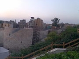
- CairoCairoCairo , is the capital of Egypt and the largest city in the Arab world and Africa, and the 16th largest metropolitan area in the world. Nicknamed "The City of a Thousand Minarets" for its preponderance of Islamic architecture, Cairo has long been a centre of the region's political and cultural life...
- Al-Fustat
- Damietta
See List of Egypt castles, forts, fortifications and city walls.
Libya
- TripoliTripoliTripoli is the capital and largest city in Libya. It is also known as Western Tripoli , to distinguish it from Tripoli, Lebanon. It is affectionately called The Mermaid of the Mediterranean , describing its turquoise waters and its whitewashed buildings. Tripoli is a Greek name that means "Three...
- Derna
- GhadamesGhadamesGhadames or Ghadamis is an oasis town in the Nalut District of the Fezzan region in southwestern Libya.-Geography:Ghadames lies roughly to the southwest of Tripoli, near the borders with Algeria and Tunisia. Ghadames borders Illizi Province, Algeria and Tataouine Governorate, Tunisia.The oasis...
- Waddan
- GermaGermaGerma, known in ancient times as Garama, is an archaeological site in Libya and was the capital of the Garamantes.The Garamantes were a Berber people living in the Fezzan in the northeastern Sahara, originating from the Sahara's Tibesti region. Garamantian power climaxed during the 2nd and the 3rd...
- KabawKabawKabaw, Kabao or Cabao is a town in the Nalut District in northwestern Libya. It lies just off of the Gharyan–Nalut road and about west of Jadu, on the northern edge of the Tripolitanian Plateau in the Nafusa Mountains.-History:...
- NalutNalutNalut is the capital of the Nalut District in Libya and is home to a Berber granary and community.Nalut lies approximately half way between Tripoli and Ghadames, at the western end of the Nafusa Mountains coastal range, in the Tripolitania region.-Architecture:Nalut is home to the Ksar Nalut,...
- CyreneCyreneCyrene may refer to:* Cyrene , a Greek mythological figure* Cyrene, Libya, an ancient Greek colony in North Africa* USS Cyrene , a motor torpedo boat tender* 133 Cyrene, an asteroid...
- ApolloniaApollonia-Places:Albania:* Apollonia, IllyriaBulgaria:* Apollonia, Thrace now SozopolFrance:* Sainte-Apollonie island, Île de Sainte-Apollonie, on the Mayenne river in the French region Pays de la LoireGreece:*Apollonia , a city on Mount Athos...
- TolmeithaTolmeithaTolmeitha, Tolometa, or Tolmeita is a tiny village in the northern Cyrenaica region of eastern Libya, some east of Benghazi, near Ad Dirsiyah...
- BenghaziBenghaziBenghazi is the second largest city in Libya, the main city of the Cyrenaica region , and the former provisional capital of the National Transitional Council. The wider metropolitan area is also a district of Libya...
- Sokna
- Ghat
- MurzuqMurzuqMurzuq is one of the districts of Libya. It is in the south of the country. Its capital is Murzuk. The city was occupied by the Ottoman Empire in 1578 and served as the capital of Fezzan off and on until the Ottomans ceded Libya to Italy in 1912...
- Jaghbub
Mali
- TimbuktuTimbuktuTimbuktu , formerly also spelled Timbuctoo, is a town in the West African nation of Mali situated north of the River Niger on the southern edge of the Sahara Desert. The town is the capital of the Timbuktu Region, one of the eight administrative regions of Mali...
.jpg)
Morocco
- Aït BenhaddouAït BenhaddouAït Benhaddou is a 'fortified city', or ksar, along the former caravan route between the Sahara and Marrakech in present-day Morocco. It is situated in Souss-Massa-Draâ on a hill along the Ounila River and has some beautiful examples of kasbahs, which unfortunately sustain damage during each...
- AsilahAsilahAsilah or Arzila is a fortified town on the northwest tip of the Atlantic coast of Morocco, about 31 km from Tangier. Its ramparts and gateworks remain fully intact...
- CasablancaCasablancaCasablanca is a city in western Morocco, located on the Atlantic Ocean. It is the capital of the Grand Casablanca region.Casablanca is Morocco's largest city as well as its chief port. It is also the biggest city in the Maghreb. The 2004 census recorded a population of 2,949,805 in the prefecture...
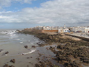
- EssaouiraEssaouiraMogador redirects here, for the hamlet in Surrey see Mogador, Surrey.Essaouira is a city in the western Moroccan economic region of Marrakech-Tensift-Al Haouz, on the Atlantic coast. Since the 16th century, the city has also been known by its Portuguese name of Mogador or Mogadore...
- FesFesFes or Fez is the second largest city of Morocco, after Casablanca, with a population of approximately 1 million . It is the capital of the Fès-Boulemane region....
- MarrakechMarrakechMarrakech or Marrakesh , known as the "Ochre city", is the most important former imperial city in Morocco's history...
- MeknesMeknesMeknes is a city in northern Morocco, located from the capital Rabat and from Fes. It is served by the A2 expressway between those two cities and by the corresponding railway. Meknes was the capital of Morocco under the reign of Moulay Ismail , before it was relocated to Marrakech. The...
- Moulay IdrissMoulay IdrissMoulay Idriss or Moulay Idriss Zerhoun , a town in northern Morocco located at, is named after Moulay Idris I, the founder of the Idrisid Dynasty. Moulay is a term roughly equivalent to "Prince" or "Lord". Idris founded both Fez and the city that bears his name. His tomb, located in Moulay Idriss,...
- OuarzazateOuarzazate-See also:* Tizi n'Tichka: The mountain pass that leads to Ouarzazate* List of Movies shot in Morocco-External links:* at IMDb...
- RabatRabatRabat , is the capital and third largest city of the Kingdom of Morocco with a population of approximately 650,000...
- SafiSafi, MoroccoSafi is a city in western Morocco on the Atlantic Ocean. The capital of the Doukkala-Abda Region, it has a population of 282,227 , but is also the centre of an agglomeration which has an estimated 793,000 inhabitants ....
- SaléSaléSalé is a city in north-western Morocco, on the right bank of the Bou Regreg river, opposite the national capital Rabat, for which it serves as a commuter town...
- TangierTangierTangier, also Tangiers is a city in northern Morocco with a population of about 700,000 . It lies on the North African coast at the western entrance to the Strait of Gibraltar where the Mediterranean meets the Atlantic Ocean off Cape Spartel...
- TaroudantTaroudantTaroudant is a Moroccan city located in the Sous Valley in the southern part of the country. It is situated east of Agadir on the road to Ouarzazate and the Sahara desert and south of Marrakech. It is called the "Grandmother of Marrakech" because it looks like a smaller Marrakech with its...
- TétouanTétouanTetouan is a city in northern Morocco. The Berber name means literally "the eyes" and figuratively "the water springs". Tetouan is one of the two major ports of Morocco on the Mediterranean Sea. It lies a few miles south of the Strait of Gibraltar, and about 40 mi E.S.E. of Tangier...
- OujdaOujdaOujda is a city in eastern Morocco with an estimated population of 1 million. The city is located about 15 kilometers west of Algeria and about 60 kilometers south of the Mediterranean Sea. It is the capital of the Oriental Region of Morocco and the birthplace of the current Algerian president,...
Niger
- ZinderZinderZinder is the second largest city in Niger, with a population of 170,574 by 2005 was estimated to be over 200,000...
, NigerNigerNiger , officially named the Republic of Niger, is a landlocked country in Western Africa, named after the Niger River. It borders Nigeria and Benin to the south, Burkina Faso and Mali to the west, Algeria and Libya to the north and Chad to the east...
was well known for its city wall, the remains of which can still be seen
Canada
- The Ramparts of Quebec CityRamparts of Quebec CityLocated in Canada, the Ramparts of Quebec City are the only remaining fortified city walls in the Americas, north of Mexico. The English began fortifying the existing walls, after they took Quebec City from the French in the Battle of the Plains of Abraham in 1759.The wall surrounds most of Old...
are the only fortified city walls in the Americas north of Mexico that still exist. - MontrealMontrealMontreal is a city in Canada. It is the largest city in the province of Quebec, the second-largest city in Canada and the seventh largest in North America...
, Quebec - Remnants of Montreal's nearly demolished city wall remain surrounding the Old Port neighborhood.
Dominican Republic
- Santo DomingoSanto DomingoSanto Domingo, known officially as Santo Domingo de Guzmán, is the capital and largest city in the Dominican Republic. Its metropolitan population was 2,084,852 in 2003, and estimated at 3,294,385 in 2010. The city is located on the Caribbean Sea, at the mouth of the Ozama River...
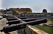
was a fortified city from the 16th century to the early 20th century. Parts of the wall are still visible in the Colonial ZoneCiudad Colonial (Santo Domingo)Ciudad Colonial is the first settlement made by Christopher Columbus and the Spanish explorers in the New World. It has been declared a World Heritage Site by UNESCO. Colloquially known as "Zona Colonial" , Ciudad Colonial is part of the original Santo Domingo, Dominican Republic, and the origin...
. One of the main gates is very well preserved and centuries ago was named "The Gate of the Count"Puerta del CondeLa Puerta del Conde is the site in Santo Domingo, Dominican Republic where Francisco del Rosario Sanchez, one of the Dominican Founding Fathers, proclaimed Dominican independence and raised the first Dominican Flag, on February 27, 1844....
after the Count of Peñalba, who stopped the invasion of William PennWilliam PennWilliam Penn was an English real estate entrepreneur, philosopher, and founder of the Province of Pennsylvania, the English North American colony and the future Commonwealth of Pennsylvania. He was an early champion of democracy and religious freedom, notable for his good relations and successful...
and Robert VenablesRobert VenablesRobert Venables , was a soldier during the English Civil War and noted angler.Venables was lieutenant-colonel in the parliamentary army. He was wounded at Chester in 1645. He was appointed governor of Liverpool in 1648. He served with success in Ireland from 1649 until 1654...
during the Siege of Santo DomingoSiege of Santo Domingo (1655)The Siege of Santo Domingo of 1655, was fought between April 23, 1655 to April 30, 1655 at the Spanish Colony of Santo Domingo. A force of 2,400 Spanish troops led by Governor Don Bernardino Meneses y Bracamonte, Count of Peñalba, successfully resisted a force of 13,120 troops and 34 ships of the...
.
Mexico
- CampecheCampeche, CampecheSan Francisco de Campeche is the capital city of the Mexican state of Campeche, located at,...
- Tulum
- VeracruzVeracruz, VeracruzVeracruz, officially known as Heroica Veracruz, is a major port city and municipality on the Gulf of Mexico in the Mexican state of Veracruz. The city is located in the central part of the state. It is located along Federal Highway 140 from the state capital Xalapa, and is the state's most...
(walls demolished in the 19th century)
United States
- Rampart StreetRampart StreetRampart Street is a historic avenue located in New Orleans, Louisiana.The upper end of the street is in the New Orleans Central Business District...
, in New Orleans, is named for the rampart, or wall, that protected the French QuarterFrench QuarterThe French Quarter, also known as Vieux Carré, is the oldest neighborhood in the city of New Orleans. When New Orleans was founded in 1718 by Jean-Baptiste Le Moyne de Bienville, the city was originally centered on the French Quarter, or the Vieux Carré as it was known then...
from the British and Native Americans during the city's early days. Dismantled during Spanish Rule. - Wall StreetWall StreetWall Street refers to the financial district of New York City, named after and centered on the eight-block-long street running from Broadway to South Street on the East River in Lower Manhattan. Over time, the term has become a metonym for the financial markets of the United States as a whole, or...
, located in the financial districtFinancial District, ManhattanThe Financial District of New York City is a neighborhood on the southernmost section of the borough of Manhattan which comprises the offices and headquarters of many of the city's major financial institutions, including the New York Stock Exchange and the Federal Reserve Bank of New York...
in Lower ManhattanLower ManhattanLower Manhattan is the southernmost part of the island of Manhattan, the main island and center of business and government of the City of New York...
, in New York City, is named after the wooden fortification that ran along the northern border of original Dutch colony. Contrary to popular myth, it was used to keep out wolves and other wild animals, and not the Native AmericansNative Americans in the United StatesNative Americans in the United States are the indigenous peoples in North America within the boundaries of the present-day continental United States, parts of Alaska, and the island state of Hawaii. They are composed of numerous, distinct tribes, states, and ethnic groups, many of which survive as...
who were still living in the area. - St. Augustine, FloridaSt. Augustine, FloridaSt. Augustine is a city in the northeast section of Florida and the county seat of St. Johns County, Florida, United States. Founded in 1565 by Spanish explorer and admiral Pedro Menéndez de Avilés, it is the oldest continuously occupied European-established city and port in the continental United...
- Charleston, South CarolinaCharleston, South CarolinaCharleston is the second largest city in the U.S. state of South Carolina. It was made the county seat of Charleston County in 1901 when Charleston County was founded. The city's original name was Charles Towne in 1670, and it moved to its present location from a location on the west bank of the...
(Walls no longer extant)
China
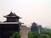
- Chinese cities occasionally have remnants of city walls that were built in the Ming DynastyMing DynastyThe Ming Dynasty, also Empire of the Great Ming, was the ruling dynasty of China from 1368 to 1644, following the collapse of the Mongol-led Yuan Dynasty. The Ming, "one of the greatest eras of orderly government and social stability in human history", was the last dynasty in China ruled by ethnic...
and designed to withstand artilleryArtilleryOriginally applied to any group of infantry primarily armed with projectile weapons, artillery has over time become limited in meaning to refer only to those engines of war that operate by projection of munitions far beyond the range of effect of personal weapons...
bombardment. Chinese cities generally outgrew their walls, which fell into disrepair in the Qing dynastyQing DynastyThe Qing Dynasty was the last dynasty of China, ruling from 1644 to 1912 with a brief, abortive restoration in 1917. It was preceded by the Ming Dynasty and followed by the Republic of China....
. The city of Xi'anXi'anXi'an is the capital of the Shaanxi province, and a sub-provincial city in the People's Republic of China. One of the oldest cities in China, with more than 3,100 years of history, the city was known as Chang'an before the Ming Dynasty...
has well-preserved walls with a water filled moat that is a tourist attraction incorporating small parks surrounding a busy and modern area of the city. - Many parts of the walls of BeijingBeijingBeijing , also known as Peking , is the capital of the People's Republic of China and one of the most populous cities in the world, with a population of 19,612,368 as of 2010. The city is the country's political, cultural, and educational center, and home to the headquarters for most of China's...
were demolished during the 1960s to open large streets around the city. A metroRapid transitA rapid transit, underground, subway, elevated railway, metro or metropolitan railway system is an electric passenger railway in an urban area with a high capacity and frequency, and grade separation from other traffic. Rapid transit systems are typically located either in underground tunnels or on...
line also follows the location of the former city walls. - BeijingBeijingBeijing , also known as Peking , is the capital of the People's Republic of China and one of the most populous cities in the world, with a population of 19,612,368 as of 2010. The city is the country's political, cultural, and educational center, and home to the headquarters for most of China's...
, see City Wall of BeijingBeijing city wallThe city wall of Beijing was a fortification built around 1435. It was 23.5 km long. The thickness at ground level was 20m and the top 12m. The wall was 15m high, and it had nine gates. This wall stood for nearly 530 years, but in 1965 it was removed to give way to 2nd Ring Road and the loop... - Dali
- JianshuiJianshuiJianshui County is a city in Honghe prefecture, Yunnan province, China. It was historic center of the province and remains an important transportation crossroad.-Geography:...
- JingzhouJingzhouJingzhou is a prefecture-level city in Hubei Province, People's Republic of China. The city is located on the banks of the Yangtze River.Its population is 5,691,707 at the 2010 census whom 1,154,086 in the built up area made of 3 urban districts.-Geography:Jingzhou occupies an area of...
- Kowloon Walled CityKowloon Walled CityKowloon Walled City was a densely populated, largely ungoverned settlement in Kowloon, Hong Kong. Originally a Chinese military fort, the Walled City became an enclave after the New Territories were leased to Britain in 1898....
, a former enclave of Hong Kong - KunmingKunming' is the capital and largest city of Yunnan Province in Southwest China. It was known as Yunnan-Fou until the 1920s. A prefecture-level city, it is the political, economic, communications and cultural centre of Yunnan, and is the seat of the provincial government...
- NanjingNanjing' is the capital of Jiangsu province in China and has a prominent place in Chinese history and culture, having been the capital of China on several occasions...
, see City Wall of NanjingCity Wall of NanjingThe City Wall of Nanjing was designed by Emperor Zhu Yuanzhang after he founded the Ming Dynasty and established Nanjing as the capital 600 years ago. To consolidate his sovereignty and keep out invaders, he adopted the suggestions of advisor Zhu Sheng to build a higher city wall, to collect... - QufuQufuQufu is a city in southwestern Shandong province, People's Republic of China. It is located at 35° 36′ northern latitude and 117° 02′ east, about south of the provincial capital Jinan and northeast of the prefecture seat at Jining...
- PingyaoPingyaoPingyao is a Chinese city and county in central Shanxi province, China. It lies about 715 km from Beijing and 80 km from the provincial capital, Taiyuan. During the Qing Dynasty, Pingyao was a financial center of China...
- Walled villageWalled villages of Hong KongOnce common throughout China, walled villages can still be found in southern China and Hong Kong. Most of the walled villages in Hong Kong are located in the New Territories...
s can still be found in Mainland ChinaMainland ChinaMainland China, the Chinese mainland or simply the mainland, is a geopolitical term that refers to the area under the jurisdiction of the People's Republic of China . According to the Taipei-based Mainland Affairs Council, the term excludes the PRC Special Administrative Regions of Hong Kong and...
and Hong KongHong KongHong Kong is one of two Special Administrative Regions of the People's Republic of China , the other being Macau. A city-state situated on China's south coast and enclosed by the Pearl River Delta and South China Sea, it is renowned for its expansive skyline and deep natural harbour...
. - Xi'anXi'anXi'an is the capital of the Shaanxi province, and a sub-provincial city in the People's Republic of China. One of the oldest cities in China, with more than 3,100 years of history, the city was known as Chang'an before the Ming Dynasty...
- Zhengding
India
- DholaviraDholaviraDholavira is an archaeological site in Khadirbet in Bhachau Taluka of Kachchh district of Gujarat state in western India, which has taken its name from a modern village 1 km south of it. The site of Dholavira, locally known as Kotada timba contains ruins of an ancient Harappan city...
- WarangalWarangalWarangal is a city and a municipal corporation in Warangal district in the Indian state of Andhra Pradesh. Warangal is located northeast of the state capital of Hyderabad and is the administrative headquarters of Warangal District. This district is a combination of three cities: Warangal,...
- JaipurJaipurJaipur , also popularly known as the Pink City, is the capital and largest city of the Indian state of Rajasthan. Founded on 18 November 1727 by Maharaja Sawai Jai Singh II, the ruler of Amber, the city today has a population of more than 3.1 million....
- JodhpurJodhpurJodhpur , is the second largest city in the Indian state of Rajasthan. It is located west from the state capital, Jaipur and from the city of Ajmer. It was formerly the seat of a princely state of the same name, the capital of the kingdom known as Marwar...
- UdaipurUdaipurUdaipur , also known as the City of Lakes, is a city, a Municipal Council and the administrative headquarters of the Udaipur district in the state of Rajasthan in western India. It is located southwest of the state capital, Jaipur, west of Kota, and northeast from Ahmedabad...
- Raigad
- MumbaiMumbaiMumbai , formerly known as Bombay in English, is the capital of the Indian state of Maharashtra. It is the most populous city in India, and the fourth most populous city in the world, with a total metropolitan area population of approximately 20.5 million...
(old city of Bombay) - LucknowLucknowLucknow is the capital city of Uttar Pradesh in India. Lucknow is the administrative headquarters of Lucknow District and Lucknow Division....
- AhmedabadAhmedabadAhmedabad also known as Karnavati is the largest city in Gujarat, India. It is the former capital of Gujarat and is also the judicial capital of Gujarat as the Gujarat High Court has its seat in Ahmedabad...
- AgraAgraAgra a.k.a. Akbarabad is a city on the banks of the river Yamuna in the northern state of Uttar Pradesh, India, west of state capital, Lucknow and south from national capital New Delhi. With a population of 1,686,976 , it is one of the most populous cities in Uttar Pradesh and the 19th most...
- DelhiDelhiDelhi , officially National Capital Territory of Delhi , is the largest metropolis by area and the second-largest by population in India, next to Mumbai. It is the eighth largest metropolis in the world by population with 16,753,265 inhabitants in the Territory at the 2011 Census...
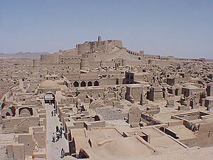
Israel
- AcreAcre, IsraelAcre , is a city in the Western Galilee region of northern Israel at the northern extremity of Haifa Bay. Acre is one of the oldest continuously inhabited sites in the country....
- 18th century modern OttomanOttoman EmpireThe Ottoman EmpireIt was usually referred to as the "Ottoman Empire", the "Turkish Empire", the "Ottoman Caliphate" or more commonly "Turkey" by its contemporaries...
fortification able to withstand cannons attack. The wall has been restored and now includes rampart for tourists. - Jerusalem's Old City wallsJerusalem's Old City wallsThe Old City is a walled area within the modern city of Jerusalem. Until 1860, when the Jewish neighborhood, Mishkenot Sha'ananim, was established, this area constituted the entire city of Jerusalem...
- SafedSafedSafed , is a city in the Northern District of Israel. Located at an elevation of , Safed is the highest city in the Galilee and of Israel. Due to its high elevation, Safed experiences warm summers and cold, often snowy, winters...
Malaysia
- MalaccaMalaccaMalacca , dubbed The Historic State or Negeri Bersejarah among locals) is the third smallest Malaysian state, after Perlis and Penang. It is located in the southern region of the Malay Peninsula, on the Straits of Malacca. It borders Negeri Sembilan to the north and the state of Johor to the south...
- Built by the Portuguese after the city's occupation in 1511, it was torn down by the British in 1806. Known locally as the A FamosaA FamosaA Famosa is a Portuguese fortress located in Malacca, Malaysia. It is among the oldest surviving European architectural remains in Asia. The Porta de Santiago, a small gate house, is the only remaining part of the fortress still standing....
.
Pakistan
Almost every old city in Pakistan had a defensive wall. Much of these walls were destroyed by the British in order to defortify the cites. Few cities which were fortified are:- Walled City of LahoreWalled City of LahoreThe Walled City of Lahore, also known as the "Old City," or "Anderoon Shehr ," is the section of Lahore, Punjab, Pakistan, that was fortified by a city wall during the Mughal era.-Origins:The origins of the original Lahore are unspecific...
- MultanMultanMultan , is a city in the Punjab Province of Pakistan and capital of Multan District. It is located in the southern part of the province on the east bank of the Chenab River, more or less in the geographic centre of the country and about from Islamabad, from Lahore and from Karachi...
- PeshawarPeshawarPeshawar is the capital of Khyber-Pakhtunkhwa and the administrative center and central economic hub for the Federally Administered Tribal Areas of Pakistan....
- Hyderabad, SindhHyderabad, Sindhis the second largest city in the Sindh province of Pakistan. It is the seventh largest city in the country. The city was founded in 1768 by Mian Ghulam Shah Kalhoro upon the ruins of a Mauryan fishing village along the bank of the Indus known as Neroon Kot...
,
Philippines
- IntramurosIntramurosIntramuros is the oldest district in the present day city of Manila, the capital of the Republic of the Philippines. Nicknamed the "Walled City", Intramuros is the historic fortified city of Manila, the seat ot the government during the Spanish Colonial Period. Its name in Latin, intramuros,...
- partially preserved, partially restored after World War IIWorld War IIWorld War II, or the Second World War , was a global conflict lasting from 1939 to 1945, involving most of the world's nations—including all of the great powers—eventually forming two opposing military alliances: the Allies and the Axis...
. Original walls are still well preserved.
Thailand
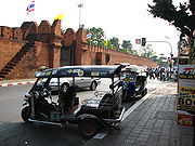
- AyutthayaAyutthaya (city)Ayutthaya city is the capital of Ayutthaya province in Thailand. Located in the valley of the Chao Phraya River. The city was founded in 1350 by King U Thong, who went there to escape a smallpox outbreak in Lop Buri and proclaimed it the capital of his kingdom, often referred to as the Ayutthaya...
- BangkokBangkokBangkok is the capital and largest urban area city in Thailand. It is known in Thai as Krung Thep Maha Nakhon or simply Krung Thep , meaning "city of angels." The full name of Bangkok is Krung Thep Mahanakhon Amon Rattanakosin Mahintharayutthaya Mahadilok Phop Noppharat Ratchathani Burirom...
- Chiang MaiChiang MaiChiang Mai sometimes written as "Chiengmai" or "Chiangmai", is the largest and most culturally significant city in northern Thailand. It is the capital of Chiang Mai Province , a former capital of the Kingdom of Lanna and was the tributary Kingdom of Chiang Mai from 1774 until 1939. It is...
was surrounded by a moat and city walls when it was established by King Mangrai the Great in 1296. They were extensively rebuilt in the early 19th century. Large parts of the city walls and city gates of Chiang Mai survived till the present. - Chiang RaiChiang Rai-Demographics:Official Population count: According to the Thailand National Statistical Office, as of September 2010, Chiang Rai municipal district has a population of 199,699...
- Chiang SaenAmphoe Chiang SaenChiang Saen is a district in the northern part of Chiang Rai Province, northern Thailand.-History:According to an ancient chronicle, the original city of Chiang Saen was built in 545 in an area called Yonok, by Tai migrants from the Chinese province of Yunnan, and was an important city of the...
- Kamphaeng PhetKamphaeng Phet Historical ParkKamphaeng Phet Historical Park is an archeological site in Kamphaeng Phet, Thailand. Along with Sukhothai Historical Park and Si Satchanalai historical park, it is a part of the UNESCO World Heritage Site Historic Town of Sukhothai and Associated Historic Towns...
- LopburiLopburiLopburi ) is the capital city of Lopburi Province in Thailand. It is located about 150 km north-east of Bangkok. As of 2006 it has a population of 26,500...
- Nakhon RatchasimaNakhon RatchasimaNakhon Ratchasima or is a city in the north-east of Thailand and gateway to Isan. It is the capital of the Nakhon Ratchasima Province and Nakhon Ratchasima district...
- Nakhon Si ThammaratNakhon Si ThammaratNakhon Si Thammarat is a town in southern Thailand, capital of the Nakhon Si Thammarat Province and the Nakhon Si Thammarat district. It is about south of Bangkok, on the east coast of the Malay Peninsula. The city was the administrative center of southern Thailand during most of its history. ...
- Nan, ThailandNan, ThailandNan is a town in Northern Thailand. It is located some 668 km north of Bangkok. Its population exceeds 24.000. It is situated in the centre of the province which bears its name, and of which it is the administrative capital. It covers the whole tambon Nai Wiang of Mueang Nan district, an area...
- PhichaiAmphoe PhichaiPhichai is the southernmost district of Uttaradit Province, northern Thailand.-Geography:Neighboring districts are Tron, Thong Saen Khan of Uttaradit Province, Wat Bot, Phrom Phiram of Phitsanulok Province, Sawankhalok and Si Nakhon of Sukhothai Province-History:Mueang Phichai is believed to be...
- PhimaiPhimaiPhimai is a township in the Nakhon Ratchasima Province in the northeast of Thailand. The town is located at . As of 2005 the town has a population of 9,768...
- PhitsanulokPhitsanulokPhitsanulok is an important and historic city in lower northern Thailand and is the capital of Phitsanulok Province, which stretches all the way to the Laotian border. Phitsanulok is one of the oldest cities in Thailand, founded over 600 years ago...
- PhraePhrae ProvincePhrae is one of the northern provinces of Thailand. Neighboring provinces are Phayao, Nan, Uttaradit, Sukhothai and Lampang.-Geography:Phrae is located in the valley of the river Yom.-History:...
- Si SatchanalaiSi Satchanalai historical parkThe Si Satchanalai Historical Park is a historical park in Si Satchanalai district, Sukhothai Province, northern Thailand.The protection of the area was first announced in Volume 92, Part 112 of the Royal Gazette on August 2, 1961. In 1976 the restoration project was approved, and in July 1988 the...
- SukhothaiSukhothai historical parkThe Sukhothai Historical Park ) covers the ruins of Sukhothai, capital of the Sukhothai kingdom in the 13th and 14th centuries, in what is now the north of Thailand. It is located near the modern city of Sukhothai, capital of the province with the same name....
- SuphanburiSuphanburi ProvinceSuphan Buri is one of the central provinces of Thailand. Neighboring provinces are Uthai Thani, Chai Nat, Sing Buri, Ang Thong, Phra Nakhon Si Ayutthaya, Nakhon Pathom and Kanchanaburi.- Etymology :...
- ThonburiThonburiThon Buri is an area of modern Bangkok. It was capital of Thailand from 1767 to 1782, during the reign of King Taksin, after the previous capital Ayutthaya was sacked by the Burmese. It is located on the opposite bank of Chao Phraya River to Bangkok...
Yemen

- Sana'aSana'a-Districts:*Al Wahdah District*As Sabain District*Assafi'yah District*At Tahrir District*Ath'thaorah District*Az'zal District*Bani Al Harith District*Ma'ain District*Old City District*Shu'aub District-Old City:...
- ShibamShibamShibam is a town in Yemen with about 7,000 inhabitants. The first known inscription about the city dates from the 3rd century AD...
Austria
- BludenzBludenzBludenz is a town in the state of Vorarlberg in Austria. The town, surrounded by mountains, lies at the meeting point of five different valleys: The Klostertal, The Montafon, The Walgau, The Brandnertal, The Groß Walsertal....
- Bruck an der LeithaBruck an der LeithaBruck an der Leitha is a city located in Lower Austria, Austria at the border to the Burgenland, which is marked by the Leitha river....
- partially preserved - DrosendorfDrosendorf-ZissersdorfDrosendorf-Zissersdorf is a town in the district of Horn in Lower Austria, Austria....
- DürnsteinDürnsteinDürnstein is a small town on the Danube river in the Krems-Land district, in the Austrian state of Lower Austria. It is one of the most visited tourist destinations in the Wachau region and also a well-known wine growing area...
- EggenburgEggenburgEggenburg is a municipality in the district of Horn in Lower Austria, Austria....
- EisenstadtEisenstadt- Politics :The current mayor of Eisenstadt is Andrea Fraunschiel ÖVP.The district council is composed as follows :* ÖVP: 17 seats* SPÖ: 8 seats* Austrian Green Party: 2 seats* FPÖ: 2 seats- Castles and palaces :...
- EnnsEnns (city)Enns is a city in the Austrian state of Upper Austria, located 281 m above sea level on the river Enns, which forms the border with the state of Lower Austria....
- FreistadtFreistadtFreistadt is a small Austrian town in the state of Upper Austria in the region Mühlviertel. With a population of approximately 7,500 residents, it is a trade centre for local villages. Freistadt is the economic centre of a district of the same name District Freistadt...
- almost completely preserved - FriesachFriesachFriesach is a historic town in the Sankt Veit an der Glan district of Carinthia, Austria. First mentioned in a 860 deed, it is known as the oldest town in Carinthia.-Location:...
- FürstenfeldFürstenfeldFürstenfeld is a town and a district in southeastern Austria. It is situated within the Austrian federal state of StyriaAccording to the 2005 census, Fürstenfeld has 5,986 citizens within its communal area, the larger urban area of Fürstenfeld includes approximately 20% more citizens.Fürstenfeld...
- Hainburg an der DonauHainburg an der DonauHainburg an der Donau is a town in the Bruck an der Leitha district, Lower Austria, Austria.-Geography:The city Hainburg is located next to the Danube river and Bratislava in Slovakia and 50 km east of Vienna. It is part of the Industrial Quarter Industrieviertel in Lower Austria.45.87% of the...
- almost completely preserved (2.5 km, 3 gates, 15 towers) - Hall in TirolHall in TirolHall in Tirol is a town in the Innsbruck-Land district of Tyrol, Austria. Located at an altitude of 574 m, about 5 km east of the state's capital Innsbruck in the Inn valley, it has a population of about 12,700 .-History:...
- partially preserved - HartbergHartbergHartberg is a city in Styria, Austria, the capital of the district of the same name. As of the census of 2001, it has a population of 6,547 in an area of 21.54 km². About 68 km up the A2 is the large city of Graz....
- HornHorn, AustriaHorn is a small town in the Waldviertel in Lower Austria, Austria and the capital of the district of the same name.2008 Austrian Cup winner SV Horn is the local soccerclub....
- KufsteinKufsteinKufstein is a city in Tyrol, Austria, located along the river Inn, in the lower Inn valley, near the border with Bavaria, Germany, and is the site of a post World War II French sector United Nations Relief and Rehabilitation Administration Displaced Persons camp.Kufstein is the second largest city...
- Laa an der ThayaLaa an der ThayaLaa an der Thaya is a town in Lower Austria, Austria near the Czech border. The population in 2001 was 6137.In June 2005, about 250 townspeople and 80 visitors from the US, Israel and Europe with historical family links to former Jewish citizens of Laa an der Thaya assembledwith Mayor Fass to...
- MarcheggMarcheggMarchegg is a town in the district of Gänserndorf in the Austrian state of Lower Austria near the Slovak border...
- some segments preserved - RetzRetzRetz is a town with a population of 4,168 in the district of Hollabrunn in Lower Austria, Austria.- Geography :Retz is located in the north western Weinviertel in Lower Austria. The municipality's area covers 45,01 km². 11.83 percent of this area is forested...
- SchärdingSchärdingSchärding is a town in northern Upper Austria, Austria, capital of the district of the same name, and a major port on the Inn River. As of 2001, it has a population of 5,052. Historically it was owned by the Wittelsbach family, which reflects on the town's architecture...
- SchladmingSchladmingSchladming is a small mining town in the Austrian state of Styria, that is now very popular with tourists. It has become a large ski resort and has held various skiing competitions recently. The shopping area has lots of cafes, restaurant and a variety of shops and caters well for tourists.As of...
- StadtschlainingStadtschlainingStadtschlaining is a town in the district of Oberwart in Burgenland in Austria. The European University Center for Peace Studies is in Stadtschlaining....
- ViennaViennaVienna is the capital and largest city of the Republic of Austria and one of the nine states of Austria. Vienna is Austria's primary city, with a population of about 1.723 million , and is by far the largest city in Austria, as well as its cultural, economic, and political centre...
- destroyed and became the RingstraßeRingstraßeThe Ringstraße is a circular road surrounding the Innere Stadt district of Vienna, Austria and is one of its main sights... - WeitraWeitraWeitra is a small town in the district of Gmünd in the Austrian state of Lower Austria. It is located within the rural Waldviertel region on the upper Lužnice river, near the border with the Czech Republic. The municipality consists of the Katastralgemeinden Brühl, Großwolfgers, Oberwindhag,...
- ZwettlZwettlZwettl is a town and district capital in Lower Austria. It is chiefly known as the location of Zwettl Abbey, first mentioned in October 1139.- Geography :...
Azerbaijan
- BakuBakuBaku , sometimes spelled as Baki or Bakou, is the capital and largest city of Azerbaijan, as well as the largest city on the Caspian Sea and of the Caucasus region. It is located on the southern shore of the Absheron Peninsula, which projects into the Caspian Sea. The city consists of two principal...
, retains most of its city walls that separate the historic Inner City from the newer parts of the city developed after 19-th century. (According to the CIA, Azerbaijan is more accurately placed in Asia, not Europe.)
Belgium
- BincheBincheBinche is a Walloon municipality located in the Belgian province of Hainaut. On January 1, 2006 Binche had a total population of 32,409. The total area is 60.66 km² which gives a population density of 534 inhabitants per km²...
- The city of Binche sports the most intact set of city walls of Belgium. Built in 1230 AD, they are 2.1 kilometers long and sport about 30 towers. There were six gates, but these have been demolished in the 19th century. - Brugges - Out of the 9 gates in the 14th century walls, 4 survive today.
- BrusselsBrusselsBrussels , officially the Brussels Region or Brussels-Capital Region , is the capital of Belgium and the de facto capital of the European Union...
- Of the first city wall, built in the 13th century, a small stretch of curtain wall and several isolated towers still remain. Of the second wall, only the Halle gate remains. The inner ring road of Brussels now occupies the location of this second wall. - DammeDammeDamme is a municipality located in the Belgian province of West Flanders, six kilometres northeast of Brugge . The municipality comprises the city of Damme proper and the towns of Hoeke, Lapscheure, Moerkerke, Oostkerke, Sijsele, Vivenkapelle, and Sint-Rita. On 1 January 2006, the municipality had...
- The location of the 16th century, 7-sided ring of fortifications can still be seen from the air. A small portion of the inner and outer wall has recently been reconstructed. - DiestDiestDiest is a city and municipality located in the Belgian province of Flemish Brabant. Situated in the northeast of the Hageland region, Diest neighbours the provinces of Antwerp to its North, and Limburg to the East and is situated around 60km from Brussels. The municipality comprises the city of...
- To the north of the city centre, one can still find two polygonous fronts featuring a land gate; a watergate and a ravelinRavelinA ravelin is a triangular fortification or detached outwork, located in front of the innerworks of a fortress...
. An outer wall in front of this wall fragment sports two casemated caponieres. To the east, the shape of several bastions have remained intact. An outer work, to the east of the fortifications, is incorporated in a swimming pool complex. The Citadel remains mostly intact, although the side facing the city was demolished to make room for barracks. There is a small fortress to the north of the city centre. - LeuvenLeuvenLeuven is the capital of the province of Flemish Brabant in the Flemish Region, Belgium...
- Several towers and fragments of the 12th century first wall of Leuven can be found throughout the city centre. Of the second wall, only the ground floor of a watchtower and the base of a watergate over the Dijle river still stand. The second wall was changed into a park in the 19th century, this park was largely destroyed and replaced by a ring road in the 20th century. - LiègeLiègeLiège is a major city and municipality of Belgium located in the province of Liège, of which it is the economic capital, in Wallonia, the French-speaking region of Belgium....
- Several towers and fragments of the medieval city wall remain on the slopes to the north of the old town. The south side of the citadel, featuring three bastions and two ravelins, remains intact. The rest of the citadel was demolished and now the site houses a large hospital. A ring of detached fortresses still encloses the city. - Middelburg - Nothing remains above ground of the earth bastions that surrounded this tiny village (which should not be confused with its nearby, much larger Dutch namesake), but the location and course of the defences can still be recognized from air.
- MonsMonsMons is a Walloon city and municipality located in the Belgian province of Hainaut, of which it is the capital. The Mons municipality includes the old communes of Cuesmes, Flénu, Ghlin, Hyon, Nimy, Obourg, Baudour , Jemappes, Ciply, Harmignies, Harveng, Havré, Maisières, Mesvin, Nouvelles,...
- Several fragments of the first city wall of mons have been preserved. Of the later defences, only two bastion-like structures remain to the south of the city centre, but the location of the fortifications can still be seen in the zig-zagging street pattern on the east side of the city. - NamurNamur (city)Namur is a city and municipality in Wallonia, in southern Belgium. It is both the capital of the province of Namur and of Wallonia....
- Nothing remains of the defences of the city itself, with the exception of the enormous arsenal building. The mighty citadel that grew out of the medieval count's castle, remains mostly intact and can be visited. - Tongeren - Important parts of the 13th century wall, including several towers and a gate, remain. Outside the medieval town, one can still find remnants of the first Roman wall, which enclosed a much larger area than the medieval wall. Of the much smaller second Roman wall, no above-ground remnants remain.
- VeurneVeurneVeurne is a city and municipality in the Belgian province of West Flanders. The municipality comprises the town of Veurne proper and the settlements of Avekapelle, Booitshoeke, Bulskamp, De Moeren, Eggewaartskapelle, Houtem, Steenkerke, Vinkem, Wulveringem, and Zoutenaaie.-Origins in the 15th...
- The bendy route of the canal as well as the street plan around the city centre clearly indicate the location of the earthen bastions that used to surround the city. - YpresYpresYpres is a Belgian municipality located in the Flemish province of West Flanders. The municipality comprises the city of Ypres and the villages of Boezinge, Brielen, Dikkebus, Elverdinge, Hollebeke, Sint-Jan, Vlamertinge, Voormezele, Zillebeke, and Zuidschote...
- A wall with 3 unusually flat bastions defends the east side of the city. To the south a medieval gate and the lower portions of two medieval towers can be found. Both towers are defended by a ravelin. - ZandvlietZandvlietZandvliet is a Belgian town forming part of the Antwerp district of Berendrecht-Zandvliet-Lillo. The place dates back to 1135 when it was known as Santflit, meaning "a navigable passage through sand"....
- The "Conterscherp" road follows the route of the former 17th century defences around the city, giving the town centre a star shaped appearance from the air. - ZoutleeuwZoutleeuwZoutleeuw is a municipality and city in the Hageland, in the extreme east of the Belgian province of Flemish Brabant. On 1 January 2006 the municipality had 7,947 inhabitants...
- Remnants of the first 12th century city wall and a gate can be found incorporated in the old city hall and the adjacent house. Outside the city, a bridge over the river Gete incorporates a partial reconstruction of a 14th century watergate belonging to the second wall. To the south of the city, several low hills in the landscape indicate the position of a Spanish-built citadelCitadelA citadel is a fortress for protecting a town, sometimes incorporating a castle. The term derives from the same Latin root as the word "city", civis, meaning citizen....
Bulgaria
- Nessebar - small fortified island city
- Veliko Turnovo - three fortified hills make one city
- VidinVidinVidin is a port town on the southern bank of the Danube in northwestern Bulgaria. It is close to the borders with Serbia and Romania, and is also the administrative centre of Vidin Province, as well as of the Metropolitan of Vidin...
Croatia
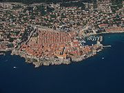
- DubrovnikDubrovnikDubrovnik is a Croatian city on the Adriatic Sea coast, positioned at the terminal end of the Isthmus of Dubrovnik. It is one of the most prominent tourist destinations on the Adriatic, a seaport and the centre of Dubrovnik-Neretva county. Its total population is 42,641...
has well-preserved city fortificationFortificationFortifications are military constructions and buildings designed for defence in warfare and military bases. Humans have constructed defensive works for many thousands of years, in a variety of increasingly complex designs...
s including towers, gate, rampart walk and two citadelCitadelA citadel is a fortress for protecting a town, sometimes incorporating a castle. The term derives from the same Latin root as the word "city", civis, meaning citizen....
s guarding the docks. Walls of DubrovnikWalls of DubrovnikThe Walls of Dubrovnik are a series of defensive stone walls that have surrounded and protected the citizens of the afterward proclaimed maritime city-state of Dubrovnik , situated in southern Croatia, since the city's founding prior to the 7th century as a Byzantium castrum on a rocky island...
are among the finest and most complete in Europe. - HvarHvar- Climate :The climate of Hvar is characterized by mild winters and warm summers. The yearly average air temperature is , 686 mm of precipitation fall on the town of Hvar on average every year and the town has a total of 2800 sunshine hours per year. For comparison Hvar has an average of 7.7...
- KorculaKorculaKorčula is an island in the Adriatic Sea, in the Dubrovnik-Neretva County of Croatia. The island has an area of ; long and on average wide — and lies just off the Dalmatian coast. Its 16,182 inhabitants make it the second most populous Adriatic island after Krk...
- KrkKrkKrk is a Croatian island in the northern Adriatic Sea, located near Rijeka in the Bay of Kvarner and part of the Primorje-Gorski Kotar county....
city walls which obtained their current appearance between the 12th and the 15th century but the town itself was fortified since Roman period - StonStonSton is a village and municipality in the Dubrovnik-Neretva County of Croatia, located at the south of isthmus of the Pelješac peninsula. The town of Ston is the center of the Ston municipality.- Demographics :...
: Walls of StonWalls of StonThe Walls of Ston are a series of defensive stone walls, originally more than long, that surrounded and protected the city of Ston, in Dalmatia, part of the Republic of Ragusa, in what is now southern Croatia....
were built in 14th-16th century, at the isthmus of the PelješacPelješacPelješac is a peninsula in southern Dalmatia in Croatia. The peninsula is part of the Dubrovnik-Neretva County and is the second largest peninsula in Croatia...
peninsula, to the north of Dubrovnik; 890 meters long town wall and 5 km Great Wall outside the town StonStonSton is a village and municipality in the Dubrovnik-Neretva County of Croatia, located at the south of isthmus of the Pelješac peninsula. The town of Ston is the center of the Ston municipality.- Demographics :...
. - KarlovacKarlovacKarlovac is a city and municipality in central Croatia. The city proper has a population of 49,082, while the municipality has a population of 59,395 inhabitants .Karlovac is the administrative centre of Karlovac County...
city walls, built in 1579 as a six-point star with bastions. - The town of SplitSplit (city)Split is a Mediterranean city on the eastern shores of the Adriatic Sea, centered around the ancient Roman Palace of the Emperor Diocletian and its wide port bay. With a population of 178,192 citizens, and a metropolitan area numbering up to 467,899, Split is by far the largest Dalmatian city and...
retains much of its ancient wall. - ZadarZadarZadar is a city in Croatia on the Adriatic Sea. It is the centre of Zadar county and the wider northern Dalmatian region. Population of the city is 75,082 citizens...
retains about half of its wall - GrožnjanGrožnjanGrožnjan is a settlement and municipality in Croatia. It is part of Croatia's Istria County, which takes up most of the Istria peninsula. It is also the only place in Croatia to have an Italian majority.-Early history:...
Cyprus
- FamagustaFamagustaFamagusta is a city on the east coast of Cyprus and is capital of the Famagusta District. It is located east of Nicosia, and possesses the deepest harbour of the island.-Name:...
has well preserved city fortifications - NicosiaNicosiaNicosia from , known locally as Lefkosia , is the capital and largest city in Cyprus, as well as its main business center. Nicosia is the only divided capital in the world, with the southern and the northern portions divided by a Green Line...
the heart of the city is enclosed by 16th century Venetian walls
Czech Republic
- BerounBerounBeroun is a town in the Central Bohemian Region of the Czech Republic. The town is part of the Prague metropolitan area. It is located 30 km southwest of Prague and has a population of 18,930 . It lies on the confluence of Berounka and Litavka rivers.Despite its small size, it is an...
- BrnoBrnoBrno by population and area is the second largest city in the Czech Republic, the largest Moravian city, and the historical capital city of the Margraviate of Moravia. Brno is the administrative centre of the South Moravian Region where it forms a separate district Brno-City District...
- ČáslavCáslavČáslav is a town in eastern part of Central Bohemian Region of the Czech Republic.- History :History of Čáslav begins after year 800 with founding of citadel and settlement called Hrádek. Near Hrádek, new town with huge square was founded by king Přemysl Otakar II in 1250...
- České BudějoviceCeské BudejoviceČeské Budějovice is a city in the Czech Republic. It is the largest city in the South Bohemian Region and is the political and commercial capital of the region and centre of the Roman Catholic Diocese of České Budějovice and of the University of South Bohemia and the Academy of Sciences...
- Český KrumlovČeský KrumlovČeský Krumlov is a small city in the South Bohemian Region of the Czech Republic, best known for the fine architecture and art of the historic old town and Český Krumlov Castle...
- Havlíčkův BrodHavlíckuv BrodHavlíčkův Brod , Německý Brod until 1945 is a town in the Vysočina Region of the Czech Republic. It is also the capital of the Havlíčkův Brod district. It is located on the Sázava River in the Bohemian-Moravian Highlands and has a population of 24,321 as of 2003...
- HoražďoviceHoraždoviceHoražďovice is a town in the Plzeň Region of the Czech Republic. It lies on the Otava River, some to the South-West from the region capital of Plzeň....
- JevíčkoJevíckoJevíčko is a town in Svitavy District, in the Pardubice Region of the Czech Republic. The town has a population of 2,900.-History:Jevíčko was part of the Great Moravian Empire in the 9th and early 10th century, and at various times was under the control of one or the other of Boskovice or Olomouc....
- JihlavaJihlavaJihlava is a city in the Czech Republic. Jihlava is a centre of the Vysočina Region, situated on the Jihlava river on the ancient frontier between Moravia and Bohemia, and is the oldest mining town in the Czech Republic, ca. 50 years older than Kutná Hora.Among the principal buildings are the...
- KadaňKadanKadaň , is a city in the Ústí nad Labem Region of the Czech Republic.The city lies on the banks of the river Ohře. Although it is situated in an industrial part of the Czech Republic there is no major industry within the city and people usually work in offices or have to commute. There are two...
- KouřimKourimKouřim is a small town in the Central Bohemian Region, Czech Republic. It is located 45 km east of Prague and has a population of 1,769 ....
- LoketLoketLoket is a town of some 3 000 inhabitants in the Sokolov District in the Karlovy Vary region of the Czech Republic.Loket means "elbow" in English. The town is named this due to the town centre being surrounded on three sides by the Ohře River, and the shape the river takes is similar to that of an...
- LounyLounyLouny is a town in the Ústí nad Labem Region of the Czech Republic. It is situated on the River Ohře.-History:The city was founded in the 12th century . The Church of St Peter stands on the site of the original fort...
- Nové Město nad MetujíNové Mesto nad MetujíNové Město nad Metují is a town in the Hradec Králové Region of the Czech Republic. It had 10049 inhabitants in January 2007. The Metuje River flows through the town.Nové Město nad Metují was founded by Jan Černčický of Kácov in 1501....
- NymburkNymburkNymburk is a city in the Central Bohemian Region of the Czech Republic, located 45 km east of Prague on the Elbe River. It is also home to the Czech men's basketball team ČEZ Basketball Nymburk...
- PísekPísekPísek is a town in the South Bohemian Region of the Czech Republic. It has a population of 29 909 .-About:Písek is usually called "The Athens of the South", although Athens is much more southerly, because it has many high schools and schools of higher education, e.g. the Film School in Písek...
- PoličkaPolickaPolička is a town on Bohemia-Moravia borderline in the Pardubice Region of the Czech Republic. It has cca 10,000 inhabitants. It is about 17 km west of Svitavy.- History :Polička was founded in the year 1265 by Bohemian king Přemysl Otakar II...
- PrachaticePrachaticePrachatice is a town in the South Bohemian Region, Czech Republic.-History:The town of Prachatice has its origins in the 11th century, following the beginning of trade on the "Golden Path"...
- PraguePraguePrague is the capital and largest city of the Czech Republic. Situated in the north-west of the country on the Vltava river, the city is home to about 1.3 million people, while its metropolitan area is estimated to have a population of over 2.3 million...
- ProstějovProstejovProstějov is a city in the Olomouc Region of the Czech Republic. Today the city is known for its fashion industry and special military forces based there....
- PřerovPrerovPřerov is a town in the Olomouc Region of the Czech Republic where the Bečva river flows through. Přerov is a statute town . It has population of about 47,373 to January 2, 2008. Přerov is about 22 km south west of Olomouc. In the past it was a major crossroad in the heart of Moravia in the...
- Strážnice
- TáborTáborTábor is a city of the Czech Republic, in the South Bohemian Region. It is named after Mount Tabor, which is believed by many to be the place of the Transfiguration of Christ; however, the name became popular and nowadays translates to "camp" or "encampment" in the Czech language.The town was...
- TachovTachovTachov is a town in the Pilsen Region of the Czech Republic. It lies on the Mže River, some to the west from the region capital of Pilsen....
- TřeboňTrebonTřeboň is a historical town in South Bohemian Region of Czech Republic. The population stands at 8,862 .-History:Třeboň was established around the middle of the 12th century. In 1366 the House of Rožmberk become owner of the estate...
- UničovUnicovUničov is a town in the Olomouc Region of the Czech Republic. It has around 12,400 inhabitants.Villages Benkov, Brníčko, Dětřichov, Dolní Sukolom, Horní Sukolom, Nová Dědina, Renoty, and Střelice are administrative parts of Uničov....
- ZnojmoZnojmoZnojmo is a city in the South Moravian Region of the Czech Republic, near the border with Lower Austria, connected to Vienna by railway and road . The royal city of Znojmo was founded shortly before 1226 by King Ottokar I on the plains in front of Znojmo Castle...
- ŽatecŽatecŽatec is an old town in the Czech Republic, in Louny District, Ústí nad Labem Region. It has a population of 19,813 .The earliest historical reference to Sacz is in the Latin chronicle of Thietmar of Merseburg of 1004. During the 11th century it belonged to the Vršovci - a powerful Czech...
Denmark
- FredericiaFredericiaFredericia is a town located in Fredericia municipality in the eastern part of the Jutland peninsula in Denmark, in a sub-region known locally as Trekanten, or The Triangle...
, extensive renaissance ramparts to the north and west of the city. - CopenhagenCopenhagenCopenhagen is the capital and largest city of Denmark, with an urban population of 1,199,224 and a metropolitan population of 1,930,260 . With the completion of the transnational Øresund Bridge in 2000, Copenhagen has become the centre of the increasingly integrating Øresund Region...
, extensive renaissance ramparts to the south and east, trace remains to the north and west, nice fort at the harbor mouth, three small island fortlets outside the harbor entrance.
Finland


- HaminaHaminaHamina is a town and a municipality of Finland. It is located in the province of Southern Finland and is part of the Kymenlaakso region. The town has a population of and covers an area of ofwhich is water. The population density is...
Surrounded by about 4–5 km long star-shaped walled fortification - SuomenlinnaSuomenlinnaSuomenlinna, until 1918 Viapori , or Sveaborg , is an inhabited sea fortress built on six islands , and which now forms part of the city of Helsinki, the capital of Finland.Suomenlinna is a UNESCO World Heritage site and popular with both tourists and locals, who...
An inhabited sea fortress off the coast of HelsinkiHelsinkiHelsinki is the capital and largest city in Finland. It is in the region of Uusimaa, located in southern Finland, on the shore of the Gulf of Finland, an arm of the Baltic Sea. The population of the city of Helsinki is , making it by far the most populous municipality in Finland. Helsinki is...
France
- Aigues-MortesAigues-MortesAigues-Mortes is a commune in the Gard department in southern France.The medieval city walls surrounding the city are well preserved.-History:...
- AngersAngersAngers is the main city in the Maine-et-Loire department in western France about south-west of Paris. Angers is located in the French region known by its pre-revolutionary, provincial name, Anjou, and its inhabitants are called Angevins....
- Roman wall partially extant - AngoulêmeAngoulême-Main sights:In place of its ancient fortifications, Angoulême is encircled by boulevards above the old city walls, known as the Remparts, from which fine views may be obtained in all directions. Within the town the streets are often narrow. Apart from the cathedral and the hôtel de ville, the...
- AntibesAntibesAntibes is a resort town in the Alpes-Maritimes department in southeastern France.It lies on the Mediterranean in the Côte d'Azur, located between Cannes and Nice. The town of Juan-les-Pins is within the commune of Antibes...
- ArlesArlesArles is a city and commune in the south of France, in the Bouches-du-Rhône department, of which it is a subprefecture, in the former province of Provence....
(partial remains) - AuxonneAuxonneAuxonne is a commune in the Côte-d'Or department in Bourgogne in eastern France.Auxonne is one of the sites of the defensive structures of Vauban, clearly seen from the train bridge as it enters the Auxonne SNCF train station on the Dijon - Besançon train line. It also was home to the Artillery...
- AvignonAvignonAvignon is a French commune in southeastern France in the départment of the Vaucluse bordered by the left bank of the Rhône river. Of the 94,787 inhabitants of the city on 1 January 2010, 12 000 live in the ancient town centre surrounded by its medieval ramparts.Often referred to as the...
- BerguesBerguesBergues is a commune in the Nord department in northern France.It is situated to the south of Dunkirk and from the Belgian border. Locally it is referred to as "the other Bruges in Flanders"...
- Boulogne-sur-MerBoulogne-sur-Mer-Road:* Metropolitan bus services are operated by the TCRB* Coach services to Calais and Dunkerque* A16 motorway-Rail:* The main railway station is Gare de Boulogne-Ville and located in the south of the city....
(complete enclosure of old town) - CaenCaenCaen is a commune in northwestern France. It is the prefecture of the Calvados department and the capital of the Basse-Normandie region. It is located inland from the English Channel....
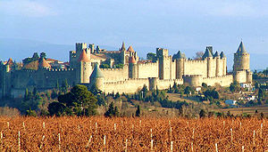
- CarcassonneCarcassonneCarcassonne is a fortified French town in the Aude department, of which it is the prefecture, in the former province of Languedoc.It is divided into the fortified Cité de Carcassonne and the more expansive lower city, the ville basse. Carcassone was founded by the Visigoths in the fifth century,...
- ConcarneauConcarneauConcarneau is a commune in the Finistère department of Brittany in north-western France.The town has two distinct areas: the modern town on the mainland and the medieval Ville Close, a walled town on a long island in the centre of the harbour. Historically, the old town was a centre of shipbuilding...
's old town (ville close) - DinanDinanDinan is a walled Breton town and a commune in the Côtes-d'Armor department in northwestern France.-Geography:Its geographical setting is exceptional. Instead of nestling on the valley floor like Morlaix, most urban development has been on the hillside, overlooking the river Rance...
(nearly complete ramparts with a large 14th century keep known as the Donjon de la duchesse Anne ) - GuérandeGuérandeThe medieval town of Guérande is located in the département of Loire-Atlantique in western France.The inhabitants are so called Guérandais, for men, and Guérandaise, for women....
(nearly complete ramparts with four fortified gates) - GravelinesGravelinesGravelines is a commune in the Nord department in northern France.It lies at the mouth of the river Aa 15 miles southwest of Dunkirk. There is a market in the town square on Saturdays. The "Arsenal" approached from the town square is home to an extensive and carefully displayed art collection....
- HennebontHennebontHennebont is a commune in the Morbihan department in the region of Brittany in north-western France.-Geography:Hennebont is situated about ten miles from the mouth of the River Blavet, which divides it into two parts: the Ville Close, the medieval walled town, and the 17th century Ville Neuve on...
's old town: (partial remains of ramparts and large fortified châtelet) - La CouvertoiradeLa CouvertoiradeLa Couvertoirade is a commune in the Aveyron department in southern France.-History and sites of interest:This well-preserved fortified town was owned by the Knights Templar, under orders from the Commandery of Sainte-Eulalie, from the twelfth century. The Templars built the fortress there during...
- La RochelleLa RochelleLa Rochelle is a city in western France and a seaport on the Bay of Biscay, a part of the Atlantic Ocean. It is the capital of the Charente-Maritime department.The city is connected to the Île de Ré by a bridge completed on 19 May 1988...
- LangresLangresLangres is a commune in north-eastern France. It is a subprefecture of the Haute-Marne département in the Champagne-Ardenne region.-History:As the capital of the Romanized Gallic tribe the Lingones, it was called Andematunnum, then Lingones, and now Langres.The town is built on a limestone...
- Le Château-d'OléronLe Château-d'OléronLe Château-d'Oléron is a commune located on the island of Oleron in the Charente-Maritime department in southwestern France.-Population:-References:*...
, renaissance city walls and nice-sized fortress - Le QuesnoyLe QuesnoyLe Quesnoy is a commune in the Nord department in northern France.Le Quesnoy's inhabitants are known as Quercitains.- Economy :The town of Le Quesnoy has somehow missed much of the Industrial Revolution. Unlike the neighboring towns of Valenciennes or Maubeuge, iron/steel works did not take hold...
- Montreuil, Pas-de-Calais
- MetzMetzMetz is a city in the northeast of France located at the confluence of the Moselle and the Seille rivers.Metz is the capital of the Lorraine region and prefecture of the Moselle department. Located near the tripoint along the junction of France, Germany, and Luxembourg, Metz forms a central place...
, defensive walls extending from 2nd BC until 20th AC, including partial remains of ancient Celtic and Gallo-Roman ramparts, HighHigh Middle AgesThe High Middle Ages was the period of European history around the 11th, 12th, and 13th centuries . The High Middle Ages were preceded by the Early Middle Ages and followed by the Late Middle Ages, which by convention end around 1500....
and LateLate Middle AgesThe Late Middle Ages was the period of European history generally comprising the 14th to the 16th century . The Late Middle Ages followed the High Middle Ages and preceded the onset of the early modern era ....
Medieval fortifications, Vauban and CormontaigneLouis de CormontaigneLouis de Cormontaigne was a French military engineer.He was the successor of Vauban. Together, they designed the fortifications of Metz....
citadel, Séré de RivièresRaymond Adolphe Séré de RivièresRaymond Adolphe Séré de Rivières was a French military engineer and general whose ideas revolutionized the design of fortifications in France. He gave his name to the Séré de Rivières system of fortifications constructed after the Franco-Prussian War of 1870...
system, and MaginotAndré MaginotAndré Maginot was a French civil servant, soldier, and Member of Parliament. He is undoubtedly best known for his advocacy for the string of forts that would be known as the Maginot Line.- Early years, to World War I :...
line. - NantesNantesNantes is a city in western France, located on the Loire River, from the Atlantic coast. The city is the 6th largest in France, while its metropolitan area ranks 8th with over 800,000 inhabitants....
- partial remains of medieval wall - Neuf-BrisachNeuf-BrisachNeuf-Brisach is a commune in the Haut-Rhin department in Alsace in north-eastern France.The town's name means New Breisach, referring to the German town Breisach, located on the other side of the Rhine....
- Obernai, some sections of ramparts remain.
- Paris
- PerougesPérougesPérouges is a commune in the Ain department in eastern France. It is a medieval walled town northeast of Lyon. It is perched on a small hill that overlooks the plain of the Ain River.-History:...
- RocamadourRocamadourRocamadour is a commune in the Lot department in south-western France. It lies in the former province of Quercy.Rocamadour has attracted visitors for its setting in a gorge above a tributary of the River Dordogne, and especially for its historical monuments and its sanctuary of the Blessed Virgin...
- Saint-Hippolyte, Haut-RhinSaint-Hippolyte, Haut-RhinSaint-Hippolyte is a commune in the Haut-Rhin department in Alsace in north-eastern France.It is often said to be the birthplace of the 8th century saint and abbot, Fulrad, who built a monastery there...
- Sarlat-la-CanédaSarlat-la-CanédaSarlat-la-Canéda , or simply Sarlat, is a commune in the Dordogne department in Aquitaine in southwestern France.Sarlat is one of the most attractive and alluring towns in southwestern France.-Geography:...
- VannesVannesVannes is a commune in the Morbihan department in Brittany in north-western France. It was founded over 2000 years ago.-Geography:Vannes is located on the Gulf of Morbihan at the mouth of two rivers, the Marle and the Vincin. It is around 100 km northwest of Nantes and 450 km south west...
- Villeneuve-sur-YonneVilleneuve-sur-YonneVilleneuve-sur-Yonne is a commune in the Yonne department in Burgundy in north-central France.It is surrounded by a partly intact wall, built during the 12th century, which was one of the 8 residences of the French kings.-Geography:...
- Viviers, ArdècheViviers, ArdècheViviers is a commune in the department of Ardèche in southern France.It is a small walled city situated on the right bank of the Rhône.-Population:-History:...
Georgia
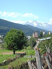
- MestiaMestiaMestia is a highland townlet in northwest Georgia, at an elevation of 1,500 meters in the Caucasus Mountains.-General information:According to the current administrative subdivision of Georgia, Mestia is located in the Samegrelo-Zemo Svaneti region , some 128 km northeast of the regional...
(The "SvanSvansThe Svans are a group of Georgians that mostly live in Svaneti, a region of Georgia speaking the Svan language. The self designated Svan is Mushüan, known to the ancient authors as Misimian.-History:...
towers".) - TushetiTushetiTusheti is a historic region in northeast Georgia.-Geography:Located on the northern slopes of the Greater Caucasus Mountains, Tusheti is bordered by the Russian republics of Chechnya and Dagestan to the north and east, respectively; and by the Georgian historic provinces Kakheti and...
Germany
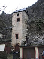
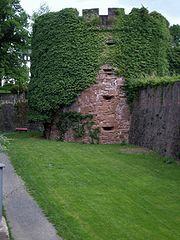
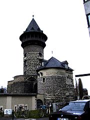
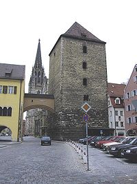

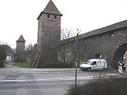
- AbensbergAbensbergAbensberg is a town in the Lower Bavarian district of Kelheim, in Bavaria, Germany, lying around 30 km southwest of Regensburg, 40 km east of Ingolstadt, 50 northwest of Landshut and 100 km north of Munich...
- AhrweilerAhrweilerAhrweiler is a district in the north of Rhineland-Palatinate, Germany. It is bounded by the districts Euskirchen, Rhein-Sieg and the city Bonn in the state North Rhine-Westphalia, and the districts of Neuwied, Mayen-Koblenz and Vulkaneifel.- History :The region was conquered by the Romans under...
- Annaberg-BuchholzAnnaberg-BuchholzAnnaberg-Buchholz is a town in the Free State of Saxony, Germany, in the Erzgebirge, capital of the district Erzgebirgskreis.The town is located in the Ore Mountains, at the side of the Pöhlberg . It has three Protestant churches, among them that of St...
- AmbergAmbergAmberg is a town in Bavaria, Germany. It is located in the Upper Palatinate, roughly halfway between Regensburg and Bayreuth. Population: 44,756 .- History :...
- AndernachAndernachAndernach is a town in the district of Mayen-Koblenz, in Rhineland-Palatinate, Germany, of currently about 30,000 inhabitants. It is situated towards the end of the Neuwied basin on the left bank of the Rhine between the former tiny fishing village of Fornich in the north and the mouth of the...
- Bad MünstereifelBad MünstereifelBad Münstereifel is a historical spa town in the district of Euskirchen, Germany, with about 19,000 inhabitants, situated in the far south of the German state of North Rhine-Westphalia...
- Bad Neustadt an der Saale
- BautzenBautzenBautzen is a hill-top town in eastern Saxony, Germany, and administrative centre of the eponymous district. It is located on the Spree River. As of 2008, its population is 41,161...
- BeilngriesBeilngriesBeilngries is a town in the district of Eichstätt, in Bavaria, Germany. It is situated on the river Altmühl and the Rhine-Main-Danube Canal, 30 km north of Ingolstadt....
- BerchingBerchingBerching is a town in the district of Neumarkt in Bavaria, Germany.Berching is a historical town with a fully preserved town wall and low streamlet. The first settlement was registered in 883, so that it is more than 1100 years old. is located in the district of Neumarkt in Bavaria, Germany. It is...
- BerlinBerlinBerlin is the capital city of Germany and is one of the 16 states of Germany. With a population of 3.45 million people, Berlin is Germany's largest city. It is the second most populous city proper and the seventh most populous urban area in the European Union...
had a defensive wall around the city from about 1250 until the mid-17th century, and a Customs WallBerlin Customs WallThe Berlin Customs Wall was a ring wall around the historic city of Berlin; the wall itself had no defence function but was used to facilitate the levying of taxes on the import and export of goods which was the primary income of many cities at the time.- History :The wall was erected...
from the mid-18th to the mid-19th century. The Berlin WallBerlin WallThe Berlin Wall was a barrier constructed by the German Democratic Republic starting on 13 August 1961, that completely cut off West Berlin from surrounding East Germany and from East Berlin...
that existed from 1961 to 1989 was claimed by the authorities of East Germany to be defensive, but in fact it was rather intended to prevent unauthorized emigrationEmigrationEmigration is the act of leaving one's country or region to settle in another. It is the same as immigration but from the perspective of the country of origin. Human movement before the establishment of political boundaries or within one state is termed migration. There are many reasons why people...
. - Bernau bei BerlinBernau bei BerlinBernau bei Berlin is a German town in the Barnim district. The town is located about northeast of Berlin.-History:...
- Blankenburg (Harz)
- BoppardBoppardBoppard is a town in the Rhein-Hunsrück-Kreis in Rhineland-Palatinate, Germany, lying in the Rhine Gorge, a UNESCO World Heritage Site. It belongs to no Verbandsgemeinde. The town is also a state-recognized tourism resort and is a winegrowing centre.-Location:Boppard lies on the upper Middle...
- BrandenburgBrandenburg (town)Brandenburg an der Havel is a town in the state of Brandenburg, Germany, with a population of 71,778 . It is located on the banks of the River Havel. The town of Brandenburg, which is almost as widely known as the state of Brandenburg, provided the name for the medieval Bishopric of Brandenburg,...
- Büdingen
- DarmstadtDarmstadtDarmstadt is a city in the Bundesland of Hesse in Germany, located in the southern part of the Rhine Main Area.The sandy soils in the Darmstadt area, ill-suited for agriculture in times before industrial fertilisation, prevented any larger settlement from developing, until the city became the seat...
- DettelbachDettelbachDettelbach is a town in the district of Kitzingen in the Regierungsbezirk Unterfranken in Bavaria, Germany. It is situated on the right bank of the Main, 17 km east of Würzburg, and 7 km north of Kitzingen....
- DinkelsbühlDinkelsbühlDinkelsbühl is a historic city in Bavaria, Germany and a former Free imperial city of the Holy Roman Empire. Now it belongs to the district of Ansbach, north of Aalen.-History:...
- DollnsteinDollnsteinDollnstein is a municipality in the district of Eichstätt in Bavaria in Germany. The Name Dollnstein has its origins in Middle High German "Tollunstein"....
- DonauwörthDonauwörthDonauwörth is a city in the German State of Bavaria , in the region of Swabia . It is said to have been founded by two fisherman where the Danube and Wörnitz rivers meet...
- DuisburgDuisburg- History :A legend recorded by Johannes Aventinus holds that Duisburg, was built by the eponymous Tuisto, mythical progenitor of Germans, ca. 2395 BC...
- EbernEbernEbern is a town in the Haßberge district, in Bavaria, Germany. It is situated 22 km southwest of Coburg and 23 km northwest of Bamberg.The population of Ebern is about 8,000 people. Its mayor is Robert Herrmann....
- Eberbach (Baden)Eberbach (Baden)Eberbach is a town in Germany, in northern Baden-Württemberg, located 33 km east of Heidelberg. It belongs to the Rhein-Neckar-Kreis. Its sister city is Ephrata, United States.- Location :...
- EibelstadtEibelstadtEibelstadt is a town in the district of Würzburg, in Bavaria, Germany.-Geography:Eibelstadt is situated among vineyards on the right bank of the Main, 10 km southeast of Würzburg.-History:...
- EichstättEichstättEichstätt is a town in the federal state of Bavaria, Germany, and capital of the District of Eichstätt. It is located along the Altmühl River, at , and had a population of 13,078 in 2002. It is home to the Katholische Universität Eichstätt-Ingolstadt, the lone Catholic university in Germany. The...
- FladungenFladungenFladungen is a town in the district Rhön-Grabfeld, in Bavaria, Germany. It is situated in the Rhön Mountains, 20 km west of Meiningen, and 33 km east of Fulda.-Twinnings: Kõo, Estonia Köyliö, Finland Nora, Sweden...
- ForchheimForchheim (Oberfranken)Forchheim is a large town in Upper Franconia in northern Bavaria, and also the seat of the administrative district of Forchheim. Forchheim is a former royal city, and is sometimes called the “Gateway to the Franconian Switzerland”, as the region is known. Its population, as of October 2008, was...
- FreibergFreiberg, SaxonyFreiberg is a city in the Free State of Saxony, Germany, administrative center of the Mittelsachsen district.-History:The city was founded in 1186, and has been a center of the mining industry in the Ore Mountains for centuries...
- Friedberg, BavariaFriedberg, BavariaFriedberg is a city in the district Aichach-Friedberg, Bavaria, Germany, with some 30,000 inhabitants. It is located next to Augsburg at the Lech river...
- FreinsheimFreinsheimFreinsheim is a town in the Bad Dürkheim district in Rhineland-Palatinate, Germany. With about 5,000 inhabitants, it is among the state’s smaller towns...
- FrickenhausenFrickenhausenFrickenhausen is a town in the district of Esslingen in Baden-Württemberg in Germany....
- FritzlarFritzlarFritzlar is a small German town in the Schwalm-Eder district in northern Hesse, north of Frankfurt, with a storied history. It can reasonably be argued that the town is the site where the Christianization of northern Germany began and the birthplace of the German empire as a political entity.The...
- GerolzhofenGerolzhofenGerolzhofen is a town in the district of Schweinfurt, Bavaria, Germany. The town is the former center of the district of Gerolzhofen and has about 7,000 inhabitants. The mayor of Gerolzhofen is Irmgard Krammer .-Twin towns:...
- GredingGredingGreding is a town in the district of Roth, in Bavaria, Germany. It is situated 28 km southeast of Roth bei Nürnberg and 32 km north of Ingolstadt.-Geography:Greding is located in the south-eastern corner of Middle Franconia...
- GunzenhausenGunzenhausenGunzenhausen is a town in the Weißenburg-Gunzenhausen district, in Bavaria, Germany. It is situated on the river Altmühl, 19 km northwest of Weißenburg in Bayern, and 45 km southwest of Nuremberg. Gunzenhausen is a nationally recognized recreation area. The city was mentioned first in the...
- Heidingsfeld, today part of WürzburgWürzburgWürzburg is a city in the region of Franconia which lies in the northern tip of Bavaria, Germany. Located at the Main River, it is the capital of the Regierungsbezirk Lower Franconia. The regional dialect is Franconian....
- HammelburgHammelburgHammelburg is a town in the district of Bad Kissingen, in Lower Franconia, Bavaria, Germany. It is situated on the river Franconian Saale, 25 km west of Schweinfurt...
- IngolstadtIngolstadtIngolstadt is a city in the Free State of Bavaria, in the Federal Republic of Germany. It is located along the banks of the Danube River, in the center of Bavaria. As at 31 March 2011, Ingolstadt had 125.407 residents...
- IphofenIphofenIphofen is a town in the district of Kitzingen, in Bavaria, Germany. It is situated 9 km southeast of Kitzingen along the Bundesstrasse 8....
- JenaJenaJena is a university city in central Germany on the river Saale. It has a population of approx. 103,000 and is the second largest city in the federal state of Thuringia, after Erfurt.-History:Jena was first mentioned in an 1182 document...
- Karlstadt am MainKarlstadt am MainKarlstadt is a town in the Main-Spessart district in the Regierungsbezirk of Lower Franconia in Bavaria, Germany. It is the Main-Spessart district seat ....
- KaufbeurenKaufbeurenKaufbeuren is an independent city in the Regierungsbezirk of Schwaben, southern Bavaria. The city is completely enclaved within the district of Ostallgäu.- Culture and Objects of Interest :* Townhall * Crescentiakloster...
- KorbachKorbachKorbach is the district seat of Waldeck-Frankenberg in northern Hesse, Germany. It is over a thousand years old and a former Hanseatic town. It is located on the German Framework Road.- Geography and geology :...
- KronachKronachKronach is a town in Oberfranken, Bavaria, Germany, located in the Frankenwald area. It is the capital of the district Kronach.Kronach is the birthtown of Lucas Cranach the Elder and Maximilian von Welsch, as well as Johann Kaspar Zeuss and Josef Stangl....
- Landsberg am LechLandsberg am LechLandsberg am Lech is a town in southwest Bavaria, Germany, about 65 kilometers west of Munich and 35 kilometers south of Augsburg. It is the capital of the district of Landsberg am Lech....
- LauingenLauingenLauingen is a town in the district of Dillingen in Bavaria, Germany. It is located on the left bank of the Danube, 5 km west of Dillingen, and 37 km northeast of Ulm.St. Albert the Great was born in Lauingen, c. 1200....
- Lohr am Main
- MainbernheimMainbernheimMainbernheim is a municipality 4 kilometers to the south of Kitzingen in the direction of Nürnberg, was first recorded in the chronicles of 889, during the reign of King Arnulf, the church being recognized by the influential bishopric of nearby Würzburg...
- MemmingenMemmingenMemmingen is a town in the Bavarian administrative region of Swabia in Germany. It is the central economic, educational and administrative centre in the Danube-Iller region. To the west the town is flanked by the Iller, the river that marks the Baden-Württemberg border...
- Merkendorf
- MiltenbergMiltenbergMiltenberg is the seat of the like-named district in the Regierungsbezirk of Lower Franconia in Bavaria, Germany.- Location :...
- MühlhausenMühlhausenMühlhausen is a city in the federal state of Thuringia, Germany. It is the capital of the Unstrut-Hainich district, and lies along the river Unstrut. Mühlhausen had c. 37,000 inhabitants in 2006.-History:...
- MünchebergMünchebergMüncheberg is a small town in Märkisch-Oderland, Germany approximately half-way between Berlin and the border with Poland.-Geography:Prior to 2003 the area today covered by Müncheberg was organized as the so-called "Amt Müncheberg"...
- MünnerstadtMünnerstadtMünnerstadt is a town in the district of Bad Kissingen in Bavaria, Germany. It borders with the towns of Burglauer, Bad Bocklet, Nüdlingen, Maßbach, Großbardorf, and Strahlungen. As of 2000 it has a population of 8,300, and covers an area of 95 km²....
- NabburgNabburgNabburg is a municipality in the district of Schwandorf, in Bavaria, Germany. It is situated on the river Naab, 23 km east of Amberg....
- NeubrandenburgNeubrandenburgNeubrandenburg is a city in Mecklenburg-Vorpommern, Germany. It is located in the southeastern part of the state, on the shore of a lake called the Tollensesee ....
- Neuburg an der DonauNeuburg an der DonauNeuburg an der Donau, literally Neuburg on the Danube River, is a town which is the capital of the Neuburg-Schrobenhausen district in the state of Bavaria in Germany.-Divisions:The municipality has 16 divisions:-History:...
- Neumarkt in der OberpfalzNeumarkt in der OberpfalzNeumarkt in der Oberpfalz is the capital of the Neumarkt district in the administrative region of the Upper Palatinate, in Bavaria, Germany. With a population of about 40,000, Neumarkt is the seat of various projects, and acts as the economic and cultural center of the western Upper Palatinate,...
- NördlingenNördlingenNördlingen is a town in the Donau-Ries district, in Bavaria, Germany, with a population of 20,000. It is located in the middle of a complex meteorite crater, called the Nördlinger Ries. The town was also the place of two battles during the Thirty Years' War...
- Nürnberg
- Obernburg am Main
- OberweselOberweselOberwesel is a town on the Middle Rhine in the Rhein-Hunsrück-Kreis in Rhineland-Palatinate, Germany. It belongs to the Verbandsgemeinde of Sankt Goar-Oberwesel, whose seat is in the town.-Location:...
- OchsenfurtOchsenfurtOchsenfurt is a town in the district of Würzburg, in Bavaria, Germany. It is situated on the left bank of the River Main, here crossed by a stone bridge, 13 miles south from Würzburg by the railway to Munich, and at the junction of a line to Röttingen. Pop. 11,600...
- Oettingen
- OldenburgOldenburgOldenburg is an independent city in Lower Saxony, Germany. It is situated in the western part of the state between the cities of Bremen and Groningen, Netherlands, at the Hunte river. It has a population of 160,279 which makes it the fourth biggest city in Lower Saxony after Hanover, Braunschweig...
- OrnbauOrnbauOrnbau is a walled city in the district of Ansbach, in Bavaria, Germany. It is situated on the river Altmühl, 15 km southeast of Ansbach.-Smallest City in Bavaria:Ornbau is the smallest city in the German state of Bavaria...
- PappenheimPappenheimPappenheim is a town in the Weißenburg-Gunzenhausen district, in Bavaria, Germany. It is situated on the river Altmühl, 11 km south of Weißenburg in Bayern.- Notable people :The architect and professor Eduard Mezger was born in Pappenheim....
- PotsdamPotsdamPotsdam is the capital city of the German federal state of Brandenburg and part of the Berlin/Brandenburg Metropolitan Region. It is situated on the River Havel, southwest of Berlin city centre....
- RostockRostockRostock -Early history:In the 11th century Polabian Slavs founded a settlement at the Warnow river called Roztoc ; the name Rostock is derived from that designation. The Danish king Valdemar I set the town aflame in 1161.Afterwards the place was settled by German traders...
- RöttingenRöttingenRöttingen is a town in the district of Würzburg, in Bavaria, Germany. It is situated 30 km south of Würzburg, and 15 km east of Bad Mergentheim.-Climate:...
- Rothenburg ob der TauberRothenburg ob der TauberRothenburg ob der Tauber is a town in the district of Ansbach of Mittelfranken , the Franconia region of Bavaria, Germany, well known for its well-preserved medieval old town, a destination for tourists from around the world. In the Middle Ages, it was an Imperial Free City...
- RottweilRottweilRottweil is a town in the south west of Germany and is the oldest town in the federal state of Baden-Württemberg.Located between the Black Forest and the Swabian Alb hills, Rottweil has about 25,000 inhabitants...
- Schongau, BavariaSchongau, BavariaSchongau is a small town in Bavaria, near the Alps. It is located along the Lech, between Landsberg am Lech and Füssen. It has about 12,000 inhabitants...
- SchweinfurtSchweinfurtSchweinfurt is a city in the Lower Franconia region of Bavaria in Germany on the right bank of the canalized Main, which is here spanned by several bridges, 27 km northeast of Würzburg.- History :...
- SeßlachSeßlachSeßlach is a town in the district of Coburg, in northern Bavaria, Germany. It is situated 12 km southwest of Coburg.Seßlach consists of 15 parts:-History:...
- SeligenstadtSeligenstadtSeligenstadt is a town in the Offenbach district in the Regierungsbezirk of Darmstadt in Hesse, Germany. Seligenstadt is one of Germany’s oldest towns and was already of great importance in Carolingian times.-Location:...
- SoestSoest, GermanySoest is a town in North Rhine-Westphalia, Germany. It is the capital of the Soest district. After Lippstadt, a neighbouring town, Soest is the second biggest town in its district.-Geography:...
- SömmerdaSömmerdaSömmerda is a town near Erfurt in Thuringia, Germany, on the Unstrut river. It is the capital of the district of Sömmerda.-History:Archeological digs in the area that is now Sömmerda, formerly Leubingen, have uncovered prominently buried human remains dating to around 2000 BCE...
- SommerhausenSommerhausenSommerhausen is a municipality in the district of Würzburg in Bavaria, Germany....
- StralsundStralsund- Main sights :* The Brick Gothic historic centre is a UNESCO World Heritage Site.* The heart of the old town is the Old Market Square , with the Gothic Town Hall . Behind the town hall stands the imposing Nikolaikirche , built in 1270-1360...
- Sulzfeld am MainSulzfeld am MainSulzfeld am Main is a municipality in the district of Kitzingen in Bavaria in Germany....
- TemplinTemplinTemplin is a small town in the Uckermark district of Brandenburg, Germany. Though it has a population of only 17,127 , it is with 377.01 km2 the second largest town in Brandenburg and the seventh largest town in Germany by area...
- TrierTrierTrier, historically called in English Treves is a city in Germany on the banks of the Moselle. It is the oldest city in Germany, founded in or before 16 BC....
, portions of the city walls still exist, but the size of the Roman gate, the "Porta NigraPorta NigraThe Porta Nigra is a large Roman city gate in Trier, Germany. It is today the largest Roman city gate north of the Alps and has been designated a World Heritage Site....
", gives evidence of the importance of the city. Other Roman remains include the baths, the Constantine BasilicaAula PalatinaThe Basilica of Constantine , or Aula Palatina, at Trier, Germany is a Roman palace basilica that was built by the emperor Constantine at the beginning of the 4th century....
, an amphitheater, and a 2nd century AD Roman bridgeRoman bridgeRoman bridges, built by ancient Romans, were the first large and lasting bridges built. Roman bridges were built with stone and had the arch as its basic structure....
. - Ulm an der DonauUlmUlm is a city in the federal German state of Baden-Württemberg, situated on the River Danube. The city, whose population is estimated at 120,000 , forms an urban district of its own and is the administrative seat of the Alb-Donau district. Ulm, founded around 850, is rich in history and...
- VellbergVellbergVellberg is a town in the district of Schwäbisch Hall, in Baden-Württemberg, Germany. It is located 10 km east of Schwäbisch Hall, and 15 km southwest of Crailsheim....
- VolkachVolkachVolkach is a town in the district of Kitzingen in the Regierungsbezirk Unterfranken in Bavaria. The town was founded in 906 AD.Volkach's main tourist attraction is its annual wine festival. Volkach's wine festival is the culminating festival for the entire Franken wine region.-External links:*...
- WarburgWarburgWarburg is a town in eastern North Rhine-Westphalia on the river Diemel near the three-state point shared by Hessen, Lower Saxony and North Rhine-Westphalia. It is in Höxter district and Detmold region...
(Westfalia) - WemdingWemdingWemding is a municipality in the Donau-Ries district of Bavaria, Germany. Botanist Leonhart Fuchs was born here in 1501.Wemding is home to the Time pyramid, a public art work begun in 1993 and scheduled to be completed in the year 3183....
- Weißenburg (Bavaria)
- WittstockWittstockWittstock is a town in the Ostprignitz-Ruppin district, in north-western Brandenburg, Germany. It is situated on the river Dosse, 20 km east of Pritzwalk, and 95 km northwest of Berlin. It was the location of the 1636 Battle of Wittstock between Sweden and an alliance of the Holy Roman...
- Wolframs-EschenbachWolframs-EschenbachWolframs-Eschenbach is a town in the district of Ansbach, in Bavaria, Germany. It is situated 14 km southeast of Ansbach, and 36 km southwest of Nuremberg....
- Worms, GermanyWorms, GermanyWorms is a city in Rhineland-Palatinate, Germany, on the Rhine River. At the end of 2004, it had 85,829 inhabitants.Established by the Celts, who called it Borbetomagus, Worms today remains embattled with the cities Trier and Cologne over the title of "Oldest City in Germany." Worms is the only...
- Wörth am MainWörth am MainWörth am Main is a town in the Miltenberg district in the Regierungsbezirk of Lower Franconia in Bavaria, Germany.- Location :...
- WürzburgWürzburgWürzburg is a city in the region of Franconia which lies in the northern tip of Bavaria, Germany. Located at the Main River, it is the capital of the Regierungsbezirk Lower Franconia. The regional dialect is Franconian....
- Zeil am MainZeil am MainZeil am Main is a town in the Haßberge district in Lower Franconia, an area in the federal state of Bavaria, Germany. It is situated on the right bank of the Main, 7 km east of Haßfurt, 24 km northwest of Bamberg, and 25 km east of Schweinfurt...
- ZerbstZerbstZerbst is a town in the district of Anhalt-Bitterfeld, in Saxony-Anhalt, Germany. Until the administrative reform of 2007, Zerbst was the capital of the Anhalt-Zerbst district. Since the 1 January 2010 local government reform, Zerbst has about 24,000 inhabitants.It is not clear when was it founded;...
- ZonsZonsZons, or Feste Zons is an old city in the Rhein-Kreis Neuss, Germany. It is now a part of the city of Dormagen since 1975. In 2006 its population was 5,405 .- History :...
- ZwickauZwickauZwickau in Germany, former seat of the government of the south-western region of the Free State of Saxony, belongs to an industrial and economical core region. Nowadays it is the capital city of the district of Zwickau...
Greece
- ChaniaChaniaChaniá , , also transliterated Chania, Hania, and Xania, older form Chanea and Venetian Canea, Ottoman Turkish خانيه Hanya) is the second largest city of Crete and the capital of the Chania peripheral unit...
- IoanninaIoanninaIoannina , often called Jannena within Greece, is the largest city of Epirus, north-western Greece, with a population of 70,203 . It lies at an elevation of approximately 500 meters above sea level, on the western shore of lake Pamvotis . It is located within the Ioannina municipality, and is the...
- Iraklion
- Monemvassia
- NafplionNafplionNafplio is a seaport town in the Peloponnese in Greece that has expanded up the hillsides near the north end of the Argolic Gulf. The town was the first capital of modern Greece, from the start of the Greek Revolution in 1821 until 1834. Nafplio is now the capital of the peripheral unit of...
- RhodesRhodesRhodes is an island in Greece, located in the eastern Aegean Sea. It is the largest of the Dodecanese islands in terms of both land area and population, with a population of 117,007, and also the island group's historical capital. Administratively the island forms a separate municipality within...
- ThessalonikiThessalonikiThessaloniki , historically also known as Thessalonica, Salonika or Salonica, is the second-largest city in Greece and the capital of the region of Central Macedonia as well as the capital of the Decentralized Administration of Macedonia and Thrace...
- Corfu (city)Corfu (city)Corfu is a city and a former municipality on the island of Corfu, Ionian Islands, Greece. Since the 2011 local government reform, it is part of the municipality Corfu, of which it is a municipal unit. It is the capital of the island and of the Corfu regional unit. The city also serves as a capital...
Hungary
- BudaBudaFor detailed information see: History of Buda CastleBuda is the western part of the Hungarian capital Budapest on the west bank of the Danube. The name Buda takes its name from the name of Bleda the Hun ruler, whose name is also Buda in Hungarian.Buda comprises about one-third of Budapest's...
- the Castle Hill is surrounded by preserved medieval and early modern fortifications. Only a short section survived from the walls of the Víziváros neighbourhood. - Pest - segments of the 15th century city walls are preserved inside the courtyards of later houses.
- SopronSopronIn 1910 Sopron had 33,932 inhabitants . Religions: 64.1% Roman Catholic, 27.8% Lutheran, 6.6% Jewish, 1.2% Calvinist, 0.3% other. In 2001 the city had 56,125 inhabitants...
- medieval circle of walls partly built on ancient Roman foundations - PécsPécsPécs is the fifth largest city of Hungary, located on the slopes of the Mecsek mountains in the south-west of the country, close to its border with Croatia. It is the administrative and economical centre of Baranya county...
- long sections of the medieval walls are preserved and freed to later intrusions. - VeszprémVeszprémVeszprém is one of the oldest urban areas in Hungary, and a city with county rights. It lies approximately north of the Lake Balaton. It is the administrative center of the county of the same name.-Location:...
- walled old town on Castle Hill - SzékesfehérvárSzékesfehérvárSzékesfehérvár is a city in central Hungary and is the 9th largest in the country. Located around southwest of Budapest. It is inhabited by 101,973 people , with 136,995 in the Székesfehérvár Subregion. The city is the centre of Fejér county and the regional centre of Central Transdanubia...
- long sections of the medieval walls are preserved - SárospatakSárospatak----Sárospatak is a town in Borsod-Abaúj-Zemplén county, northern Hungary. It lies northeast from Miskolc, in the Bodrog river valley. The town, often called simply Patak, is an important cultural centre.- History :The area has been inhabited since ancient times...
- VácVácVác is a town in Pest county in Hungary with approximately 35,000 inhabitants. The archaic spellings of the name are Vacz and Vacs.-Location:...
- some segments and one tower preserved - EgerEgerEger is the second largest city in Northern Hungary, the county seat of Heves, east of the Mátra Mountains. Eger is best known for its castle, thermal baths, historic buildings , and red and white wines.- Name :...
- some segments preserved, mostly demolished - GyőrGyor-Climate:-Main sights:The ancient core of the city is Káptalan Hill at the confluence of three rivers: the Danube, Rába and Rábca. Püspökvár, the residence of Győr’s bishops can be easily recognised by its incomplete tower. Győr’s oldest buildings are the 13th-century dwelling tower and the...
- the walls were demolished in the 19th century but segments are preserved - MosonmagyaróvárMosonmagyaróvárMosonmagyaróvár is a city in Győr-Moson-Sopron county in northwestern Hungary. It lies close to both the Austrian and Slovakian borders and has a population of 30,200 ....
- the walls were demolished in the 1820s
Ireland
- AthenryAthenryAthenry is a town in County Galway, Ireland. It lies east of Galway city, and one of the attractions of the town is its medieval castle. The town is also well-known by virtue of the song "The Fields of Athenry".-History:...
- Athlone
- CarlingfordCarlingford, County LouthCarlingford is a coastal town and townland in northern County Louth, Ireland. It is situated between Carlingford Lough and Slieve Foy, sometimes known as Carlingford Mountain...
- CashelCashel, County TipperaryCashel is a town in South Tipperary in Ireland. Its population was 2936 at the 2006 census. The town gives its name to the ecclesiastical province of Cashel. Additionally, the cathedra of the Roman Catholic Archdiocese of Cashel and Emly was originally in the town prior to the English Reformation....
- ClonmelClonmelClonmel is the county town of South Tipperary in Ireland. It is the largest town in the county. While the borough had a population of 15,482 in 2006, another 17,008 people were in the rural hinterland. The town is noted in Irish history for its resistance to the Cromwellian army which sacked both...
- CorkCork (city)Cork is the second largest city in the Republic of Ireland and the island of Ireland's third most populous city. It is the principal city and administrative centre of County Cork and the largest city in the province of Munster. Cork has a population of 119,418, while the addition of the suburban...
- DerryDerryDerry or Londonderry is the second-biggest city in Northern Ireland and the fourth-biggest city on the island of Ireland. The name Derry is an anglicisation of the Irish name Doire or Doire Cholmcille meaning "oak-wood of Colmcille"...
- DroghedaDroghedaDrogheda is an industrial and port town in County Louth on the east coast of Ireland, 56 km north of Dublin. It is the last bridging point on the River Boyne before it enters the Irish Sea....
- Fethard, County TipperaryFethard, County TipperaryFethard is a village in South Tipperary in Ireland. It is located east of Cashel on the Clashawley River where the R692, R689 and R706 regional roads intersect. It is in the barony of Middle Third, and is also a parish in the Roman Catholic Archdiocese of Cashel and Emly...
- GalwayGalwayGalway or City of Galway is a city in County Galway, Republic of Ireland. It is the sixth largest and the fastest-growing city in Ireland. It is also the third largest city within the Republic and the only city in the Province of Connacht. Located on the west coast of Ireland, it sits on the...
- KilkennyKilkennyKilkenny is a city and is the county town of the eponymous County Kilkenny in Ireland. It is situated on both banks of the River Nore in the province of Leinster, in the south-east of Ireland...
- KilmallockKilmallockKilmallock or Kilmalloc is a town in south County Limerick, Ireland, near the border with County Cork. There is a Dominican Priory in the town and King's Castle . The remains of medieval walls which encircled the settlement are still visible. The Dublin–Cork railway line passes by the town,...
- LimerickLimerickLimerick is the third largest city in the Republic of Ireland, and the principal city of County Limerick and Ireland's Mid-West Region. It is the fifth most populous city in all of Ireland. When taking the extra-municipal suburbs into account, Limerick is the third largest conurbation in the...
- New RossNew RossNew Ross is a town located in southwest County Wexford, in the southeast of Ireland. In 2006 it had a population of 7,709 people, making it the third largest town in the county after Wexford and Enniscorthy.-History:...
- TrimTrim, County MeathTrim is the traditional county town of County Meath in Ireland, although the county town is now Navan. The town was recorded in the 2006 census to have a population of 6,870....
- WaterfordWaterfordWaterford is a city in the South-East Region of Ireland. It is the oldest city in the country and fifth largest by population. Waterford City Council is the local government authority for the city and its immediate hinterland...
- WexfordWexfordWexford is the county town of County Wexford, Ireland. It is situated near the southeastern corner of Ireland, close to Rosslare Europort. The town is connected to Dublin via the M11/N11 National Primary Route, and the national rail network...
- YoughalYoughalYoughal is a town in County Cork, Ireland. Sitting on the estuary of the River Blackwater, in the past it was militarily and economically important. Being built on the edge of a steep riverbank, the town has a distinctive long and narrow layout...
in County CorkCounty CorkCounty Cork is a county in Ireland. It is located in the South-West Region and is also part of the province of Munster. It is named after the city of Cork . Cork County Council is the local authority for the county...
still retains part of the town walls.
Italy
- AostaAostaAosta is the principal city of the bilingual Aosta Valley in the Italian Alps, north-northwest of Turin. It is situated near the Italian entrance of the Mont Blanc Tunnel, at the confluence of the Buthier and the Dora Baltea, and at the junction of the Great and Little St. Bernard routes...
's Roman walls are still preserved almost in their entirety - BergamoBergamoBergamo is a town and comune in Lombardy, Italy, about 40 km northeast of Milan. The comune is home to over 120,000 inhabitants. It is served by the Orio al Serio Airport, which also serves the Province of Bergamo, and to a lesser extent the metropolitan area of Milan...
surrounding hill of the old city - BolognaBolognaBologna is the capital city of Emilia-Romagna, in the Po Valley of Northern Italy. The city lies between the Po River and the Apennine Mountains, more specifically, between the Reno River and the Savena River. Bologna is a lively and cosmopolitan Italian college city, with spectacular history,...
- Castelfranco VenetoCastelfranco VenetoCastelfranco Veneto is a town and comune of Veneto, northern Italy, in the province of Treviso, 30 km by rail from the town of Treviso. It is approximately 40 km inland from Venice.-History:...
- Castiglion FiorentinoCastiglion FiorentinoCastiglion Fiorentino is a small, walled city in eastern Tuscany, Italy, in the province of Arezzo, between the cities of Arezzo and Cortona. It is well known for its annual festivals and Etruscan archeological site.-Geography:...
- CittadellaCittadellaCittadella is a medieval walled city in the province of Padua, northern Italy, founded in the thirteenth century as a military outpost of Padua. The surrounding wall has been restored and is 1461 m in circumference with a diameter of around 450 m. There are four gates which roughly...
- FerraraFerraraFerrara is a city and comune in Emilia-Romagna, northern Italy, capital city of the Province of Ferrara. It is situated 50 km north-northeast of Bologna, on the Po di Volano, a branch channel of the main stream of the Po River, located 5 km north...
- FlorenceFlorenceFlorence is the capital city of the Italian region of Tuscany and of the province of Florence. It is the most populous city in Tuscany, with approximately 370,000 inhabitants, expanding to over 1.5 million in the metropolitan area....
- GenoaGenoaGenoa |Ligurian]] Zena ; Latin and, archaically, English Genua) is a city and an important seaport in northern Italy, the capital of the Province of Genoa and of the region of Liguria....
has partial fortifications still standing - GlurnsGlurnsGlurns is a comune in South Tyrol in the Italian region Trentino-Alto Adige/Südtirol, located about 80 km northwest of Trento and about 60 km northwest of Bolzano ....
Glorenza in Italian - GradaraGradaraGradara is a town and comune in the province of Pesaro and Urbino, in the region of Marche in central Italy. It is located 25 km from Rimini and 13 km from Pesaro....
- JesiJesithumb|250px|Teatro Pergolesi.Iesi is a town and comune of the province of Ancona in the Marche, Italy.It is an important industrial and artistic center in the floodplain on the left bank of the Esino river before its mouth on the Adriatic Sea.-History:Iesi was one of the last towns of the Umbri...
- LuccaLuccaLucca is a city and comune in Tuscany, central Italy, situated on the river Serchio in a fertile plainnear the Tyrrhenian Sea. It is the capital city of the Province of Lucca...
- MacerataMacerataMacerata is a city and comune in central Italy, the capital of the province of Macerata in the Marche region.The historical city center is located on a hill between the Chienti and Potenza rivers. It consisted of the Picenes city named Ricina, then, after the romanization, Recina and Helvia Recina...
- MontagnanaMontagnanaMontagnana is a town and comune in the province of Padova, in Veneto . It is bounded by other communes of Saletto, Megliadino San Fidenzio, Casale di Scodosia, Urbana, Bevilacqua, Pojana Maggiore and Noventa Vicentina...
- NorciaNorciaNorcia is a town and comune in the province of Perugia in southeastern Umbria, located in a wide plain abutting the Monti Sibillini, a subrange of the Apennines with some of its highest peaks, near the Sordo River, a small stream that eventually flows into the Nera...
- Padova
- PalmanovaPalmanovaPalmanova is a town and comune in northeastern Italy, close to the border with Slovenia. It is located 20 km from Udine, 28 km from Gorizia and 55 km from Trieste near the junction of the Autostrada Alpe-Adria and the Autostrada Venezia-Trieste .Palmanova is famous for its fortress...
has fortress plan and structure, called a star fort it is a nine pointed citadel - PiacenzaPiacenzaPiacenza is a city and comune in the Emilia-Romagna region of northern Italy. It is the capital of the province of Piacenza...
has large sections of its Renaissance walls still standing - PisaPisaPisa is a city in Tuscany, Central Italy, on the right bank of the mouth of the River Arno on the Tyrrhenian Sea. It is the capital city of the Province of Pisa...
- PratoPratoPrato is a city and comune in Tuscany, Italy, the capital of the Province of Prato. The city is situated at the foot of Monte Retaia , the last peak in the Calvana chain. The lowest altitude in the comune is 32 m, near the Cascine di Tavola, and the highest is the peak of Monte Cantagrillo...
- RomeRomeRome is the capital of Italy and the country's largest and most populated city and comune, with over 2.7 million residents in . The city is located in the central-western portion of the Italian Peninsula, on the Tiber River within the Lazio region of Italy.Rome's history spans two and a half...
has wallsAurelian WallsThe Aurelian Walls is a line of city walls built between 271 and 275 in Rome, Italy, during the reign of the Roman Emperors Aurelian and Probus....
since the Roman EmpireRoman EmpireThe Roman Empire was the post-Republican period of the ancient Roman civilization, characterised by an autocratic form of government and large territorial holdings in Europe and around the Mediterranean.... - SienaSienaSiena is a city in Tuscany, Italy. It is the capital of the province of Siena.The historic centre of Siena has been declared by UNESCO a World Heritage Site. It is one of the nation's most visited tourist attractions, with over 163,000 international arrivals in 2008...
- TuscaniaTuscaniaTuscania is a town and comune in the province of Viterbo, Lazio Region, Italy. Until the late 19th century the town was known as Toscanella.-Ancient times:...
- VeronaVeronaVerona ; German Bern, Dietrichsbern or Welschbern) is a city in the Veneto, northern Italy, with approx. 265,000 inhabitants and one of the seven chef-lieus of the region. It is the second largest city municipality in the region and the third of North-Eastern Italy. The metropolitan area of Verona...
- Vaste
Latvia
- RigaRigaRiga is the capital and largest city of Latvia. With 702,891 inhabitants Riga is the largest city of the Baltic states, one of the largest cities in Northern Europe and home to more than one third of Latvia's population. The city is an important seaport and a major industrial, commercial,...
(only the Powder Tower still stands) - CēsisCesisCēsis , is a town in Latvia located in the northern part of the Central Vidzeme Upland. Cēsis is on the Gauja River valley, and is built on a series of ridges above the river overlooking the woods below...
(see Cēsis Castle) - DaugavpilsDaugavpils fortressDaugavpils Fortress, also known as Dinaburg Fortress, is a fortress in Daugavpils, Latvia. It is the only early 19th century military fortification of its kind in Northern Europe that has been preserved without significant alterations...
Fortress (Not a true walled city, but a huge fortress with buildings)
Lithuania
- VilniusVilnius city wallthumb|Vilnius city wall in the 16th centuryThe Vilnius city wall was a defensive wall around Vilnius, capital city of the Grand Duchy of Lithuania. It was built between 1503 and 1522 for protection from the attacks by the Crimean Khanate at the beginning of the Muscovite–Lithuanian Wars...
(Can be seen in some places) - KaunasKaunasKaunas is the second-largest city in Lithuania and has historically been a leading centre of Lithuanian economic, academic, and cultural life. Kaunas was the biggest city and the center of a powiat in Trakai Voivodeship of the Grand Duchy of Lithuania since 1413. During Russian Empire occupation...
(Partially built)
Malta
- Cospicua, "Città Cottonera"CospicuaĊittà Cottonera, Ċittà Cospicua, Cospicua is a double-fortified harbour city on the Mediterranean island of Malta. It is the largest of the Three Cities. It was also given a title as Citta' Cottonera, but erroneously the title is now used to define the whole region...
- VallettaVallettaValletta is the capital of Malta, colloquially known as Il-Belt in Maltese. It is located in the central-eastern portion of the island of Malta, and the historical city has a population of 6,098. The name "Valletta" is traditionally reserved for the historic walled citadel that serves as Malta's...
- Mdina, "Città Notabile"MdinaMdina, Città Vecchia, or Città Notabile, is the old capital of Malta. Mdina is a medieval walled town situated on a hill in the centre of the island. Punic remains uncovered beyond the city’s walls suggest the importance of the general region to Malta’s Phoenician settlers. Mdina is commonly...
- The Citadel, (Victoria, Gozo)Victoria, MaltaVictoria or Città Victoria is the capital of Gozo, an island of the Maltese archipelago in the Mediterranean Sea. The town has a total population of 6,414 , and by population is the largest locality in Gozo....
- Birgu, "Città Vittoriosa"BirguBirgu is an ancient city in Malta. It played a vital role in the Siege of Malta in 1565. Its population stood at 2,633 in December 2008.-History:...
- Senglea, "Città Invicta"SengleaSenglea is a fortified city in the east of Malta, mainly in the Grand Harbour area. It is one of the Three Cities in the east of Malta, the other two being Cospicua and Vittoriosa. The city of Senglea is also called Civitas Invicta, because it managed to resist the Ottoman invasion at the Great...
Montenegro
- KotorKotorKotor is a coastal city in Montenegro. It is located in a secluded part of the Gulf of Kotor. The city has a population of 13,510 and is the administrative center of the municipality....
- BarBar, MontenegroBar is a coastal town in Montenegro. It has a population of 17,727...
- BudvaBudvaBudva is a coastal town in Montenegro. It has around 15,000 inhabitants, and it is the centre of municipality...
- Herceg NoviHerceg NoviHerceg Novi is a coastal town in Montenegro located at the entrance to the Bay of Kotor and at the foot of Mount Orjen. It is the administrative center of the Herceg Novi Municipality with around 33,000 inhabitants...
- PodgoricaPodgoricaPodgorica , is the capital and largest city of Montenegro.Podgorica's favourable position at the confluence of the Ribnica and Morača rivers and the meeting point of the fertile Zeta Plain and Bjelopavlići Valley has encouraged settlement...
- Sveti StefanSveti StefanSveti Stefan, , now Aman Sveti Stefan including the Villa Miločer is a small islet and hotel and resort in Montenegro, approximately southeast of Budva. The resort includes the islet of Sveti Stefan and part of the mainland, where the Villa Miločer part of the resort is located...
- UlcinjUlcinjUlcinj is a coastal resort town and municipality in Montenegro. The town of Ulcinj has a population of 10,828 of which the majority are Albanians...
Netherlands
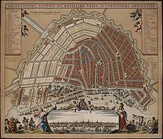
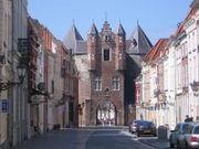
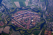
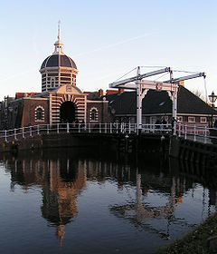
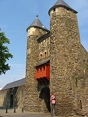
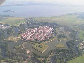
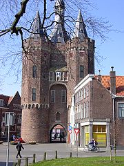
2: Sizable parts of the fortifications remain intact
3: (Parts of the) walls and moats are preserved as parks
4: One or more individual structures (Bastions, gates, towers, etc.) remain.
5: Location of the fortifications can be traced in the street plan or location of (former) moats
6: No trace remains
7: The fortifications were reconstructed in recent times
- 's-Hertogenbosch 2
- AardenburgAardenburgAardenburg is a small city close to the Dutch border with Belgium. It is part of the Sluis Municipality, located in the province of Zeeland in the Netherlands...
6 - AmersfoortAmersfoortAmersfoort is a municipality and the second largest city of the province of Utrecht in central Netherlands. The city is growing quickly but has a well-preserved and protected medieval centre. Amersfoort is one of the largest railway junctions in the country, because of its location on two of the...
4 - AmsterdamAmsterdamAmsterdam is the largest city and the capital of the Netherlands. The current position of Amsterdam as capital city of the Kingdom of the Netherlands is governed by the constitution of August 24, 1815 and its successors. Amsterdam has a population of 783,364 within city limits, an urban population...
4, 5 - ArnhemArnhemArnhem is a city and municipality, situated in the eastern part of the Netherlands. It is the capital of the province of Gelderland and located near the river Nederrijn as well as near the St. Jansbeek, which was the source of the city's development. Arnhem has 146,095 residents as one of the...
4, 5 - AsperenAsperenAsperen is a village in the Dutch province of Gelderland. It is a part of the municipality of Lingewaal, and lies about 10 km east of Gorinchem on the river Linge. It received city rights in 1313....
4, 5 - AxelAxel (Netherlands)Axel is a town in the Dutch province of Zeeland. It is a part of the municipality of Terneuzen, and lies about 31 km southeast of Vlissingen. It received city rights in 1213.In 2001, the town of Axel had 7421 inhabitants...
6 - BatenburgBatenburgBatenburg is a village in the municipality of Wijchen, in the Dutch province of Gelderland. It is located on the Meuse, about 15 km west of Nijmegen...
5 - Bergen op ZoomBergen op ZoomBergen op Zoom is a municipality and a city located in the south of the Netherlands.-History:Bergen op Zoom was granted city status probably in 1266. In 1287 the city and its surroundings became a lordship as it was separated from the lordship of Breda. The lordship was elevated to a margraviate...
4 - BiervlietBiervlietBiervliet is a town in the Dutch province of Zeeland. It is a part of the municipality of Terneuzen, and lies about 16 km South of Vlissingen.Biervliet received city rights in 1183. It is originally a fishing village...
5 - BolswardBolswardBolsward is a city in Súdwest Fryslân in the province of Friesland, the Netherlands. Bolsward is just short of a population of 10,000.- History :The town is founded on three artificial dwelling hills, of which the first was built some time before Christ....
5 - Bourtange 1, 7
- BredaBredaBreda is a municipality and a city in the southern part of the Netherlands. The name Breda derived from brede Aa and refers to the confluence of the rivers Mark and Aa. As a fortified city, the city was of strategic military and political significance...
4, 5 - BredevoortBredevoortBredevoort or Brevoort is a small city with Town privileges of about 1600 inhabitants, located in the municipality of Aalten, Netherlands. It is situated between the towns of Aalten and Winterswijk....
3, 5 - BrielleBrielleBrielle , also called Den Briel is a town and municipality in the western Netherlands, in the province of South Holland, on the north side of the island of Voorne-Putten, at the mouth of the New Maas. The municipality covers an area of 31.12 km² of which 3.63 km² is water...
1 - BrouwershavenBrouwershavenBrouwershaven is a small city on the Grevelingen in the Dutch province of Zeeland. It is a part of the municipality of Schouwen-Duiveland, and lies about 45 km southwest of Hellevoetsluis.Brouwershaven received city rights in 1477....
2, 3 - BurenBurenBuren is a municipality and a city in the eastern Netherlands. It is also a county; with the Dutch Monarch still holding the title "Count of Buren".- Population centres :...
4, 5 - CulemborgCulemborgCulemborg is a municipality and a city in the centre of the Netherlands. The city is situated just south of the Lek River...
4, 5 - DeldenDeldenDelden is a city in the Dutch province of Overijssel and, since 2001, in the municipality of Hof van Twente.Although its population is small, it gained city rights in 1333. Castle Twickel is a famous landmark near Delden and the Baron van Heeckeren of Twickel built a watertower in Delden...
5 - DelftDelftDelft is a city and municipality in the province of South Holland , the Netherlands. It is located between Rotterdam and The Hague....
4, 5 - DoesburgDoesburgDoesburg Doesburg Doesburg (Dutch is a municipality and a city in the eastern Netherlands in the province of Gelderland. Doesburg received city rights in 1237 and currently has 11,602 inhabitants (1 January 2007, source: CBS). The city is situated on the right bank of river IJssel, at the...
2, 3 - DokkumDokkumDokkum is a Dutch fortified town in the municipality of Dongeradeel in the province of Friesland. It has 13,145 inhabitants . The fortifications of Dokkum are well preserved and are known as the bolwerken . - History :...
1 - DoetinchemDoetinchemDoetinchem is a city and municipality in the east of the Netherlands. It is situated along the Oude IJssel river in a part of the province of Gelderland called the Achterhoek . The municipality has 56,700 inhabitants and has an area of 79.66 km²...
5 - DordrechtDordrechtDordrecht , colloquially Dordt, historically in English named Dort, is a city and municipality in the western Netherlands, located in the province of South Holland. It is the fourth largest city of the province, having a population of 118,601 in 2009...
5 - Eindhoven 6
- ElburgElburgElburg is a municipality and a city in the province of Gelderland, Netherlands.-History:There is evidence of a Neolithic settlement at Elburg consisting of stone tools and pottery shards....
2, 4 - FranekerFranekerFraneker is one of the eleven historical cities of Friesland and capital of the municipality of Franekeradeel. It is located about 20 km west of Leeuwarden on the Van Harinxma Canal. As of 1 January 2006, it had 12,996 inhabitants. The city is famous for the Eisinga Planetarium from around...
5 - GennepGennepGennep is a municipality and a city in the southeastern Netherlands.- Population centres :Aaldonk, Dam, De Looi, Diekendaal, Gennep, Heijen, Hekkens, Milsbeek, Ottersum, Smele, Ven-Zelderheide and Zelder.- The city of Gennep :...
4 - GeertruidenbergGeertruidenbergGeertruidenberg is a city and municipality in the province North Brabant in the south of the Netherlands. The city, named after Saint Gertrude of Nivelles, received city rights in 1213 from the count of Holland. The fortified city prospered until the 15th century.Today, the municipality of...
2 - GoesGoesGoes is a municipality and a city in the southwestern Netherlands in Zuid-Beveland, in the province Zeeland. The city of Goes has approximately 27,000 residents.-History of Goes:...
5 - GorinchemGorinchemGorinchem , also called Gorkum , is a city and municipality in the western Netherlands, in the province of South Holland. The municipality covers an area of 21.99 km² of which 3.03 km² is water...
1 - GoudaGoudaGouda is a city and municipality in the western Netherlands, in the province of South Holland. Gouda, which was granted city rights in 1272, is famous for its Gouda cheese, smoking pipes, and 15th-century city hall....
5 - Grave 5
- GroenloGroenloGroenlo is a city in the municipality of Oost Gelre, situated in the eastern part of the Netherlands on the German border, a region in the province of Gelderland called the Achterhoek . Groenlo was a municipality until January 1, 2005, when it merged with Lichtenvoorde. Until May 19 2006 Groenlo...
3, 4, 5, 7 - Groningen 3, 5
- HaarlemHaarlemHaarlem is a municipality and a city in the Netherlands. It is the capital of the province of North Holland, the northern half of Holland, which at one time was the most powerful of the seven provinces of the Dutch Republic...
4, 5 - HarderwijkHarderwijk' is a municipality and a small city in the eastern Netherlands.- The history of Harderwijk :Harderwijk received city rights from Count Otto II of Guelders in 1231. A defensive wall surrounding the city was completed by the end of that century. The oldest part of the city is near where the...
3, 4, 5 - HarlingenHarlingen, NetherlandsHarlingen is a municipality and a city in the northern Netherlands, in the province of Friesland at the Wadden Sea. Harlingen is an old town with a long history of fishing and shipping....
3, 5 - HasseltHasseltHasselt is a Belgian city and municipality, and capital of the Flemish province of Limburg...
3 - HattemHattemHattem is a municipality and a city in the eastern Netherlands. The city population is 11,797. The name “Hattem” is a typical farmyard name. The exact origin of “Hattem” is yet unclear. In general two explanation exist. Hattem would be the ‘heem’ of a people who belong to the tribe of Chattuarii...
4, 5 - HellevoetsluisHellevoetsluisHellevoetsluis is a small city and municipality on Voorne-Putten Island in the western Netherlands, in the province of South Holland...
1 - HelmondHelmondHelmond is a municipality and a city in the province of North Brabant in the southern Netherlands.- Quarters and Neighbourhoods :*Quarter 11 Inner City**Neighbourhood 0 Centrum**Neighbourhood 2 Leonardus**Neighbourhood 3 Heipoort...
6 - HeukelumHeukelumHeukelum is a town in the Dutch province of Gelderland. It is a part of the municipality of Lingewaal, and lies about 8 km northeast of Gorinchem. It received city rights in 1391.In 2001, the town of Heukelum had 1967 inhabitants...
5 - HeusdenHeusdenHeusden is a municipality and a city in the South of the Netherlands. It is located between the cities Waalwijk and 's-Hertogenbosch.- Population centres :...
7 - HoornHoorn-Cities :* Purmerend * Enkhuizen * Alkmaar * Amsterdam * Lelystad * Den Helder * Leeuwarden -Towns :* Edam...
4, 5 - HulstHulstHulst is a municipality and a city in southwestern Netherlands in the east of Zeelandic Flanders.- History :Hulst received city rights in the 12th century....
1 - IJzendijkeIJzendijkeIJzendijke is a city in the municipality of Sluis, about 10 km east of Oostburg, in the Dutch province of Zeeland. Its population is 1,780 .The town received city rights in 1303....
4, 5 - IJsselsteinIJsselsteinIJsselstein is a municipality and a town in the Netherlands, in the province of Utrecht. IJsselstein received city rights in 1331. IJsselstein owes its name to the river Hollandse IJssel which flows through the city....
4 - KampenKampen (Overijssel)Kampen is a municipality, a city and an old Hanseatic city at the lower reaches of the river IJssel in the Dutch province of Overijssel.The municipality of Kampen counts 50,073 inhabitants in an area of approximately 162 km² . Kampen is located in the North West of Overijssel and is the...
3, 4 - KlundertKlundertKlundert is a city in the Dutch province of North Brabant. It is located close to the Hollands Diep, about 3 km northwest of Zevenbergen. It received city rights in 1357....
2, 5 - LeerdamLeerdamLeerdam is a city and municipality in the western Netherlands, in the province of South Holland.The municipality covers an area of 34.32 km² of which 0.53 km² is water. It comprises the town of Leerdam, the rural villages Kedichem, Schoonrewoerd and Oosterwijk. The south border of the...
2, 4, 5 - Leeuwarden 3, 5
- Leiden 3, 4, 5
- LochemLochemLochem is a municipality and a city in the eastern Netherlands. it is also the hebrew word for soldier or warrior. On 1 January 2005, the municipality merged with the municipality of Gorssel.- Population centres :Small hamlets are printed in italics....
5 - MaastrichtMaastrichtMaastricht is situated on both sides of the Meuse river in the south-eastern part of the Netherlands, on the Belgian border and near the German border...
2, 3, 4, 5 - MegenMegenMegen or Meghem is a small city in the southern part of the Netherlands, in the province North Brabant, close to the river Maas. It is part of the Oss municipality. The number of inhabitants is approximately 1700....
4 - MiddelburgMiddelburgMiddelburg is a municipality and a city in the south-western Netherlands and the capital of the province of Zeeland. It is situated in the Midden-Zeeland region. It has a population of about 48,000.- History of Middelburg :...
3, 4 - MontfoortMontfoortMontfoort is a municipality and a town in the Netherlands, in the province of Utrecht. Montfoort received city rights in 1329.-Population centres :...
4, 5 - MuidenMuidenMuiden is a municipality and a town in the Netherlands, in the province of North Holland. It lies at the mouth of the Vecht and is in an area called the Vechtstreek.-Population centres :...
2 - Naarden 1
- NieuweschansNieuweschansBad Nieuweschans is a town in the Dutch province of Groningen. It is located in the municipality of Oldambt, about 12 km east of Winschoten. In April 2009 the municipality of Reiderland changed the name from Nieuweschans, to promote the town as a spa...
5, 7 - Nijmegen 3, 4, 5
- Oldenzaal 5
- OotmarsumOotmarsumOotmarsum is a city in the Dutch province of Overijssel. It is a part of the municipality of Dinkelland, and lies about 10 km north of Oldenzaal. It received city rights in 1325....
5 - Oudeschans 2, 3, 5, 7
- OudewaterOudewaterOudewater is a municipality and a town in the Netherlands, in the province of Utrecht.-Population centres :The municipality of Oudewater consists of the following cities, towns, villages and/or districts: Hekendorp, Oudewater, Papekop, Snelrewaard....
5 - Philippine 5
- RavensteinRavenstein, NetherlandsRavenstein is a city and a former municipality in the South of the Netherlands, in the province of North Brabant. The former municipality covered an area of 42.68 km²...
3, 4 - RetranchementRetranchementRetranchement is a village in the Dutch province of Zeeland. It is located on the Belgian border, about 9 km northwest of Oostburg, in the municipality of SluisRetranchement was a separate municipality until 1970, when it was merged with Sluis....
1 - RhenenRhenenRhenen is a municipality and a city in the central Netherlands.The municipality also includes the villages of Achterberg, Remmerden, Elst and Laareind. The town lies at a geographically interesting location, namely on the southernmost part of the chain of hills known as the Utrecht Hill Ridge ,...
4, 5 - RijssenRijssenRijssen is a town in the Dutch province of Overijssel. It is part of Rijssen-Holten, one of thirteen municipalities in Twente. It has over 28,000 inhabitants...
5 - RoermondRoermondRoermond is a city, a municipality, and a diocese in the southeastern part of the Netherlands.The city of Roermond is a historically important town, on the lower Roer at the east bank of the Meuse river. It received city rights in 1231...
4 - RotterdamRotterdamRotterdam is the second-largest city in the Netherlands and one of the largest ports in the world. Starting as a dam on the Rotte river, Rotterdam has grown into a major international commercial centre...
6 - Sas van Gent 4
- SittardSittardSittard is a city in the Dutch province of Limburg, which is the southernmost province of the Netherlands.On the east Sittard borders on Germany . It has some 48,400 inhabitants . Sittard is part of the municipality of Sittard-Geleen...
2 - SluisSluisSluis is the name of both a municipality and a town located in the west of Zeelandic Flanders, in the south-western part of the Netherlands....
1 - SlotenSloten (Friesland)Sloten received city rights in 1426, and is the smallest of the eleven Frisian cities. It lies within the municipality of Gaasterlân-Sleat.Sloten is one of the smallest cities of the Netherlands and is a popular place for sports such as sailing....
2 - SteenbergenSteenbergenSteenbergen can mean:*Steenbergen, a town and municipality in North Brabant, the Netherlands*Steenbergen , a hamlet in the south of Drenthe, the Netherlands*Steenbergen , a hamlet in the north of Drenthe, the Netherlands...
5 - SteenwijkSteenwijkSteenwijk is a city in the Dutch province of Overijssel. It is located in the municipality of Steenwijkerland. It is the largest town of the municipality.Steenwijk received city rights in 1327...
3, 5 - StevensweertStevensweert-Geography:Stevensweert is a village in the Dutch province Limburg. It is located in the municipality of Maasgouw. It lies on the right board of the river Meuse, which forms the limit with Belgium Kessenich. There was also a ferry to this village.-History:...
5 - TerneuzenTerneuzenTerneuzen is a city and municipality in the southwestern Netherlands, in the province of Zeeland, in the middle of Zeelandic Flanders. With over 55,000 inhabitants, it is the most populous municipality of Zeeland.-Population centres :...
6 - TholenTholenTholen is a municipality in the southwest of the Netherlands. The municipality of Tholen has lent its name from the town of Tholen, which is the largest population center in the municipality....
3 - TielTiel' is a municipality and a town in the middle of the Netherlands.The town is enclosed by the Waal river and the Linge river on the south and the north side, and the Amsterdam-Rhine Canal on the east side. The city was founded in the 5th century AD....
4, 5 - UtrechtUtrecht (city)Utrecht city and municipality is the capital and most populous city of the Dutch province of Utrecht. It is located in the eastern corner of the Randstad conurbation, and is the fourth largest city of the Netherlands with a population of 312,634 on 1 Jan 2011.Utrecht's ancient city centre features...
3, 4, 5 - Valkenburg aan de GeulValkenburg aan de GeulValkenburg aan de Geul is a municipality in the southeastern Netherlands.-History:Siege and conquest were characteristic of the history of Valkenburg. Each event is withheld, followed by subsequent restorations. This most definitely holds for the castle perched atop of a hill in the middle of the...
4 - VeereVeereVeere is a municipality and a city in the southwestern Netherlands, on Walcheren island in the province of Zeeland.-Population centres :Aagtekerke , Biggekerke , Domburg , Gapinge , Grijpskerke , Koudekerke , Meliskerke , Oostkapelle , Serooskerke , Veere , Vrouwenpolder , Westkapelle...
1 - VenloVenloVenlo is a municipality and a city in the southeastern Netherlands, next to the German border. It is situated in the province of Limburg.In 2001, the municipalities of Belfeld and Tegelen were merged into the municipality of Venlo. Tegelen was originally part of the Duchy of Jülich centuries ago,...
4 - Vianen 4, 5
- Vlissingen 4
- WageningenWageningen' is a municipality and a historical town in the central Netherlands, in the province of Gelderland. It is famous for Wageningen University, which specializes in life sciences. The city has 37,414 inhabitants , of which many thousands are students...
3, 5 - WeespWeespWeesp is a town and a municipality in the Netherlands, in the province of North Holland. It has a population of 17,533 .Weesp lies next to the rivers de Vecht and Smal Weesp and also next to the Amsterdam-Rhine Canal. It is in an area called the "Vechtstreek"...
1 (only 4 of the planned 7 bastions were ever built) - WeertWeertWeert is a municipality and city in the southeastern Netherlands. As of 2010, Weert had a population of 48,405. It lies on the Eindhoven–Maastricht railway line, and is also astride the Zuid-Willemsvaart canal.- Population centres :* Altweerterheide...
5 - WillemstadWillemstad (North Brabant)Willemstad is a city in the Dutch province of North Brabant. It is located in the municipality of Moerdijk. Its population as of 2002 was 2,329....
1 - Wijk bij DuurstedeWijk bij Duurstede- The city of Wijk bij Duurstede :The city is located on the Rhine. At Wijk bij Duurstede, the Kromme Rijn branches off, and the main branch is called Lek River downstream from Wijk bij Duurstede....
3, 4 - WoerdenWoerdenWoerden is a municipality and a city in the central Netherlands. Due to its central location between Amsterdam, Rotterdam, The Hague and Utrecht, and the fact that it has excellent rail and road connections to those cities, it is a popular town for commuters who work in those cities.-Population...
3, 5 - WoudrichemWoudrichemWoudrichem is a municipality and a city in the south of the Netherlands.- Population centres :Almkerk, Andel, Bronkhorst, Duizend Morgen, Eng, Giessen, Oudendijk, Rijswijk, Stenenheul, Uitwijk, Uppel, Waardhuizen, Woudrichem and Zandwijk....
1 - ZaltbommelZaltbommelZaltbommel is a municipality and a city in the Netherlands. The town of Zaltbommel was first mentioned as "Bomela" in the year 850. Zaltbommel first received city status in 1231, which status was renewed in 1316....
3 - ZierikzeeZierikzeeZierikzee is a small city, located on the former island of Schouwen in the Dutch province of Zeeland. It is a part of the municipality of Schouwen-Duiveland, and lies about 26 km southwest of Hellevoetsluis....
3, 4 - Zutphen 3, 4, 5
- ZwolleZwolleZwolle is a municipality and the capital city of the province of Overijssel, Netherlands, 120 kilometers northeast of Amsterdam. Zwolle has about 120,000 citizens.-History:...
3, 4
Poland
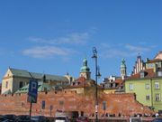
- Chełmno - almost whole length of walls (2.2 km), with 17 watch towers and city gate, 13th-14th cent.
- LęborkLeborkLębork is a town on the Łeba and Okalica rivers in Middle Pomerania region, north-western Poland with some 37,000 inhabitants.Lębork is also the capital of Lębork County in Pomeranian Voivodeship since 1999, formerly in Słupsk Voivodeship ....
- city ruins from the Medieval era - LubańLubanLubań is a town in southwest Poland north of the Jizera Mountains on the Kwisa river, with 22,137 inhabitants . Situated within the historic Upper Lusatia region, it today belongs to the Lower Silesian Voivodeship...
- partially preserved - KrakówKrakówKraków also Krakow, or Cracow , is the second largest and one of the oldest cities in Poland. Situated on the Vistula River in the Lesser Poland region, the city dates back to the 7th century. Kraków has traditionally been one of the leading centres of Polish academic, cultural, and artistic life...
- only the barbicanBarbicanA barbican, from medieval Latin barbecana, signifying the "outer fortification of a city or castle," with cognates in the Romance languages A barbican, from medieval Latin barbecana, signifying the "outer fortification of a city or castle," with cognates in the Romance languages A barbican, from...
, Floriańska Gate, two watch towers and some traces preserved - OlkuszOlkuszOlkusz is a town in south Poland with 37,696 inhabitants . Situated in the Lesser Poland Voivodeship , previously in Katowice Voivodeship , it is the capital of Olkusz County...
- PaczkówPaczkówPaczków is a town in Nysa County, Opole Voivodeship, Poland, with 8,226 inhabitants . It is one of the few towns in Europe in which medieval fortifications have been almost completely preserved...
- very well preserved walls with 19 towers and 3 gates - PoznańPoznanPoznań is a city on the Warta river in west-central Poland, with a population of 556,022 in June 2009. It is among the oldest cities in Poland, and was one of the most important centres in the early Polish state, whose first rulers were buried at Poznań's cathedral. It is sometimes claimed to be...
– city walls existed until the early 19th century (fragments remain); Prussian fortifications were built in the 19th century - PyrzycePyrzycePyrzyce , is a town in Pomerania, north-western Poland, with 13,331 inhabitants Capital of the Pyrzyce County in West Pomeranian Voivodeship , previously in Szczecin Voivodeship .-History:...
- until World War II best preserved city walls in Pomerania region, from 14th cent. - Stargard SzczecińskiStargard SzczecinskiStargard Szczeciński is a city in northwestern Poland, with a population of 71,017 . Situated on the Ina River it is the capital of Stargard County and since 1999 has been in the West Pomeranian Voivodeship; prior to that it was in the Szczecin Voivodeship...
- significant parts survived with 3 gates (including unique water gate - Brama Młyńska); one of the most interesting city walls in Poland - Szydłów - city walls with Krakowska Gate and watch towers built in 14th cent.
- ToruńTorunToruń is an ancient city in northern Poland, on the Vistula River. Its population is more than 205,934 as of June 2009. Toruń is one of the oldest cities in Poland. The medieval old town of Toruń is the birthplace of the astronomer Nicolaus Copernicus....
- several watch towers, three city gates and some sections (the longest and most impressive from Vistula) from 13th-15th centuries - WarsawWarsawWarsaw is the capital and largest city of Poland. It is located on the Vistula River, roughly from the Baltic Sea and from the Carpathian Mountains. Its population in 2010 was estimated at 1,716,855 residents with a greater metropolitan area of 2,631,902 residents, making Warsaw the 10th most...
- partially preserved, partially restored after World War II, barbicanBarbicanA barbican, from medieval Latin barbecana, signifying the "outer fortification of a city or castle," with cognates in the Romance languages A barbican, from medieval Latin barbecana, signifying the "outer fortification of a city or castle," with cognates in the Romance languages A barbican, from...
restored - ZamośćZamoscZamość ukr. Замостя is a town in southeastern Poland with 66,633 inhabitants , situated in the south-western part of Lublin Voivodeship , about from Lublin, from Warsaw and from the border with Ukraine...
- complete renaissance and 19th century walls preserved - PrzemyślPrzemyslPrzemyśl is a city in south-eastern Poland with 66,756 inhabitants, as of June 2009. In 1999, it became part of the Podkarpackie Voivodeship; it was previously the capital of Przemyśl Voivodeship....
- partially preserved ruins.
Portugal
- AlmeidaAlmeida, PortugalAlmeida is a town in Almeida Municipality, Portugal. The fortress around the town guards an important cross-border road from Spain, and underwent several sieges. The siege of 1810 ended spectacularly when a chance shell ignited the main gunpowder magazine, which exploded, killing 500 defenders...
Vauban style fortress town. - ÉvoraÉvoraÉvora is a municipality in Portugal. It has total area of with a population of 55,619 inhabitants. It is the seat of the Évora District and capital of the Alentejo region. The municipality is composed of 19 civil parishes, and is located in Évora District....
- Elvas
- Estremoz
- MarvãoMarvãoMarvão is a municipality in Portugal with a total area of 154.9 km² and a total population of 3,739 inhabitants.The municipality is composed of 4 parishes, and is located in Portalegre District....
- Óbidos
- ValençaValença, PortugalValença is a city in Valença Municipality, Portugal. It is a half-castle and half-land city. Bordering Galicia, Valença is also a famous Portuguese landmark to view an ancient castle town. These two parts of this city are not separated from each other and is also near to Viana Do Castelo....
- Vide
And more...
Romania
- Alba IuliaAlba IuliaAlba Iulia is a city in Alba County, Transylvania, Romania with a population of 66,747, located on the Mureş River. Since the High Middle Ages, the city has been the seat of Transylvania's Roman Catholic diocese. Between 1541 and 1690 it was the capital of the Principality of Transylvania...
- BistriţaBistritaBistrița is the capital city of Bistriţa-Năsăud County, Transylvania, Romania. It is situated on the Bistriţa River. The city has a population of approximately 80,000 inhabitants, and it administers six villages: Ghinda, Sărata, Sigmir, Slătiniţa, Unirea and Viişoara.-History:The earliest sign of...
- BraşovBrasovBrașov is a city in Romania and the capital of Brașov County.According to the last Romanian census, from 2002, there were 284,596 people living within the city of Brașov, making it the 8th most populated city in Romania....
- Cluj-NapocaCluj-NapocaCluj-Napoca , commonly known as Cluj, is the fourth most populous city in Romania and the seat of Cluj County in the northwestern part of the country. Geographically, it is roughly equidistant from Bucharest , Budapest and Belgrade...
- MediaşMediasMediaș is the second largest city in Sibiu County, Transylvania, Romania.-Geographic location:Mediaș is located in the middle basin of Târnava Mare River, at 39 km from Sighișoara and 41 km from Blaj. The health resort Bazna, officially recognized for the first time in 1302, is...
- OradeaOradeaOradea is the capital city of Bihor County, in the Crișana region of north-western Romania. The city has a population of 204,477, according to the 2009 estimates. The wider Oradea metropolitan area has a total population of 245,832.-Geography:...
- OrăştieOrastieOrăștie is a city in Hunedoara County, south-western Transylvania, Romania.-History:7th–9th century – on the site of an old swamp , which today is the old center of town, it was a human settlement whose traces have been scattered into the X-th century by the construction of the first...
- SebeşSebesSebeș is a city in Alba County, central Romania, southern Transylvania.-Geography:The city lies on the Mureș River valley and it straddles the Sebeș river...
- SibiuSibiuSibiu is a city in Transylvania, Romania with a population of 154,548. Located some 282 km north-west of Bucharest, the city straddles the Cibin River, a tributary of the river Olt...
- SighişoaraSighisoaraSighişoara is a city and municipality on the Târnava Mare River in Mureş County, Romania. Located in the historic region Transylvania, Sighişoara has a population of 27,706 ....
- TimişoaraTimisoaraTimișoara is the capital city of Timiș County, in western Romania. One of the largest Romanian cities, with an estimated population of 311,586 inhabitants , and considered the informal capital city of the historical region of Banat, Timișoara is the main social, economic and cultural center in the...
Russia

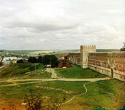
- AstrakhanAstrakhanAstrakhan is a major city in southern European Russia and the administrative center of Astrakhan Oblast. The city lies on the left bank of the Volga River, close to where it discharges into the Caspian Sea at an altitude of below the sea level. Population:...
- DerbentDerbentDerbent |Lak]]: Чурул, Churul; Persian: دربند; Judæo-Tat: דארבּאנד/Дэрбэнд/Dərbənd) is a city in the Republic of Dagestan, Russia, close to the Azerbaijani border. It is the southernmost city in Russia, and it is the second most important city of Dagestan...
- IzborskIzborskIzborsk is a rural locality in Pechorsky District of Pskov Oblast, Russia. It contains one of the most ancient and impressive fortresses of Western Russia....
- IvangorodIvangorod fortressIvangorod Fortress is a Russian medieval castle established by Ivan III in 1492 and since then grown into the town of Ivangorod....
- KazanKazan KremlinThe Kazan Kremlin is the chief historic citadel of Tatarstan, situated in the city of Kazan. It was built on behest of Ivan the Terrible on the ruins of the former castle of Kazan khans...
- KolomnaKolomna KremlinKolomna Kremlin is a very large fortress in Kolomna, Russia. The stone Kolomna Kremlin was built from 1525—1531 under the Russian Tsar Vasily III. Before its reconstruction in 1531, the Kolomna Kremlin was made of wood...
- MoscowMoscow KremlinThe Moscow Kremlin , sometimes referred to as simply The Kremlin, is a historic fortified complex at the heart of Moscow, overlooking the Moskva River , Saint Basil's Cathedral and Red Square and the Alexander Garden...
- Nizhny NovgorodNizhny NovgorodNizhny Novgorod , colloquially shortened to Nizhny, is, with the population of 1,250,615, the fifth largest city in Russia, ranking after Moscow, St. Petersburg, Novosibirsk, and Yekaterinburg...
- NovgorodNovgorod KremlinNovgorod Kremlin stands on the left bank of the Volkhov River about two miles north of where it empties out of Lake Ilmen.-History:...
- PorkhovPorkhovPorkhov is a town and the administrative center of Porkhovsky District of Pskov Oblast, Russia, located on the Shelon River, east of Pskov. Population:...
- PskovPskovPskov is an ancient city and the administrative center of Pskov Oblast, Russia, located in the northwest of Russia about east from the Estonian border, on the Velikaya River. Population: -Early history:...
- SmolenskSmolenskSmolensk is a city and the administrative center of Smolensk Oblast, Russia, located on the Dnieper River. Situated west-southwest of Moscow, this walled city was destroyed several times throughout its long history since it was on the invasion routes of both Napoleon and Hitler. Today, Smolensk...
- ShlisselburgShlisselburgShlisselburg is a town in Leningrad Oblast, Russia, situated at the head of the Neva River on Lake Ladoga, east of St. Petersburg. From 1944 to 1992, it was known as Petrokrepost...
- TobolskTobolskTobolsk is a town in Tyumen Oblast, Russia, located at the confluence of the Tobol and Irtysh Rivers. It is a historic capital of Siberia. Population: -History:...
- TulaTula, RussiaTula is an industrial city and the administrative center of Tula Oblast, Russia. It is located south of Moscow, on the Upa River. Population: -History:...
- YaroslavlYaroslavlYaroslavl is a city and the administrative center of Yaroslavl Oblast, Russia, located northeast of Moscow. The historical part of the city, a World Heritage Site, is located at the confluence of the Volga and the Kotorosl Rivers. It is one of the Golden Ring cities, a group of historic cities...
(only several towers still stand) - ZarayskZarayskZaraysk is a town and the administrative center of Zaraysky District of Moscow Oblast, Russia, situated about southeast from Moscow. Population: The town stands on the right bank of the Osyotr River, which is a right confluent of the Oka...
Serbia
- BelgradeBelgradeBelgrade is the capital and largest city of Serbia. It is located at the confluence of the Sava and Danube rivers, where the Pannonian Plain meets the Balkans. According to official results of Census 2011, the city has a population of 1,639,121. It is one of the 15 largest cities in Europe...
- KalemegdanKalemegdanBelgrade Fortress , represent old citadel and Kalemegdan Park on the confluence of the River Sava and Danube, in an urban area of modern Belgrade, the capital of Serbia. It is located in Belgrade's municipality of Stari Grad... - Novi SadNovi SadNovi Sad is the capital of the northern Serbian province of Vojvodina, and the administrative centre of the South Bačka District. The city is located in the southern part of Pannonian Plain on the Danube river....
- PetrovaradinPetrovaradinPetrovaradin , is part of the agglomeration of Novi Sad in Serbia... - Bač
- Manasija - ResavaResavaResava refers to several toponyms and related topics, all of them located around the river Resava in central Serbia:* Resava , a river* Resava, a region, surrounding the river* Resava, a monastery...
- NišNišNiš is the largest city of southern Serbia and third-largest city in Serbia . According to the data from 2011, the city of Niš has a population of 177,972 inhabitants, while the city municipality has a population of 257,867. The city covers an area of about 597 km2, including the urban area,...
- PirotPirotPirot is a town and municipality located in south-eastern Serbia. According to 2011 census, the town has a total population of 38,432, while the population of the municipality is 57,911...
- SmederevoSmederevoSmederevo is a city and municipality in Serbia, on the right bank of the Danube, about 40 km downstream of the capital Belgrade. According to official results of the 2011 census, the city has a population of 107,528...
- GolubacGolubacGolubac is a village and municipality in north-eastern Serbia, on the right side of the Danube river. It is bordered by Romania to the east, Veliko Gradište to the west and Kučevo to the south...
- MagličMaglicMaglič is a medieval fortress in Ibar gorge 20 km south from Kraljevo in Serbia. It is placed atop a hill around which the Ibar River makes a curve, about 100 m above river level. The fortress protected the only caravan road that connected the Morava Valley and Kosovo polje...
Slovakia
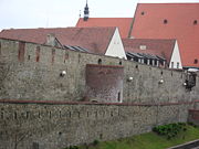
- Banská BystricaBanská BystricaBanská Bystrica is a key city in central Slovakia located on the Hron River in a long and wide valley encircled by the mountain chains of the Low Tatras, the Veľká Fatra, and the Kremnica Mountains. With 81,281 inhabitants, Banská Bystrica is the sixth most populous municipality in Slovakia...
- Banská ŠtiavnicaBanská ŠtiavnicaBanská Štiavnica is a town in central Slovakia, in the middle of an immense caldera created by the collapse of an ancient volcano. For its size, the caldera is known as Štiavnica Mountains. Banská Štiavnica has a population of more than 10,000. It is a completely preserved medieval town...
- only one city gate left - BardejovBardejovBardejov is a town in North-Eastern Slovakia. It is situated in the Šariš region and has about 33,000 inhabitants. The spa town, mentioned for the first time in 1241, exhibits numerous cultural monuments in its completely intact medieval town center...
- walls almost completely preserved, with bastions and barbicanBarbicanA barbican, from medieval Latin barbecana, signifying the "outer fortification of a city or castle," with cognates in the Romance languages A barbican, from medieval Latin barbecana, signifying the "outer fortification of a city or castle," with cognates in the Romance languages A barbican, from... - BeckovBeckovBeckov is a village and municipality in Nové Mesto nad Váhom District in the Trenčín Region of western Slovakia.-History:In historical records the village was first mentioned in 1208...
- BojniceBojniceBojnice is a small town in central Slovakia at the upper Nitra river, near the city of Prievidza. It has population of 4,983 . Bojnice is best known for its tourist attractions: the oldest zoo in Slovakia, the most visited castle, and one of the oldest spa towns in Slovakia. The town is situated...
- large parts of the wall preserved, together with one of the city gates - BratislavaBratislavaBratislava is the capital of Slovakia and, with a population of about 431,000, also the country's largest city. Bratislava is in southwestern Slovakia on both banks of the Danube River. Bordering Austria and Hungary, it is the only national capital that borders two independent countries.Bratislava...
- only few structures have survived from original fortificationsBratislava FortificationsThe Bratislava fortifications are the system of fortifications of the city of Bratislava, the capital of Slovakia, of which one gate and two sections of walls remain today. Most of the medieval fortification system was demolished in the year 1775 by the order of Empress Maria Theresa of Austria,...
. - FiľakovoFilakovoFiľakovo is a town in the Banská Bystrica Region of south-central Slovakia. Historically it was part of the Nógrád region.-Geography:...
- KomárnoKomárnoKomárno is a town in Slovakia at the confluence of the Danube and the Váh rivers. Komárno was formed from part of a historical town in Hungary situated on both banks of the Danube. Following World War I, the border of the newly created Czechoslovakia cut the historical, unified town in half,...
- baroque fortifications almost completely preserved - KošiceKošiceKošice is a city in eastern Slovakia. It is situated on the river Hornád at the eastern reaches of the Slovak Ore Mountains, near the border with Hungary...
- KremnicaKremnicaKremnica is a town in central Slovakia. It has some 5,700 inhabitants. The well-preserved medieval town built above important gold mines is the site of the oldest still-working mint in the world.-History:...
- about two thirds of the defensive walls around the town preserved, with several bastions and the city gate with barbican. - LeviceLeviceLevice is a town in western Slovakia. The town lies on the left bank of the lower Hron river. The Old Slavic name of the town was Leva, which means "the Left One"....
- parts of the defensive walls were found during an archaeological survey - LevočaLevocaLevoča is a town in the Spiš region of eastern Slovakia with a population of 14,600. The town has a historic center with a well preserved town wall, a Renaissance church with the highest wooden altar in Europe, carved by Master Paul of Levoča, and many other Renaissance buildings.On 28 June 2009,...
- almost completely preserved - ModraModraModra is a city and municipality in the Bratislava Region in Slovakia. It has a population of 8,704 as of 2005. It nestles in the foothills of the Malé Karpaty and is an excellent centre of hiking.Modra is famous for its pottery industry...
- about two thirds of the walls still standing, one bastion and one of the city gates - PezinokPezinokPezinok is a city in southwestern Slovakia. It is roughly northeast of Bratislava and has a population of 21,334 .Pezinok lies near the Little Carpathians and thrives mainly on viticulture and agriculture, as well as on brick making and ceramic production.-History:From the second half of the 10th...
- parts of the defensive walls visible on several locations of the town - PodolínecPodolínecPodolínec is a town in the Stará Ľubovňa District of the Prešov Region in northern Slovakia.-History:Originally Podoliniec belonged to Poland and was part of the Ziema Sądecka land...
- PukanecPukanecPukanec anz, ; ) is a village and municipality in the Levice District in the Nitra Region of southern Slovakia.-History:In the past, it was one of the nine free royal mining towns, where silver and other precious ore was mined....
- PrešovPrešovPrešov Historically, the city has been known in German as Eperies , Eperjes in Hungarian, Fragopolis in Latin, Preszów in Polish, Peryeshis in Romany, Пряшев in Russian and Пряшів in Rusyn and Ukrainian.-Characteristics:The city is a showcase of Baroque, Rococo and Gothic...
- parts of the defensive walls were found during an archaeological survey - SabinovSabinovSabinov is a small town located in the Prešov Region , approximately 20 km from Prešov and 55 km from Košice. The population of Sabinov is 12,378.- History :...
- SkalicaSkalicaSkalica is the largest city in Skalica District in western Slovakia in the Záhorie region. Located near the Czech border, Skalica has a population of 14,963 .-History:...
- large parts preserved - Spišská KapitulaSpišská KapitulaSpišská Kapitula, is an exceptionally well-preserved ecclesiastical town on the outskirts of Spišské Podhradie, Slovakia, and overlooking Spiš Castle. It is part of the UNESCO World Heritage site Levoča, Spiš Castle and the associated cultural monuments.-Town and history:The town consists of St....
- Svätý JurSvätý JurSvätý Jur is a small town northeast of Bratislava, the capital of Slovakia. The name means Saint George. Between 1960 and 1990, the Communist government forced the town to use a "non-religious" name Jur pri Bratislave. Svätý Jur has a population of almost 5,000.-Geography:Svätý Jur is situated in...
- TrenčínTrencínTrenčín is a city in western Slovakia of the central Váh River valley near the Czech border, around from Bratislava. It has a population of more than 56,000, which makes it the ninth largest municipality of the country and is the seat of the Trenčín Region and the Trenčín District...
- parts of the defensive walls were found during an archaeological survey - TrnavaTrnavaTrnava is a city in western Slovakia, 47 km to the north-east of Bratislava, on the Trnávka river. It is the capital of a kraj and of an okres . It was the seat of a Roman Catholic archbishopric . The city has a historic center...
- mostly preserved, with several bastions and one city gate - ŽilinaŽilinaŽilina is a city in north-western Slovakia, around from the capital Bratislava, close to both the Czech and Polish borders. It is the fourth largest city of Slovakia with a population of approximately 85,000, an important industrial center, the largest city on the Váh river, and the seat of a...
Slovenia
- KranjKranj' is the third largest municipality and fourth largest city in Slovenia, with a population of 54,500 . It is located approximately 20 km north-west of Ljubljana...
evidence of 1st century fortifications with parts of medieval fortifications with four of the original 8 towers preserved - LjubljanaLjubljanaLjubljana is the capital of Slovenia and its largest city. It is the centre of the City Municipality of Ljubljana. It is located in the centre of the country in the Ljubljana Basin, and is a mid-sized city of some 270,000 inhabitants...
- PiranPiranPiran is a city and municipality in southwestern Slovenia on the Gulf of Piran on the Adriatic Sea. It is one of the three major towns of Slovenian Istria. The city resembles a large open-air museum, with medieval architecture and a rich cultural heritage. Narrow streets and compact houses give...
7th century fortification expanded between 1470 and 1533
Spain
- Ávila complete medieval walls.
- BadajozBadajozBadajoz is the capital of the Province of Badajoz in the autonomous community of Extremadura, Spain, situated close to the Portuguese border, on the left bank of the river Guadiana, and the Madrid–Lisbon railway. The population in 2007 was 145,257....
has medieval walls and most of its renaissance fortress. - BarcelonaBarcelonaBarcelona is the second largest city in Spain after Madrid, and the capital of Catalonia, with a population of 1,621,537 within its administrative limits on a land area of...
has portions of a RomanAncient RomeAncient Rome was a thriving civilization that grew on the Italian Peninsula as early as the 8th century BC. Located along the Mediterranean Sea and centered on the city of Rome, it expanded to one of the largest empires in the ancient world....
wall. - CartagenaCartagena, SpainCartagena is a Spanish city and a major naval station located in the Region of Murcia, by the Mediterranean coast, south-eastern Spain. As of January 2011, it has a population of 218,210 inhabitants being the Region’s second largest municipality and the country’s 6th non-Province capital...
- Ciudad RodrigoCiudad RodrigoCiudad Rodrigo is a small cathedral city in the province of Salamanca, in western Spain, with a population of about 14,000. It is the seat of a judicial district as well....
suffered several sieges in Napoleonic wars, walls remain intact. - GironaGironaGirona is a city in the northeast of Catalonia, Spain at the confluence of the rivers Ter, Onyar, Galligants and Güell, with an official population of 96,236 in January 2009. It is the capital of the province of the same name and of the comarca of the Gironès...
- LeónLeón, SpainLeón is the capital of the province of León in the autonomous community of Castile and León, situated in the northwest of Spain. Its city population of 136,985 makes it the largest municipality in the province, accounting for more than one quarter of the province's population...
- LugoLugoLugo is a city in northwestern Spain, in the autonomous community of Galicia. It is the capital of the province of Lugo. The municipality had a population of 97,635 in 2010, which makes is the fourth most populated city in Galicia.-Population:...
has a complete ringwall, most of which dates back to Roman times. It is protected by UNESCOUNESCOThe United Nations Educational, Scientific and Cultural Organization is a specialized agency of the United Nations...
as a World Heritage SiteWorld Heritage SiteA UNESCO World Heritage Site is a place that is listed by the UNESCO as of special cultural or physical significance...
. - MataróMataróMataró is the capital and largest city of the comarca of the Maresme, in the province of Barcelona, Catalonia Autonomous Community, Spain. It is located on the Costa del Maresme, to the south of Costa Brava, between Cabrera de Mar and Sant Andreu de Llavaneres, to the north-east of Barcelona. , it...
- Niebla, Huelva
- PamplonaPamplonaPamplona is the historial capital city of Navarre, in Spain, and of the former kingdom of Navarre.The city is famous worldwide for the San Fermín festival, from July 6 to 14, in which the running of the bulls is one of the main attractions...
- TarragonaTarragonaTarragona is a city located in the south of Catalonia on the north-east of Spain, by the Mediterranean. It is the capital of the Spanish province of the same name and the capital of the Catalan comarca Tarragonès. In the medieval and modern times it was the capital of the Vegueria of Tarragona...
- ToledoToledo, SpainToledo's Alcázar became renowned in the 19th and 20th centuries as a military academy. At the outbreak of the Spanish Civil War in 1936 its garrison was famously besieged by Republican forces.-Economy:...
- ZaragozaZaragozaZaragoza , also called Saragossa in English, is the capital city of the Zaragoza Province and of the autonomous community of Aragon, Spain...
Sweden
- City wall of Visby
- GothenburgGothenburgGothenburg is the second-largest city in Sweden and the fifth-largest in the Nordic countries. Situated on the west coast of Sweden, the city proper has a population of 519,399, with 549,839 in the urban area and total of 937,015 inhabitants in the metropolitan area...
has a part of the western city wall left, the bastionBastionA bastion, or a bulwark, is a structure projecting outward from the main enclosure of a fortification, situated in both corners of a straight wall , facilitating active defence against assaulting troops...
Carolus Rex at Esperanto platsen (Esperanto square) and most of the city moatMoatA moat is a deep, broad ditch, either dry or filled with water, that surrounds a castle, other building or town, historically to provide it with a preliminary line of defence. In some places moats evolved into more extensive water defences, including natural or artificial lakes, dams and sluices...
is still left. - StockholmStockholmStockholm is the capital and the largest city of Sweden and constitutes the most populated urban area in Scandinavia. Stockholm is the most populous city in Sweden, with a population of 851,155 in the municipality , 1.37 million in the urban area , and around 2.1 million in the metropolitan area...
has a small remainder of the medieval city wall preserved. - Bohus FortressBohus FortressBohus Fortress lies along the old Norwegian - Swedish border in Kungälv, Bohuslän, Sweden, north east from Hisingen where the Göta river splits into two branches...
Switzerland
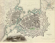
- BellinzonaBellinzonaBellinzona is the administrative capital of the canton Ticino in Switzerland. The city is famous for its three castles that have been UNESCO World Heritage Sites since 2000....
(Dominated by its three castles: Castelgrande, Castello di Montebello and Castello di Sasso Corbaro) - FribourgFribourgFribourg is the capital of the Swiss canton of Fribourg and the district of Sarine. It is located on both sides of the river Saane/Sarine, on the Swiss plateau, and is an important economic, administrative and educational center on the cultural border between German and French Switzerland...
- GenevaGenevaGeneva In the national languages of Switzerland the city is known as Genf , Ginevra and Genevra is the second-most-populous city in Switzerland and is the most populous city of Romandie, the French-speaking part of Switzerland...
- GruyèresGruyèresGruyères is a town in the district of Gruyère in the canton of Fribourg in Switzerland. Its German name is Greyerz.The medieval town is an important tourist location in the upper valley of the Saane river, and gives its name to the well-known cheese. In this town, a trackless train is the only...
- LucerneLucerneLucerne is a city in north-central Switzerland, in the German-speaking portion of that country. Lucerne is the capital of the Canton of Lucerne and the capital of the district of the same name. With a population of about 76,200 people, Lucerne is the most populous city in Central Switzerland, and...
: The wall on the northern bank of the Reuss RiverReuss RiverThe Reuss is a river in Switzerland. With a length of and a drainage basin of , it is the fourth largest river in Switzerland...
is well preserved and among the principal landmarks of the city. - MurtenMurtenMurten is a municipality in the See district of the canton of Fribourg in Switzerland.It is located on the southern shores of Lake Morat. Morat is situated between Bern and Lausanne and is the capital of the Lake District of the canton of Fribourg....
: Medieval walls
Turkey
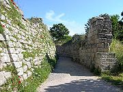
- TroyTroyTroy was a city, both factual and legendary, located in northwest Anatolia in what is now Turkey, southeast of the Dardanelles and beside Mount Ida...
. The ancient city of Troy was famous for its defensive walls. There is archaeological evidence that Troy VIITroy VIITroy VII, in the mound at Hisarlik, is an archaeological layer of Troy representing late Hittite Empire to Neo-Hittite times . It was a walled city with towers reaching a height of nine meters; the foundations of one of its bastions measure 18 meters by 18 meters...
, generally identified as the stage of the legendary Trojan WarTrojan WarIn Greek mythology, the Trojan War was waged against the city of Troy by the Achaeans after Paris of Troy took Helen from her husband Menelaus, the king of Sparta. The war is among the most important events in Greek mythology and was narrated in many works of Greek literature, including the Iliad...
of HomerHomerIn the Western classical tradition Homer , is the author of the Iliad and the Odyssey, and is revered as the greatest ancient Greek epic poet. These epics lie at the beginning of the Western canon of literature, and have had an enormous influence on the history of literature.When he lived is...
's IliadIliadThe Iliad is an epic poem in dactylic hexameters, traditionally attributed to Homer. Set during the Trojan War, the ten-year siege of the city of Troy by a coalition of Greek states, it tells of the battles and events during the weeks of a quarrel between King Agamemnon and the warrior Achilles...
, usually dated between 1194 BC – 1184 BC, had walls with a carefully built stone base over four meters thick and some nine meters high in places, which was surmounted by a larger superstructure with towers in mudbrick. The walls in Homer's epic are so mighty that the siege of Troy by Achaeans lasts more than nine years, and only could be finished with the trickery of the Trojan HorseTrojan HorseThe Trojan Horse is a tale from the Trojan War about the stratagem that allowed the Greeks finally to enter the city of Troy and end the conflict. In the canonical version, after a fruitless 10-year siege, the Greeks constructed a huge wooden horse, and hid a select force of men inside...
. Sections of the stone base of Trojan walls still survive on the archaeological site in present day Hisarlık, in Çanakkale provinceÇanakkale ProvinceÇanakkale Province is a province of Turkey, located in the northwestern part of the country. It takes its name from the town of Çanakkale.Like Istanbul, Çanakkale province has a European and an Asian part. The European part is formed by the Gallipoli peninsula, while the Asian part is largely...
.
- IstanbulIstanbulIstanbul , historically known as Byzantium and Constantinople , is the largest city of Turkey. Istanbul metropolitan province had 13.26 million people living in it as of December, 2010, which is 18% of Turkey's population and the 3rd largest metropolitan area in Europe after London and...
. The system of walls around (as it was then known) ConstantinopleConstantinopleConstantinople was the capital of the Roman, Eastern Roman, Byzantine, Latin, and Ottoman Empires. Throughout most of the Middle Ages, Constantinople was Europe's largest and wealthiest city.-Names:...
built in 412 by the Roman emperor Theodosius IITheodosius IITheodosius II , commonly surnamed Theodosius the Younger, or Theodosius the Calligrapher, was Byzantine Emperor from 408 to 450. He is mostly known for promulgating the Theodosian law code, and for the construction of the Theodosian Walls of Constantinople...
was a complex stone barrier that stretched 6.5 kilometers and is often called the Wall of TheodosiusWalls of ConstantinopleThe Walls of Constantinople are a series of defensive stone walls that have surrounded and protected the city of Constantinople since its founding as the capital of the Eastern Roman Empire by Constantine the Great...
. This barrier stood impregnable for ten centuries and resisted several violent sieges until 1453 when the OttomansOttoman EmpireThe Ottoman EmpireIt was usually referred to as the "Ottoman Empire", the "Turkish Empire", the "Ottoman Caliphate" or more commonly "Turkey" by its contemporaries...
succeeded in breaching the walls. There was a new element in the battlefield: the Ottoman army had powderGunpowderGunpowder, also known since in the late 19th century as black powder, was the first chemical explosive and the only one known until the mid 1800s. It is a mixture of sulfur, charcoal, and potassium nitrate - with the sulfur and charcoal acting as fuels, while the saltpeter works as an oxidizer...
cannonCannonA cannon is any piece of artillery that uses gunpowder or other usually explosive-based propellents to launch a projectile. Cannon vary in caliber, range, mobility, rate of fire, angle of fire, and firepower; different forms of cannon combine and balance these attributes in varying degrees,...
and the walls offered limited resistance to them.
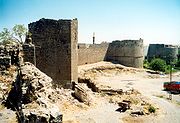
- DiyarbakırDiyarbakırDiyarbakır is one of the largest cities in southeastern Turkey...
. Diyarbakır is surrounded by an almost intact, dramatic set of high walls of black basalt forming a 5.5 km (3.4 mi) circle around the old city. There are four gates into the old city and 82 watch-towers on the walls, which were built in antiquity, restored and extended by the Roman emperor Constantius in 349.
Ukraine
- Bilhorod-DnistrovskyiBilhorod-DnistrovskyiBilhorod-Dnistrovskyi is a city situated on the right bank of the Dniester Liman in the Odessa Oblast of southwestern Ukraine, in the historical region of Bessarabia...
- LetychivLetychivLetychiv is a town in the eastern part of Khmelnytskyi Oblast of western Ukraine. 51 km from Khmelnytskyi and 33 km from the railway station Derazhnya. Administrative center since Tsarist times, formerly in Podolia Province. Population: 11,081 inhabitants . There are brickworks, dairy,...
(see Letychiv FortressLetychiv FortressLetychiv Fortress is a complex of limestone walls built in 1598 by Jan Potocki to defend Podolia from the regular raids of the Crimean Tatars. The north-western tower, the eastern wall and parts of the southern wall still stand in the town of Letychiv, Ukraine. The most prominent feature on the...
) - LutskLutskLutsk is a city located by the Styr River in northwestern Ukraine. It is the administrative center of the Volyn Oblast and the administrative center of the surrounding Lutskyi Raion within the oblast...
(see Lubart's CastleLubart's CastleLutsk High Castle, also known as Lubart's Castle, began its life in the mid-14th century as the fortified seat of Gediminas' son Liubartas , the last ruler of united Galicia-Volhynia. It is the most prominent landmark of Lutsk, Ukraine and as such appears on the 200 hryvnia bill...
) - LvivLvivLviv is a city in western Ukraine. The city is regarded as one of the main cultural centres of today's Ukraine and historically has also been a major Polish and Jewish cultural center, as Poles and Jews were the two main ethnicities of the city until the outbreak of World War II and the following...
(see Hlyniany GateHlyniany GateHlyniany Gate is the focal point of the few remaining fortifications in Lviv, Ukraine. It was built in 1618 to Fryderyk Getkant's designs in order to defend the approach from Hlyniany. The outer moat and the wooden galleries on the inside are the upshot of a 1970s reconstruction...
) - MedzhybizhMedzhybizhMedzhybizh, previously known as Mezhybozhe, population 1731, is a town in the Khmelnytskyi Oblast of western Ukraine. It is located in the Letychivsky Raion , 25 kilometres from the Khmelnytskyi on the main highway between Khmelnytskyi and Vinnytsia at the confluence of the Southern Buh and...
(see Medzhybizh FortressMedzhybizh FortressMedzhybizh Castle , when built as a bulwark against Ottoman expansion in the 1540s, was one of the strongest fortresses in Podolia. It is situated at the confluence of the Southern Bug and Buzhenka rivers, in the town of Medzhybizh, Ukraine....
)
England
- AlnwickAlnwickAlnwick is a small market town in north Northumberland, England. The town's population was just over 8000 at the time of the 2001 census and Alnwick's district population was 31,029....
Grade 1 listed Bondgate (Hotspur Gateway) and section of wall remain of medival defences, Pottergate Tower is C18 rebuild of medieval gate and may incorporate some medieval fabric. - Bath - Several fragments of the medieval wall still survive. The East Gate is the only remaining gateway. The length of wall opposite the Mineral Water Hospital is largely a reconstruction of the medieval wall. By far the best length, over 160ft, could until 1963 be seen on the site cleared by an air-raid in 1940. This was the SE corner of the medieval city. The remains of this wall now lie buried below the floor of the new Woolworths store.
- Berwick-upon-TweedBerwick-upon-TweedBerwick-upon-Tweed or simply Berwick is a town in the county of Northumberland and is the northernmost town in England, on the east coast at the mouth of the River Tweed. It is situated 2.5 miles south of the Scottish border....
- the Elizabethan ramparts with their bastions, gateways and earthworks survive. Spades Mire is an earthwork linear ditches, possibly forming an outer line of defence for medieval Berwick. Situated on the south side of the ditch are traces of an accompanying rampart, now much spread and up to 13m wide. The Lord's Mount is a massive curved stone bulwark which was built in the 1540s to protect the town walls at their weakest point. - BridgnorthBridgnorthBridgnorth is a town in Shropshire, England, along the Severn Valley. It is split into Low Town and High Town, named on account of their elevations relative to the River Severn, which separates the upper town on the right bank from the lower on the left...
- the North Gate is still present, the site of the former Postern Gate still very visible; and parts of the wall now form garden walls in various parts of the town. - Bristol CastleBristol CastleBristol Castle was a Norman castle built for the defence of Bristol. Remains can be seen today in Castle Park near the Broadmead Shopping Centre, including the sally port.-History:...
- CanterburyCanterburyCanterbury is a historic English cathedral city, which lies at the heart of the City of Canterbury, a district of Kent in South East England. It lies on the River Stour....
- Carlisle
- ChesterChesterChester is a city in Cheshire, England. Lying on the River Dee, close to the border with Wales, it is home to 77,040 inhabitants, and is the largest and most populous settlement of the wider unitary authority area of Cheshire West and Chester, which had a population of 328,100 according to the...
- the city wallsChester city walls.Chester city walls consist of a defensive structure built to protect the city of Chester in Cheshire, England. Their construction was started by the Romans when they established the fortress of Deva Victrix between 70 and 80 AD. It originated with a rampart of earth and turf surmounted by a...
are one of the city's biggest tourist attractions. They were originally built by the Romans and continue to form a complete ring around much of the present-day city centre. - ChichesterChichesterChichester is a cathedral city in West Sussex, within the historic County of Sussex, South-East England. It has a long history as a settlement; its Roman past and its subsequent importance in Anglo-Saxon times are only its beginnings...
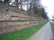
- ColchesterColchesterColchester is an historic town and the largest settlement within the borough of Colchester in Essex, England.At the time of the census in 2001, it had a population of 104,390. However, the population is rapidly increasing, and has been named as one of Britain's fastest growing towns. As the...
- the town was surrounded by a wall built by the Romans after BoudicaBoudicaBoudica , also known as Boadicea and known in Welsh as "Buddug" was queen of the British Iceni tribe who led an uprising against the occupying forces of the Roman Empire....
had sacked the town. Approximately half of the walls remain. - CoventryCoventryCoventry is a city and metropolitan borough in the county of West Midlands in England. Coventry is the 9th largest city in England and the 11th largest in the United Kingdom. It is also the second largest city in the English Midlands, after Birmingham, with a population of 300,848, although...
- the walls were demolished in 1662. Two gates survive, connected by a section of wall that runs through Lady Herbert's garden. Other small fragments dotted around the city centre, mainly hidden by modern buildings, include the remains of a bastion near Upper Well Street. Several fragments have been incorporated into newer buildings. - DurhamDurhamDurham is a city in north east England. It is within the County Durham local government district, and is the county town of the larger ceremonial county...
- The Castle formed the largest part of Durham's defences, with the neighbouring "Backgate", demolished in the 1760s, which sat across Sadler Street. This was accompanied by a Gaol, which survived until the 1840s, remains of which are present in an alley off Sadler Street. Other walls surrounding the centre of Durham survive between the River WearRiver WearThe River Wear is located in North East England, rising in the Pennines and flowing eastwards, mostly through County Durham, to the North Sea at Sunderland.-Geology and history:...
, and the houses lining a number of thoroughfares: Sadler Street, North Bailey, South Bailey, and Palace Green. The street names North Bailey and South Bailey are testament to this fact. It is debatable just how defensive these walls were, and some parts have since become garden walls. The archway of a Water Gate survives where South Bailey meets Prebends' Bridge. - ExeterExeterExeter is a historic city in Devon, England. It lies within the ceremonial county of Devon, of which it is the county town as well as the home of Devon County Council. Currently the administrative area has the status of a non-metropolitan district, and is therefore under the administration of the...
- Great YarmouthGreat YarmouthGreat Yarmouth, often known to locals as Yarmouth, is a coastal town in Norfolk, England. It is at the mouth of the River Yare, east of Norwich.It has been a seaside resort since 1760, and is the gateway from the Norfolk Broads to the sea...
- about two-thirds of the wall remains. Of the original eighteen towers, eleven survive. - HartlepoolHartlepoolHartlepool is a town and port in North East England.It was founded in the 7th century AD, around the Northumbrian monastery of Hartlepool Abbey. The village grew during the Middle Ages and developed a harbour which served as the official port of the County Palatine of Durham. A railway link from...
- HerefordHerefordHereford is a cathedral city, civil parish and county town of Herefordshire, England. It lies on the River Wye, approximately east of the border with Wales, southwest of Worcester, and northwest of Gloucester...
- Kingston upon HullKingston upon HullKingston upon Hull , usually referred to as Hull, is a city and unitary authority area in the ceremonial county of the East Riding of Yorkshire, England. It stands on the River Hull at its junction with the Humber estuary, 25 miles inland from the North Sea. Hull has a resident population of...
- LeicesterLeicesterLeicester is a city and unitary authority in the East Midlands of England, and the county town of Leicestershire. The city lies on the River Soar and at the edge of the National Forest...
- LincolnLincoln, LincolnshireLincoln is a cathedral city and county town of Lincolnshire, England.The non-metropolitan district of Lincoln has a population of 85,595; the 2001 census gave the entire area of Lincoln a population of 120,779....
- fragmentary remains - LondonLondonLondon is the capital city of :England and the :United Kingdom, the largest metropolitan area in the United Kingdom, and the largest urban zone in the European Union by most measures. Located on the River Thames, London has been a major settlement for two millennia, its history going back to its...
- fragments of London WallLondon WallLondon Wall was the defensive wall first built by the Romans around Londinium, their strategically important port town on the River Thames in what is now the United Kingdom, and subsequently maintained until the 18th century. It is now the name of a road in the City of London running along part of...
, the wall that once surrounded the RomanRoman EmpireThe Roman Empire was the post-Republican period of the ancient Roman civilization, characterised by an autocratic form of government and large territorial holdings in Europe and around the Mediterranean....
town of LondiniumLondiniumThe city of London was established by the Romans around AD 43. It served as a major imperial commercial centre until its abandonment during the 5th century.-Origins and language:...
, are still visible just outside the Museum of LondonMuseum of LondonThe Museum of London documents the history of London from the Prehistoric to the present day. The museum is located close to the Barbican Centre, as part of the striking Barbican complex of buildings created in the 1960s and 70s as an innovative approach to re-development within a bomb damaged...
and at Tower Hill in the City of LondonCity of LondonThe City of London is a small area within Greater London, England. It is the historic core of London around which the modern conurbation grew and has held city status since time immemorial. The City’s boundaries have remained almost unchanged since the Middle Ages, and it is now only a tiny part of...
. - LudlowLudlowLudlow is a market town in Shropshire, England close to the Welsh border and in the Welsh Marches. It lies within a bend of the River Teme, on its eastern bank, forming an area of and centred on a small hill. Atop this hill is the site of Ludlow Castle and the market place...
- good lengths of the wall remain and a number of the gates too
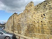
- Newcastle upon TyneNewcastle upon TyneNewcastle upon Tyne is a city and metropolitan borough of Tyne and Wear, in North East England. Historically a part of Northumberland, it is situated on the north bank of the River Tyne...
- much of the town wallNewcastle town wallThe Newcastle town wall is a medieval defensive wall, and Scheduled Ancient Monument, in Newcastle upon Tyne, England. It was built during the 13th and 14th centuries, and helped protect the town from attack and occupation during times of conflict...
was demolished during the late 18th and early 19th centuries but several sections still remain. - NorwichNorwichNorwich is a city in England. It is the regional administrative centre and county town of Norfolk. During the 11th century, Norwich was the largest city in England after London, and one of the most important places in the kingdom...
- OxfordOxfordThe city of Oxford is the county town of Oxfordshire, England. The city, made prominent by its medieval university, has a population of just under 165,000, with 153,900 living within the district boundary. It lies about 50 miles north-west of London. The rivers Cherwell and Thames run through...
- major fragments are preserved in the gardens of New CollegeNew College, OxfordNew College is one of the constituent colleges of the University of Oxford in the United Kingdom.- Overview :The College's official name, College of St Mary, is the same as that of the older Oriel College; hence, it has been referred to as the "New College of St Mary", and is now almost always...
and Merton CollegeMerton College, OxfordMerton College is one of the constituent colleges of the University of Oxford in England. Its foundation can be traced back to the 1260s when Walter de Merton, chancellor to Henry III and later to Edward I, first drew up statutes for an independent academic community and established endowments to...
and as part of the exterior wall of Pembroke CollegePembroke College, OxfordPembroke College is one of the constituent colleges of the University of Oxford in England, located in Pembroke Square. As of 2009, Pembroke had an estimated financial endowment of £44.9 million.-History:...
on Brewer StreetBrewer Street, OxfordBrewer Street is a historic narrow street in central Oxford, England, south of Carfax.The street runs east-west, connecting with St Aldate's to the east and St Ebbe's Street to the west....
. - RyeRye, East SussexRye is a small town in East Sussex, England, which stands approximately two miles from the open sea and is at the confluence of three rivers: the Rother, the Tillingham and the Brede...
- SalisburySalisburySalisbury is a cathedral city in Wiltshire, England and the only city in the county. It is the second largest settlement in the county...
- around the original medieval city, including the cathedral and the close. - ShrewsburyShrewsburyShrewsbury is the county town of Shropshire, in the West Midlands region of England. Lying on the River Severn, it is a civil parish home to some 70,000 inhabitants, and is the primary settlement and headquarters of Shropshire Council...
- one long section remains along the 'Town Walls' road; other shorter sections exist, such as behind Newport House on Dogpole, and near Shrewsbury CastleShrewsbury CastleShrewsbury Castle is a red sandstone castle in Shrewsbury, Shropshire, England. It stands on a hill in the neck of the meander of the River Severn on which the town originally developed. The castle is situated directly above Shrewsbury railway station.... - SilchesterSilchesterSilchester is a village and civil parish about north of Basingstoke in Hampshire. It is adjacent to the county boundary with Berkshire and about south-west of Reading....
- the nearby deserted Roman town of Calleva Atrebatum has a complete set of walls. - SouthamptonSouthamptonSouthampton is the largest city in the county of Hampshire on the south coast of England, and is situated south-west of London and north-west of Portsmouth. Southampton is a major port and the closest city to the New Forest...
- Wallingford
- WarehamWareham, DorsetWareham is an historic market town and, under the name Wareham Town, a civil parish, in the English county of Dorset. The town is situated on the River Frome eight miles southwest of Poole.-Situation and geography:...
- WarwickWarwickWarwick is the county town of Warwickshire, England. The town lies upon the River Avon, south of Coventry and just west of Leamington Spa and Whitnash with which it is conjoined. As of the 2001 United Kingdom census, it had a population of 23,350...
- WinchelseaWinchelseaWinchelsea is a small village in East Sussex, England, located between the High Weald and the Romney Marsh, approximately two miles south west of Rye and seven miles north east of Hastings...
- WinchesterWinchesterWinchester is a historic cathedral city and former capital city of England. It is the county town of Hampshire, in South East England. The city lies at the heart of the wider City of Winchester, a local government district, and is located at the western end of the South Downs, along the course of...
"Walls fragmentary, but traceable throughout their length. Repaired in C14 and C15. Limestone rubble. South east corner of full height complete with battlements. Walls shared by the city, Wolvesey Palace, Cathedral Close and Wolvesey Castle. Two gates remain. Wall ran along line of Roman Wall." - WorcesterWorcesterThe City of Worcester, commonly known as Worcester, , is a city and county town of Worcestershire in the West Midlands of England. Worcester is situated some southwest of Birmingham and north of Gloucester, and has an approximate population of 94,000 people. The River Severn runs through the...
- remains of the Worcester city wallsWorcester city wallsWorcester's city walls are a sequence of defensive structures built around the city of Worcester in England between the 1st and 17th centuries. The first walls to be built around Worcester were constructed by the Romans...
can still be seen - YorkYorkYork is a walled city, situated at the confluence of the Rivers Ouse and Foss in North Yorkshire, England. The city has a rich heritage and has provided the backdrop to major political events throughout much of its two millennia of existence...
- the extensive city wallsYork city wallsThe English city of York has, since Roman times, been defended by walls of one form or another. To this day, substantial portions of the walls remain, and York has more miles of intact wall than any other city in England...
are the longest and most complete in England, lacking only a few short sections and most of the posternPosternA postern is a secondary door or gate, particularly in a fortification such as a city wall or castle curtain wall. Posterns were often located in a concealed location, allowing the occupants to come and go inconspicuously. In the event of a siege, a postern could act as a sally port, allowing...
s.
Northern Ireland
- Bangor, County DownBangor, County DownBangor is a large town in County Down, Northern Ireland. It is a seaside resort on the southern side of Belfast Lough and within the Belfast Metropolitan Area. Bangor Marina is one of the largest in Ireland, and holds Blue Flag status...
- CarrickfergusCarrickfergusCarrickfergus , known locally and colloquially as "Carrick", is a large town in County Antrim, Northern Ireland. It is located on the north shore of Belfast Lough, from Belfast. The town had a population of 27,201 at the 2001 Census and takes its name from Fergus Mór mac Eirc, the 6th century king...
- DerryDerryDerry or Londonderry is the second-biggest city in Northern Ireland and the fourth-biggest city on the island of Ireland. The name Derry is an anglicisation of the Irish name Doire or Doire Cholmcille meaning "oak-wood of Colmcille"...
walls withstood a siege during the Siege of DerrySiege of DerryThe Siege of Derry took place in Ireland from 18 April to 28 July 1689, during the Williamite War in Ireland. The city, a Williamite stronghold, was besieged by a Jacobite army until it was relieved by Royal Navy ships...
and are amongst the best preserved in Europe.
Scotland
- DundeeDundeeDundee is the fourth-largest city in Scotland and the 39th most populous settlement in the United Kingdom. It lies within the eastern central Lowlands on the north bank of the Firth of Tay, which feeds into the North Sea...
has only one remaining section of its city walls, first constructed in 1545, the Wishart Arch. - EdinburghEdinburghEdinburgh is the capital city of Scotland, the second largest city in Scotland, and the eighth most populous in the United Kingdom. The City of Edinburgh Council governs one of Scotland's 32 local government council areas. The council area includes urban Edinburgh and a rural area...
, walled from the 12th century, fragments of the 16th-century Flodden Wall and 17th-century Telfer Wall remain. - StirlingStirlingStirling is a city and former ancient burgh in Scotland, and is at the heart of the wider Stirling council area. The city is clustered around a large fortress and medieval old-town beside the River Forth...
- St AndrewsSt AndrewsSt Andrews is a university town and former royal burgh on the east coast of Fife in Scotland. The town is named after Saint Andrew the Apostle.St Andrews has a population of 16,680, making this the fifth largest settlement in Fife....
See also
- Defensive wallDefensive wallA defensive wall is a fortification used to protect a city or settlement from potential aggressors. In ancient to modern times, they were used to enclose settlements...
- City gateCity gateA city gate is a gate which is, or was, set within a city wall. Other terms include port.-Uses:City gates were traditionally built to provide a point of controlled access to and departure from a walled city for people, vehicles, goods and animals...
- FortificationFortificationFortifications are military constructions and buildings designed for defence in warfare and military bases. Humans have constructed defensive works for many thousands of years, in a variety of increasingly complex designs...
- List of walls
- WallWallA wall is a usually solid structure that defines and sometimes protects an area. Most commonly, a wall delineates a building and supports its superstructure, separates space in buildings into rooms, or protects or delineates a space in the open air...
- Stone wallStone wallStone walls are a kind of masonry construction which have been made for thousands of years. First they were constructed by farmers and primitive people by piling loose field stones in what is called a dry stone wall, then later with the use of mortar and plaster especially in the construction of...
- Medieval fortificationMedieval fortificationMedieval fortification is military methods of Medieval technology that covers the development of fortification construction and use in Europe roughly from the fall of the Western Roman Empire to the Renaissance...

